

.

Administrative Region : Attica
Regional unit : Islands
Methana, Satellite Images, Greece
[Source]
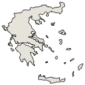
Methana (Greek: Μέθανα ), is a town, a municipality, a volcano and a peninsula located in the eastern part of the Peloponnese peninsula. The shortest length is about 200 ot 300 m. It is located north of the road connecting the rest of the Peloponnese and Galatas. It is located east of Ligouri, northeast of Kranidi, north of Ermioni and northwest of Galatas and Poros. The highest point is 760 m. The district name is Loutropolis Methana (Λουτρούπολη fr. λούτρο loutros spring + πόλη poli city)
| Statistics | |
|---|---|
| Location: Latitude: Longitude: |
37.385/37° 23'12' N 23.556/23° 34'23' E |
| Population: (2001) |
2.057 |
| Elevation: -lowest: -centre: -highest: |
sea level 18 m(centre) 760 m |
| Postal code: | 180 30 |
| Area/distance code: | 11-30-22980 (030-22980)-9 |
| Municipal code: | 4011 |
| Car designation: | AM |
| 3-letter abbreviation: | MET Methana |
| Address of administration: | 5 Agia Paraskevis Methana 180 30 |
| Website: | www.methana.gr |
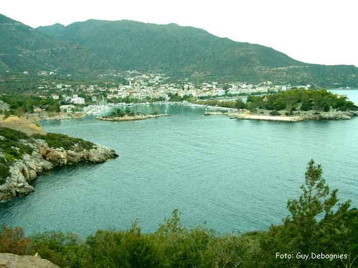
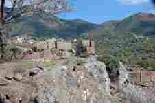
Methana has a school, a lyceum, a gymnasuim, a church, a post office, a port which is located to the east, banks, hotels, taverns and a square (plateia). The residential area is within the eastern part of the mountain. Methana has a famous spa and springs.
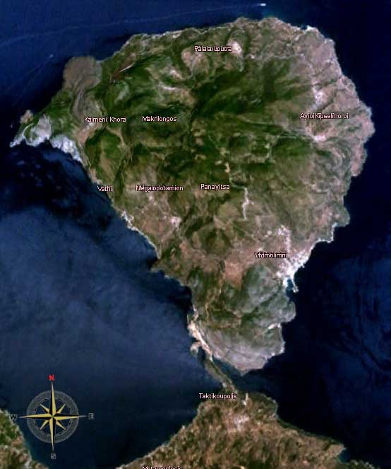
The peninsula is entirely of volcanic origin and contains over 30 extinct volcanoes. The last volcanic eruption occurred near present-day Kameni Chora in 230 BC. Famous writers such as Ovid, Strabo and Pausanias reported the last volcanic eruption in Methana. The peninsula is the northwesternmost of the elbow of the Aegean islands of which the active volcanic areas are Methana, Milos, Santorini and Nisyros. In the future, Methana may expect other volcanic eruptions.
The panorama of the northeastern part of Argolis, southeastern and eastern Corinthia along with the southern part of the Attica peninsula and the Saronic Islands of Aegina and Salamis along with a smaller one and the mountains of the eastern tip of the neighboring peninsula.
Much of the municipality are mountainous and bushy and grassy. The mountain range covers the central part of the peninsula and has a small ridge north of the seat. The residential area is within the sea. The pastures are around Methana. A mountain ridge is founded in the west and is about 3 km long with a stream in the middle and a cliff in the south.
The settlement dates back to ancient times.
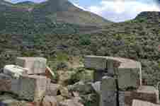
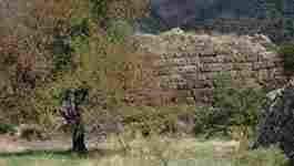
Ancient relics of the peninsula are scattered. The Acropolis near Palaiokastro was famous for the fishing village of Vathy. The fortress is in Kypseli at the coast (Akropolis Oga) at the principal pace of Nisaki (Νησάκι, meaning little island). The discovery of the Mycenaean settlement was excavated by Sofia Michalopoulou in 1990 along with the chapel of Agios Konstantinos and Elenis. The settlement dates to between 1500 and 1300 BC.
Since 1991, the peninsula has been investigated by the team of ETH Zurich geologically and cartographically. From this, a topographical map of the entire peninsula at a scale of 1:25,000 was made. An interactive 3D map was created and is on the worldwide web.
I will also relate what astonished me most in Methana. The wind called Lips, striking the budding vines from the Saronic Gulf, blights their buds. So while the wind is still rushing on, two men cut in two a cock whose feathers are all white, and run round the vines in opposite directions, each carrying half of the cock. When they meet at their starting place, they bury the pieces there. Pausanias, Description of Greece, Corinth
Historical population
| Year | Communal population | Municipal population |
|---|---|---|
| 1981 | 1035 | - |
| 1991 | 1054 | 2056 |
| 2001 | 1148 | 2057 |
Half of the entire peninsula's population lives in Methana.

Persons
Giorgos Batis (1885 - March 10, 1967), a Greek singer which he moved to Piraeus when he was little
| North: Saronic Gulf | |||
| West: Askilipo |
Methana | East: Troizina | |
| South: Troizina |
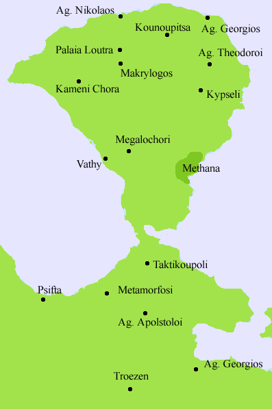
Division of the former Methana municipality
The municipality of Methana with a population 2057 (2001) is divided in
- Loutropoli Methanon / Δ.δ. Λουτροπόλεως Μεθάνων [ 1.212 ]
- Methana / τα Μέθανα [ 1.148 ]
- Dritsaiika / τα Δριτσαίικα [ 64 ]
- Kounoupitsa / Δ.δ. Κουνουπίτσας [ 263 ]
- Kounoupitsa / η Κουνουπίτσα [ 136 ]
- Agios Georgios / ο Άγιος Γεώργιος [ 47 ]
- Agios Nikolaos / ο Άγιος Νικόλαος [ 16 ]
- Makrylongos / ο Μακρύλογγος [ 30 ]
- Palia Loutra / τα Παλιά Λουτρά [ 34 ]
- Kypseli Methanos / Δ.δ. Κυψέλης Μεθάνων [ 169 ]
- Kypseli / η Κυψέλη [ 94 ]
- Agioi Theodoroi / οι Άγιοι Θεόδωροι [ 75 ]
- Megalochori / Δ.δ. Μεγαλοχωρίου [ 413 ]
- Megalochori / το Μεγαλοχώρι [ 167 ]
- Vathy / το Βαθύ [ 170 ]
- Kaimeni Chora / η Καημένη Χώρα [ 35 ]
- Megalo Potami / το Μεγάλο Ποτάμι [ 41 ]
| Ancient Greece
Science, Technology , Medicine , Warfare, , Biographies , Life , Cities/Places/Maps , Arts , Literature , Philosophy ,Olympics, Mythology , History , Images Medieval Greece / Byzantine Empire Science, Technology, Arts, , Warfare , Literature, Biographies, Icons, History Modern Greece Cities, Islands, Regions, Fauna/Flora ,Biographies , History , Warfare, Science/Technology, Literature, Music , Arts , Film/Actors , Sport , Fashion --- |
Greece :
A - B - C - D - E - F - G - H - I - J - K - L - M -
N - O - P - Q - R - S - T - U - V - W - X - Y - Z
Retrieved from "http://en.wikipedia.org/"
All text is available under the terms of the GNU Free Documentation License
