.
Vermont ( /vərˈmɒnt/ or /vɜrˈmɒnt/,[6] locally: [vɚˈmɑ̟̃(ʔ)])[7] is a New England state in the northeastern United States. Forests cover approximately 75% of its total land area. Vermont is the leading producer of maple syrup in the United States.[8]
Lake Champlain forms half of Vermont's western border, which it shares with the state of New York. The Green Mountains are within the state. Vermont is bordered by Massachusetts to the south, New Hampshire to the east across the Connecticut River, New York to the west, and the Canadian province of Quebec to the north.The state capital is Montpelier with a population of 7,855, making it the least populous state capital in the country.[9] Vermont's most populous city is Burlington, with a 2013 population of 42,284,[10] which makes it the least populous city in the United States to be the largest city within a state. Burlington's metropolitan area has a population of 214,796.[11] Vermont is one of the most racially homogeneous states; 94.3% of its population identified as white in 2010.
Fine Art Prints | Greeting Cards | Phone Cases | Lifestyle | Face Masks | Men's , Women' Apparel | Home Decor | jigsaw puzzles | Notebooks | Tapestries | ...

Map of Vermont, Joseph Hutchins Colton
Vermont is the 6th smallest in area and the 2nd least populous of the 50 United States. It is the only New England state not bordering the Atlantic Ocean.
Originally inhabited by two major Native American tribes (the Algonquian-speaking Abenaki and the Iroquois), much of the territory that is now Vermont was claimed by France during its early colonial period. France ceded the territory to the Kingdom of Great Britain after being defeated in 1763 in the Seven Years' War (in the United States, referred to as the French and Indian War). For many years, the nearby colonies, especially New Hampshire and New York, disputed control of the area (then called the New Hampshire Grants). Settlers who held land titles granted by these colonies were opposed by the Green Mountain Boys militia, which eventually prevailed in creating an independent state, the Vermont Republic. Founded in 1777 during the Revolutionary War, the republic lasted for fourteen years. Aside from the Thirteen Colonies, Vermont is one of only four U.S. states that was previously a sovereign state (along with Texas, Hawaii, and California). In 1791, Vermont joined the United States as the 14th state, the first in addition to the original 13 colonies. Vermont was the first state to partially abolish slavery[12][13] while still independent.
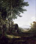
Distant View of the Mansfield Mountain, Vermont, John Frederick Kensett
Geography
See also: List of counties in Vermont, List of towns in Vermont and List of mountains in Vermont
Map of Vermont, showing cities, roads, and rivers
The Hancock Overlook, on Route 100 in Hancock, Vermont.
Vermont is located in the New England region in the eastern United States and comprises 9,614 square miles (24,900 km2), making it the 45th-largest state. It is the only state that does not have any buildings taller than 124 feet (38 m).[14] Land comprises 9,250 square miles (24,000 km2) and water comprises 365 square miles (950 km2), making it the 43rd-largest in land area and the 47th in water area. In total area, it is larger than El Salvador and smaller than Haiti.
The west bank of the Connecticut River marks the eastern (New Hampshire) border of the state (the river is part of New Hampshire).[15] 41% of Vermont's land area is part of the Connecticut River's watershed.[16]
Lake Champlain, the major lake in Vermont, is the sixth-largest body of fresh water in the United States and separates Vermont from New York in the northwest portion of the state. From north to south, Vermont is 159 miles (256 km) long. Its greatest width, from east to west, is 89 miles (143 km) at the Canadian border; the narrowest width is 37 miles (60 km) at the Massachusetts line. The width averages 60.5 miles (97.4 km). The state's geographic center is approximately three miles (5 km) east of Roxbury, in Washington County. There are fifteen US federal border crossings between Vermont and Canada.

Green mountains Vermont, Julian Walbridge Rix
The origin of the name "Vermont" is uncertain, but likely comes from the French les Verts Monts, meaning "the Green Mountains".[17] Thomas Young introduced it in 1777.[18] Some authorities[specify] say that the mountains were called green because they were more forested than the higher White Mountains of New Hampshire and Adirondacks of New York; others say that the predominance of mica-quartz-chlorite schist, a green-hued metamorphosed shale, is the reason. The Green Mountain range forms a north–south spine running most of the length of the state, slightly west of its center. In the southwest portion of the state are the Taconic Mountains; the Granitic Mountains are in the northeast.[19] In the northwest, near Lake Champlain, is the fertile Champlain Valley. In the south of the valley is Lake Bomoseen.
Several mountains have timberlines with delicate year-round alpine ecosystems, including Mount Mansfield, the highest mountain in the state; Killington Peak, the second-highest; Camel's Hump, the state's third-highest; and Mount Abraham, the fifth-highest peak. About 77% of the state is covered by forest; the rest is covered in meadow, uplands, lakes, ponds, and marshes.
Areas in Vermont administered by the National Park Service include the Marsh-Billings-Rockefeller National Historical Park (in Woodstock) and the Appalachian National Scenic Trail.[20]
Cities
Vermont has nine incorporated cities, listed by population.
Burlington, Vermont's largest city
Rutland
Montpelier, Vermont's capital city
City populations (2010 census) City Population
Burlington
42,417
South Burlington
17,904
Rutland
16,495
Barre
9,052
Montpelier
7,855
Winooski
7,267
St. Albans
6,918
Newport
5,005
Vergennes
2,741
The most populated city in Vermont by city population is Burlington, which is also the most populated metropolitan area in Vermont with a population of 214,796 as of 2013.
Largest towns
Although these towns are large enough to be considered cities, they are not incorporated as such.
Large town populations (2010 census) Town Population
Essex
19,587
Colchester
17,067
Bennington
15,764
Brattleboro
12,046
Milton
10,352
Hartford
9,952
Springfield
9,373
Williston
8,698
Middlebury
8,496
Barre
7,924
St. Johnsbury
7,603
Shelburne
7,144
Climate
Autumn along Vermont Route 73
Winhall River Trail, in winter
The annual mean temperature for the state is 43 °F (6 °C).[21] Vermont has a humid continental climate, with muddy springs, in general a mild early summer, hot Augusts; it has colorful autumns: Vermont's hills reveal red, orange, and (on sugar maples) gold foliage as cold weather approaches. Winters are colder at higher elevations.[22] It has a Köppen climate classification of Dfb, similar to Minsk, Stockholm, and Fargo.[23]
The rural northeastern section (dubbed the "Northeast Kingdom") often averages 10 °F (5.6 °C) colder than the southern areas of the state during winter. The annual snowfall averages between 60 and 100 inches (1,500 and 2,500 mm) depending on elevation.
Vermont is the seventh coldest state in the country.[24] In winter, until typical El Niño conditions, Vermont's winters are "too cold to snow"; the air is too cold to contain sufficient moisture to prompt precipitation.[25]
The highest recorded temperature was 105 °F (41 °C), at Vernon, on July 4, 1911; the lowest recorded temperature was −50 °F (−46 °C), at Bloomfield, on December 30, 1933; this is the lowest temperature recorded in New England (Big Black River, Maine, also recorded a verified −50 °F (−46 °C) in 2009).[26][27] The agricultural growing season ranges from 120 to 180 days.[28]
The USDA Plant hardiness zones for the state range between zone 3b (no colder than −35 °F (−37 °C)) in the Northeast Kingdom and northern part of the state and zone 5b (no colder than −15 °F (−26 °C)) in the southern part of the state.[29]
The state receives between 2,000 and 2,400 hours of sunshine annually.[30]
[hide]Climate data for Burlington
Month Jan Feb Mar Apr May Jun Jul Aug Sep Oct Nov Dec Year
Record high °F (°C) 59
(15) 63
(17) 84
(29) 91
(33) 94
(34) 96
(36) 101
(38) 98
(37) 95
(35) 87
(31) 69
(21) 62
(17) 101
(38)
Average high °F (°C) 25
(−4) 31
(−1) 43
(6) 51
(11) 64
(18) 76
(24) 81
(27) 78
(26) 71
(22) 54
(12) 36
(2) 28
(−2) 53
(12)
Average low °F (°C) 4
(−16) 10
(−12) 22
(−6) 30
(−1) 43
(6) 55
(13) 60
(16) 57
(14) 50
(10) 33
(1) 15
(−9) 7
(−14) 32
(0)
Record low °F (°C) −38
(−39) −35
(−37) −18
(−28) 9
(−13) 24
(−4) 36
(2) 41
(5) 38
(3) 21
(−6) 4
(−16) −16
(−27) −32
(−36) −38
(−39)
Average precipitation inches (mm) 0.61
(15.5) 0.63
(16) 0.68
(17.3) 1.99
(50.5) 4.01
(101.9) 4.06
(103.1) 4.07
(103.4) 4.00
(101.6) 3.95
(100.3) 2.48
(63) 0.66
(16.8) 0.62
(15.7) 28
(710)
Source: USTravelWeather.com[31]
Geology
Further information: Geology of New England
There are five distinct physiographic regions of Vermont. Categorized by geological and physical attributes, they are the Northeastern Highlands, the Green Mountains, the Taconic Mountains, the Champlain Lowlands, and the Vermont Piedmont.[32]
About 500 million years ago, Vermont was part of Laurentia and located in the tropics.[33]
The central and southern Green Mountain range include the oldest rocks in Vermont, formed about one billion years ago during the first mountain building period (or orogeny). Subsequently, about 400 million years ago, the second mountain building period created Green Mountain peaks that were 15,000–20,000 feet (4,600–6,100 m) tall, three to four times their current height and comparable to the Himalayas. The geological pressures that created those peaks remain evident as the Champlain Thrust, running north–south to the west of the mountains (now the eastern shore of Lake Champlain). It is an example of geological fault thrusting where bedrock is pushed over the newer rock formation.
As a result of tectonic formation, Vermont east of the Green Mountains tends to be formed from rocks produced in the Silurian and Devonian periods. Western Vermont mainly from the older Pre-Cambrian and Cambrian material.[34]
Several large deposits within the state contain granite.
Some buildings in Germany, Hong Kong and Abu Dhabi are constructed almost primarily[clarification needed] of Vermont granite. Rock of Ages quarries two kinds of granite in Vermont: Barre Gray and Bethel White.[35][36]
The remains of the Chazy Formation can be observed in Isle La Motte. It was one of the first tropical reefs. It is the site of the limestone Fisk Quarry, which contains a collection of ancient marine fossils such as stromatoporoids that date back to 200 million years ago. It is believed that at one point, Vermont was connected to Africa (Pangaea) and the fossils found and the rock formations found on the coasts in both Africa and America are further evidence of the Pangaea theory.[37][38][39]
In the past four centuries, Vermont has experienced a few earthquakes rarely centered under Vermont, the highest being a Richter magnitude scale 6.0 in 1952.[40]
Fauna
The state contains 41 species of reptiles and amphibians, 89 species of fish, of which 12 are non-native;[41] 193 species of breeding birds, 58 species of mammals, more than 15,000 insect species, and 2,000 higher plant species, plus fungi, algae, and 75 different types of natural communities.[42] Vermont's state bird is the hermit thrush.
Vermont contains one species of venomous snake, the eastern timber rattlesnake, which is confined to a few acres in western Rutland County.[43]
By the mid-19th century, wild turkeys were exterminated in the state through overhunting and destruction of habitat. Sixteen were re-introduced in 1969 and had grown to an estimated flock of 45,000 in 2009.[44] in 2013, hunters killed 6,968 of these.[45]
Since 1970, reduction of farmland has resulted in reduced environment for, and reduced numbers of various shrubland birds including the American woodcock, brown thrasher, eastern towhee, willow flycatcher, golden-winged warbler, blue-winged warbler, field sparrow, and Baltimore oriole.[46]
DDT destroyed the eggshells of ospreys, which resulted in their disappearance from the state. This species began reviving in 1998. As of 2010, they were no longer endangered in the state.[47]
White-nose syndrome killed an estimated two-thirds of all cave-wintering bats in the state from 2008 to 2010.[48]
The New England cottontail disappeared from the state in the early 1970s, out-competed by the eastern cottontail rabbit, imported in the 1800s for hunting, and which is better able to detect predators.[49]
Out of a total of 33 species of bumblebee, there were 19 or 20 in the state in 2013. Bombus terricola (the yellow-banded bumblebee), although once common in Vermont, has not been seen in most of its range since 1999 and is now absent from Vermont.[50] For honey bees, colony collapse disorder has affected bee population in the state, as elsewhere.[51]
Invasive species included the Asian spotted-wing drosophila, which started damaging berry crops in 2012. Vermont was the initial point of invasion in New England.[52]
Since 2010, the Vermont Department of Health has worked with the Centers for Disease Control and Prevention to conduct blood serum surveys of the state's deer and moose populations. Tests for eastern equine encephalitis virus antibodies were positive in moose or deer in each of Vermont's counties. In 2012, 12% of deer and 2.4% of moose tested positive.[53]
Flora
Vermont is in the temperate broadleaf and mixed forests biome. Much of the state, in particular the Green Mountains, is covered by the conifers and northern hardwoods of the New England-Acadian forests. The western border with New York and the area around Lake Champlain lies within the Eastern Great Lakes lowland forests. The southwest corner of the state and parts of the Connecticut River are covered by Northeastern coastal forests of mixed oak.[54] Vermont's state flower is the red clover.
Invasive wild honeysuckle has been deemed a threat to the state's forests, native species of plants, and wildlife.[55]
Many of Vermont's rivers, including the Winooski River, have been subjected to man-made barriers to prevent flooding.
Climate change appears to be affecting the maple sugar industry. Sugar maples have been subject to stress by acid rain, asian longhorn beetles, pear thrips, and, in 2011, an excessive deer herd that is forced to eat bark in the winter. These maples need a certain amount of cold to produce sap for maple syrup. The time to tap these trees has shrunk to one week in some years. The tree may be replaced by the more aggressive Norway maples, in effect forcing the sugar maples to "migrate" north to Canada.[56]
History
This article needs additional citations for verification. Please help improve this article by adding citations to reliable sources. Unsourced material may be challenged and removed. (May 2012)
Main article: History of Vermont
Mount Mansfield, at 4,393 feet (1,339 m), is the highest point in Vermont.
Native American occupancy
Between 8500 and 7000 BCE, at the time of the Champlain Sea, Native Americans inhabited and hunted in present-day Vermont. During the Archaic period, from the 8th millennium BCE to 1000 BCE, Native Americans migrated year-round. During the Woodland period, from 1000 BCE to 1600 CE, villages and trade networks were established, and ceramic and bow and arrow technology was developed. In the western part of the state there lived a small population of Algonquian-speaking tribes, including the Mohican and Abenaki peoples. Sometime between 1500 and 1600 CE, the Iroquois, based in present-day New York, drove many of the smaller native tribes out of Vermont, later using the area as a hunting ground and warring with the remaining Abenaki. The population in 1500 CE was estimated to be around 10,000 people.
Colonial
See also: List of forts in Vermont
The Old Constitution House at Windsor, where the Constitution of Vermont was adopted on July 8, 1777
A c. 1775 flag used by the Green Mountain Boys
The first European to see Vermont is thought to have been Jacques Cartier in 1535. On July 30, 1609, French explorer Samuel de Champlain claimed Vermont as part of New France. In 1666, French settlers erected Fort Lamotte, the first European settlement in Vermont.
In 1638, a "violent" earthquake was felt throughout New England, centered in the St. Lawrence Valley. This was the first seismic event noted in Vermont.[40]
In 1690, a group of Dutch-British settlers from Albany established a settlement and trading post at Chimney Point 8 miles (13 km) west of present-day Addison.
During Dummer's War, the first permanent British settlement was established in 1724, with the construction of Fort Dummer. It was to protect the nearby settlements of Dummerston and Brattleboro.
From 1731 to 1734, the French constructed Fort St. Frédéric, which gave the French control of the New France/Vermont frontier region in the Lake Champlain Valley. With the outbreak of the French and Indian War in 1754, the North American front of the Seven Years' War between the French and English, the French began construction of Fort Carillon at present-day Ticonderoga, New York in 1755. The British failed to take Fort St. Frédéric or Fort Carillon between 1755 and 1758. In 1759, a combined force of 12,000 British regular and provincial troops under Sir Jeffery Amherst captured Carillon, after which the French abandoned Fort St. Frédéric. Amherst constructed Fort Crown Point next to the remains of the Fort St. Frédéric, securing British control over the area.
Following France's loss in the French and Indian War, through the 1763 Treaty of Paris they ceded control of the land to the British. Colonial settlement was limited by the Crown to lands east of the Appalachians, in order to try to end encroachment on Native American lands. The territory of Vermont was divided nearly in half in a jagged line running from Fort William Henry in Lake George diagonally north-eastward to Lake Memphremagog. With the end of the war, new settlers arrived in Vermont. Ultimately, Massachusetts, New Hampshire and New York all claimed this frontier area.
On March 20, 1764, King George III established the boundary between New Hampshire and New York along the west bank of the Connecticut River, north of Massachusetts, and south of 45 degrees north latitude. In 1770, Ethan Allen, his brothers Ira and Levi, and Seth Warner, recruited an informal militia known as the Green Mountain Boys to protect the interests of the original New Hampshire settlers against newcomers from New York. Added to it, the first patriot success of the war was the capture of Fort Ticonderoga, which occurred due to the efforts of Vermonter Ethan Allen and his Green Mountain Boys.
When New York refused to recognize the land titles known as the New Hampshire Grants (towns created by land grants sold by New Hampshire Governor Benning Wentworth), dissatisfied New Hampshire settlers organized in opposition. This led to their proclaiming an independent Vermont on January 15, 1777, during the American Revolutionary War.[57][58]
Sovereignty
The gold leaf dome of the neoclassical Vermont State House (Capitol) in Montpelier
Main article: Vermont Republic
On January 15, 1777, representatives of the New Hampshire Grants declared the independence of Vermont.[59] For the first six months of its existence, it was called The Republic of New Connecticut.[60]
On June 2, 1777, a second convention of 72 delegates met and adopted the name "Vermont." This was on the advice of a friendly Pennsylvanian, Dr. Thomas Young, friend and mentor of Ethan Allen, who wrote to them on how to achieve admission into the newly independent United States of America as the 14th state.[60] On July 4, the Constitution of Vermont was drafted at the Windsor Tavern; it was adopted by the delegates on July 8. This was among the first written constitutions in North America to partially ban slavery, provide for universal adult male suffrage, and require support of public schools. It was in effect from 1777 to 1791.[61] Slavery was fully banned by state law on November 25, 1858, less than three years before the American Civil War.[62][63][64]
Revolutionary War
1791 Act of Congress, admitting Vermont to the federal union.
Main article: Battle of Bennington
The Battle of Bennington, fought on August 16, 1777, was a seminal event in the history of the state of Vermont and the United States. A combined American force, under General John Stark's command, attacked the British column at Hoosick, New York, just across the border from Bennington. It killed or captured virtually the entire British detachment. General Burgoyne never recovered from this loss and eventually surrendered the remainder of his 6,000-man force at Saratoga, New York, on October 17 that year.
The battles of Bennington and Saratoga together are recognized as the turning point in the Revolutionary War because they were the first major defeat of a British army. The anniversary of the battle is still celebrated in Vermont as a legal holiday.
The Battle of Hubbardton (July 7, 1777) was the only Revolutionary battle in present day Vermont. Although the Continental forces were technically defeated, the British forces were damaged to the point that they did not pursue the Americans (retreating from Fort Ticonderoga) any further.
Admission to the Union
Vermont continued to govern itself as a sovereign entity based in the eastern town of Windsor for 14 years. The independent state of Vermont issued its own coinage from 1785 to 1788[65] and operated a statewide postal service. Thomas Chittenden was the Governor in 1778–89 and in 1790–91. The state was obliged to solve conflicting property ownership disputes with New Yorkers. Vermont petitioned Congress to become a state in the federal union. Congress acted on February 18, 1791 to admit Vermont to the Union as the 14th state as of March 4, 1791,[66] and become the first to enter the Union after the original 13 colonies. Vermont had a unicameral legislature until 1836.
The Civil War
Vermont in 1827. The county boundaries have since changed.
Main article: Vermont in the American Civil War
From the mid-1850s on, Vermonters became activists opposing slavery, which they had previously worked to contain in the South. Abolitionist Thaddeus Stevens developed as a national leader and later promoted Radical Republican goals after the American Civil War. While the Whig Party shriveled, and the Republican Party emerged, Vermont supported Republican candidates. In 1860 it voted for Abraham Lincoln for US President, giving him the largest margin of victory of any state.
During the American Civil War, Vermont sent more than 34,000 men into United States service. Almost 5,200 Vermonters, 15 percent, were killed or mortally wounded in action or died of disease, a higher percentage than any other state.
The northernmost land/battle action of the war, the St. Albans Raid, took place in Vermont. However, the raiders were forced to return the possessions after the Canadians captured them at their border.
Postbellum era to present
Demographic changes
Beginning in the mid-19th century, Vermont attracted numerous Irish, Scots-Irish and Italian immigrants, adding to its residents of mostly English and French-Canadian ancestry. Many migrated to Barre, where the men worked as stonecutters of granite, for which there was a national market. Vermont granite was used in major public buildings in many states. Many Italian and Scottish women operated boarding houses in the late 19th century to support their families. Such facilities helped absorb new residents, who peaked between 1890 and 1900. Typically immigrants boarded with people of their own language and ethnicity, but sometimes they boarded with others.[67]
Natural disasters
The state has suffered some natural disasters in the 20th and 21st centuries related to hurricanes, extensive rain and flooding. Large-scale flooding occurred in early November 1927. During this incident, 84 people died, including the state's lieutenant-governor.[68]
The 1938 New England hurricane in the fall of that year blew down 15,000,000 acres (61,000 km2) of trees, one-third of the total forest at the time in New England. Three billion board feet were salvaged. Today many of the older trees in Vermont are about 75 years old, dating from after this storm.[69]
Another flood occurred in 1973, causing the death of two people and millions of dollars in property damage.
The state suffered severe flooding in late August 2011 caused by Tropical Storm Irene. Heavy rains caused flooding in many towns built in narrow river valleys. The governor described it as one of the worst natural disasters of the 20th and 21st centuries, second only to the flood of 1927.[70]
Political changes
Vermont approved women's suffrage decades before it became part of the national constitution. Women were first allowed to vote in the elections of December 18, 1880, when women were granted limited suffrage. They were first allowed to vote in town elections, and later in state legislative races.
In 1964, the US Supreme Court decision in Reynolds v. Sims required "one-man, one-vote" redistricting in all states; this resulted in major changes in Vermont. This ruling required city residents to be given an equitable share of apportionment in both houses in every state. Vermont had long been dominated by rural districts, as were several Southern states in those years.[71] Until that time, apportionment was based on county jurisdictions, which had given more power to rural counties and decreased representation of urban residents. This arrangement had meant that urban issues were not considered in proportion to the number of people affected by them.
In July 2000 Vermont was the first state to introduce civil unions. In 2009 the Vermont became the first state to legislate same-sex marriage, unforced by court challenge or ruling.[72] In May 2015, longtime Vermont politician and U.S. Senator Bernie Sanders formally announced his campaign for the presidential Democratic nomination in Burlington's Waterfront Park.[73]
Demographics
Population
Historical population
Census Pop. %±
1790 85,425 —
1800 154,465 80.8%
1810 217,895 41.1%
1820 235,981 8.3%
1830 280,652 18.9%
1840 291,948 4.0%
1850 314,120 7.6%
1860 315,098 0.3%
1870 330,551 4.9%
1880 332,286 0.5%
1890 332,422 0.0%
1900 343,641 3.4%
1910 355,956 3.6%
1920 352,428 −1.0%
1930 359,611 2.0%
1940 359,231 −0.1%
1950 377,747 5.2%
1960 389,881 3.2%
1970 444,330 14.0%
1980 511,456 15.1%
1990 562,758 10.0%
2000 608,827 8.2%
2010 625,741 2.8%
Est. 2014 626,562 0.1%
Source: 1910–2010[74]
2014 Estimate[2]
The United States Census Bureau estimates that the population of Vermont was 626,562 on July 1, 2014, a 0.13% increase since the 2010 United States Census.[2] The center of population of Vermont is located in Washington County, in the town of Warren.[75]
According to the United States Census Bureau, as of 2014, Vermont has an estimated population of 626,562, which is an increase of 821, or 0.13% percent, from the prior year and an increase of 821, or 0.13% percent, since 2010. This includes a natural increase since the last census of 7,148 people (33,606 births minus 26,458 deaths) and an increase due to net migration of 7,889 people into the state. In 2006 it had the second lowest birthrate in the nation, 42/1000 women.[76]
Net migration from outside the United States resulted in an increase of 4,359 people, and net migration from within the country produced an increase of 3,530 people. As of 2009, 47.8% of Vermont's population was born outside the state, with first and second-generation Vermonters representing a majority of the population. The changing demographics between those with multi-generational ties to the state and those who are newcomers, bringing different values with them, has resulted in a degree of tension between the two perspectives. This tension is expressed in the terms, "Woodchuck", being applied to those established in the state, and "Flatlander", applied to the newcomers.[77] Vermont is the least populous New England state. As of 2012, Vermont is one of only two states in the U.S. that has fewer people than the District of Columbia (the other state is Wyoming).[78]
From 2010 to 2013, 16 out of Vermont's 251 towns experienced an increase in population. All towns in Chittenden increased with the exception of Burlington. More than 180 towns experienced a decrease which hasn't happened since the mid-19th century.[79]
In 2009, 12.6 percent of people over 15 were divorced. This was the fifth highest percentage in the nation.[80] As of 2008, the median age of Vermonters was 40.6 and that of the work force was 43.7, compared with the national average of 41.1 years.[81]
Race and gender
Vermont racial breakdown of population [hide]Racial composition 1990[82] 2000[83] 2010[84]
White 98.6% 96.8% 95.3%
Asian 0.6% 0.9% 1.3%
Black 0.3% 0.5% 1.0%
Native 0.3% 0.4% 0.4%
Native Hawaiian and
other Pacific Islander - - -
Other race 0.1% 0.2% 0.3%
Two or more races - 1.2% 1.7%
Vermont Population Density Map
Vermont's population is:[85]
50.8% female
49.2% male
Among the 50 states and the District of Columbia, Vermont ranks:
2nd highest proportion of non-Hispanic Whites (94.3%)[86][87]
2nd oldest median age[88]
41st highest proportion of Asians (1.3%)
49th highest proportion of Hispanics (1.5%)
48th highest proportion of Blacks (1.0%)
29th highest proportion of Native Americans (0.4%)
39th highest proportion of people of mixed race (1.7%)
28th highest proportion of males (49.2%)
24th highest proportion of females (50.8%)
The above percentages are from the 2010 Census.
Ethnicity and language
The largest ancestry groups are:[89]
23.9% French or French Canadian
18.6% English
17.9% Irish
10.3% German
7.5% Italian
7.0% American
5.0% Scottish
3.9% Polish
2.7% Scotch Irish
1.9% Swedish
1.6% Dutch
1.4% Russian
1.4% Welsh
Residents of British ancestry (especially English) live throughout most of Vermont. The northern part of the state maintains a significant percentage of people of French-Canadian ancestry. Some vestiges of a Vermont accent are heard but the population has become more homogenized around General American in recent years.
According to the 2000 U.S. Census, 2.54 percent of the population aged five and older speak French at home, while 1 percent speak Spanish.[90]
Religion
Religious identification Religion 1990[91] 2001[92] 2008[91]
Christian 84% 67% 55%
Roman Catholic 37% 38% 26%
Protestant 47% 29% 29%
Congregational/United
Church of Christ 6%
Methodist 6%
Episcopal 4%
Other Christian 4%
Baptist 3%
Other Protestant 2%
Assemblies of God 1%
Evangelical 1%
Seventh-day Adventist 1%
Non-Denominational 1%
Other religions 3% 2% 4%
No religion 13% 22% 34%
Declined to answer 1% 8% 6%
According to 2012 and 2014 Gallup polls, Vermont ranked the least religious state in the U.S., with 23% of the residents considering themselves "very religious".[93][94] In 2008, just over half of Vermont residents identified themselves as Christians. The largest single religious body in the state is the Roman Catholic Church. According to the ARDA in 2010, the Catholic Church had 128,293 members.[95]
Almost one-third of Vermonters were self-identified Protestants. The Congregational United Church of Christ is the largest Protestant denomination with 16,392 members.[95] Vermont has the largest percentage of this denomination of any state.[96] The number of congregations of the United Church of Christ (135) was larger than the number of Catholic congregations (129).[95]
The second-largest Protestant denomination is the United Methodist Church with 14,710 members; followed by the Baptists with 7,178 members.[95]
Twenty-four percent of Vermonters attended church regularly. This low is matched nationally only by New Hampshire.[97]
In 2008, 34 percent of Vermonters claimed no religion; this is the highest percentage in the nation.[98][99] A survey suggested that people in Vermont and New Hampshire, which were polled jointly, were less likely to attend weekly services and are less likely to believe in God (54 percent) than people in the rest of the nation (71 percent). The two states were at the lowest levels among states in religious commitment. About 23 percent of the respondents attended religious service at least once a week (39 percent nationally). Thirty-six percent said religion is very important to them (56 percent nationally).[100]
Joseph Smith, founder of the Latter Day Saint movement, and Brigham Young, the 2nd president of The Church of Jesus Christ of Latter-day Saints, were both born in Vermont. A memorial to Joseph Smith, at his birthplace in Sharon, is maintained by the LDS church and draws about 70,000 visitors annually. As of 2010, the church reports 4,386 members in twelve congregations throughout the state.[101]
Vermont may have the highest concentration of western-convert Buddhists in the country. Several Buddhist retreat centers are located in the state.[102]
2,000 people of the Islamic faith are estimated to live in the state.[103]
Economy
In 2014, Vermont was ranked by Forbes magazine as 43rd best among states in which to do business.[104] It was 32nd in 2007, and 30th in 2006.[105] In 2008, an economist said that the state had "a really stagnant economy, which is what we are forecasting for Vermont for the next 30 years."[106] In May 2010, Vermont's 6.2 percent unemployment rate was the fourth lowest in the nation.[107] This rate reflects the second sharpest decline among the 50 states since the prior May.[108]
According to the 2010 U.S. Bureau of Economic Analysis report, Vermont's gross state product (GSP) was $26 billion.[109] Not accounting for size, this places the state 50th among the 50 states. It stood 34th in per capita GSP.[110][111]
Components of GSP were:[112][113]
Government – $3 billion (13.4%)
Real Estate, Rental and Leasing – $2,6 billion (11.6%)
Durable goods manufacturing – $2,2 billion (9.6%)
Health Care and Social Assistance – $2,1 billion (9.4%)
Retail trade – $1,9 billion (8.4%)
Finance and Insurance – $1,3 billion (5.9%)
Construction – $1,2 billion (5.5%)
Professional and technical services – $1,2 billion (5.5%)
Wholesale trade – $1,1 billion (5.1%)
Accommodations and Food Services – ~$1 billion (4.5%)
Information – $958 million (4.2%)
Non-durable goods manufacturing – $711 million (3.1%)
Other Services – $563 million (2.4%)
Utilities – $553 million (2.4%)
Educational Services – $478 million (2.1%)
Transportation and Warehousing – $484 million (2.1%)
Administrative and Waste Services – $436 million (1.9%)
Agriculture, forestry, fishing, and hunting – $375 million (1.6%)
Arts, Entertainment, and Recreation – $194 million (.8%)
Mining – $100 million (.4%)
Management of Companies – $35 million (.2%)
Canada was Vermont's largest foreign trade partner in 2007. The state's second-largest foreign trade partner was Taiwan.[114] The state had $4 billion worth of commerce with Québec.[115]
One measure of economic activity is retail sales. The state had $5.2 billion in 2007.[116] In 2008, 8,631 new businesses were registered in Vermont, a decline of 500 from 2007.[117]
Personal income
See also: Vermont locations by per capita income
The median household income from 2002 to 2004 was $45,692. This was 15th nationally.[118] The median wage in the state in 2008 was $15.31 hourly or $31,845 annually.[119] In 2007 about 80 percent of the 68,000 Vermonters who qualify for food stamps received them.[120] 40 percent of seniors 75 years or older live on annual incomes of $21,660 or less.[121] In 2011, 15.2% of Vermonters received food stamps. This compares to 14.8% nationally.[122]
In 2011, 91,000 seniors received an annual average of $14,000 from Social Security. This comprised 59% of the average senior's income. This contributed $1.7 billion to the state's economy.[123]
Agriculture
Agriculture contributed 2.2% of the state's domestic product in 2000.[124] In 2000, about 3 percent of the state's working population engaged in agriculture.[125]
Fall foliage seen from Hogback Mountain, Wilmington
Over the past two centuries, logging has fallen off as over-cutting and the exploitation of other forests made Vermont's forest less attractive. The decline of farms has resulted in a regrowth of Vermont's forests due to ecological succession. Today, most of Vermont's forests are secondary. The state and non-profit organizations are actively encouraging regrowth and careful forest management. Over 78 percent of the land area of the state is forested. Over 85 percent of that area is non-industrial, private forestland owned by individuals or families. In 2011 914,000 cord (117,000,000 cu ft of wood) were harvested in Vermont. Most of it was processed within the state. In this century the manufacture of wood products has fallen by almost half since 2005. The state estimates that 80,000,000 cord (1.0×10¹⁰ cu ft of wood) remain in the state.[126]
Dairy farming is the primary source of agricultural income. In the last half of the 20th century, developers had plans to build condos and houses on what was relatively inexpensive, open land. Vermont's government responded with a series of laws controlling development and with some pioneering initiatives to prevent the loss of Vermont's dairy industry. Still, the number of Vermont dairy farms has declined more than 85 percent from the 11,206 dairy farms operating in 1947. In 2003 there were fewer than 1,500 dairy farms in the state; in 2006 there were 1,138; and in 2007 there were 1,087. The number of dairy farms has been diminishing by 10 percent annually.[127]
The number of cattle in Vermont had declined by 40 percent; however, milk production has doubled in the same period due to tripling the production per cow.[128] While milk production rose, Vermont's market share declined. Within a group of states supplying the Boston and New York City markets,[129] Vermont was third in market share, with 10.6 percent; New York has 44.9 percent and Pennsylvania has 32.9 percent.[130] In 2007, dairy farmers received a record $23.60 for 100 pounds (45 kg) of milk. This dropped in 2008 to $17.[131] The average dairy farm produced 1.3 million pounds of milk annually in 2008.[132]
The dairy barn remains an iconic image of Vermont, but the 87 percent decrease in active dairy farms between 1947 and 2003[133] means that preservation of the dairy barns has increasingly become dependent upon a commitment to maintaining a legacy rather than basic need in the agricultural economy. The Vermont Barn Census, organized by a collaboration of educational and nonprofit state and local historic preservation programs, has developed educational and administrative systems for recording the number, condition, and features of barns throughout Vermont.[134]
In 2009, there were 543 organic farms. Twenty percent of the dairy farms were organic and 23 percent (128) vegetable farms were organic. Organic farming increased in 2006–07, but leveled off in 2008–09. Nor are any expected for 2010.[135]
A significant amount of milk is shipped into the Boston market. Therefore the Commonwealth of Massachusetts certifies that Vermont farms meet Massachusetts sanitary standards. Without this certification, a farmer may not sell milk for distribution into the bulk market.[136]
An important and growing part of Vermont's economy is the manufacture and sale of artisan foods, fancy foods, and novelty items trading in part upon the Vermont "brand," which the state manages and defends. Examples of these specialty exports include Cabot Cheese, the Vermont Teddy Bear Company, Fine Paints of Europe, Vermont Butter and Cheese Company, several micro breweries, ginseng growers, Burton Snowboards, Lake Champlain Chocolates, King Arthur Flour, and Ben and Jerry's Ice Cream.
There were about 2,000 maple products producers in 2010.[137] In 2001, Vermont produced 275,000 US gallons (1,040,000 L) of maple syrup, about one-quarter of U.S. production. For 2005 that number was 410,000 US gallons (1,600,000 l; 340,000 imp gal) accounting for 37 percent of national production.[138] This rose to 920,000 US gallons (3,500,000 l; 770,000 imp gal) in 2009.[139] The state's share of the nation's production rose to 42% in 2013. It had the second lowest price at $33.40/gallon.[140]
Wine industry in Vermont started in 1985. As of 2007, there were 14 wineries.[141]
Farms in the state were estimated to have hired 2,000 illegal immigrants as of 2005, largely tolerated by local police and U.S. Immigration and Customs Enforcement.[142]
Manufacturing
Vermont's largest for-profit employer, IBM, in Essex Junction, provides 25 percent of all manufacturing jobs in Vermont, employing 5,000 workers in 2013.[143] It is responsible for $1 billion of the state's annual economy.[144]
A 2010 University of Connecticut study reported that Vermont, Rhode Island, and New Hampshire tied as the most costly states in the U.S. for manufacturers.[145]
Health
See also: Vermont § Public health
An increasingly aging population is expected to improve the position of aging services and health care in the state economy. In 2013, Fletcher Allen Health Care, with 7,100 employees, was the second-largest employer of people in the state and the largest private employer.[143]
In 2010, all of Vermont's hospitals billed patients $3.76 billion, and collected $2 billion.[146] 92,000 people are enrolled in Medicare. In 2011, Medicare spent $740 million on health care in the state.[123]
Housing
In 2007 Vermont was the 17th highest state in the nation for mortgage affordability. However, in 41 other states, inhabitants contributed within plus or minus 4 percent of Vermont's 18.4 percent of household income to a mortgage.[147]
Housing prices did not rise much during the early 2000s. As a result, the collapse in real estate values was not that precipitous either. While foreclosure rose significantly in 2007, the state stood 50th—the most favorable—in ratio of foreclosure filings to households.[148] While housing sales dropped annually from 2004 to 2008, prices continued to rise.[149]
In 2007, Vermont was best in the country for construction of new energy efficient homes as evaluated by the United States Environmental Protection Agency under the Energy Star program.[150] However, about 60 percent of Vermont homes were heated with oil in 2008.[151] In August 2008, the cost in Vermont of various heating sources per 1 million BTU ranged from $14.39 for cord wood to $43.50 for kerosene.
While the number of houses sold in the state has dropped from 8,318 in 2004 to 8,120 in 2005, 6,919 in 2006, and 5,820 in 2007, the average price has continued to rise to $202,500 in 2008 ($200,000 in 2007).[152]
In 2009, the average rent for a two-bedroom apartment was $920 per month. Rental vacancy was 5.4 percent, the lowest in the nation. 2,800 people were counted as homeless in January 2010, 22 percent more than in 2008.[153]
In 2011, Vermont was fifth among the states with the greatest backlog of foreclosures needing court processing, taking an estimated 18 years. The national average was eight years.[154]
Labor
As of 2006, there were 305,000 workers in Vermont. 11 percent of these are unionized.[155][156] Out of a workforce of 299,200 workers, 52,000 were government jobs, federal, state and local. [157]
A modern high unemployment rate of 9 percent was reached in June 1976. A modern low of 2.4 percent was measured in February 2000.[158] As of September 2010, the unemployment rate was 5.8 percent.[159]
Employment grew 7.5 percent from 2000 to 2006. From 1980 to 2000, employment grew by 3.4 percent; nationally it was up 4.6 percent. Real wages were $33,385 in 2006 constant dollars and remained there in 2010; the nation, $36,871.[160]
Insurance
Captive insurance plays an increasingly large role in Vermont's economy. With this form of alternative insurance, large corporations or industry associations form standalone insurance companies to insure their own risks, thereby substantially reducing their insurance premiums and gaining a significant measure of control over types of risks to be covered. There are also significant tax advantages to be gained from the formation and operation of captive insurance companies. According to the Insurance Information Institute, Vermont in 2009 was the world's third-largest domicile for captive insurance companies, following Bermuda and the Cayman Islands.[161] In 2009, there were 560 such companies.[162] In 2010, the state had 900 such companies.[163]
Tourism
Stowe Resort Village
Tourism is an important industry to the state. Some of the largest ski areas in New England are located in Vermont. Skiers and snowboarders visit Burke Mountain Ski Area, Bolton Valley, Smugglers' Notch, Killington Ski Resort, Mad River Glen, Stowe Mountain Resort, Sugarbush, Stratton, Jay Peak, Okemo, Suicide Six, Mount Snow, Bromley, and Magic Mountain Ski Area. Summer visitors tour resort towns like Stowe, Manchester, Quechee, Wilmington and Woodstock. Resorts, hotels, restaurants, and shops, designed to attract tourists, employ people year-round. Summer camps contribute to Vermont's tourist economy.
Lake Champlain
Visitors participate in trout fishing, lake fishing, and ice fishing. Some hike the Long Trail.
In winter, Nordic and backcountry skiers visit to travel the length of the state on the Catamount Trail. Several horse shows are annual events. Vermont's state parks, historic sites, museums, golf courses, and new boutique hotels with spas were designed to attract tourists.
According to the 2000 Census, almost 15 percent of all housing units in Vermont were vacant and classified "for seasonal, recreational, or occasional use".[164][clarification needed] This was the second highest percentage nationwide, after Maine. In some Vermont cities, vacation homes owned by wealthy residents of New England and New York City constitute the bulk of all housing stock. According to one estimate, as of 2009, 84 percent of all houses in Ludlow, Vermont, were owned by out-of-state residents.[165] Other notable vacation-home resorts include Manchester and Stowe.
In 2005, visitors made an estimated 13.4 million trips to the state, spending $1.57 billion.[166] In 2012, fall accounted for $460 million of income, about one-quarter of all tourism.[167]
In 2011, the state government earned $274 million in taxes and fees from tourism. 89% of the money came from out-of-state visitors. Tourism supported over 26,000 jobs, 7.2% of total employment.[168]
In 2000–01, there were 4,579,719 skier and snowboarder visits to the state. There were 4,125,082 visits in 2009–2010, a rise from recent years.[169]
In 2008, there were 35,000 members of 138 snowmobiling clubs in Vermont. The combined association of clubs maintains 6,000 miles (9,700 km) of trail often over private lands. The industry is said to generate "hundreds of millions of dollars worth of business."[170]
Hunting is controlled for black bear, wild turkeys, deer, and moose.[171] There are 5,500 bears in the state. The goal is to keep the numbers between 4,500 and 6,000.[172] In 2010, there were about 141,000 deer in the state, which is in range of government goals. However, these are distributed unevenly and when in excess of 10-15 per square mile, negatively impact timber growth.[173]
In 2012, hunting of migratory birds was limited to October 13 to December 16. Waterfowl hunting is also controlled by federal law.[174]
Quarrying
The towns of Rutland and Barre are the traditional centers of marble and granite quarrying and carving in the U.S. For many years Vermont was also the headquarters of the smallest union in the U.S., the Stonecutters Association, of about 500 members. The first marble quarry in America was on Mount Aeolus overlooking East Dorset.[175] The granite industry attracted numerous skilled stonecutters in the late 19th century from Italy, Scotland, and Ireland. Barre is the location of the Rock of Ages quarry, the largest dimension stone granite quarry in the United States. Vermont is the largest producer of slate in the country. The highest quarrying revenues result from the production of dimension stone. The Rock of Ages Quarry in Barre is one of the leading exporters of granite in the country. The work of the sculptors of this corporation can be seen 3 miles (4.8 km) down the road at the Hope Cemetery, where there are gravestones and mausoleums.
Non-profits and volunteerism
There were 2,682 non-profit organizations in Vermont in 2008, with $2.8 billion in revenue.[176] The state ranked ninth in the country for volunteerism for the period 2005–08. 35.6% of the population volunteered during this period. The national average was 26.4%.[177]
Transportation
Vermont welcome sign in Addison on Route 17 just over the New York border over the Champlain Bridge
Vermont's main mode of travel is by automobile. 5.7 percent of Vermont households did not own a car in 2008.[178] In 2012, there were 605,000 motor vehicles registered, nearly one car for every person in the state. This is similar to average car ownership nationwide.[179] In 2012, about half the carbon emissions in the state resulted from vehicles.[180]
On average, 20–25 people die each year from drunk driving incidents; as well as 70–80 people in fatal car crashes in the state.[181] Motorists have the highest rate of insurance in the country, 93%, tied with Pennsylvania.[182]
In 2010 Vermont owned 2,840 miles (4,570 km) of highway. This was the third smallest quantity among the 50 states. 2.5 percent of the highways were listed as "congested," the 5th lowest in the country. The highway fatality rate was 1 per 100,000,000 miles (160,000,000 km), tenth lowest in the nation. The highways cost $28,669 per 1 mile (1.6 km) to maintain, the 17th highest in the states. 34.4 percent of its bridges were rated deficient or obsolete, the 8th worst in the nation.[183]
Individual communities and counties have public transit, but their breadth of coverage is frequently limited. Greyhound Lines services a number of small towns. Two Amtrak trains serve Vermont, the Vermonter[184] and the Ethan Allen Express.[185] In 2011, Amtrak evaluated the track used by the Ethan Allen Express between Rutland and Whitehall, as the worst in the nation.[186]
Trucks weighing less than 80,000 pounds (36,000 kg) can use Vermont's interstate highways. The limit for state roads is 99,000 pounds (45,000 kg). This means that vehicles too heavy for the turnpikes can legally only use secondary roads.[187][188]
In 1968 Vermont outlawed the use of billboards for advertisement along its roads. It is one of four states in the US to have done this, along with Hawaii, Maine, and Alaska.[189][190]
Major routes
The state has 2,843 miles (4,575 km) of highways under its control.[191]
For a more detailed explanation see a List of Routes in Vermont.
North–south routes
I-89.svg Interstate 89 – Runs northwestward from White River Junction to serve both Montpelier and Burlington en route to the Canadian border.
I-91.svg Interstate 91 – Runs northward from the Massachusetts border to the Canadian border, connecting Brattleboro, White River Junction, St. Johnsbury, and Newport.
I-93.svg Interstate 93 – Has its northern terminus at I-91 in St. Johnsbury and connects the northern part of the state with New Hampshire and points south.
US 5.svg U.S. Route 5 – Travels south to north along the eastern border of the state, parallel to I-91 for its entire length in the state.
US 7.svg U.S. Route 7 – Runs south to north along the western border of the state connecting Burlington, Middlebury, Rutland, and Bennington. U.S. 7 parallels I-89 from Burlington northward to the Canadian border.
Vermont 100.svg Vermont Route 100 – Runs south to north almost directly through the center of the state, providing a route along the full length of the Green Mountains.
East–west routes
US 2.svg U.S. Route 2 – Crosses northern Vermont from west to east and connects the population centers of Burlington, Montpelier, and St. Johnsbury.
US 4.svg U.S. Route 4 – Crosses south-central Vermont from west to east. It connects with the New York border, in the town of Fair Haven, with the city of Rutland and continues running through Killington and White River Junction.
US 302.svg U.S. Route 302 – Travels eastward from Montpelier and Barre, into New Hampshire and Maine.
Vermont 9.svg Vermont Route 9 – A route across the southern part of the state that connects Bennington to Brattleboro.
Vermont 105.svg Vermont Route 105 – Crosses the northernmost parts of Vermont (sometimes within a few miles of the Canadian border) and connects the cities of St. Albans and Newport.
A 2005–06 study ranked Vermont 37th out of the states for "cost-effective road maintenance", a decline of thirteen places since 2004–05.[192]
Federal data indicates that 16 percent of Vermont's 2,691 bridges had been rated structurally deficient by the state in 2006.[193] In 2007 Vermont had the sixth worst percentage of structurally deficient bridges in the country.[194]
Rail
Amtrak station in White River Junction
The state is served by Amtrak's Vermonter and Ethan Allen Express, the New England Central Railroad, the Vermont Railway, and the Green Mountain Railroad.
The Ethan Allen Express serves Rutland and Castleton,[185] while the Vermonter serves Saint Albans, Essex Junction, Waterbury, Montpelier, Randolph, White River Junction, Windsor, Bellows Falls and Brattleboro.[184]
Bus
Intercity
Greyhound Lines stops at Bellows Falls, Brattleboro, Burlington, Montpelier, and White River Junction.[195] Megabus, as of November 2014, stops in Burlington and Montpelier also.[196] Vermont Translines, an intercity bus company started by Premier Coach in 2013 partnering with Greyhound and starting service on June 9, 2014, serves Milton, Colchester, Burlington, Middlebury, Brandon, Rutland, Wallingford, Manchester and Bennington on its Burlington to Albany line, and Rutland, Killington, Bridgewater, Woodstock, Queechee and White River Junction along the US Route 4 corridor.[197]
Local
Other transportation includes:[198]
Addison County Transit Resources (ACTR) services Addison County, including the college town of Middlebury, Bristol, and Vergennes.
Bennington County is served by the Green Mountain Community Network (GMCN) out of Bennington and Yankee Trails World Travel out of Rensselaer, New York.
Brattleboro in Windham County is served by the BeeLine (Brattleboro Town Bus), which is part of Connecticut River Transit ("the Current"). Southern Windham County is served, out of West Dover, by the MOOver (Deerfield Valley Transit Association or DVTA).
Burlington has Chittenden County Transportation Authority (CCTA) and CATS (University of Vermont Campus Area Transportation System).
Colchester in Chittenden County is serviced by the SSTA (Special Services Transportation Agency).
Rutland County has "the Bus" (Marble Valley Regional Transit District, MVRTD) out of Rutland.
Windsor County:
Ludlow (in Windsor County) is served by the LMTS (Ludlow Municipal Transit System).
The Connecticut River Transit (CRT) out of Springfield, serves parts of Windham and Windsor County.
In parts of Windsor County, including Norwich and Hartford, as well as in White River Junction and in parts of New Hampshire there is a free public transportation service called Advance Transit.[199] It has routes and many different lines all throughout the Upper Valley region.
Stowe in Lamoille County is serviced by STS (Stowe Trolley System, Village Mountain Shuttle, Morrisville Shuttle).
Stagecoach Transportation Services (STS) out of Randolph in Orange County also serves parts of Windsor County.
In Washington County, the Green Mountain Transit Authority (GMTA) runs out of the capital city, Montpelier.
The Network (Northwest Vermont Public Transit Network, NVPT) running out of Saint Albans services Franklin and Grand Isle counties.
Rural Community Transportation (RCT) runs out of Saint Johnsbury and services Caledonia, Essex, Lamoille and Orleans Counties. There is a shuttle bus linking the various local networks.[200]
There is ferry service to New York State from Burlington, Charlotte, Grand Isle, and Shoreham. All but the Shoreham ferry are operated by the LCTC (Lake Champlain Transportation Company).
Airports
Vermont is served by two commercial airports:
Burlington International Airport is the largest in the state, with regular flights to Chicago, Cleveland, Detroit, Newark, New York City, Orlando, Toronto, Philadelphia, and Washington, DC.[201]
Rutland Southern Vermont Regional Airport has regular flights to Boston via Cape Air.[202]
Media
Newspapers of record
Vermont statute[203] requires the Vermont secretary of state to designate newspapers that provide general coverage across the state as the "Newspapers of Record." On June 30, 2010, the secretary of state designated the following newspapers for publishing administrative rule notices during the period of July 1, 2010 through June 30, 2011:[204]
Addison Independent
Bennington Banner
Brattleboro Reformer
Burlington Free Press
Caledonian Record
The Chronicle
Islander
Rutland Herald
Milton Independent
Newport Daily Express
News & Citizen/The Transcript
St. Albans Messenger
Times Argus
Valley News
Vermont Lawyer
White River Valley Herald (a.k.a. Herald of Randolph)
Further information: List of newspapers in Vermont
Broadcast media
Vermont hosts 93 radio broadcast stations. The top categories are Talk/Information (11), Country (9), and Classic Rock (9). The top two owners of radio broadcast stations were Vermont Public Radio (11 broadcast frequencies + 13 low-power, local translators)[205] and Nassau Broadcasting III, LLC (6 broadcast frequencies + 6 translators based in Lebanon, NH). Other companies had five or fewer stations. The state has fifteen on-line radio stations.[206]
Vermont hosts 10 high-power television broadcast stations, three of which are satellites of a primary station. Represented are the following networks and number of high-power transmitters, ABC (1), CBS (1), Fox (1), NBC (2), PBS (4), and RTV (1). In addition, it has 17 low-power television broadcast stations, which in several cases are satellites of the high-power stations.
Further information: List of radio stations in Vermont and List of television stations in Vermont
Utilities
Electricity
Main article: Energy in Vermont
The Vermont Yankee Nuclear Power Plant, in Vernon
2008 peak demand in the state was 1,100 megawatts (MW).[207]
In May 2009, Vermont created the first state-wide renewable energy feed-in law.[208] In 2010, there were about 150 methane digesters in the nation, Vermont led the nation with six online.[209]
While Vermont paid the lowest rates in New England for power in 2007, it is still ranked among the highest eleven states in the nation; that is, about 16 percent higher than the national average.[210]
In 2009, the state had the highest energy rates for energy (including heating) in the U.S. and the worst affordability gap nationwide.[121]
In 2009, the state received one-third (400 MW)[207] of its power from Hydro-Québec and one-third from Vermont Yankee.[211] In total, the state got half its power from Canada and other states. It received 75 percent of the power it generated in the state from Vermont Yankee.[212] The state is part of the Northeast Power Coordinating Council for the distribution of electricity.
The state's two largest electric utilities, Green Mountain Power Corporation and Central Vermont Public Service Corporation, together serve 80 percent of Vermont households.[121]
Vermont experts estimate that the state has the capacity to ultimately generate from 134 to 175 megawatts of electricity from hydro power.[213]
In 2006, the total summer generating capacity of Vermont was 1,117 megawatts.[214] In 2005, the inhabitants of the state used an average of 5,883 kilowatt-hours (21,180 MJ) of electricity per capita.[215] Another source says that each household consumed 7,100 kilowatt-hours (26,000 MJ) annually in 2008.[216]
Vermont has the highest rate of nuclear-generated power in the nation, 73.7 percent.[217] Vermont is one of two states with no coal-fired power plant.[218]
All Vermont utilities get their power from lines run by ISO New England. Each utility pays a share of transmitting power over these lines. Vermont's share is about 4.5 percent.[219]
The state has 78 hydropower dams. They generate 143 MW, about 12 percent of the state's total requirement.[207]
Communication
A 2013 survey found that of 18,790 miles (30,240 km) of roads surveyed, all but 3,118 mi had cellular coverage by at least one carrier. The roads surveyed are concentrated in the more heavily populated areas.[220]
A June 2013 survey found that of nearly 249,976 addresses surveyed, 84.7% had fixed (as opposed to mobile) broadband available. It was projected that all but 29 addresses would have fixed broadband available by the end of 2013.[221]
Law and government
Main article: Government of Vermont
The Vermont Supreme Court's building in Montpelier
Vermont is federally represented in the United States Congress by two senators and one representative.
The state is governed by a constitution which divides governmental duties into legislative, executive and judicial branches: the Vermont General Assembly, the Governor of Vermont and the Vermont Supreme Court. The governorship and the General Assembly serve two-year terms including the governor and 30 senators. There are no term limits for any office. The state capital is in Montpelier.
There are three types of incorporated municipalities in Vermont: towns, cities, and villages. Like most of New England, there is slight provision for autonomous county government. Counties and county seats are merely convenient repositories for various government services such as state courts, with several elected officers such as a state's Attorney and sheriff. All county services are directly funded by the state of Vermont. The next effective governmental level below state government are municipalities. Most of these are towns.[222]
Finances and taxation
Vermont is the only state in the union not to have a balanced budget requirement, yet Vermont has had a balanced budget every year since 1991.[223] In 2007, Moody's gave its top bond credit rating (Aaa) to the state.[224]
The state uses enterprise funds for operations that are similar to private business enterprises. The Vermont Lottery Commission, the Liquor Control Fund, and the Unemployment Compensation Trust Fund, are the largest of the State's enterprise funds.[225]
In 2007, Vermont was the 14th highest out of 50 states and the District of Columbia for state and local taxation, with a per capita load of $3,681. The national average was $3,447.[226] However, CNNMoney ranked Vermont highest in the nation based on the percentage of per capita income. The rankings showed Vermont had a per capita tax load of $5,387, 14.1 percent of the per capita income of $38,306.[227]
Vermont collects a state personal income tax in a progressive structure of five different income brackets, with marginal tax rates ranging from 3.6 percent to 9.5 percent. In 2008, the top 1 percent of Vermont residents provided 30 percent of the income tax revenue; around 2,000 people had sufficient income to be taxed at the highest marginal rate of 9.5 percent.[228]
Vermont's general state sales tax rate is 6 percent, which is imposed on sales of tangible personal property, amusement charges, fabrication charges, some public utility charges and some service contracts. Some towns and cities impose an additional 1 percent Local Option Tax. There are 46 exemptions from the sales tax, including exemptions for food, medical items, manufacturing machinery, equipment and fuel, residential fuel and electricity, clothing, and shoes. A use tax is imposed on the buyer at the same rate as the sales tax. The buyer pays the use tax when the seller fails to collect the sales tax or the items are purchased from a source where no tax is collected. The use tax applies to items taxable under the sales tax.
Vermont does not collect inheritance taxes, but does impose a state estate tax; a Vermont estate tax return must be filed if the estate must file a federal estate tax return (the requirement for which depends on federal law).[229]
Vermont does not collect a state gift tax.[229]
Property taxes are levied by municipalities for the support of education and municipal services. Vermont does not assess tax on personal property.[230] Property taxes are based on appraisal of the fair market value of real property.[230] Rates vary from .97 percent on homesteaded property in Ferdinand, Essex County, to 2.72 percent on nonresidents' property in Barre City.[231] Statewide, towns average 1.77 percent to 1.82 percent tax rate. In 2007, Vermont counties were among the highest in the country for property taxes. Chittenden ($3,809 median), Windham ($3,412), Addison ($3,352), and Windsor ($3,327) ranked in the top 100, out of 1,817 counties in the nation with populations greater than 20,000. Twelve of the state's 14 counties stood in the top 20 percent.[232] Median annual property taxes as a percentage of median homeowners income, 5.4%, was rated as the third highest in the nation in 2011.[233][234]
To equitably support education, some towns are required by Act 60 to send some of their collected taxes to be redistributed to school districts lacking adequate support.[235]
Politics
Main article: Politics of Vermont
See also: Political party strength in Vermont, United States Congressional Delegations from Vermont and Category:Vermont elections
Vermonters have been known for their political independence. Vermont is one of four states (aside from the original Thirteen Colonies) that were once independent nations (the others being Texas, California, and Hawaii). It has sometimes voted contrarian in national elections. Notably, Vermont is the only state to have voted for a presidential candidate from the Anti-Masonic Party, and Vermont was one of only two states to vote against Franklin D. Roosevelt in all four of his presidential campaigns (the other was Maine).
Vermont's history of independent political thought has led to movements for the establishment of the Second Vermont Republic and other plans advocating secession.[236]
State politics
Much of the business of local government in Vermont towns takes place each March at a town meeting held at a meetinghouse, such as this one in Marlboro, Vermont.
Republicans dominated local Vermont politics from the party's founding in 1854 until the mid-1970s. Prior to the 1960s, rural interests dominated the legislature. As a result, cities, particularly the older sections of Burlington and Winooski, were neglected and fell into decay. People began to move out to newer suburbs.
Vermont was for many years a stronghold of the Republican Party. Ethno-political culture of the last century has seen a dramatic shift in voter turnout in the Green Mountain State. Americans of French descent overwhelmingly vote Democratic, and are the largest ethnicity in Vermont. Vermonters of English descent, (sometimes known as the "Yankee" Vermonters) overwhelmingly vote Republican. Americans of English descent make up between a fifth and a quarter of the state and Americans of French descent make roughly one third of the state. All other ethnicities in the state breakdown roughly 50-50 along political lines, however the predominance of French-Canadian descended Vermonters who vote Democrat the overwhelming majority of the time has led to a dwindling of the "Yankee Republicanism" for which Vermont was once synonymous. The Irish Catholic vote has fluctuated during this time, while the French-Canadian vote has remained solidly Democrat and the vote of the "Yankee" Vermonters of English descent has remained solidly Republican. Since 1992 Vermont has voted for the Democrat in every Presidential election. Prior to 1992 Vermont has voted for the Republican in every single Presidential election with the exception of 1964.[237][238][239][240]
A series of one man, one vote decisions made by the United States Supreme Court in the 1960s required states to redraw their legislative districts to more fairly reflect population. As a result, urban areas in Vermont gained political power.
After the legislature was redistricted under one-person, one-vote in the 1960s, it passed legislation to accommodate[clarification needed] the new arrivals to the state. This legislation was the Land Use and Development Law (Act 250) in 1970. The law, which was the first of its kind in the nation, created nine District Environmental Commissions consisting of private citizens, appointed by the Governor, who must approve land development and subdivision plans that would have a significant impact on the state's environment and many small communities. As a result of Act 250, Vermont was the last state to get a Wal-Mart (there are now five Wal-Marts in the state, as of December 2013, but only two - in Williston and St. Albans - were newly built from the ground up). Because of the successful attempts to dilute what is perceived as the original intent of Act 250,[241] and other development pressures, Vermont has been designated one of America's most "endangered historic places" by the National Trust for Historic Preservation.[242]
In 1995, the state banned the spreading of manure from December 15 to April 1, to prevent runoff and protect the water. Therefore farms must have environmentally approved facilities to store manure during this time frame.[243]
While the state voted largely Democratic, Republican Governor Douglas won all counties but Windham in the 2006 election.
A controversy dating from 1999 has been over the adoption of civil unions, an institution which grants same-sex couples nearly all the rights and privileges of marriage at the state, but not federal, level. In Baker v. Vermont (1999), the Vermont Supreme Court ruled that, under the Constitution of Vermont, the state must either allow same-sex marriage or provide a separate but equal status for them. The state legislature chose the second option by creating the institution of civil union; the bill was passed by the legislature and signed into law by Governor Howard Dean. In April 2009 the state legislature overrode governor Jim Douglas's veto to allow same-sex marriage, becoming the first state in the nation to legalize same-sex marriage through legislation.[244] In September 2009, Vermont became the fourth state in which same-sex couples could marry.[245]
In 2007, the state's House of Representatives rejected a measure which would have legalized assisted suicide for the terminally ill, by a vote of 82–63.[246] Then with the governor's signature on May 20, 2013, Vermont became the fourth state to pass a "death with dignity" law—the first to be passed through legislation rather than by ballot initiative.[247]
Minor parties and Independents flourish. Rules which eliminate smaller parties from the ballot in most states do not exist in Vermont. As a result, voters often have extensive choices for general elections. This has resulted in the election to Mayor of Burlington and then to U.S. Congressman of Bernie Sanders, then a Socialist, and later, as an Independent, to U.S. Senator.
A political issue has been Act 60, which balances taxation for education funding. This has resulted in the town of Killington trying to secede from Vermont and join New Hampshire due to what the locals say is an unfair tax burden.[248][249]
The Vermont constitution and the courts supports the right of a person to walk (fish and hunt) on any unposted, unfenced land. That is, trespass must be proven by the owner; it is not automatically assumed.[250]
The state is an alcoholic beverage control state. In 2007, through the Vermont Department of Liquor Control, it took in over $14 million from the sale and distribution of liquor.[251]
In 2013, Vermont became the 17th state to decriminalize marijuana. The statute makes possession of less than an ounce of the drug punishable by a small fine rather than arrest and possible jail time.[252]
In 2014, Vermont became the first state to call for a constitutional convention to overturn the Supreme Court's Citizens United decision.[253]
In 2014 Vermont became the first state to mandate labeling of genetically modified organisms in the retail food supply.
Elections to federal office
Presidential elections results Year Republican Democratic
2012 30.97% 92,698 66.57% 199,239
2008 30.45% 98,974 67.46% 219,262
2004 38.80% 121,180 58.94% 184,067
2000 40.70% 119,775 50.63% 149,022
1996 31.09% 80,352 53.35% 137,894
1992 30.42% 88,122 46.11% 133,592
1988 51.10% 124,331 47.58% 115,775
1984 57.92% 135,865 40.81% 95,730
1980 44.37% 94,628 38.41% 81,952
1976 54.34% 102,085 43.14% 81,004
1972 62.66% 117,149 36.47% 68,174
1968 52.75% 85,142 43.53% 70,255
1964 33.69% 54,942 66.30% 108,127
1960 58.65% 98,131 41.35% 69,186
1956 72.16% 110,390 27.81% 42,549
1952 71.45% 109,717 28.23% 43,355
1948 61.54% 75,926 36.92% 45,557
Historically, Vermont was considered one of the most reliably Republican states in the country in terms of national elections. From 1856 to 1988, Vermont voted Democratic only once, in Lyndon B. Johnson's landslide victory of 1964 against Barry M. Goldwater. It was also one of only two states—the other being Maine—where Franklin D. Roosevelt was completely shut out in all four of his presidential bids. In the late 19th and early 20th centuries, Republican presidential candidates frequently won the state with over 70 percent of the vote.
In the 1980s and 1990s, many people moved in from out of state.[77][86][254] Much of this immigration included the arrival of more liberal political influences of the urban areas of New York and the rest of New England in Vermont.[86] The brand of Republicanism in Vermont has historically been a moderate one, and combined with the newcomers from out of state, this made Vermont friendlier to Democrats as the national GOP moved to the right. As evidence of this, in 1990 Bernie Sanders, a self-described democratic socialist, was elected to Vermont's lone seat in the House as an independent. Sanders became the state's junior Senator in 2007, and is presently one of only two members of that body who does not identify with a political party. However, for his entire career in the House and Senate, Sanders has caucused with the Democrats and is counted as a Democrat for the purposes of committee assignments and voting for party leadership.[255]
After narrowly supporting George H. W. Bush in 1988, it gave Democrat Bill Clinton a 16-point margin in 1992—the first time the state had gone Democratic since 1964. Vermont has voted Democratic in every presidential election since.
Since 2004, Vermont has been one of the Democrats' most loyal states. It gave John Kerry his fourth-largest margin of victory in the presidential campaign against George W. Bush; he won the state's popular vote by 20 percentage points, taking almost 59 percent of the vote. (Kerry, from neighboring Massachusetts, also became the first Northern Democrat ever to carry Vermont; Johnson was from Texas, Clinton from Arkansas and Al Gore, triumphant in the Green Mountain State in 2000, from Tennessee.) Essex County in the state's northeastern section was the only county to vote for Bush. Vermont is the only state that did not receive a visit from George W. Bush during his tenure as President of the United States.[256] Indeed, George W. Bush is the only Republican to win the White House without carrying Vermont; he lost it in 2000 as well. In 2008, Vermont gave Barack Obama his third-largest margin of victory (37 percentage points) and third-largest vote share in the nation by his winning the state 68% to 31%. Only Obama's birth state of Hawaii and Washington, D.C. were stronger Democratic victories. The same held true in 2012, when Obama carried Vermont 67% to 31%.
Vermont's two Senators are Democrat Patrick Leahy, the longest-serving member of the Senate, and independent Bernie Sanders. The state is represented by an at-large member of the House, Democrat Peter Welch, who succeeded Sanders in 2007.
Public health
In 2010 Vermont was the sixth highest ranked state for Well-Being in a study by Gallup and Healthways.[257] In 2010, the state stood third in physical well-being of children.[258]
In 2010, Vermont was ranked the highest in the country for health outcomes.[259]
In 2000 the state implemented the Vermont Child Health Improvement Program to improve preventive services and management of chronic conditions. In 2011, the state ranked third in the nation in child health system performance.[260] In 2011, the March of Dimes gave Vermont an "A," ranking it number one in the country on its Prematurity Report Card.[261]
In 2008 Vermont was ranked number one in the nation as the healthiest place to live for the seventh time in eight years. Criteria included low teenage birth rate, strong health coverage, the lowest AIDS rate in the country, and 18 other factors.[262] The state scored well in cessation of smoking, obesity, fewer occupational fatalities, prevalence of health insurance, and low infant mortality. A problem area was a high prevalence of binge drinking.[263] While ranking sixth from best for adults in obesity in 2009, the state still had 22% obese with a rate of 27% for children 10–17. The ranking for children was ninth best in the nation.[264] In 1993, the obesity rate for adults was 12%. Vermonters spend $141 million annually in medical costs related to obesity.[265] The combined figures for overweight and obese adults rose from 40.7% in 1990 to 58.4% in 2010. This is better than most other states.[266]
In 2011, Vermont led the nation in the rate of young people who had consumed alcohol in the past month; one-third of people aged 11 through 20. One-fifth of that group had binged during that time. The state was second for the use of marijuana by young people; 30% of adults 18 to 25 in the past month.[267]
In 2009, Vermont was ranked second in the nation for safety. Crime statistics on violence were used for the criteria.[268]
Vermont has some of the least restrictive gun control laws in the country. A permit or license is not required for purchasing or carrying firearms. Concealed Carry and Open Carry of a firearm is legal over the age of 16, with those below 16 requiring parental permission.[269][270][271][272]
In 2007, Vermont was ranked among the best five states in the country for preventing "premature death" in people under 75 years of age. The rate of survival was twice that of the five lowest performing states.[273]
In 2007, Vermont was ranked the third safest state for highway fatalities.[274] In 2007, a third of fatal crashes involved a drunken driver.[275] In 2008, Vermont was the fifth best state for fewest uninsured motorists – 6%.[276]
Parts of the state have been declared federal disaster areas on 28 occasions from 1963 to 2008.[277]
In 2007, the Environmental Protection Agency cited Chittenden and Bennington as counties with 70 parts per billion of smog which is undesirable.[278]
In northern Vermont particularly, moose are not uncommon, including in urban areas.[279] They constitute a traffic threat since they are unaware of vehicles. There are several deaths each year from automobiles striking moose.
In 2008, about 100,000 Vermonters got their health care through the federal government, Medicare, Tri-Care and the Veteran's Administration. An additional 10,000 work for employers who provide insurance under federal law under ERISA. About 20% of Vermonters receive health care outside of Vermont; 20% of the care provided within the state is to non-Vermonters.[280] In 2008, the state had an estimated 7.6% with no medical insurance, down from 9.8% in 2005.[281] In 2008, the Vermont Health Access Program for low-income, uninsured adults cost from $7 to $49 per month.[282] A "Catamount Health" premium assistance program was available for Vermonters who do not qualify for other programs. Total monthly premiums ranged from $60 to $393 for an individual. There was a $250 deductible. Insured paid $10 toward each generic prescription. 16.9% of residents 18 to 35 were uninsured, the highest group.[283]
Health care spending increased from $2.3 billion in 2000 to $4.8 billion in 2009.[284] In 2009, adult day care services cost more in Vermont than any other state – $150 daily.[285]
The state started air drops of rabies bait for raccoons in 1997. Known rabies cases in raccoons peaked in 2007 at 165. The program is in cooperation with neighboring states and Canada.[286]
Education
Main article: Education in Vermont
The Lyndon Institute, a high school in Lyndon, Vermont
Vermont was named the nation's smartest state in 2005 and 2006.[287] In 2006, there was a gap between state testing standards and national, which is biased in favor of the state standards by 30%, on average. This puts Vermont 11th-best in the nation. Most states have a higher bias.[288] However, when allowance for race is considered, a 2007 US Government list of test scores shows Vermont white fourth graders performed 25th in the nation for reading (229), 26th for math (247).[289] White eighth graders scored 18th for math (292) and 12th for reading (273). The first three scores were not considered statistically different from average. White eighth graders scored significantly above average in reading. Statistics for black students were not reliable because of their small representation in the testing.
The average effective spending per pupil in Vermont was $11,548 in 2008.[290]
Education Week ranked the state second[291] in high school graduation rates for 2007.[292]
In 2011, 91% of the population had graduated from high school compared with 85% nationally. Almost 34% have at least an undergraduate degree compared with 28% nationally.[293]
In 2013, the ratio of pupils to teachers was the lowest in the country.[294]
Higher education
Main article: List of colleges and universities in Vermont
The University of Vermont
Old Mill, the oldest building of the university
Experimentation at the University of Vermont by George Perkins Marsh, and later the influence of Vermont-born philosopher and educator John Dewey brought about the concepts of electives and learning by doing.
Vermont has five colleges within the Vermont State Colleges system, University of Vermont (UVM), and fourteen other private, degree-granting colleges, including Bennington College, Burlington College, Champlain College, Goddard College, Marlboro College, Middlebury College, Saint Michael's College, the Vermont Law School, and Norwich University.
Sports
Olympics
Vermont Olympic gold medalists include Barbara Cochran,[295] Hannah Kearney,[296] Kelly Clark,[297] Ross Powers,[298] and Hannah Teter.[299]
Baseball
The largest professional franchise is the Vermont Lake Monsters, a single-A minor league baseball affiliate of the Oakland Athletics, based in Burlington. They were named the Vermont Expos prior to 2006.[300] Up until the 2011 season, they were the affiliate of the Washington Nationals (formerly the Montreal Expos).
Basketball
The Vermont Frost Heaves, the 2007 and 2008 American Basketball Association national champions, were a franchise of the Premier Basketball League, and were based in Barre and Burlington from the fall of 2006 through the winter of 2011.
Currently the highest teams in basketball, representing Vermont are Vermont Catamounts (NCAA), two teams - male and female.[301]
Football
A semi-professional[302] football team, the Vermont Ice Storm, is based in South Hero.[303] It plays its home games at the Colchester High School stadium. It is a member of the Empire Football League.
Winter sports
Winter sports are very popular in New England and Vermont's winter sports attractions are a big part of Vermont tourism. Some well known attractions include, Burke Mountain Ski Area, Jay Peak Resort, Killington Resort, The Quechee Club Ski Area, and Smugglers' Notch Resort.
Vermont natives in the snowboarding profession include: Kevin Pearce, Ross Powers, Hannah Teter, and Kelly Clark. Others learned snowboarding in the state such as: Louie Vito, and Ellery Hollingsworth.
Soccer
The Vermont Voltage is a USL Premier Development League soccer club that plays in St. Albans.
Annually since 2002, high school statewide all stars compete against New Hampshire in ten sports during "Twin State" playoffs.[304]
Auto racing
Vermont also has a few auto racing venues. The most popular of them is Thunder Road International Speedbowl in Barre, Vermont. It is well known for its tight racing and has become well known in short track stock car racing. Other racing circuits include the USAC sanctioned Bear Ridge Speedway, and the NASCAR sanctioned Devil's Bowl Speedway. Some NASCAR Cup drivers have come to Vermont circuits to compete against local weekly drivers such as Tony Stewart, Clint Bowyer, Kevin Harvick, Kenny Wallace, and Joe Nemechek. Kevin Lepage from Shelburne, Vermont is one of a few professional drivers from Vermont. Racing series in Vermont include NASCAR Whelen All-American Series, American Canadian Tour ,and Vermont's own Tiger Sportsman Series.
Culture
Vermontasaurus sculpture in Post Mills, Vermont in 2010
Vermont festivals include the Vermont Maple Festival, Festival on the Green,[305] The Vermont Dairy Festival in Enosburg Falls,[306] the Apple Festival (held each Columbus Day Weekend), the Marlboro Music Festival, and the Vermont Brewers Festival.[307] The Vermont Symphony Orchestra is supported by the state and performs throughout the area.
Since 1973 the Sage City Symphony, formed by composer Louis Calabro, has performed in the Bennington area. In 1988 a number of Vermont-based composers including Gwyneth Walker formed the Vermont Composers Consortium,[308][309] which was recognized by the governor proclaiming 2011 as The Year of the Composer.[310]
The Brattleboro-based Vermont Theatre Company presents an annual summer Shakespeare festival. Brattleboro also hosts the summertime Strolling of the Heifers parade which celebrates Vermont's unique dairy culture. The annual Green Mountain Film Festival is held in Montpelier.
In the Northeast Kingdom, the Bread and Puppet Theatre holds weekly shows in Glover in a natural outdoor amphitheater.
Vermont's most recent best known musical talent was the group Phish, whose members met while attending school in Vermont and spent much of their early years playing at venues across the state.
The Vermont-based House of LeMay[311] performs several shows a year, hosts the annual "Winter is a Drag Ball,"[312] and performs for fundraisers.
Examples of folk art found in Vermont include the Vermontasaurus in Post Mills, a community in Thetford.
The rate of volunteerism in Vermont was eighth in the nation with 37% in 2007. The state stood first in New England.[313] In 2011, Vermont residents were ranked as the healthiest in the country.[314] Also in 2011, Vermont was ranked as the fourth most peaceful state in the United States.[315] In 2011, Vermont residents were ranked as the sixth most fit/leanest in the country.[316] Vermonters were the second most active citizens of state with 55.9% meeting the Centers for Disease Control and Prevention's physical activity requirements.[317] Vermont was ranked as the twelfth happiest state in the country.[318]
There are a number of museums in the state.
State symbols
Main article: List of Vermont state symbols
The hermit thrush is Vermont's state bird.
State symbols include:
State song – These Green Mountains,
Unofficial popular state song – Moonlight in Vermont
State Beverage – milk
State Pie – apple pie
State Fruit – apple
State Flower – red clover
State Mammal – Morgan horse
State rock – granite, marble, and slate
State Tree – sugar maple
State butterfly – Monarch Butterfly
State fish cold water – Brook Trout
State fish warm water – Walleye Pike
State Fossil – White Whale (Beluga Whale)
State bird - Hermit Thrush
Notable Vermonters
Vermont native Calvin Coolidge as he appears at the National Portrait Gallery in Washington, D.C.
Main article: List of people from Vermont
Vermont is the birthplace of former U.S. Presidents Chester A. Arthur and Calvin Coolidge.
Notable fictional Vermonters
Vermont was the original home of the fictional villain Simon Legree in the novel Uncle Tom's Cabin.
Vermont was also the home of Dick Loudon, Bob Newhart's character on the 1980s sitcom Newhart. All action supposedly took place in Vermont.
Vermont was the home of Pollyanna and her Aunt Polly in the novel Pollyanna, later made into the 1960 Disney film starring Hayley Mills and Jane Wyman, respectively.[319]
In the first seasons of M*A*S*H Alan Alda's character "Hawkeye Pierce" was from Vermont.[320]
In the Marvel Comics shared universe, Vermont is home of the superhero team the Garrison.
In H. P. Lovecraft's The Whisperer in Darkness, Vermont is the home of folklorist Henry Akeley (and the uninhabited hills of Vermont serve as one of the earth bases of the extraterrestrial Mi-Go).
See also
Portal icon Vermont portal
Outline of Vermont – organized list of topics about Vermont
Index of Vermont-related articles
References
us-english.org Vermont
"Table 1. Annual Estimates of the Resident Population for the United States, Regions, States, and Puerto Rico: April 1, 2010 to July 1, 2014" (CSV). U.S. Census Bureau. December 27, 2014. Retrieved December 27, 2014.
"Mt Mansfield Highest Point". NGS data sheet. U.S. National Geodetic Survey. Retrieved July 20, 2015.
"Elevations and Distances in the United States". United States Geological Survey. 2001. Retrieved October 24, 2011.
Elevation adjusted to North American Vertical Datum of 1988.
"Vermont". Oxford English Dictionary (3rd ed.). Oxford University Press. September 2005. (Subscription or UK public library membership required.)
Zind, Steve (March 18, 2012). "Examining The Vermont Accent". Vermont Public Radio. Retrieved December 2, 2012.
"US Department of Agriculture – Economic Research Service". 'Table 44—U.S. maple syrup production and value, by state, calendar years. Retrieved January 5, 2007.
Wetherell, W. D. (September 17, 1995). "A Picture-Perfect Capital". NY Times. Retrieved March 31, 2009.
"Burlington (city) QuickFacts" 2013
"Metropolitan and Micropolitan Statistical Areas - Annual Estimates of the Resident Population: April 1, 2010 to July 1, 2013". 2013 Population Estimates. United States Census Bureau, Population Division. December 27, 2014. Retrieved December 27, 2014.
"Vermont Constitution of 1777". Chapter I, Section I: State of Vermont. Retrieved February 12, 2014. "Therefore, no male person, born in this country, or brought from over sea, ought to be holden by law, to serve any person, as a servant, slave, or apprentice, after he arrives to the age of twenty-one years; nor female, in like manner, after she arrives to the age of eighteen years, unless they are bound by their own consent, after they arrive to such age, or bound by law for the payment of debts, damages, fines, costs, or the like."
Lee Ann, Cox. "UVM historian examines Vermont's mixed history of slavery and abolition". University of Vermont. Retrieved February 12, 2014.
"Burlington high rise gets facelift", Burlington Free Press
Vermont v. New Hampshire 289 U.S. 593 (1933)
Fast Facts about the Connecticut River. Crjc.org (October 9, 2008). Retrieved April 12, 2014.
Van DeWater, Frederic F. (1974) [1941]. The Reluctant Republic, Vermont 1724–1791.. The Countryman Press. pp. 195, 218–219. ISBN 0-914378-02-3.
Senecal, Joseph-Andre. "The Name Vermont".
Google Books. Books.google.com. August 28, 2006. Retrieved July 31, 2010.
"Vermont". National Park Service. Retrieved July 15, 2008.[dead link]
"Vermont". 1911 Encyclopedia Britannica. Vermont Online Encyclopedia. Retrieved October 7, 2012.
"accessed September 15, 2007". Academics.smcvt.edu. July 4, 1911. Retrieved July 31, 2010.
"wedding.net: The Leading Wedding Site on the Net". Vermont.wedding.net. Retrieved February 23, 2012.
"Average Annual Temperatures by State". Current Results. Retrieved January 25, 2012.
Wooster, Chuck (December 7, 2011). "La Nina should bring plenty of snow this year". the Chronicle (Barton, Vermont). p. 39.
Though this was tied by Big Black River, Maine, in 2009
Adams, Glenn (February 11, 2009). Maine ties Vt. for record low temperature. Burlington Free Press.
"National Gardening Association". Garden.org. Retrieved July 31, 2010.
"Vermont USDA Plant Hardiness Zone Map". Retrieved March 21, 2011.
"united states annual sunshine map". HowStuffWorks, Inc. Retrieved March 14, 2011.
"Burlington Weather|Burlington Weather Forecast|Burlington Climate". Web.archive.org. Archived from the original on June 23, 2008. Retrieved July 31, 2010.
"Academics Content Server at Saint Michael's". The Physiographic Regions of Vermont. Retrieved January 3, 2007.
Baird, Joel Banner (July 24, 2011). "Tremors of discovery". Burlington Free Press (Burlington, Vermont). pp. 1–3D.
"Generalized geologic map of Vermont" (PDF). Retrieved February 23, 2012.
"QUARRIES | Rock of Ages Corporation". Rockofages.com. Retrieved July 31, 2010.
http://www.anr.state.vt.us/dec/geo/images/gengeo52.pdf
"Geology and Mineral Resources - Vermont Geological Survey". Anr.state.vt.us. Retrieved January 25, 2012.
Slayton, Thomas (December 1, 2009). "The Outside Story | Vermont's Farmers Have Geology to Thank". Northern Woodlands. Retrieved January 25, 2012.
http://www.uvm.edu/landscape/learn/Downloads/BRIEFGeologicHistory.pdf
"Canada quake shakes Vt.". Burlington, Vermont: Burlington Free Press. June 24, 2010. pp. 1A,4A.
Gresser, Joseph (November 24, 2010). "How all those fish got to Vermont". Barton, Vermont: the chronicle. p. 17.
"Vermont Fish and Wildlife Department". Vtfishandwildlife.com. Retrieved July 31, 2010.
Page, Candace (July 9, 2009). "Sightings of milk snakes, rattlesnake mimics, shake residents". Burlington, Vermont: Burlington Free Press. pp. 1B.
Editors (September 2009). "Hunting Wild Turkeys". Newport, Vermont: Newport Daily Express. pp. THREE, HUNTING GUIDE.
Fish and Wildlife (January 15, 2014). "Turkey hunters had record year". The Chronicle (Barton, Vermont). pp. 31A.
Page, Candace (July 6, 2010). "Saving shrubland". Burlington, Vermont: Burlington Free Press. pp. 1B.
Diblasio, Natalie (July 30, 2010). "Lake Arrowhead failure is first in 12 years". Burlington, Vermont: Burlington Free Press. pp. 1B.
Page, Candace (July 27, 2010). "Bats struggle to survive". Burlington, Vermont: Burlington Free Press. pp. 1B,4B.
Macalaster, Elizabeth (April 11, 2012). "New England cottontail: Rabbit, come back!". the Chronicle (Barton, Vermont). p. 15.
Editors. "Bumble bees: yellowbanded bumble bee (Bombus terricola)". Xerces Society. Retrieved April 5, 2014.
Dunbar, Bethany (April 24, 2013). "Keep an eye out for rare bumblebees". the Chronicle (Barton, Vermont). pp. 2C.
Gresser, Joseph (April 24, 2013). "Tiny pest cuts through New England fruit". The Chronicle (Barton, Vermont). pp. 1B.
Secretary (2014). "Eastern Equine Encephalitis Virus Deer and Moose Serosurvey Project". Vermont Department of Public Health. Retrieved April 9, 2014.
Olson, D. M, E. Dinerstein et al. (2001). "Terrestrial Ecoregions of the World: A New Map of Life on Earth". BioScience 51 (11): 933–938. doi:10.1641/0006-3568(2001)051[0933:TEOTWA]2.0.CO;2.
Dimarlo, Larson (June 13, 2010). "Using undiluted herbicides to fight invasive species". Burlington, Vermont: Burlington Free Press. pp. 2D.
Winston, Keith (November 29, 2011). "Wildlife habitats shift as winters grow warmer". Florida Today (Melbourne, Florida). pp. 7B.
Slade, William, Jr., Compiler. Vermont State Papers: Being a Collection of Records and Documents Connected with the Assumption and Establishment of Government by the People of Vermont, Together with the Journal of the Council of Safety, the First Constitution, the Early Journals of the General Assembly, and the Laws from the Year 1779 to 1786, Inclusive.; Middlebury, Vermont; 1823. pp.13–19.
Van Zandt, Franklin K.; Boundaries of the United States and the Several States; Geological Survey Professional Paper 909. Washington, D.C.; Government Printing Office; 1976. The standard compilation for its subject. P.63.
"Second Vermont Republic". Vermont's Declaration of Independence (1777). Retrieved January 17, 2007.
Esther Munroe Swift, Vermont Place-Names: Footprints in History Picton Press, 1977
The Old Constitution House State Historic Site, Historic Vermont
Barton Chronicle book review[dead link]. Retrieved August 21, 2009.
Child, Lydia Maria (1860). The Duty of Civil Disobedience to the Fugitive Slave Act: An Appeal to the Legislators of Massachusetts. Boston: American Anti-Slavery Society. pp. Anti–Slavery Tracts No. 9, 36.
Bunch, Lonnie. "Vermont 1777: Early Steps Against Slavery". Smithsonian National Museum of African American History and Culture. Retrieved February 12, 2014.
Bucholt, Margaret (1991), "Manchester and the Mountains Chamber of Commerce", An Insider's Guide to Southern Vermont, Penguin
First Congress, Third Session (February 18, 1791). "An Act for the admission of the State of Vermont into this Union". The Avalon Project. Yale Law School. Retrieved 2014-11-24.
Susan Richards, "Making Home Pay: Italian and Scottish Boardinghouse Keepers in Barre, 1880–1910", Vermont History Journal, 2005, accessed October 23, 2013
btv webmaster (August 1, 2007). "National Weather Service – Burlington, VT – The Flood of 1927". Erh.noaa.gov. Retrieved July 31, 2010.
Long, Stephen (September 7, 2011). "Remembering the hurricane of 1938". The Chronicle (Barton, Vermont). p. 3.
Remsen, Nancy (September 2, 2011). "Obama declares disaster in Vermont, federal aid on way". Burlington Free Press (Burlington, Vermont). pp. 1A.
""One Man, One Vote" ... That's All She Wrote". Arizona State Library. Retrieved December 28, 2006.
Goodnough, Abby (April 7, 2009). "Vermont Legislature Makes Same-Sex Marriage Legal". The New York Times. Retrieved May 23, 2010.
C-Span
Resident Population Data. "Resident Population Data – 2010 Census". 2010.census.gov. Retrieved December 24, 2012.
"Population and Population Centers by State: 2000". U. S. Census Bureau. Retrieved May 11, 2008.
Associated Press (August 22, 2008). Vt. birth rate ranks second lowest in U.S. Burlington Free Press.
"Modern Vermont 1940-today: Flatlanders vs. Woodchucks". Vermont Historical Society. Retrieved December 5, 2012.
"2012 State Population Census Estimates". Governing.com. January 11, 2013. Retrieved May 9, 2013.
Woolf, Art (June 19, 2014). "Population shrinking in many Vermont cities". Burlington Free Press (Burlington, Vermont). pp. 2D. Retrieved June 19, 2014.
Lush, Tamara; Martin, Deanna (September 25, 2009). "Indiana, Florida counties tops in divorce". Burlington, Vermont: Burlington Free Press. pp. 3A.
Wong, Michelle et al. (March 2008). "Vermont Indicators: Aging & Work" (PDF). State Profile Series. Boston College. Retrieved February 25, 2014.
Historical Census Statistics on Population Totals By Race, 1790 to 1990, and By Hispanic Origin, 1970 to 1990, For The United States, Regions, Divisions, and States
Population of Vermont: Census 2010 and 2000 Interactive Map, Demographics, Statistics, Quick Facts
2010 Census Data
"Vermont Bigger Cities (over 6000 residents) - Real Estate, Housing, Schools, Residents, Crime, Pollution, Demographics and More". City-data.com. Retrieved May 9, 2013.
Cohen, Micah (October 1, 2014). "'New' Vermont Is Liberal, but 'Old' Vermont Is Still There". The New York Times. Retrieved February 23, 2015.
"United States - White, not Hispanic Population Percentage by State". indexmundi. Retrieved May 8, 2014.
40.7 in 2005, US Census Community Survey
American FactFinder, United States Census Bureau. "2006–2008 American Community Survey 3-Year Estimates". Factfinder.census.gov. Retrieved July 31, 2010.
"Language Map Data Center". Mla.org. July 17, 2007. Retrieved July 31, 2010.
Kosmin, Barry A.; Keysar, Ariela (March 2009). "American Religious Identification Survey 2008: ARIS 2008 Report: Part IIIC – Geography". Trinity College. Retrieved April 7, 2009.
"The Graduate Center, CUNY". American Religious Identification Survey 2001. Retrieved January 5, 2007.
Frank Newport (March 27, 2012). "Mississippi is The Most Religious U.S. State". Gallup.
Newport, Frank. "Mississippi Is Most Religious U.S. State Vermont and New Hampshire are the least religious states". gallup.com/poll. Gallup. Retrieved 13 October 2014.
"The Association of Religion Data Archives | State Membership Report". www.thearda.com. Retrieved December 12, 2013.
"Adherents.com". Religion in Vermont. Retrieved January 5, 2007.
Sullivan, Will (June 11, 2007). A New Shade of Granite. U.S. News & World Report.
American Religious Identification Survey is Third in Landmark Series. Trinity College. Retrieved March 25, 2009.
Kosmin, Barry A.; Keysar, Ariela (March 2009). American Religious Identification Survey 2008 Summary Report (PDF). Trinity College. p. 17. Retrieved March 15, 2009.
[1][dead link]. Retrieved July 29, 2008.
[2]. Retrieved August 27, 2010.
Schweitzer, Sarah (February 23, 2005). "Buddhist retreat centers". Boston.com. Retrieved July 31, 2010.
"Vermont Edition: Vermont's Muslims". Vpr.net. Retrieved July 31, 2010.
"Vermont". Forbes-Best States for Business and Careers. Forbes Magazine. November 3, 2014. Retrieved June 10, 2015.
Gram, David (July 14, 2007). Forbes ranks Vt. 30th (sic) for business. Burlington Free Press.
McLean, Dan (June 29, 2008). "IBM won't be No. 1 employer for much longer". Burlington, Vermont: Burlington Free Press. pp. 1A.
"Unemployment Rates for States". Bls.gov. July 20, 2010. Retrieved July 31, 2010.
Izzo, Phil (June 18, 2010). "Unemployment Rates by State: Nevada Overtakes Michigan for Nation's Worst – Real Time Economics – WSJ". Blogs.wsj.com. Retrieved July 31, 2010.
"Gross State Product". Greyhill Advisors. Retrieved September 23, 2011.
List of U.S. states by GDP per capita (nominal)
Rankings tend to favor higher cost of living areas and downrate lower cost of living areas
Percentages may not add up to exactly 100% because of rounding
"Gross Domestic Product (GDP) by State". Bea.gov. December 22, 2008. Retrieved July 31, 2010.
Creaser, Richard (October 24, 2007). Illuzi learns about economy of Taiwan during visit. the Chronicle.
Curran, John (October 7, 2008). Vt. Quebec leaders promote 'green zone'. Burlington Free Press.
McLean, Dan (July 13, 2008). Retail Sales by the numbers. Burlington Free Press.
Associated Press (January 26, 2009). Fewer businesses launched in '08. Burlington Free Press.
Income 2004 – Three-Year-Average Median Household Income by State: 2001–2004[dead link]
"What Vermonters Earn", Burlington Free Press[dead link]. Retrieved August 23, 2009.
Ober, Lauren (November 9, 2008). Food stamp program set for expansion. Burlington Free Press.
Coutts, Jim (June 28, 2009). "My Turn:Vermont's energy support program is long overdue". Burlington, Vermont: Burlington Free Press. pp. 7B.
Guerin, Emily (May 28, 2014). "Use of food stamps rises in Orleans County". The Chronicle (Barton, Vermont). pp. 13A.
AARP Vermont (December 12, 2012). "How fiscal cliff debate affects seniors". the Chronicle (Barton, Vermont). p. 6.
Vermont Encyclopedia, page 27. Books.google.com. August 1, 2003. ISBN 9781584650867. Retrieved February 23, 2012.
Liz Halloran (2007). Vermont's War. US News and World Report, January 22, page 45.
Lefebvre, Paul (February 26, 2014). "Vermont forest industries still strong". The Chronicle (Barton, Vermont). pp. 1A, 22A, 23A.
Dunbar, Bethany M. (September 10, 2008). Vermont Milk Commission considers price premium. the Chronicle.
"Dairy Farm Numbers – Vermont Dairy". Vermontdairy.com. Retrieved July 31, 2010.
called "federal order one"
Dunbar, Bethany (November 14, 2007). Vermont Milk Commission takes a look at hauling costs. the Chronicle.
Dunbar, Bethany M. quoting from book by James Maroney Jr. (December 4, 2008). Former farmer has a plan for profits in Vermont dairying. the Chronicle.
Lefebvre, Paul (February 11, 2009). Average Vermont dairy farmer expected to lose $92,000. the Chronicle.
"Dairy Farm Numbers". Vermont Dairy. Retrieved July 31, 2010.
"Vermont Barn Census". Uvm.edu. Retrieved July 31, 2010.
Hallenbeck, Terri (September 6, 2009). "A look at Vermont organic farming". Burlington, Vermont: Burlington Free Press. pp. 5D.
LeClair vs Saunders. Retrieved April 21, 1980.
Dunbar, Bethany (March 17, 2010). "Maple season starts early with record sap run". Barton, Vermont: the Chronicle. p. 23.
Vermont Maple Sugar Makers Assoc. "Maple Facts". Archived from the original on April 2, 2007. Retrieved April 8, 2007.
Burlington Free Press, June 18, 2009, page 17B, "Bumper season for sugar makers"
Hormilla, Natalie (July 16, 2014). "Vermont leads the nation in sugarmaking again". Barton, Vermont: the Chronicle. p. 1.
Curran, John (July 29, 2007). Winemakers hope new state council will help them grow. Burlington Free Press.
"Vermont dairy farms count on illegal immigrants". Blnz.com. Retrieved July 31, 2010.
Associated Press (July 9, 2013). "Fletcher Allen now Vermont's largest private employer". The Burlington Free Press (Burlington, Vermont). pp. 9B. Retrieved July 16, 2013.
The Burlington Free Press, February 28, 2007, page 8C, "IBM:Enriching economy for 50 years."
Singer, Stephen (September 9, 2010). "UConn study says Vermont costliest for manufacturers". Burlington, Vermont: Burlington Free Press. pp. 6B.
Gresser, Joseph (September 28, 2009). "State officials scrutinize hospital revenues". the Chronicle (Barton, Vermont: the Chronicle). p. 11.
"Vermont Business Roundtable" (PDF). Housing Prices, Availability, and Affordability in Vermont. Archived from the original (PDF) on June 5, 2007. Retrieved January 7, 2007.
Braithwaite, Chris (December 19, 2007). Vermont weathers mortgage storm. the Chronicle.
Ryan, Matt (August 3, 2008). Moving In: Essex home prices edge higher. Burlington Free Press.
Gresser, Joseph (October 3, 2007). Vermont is top in N.E. for new energy efficient homes. the Chronicle.
Pollak, Sally (September 14, 2008). In from the cold. Burlington Free Press.
Ryan, Matt and Hart, Melissa (November 30, 2008). Vermont Numbers. Burlington Free Press.
Remsen, +Nancy (June 16, 2010). "Home ownership still difficult goal in Vermont". Burlington, Vermont: Burlington Free Press. pp. 1B, 3B.
Schmit, Julie (April 1, 2011). "Foreclosures go nowhere fast". Florida Today (Melbourne, Florida). pp. 4A.
"Unions Shrink Even in NY, Data Show". Empirecenter.org. January 26, 2007. Retrieved July 31, 2010.
"A separate study shows over 325,000 workers in 2000" (PDF). Archived from the original (PDF) on June 14, 2007. Retrieved July 31, 2010.
"Regional Plan Volume II. Chapter 6. Economic Development" (PDF). 2003.
"BLS Local Area Unemployment Statistics – History". Data.bls.gov. Retrieved July 31, 2010.
"BLS Local Area Unemployment Statistics". Bls.gov. Retrieved October 26, 2010.
Briggs, John (June 21, 2010). "25 years of numbers". Burlington, Vermont: Burlington Free Press. pp. 1B, 4B.
"Insurance Information Institute". Captives & Other Risk-Financing Options. Retrieved January 7, 2007.
Sutkoski, Matt (August 1, 2009). "State unconcerned about insurance report". Burlington, Vermont: Burlington Free Press. pp. 9B.
Hallenbeck, Terri (August 11, 2010). "Captive industry descends on Vt.". Burlington, Vermont: Burlington Free Press. pp. 1B.
"Vacant housing units, Vermont, 2000 Census".
"Cottage industry".
Dunbar, Bethany M. (December 1, 2008). I can remember Barton when it was a booming town. The Chronicle.
Hormilia, Natalie (October 9, 2013). "Foliage brightened area tourist economy". The Chronicle (Barton, Vermont). pp. 1A.
Starr, Tena (July 24, 2013). "Needed soon:1,300 hospitality and tourism workers". The Chronicle (Barton, Vermont). pp. 1A, 31A.
"Vt. ski area visits rise 1.4%". Burlington, Vermont: Burlington Free Press. June 10, 2010. pp. 6C.
McLean, Dan (December 14, 2008). Hard times may slow snowmobiling. Burlington Free Press.
"Hunting Season Opening Dates". Newport, Vermont: Newport Daily Express. September 2009. pp. TWO, HUNTING GUIDE.
"Vermont bear hunting season opens on Sept. 1". Barton, Vermont: the Chronicle. September 1, 2010. p. 8.
"Estimates place the deer herd at 141,000". the chronicle (Barton, Vermont). January 26, 2011. p. 21.
"Migratory bird hunting dates". the Chronicle (Barton, Vermont). September 19, 2012. p. 15.
"VirtualVermont.com". VirtualVermont.com. June 13, 2010. Retrieved July 31, 2010.
"Vermont Nonprofit Association Folds". Where Most Needed. June 8, 2006. Retrieved July 31, 2010.
Sutkoski, Matt (July 29, 2009). "Vermont volunteering thrives". Burlington, Vermont: Burlington Free Press. pp. 1B.
Johnson, Tim (June 20, 2010). "Ditch the ride and catch a ride". Burlington, Vermont: Burlington Free Press. pp. 1C.
Woolf, Art (July 18, 2013). "Vehicle registration declines with population in Vt.". Burlington, Vermont: The Burlington Free Press. pp. 2C. Retrieved July 18, 2013.
Page, Candace (July 28, 2013). "Riding Green". The Burlington Free Press (Burlington, Vermont). pp. 1C.
"Vermont DUI Laws".
"Date" (PDF). Retrieved January 25, 2012.
"Roadwork:Vermont highways don't measure up". Burlington, Vermont: Burlington Free Press. September 7, 2010. pp. 1B.
"Amtrak Vermonter".
"Amtrak Ethan Allen Express".
"Amtrak ranks Vermont last as worst railroad". Burlington Free Press. Burlington Free Press. February 24, 2011.
Office of Senator Patrick Leahy (December 22, 2009). "Pilot program will route heavy trucks onto interstate". the Chronicle (Barton, Vermont: the Chronicle). p. 33.
Starr, Tena (September 28, 2011). "Leahy tries again, to move trucks to the interstate". the Chronicle (Barton, Vermont: the Chronicle). p. 10.
"Communities Prohibiting Billboards".
"Hawaii Fact 15 of 50: No Billboards in the 50th State".
Fahy, Jill (August 1, 2008). Vermont roads in the middle of the pack. Burlington Free Press.
"Microsoft Word – ps360final.doc" (PDF). Reason.org. June 1, 2007. Retrieved July 31, 2010.
"State to inspect bridges similar to Minn. span". Burlington Free Press. August 4, 2007. page 1B
Creaser, Richard (November 14, 2007). The bridges of Orleans County await repair. the Chronicle.
"Locations: Vermont". Greyhound.com. Retrieved July 31, 2010.
Bus Stops, Megabus. Retrieved 2014-11-04.
VT NY NH Bus Service, Vermont Translines. Retrieved 2014-11-04.
Local Bus Providers, Vermont Agency of Transportation. Retrieved 2014-11-04.
"Advance Transit Home". Advancetransit.com. June 16, 2010. Retrieved July 31, 2010.
Annual City & School Report, City of Newport, Vermont. Memphremagog Press, Inc., Newport, Vermont. 2007.
"Burlington International Airport".
"Rutland Southern Vermont Regional Airport".
"3 V.S.A. § 839 (d) Publication of proposed rules". Title 3: Executive (The Vermont Statutes Online) (Chapter 25: Administrative Procedure). 2009. Retrieved February 15, 2011.
"Newspapers of Record". Vermont Office of the Secretary of State. December 27, 2010. Retrieved February 15, 2011.
"Radio: Frequencies, Stations, Find a Station, Coverage Map". Vpr.net. Retrieved January 25, 2012.
"USA - Vermont Radio Stations Live Internet Radio Feeds - Instantly Listen to USA - Vermont Radio Online". Radiotower.com. Retrieved January 25, 2012.
Baird, Joel Banner (August 9, 2009). "Vermont Dam Dilemma". Burlington, Vermont: Burlington Free Press. pp. 1D.
Austin, Anna. "Vermont first state to pass renewable energy feed-in law". Biomassmagazine.com. Retrieved July 31, 2010.
Dunbar, Bethany M. (February 10, 2010). "Dairy farmers are making more than milk these days". the Chronicle (Barton, Vermont). p. 1.
Handelsman, Richard (December 1, 2008). My Turn:Truths, half-truths about energy. Burlington Free Press.
Dunbar, Bethany M. (October 22, 2008). Ten candidates talk business. the Chronicle.
McMahon, Dennis (September 20, 2009). "My Turn:Getting real on electricity challenges". Burlington, Vermont: Burlington Free Press. pp. 7B.
Gresser, Joseph (August 20, 2008). Panel considers small hydro power potential. the Chronicle.
"State Electric Profiles". Eia.doe.gov. Retrieved July 31, 2010.
U.S. Per Capita Electricity Use By State In 2005. "Data – Swivel". Swivel.com. Retrieved July 31, 2010.
Bill Morris (December 4, 2009). "What's the Greenest Place in America? Hint: It Has 8 Million People".
Hemingway, Sam (July 20, 2008). Nukes by the numbers. Burlington Free Press.
Handelsman, Richard, (December 1, 2008). My Turn:Truths, half-truths about energy. Burlington Free Press.
Gresser, Joseph (November 5, 2008). VEC seeks a 9.2 percent rate hike. the Chronicle.
Stone Environmental Inc. (2013). "Wireless Communications Service by Road Segment 2010 to 2013" (PDF). BroabandVT.org.
Budreski, Kate (2013). "Address Summary of 768/200 Broadband Service Without Mobile by 2010 Census Block as of June 30, 2013 by Statewide" (Excel spreadsheet). BroabandVT.org.
"town offices". Sec.state.vt.us. Retrieved July 31, 2010.
Ron Snell (March 4, 2004). "State Balanced Budget Requirements: Provisions and Practice". Ncsl.org. Retrieved July 31, 2010.
Burlington Free Press, February 6, 2007, Business, page 7A, Moody's gives highest bond rating to Vermont.
State Auditor: Lottery is a highly visible government activity at the Wayback Machine (archived August 4, 2008) August 3, 2007, by Tom Salmon, CPA, Vermont State Auditor. Retrieved March 8, 2009.
DatabankUSA,AARP Bulletin, April 2007, compiled from figures from the US Census
Ellis, David. "Where does your state rank?". CNN. Retrieved May 27, 2010.
Win Smith, My Turn: Taxes put sustainability at risk, Burlington Free Press (June 16, 2009), 6A.
Major Vermont Taxes, Vermont Department of Taxes.
Property Valuation and Review, Vermont Department of Taxes. Retrieved March 10, 2009.
http://www.vermontproperty.com/newsltr/2005effectivetaxrates.pdf PDF (111 KB)
McLean, Dan (December 17, 2008). Property tax bills among highest. Burlington Free Press.
Michael B. Sauter; Douglas A. McIntyre (April 5, 2011). "The Ten States With The Worst Property Taxes". 247Wallst.com.
Average Property Taxes as % of Median Income: 5.4% (3rd Most in nation). Average Median Property Taxes Paid on Homes: $4,618 (3rd Most in nation); Unemployment Rate: 5.6% (5th lowest in the country); Average Median Income for Home Owners: $77,161 (7th Highest in the US)
"Laws & Regulations: Act 60 Links & Resources". Education.vermont.gov. July 29, 2004. Retrieved July 31, 2010.
These relatively small political movements are similar in nature to those found in California, Hawaii, Louisiana, and Texas; although the historical contexts are variant.
Changing Patterns of Voting in the Northern United States: Electoral Realignment, 1952-1996 page 45 "historian Charles Morrissey has noted that Canadian support for the democratic party..." "Table 3.5 Frenchest towns were most Democrat voting towns" Page 50, table 3.6 also shows towns with highest portion of French ancestry have highest portion of Democrat voters, highest portion of English ancestry corresponds with highest portion of Republican voters
The Princeton Encyclopedia of American Political History. (Two volume set) edited by Michael Kazin, Rebecca Edwards, Adam Rothman page 535
Franco-Americans of New England: Dreams and Realities By Yves Roby page 239
Real Democracy: The New England Town Meeting and How It Works By Frank M. Bryan page 264
DeWeese-Boyd, Margaret (July 3, 2006). "Community versus development? Land use and development policy in Vermont as a tool toward community viability" (PDF). Community Development Journal (Oxford University Press) 41 (3): 334–351. doi:10.1093/cdj/bsi060. Retrieved December 22, 2013.
Rimer, Sara (July 4, 1993). Vermont Debates Value of Saving a Rural Image. The New York Times.
"Winter manure spreading ban in effect". the chronicle (Barton, Vermont). December 19, 2012. p. 21.
"Vermont lawmakers legalize gay marriage – Life – msnbc.com". MSNBC. Retrieved July 31, 2010.
The previous three were Massachusetts, Connecticut, Iowa. The same-sex marriage law in Maine was repealed by voters in November 2009 while Washington, D.C., now allows it.
"It's sudden death in Vermont for assisted suicide proposal". Worldnetdaily.com. Retrieved July 31, 2010.
Muller, Sarah (May 20, 2013). "Assisted suicide: Vermont governor signs 'death with dignity' measure". The Last Word with Lawrence O'Donnell / Society / Health. MSNBC. Retrieved July 27, 2014.
"Killington Secession Not Too Popular in VT New Hampshire Public Radio". Nhpr.org. March 16, 2005. Retrieved July 31, 2010.
CNN.com – Killington residents vote to secede from Vermont – March 4, 2004[dead link]
Vermont Constitution. Retrieved May 29, 2008.
"2007 Annual Report of the Department of Liquor Control" (PDF). Retrieved July 31, 2010.
"Vermont becomes 17th state to decriminalize marijuana, making possession of less than an ounce of pot punishable by fine". NY Daily News. Retrieved June 6, 2013.
MORGAN TRUE, Mar 5, 2014, Brattleboro Reformer, Vermont first state to call for constitutional convention to get money out of politics, Accessed May 5, 2014, "...Vermont became the first state to call for a convention to amend the U.S. Constitution to reverse the U.S. Supreme Court's Citizens United decision ... Monetta is the organizing director for Wolf PAC...
Capen, David. "A Planning Tool for Conservationists: Spatial Modeling of Past and Future Land Use in Vermont Towns". University of Vermont. Retrieved December 5, 2012.
Powell, Michael. http://www.washingtonpost.com/wp-dyn/content/article/2006/11/04/AR2006110401124.html Exceedingly Social, But Doesn't Like Parties. The Washington Post November 5, 2006.
Hallenbeck, Terri (March 31, 2012). "President Obama tells Vermont crowd there's 'more work to do'". The Burlington Free Press. Gannett Company. Retrieved December 12, 2012.
"Vermont Ranked #6 for Well-Being –". Vermontbusiness.com. February 15, 2010. Retrieved July 31, 2010.
"Study ranks Vermont third in well-being of children". Burlington, Vermont: Burlington Free Press. July 28, 2010. pp. 1B.
"County Health Rankings: National Comparisons". Robert Wood Johnson Foundation and the University of Wisconsin. 2010.
"State Partnership Supports Quality Improvement in Pediatric Practices, Leading to More Evidence-Based Care, Better Care Coordination, and High Satisfaction in Participating Practices". Agency for Healthcare Research and Quality. October 2, 2013. Retrieved October 21, 2013.
"State Partnership Supports Quality Improvement in Pediatric Practices, Leading to More Evidence-Based Care, Better Care Coordination, and High Satisfaction in Participating Practices". Agency for Healthcare Research and Quality. June 5, 2013. Retrieved June 6, 2013.
"Healthiest States 2007 – AOL Money & Finance". Money.aol.com. Retrieved July 31, 2010.
Remsen, Nancy (December 4, 2008). Vermont tops healthy list again. Burlington Free Press.
Staff (July 2, 2009). "Fairly fit Vermont still gaining with U.S.". Burlington, Vermont: Burlington Free Press. pp. 1A.
Baird, Joel Banner (June 30, 2010). "Study:Vermont among least obsese states". Burlington, Vermont: Burlington Free Press. pp. 1A.
Remsen, Nancy (July 8, 2011). "Vermont is getting fatter". Burlington Free Press (Burlington, Vermont). pp. 1A.
"Study:Alcohol, pot use high among Vt. youths". Burlington Free Press (Burlington, Vermont). Associated Press. August 4, 2011. pp. 1C.
"Morgan Quitno Press". Money.aol.com. Retrieved July 31, 2010.
"Vermont Attorney General Gun Laws". http://www.atg.state.vt.us/index.php. Retrieved July 2, 2012.
"Brady Campaign Gun Laws". http://www.bradycampaign.org/. Retrieved June 2, 2012.
"NRA ILA Gun Laws". http://www.nraila.org/default.aspx. Retrieved July 2, 2012.
"Law Center to prevent Gun Violence". http://smartgunlaws.org/. Retrieved July 2, 2012.
"South Lags In Report Card on Health Care – AOL Body". Body.aol.com. November 30, 2009. Retrieved July 31, 2010.
Vermont information Times Daily. Retrieved October 14, 2007.
Sutkowski, Matt (December 7, 2008). Mixed drinks, mixed feelings. Burlington Free Press.
staff, wire reports (January 23, 2009). Vt. has few uninsured motorists. Burlington Free Press.
Sutkowski, Matt (August 16, 2008). Disaster declarations in Vermont. Burlington Free Press.
Overberg, Paul, Hundreds of counties would fail smog standards, USA Today, June 22, 2007
Burlington Free Press[dead link]. Retrieved June 30, 2008.
Moore, Mark (October 31, 2008). Letter to the editor:Question credibility of single-payer plans. Burlington Free Press.
Hallenbeck, Terri (December 23, 2008). Vermont uninsured rate falls to 7.6%, survey shows. Burlington Free Press.
Green Mountain Care Programs|Green Mountain Care[dead link]
Remsen, Nancy (January 24, 2009). HEALTH: Changes are among budget's most controversial. Burlington Free Press.
Remsen, Nancy (August 10, 2009). "Health reform criticized". Burlington, Vermont: Burlington Free Press. pp. 6A.
"Long term care costs rise across the board from 2008 to 2009" (PDF). metlife.com. October 27, 2009.
Vermont Department of Health (September 2, 2009). "Aircraft to drop rabies vaccines". Barton, Vermont: the Chronicle. p. 25.
Walsh, Molly (June 8, 2007). Vermont doing better than most. Burlington Free Press.
King, Ledyard (June 8, 2007). State tests put image ahead of performance. Burlington Free Press.
US Department of Education. Retrieved July 6, 2008.
About Your 2008 School Taxes flyer sent with real estate bills
Behind New Jersey
"Vermont is No. 2 in grad rates". Burlington, Vermont: Burlington Free Press. June 19, 2010. pp. 1A.
Starr, Tina (June 15, 2013). "Historically, rural areas have lost population". The Chronicle (Barton, Vermont). p. 11.
Lefebvre, Paul (March 13, 2013). "Vermont has lowest student-to-teacher ratio in U.S.". the chronicle (Barton, Vermont). p. 14.
Pennington, Bill (January 23, 2013). "Short Hillside's Long Legacy". New York Times. Sports. Retrieved 2015-01-17.
Editors. "Hannah Kearney". Freestyle Programs. US Ski Team. Retrieved 2015-01-17.
Editors. "Kelley Clark". Snowboarding Programs. US Snowboarding. Retrieved 2015-01-17.
Editors (2014). "Ross Powers Ski and Snowboard". Team USA. United States Olympic Committee. Retrieved 2015-01-18.
Stroup, Matt. "Hannah Teter-Biography". NBC Universal. Retrieved January 9, 2010.
"Lake Monsters website". Vermontlakemonsters.com. Retrieved January 11, 2011.
2013-14 Basketball Season Tickets. Uvmathletics.com. Retrieved July 12, 2013.
The term "semi-pro" is somewhat misleading since League rules prohibit paying team members. In fact, members pay to play.
Vermont Ice Storm Home Page
Fantino, John A. (July 20, 2008). Vermont breaks through. Burlington Free Press.
"Middlebury Festival on the Green". Retrieved July 31, 2010.
"The Official Home of the Vermont Dairy Festival". June 6, 2010. Retrieved July 31, 2010.
"Welcome to Vermont Brewers Festival". Retrieved July 31, 2010.
Bathory-Kitsz, Dennis. "Article on Composers Consortium". New Music Box. Retrieved October 4, 2011.
"List of members". Vermont Composers Consortium. July 1997. Retrieved October 4, 2011.
Shumlin, Gov Peter. "Proclamation for Year of the Composer". Governor's Proclamation. The government of Vermont. Retrieved October 4, 2011.
"The Babes of Beaver Pond, Cathy Resmer, Seven Days, February 7, 2006". 7dvt.com. Retrieved July 31, 2010.
"Slideshow: Winter is a Drag Ball 2009, Seven Days, February 16, 2009". 7dvt.com. February 14, 2009. Retrieved July 31, 2010.
"State-by-state volunteer rates". Burlington Free Press. July 27, 2008.
"And The Healthiest State Is". The Huffington Post. December 7, 2011.
Bradford, Harry (April 20, 2011). "The 10 Most Peaceful States". The Huffington Post.
"Mississippi is the fattest state for 6th straight year, Colorado still leanest, Rhode Island getting fatter, Alaska slimmer". CalorieLab. June 30, 2011. Retrieved May 9, 2013.
"The Most Active States in America". Fit sugar. Retrieved May 9, 2013.
"List of Happiest US States". Gallup-Healthways Well-Being Index. LiveScience. February 27, 2012. Retrieved February 23, 2015.
Book Review. Retrieved September 12, 2008.
In later seasons he referred to Crabapple Cove, Maine, as home
Bibliography
Albers, Jan (2000), Hands on the Land: A History of the Vermont Landscape, MIT Press, ISBN 0-262-01175-1.
Allen, Ira (1969) [1798]. The natural and political history of the State of Vermont, one of the United States of America. Charles E Tuttle Co. ISBN 0-8048-0419-2.
Bryan, Frank; McClaughry, John (1989), The Vermont Papers: Recreating Democracy on a Human Scale, Chelsea Green, ISBN 0-930031-19-9.
Burlington (city) QuickFacts, US: Census Bureau, October 18, 2011.
Cohen, David Elliot; Smolan, Rick (2004), Vermont 24/7, DK, ISBN 0-7566-0086-3.
Coffin, Howard (1995), Full Duty: Vermonters in the Civil War, The Countryman, ISBN 0-88150-349-5.
Doyle, William T (1987), The Vermont Political Tradition and Those Who Helped Make It, Doyle, ISBN 0-9615486-1-4.
Duffy, John J (2000), Vermont: An Illustrated History, American Historical Press, ISBN 1-892724-08-1.
Duffy, John J.; Hand, Samuel B.; Orth, Ralph H., eds. (2003), The Vermont Encyclopedia, Lebanon, New Hampshire: University Press of New England, ISBN 1-58465-086-9.
Editors (1937), "Vermont: A guide to the Green Mountain State", Federal Writers' Project of the Works Progress Administration for the State of Vermont (Houghton Mifflin).
Grant, Kim et al. (2002), Vermont: An Explorer's Guide, The Countryman, ISBN 0-88150-519-6 .
Klyza, Christopher McGrory; Trombulak, Stephen C (1999), The Story of Vermont: A Natural and Cultural History, University Press of New England, ISBN 0-87451-936-5.
Potash, P Jeffrey et al. (2004), Freedom and Unity: A History of Vermont, Vermont Historical Society, ISBN 0-934720-49-5 .
Hall, Benjamin Homer (1858), History of eastern Vermont, p. 480.
Meeks, Harold A (1968), Vermont's Land and Resources, The New England Press, ISBN 0-933050-40-2.
Rodgers, Stephen 'Steve' (1998), Country Towns of Vermont, McGraw-Hill, ISBN 1-56626-195-3.
Sherman, Joseph 'Joe' (2000), Fast Lane on a Dirt Road: A Contemporary History of Vermont, Chelsea Green, ISBN 1-890132-74-8.
Sletcher, Michael (2004), New England, Westport, CT.
Vermont Atlas & Gazetteer, DeLorme, 2000, ISBN 0-89933-322-2.
Van Deusen, David (2007). "Neither Washington Nor Stowe—Common Sense For The Working Vermonter". Green Mountain Anarchist Collective. Montpelier, Vermont: Catamount Tavern Press. Retrieved January 11, 2014.
Van de Water, Frederic Franklyn (1974). The Reluctant Republic: Vermont 1724–1791. The Countryman Press. ISBN 0-914378-02-3.
External links
General
Vermont at DMOZ
Government
Vermont government official website
Energy Data and Statistics for Vermont
Vermont Agriculture
Vermont League of Cities and Towns
USDA Vermont State Facts
Roads compared to other states
Geology
Rodinia to Pangea: The Lithotectonic Record of the Appalachian Region
Laurentia-Gondwana connections before Pangea
Bedrock Geologic Map of Vermont United States Geological Survey
Maps and demographics
Earthquake facts, Vermont
USGS real-time, geographic, and other scientific resources of Vermont
"Vermont QuickFacts" U.S. Census Bureau.
Geographic data related to Vermont at OpenStreetMap
Tourism and recreation
Vermont Living Magazine
Vermont Department of Tourism and Marketing
Business
Vermont Chamber of Commerce
Culture and history
Vermont Native American Museum & Cultural Center
Central Vermont: Explore History in the Heart of the Green Mountains, a National Park Service Discover Our Shared Heritage Travel Itinerary
Vermont Arts Council
Vermont Historical Society.
Center for Digital Initiatives, University of Vermont Libraries
Retrieved from "http://en.wikipedia.org"
All text is available under the terms of the GNU Free Documentation License