.
New York is a state in the Northeastern and Mid-Atlantic regions of the United States. New York is the 27th-most extensive, the fourth-most populous, and the seventh-most densely populated of the 50 United States. New York is bordered by New Jersey and Pennsylvania to the south and Connecticut, Massachusetts, and Vermont to the east. The state has a maritime border with Rhode Island east of Long Island, as well as an international border with the Canadian provinces of Quebec to the north and Ontario to the west and north. The state of New York is often referred to as New York State or the State of New York to distinguish it from New York City, the state's most populous city and its economic hub.
| State of New York | |||||
|---|---|---|---|---|---|
|
|||||
| Nickname(s): The Empire State | |||||
| Motto(s): Excelsior (Latin)[1] Ever upward |
|||||
| State song(s): "I Love New York" | |||||
| Official language | None | ||||
| Spoken languages | English (only) 72% Spanish 14% Others 14%[2] |
||||
| Demonym | New Yorker | ||||
| Capital | Albany | ||||
| Largest city | New York City | ||||
| Largest metro | New York City metropolitan area | ||||
| Area | Ranked 27th | ||||
| - Total | 54,555[3] sq mi (141,300 km2) |
||||
| - Width | 285 miles (455 km) | ||||
| - Length | 330 miles (530 km) | ||||
| - % water | 13.5 | ||||
| - Latitude | 40° 30′ N to 45° 1′ N | ||||
| - Longitude | 71° 51′ W to 79° 46′ W | ||||
| Population | Ranked 4th | ||||
| - Total | 19,746,227 (2014 est)[4] | ||||
| - Density | 416.42/sq mi (159/km2) Ranked 7th |
||||
| Elevation | |||||
| - Highest point | Mount Marcy[5][6][7] 5,344 ft (1,629 m) |
||||
| - Mean | 1,000 ft (300 m) | ||||
| - Lowest point | Atlantic Ocean[6][7] sea level |
||||
| Admission to Union | July 26, 1788 (11th) | ||||
| Governor | Andrew Cuomo (D) | ||||
| Lieutenant Governor | Kathy Hochul (D) | ||||
| Legislature | New York Legislature | ||||
| - Upper house | State Senate | ||||
| - Lower house | State Assembly | ||||
| U.S. Senators | Chuck Schumer (D) Kirsten Gillibrand (D) |
||||
| U.S. House delegation | 18 Democrats, 9 Republicans (list) |
||||
| Time zone | Eastern: UTC -5/-4 | ||||
| ISO 3166 | US-NY | ||||
| Abbreviations | NY, | ||||
| Website | www |
||||
With a Census-estimated population of nearly 8.5 million in 2014,[8][9] New York City is the most populous city in the United States. The city is the nucleus of the premier gateway for legal immigration to the United States[10][11][12]—the New York City Metropolitan Area, one of the most populous urban agglomerations in the world.[13][14] New York City is also known for being the location of Ellis Island, the largest historical gateway for immigration in the history of the United States. A global power city,[15] New York City exerts a significant impact upon commerce, finance, media, art, fashion, research, technology, education, and entertainment. The home of the United Nations Headquarters,[16] New York City is an important center for international diplomacy[17] and has been described as the cultural and financial capital of the world,[18][19][20][21][22] as well as the world's most economically powerful city.[23][22][24] New York City alone makes up over 40 percent of the population of New York State. Two-thirds of the state's population lives in the New York City Metropolitan Area, and nearly 40% live on Long Island.[9] Both the state and New York City were named for the 17th century Duke of York, future King James II of England. The next four most populous cities in the state are Buffalo, Rochester, Yonkers, and Syracuse, while the state capital is Albany.
The earliest Europeans in New York were French colonists and Jesuit missionaries who arrived southward from settlements at Montreal for trade and proselytizing. New York had been inhabited by various tribes of Algonquian and Iroquoian-speaking Native Americans for several hundred years by the time Dutch settlers moved into the region in the early 17th century. In 1609, the region was first claimed by Henry Hudson for the Dutch, who built Fort Nassau in 1614 at the confluence of the Hudson and Mohawk rivers, where the present-day capital of Albany later developed. The Dutch soon also settled New Amsterdam and parts of the Hudson Valley, establishing the colony of New Netherland based on trade and profitmaking, a multicultural community from its earliest days and a center of trade and immigration. The British annexed the colony from the Dutch in 1664. The borders of the British colony, the Province of New York, were quite similar to those of the present-day state.
Many landmarks in New York are well known to both international and domestic visitors, with New York State hosting four of the world's ten most-visited tourist attractions in 2013: Times Square, Central Park, Niagara Falls (shared with Ontario), and Grand Central Terminal.[25] New York is home to the Statue of Liberty, a symbol of the United States and its ideals of freedom, democracy, and opportunity.[26]
History
Main article: History of New York
17th century
See also: Province of New York
Henry Hudson's 1609 voyage marked the beginning of European involvement with the area. Sailing for the Dutch East India Company and looking for a passage to Asia, he entered the Upper New York Bay on September 11 of that year.[27] After Hudson returned to the Netherlands, word of his findings quickly spread, and Dutch merchants began to explore the coast in search for profitable fur trade.
During the 17th century, Dutch trading posts established for the trade of pelts from the Lenape, Iroquois, and other indigenous peoples were founded in the colony of New Netherland. The first of these trading posts were Fort Nassau (1614, near present-day Albany); Fort Orange (1624, on the Hudson River just south of the current city of Albany and created to replace Fort Nassau), developing into settlement Beverwijck (1647), and into what became Albany; Fort Amsterdam (1625, to develop into the town New Amsterdam which is present-day New York City); and Esopus, (1653, now Kingston). The success of the patroonship of Rensselaerswyck (1630), which surrounded Albany and lasted until the mid-19th century, was also a key factor in the early success of the colony. The English captured the colony during the Second Anglo-Dutch War and governed it as the Province of New York. The city of New York was recaptured by the Dutch in 1673 during the Third Anglo-Dutch War (1672–1674) and renamed New Orange, returned to the English under the terms of the Treaty of Westminster a year later.[28]
American Revolution
The Sons of Liberty were organized in New York City during the 1760s, largely in response to the oppressive Stamp Act passed by the British Parliament in 1765. The Stamp Act Congress met in the city on October 19 of that year, composed of representatives from across the Thirteen Colonies who set the stage for the Continental Congress to follow. The Stamp Act Congress resulted in the Declaration of Rights and Grievances, which was the first written expression by representatives of the Americans of many of the rights and complaints later expressed in the United States Declaration of Independence. This included the right to representative government. At the same time, with strong trading between Britain and the United States on both business and personal levels many New York residents were Loyalists.
New York in 1777
The Capture of Fort Ticonderoga provided the cannon and gunpowder necessary to force a British withdrawal from the Siege of Boston in 1775.
New York was the only colony to not vote for independence, as the delegates were not authorized to do so. New York then endorsed the Declaration of Independence on July 9, 1776.[29] The New York State constitution was framed by a convention which assembled at White Plains on July 10, 1776, and after repeated adjournments and changes of location, terminated its labors at Kingston on Sunday evening, April 20, 1777, when the new constitution drafted by John Jay was adopted with but one dissenting vote. It was not submitted to the people for ratification. On July 30, 1777, George Clinton was inaugurated as the first Governor of New York at Kingston.
About one-third of the battles of the U.S. Revolutionary War took place in New York. The first major battle of the American Revolutionary War after independence was declared—and the largest battle of the entire war—was fought in New York at the Battle of Long Island (a.k.a. Battle of Brooklyn) in August 1776. After their victory, the British occupied New York City, making it their military and political base of operations in North America for the duration of the conflict, and consequently the focus of General George Washington's intelligence network. On the notorious British prison ships of Wallabout Bay, more American combatants died of intentional neglect than were killed in combat in every battle of the war, combined. Both sides of combatants lost more soldiers to disease than to outright wounds.The first of two major British armies were captured by the Continental Army at the Battle of Saratoga in 1777, a success that influenced France to ally with the revolutionaries.The state constitution was enacted in 1777. New York became the 11th state to ratify the United States Constitution, on July 26, 1788.
British general John Burgoyne surrenders at Saratoga in 1777.
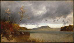
Lake George, John Frederick Kensett
In an attempt to retain their sovereignty and remain an independent nation positioned between the new United States and British North America, four of the Iroquois Nations fought on the side of the British; only the Oneida and their dependents, the Tuscarora, allied themselves with the Americans.[30] In retaliation for attacks on the frontier led by Joseph Brant and Loyalist Mohawk and related forces, the Sullivan Expedition of 1778 and 1779 destroyed nearly 50 Iroquois villages, adjacent croplands and winter stores, forcing many refugees to British-held Niagara.[31]
Fine Art Prints | Greeting Cards | Phone Cases | Lifestyle | Face Masks | Men's , Women' Apparel | Home Decor | jigsaw puzzles | Notebooks | Tapestries | ... | Tote Bags | Clothing | ...

Map of New York, Joseph Hutchins Colton
As allies of the British, the Iroquois were forced out of New York, although they had not been part of treaty negotiations. They resettled in Canada after the war and were given land grants by the Crown. In the treaty settlement, the British ceded most Indian lands to the new United States. Because New York made treaty with the Iroquois without getting Congressional approval, some of the land purchases have been subject to land claim suits since the late 20th century by the federally recognized tribes. New York put up more than 5 million acres (20,000 km2) of former Iroquois territory for sale in the years after the Revolutionary War, leading to rapid development in upstate New York.[32] As per the Treaty of Paris, the last vestige of British authority in the former Thirteen Colonies—their troops in New York City—departed in 1783, which was long afterward celebrated as Evacuation Day.[33]
1800 map of New York from Low's Encyclopaedia
New York City was the national capital under the Articles of Confederation and Perpetual Union, the first government. That organization was found to be insufficient, and prominent New Yorker Alexander Hamilton advocated a new government that would include an executive, national courts, and the power to tax. Hamilton led the Annapolis Convention (1786) that called for the Philadelphia Convention, which drafted the United States Constitution, in which he also took part. The new government was to be a strong federal national government to replace the relatively weaker confederation of individual states. Following heated debate, which included the publication of the now quintessential constitutional interpretation—The Federalist Papers—as a series of installments in New York City newspapers, New York was the 11th state to ratify the United States Constitution, on July 26, 1788.[34] New York remained the national capital under the new constitution until 1790, and was the site of the inauguration of President George Washington, the drafting of United States Bill of Rights, and the first session of the United States Supreme Court. Hamilton's revival of the heavily indebted United States economy after the war and the creation of a national bank significantly contributed to New York City becoming the financial center of the new nation.
Both the Dutch and the British imported African slaves as laborers to the city and colony; New York had the second-highest population of slaves after Charleston, SC. Slavery was extensive in New York City and some agricultural areas. The state passed a law for the gradual abolition of slavery soon after the Revolutionary War, but the last slave in New York was not freed until 1827.
19th century
The Erie Canal at Lockport, New York in 1839
Transportation in western New York was difficult before canals were built in the early part of the 19th century. The Hudson and Mohawk Rivers could be navigated only as far as Central New York. While the Saint Lawrence River could be navigated to Lake Ontario, the way westward to the other Great Lakes was blocked by Niagara Falls, and so the only route to western New York was over land.
Governor DeWitt Clinton strongly advocated building a canal connecting the Hudson River with Lake Erie, and thus all of the Great Lakes. Work commenced in 1817, and the Erie Canal was finished in 1825. Packet boats traveled up and down the canal with sightseers and visitors on board.[35] The canal was used even more extensively for commercial transport, as commodities were shipped from the Midwest, and finished goods transported along the canals in return from industries along the Mohawk Valley and New York City. It was considered an engineering marvel which opened up vast areas of New York to commerce and settlement. It enabled Great Lakes port cities such as Buffalo and Rochester to grow and prosper. It also connected the burgeoning agricultural production of the Midwest and shipping on the Great Lakes, with the port of New York City. Improving transportation, it enabled additional population migration to territories west of New York. The construction of railroads through much of the state superseded the utilization of the Erie Canal for the transportation of goods.
New York City and upstate textile mills did extensive business with the South during the antebellum years. Nearly half of New York exports were related to cotton, and Southern planters and businessmen were so frequent in New York as to have favorite hotels. At the same time, activism for abolitionism was strong in the city and upstate, where many communities also supported the Underground Railroad. In the early days of the American Civil War, the mayor of New York recommended that the city secede so its trade would not be damaged, but ultimately the city supported the war.[36] During the Civil War, New York state provided more than 370,000 soldiers to the Union armies. Over 53,000 New Yorkers died in service, roughly one of every seven who served.[37]
Immigration
Further information: Ellis Island
Castle Garden when it served as New York's first immigrant depot. Over 8 million immigrants passed through these doors.
Ellis Island in 1905
File:Ellis Island immigration footage.oggPlay media
Scenes at the Immigration Depot and a nearby dock on Ellis Island
Since the early 19th century, New York City has been the largest port of entry for legal immigration into the United States. Immigration has built the city and nation. In the United States, the federal government did not assume direct jurisdiction for immigration until 1890. Prior to this time, the matter was delegated to the individual states, then via contract between the states and the federal government. Most immigrants to New York would disembark at the bustling docks along the Hudson and East Rivers, in the eventual Lower Manhattan. On May 4, 1847 the New York State Legislature created the Board of Commissioners of Immigration to regulate immigration.[38]
The first permanent immigration depot in New York was established in 1855 at Castle Garden; a converted War of 1812 era fort located at the Battery at the tip of Manhattan. Today it stands within Battery Park. The first immigrants to arrive at the new depot were aboard three ships that had just been released from quarantine. Castle Garden served as New York's immigrant depot until it closed on April 18, 1890 when the federal government assumed control over immigration. During that period, more than 8 million immigrants passed through its doors (two out of every three U.S. immigrants).[39]
When the federal government assumed control, it established the Bureau of Immigration, which chose the three-acre Ellis Island in Upper New York Harbor for an entry depot. Already federally controlled, the island had served as an ammunition depot. It was chosen due its relative isolation with proximity to New York City and the rail lines of Jersey City, New Jersey, via a short ferry ride. While the island was being developed and expanded via land reclamation, the federal government operated a temporary depot at the Barge Office at the Battery.[40]
Ellis Island opened on January 1, 1892, and operated as a central immigration center until the National Origins Act was passed in 1924, reducing immigration. After that date, the only immigrants to pass through were displaced persons or war refugees. The island ceased all immigration processing on November 12, 1954 when the last person detained on the island, Norwegian seaman Arne Peterssen, was released. He had overstayed his shore leave and left on the 10:15 a.m. Manhattan-bound ferry to return to his ship.
More than 12 million immigrants passed through Ellis Island between 1892 and 1954. In the 21st century, more than 100 million Americans across the United States can trace their ancestry to these immigrants.
Ellis Island was the subject of a contentious and long-running border and jurisdictional dispute between New York State and the State of New Jersey, as both claimed it. The issue was settled in 1998 by the U.S. Supreme Court which ruled that the original 3.3 acre island was New York State territory and that the balance of the 27.5 acres (11 ha) added after 1834 by landfill was in New Jersey.[41] The island was added to the National Park Service system in May 1965 by President Lyndon B. Johnson and is still owned by the Federal government as part of the Statue of Liberty National Monument. Ellis Island was opened to the public as a museum of immigration in 1990.[42]
September 11, 2001 attacks
Two talk gray, rectangular buildings spewing black smoke and flames, particularly from the left of the two.
United Airlines Flight 175 hits the South Tower of the original World Trade Center in Lower Manhattan on September 11, 2001.
Main article: September 11 attacks
On September 11, 2001, two of four hijacked planes were flown into the Twin Towers of the original World Trade Center in Lower Manhattan, and the towers collapsed. 7 World Trade Center also collapsed due to damage from fires. The other buildings of the World Trade Center complex were damaged beyond repair and soon after demolished. The collapse of the Twin Towers caused extensive damage and resulted in the deaths of 2,753 victims, including 147 aboard the two planes. Since September 11, most of Lower Manhattan has been restored. In the years since, many rescue workers and residents of the area have developed several life-threatening illnesses, and some have already died.[43]
A memorial at the site was opened to the public on September 11, 2011. A permanent museum later opened at the site on March 21, 2014. When completed in 2014, the new One World Trade Center became the tallest skyscraper in the Western Hemisphere, at 1,776 feet.[44] Other skyscrapers are under construction at the site.
Flooding on Avenue C in Lower Manhattan, caused by Hurricane Sandy on October 29, 2012.[45]
Hurricane Sandy, 2012
Main article: Effects of Hurricane Sandy in New York
On October 29 and 30, 2012, Hurricane Sandy caused extensive destruction of the state's shorelines, ravaging portions of New York City and Long Island with record-high storm surge, with severe flooding and high winds causing power outages for hundreds of thousands of New Yorkers, and leading to gasoline shortages and disruption of mass transit systems. The storm and its profound effects have prompted the discussion of constructing seawalls and other coastal barriers around the shorelines of New York City and Long Island to minimize the risk from another such future event. This is considered highly probably due to global warming and rise in sea levels.[46][47]
Enveloped by the Atlantic Ocean and Long Island Sound, New York City and Long Island alone are home to approximately 11 million residents conjointly.
The Adirondack Mountains of Upstate New York form the southernmost zone in the Eastern forest-boreal transition ecoregion of North America.
The hydrologic source of the Hudson River is near or at Lake Tear of the Clouds, a small tarn in the Adironacks, photo circa 19th century.
Lake George, one of numerous oligotrophic lakes in the Adirondack region, is nicknamed the Queen of American Lakes.
Mirror Lake in the Village of Lake Placid in the Adirondacks, site of the 1932 and the 1980 Winter Olympics.
Lake Flower in the Village of Saranac Lake, nicknamed the Capital of the Adirondacks.
The Adirondack High Peaks region.
Geography
Main article: Geography of New York
New York terrain.
Map of the Hudson and Mohawk rivers.
The Bear Mountain Bridge, spanning the Hudson River in the Hudson Valley.
New York covers 54,555 square miles (141,300 km2) and ranks as the 27th largest state by size.[3] The Great Appalachian Valley dominates eastern New York and contains the Lake Champlain Valley as its northern half and the Hudson Valley as its southern half within the state. The rugged Adirondack Mountains, with vast tracts of wilderness, lie west of the Lake Champlain Valley. The Hudson River begins near Lake Tear of the Clouds and flows south through the eastern part of the state without draining Lakes George or Champlain. Lake George empties at its north end into Lake Champlain, whose northern end extends into Canada, where it drains into the Richelieu River and then ultimately the Saint Lawrence River. Four of New York City's five boroughs are situated on three islands at the mouth of the Hudson River: Manhattan Island; Staten Island; and Long Island, which contains Brooklyn and Queens at its western end.
Most of the southern part of the state rests on the Allegheny Plateau, which rises from the southeastern United States to the Catskill Mountains; the section in New York State is known as the Southern Tier. The western section of the state is drained by the Allegheny River and rivers of the Susquehanna and Delaware River systems. The Delaware River Basin Compact, signed in 1961 by New York, New Jersey, Pennsylvania, Delaware, and the federal government, regulates the utilization of water of the Delaware system. The highest elevation in New York is Mount Marcy in the Adirondacks, at 5,344 ft (1,629 m) above sea level; while the state's lowest point is at sea level, on the Atlantic Ocean.[48]
Much of New York State borders water, as is true for New York City as well. Of New York State's total area, 13.5% consists of water. The state's borders touch (clockwise from the west) two Great Lakes (Erie and Ontario, which are connected by the Niagara River); the provinces of Ontario and Quebec in Canada, with New York and Ontario sharing the Thousand Islands archipelago within the Saint Lawrence River; Lake Champlain; three New England states (Vermont, Massachusetts, and Connecticut); the Atlantic Ocean, and two Mid-Atlantic states, New Jersey and Pennsylvania. In addition, Rhode Island shares a water border with New York. New York is the second largest of the original Thirteen Colonies and is the only state that touches both the Great Lakes and the Atlantic Ocean.
In contrast with New York City's urban landscape, the vast majority of the state's geographic area is dominated by meadows, forests, rivers, farms, mountains, and lakes. New York's Adirondack Park is the largest state park in the United States and is larger than the Yellowstone, Yosemite, Grand Canyon, Glacier, and Olympic National Parks combined.[49] New York established the first state park in the United States at Niagara Falls in 1885. Niagara Falls is shared between New York and Ontario as it flows on the Niagara River from Lake Erie to Lake Ontario.
Upstate and downstate are often used informally to distinguish New York City or its greater metropolitan area from the rest of New York State. The placement of a boundary between the two is a matter of great contention.[50] Unofficial and loosely defined regions of Upstate New York include the Southern Tier, which often includes the counties along the border with Pennsylvania,[51] and the North Country, which can mean anything from the strip along the Canadian border to everything north of the Mohawk River.[52]
Climate
Main article: Climate of New York
Lake-effect snow is a major contributor to snowfall totals in western New York.
Skaneateles Lake, one of the eleven Finger Lakes, provides drinking water for the city of Syracuse and nearby areas in central New York.
In general, New York has a humid continental climate, though under the Köppen climate classification, New York City has a humid subtropical climate.[53] Weather in New York is heavily influenced by two continental air masses: a warm, humid one from the southwest and a cold, dry one from the northwest.
Downstate New York, comprising New York City, Long Island, and lower portions of the Hudson Valley, has rather warm summers, with some periods of high humidity, and cold, damp winters which, however, are relatively mild compared to temperatures in Upstate New York, secondary to the former region's lower elevation, proximity to the Atlantic Ocean, and relatively lower latitude compared to the latter. Upstate New York experiences warm summers, marred by only occasional, brief intervals of sultry conditions, with long and cold winters. Western New York receives heavy lake-effect snows, especially during the earlier portions of winter, before Lakes Erie and Ontario themselves freeze. The summer climate is cool in the Adirondacks, Catskills, and at higher elevations of the Southern Tier.
Summer daytime temperatures usually range from the upper 70s to mid-80s °F (25 to 30 °C), over much of the state. In the majority of winter seasons, a temperature of −13 °F (−25 °C) or lower can be expected in the northern highlands (Northern Plateau) and 5 °F (−15 °C) or colder in the southwestern and east-central highlands of the Southern Tier.
New York ranks 46th among the 50 states in the amount of greenhouse gases generated per person. This relative efficient energy usage is primarily due to the dense, compact settlement in the New York City metropolitan area, and the state population's high rate of mass transit use in this area and between major cities.[54]
| City | Jan | Feb | Mar | Apr | May | Jun | Jul | Aug | Sep | Oct | Nov | Dec | |
|---|---|---|---|---|---|---|---|---|---|---|---|---|---|
| Albany | max min |
31 13 |
34 16 |
44 25 |
57 36 |
70 46 |
78 55 |
82 60 |
80 58 |
71 50 |
60 39 |
48 31 |
36 20 |
| Binghamton | max min |
28 15 |
31 17 |
41 25 |
53 35 |
66 46 |
73 54 |
78 59 |
76 57 |
68 50 |
57 40 |
44 31 |
33 21 |
| Buffalo | max min |
31 18 |
33 19 |
42 26 |
54 36 |
66 48 |
75 57 |
80 62 |
78 60 |
70 53 |
59 43 |
47 34 |
36 24 |
| Lake Placid | max min |
27 5 |
32 8 |
40 16 |
54 29 |
66 39 |
74 48 |
78 53 |
76 51 |
69 44 |
56 34 |
44 25 |
32 12 |
| Long Beach | max min |
39 23 |
40 24 |
48 31 |
58 40 |
69 49 |
77 60 |
83 66 |
82 64 |
75 57 |
64 45 |
54 36 |
44 28 |
| New York City | max min |
38 26 |
41 28 |
50 35 |
61 44 |
71 54 |
79 63 |
84 69 |
82 68 |
75 60 |
64 50 |
53 41 |
43 32 |
| Rochester | max min |
31 17 |
33 17 |
43 25 |
55 35 |
68 46 |
77 55 |
81 60 |
79 59 |
71 51 |
60 41 |
47 33 |
36 23 |
| Syracuse | max min |
31 14 |
34 16 |
43 24 |
56 35 |
68 46 |
77 55 |
82 60 |
80 59 |
71 51 |
60 40 |
47 32 |
36 21 |
| City | Jan | Feb | Mar | Apr | May | Jun | Jul | Aug | Sep | Oct | Nov | Dec | |
|---|---|---|---|---|---|---|---|---|---|---|---|---|---|
| Albany | max min |
−1 −11 |
1 −9 |
7 −4 |
14 2 |
21 8 |
26 13 |
28 16 |
27 14 |
22 10 |
16 4 |
9 −1 |
2 −7 |
| Binghamton | max min |
−2 −9 |
−1 −8 |
5 −4 |
12 2 |
19 8 |
23 12 |
26 15 |
24 14 |
20 10 |
14 4 |
7 −1 |
1 −6 |
| Buffalo | max min |
−1 −8 |
1 −7 |
6 −3 |
12 2 |
19 9 |
24 14 |
27 17 |
26 16 |
21 12 |
15 6 |
8 1 |
2 −4 |
| Lake Placid | max min |
−3 −15 |
0 −13 |
4 −9 |
12 −2 |
19 4 |
23 9 |
26 12 |
24 11 |
21 7 |
13 1 |
7 −4 |
0 −11 |
| Long Beach | max min |
4 −5 |
4 −4 |
9 −1 |
14 4 |
21 9 |
25 16 |
28 19 |
28 18 |
24 14 |
18 7 |
12 2 |
7 −2 |
| New York City | max min |
3 −3 |
5 −2 |
10 2 |
16 7 |
22 12 |
26 17 |
29 21 |
28 20 |
24 16 |
18 10 |
12 5 |
6 0 |
| Rochester | max min |
−1 −8 |
1 −8 |
6 −4 |
13 2 |
20 8 |
25 13 |
27 16 |
26 15 |
22 11 |
16 5 |
8 1 |
2 −5 |
| Syracuse | max min |
−1 −10 |
1 −9 |
6 −4 |
13 2 |
20 8 |
25 13 |
28 16 |
27 15 |
22 11 |
16 4 |
8 0 |
2 −6 |
| Converted from Fahrenheit data (above) | |||||||||||||
Statescape
The skyscrapers of New York City, the most populous U.S. city with 8.5 million residents in 2014, are mostly situated in Manhattan, seen here in this panorama viewed across the Hudson River from Weehawken, New Jersey, in January 2015. One57 and 432 Park Avenue are noted left of center; the Empire State Building, right of center; and on the far right of the picture, One World Trade Center, the tallest skyscraper in the Western Hemisphere, as well as Four World Trade Center, 70 Pine Street, the Woolworth Building, and 40 Wall Street. At the center of the skyline picture, the Chrysler Building, The New York Times Building, and the Conde Nast Building can be picked out of the crowd by their spires.
Niagara Falls, in the Niagara Falls National Heritage Area, flows on the Niagara River connecting Lake Ontario and Lake Erie, two of the five Great Lakes of North America.
View of the Adirondack Mountains from the 5,344 ft (1,629 m) summit of Mount Marcy, New York's tallest peak.
Panorama of the state capital Albany and the Hudson River from Rensselaer. At the left foreground is the System Administration Building of the State University of New York. The tallest skyscraper visible is one of several buildings in the Empire State Plaza governmental complex.
The Thousand Islands constitute an archipelago within the Saint Lawrence River. Boldt Castle, on Heart Island, is seen at center.
The Great Peconic Bay, with the Atlantic Ocean as its primary inflow, separates the North Fork and South Fork at the East End of Long Island.
Regions
Main article: List of regions of the United States § New York
Economic regions of New York
Due to its long history, the state of New York has several overlapping (and often conflicting) definitions of regions within the state. This is further exacerbated by the colloquial use of such regional labels. The New York State Department of Economic Development provides two distinct definitions of these regions. The department divides the state into ten economic regions,[56] which approximately correspond to terminology used by residents:
Western New York
Finger Lakes
Southern Tier
Central New York
North Country
Mohawk Valley
Capital District
Hudson Valley
New York City
Long Island
Tourism regions of New York
The Department of Economic Development also groups the counties into eleven regions for tourism purposes:[57]
Chautauqua–Allegheny
Niagara Frontier
Finger Lakes
Thousand Islands
Central Region (formerly Central-Leatherstocking)
Adirondack Mountains
Capital District
Catskill Mountains
Hudson Valley
New York City
Long Island
State parks
See also: List of New York state parks and New York State Office of Parks, Recreation and Historic Preservation
Two major state parks (in green) are the Adirondack Park (north) and the Catskill Park (south).
New York has many state parks and two major forest preserves. Adirondack Park, roughly the size of the state of Vermont and the largest state park in the United States,[58] was established in 1892 and given state constitutional protection to remain "forever wild" in 1894. The park is larger than Yellowstone, Everglades, Glacier, and Grand Canyon national parks combined.[58] The thinking that led to the creation of the Park first appeared in George Perkins Marsh's Man and Nature, published in 1864.
The Catskill Park was protected in legislation passed in 1885,[59] which declared that its land was to be conserved and never put up for sale or lease. Consisting of 700,000 acres (2,800 km2) of land,[59] the park is a habitat for bobcats, minks, and fishers. There are some 400 black bears living in the region.[60] The state operates numerous campgrounds, and there are over 300 miles (480 km) of multi-use trails in the Park.
The Montauk Point State Park boasts the 1797 Montauk Lighthouse, commissioned under President George Washington, which is a major tourist attraction on the easternmost tip of Long Island. Hither Hills park offers camping and is a popular destination with surfcasting sport fishermen.
National parks
The Statue of Liberty in New York Harbor is a symbol of the United States and its ideals of freedom, democracy, and opportunity.[61]
African Burial Ground National Monument
General Shuyler's house at Saratoga National Historical Park.
The State of New York is well represented in the National Park System with 22 national parks, which received 16,349,381 visitors in 2011. In addition, there are 4 National Heritage Areas, 27 National Natural Landmarks, 262 National Historic Landmarks, and 5,379 listings on the National Register of Historic Places.
African Burial Ground National Monument in Lower Manhattan is the only National Monument dedicated to Americans of African ancestry. It preserves a site containing the remains of more than 400 Africans buried during the late 17th and 18th centuries in a portion of what was the largest colonial-era cemetery for people of African descent, both free and enslaved, with an estimated tens of thousands of remains interred. The site's excavation and study were called "the most important historic urban archeological project in the United States."[62]
Fire Island National Seashore is a United States National Seashore that protects a 26-mile (42 km) section of Fire Island, an approximately 30-mile (48 km) long barrier island separated from the mainland of Long Island by the Great South Bay. The island is part of Suffolk County.
Gateway National Recreation Area is more than 26,000 acres (10,522 ha) of water, marshes, and shoreline at the entrance to New York Harbor, the majority of which lies within New York. Including areas on Long Island and in New Jersey, it covers more area than that of two Manhattan Islands.
General Grant National Memorial is the final resting place of President Ulysses S. Grant and is the largest mausoleum in North America.
Hamilton Grange National Memorial preserves the home of Alexander Hamilton, Caribbean immigrant and orphan who rose to be a United States founding father and indispensable partner to George Washington.
Home of Franklin D. Roosevelt National Historic Site, established in 1945, preserves the Springwood estate in Hyde Park, New York. Springwood was the birthplace, lifelong home, and burial place of the 32nd President of the United States, Franklin D. Roosevelt.
Niagara Falls National Heritage Area was designated by Congress in 2008; it stretches from the western boundary of Wheatfield, New York to the mouth of the Niagara River on Lake Ontario, including the communities of Niagara Falls, Youngstown, and Lewiston. It includes Niagara Falls State Park and Colonial Niagara Historic District. It is managed in collaboration with the state.
Saratoga National Historical Park preserves the site of the Battles of Saratoga, the first significant American military victory of the American Revolutionary War. In 1777, American forces defeated a major British Army, which led France to recognize the independence of the United States, and enter the war as a decisive military ally of the struggling Americans.
Statue of Liberty National Monument includes Ellis Island and the Statue of Liberty. The statue, designed by Frédéric Bartholdi, was a gift from France to the United States to mark the Centennial of the American Declaration of Independence; it was dedicated in New York Harbor on October 28, 1886. It has since become an icon of the United States and the concepts of democracy and freedom.
Theodore Roosevelt Birthplace National Historic Site is the birthplace and childhood home of President Theodore Roosevelt, the only US President born in New York City.
Administrative divisions
Map of the counties in New York
Main article: Administrative divisions of New York
New York is divided into 62 counties. Aside from the five counties of New York City, each of these counties is subdivided into towns and cities. Towns can contain incorporated villages or unincorporated hamlets. New York City is divided into five boroughs, each coterminous with a county.
Downstate New York (New York City, Long Island, and the southern portion of the Hudson Valley) can be considered to form the central core of the Northeast megalopolis, an urbanized region stretching from New Hampshire to Virginia.
The major cities of the state developed along the key transportation and trade routes of the early 19th century, including the Erie Canal and railroads paralleling it. Today, the New York Thruway acts as a modern counterpart to commercial water routes.[63]
Demographics
| Historical population | |||
|---|---|---|---|
| Census | Pop. | %± | |
| 1790 | 340,120 | — | |
| 1800 | 589,051 | 73.2% | |
| 1810 | 959,049 | 62.8% | |
| 1820 | 1,372,812 | 43.1% | |
| 1830 | 1,918,608 | 39.8% | |
| 1840 | 2,428,921 | 26.6% | |
| 1850 | 3,097,394 | 27.5% | |
| 1860 | 3,880,735 | 25.3% | |
| 1870 | 4,382,759 | 12.9% | |
| 1880 | 5,082,871 | 16.0% | |
| 1890 | 6,003,174 | 18.1% | |
| 1900 | 7,268,894 | 21.1% | |
| 1910 | 9,113,614 | 25.4% | |
| 1920 | 10,385,227 | 14.0% | |
| 1930 | 12,588,066 | 21.2% | |
| 1940 | 13,479,142 | 7.1% | |
| 1950 | 14,830,192 | 10.0% | |
| 1960 | 16,782,304 | 13.2% | |
| 1970 | 18,236,967 | 8.7% | |
| 1980 | 17,558,072 | −3.7% | |
| 1990 | 17,990,455 | 2.5% | |
| 2000 | 18,976,457 | 5.5% | |
| 2010 | 19,378,102 | 2.1% | |
| Est. 2014 | 19,746,227 | 1.9% | |
| Sources:
2014 Estimate[4] |
|||
Main article: Demographics of New York
Population
New York population distribution map
The distribution of change in population growth is uneven in New York State; the New York City metropolitan area is growing considerably, along with Saratoga County; while most of Western New York is nearly stagnant. According to immigration statistics, the state is a leading recipient of migrants from around the globe. Between 2000 and 2005, immigration failed to surpass emigration, a trend that has been reversing since 2006. New York State lost two House seats in the 2011 congressional reapportionment, secondary to relatively slow growth when compared to the rest of the United States. In 2000 and 2005, more people moved from New York to Florida than from any one state to another.[65] However, New York State has the second-largest international immigrant population in the country among the American states, at 4.2 million as of 2008; most reside in and around New York City, due to its size, high profile, vibrant economy, and cosmopolitan culture.
The United States Census Bureau estimates that the population of New York was 19,746,227 on July 1, 2014, a 1.9% increase since the 2010 United States Census.[4] Despite the open land in the state, New York's population is very urban, with 92% of residents living in an urban area,[66] predominantly in the New York City metropolitan area.
Two-thirds of New York State's population resides in New York City Metropolitan Area. New York City is the most populous city in the United States,[67] with an estimated record high population of 8,491,079 in 2014,[8][68] incorporating more immigration into the city than emigration since the 2010 United States Census.[69] More than twice as many people live in New York City as in the second-most populous U.S. city (Los Angeles),[70] and within a smaller area. Long Island alone accounted for a Census-estimated 7,804,968 residents in 2014, representing 39.5% of New York State's population.[9][71][72][73][74]
Most populous counties
Main article: List of counties in New York
These are the ten counties with the largest populations as of 2010:[75]
Kings County (Brooklyn): 2,504,700
Queens County (Queens): 2,230,722
New York County (Manhattan): 1,585,873
Suffolk County: 1,493,350
Bronx County (the Bronx): 1,385,108
Nassau County: 1,339,532
Westchester County: 949,113
Erie County: 919,040
Monroe County: 744,344
Richmond County (Staten Island): 468,730
Major cities
Main article: List of cities in New York
Further information: List of towns in New York, List of villages in New York and List of census-designated places in New York
There are 62 cities in New York. The largest city in the state and the most populous city in the United States is New York City, which comprises five counties (boroughs): Bronx, New York County (Manhattan), Queens, Kings County (Brooklyn), and Richmond County (Staten Island). New York City is home to more than two-fifths of the state's population. Albany, the state capital, is the sixth-largest city in New York State. The smallest city is Sherrill, New York, in Oneida County. Hempstead is the most populous town in the state; if it were a city, it would be the second largest in New York State, with over 700,000 residents.
Largest cities or towns in New York
http://www.citypopulation.de/USA-NewYork.html
Rank Name County Pop.
New York City
New York City
Buffalo
Buffalo 1 New York City multiple 8,491,079[8][68] Rochester
Rochester
Yonkers
Yonkers
2 Buffalo Erie 261,310
3 Rochester Monroe 210,565
4 Yonkers Westchester 195,976
5 Syracuse Onondaga 145,170
6 Albany Albany 97,856
7 New Rochelle Westchester 77,062
8 Mount Vernon Westchester 67,292
9 Schenectady Schenectady 66,135
10 Utica Oneida 62,239
Metropolitan areas
Main article: New York statistical areas
The following are the top ten metropolitan areas in the state as of the 2010 Census:[76]
New York City and the Hudson Valley (19,567,410 in NY/NJ/PA, 13,038,826 in NY)
Buffalo-Niagara Falls (1,135,509)
Rochester (1,079,671)
Albany and the Capital District (870,716)
Syracuse (662,577)
Utica-Rome (299,397)
Binghamton (251,725)
Kingston (182,493)
Glens Falls (128,923)
Watertown-Fort Drum (116,229)
Racial and ancestral makeup
The Manhattan Chinatown (紐約華埠), home to the highest concentration of Chinese people in the Western Hemisphere,[77][78][79][80] at top, and one of several Chinatowns in Brooklyn (布魯克林華埠) below. Chinese in New York constitute the fastest-growing nationality in New York State and on Long Island,[10][11][81][82] with large-scale Chinese immigration continuing into New York.
According to the U.S. Census Bureau, the 2010 racial makeup of New York State was as follows by self-identification:[83]
White American – 65.7%
Black or African American – 15.9%
Asian American – 7.3% (3.0% Chinese, 1.6% Indian, 0.7% Korean, 0.5% Filipino, 0.3% Pakistani, 0.3% Bangladeshi, 0.2% Japanese, 0.1% Vietnamese)
Multiracial Americans – 3.0%
Native American/American Indian – 0.6%
Some other race - 7.5%
New York Racial Breakdown of Population Racial composition 1950[84] 1970[84] 1990[84] 2000[85] 2010[86]
White 93.5% 86.8% 74.4% 67.9% 65.8%
Black 6.2% 11.9% 15.9% 15.9% 15.9%
Asian 0.2% 0.7% 3.9% 5.5% 7.3%
Native 0.1% 0.2% 0.3% 0.4% 0.6%
Native Hawaiian and
other Pacific Islander – – – 0.1% 0.1%
Other race – 0.4% 5.5% 7.1% 7.4%
Two or more races – – – 3.1% 3.0%
In 2004, the major ancestry groups in New York State by self-identification were Hispanic and Latino Americans (17.6%), African American (15.8%), Italian (14.4%), Irish (12.9%), German (11.1%) and English (6%).[87] According to a 2010 estimate, 21.7% of the population is foreign-born.[83]
New York population ethnicity map
The state's most populous racial group, non-Hispanic white, has declined as a proportion of the state population from 94.6% in 1940 to 58.3% in 2010.[83][84] As of 2011, 55.6% of New York's population younger than age 1 were minorities.[88] New York's robustly increasing Jewish population, the largest outside of Israel,[89] was the highest among states both by percentage and absolute number in 2012.[90] It is driven by the high reproductive rate of Orthodox Jewish families,[91] particularly in Brooklyn and communities of the Hudson Valley.
New York is home to the second-largest African-American population (after Georgia) and the second largest Asian-American population (after California) in the United States. New York's Black population declined between 2000 and 2010 as some people migrated to the South.[92] In addition it is home to the largest Puerto Rican, Dominican, and Jamaican American populations in the continental United States. The New York City neighborhood of Harlem has historically been a major cultural capital for African-Americans of sub-Saharan descent, and Bedford-Stuyvesant in Brooklyn has the largest such population in the United States.
Queens, also in New York City, is home to the state's largest Asian-American population and is the most ethnically diverse county in the United States; it is the most ethnically diverse urban area in the world.[93][94] Queens is home to the largest Andean (Colombian, Ecuadorian, Peruvian, and Bolivian) populations in the United States.
The Chinese population constitutes the fastest-growing nationality in New York State; multiple satellites of the original Manhattan Chinatown (紐約華埠), in Brooklyn (布鲁克林華埠), and around Flushing, Queens (法拉盛華埠), are thriving as traditionally urban enclaves, while also expanding rapidly eastward into suburban Nassau County (拿騷縣),[95] on Long Island (長島).[96] New York State has become the top destination for new Chinese immigrants, and large-scale Chinese immigration continues into the state.[81][82][97][98][99] Long Island, including Queens and Nassau County, is also home to several Little Indias (लघु भारत) and a large Koreatown (롱 아일랜드 코리아타운), with large and growing attendant populations of Indian Americans and Korean Americans, respectively. Brooklyn has been a destination for West Indian immigrants of African descent, as well as Asian Indian immigrants.
In the 2000 Census, Italian Americans in New York were the largest in any state; they made up the largest self-identified ancestral group in Staten Island and Long Island, followed by Irish-Americans. Albany and the Mohawk Valley also have populations with high numbers of ethnic Irish and ethnic Italian, reflecting 19th and early 20th-century immigration. In Buffalo and western New York, German-Americans comprise the largest ancestry. In the North Country of New York, French Canadians represent the leading ethnicity, given the area's proximity to Quebec. Americans of English ancestry are present throughout all of upstate New York, reflecting early colonial and later immigrants.
6.5% of New York's population were under five years of age, 24.7% under 18, and 12.9% were 65 or older. Females made up 51.8% of the state's population.
Languages
In 2010, the most common American English dialects spoken in New York, besides General American English, were the New York City area dialect (including New York Latino English and North Jersey English), the Western New England accent around Albany, and Inland Northern American English in Buffalo and western New York State. As many as 800 languages are spoken in New York City,[100][101] making it the most linguistically diverse city in the world.[102]
As of 2010, 70.72% (12,788,233) of New York residents aged five and older reported speaking only English at home, while 14.44% (2,611,903) spoke Spanish, 2.61% (472,955) Chinese (which includes Cantonese and Mandarin), 1.20% (216,468) Russian, 1.18% (213,785) Italian, 0.79% (142,169) French Creole, 0.75% (135,789) French, 0.67% (121,917) Yiddish, 0.63% (114,574) Korean, and Polish was spoken by 0.53% (95,413) of the population over the age of five. In total, 29.28% (5,295,016) of New York's population aged five and older reported speaking a language other than English.[2]
Most common non-English languages spoken in New York Language Percentage of population
(as of 2010)[2]
Spanish 14.44%
Chinese (including Cantonese and Mandarin) 2.61%
Russian 1.20%
Italian 1.18%
French Creole 0.79%
French 0.75%
Yiddish 0.67%
Korean 0.63%
Polish 0.53%
Bengali 0.43%
Religion
Brooklyn's growing Orthodox Jewish (יהודי) community is the largest in the United States, with approximately 600,000 individuals.[103]
The 2014 Pew Religious Landscape Survey showed the religious makeup of the state was as follows:[104]
Christian 60%:
10% Evangelical Protestant
11% Mainline Protestant
5% Black Protestant
31% Catholic
3% Other Christian
Jewish 7%
Other Non-Christian Faiths 5%
Unaffiliated 27%
In 2010, the Association of Religion Data Archives (ARDA) reported that the largest denominations were the Catholic Church with 6,286,916; Orthodox Judaism with 588,500; Islam with 392,953; and the United Methodist Church with 328,315 adherents.[105]
LGBT
Gay pride parade, Albany
Roughly 3.8 percent of the state's adult population self-identifies as lesbian, gay, bisexual, or transgender. This constitutes a total LGBT adult population of 570,388 individuals.[106] In 2010, the number of same-sex couple households stood at roughly 48,932.[107] New York was the fifth state to license same-sex marriages, after New Hampshire. Michael Bloomberg, the Mayor of New York City, stated that "same-sex marriages in New York City have generated an estimated $259 million in economic impact and $16 million in City revenues" in the first year after the enactment of the Marriage Equality Act".[108] Same-sex marriages in New York were legalized on June 24, 2011 and were authorized to take place beginning 30 days thereafter.[109]
Economy
Main article: Economy of New York
See also: New York locations by per capita income
2001 NY Proof.png
The New York Stock Exchange, the world's largest stock exchange by total market capitalization of its listed companies.[110]
Presidential $1 Reverse.png
Silicon Alley has expanded well beyond its cradle in the Flatiron District of Manhattan.
Midtown Manhattan in New York City, the largest central business district in the United States.
Times Square in Midtown Manhattan, hub of the Broadway theater district, a media center, and one of the world's busiest pedestrian intersections.
New York's gross state product in 2010 was $1.16 trillion, ranking third in size behind the larger states of California and Texas.[111] If New York State were an independent nation, it would rank as the 15th largest economy in the world. However, in 2013, the multi-state, New York City-centered Metropolitan Statistical Area produced a gross metropolitan product (GMP) of nearly US$1.39 trillion,[112] while in 2012, the corresponding Combined Statistical Area[113] generated a GMP of over US$1.55 trillion, both ranking first nationally by a wide margin and behind the GDP of only twelve nations and eleven nations, respectively.[114]
Wall Street
Main article: Wall Street
Anchored by Wall Street in the Financial District of Lower Manhattan, New York City has been called both the most economically powerful city and the leading financial center of the world.[23][22][115][116][117] Lower Manhattan is the third-largest central business district in the United States and is home to the New York Stock Exchange, on Wall Street, and the NASDAQ, at 165 Broadway, representing the world's largest and second largest stock exchanges, respectively, when measured both by overall average daily trading volume and by total market capitalization of their listed companies in 2013.[110][118] Investment banking fees on Wall Street totaled approximately $40 billion in 2012,[119] while in 2013, senior New York City bank officers who manage risk and compliance functions earned as much as $324,000 annually.[120] In fiscal year 2013-14, Wall Street's securities industry generated 19% of New York State's tax revenue.[121] New York City remains the largest global center for trading in public equity and debt capital markets, driven in part by the size and financial development of the U.S. economy.[122]:31–32[123] New York also leads in hedge fund management; private equity; and the monetary volume of mergers and acquisitions. Several investment banks and investment mangers headquartered in Manhattan are important participants in other global financial centers.[122]:34–35 New York is also the principal commercial banking center of the United States.[124]
Many of the world's largest media conglomerates are also based in the city. Manhattan contained approximately 520 million square feet (48.1 million m2) of office space in 2013,[125] making it the largest office market in the United States,[126] while Midtown Manhattan is the largest central business district in the nation.[127]
Silicon Alley
Main article: Silicon Alley
Silicon Alley, centered in New York City, has evolved into a metonym for the sphere encompassing the New York City metropolitan region's high technology and entrepreneurship ecosystem; in the first half of 2015, Silicon Alley generated over $3.7 billion in venture capital investment.[128] High tech industries including digital media, biotechnology, software development, game design, and other fields in information technology are growing, bolstered by New York City's position at the terminus of several transatlantic fiber optic trunk lines,[129] its intellectual capital, as well as its growing outdoor wireless connectivity.[130] In December 2014, New York State announced a $50 million venture-capital fund to encourage enterprises working in biotechnology and advanced materials; according to Governor Andrew Cuomo, the seed money would facilitate entrepreneurs in bringing their research into the marketplace.[131]
Microelectronic hardware and photographic processing
Main article: Tech Valley
Albany,[132] Saratoga County,[133][134] and the Hudson Valley, collectively recognized as eastern New York's Tech Valley, have experienced significant growth in the computer hardware side of the high-technology industry, with great strides in the nanotechnology sector, digital electronics design, and water- and electricity-dependent integrated microchip circuit manufacturing,[133] involving companies including IBM, GlobalFoundries, Samsung, and Taiwan Semiconductor, among others.[132][135] In the first half of 2015, Tech Valley generated over $30 million in venture capital investment.[128] The Rochester area is important in the field of photographic processing and imaging.
Media and entertainment
Main article: Media in New York City
Creative industries, which are concerned with generating and distributing knowledge and information, such as new media, digital media, film and television production, advertising, fashion, design, and architecture, account for a growing share of employment, with New York City possessing a strong competitive advantage in these industries.[136] As of 2014, New York State was offering tax incentives of up to $420 million annually for filmmaking within the state, the most generous such tax rebate among the U.S. states. New York has also attracted higher-wage visual-effects employment by further augmenting its tax credit to a maximum of 35% for performing post-film production work in Upstate New York.[137]
The I Love New York logo was designed by Milton Glaser in 1977.
Tourism
Main articles: Tourism in New York City, Niagara Falls and Broadway theatre
I Love New York (stylized I ❤ NY) is both a logo and a song that are the basis of an advertising campaign and have been used since 1977 to promote tourism in New York City,[138] and later to promote New York State as well. The trademarked logo, owned by New York State Empire State Development,[139] appears in souvenir shops and brochures throughout the state, some licensed, many not. The song is the state song of New York. The Broadway League reported that Broadway shows sold approximately US$1.27 billion worth of tickets in the 2013–2014 season, an 11.4% increase from US$1.139 billion in the 2012–2013 season. Attendance in 2013–2014 stood at 12.21 million, representing a 5.5% increase from the 2012–2013 season's 11.57 million.[140]
Exports
New York exports a wide variety of goods such as foodstuffs, computers and electronics, cut diamonds and other commodities, and automobile parts. In 2007, the state exported a total of $71.1 billion worth of goods, with the five largest foreign export markets being Canada (US$15 billion), the United Kingdom (US$6 billion), Switzerland (US$5.9 billion), Israel (US$4.9 billion), and Hong Kong (US$3.4 billion). New York's largest imports are oil, gold, aluminum, natural gas, electricity, rough diamonds, and lumber. The state also has a large manufacturing sector that includes printing and the production of garments, furs, railroad equipment and bus line vehicles; many of these industries are concentrated in Upstate regions.
New York is the nation's third-largest grape producing state, and second-largest wine producer by volume, behind California. The southern Finger Lakes hillsides, the Hudson Valley, the North Fork of Long Island, and the southern shore of Lake Erie are the primary grape- and wine-growing regions in New York, with many vineyards. In 2012, New York had 320 wineries and 37,000 grape bearing acres, generating full-time employment of nearly 25,000 and annual wages of over US$1.1 billion, and yielding US$4.8 billion in direct economic impact from New York grapes, grape juice, and wine and grape products.[141]
New York is a major agricultural producer overall, ranking among the top five states for agricultural products including maple syrup, apples, cherries, cabbage, dairy products, onions, and potatoes. The state is the largest producer of cabbage in the U.S. The state has about a quarter of its land in farms and produced $3.4 billion in agricultural products in 2001. The south shore of Lake Ontario provides the right mix of soils and microclimate for many apple, cherry, plum, pear and peach orchards. Apples are also grown in the Hudson Valley and near Lake Champlain. A moderately sized saltwater commercial fishery is located along the Atlantic side of Long Island. The principal catches by value are clams, lobsters, squid, and flounder.
Education
Main article: Education in New York
System Administration Building of the State University of New York in Albany
The University of the State of New York oversees all public primary, middle-level, and secondary education in the state, while the New York City Department of Education manages the New York City Public Schools system. In 1894, reflecting general racial discrimination, the state passed a law that allowed communities to set up separate schools for children of African-American descent. In 1900, the state passed another law requiring integrated schools.[142]
At the level of post-secondary education, the statewide public university system is the State University of New York, commonly referred to as SUNY. New York City also has its own City University of New York, which is funded by the city. The SUNY system consists of 64 community colleges, technical colleges, undergraduate colleges, and doctoral-granting institutions including several universities. The four SUNY University Centers, offering a wide array of academic programs, are the University at Albany, Binghamton University, the University at Buffalo, and Stony Brook University.
Notable large private universities include the Columbia University in Upper Manhattan and Cornell University in Ithaca, both Ivy League institutions, as well as New York University in Lower Manhattan, and Fordham University in the Bronx, Manhattan, and Westchester County. Smaller notable private institutions of higher education include Rockefeller University, New York Institute of Technology, Yeshiva University, and Hofstra University. There are also a multitude of postgraduate-level schools in New York State, including Medical, Law, and Engineering schools. West Point, the service academy of the U.S. Army, is located just south of Newburgh, on the west bank of the Hudson River.
During the fiscal 2013 year, New York spent more on public education per pupil than any other state, according to U.S. Census Bureau statistics.[143]
Transportation
Main article: Transportation in New York
New York State Thruway
The Thaddeus Kosciusko Bridge, crossing the Mohawk River, is the portion of the toll-free, six-lane Adirondack Northway that connects Albany County and Saratoga County.
The New York City Subway is one of the world's busiest, serving a passenger ridership of over 5 million per average weekday.
Connecting Westchester and Rockland counties, the Tappan Zee Bridge, at top, carries the New York Thruway and is the busiest Hudson River crossing entirely within New York State, carrying an average 135,000 motor vehicles daily. Below is a rendering of its replacement under construction.
New York has one of the most extensive and one of the oldest transportation infrastructures in the country. Engineering challenges posed by the complex terrain of the state and the unique infrastructural issues of New York City brought on by urban crowding have had to be overcome perennially. Population expansion of the state has followed the path of the early waterways, first the Hudson River and Mohawk River, then the Erie Canal. In the 19th century, railroads were constructed along the river valleys, followed by the New York State Thruway in the 20th century.
The New York State Department of Transportation (NYSDOT) is the department of the government of New York[144] responsible for the development and operation of highways, railroads, mass transit systems, ports, waterways, and aviation facilities within New York State. The NYSDOT is headquartered at 50 Wolf Road in Colonie, Albany County. The Port Authority of New York and New Jersey (PANYNJ) is a joint venture between the States of New York and New Jersey and authorized by the US Congress, established in 1921 through an interstate compact, that oversees much of the regional transportation infrastructure, including bridges, tunnels, airports, and seaports, within the geographical jurisdiction of the Port of New York and New Jersey. This 1,500 square mile (3,900 km²) port district is generally encompassed within a 25-mile (40 km) radius of the Statue of Liberty National Monument.[145] The Port Authority is headquartered at 4 World Trade Center in Lower Manhattan.
In addition to the well known New York City Subway system – which is confined within New York City – four suburban commuter railroad systems enter and leave the city: the Long Island Rail Road, Metro-North Railroad, Port Authority Trans-Hudson, and five of New Jersey Transit's rail lines. The New York City Department of Transportation (NYCDOT) is the agency of the government of New York City[146] responsible for the management of much of New York City's own transportation infrastructure. Other cities and towns in New York have urban and regional public transportation. In Buffalo, the Niagara Frontier Transportation Authority runs the Buffalo Metro Rail light-rail system; in Rochester, the Rochester Subway operated from 1927 until 1956, but fell into disuse as state and federal investment went to highways.
The New York State Department of Motor Vehicles (NYSDMV or DMV) is the governmental agency responsible for registering and inspecting automobiles and other motor vehicles, as well as licensing drivers in the State of New York. As of 2008, the NYSDMV has 11,284,546 drivers licenses on file[147] and 10,697,644 vehicle registrations in force.[148] All gasoline-powered vehicles registered in New York State are required to have an emissions inspection every 12 months, in order to ensure that environmental quality controls are working to prevent air pollution. Diesel-powered vehicles with a gross weight rating over 8,500 lb that are registered in most Downstate New York counties must get an annual emissions inspection. All vehicles registered in New York State must get an annual safety inspection.
Portions of the transportation system are intermodal, allowing travelers to switch easily from one mode of transportation to another. One of the most notable examples is AirTrain JFK which allows rail passengers to travel directly to terminals at John F. Kennedy International Airport as well as to the underground New York City Subway system.
Government and politics
The New York State Capitol in Albany
Government
Main article: Government of New York
Andrew Cuomo (D), the 56th and current Governor of New York
The Government of New York is the governmental structure of the State of New York as established by the New York State Constitution. It is composed of three branches: executive, legislative and judicial.
The New York State Legislature is bicameral and consists of the New York State Senate and the New York State Assembly. The Assembly consists of 150 members; the Senate varies in its number of members, but currently has 63. The Legislature is empowered to make laws, subject to the Governor's power to veto a bill. However, the veto may be overridden by the Legislature if there is a two-thirds majority in favor of overriding in each House. The permanent laws of a general nature are codified in the Consolidated Laws.
The Governor is the State's chief executive and is assisted by the Lieutenant Governor. Both are elected on the same ticket. Additional elected officers include the Secretary of State, the Attorney General, and the Comptroller.
The highest court of appeal in the Unified Court System is the Court of Appeals whereas the primary felony trial court is the County Court (or the Supreme Court in New York City). The Supreme Court also acts as the intermediate appellate court for many cases, and the local courts handle a variety of other matters including small claims, traffic ticket cases, and local zoning matters, and are the starting point for all criminal cases. The New York City courts make up the largest local court system.
The state is divided into counties, cities, towns, and villages, which are all municipal corporations with their own government, as well as various corporate entities that serve single purposes that are also local governments, such as school districts, fire districts, and New York state public-benefit corporations, frequently known as authorities or development corporations. Each municipal corporation is granted varying home rule powers as provided by the New York Constitution. The state also has 10 Indian reservations.
Capital punishment
Main article: Capital punishment in New York
Capital punishment was reintroduced in 1995 under the Pataki administration, but the statute was declared unconstitutional in 2004, when the New York Court of Appeals ruled in People v. LaValle that it violated the state constitution. The remaining death sentence was commuted by the court to life imprisonment in 2007, in People v. John Taylor, and the death row was disestablished in 2008, under executive order from Governor Paterson. No execution has taken place in New York since 1963. Legislative efforts to amend the statute have failed, and death sentences are no longer sought at the state level, though certain crimes that fall under the jurisdiction of the federal government are subject to the federal death penalty.[149][150][151]
The United Nations Headquarters has been situated on the East Side of Midtown Manhattan since 1952.
New York State Presidential Election Results Year Democratic Republican
2012 63.35% 4,485,877 35.17% 2,490,496
2008 62.88% 4,804,945 36.03% 2,752,771
2004 58.37% 4,314,280 40.08% 2,962,567
2000 60.21% 4,107,907 35.23% 2,403,374
1996 59.47% 3,756,177 30.61% 1,933,492
1992 49.73% 3,444,450 33.88% 2,346,649
1988 51.62% 3,347,882 47.52% 3,081,871
1984 45.83% 3,119,609 53.84% 3,664,763
1980 43.99% 2,728,372 46.66% 2,893,831
1976 51.95% 3,389,558 47.52% 3,100,791
1972 41.21% 2,951,084 58.54% 4,192,778
1968 49.76% 3,378,470 44.30% 3,007,932
1964 68.56% 4,913,156 31.31% 2,243,559
1960 52.53% 3,830,085 47.27% 3,446,419
Federal representation
See also: Current United States congressional delegation from New York and New York's congressional districts
The State of New York sends 27 members to the House of Representatives[152] in addition to its two United States Senators. As of the 2000 census and the redistricting for the 2002 elections, the state had 29 members in the House, but the representation was reduced to 27 in 2013 due to the state's slower overall population growth relative to the overall national population growth.[153] From 2016, New York will have 29 electoral votes in national presidential elections (a drop from its peak of 47 votes from 1933 to 1953).
New York is represented by Chuck Schumer and Kirsten Gillibrand in the United States Senate and has the nation's third equal highest number of congressional districts, equal with Florida and behind California's 53 and Texas's 36.
The state has a strong imbalance of payments with the federal government. New York State receives 82 cents in services for every $1 it sends in taxes to the federal government in Washington.[154] The state ranks near the bottom, in 42nd place, in federal spending per tax dollar.[155]
Politics
Main articles: Elections in New York, Political party strength in New York, Politics of New York and Law of New York
Since the second half of the 20th century, New York State has generally supported candidates belonging to the Democratic Party in national elections. Democratic presidential candidate Barack Obama won New York State by 25 percentage points in 2008, a bigger margin than John Kerry in 2004. New York City is a major Democratic stronghold with liberal politics. Many of the state's other urban areas, such as Albany, Buffalo, Rochester, and Syracuse are also Democratic. Rural upstate New York, however, is generally more conservative than the cities and tends to favor Republicans. Heavily populated suburban areas downstate, such as Westchester County and Long Island, have swung between the major parties over the past 25 years, but more often than not support Democrats.
New York City is the most important source of political fundraising in the United States for both major parties. Four of the top five zip codes in the nation for political contributions are in Manhattan. The top zip code, 10021 on the Upper East Side, generated the most money for the 2000 presidential campaigns of both George W. Bush and Al Gore.[156]
New York City is an important center for international diplomacy.[157] The United Nations Headquarters has been situated on the East Side of Midtown Manhattan since 1952.
Arthur Ashe Stadium, site of the US Open tennis championships, in Flushing Meadows-Corona Park, Queens.
Sports
Belmont Park on Long Island, at top, hosts the Belmont Stakes, the final leg of the Triple Crown of thoroughbred horse racing; below is the National Museum of Racing and Hall of Fame in Saratoga Springs, Saratoga County, which honors achievements in this sport.
Sunset on Lake Champlain in the Champlain Valley, at the base of the Adirondack Mountains. This lake straddles New York, Vermont, and Quebec, and is popular with nature observers as well as water sportsmen.
Main article: Sports in New York
New York State is geographically home to one National Football League team, the Buffalo Bills, based in the Buffalo suburb of Orchard Park. Although the New York Giants and New York Jets represent the New York metropolitan area and were previously located in New York City, they play in MetLife Stadium, located in East Rutherford, New Jersey. New York also has two Major League Baseball teams, the New York Yankees (based in the Bronx) and the New York Mets (based in Queens). Minor league baseball teams also play in the State of New York, including the Long Island Ducks. New York is home to three National Hockey League franchises: the New York Rangers in Manhattan, the New York Islanders in Brooklyn, and the Buffalo Sabres in Buffalo. New York has two National Basketball Association teams, the New York Knicks in Manhattan, and the Brooklyn Nets in Brooklyn. New York is the home of a Major League Soccer franchise, New York City FC. Although the New York Red Bulls represent the New York metropolitan area, they play in Red Bull Arena in Harrison, New Jersey.
New York hosted the 1932 and 1980 Winter Olympics at Lake Placid. The 1980 Games are known for the USA–USSR ice hockey match dubbed the "Miracle on Ice", in which a group of American college students and amateurs defeated the heavily favored Soviet national ice hockey team 4–3 and went on to win the gold medal against Finland. Along with St. Moritz, Switzerland and Innsbruck, Austria, Lake Placid is one of the three cities to have hosted the Winter Olympic Games twice. New York City bid for the 2012 Summer Olympics but lost to London.
Several U.S. national sports halls of fame are or have been situated in New York. The National Baseball Hall of Fame and Museum is located in Cooperstown, Otsego County. The National Museum of Racing and Hall of Fame in Saratoga Springs, Saratoga County, honors achievements in the sport of thoroughbred horse racing. The physical facility of the National Soccer Hall of Fame in Oneonta, also in Otsego County, closed in 2010, although the organization itself has continued inductions. The annual United States Open Tennis Championships is one of the world's four Grand Slam tennis tournaments and is held at the National Tennis Center in Flushing Meadows-Corona Park in the New York City borough of Queens.[158]
New York State major league professional sports teams
Club Sport League
Buffalo Bills Football National Football League
Brooklyn Nets Basketball National Basketball Association
New York Knicks Basketball National Basketball Association
New York City FC Soccer Major League Soccer
Buffalo Sabres Ice hockey National Hockey League
New York Islanders Ice Hockey National Hockey League
New York Rangers Ice Hockey National Hockey League
New York Mets Baseball Major League Baseball
New York Yankees Baseball Major League Baseball
See also
Portal icon New York portal
Index of New York-related articles
Outline of New York – organized list of topics about New York
References
"New York State Motto". New York State Library. January 29, 2001. Archived from the original on June 8, 2007. Retrieved November 16, 2007.
"New York". Modern Language Association. Retrieved August 6, 2013.
"Land and Water Area of States (2000)". Infoplease.com. Retrieved April 11, 2008.
"Table 1. Annual Estimates of the Resident Population for the United States, Regions, States, and Puerto Rico: April 1, 2010 to July 1, 2014" (CSV). U.S. Census Bureau. December 26, 2014. Retrieved December 26, 2014.
"Marcy". NGS data sheet. U.S. National Geodetic Survey. Retrieved October 20, 2011.
"Elevations and Distances in the United States". United States Geological Survey. 2001. Archived from the original on 2009-02-01. Retrieved October 24, 2011.
Elevation adjusted to North American Vertical Datum of 1988.
"Annual Estimates of the Resident Population for Incorporated Places of 50,000 or More, Ranked by July 1, 2014 Population: April 1, 2010 to July 1, 2014 - United States -- Places of 50,000+ Population - 2014 Population Estimates". United States Census Bureau. Retrieved May 23, 2015.
"Annual Estimates of the Resident Population: April 1, 2010 to July 1, 2014 - 2014 Population Estimates". United States Census Bureau. Retrieved March 26, 2015.
"Yearbook of Immigration Statistics: 2013 Supplemental Table 2". U.S. Department of Homeland Security. Retrieved May 29, 2015.
"Yearbook of Immigration Statistics: 2012 Supplemental Table 2". U.S. Department of Homeland Security. Retrieved May 29, 2015.
"Yearbook of Immigration Statistics: 2011 Supplemental Table 2". U.S. Department of Homeland Security. Retrieved May 29, 2015.
"World's Largest Urban Areas [Ranked by Urban Area Population]". Rhett Butler. 2003–2006. Retrieved August 2, 2014.
"Largest Cities of the World – (by metro population)". Woolwine-Moen Group d/b/a Graphic Maps. Retrieved August 2, 2014.
"Global power city index 2009" (PDF). The Mori Memorial Foundation. Retrieved August 2, 2014.
"United Nations Visitors Centre". United Nations. 2011. Archived from the original on 2010-09-24. Retrieved August 2, 2014.
"Office of the Mayor Commission for the United Nations, Consular Corps and Protocol". The City of New York. 2012. Retrieved August 2, 2014.
"Consulate General of Iceland New York Culture". Consulate General of Iceland New York. Retrieved August 2, 2014.
"Consulate of Latvia in New York". Consulate of Latvia. Retrieved February 17, 2013.
"Introduction to Chapter 14: New York City (NYC) Culture". The Weissman Center for International Business Baruch College/CUNY 2011. Retrieved August 2, 2014.
"New York, Culture Capital of the World, 1940–1965 / edited by Leonard Wallock ; essays by Dore Ashton ... [et al.]". NATIONAL LIBRARY OF AUSTRALIA. Retrieved August 2, 2014.
"Top 8 Cities by GDP: China vs. The U.S.". Business Insider, Inc. July 31, 2011. Retrieved March 25, 2015. "For instance, Shanghai, the largest Chinese city with the highest economic production, and a fast-growing global financial hub, is far from matching or surpassing New York, the largest city in the U.S. and the economic and financial super center of the world."
"PAL sets introductory fares to New York". Philippine Airlines. Retrieved March 25, 2015.
Richard Florida (March 3, 2015). "Sorry, London: New York Is the World's Most Economically Powerful City". The Atlantic Monthly Group. Retrieved March 25, 2015. "Our new ranking puts the Big Apple firmly on top."
Richard Florida (May 8, 2012). "What Is the World's Most Economically Powerful City?". The Atlantic Monthly Group. Retrieved March 25, 2015.
Ann Shields (November 10, 2014). "The World's 50 Most Visited Tourist Attractions – No. 3: Times Square, New York City – Annual Visitors: 50,000,000". Travel+Lesiure. Retrieved July 17, 2015. "No. 3 Times Square, New York City - Annual Visitors: 50,000,000...No. 4 (tie) Central Park, New York City - Annual Visitors: 40,000,000...No. 9: Niagara Falls, New York and Ontario - Annual Visitors: 22,000,000...No. 10 Grand Central Terminal, New York City - Annual Visitors: 21,600,000"
"Statue of Liberty". World Heritage. UNESCO. Retrieved July 17, 2015.
Nevius, Michelle and James, "New York's many 9/11 anniversaries: the Staten Island Peace Conference", Inside the Apple: A Streetwise History of New York City, September 8, 2008. Retrieved September 24, 2012.
Scheltema, Gajus and Westerhuijs, Heleen (eds.),Exploring Historic Dutch New York. Museum of the City of New York/Dover Publications, New York (2011). ISBN 978-0-486-48637-6
"Declaration of Independence". history.com. Archived from the original on April 9, 2008. Retrieved April 10, 2008.
Alan Taylor (2006). The Divided Ground: Indians, Settlers, and the Northern Borderland of the American Revolution. Knopf. ISBN 978-0-679-45471-7.
"Sullivan/Clinton Interactive Map Set". Retrieved August 30, 2010.
Chen, David W. Battle Over Iroquois Land Claims Escalates The New York Times. May 16, 2000. . Retrieved April 11, 2008.
"Happy Evacuation Day". New York City Department of Parks and Recreation. Retrieved April 12, 2008.
"New York's Ratification". The U.S. Constitution Online. Retrieved April 10, 2008.
"The Erie Canal: A Brief History". New York State Canals. Archived from the original on 2010-01-24. Retrieved April 10, 2008.
New-York Historical Society
Phisterer, Frederick, New York in the War of the Rebellion, 1861 To 1865, Albany: Weed, Parsons and Co., 1890, p. 88.
"Castle Garden as An Immigrant Depot:1855–1890" (PDF). National Park Service. Archived from the original (PDF) on 2013-11-10. Retrieved September 9, 2013.
"Castle Clinton". National Park Service. August 22, 2013. Retrieved September 9, 2013.
Vincent J. Cannato: American Passage: The History of Ellis Island. p.50: Harper Collins (2009) ISBN 0060742739
Linda Greenhouse (May 27, 1998). "The Ellis Island Verdict: The Ruling". The New York Times. Retrieved September 5, 2013.
"Statue Of Liberty National Monument". Nps.gov. Retrieved September 9, 2013.
Edelman, Susan (January 6, 2008). "Charting post-9/11 deaths". Retrieved January 22, 2012.
Katia Hetter (November 12, 2013). "It's official: One World Trade Center to be tallest U.S. skyscraper". CNN. Retrieved November 12, 2013.
Mary Johnson (October 29, 2012). "VIDEO: Dramatic Explosion at East Village Con Ed Plant". Copyright © 2009–2012, DNAinfo.com. All Rights Reserved. Retrieved December 2, 2012.
Jeff Stone and Maria Gallucci (October 29, 2014). "Hurricane Sandy Anniversary 2014: Fortifying New York -- How Well Armored Are We For The Next Superstorm?". International Business Times. Retrieved July 23, 2015.
Robert S. Eshelman (November 15, 2012). "ADAPTATION: Political support for a sea wall in New York Harbor begins to form". E&E Publishing, LLC. Retrieved July 23, 2015.
"Elevations and Distances in the United States". U.S Geological Survey. April 29, 2005. Archived from the original on 2009-02-01. Retrieved November 6, 2006.
About the Adirondack Park, Adirondack Park Agency. Retrieved July 1, 2009.
Eisenstadt, Peter, ed. (2005). The Encyclopedia of New York State. Syracuse University Press. p. 1619. ISBN 978-0-8156-0808-0.
Eisenstadt, Peter, ed. (2005). The Encyclopedia of New York State. Syracuse University Press. p. 1437. ISBN 978-0-8156-0808-0.
Eisenstadt, Peter, ed. (2005). The Encyclopedia of New York State. Syracuse University Press. ISBN 978-0-8156-0808-0.
"Climate of New York". New York State Climate Office – Cornell University. Archived from the original on 2008-04-12. Retrieved April 10, 2008.
The New York Post (June 3, 2007). "A Breath of Fresh New York Air". Archived from the original on 2007-06-06. Retrieved June 6, 2007.
"Typical High and Low Temperatures For Various New York Cities". US Travel Weather. Retrieved March 24, 2010.
"Age/sex/race in New York State: Based on Census 2010" (PDF). Retrieved May 15, 2012.
"Map of eleven regions". Visitnewyorkstate.net. Retrieved October 2, 2010.
Largest Park Area in the Contiguous US Remains Open to Visitors, Thursday, October 3, 2013. Regional Office of Sustainable Tourism / Lake Placid CVB. Retrieved July 26, 2014.
"Catskill Park History". catskillpark.org. Archived from the original on July 5, 2008. Retrieved April 11, 2008.
"The Catskill Region". catskillmtn.org. Retrieved September 15, 2014.
"Statue of Liberty". World Heritage. UNESCO. Retrieved November 24, 2013.
African Burial Ground, General Services Administration, accessed February 10, 2012
"New York State Thruway". thruway.ny.gov. New York State Thruway Authority. Archived from the original on 2014-08-22. Retrieved September 15, 2014.
"New York: 2000 (Population and Housing Unit Counts)" (PDF). 2000 United States Census. United States Census Bureau. 2000. Retrieved September 18, 2010. (page 1 of the document, page 31 of the file)
"Domestic Migration Flows for States from the 2005 ACS". Archived from the original (Microsoft Word) on October 25, 2007. Retrieved October 19, 2007.
Timothy S. Parker (September 10, 2010). "New York Fact Sheet: NY agriculture income population food education employment farms top commodities exports counties financial indicators poverty organic farming farm income America USDA". Ers.usda.gov. Retrieved October 2, 2010.
Blake Ellis (March 25, 2011). "America's 5 biggest cities". CNN. Retrieved November 12, 2013.
"Annual Estimates of the Resident Population: April 1, 2010 to July 1, 2014 - 2014 Population Estimates". United States Census Bureau. Retrieved March 28, 2015.
Roberts, Sam (March 14, 2013). "Fewer People Are Abandoning the Bronx, Census Data Show". New York Times.
"State & County QuickFacts Los Angeles (city), California". U.S. Census Bureau. Retrieved July 9, 2015.
"Kings County, New York QuickFacts". U.S. Census Bureau. Retrieved August 2, 2014.
"Queens County, New York QuickFacts". U.S. Census Bureau. Retrieved August 2, 2014.
"Nassau County, New York QuickFacts". U.S. Census Bureau. Retrieved August 2, 2014.
"Suffolk County, New York QuickFacts". U.S. Census Bureau. Retrieved August 2, 2014.
"State & County QuickFacts New York". United States Census Bureau. Retrieved November 14, 2013.
"2010 Census National Summary File of Redistricting Data – Population and Housing Occupancy Status: 2010 – United States – Metropolitan Statistical Area; and for Puerto Rico". 2010 United States Census. United States Census Bureau, Population Division. April 14, 2011. Retrieved March 14, 2012.
Lawrence A. McGlinn, Department of Geography SUNY-New Paltz. "Beyond Chinatown: Dual immigration and the Chinese population of metropolitan New York City, 2000, Page 4" (PDF). Middle States Geographer, 2002, 35: 110–119, Journal of the Middle States Division of the Association of American Geographers. Retrieved June 28, 2015.
"Chinatown New York City Fact Sheet" (PDF). www.explorechinatown.com. Retrieved June 28, 2015.
"Chinatown". Indo New York. Retrieved December 6, 2012.
Sarah Waxman. "The History of New York's Chinatown". Mediabridge Infosystems, Inc. Retrieved June 28, 2015.
"Yearbook of Immigration Statistics: 2013 Supplemental Table 1". U.S. Department of Homeland Security. Retrieved May 29, 2015.
"Yearbook of Immigration Statistics: 2012 Supplemental Table 1". U.S. Department of Homeland Security. Retrieved May 29, 2015.
"New York QuickFacts". U.S. Census Bureau. January 17, 2012. Retrieved April 18, 2012.
"Historical Census Statistics on Population Totals By Race, 1790 to 1990, and By Hispanic Origin, 1970 to 1990, For The United States, Regions, Divisions, and States". Archived from the original on 2014-12-24.
Population of New York: Census 2010 and 2000 Interactive Map, Demographics, Statistics, Quick Facts[dead link]
Center for New Media and Promotions(C2PO). "2010 Census Data". census.gov.
Awesome America: New York. Retrieved August 18, 2007.
"Americans under age 1 now mostly minorities, but not in Ohio: Statistical Snapshot". The Plain Dealer. June 3, 2012.
Thomas Kaplan and Jason Horowitz (August 13, 2014). "Cuomo, Visiting Israel, Joins Growing U.S. List". The New York Times. Retrieved September 28, 2014.
"Jewish Population in the United States, by State". American-Israeli Cooperative Enterprise. Retrieved November 11, 2013.
David Brooks (March 7, 2013). "The Orthodox Surge". The New York Times. Retrieved November 11, 2013.
"State & County QuickFacts New York QuickLinks". United States Census Bureau. Retrieved November 11, 2013.
Christine Kim, Demand Media. "Queens, New York, Sightseeing". USA Today. Retrieved July 19, 2014.
Andrew Weber (April 30, 2013). "Queens". NewYork.com. Retrieved July 19, 2014.
"State & County QuickFacts Nassau County, New York QuickLinks". United States Census Bureau. Retrieved November 14, 2013.
Heng Shao (April 10, 2014). "Join The Great Gatsby: Chinese Real Estate Buyers Fan Out To Long Island's North Shore". Forbes. Retrieved August 2, 2014.
"Yearbook of Immigration Statistics: 2011 Supplemental Table 1". U.S. Department of Homeland Security. Retrieved November 10, 2013.
"Yearbook of Immigration Statistics: 2010 Supplemental Table 1". U.S. Department of Homeland Security. Retrieved November 10, 2013.
John Marzulli (May 9, 2011). "Malaysian man smuggled illegal Chinese immigrants into Brooklyn using Queen Mary 2: authorities". The New York Daily News. Retrieved November 10, 2013.
"Endangered Language Alliance". 2012. Retrieved November 11, 2013.
"Linguistics- Say what?". The Economist. September 10, 2011. Retrieved November 11, 2013.
Roberts, Sam (April 28, 2010). "Listening to (and Saving) the World's Languages". The New York Times. Retrieved November 11, 2013.
Simone Weichselbaum (June 26, 2012). "Nearly one in four Brooklyn residents are Jews, new study finds". New York Daily News. Retrieved May 30, 2013.
Pew Research Center, "Religious Landscape Study: New York"
"The Association of Religion Data Archives | State Membership Report". www.thearda.com. Retrieved November 27, 2013.
"LGBT Percentage Highest in D.C., Lowest in North Dakota". State of the States. Gallup Politics. February 15, 2013.
Williams Inst. Census Snapshot http://williamsinstitute.law.ucla.edu/category/research/census-lbgt-demographics-studies/
"NYC Same-Sex Marriages Generate $259 Million in Economic Impact". New York City Mayor Bloomberg, retrieved November 26, 2013
Nicholas Confessore and Michael Barbaro (June 24, 2011). "New York Allows Same-Sex Marriage, Becoming Largest State to Pass Law". The New York Times. Retrieved November 11, 2013.
"2013 WFE Market Highlights" (PDF). World Federation of Exchanges. Retrieved July 20, 2014.
"GDP by State". Greyhill Advisors. Retrieved September 8, 2011.
"Gross Metropolitan Product (GMP) of the United States in 2013, by metropolitan area (in billion current U.S. dollars)". Statista. Retrieved September 12, 2014.
"Revised Delineations of Metropolitan Statistical Areas, Micropolitan Statistical Areas, and Combined Statistical Areas, and Guidance on Uses of the Delineations of These Areas" (PDF). Executive Office of the President – Office of Management and Budget. p. 106. Retrieved June 28, 2015.
"U.S. Metro Economies (note CSA 2012 GMP total includes sum of New York, Bridgeport, New Haven, Allentown, Trenton, Poughkeepsie, and Kingston MSA 2012 GMP values cited)" (PDF). IHS Global Insight, The United States Conference of Mayors, and The Council on Metro Economies and the New American City. November 2013. pp. 9 through 18 in Appendix Tables. Retrieved June 28, 2015.
John Glover (November 23, 2014). "New York Boosts Lead on London as Leading Finance Center". Bloomberg L.P. Retrieved March 25, 2015.
"UBS may move US investment bank to NYC". e-Eighteen.com Ltd. June 10, 2011. Retrieved March 25, 2015.
"The Global Financial Centres Index 17" (PDF). Long Finance. March 23, 2015. Retrieved March 25, 2015.
"NYSE Listings Directory". Retrieved March 25, 2015.
Ambereen Choudhury, Elisa Martinuzzi & Ben Moshinsky (November 26, 2012). "London Bankers Bracing for Leaner Bonuses Than New York". Bloomberg L.P. Retrieved July 20, 2014.
Sanat Vallikappen (November 10, 2013). "Pay Raises for Bank Risk Officers in Asia Trump New York". Bloomberg L.P. Retrieved July 20, 2014.
"DiNapoli: Wall Street Bonuses Edge Up in 2014". Office of the New York State Comptroller. March 11, 2015. Retrieved July 15, 2015.
McKinsey & Company and the New York City Economic Development Corporation. "Sustaining New York's and the US' Global Financial Services Leadership" (PDF). City of New York. Retrieved July 19, 2015.
"Total debt securities" (PDF). Bank for International Settlements. June 2013. Retrieved July 19, 2015.
Saabira Chaudhuri (September 15, 2014). "Ranking the Biggest U.S. Banks: A New Entrant in Top 5". The Wall Street Journal. Retrieved July 19, 2015.
"What is an office condominium?". Rudder Property Group. Retrieved May 28, 2013.
"Understanding The Manhattan Office Space Market". Officespaceseeker.com. Retrieved July 20, 2014.
"Marketbeat United States CBD Office Report 2Q11" (PDF). Cushman & Wakefield, Inc. Archived from the original (PDF) on 2013-05-08. Retrieved July 20, 2014.
"Regional Aggregate Data". National Venture Capital Association. Retrieved July 22, 2015.
"Telecommunications and Economic Development in New York City: A Plan for Action" (PDF). New York City Economic Development Corporation. March 2005. Archived from the original (PDF) on March 7, 2008. Retrieved July 19, 2006.
Ivan Pereira (December 10, 2013). "City opens nation's largest continuous Wi-Fi zone in Harlem". amNewYork/Newsday. Retrieved February 11, 2014.[dead link]
Freeman Klopott (December 12, 2014). "New York State Will Start $50 Million Venture-Capital Fund". Bloomberg L.P. Retrieved December 12, 2014.
Larry Rulison (July 10, 2015). "Made in Albany: IBM reveals breakthrough chip made at SUNY Poly". Albany Times-Union. Retrieved July 12, 2015.
Keshia Clukey (June 27, 2014). "Better than advertised: Chip plant beats expectations". Albany Business Review. Retrieved July 20, 2015.
"Fab 8 Overview". GLOBALFOUNDRIES Inc. Retrieved July 12, 2015.
Freeman Klopott, Xu Wang, and Niamh Ring (September 27, 2011). "IBM, Intel Start $4.4 Billion in Chip Venture in New York". 2011 Bloomberg. Retrieved July 12, 2015.
Currid, Elizabeth (2006). "New York as a Global Creative Hub: A Competitive Analysis of Four Theories on World Cities". Economic Development Quarterly 20 (4): 330–350. doi:10.1177/0891242406292708.
Richard Verrier and Steven Zeitchik (May 4, 2014). "New York taking a larger bite out of Hollywood productions". Los Angeles Times. Retrieved July 15, 2015.
Interview with Milton Glaser, The Believer
"I Love New York Logo". New York State Education Department. September 26, 2013. Retrieved May 4, 2014.
"Broadway Calendar-Year Statistics". The Broadway League. Retrieved July 20, 2014.
"Welcome to New York Wine Country!". New York Wine & Grape Foundation. Retrieved July 20, 2015.
Martha A. Sandweiss, Passing Strange: A Gilded Age Tale of Love and Deception Across the Color Line, New York: Penguin Press, 2009, p. 213
"Education Spending Per Student by State". Governing. Retrieved July 15, 2015.
Transportation Law § 11. "There shall be in the state government a department of transportation. The head of the department shall be the commissioner of transportation, [...]" Accessed July 19, 2015.
"2002 Annual Report" (PDF). PANY. 2003.. Accessed July 19, 2015.
New York City Charter § 2901; "There shall be a department of transportation, the head of which shall be the commissioner of transportation." Accessed July 19, 2015.
"NYS DMV – Statistics – NYS Driver Licenses on File – 2008". New York State Department of Motor Vehicles. Archived from the original on 2010-10-11. Retrieved July 2, 2010.
"NYS DMV – Statistics – Vehicle Registrations in Force – 2008". New York State Department of Motor Vehicles. Archived from the original on 2010-10-11. Retrieved July 2, 2010.
Rob Gallagher (October 25, 2005). "New York Executions". Archived from the original on 2008-05-28. Retrieved 2009-04-09.
Scott, Brendan (July 24, 2008). "Gov Pulls Switch on Death Cell". New York Post. Retrieved 2009-04-09.
Powell, Michael (April 13, 2005). "In N.Y., Lawmakers Vote Not to Reinstate Capital Punishment". The Washington Post. Retrieved 2008-04-11.
"Directory of Representatives". House.gov. Retrieved March 15, 2014.
Rey, Jay pubdate=Dec 22, 2010. "N.Y.'s slow growth will mean loss of two seats in House". The Buffalo News. Archived from the original on May 16, 2012. Retrieved December 22, 2010.
New York City Finance Division (March 11, 2005). "A Fair Share State Budget: Does Albany Play Fair with NYC?". Retrieved July 19, 2006.[dead link]
"Federal Spending in Each State Per Dollar of Federal Taxes FY2005". Tax Foundation. Retrieved April 12, 2008.
Opensecrets.org (May 16, 2005). "2006 Election Overview: Top Zip codes". Retrieved July 19, 2006.
"NYC Mayor's Office for International Affairs". The City of New York. Retrieved June 24, 2015.
"US Open 2015". United States Tennis Association. Retrieved July 6, 2015.
Further reading
Main article: Bibliography of New York
French, John Homer (1860). Historical and statistical gazetteer of New York State. Syracuse, New York: R. Pearsall Smith. OCLC 224691273.
New York State Historical Association (1940). New York: A Guide to the Empire State. New York City: Oxford University Press. ISBN 978-1-60354-031-5. OCLC 504264143.
Note: Linked titles redirect to a free, full-view version hosted by Google Books, HathiTrust, or the Internet Archive.
External links
Find more about
New York
New York at DMOZ
Geographic data related to New York at OpenStreetMap
Retrieved from "http://en.wikipedia.org"
All text is available under the terms of the GNU Free Documentation License