
.
IN NORTHERN MISTS

IN NORTHERN MISTS
ARCTIC EXPLORATION IN EARLY TIMES
BY FRIDTJOF NANSEN
G.C.V.O., D.Sc., D.C.L., Ph.D., PROFESSOR OF OCEANOGRAPHY
IN THE UNIVERSITY OF CHRISTIANIA, ETC.
TRANSLATED BY ARTHUR G. CHATER
ILLUSTRATED
VOLUME TWO
LONDON: WILLIAM HEINEMANN: MCMXI
PRINTED BY
BALLANTYNE & COMPANY LTD
AT THE BALLANTYNE PRESS
TAVISTOCK STREET COVENT GARDEN
LONDON
CONTENTS
| CHAP. | PAGE | |
| IX. | [CONTINUED] WINELAND THE GOOD, THE FORTUNATE ISLES, AND THE DISCOVERY OF AMERICA | 1 |
| X. | ESKIMO AND SKRÆLING | 66 |
| XI. | THE DECLINE OF THE NORSE SETTLEMENTS IN GREENLAND | 95 |
| XII. | EXPEDITIONS OF THE NORWEGIANS TO THE WHITE SEA, VOYAGES IN THE POLAR SEA, WHALING AND SEALING | 135 |
| XIII. | THE NORTH IN MAPS AND GEOGRAPHICAL WORKS OF THE MIDDLE AGES | 182 |
| XIV. | JOHN CABOT AND THE ENGLISH DISCOVERY OF NORTH AMERICA | 291 |
| XV. | THE PORTUGUESE DISCOVERIES IN THE NORTH-WEST | 345 |
| CONCLUSION | 379 | |
| LIST OF THE MORE IMPORTANT WORKS REFERRED TO | 384 | |
| INDEX | 397 |
From an Icelandic MS., fourteenth century
CHAPTER IX
[continued]
WINELAND THE GOOD, THE FORTUNATE ISLES, AND THE DISCOVERY OF AMERICA
A confirmation of the identity of Wineland and the Insulæ Fortunatæ, which in classical legend lay to the west of Africa, occurs in the Icelandic geography (in MSS. of the fourteenth and fifteenth centuries) which may partly be the work of Abbot Nikulás of Thverá (ob. 1159) (although perhaps not the part here quoted), where we read:
“South of Greenland is ‘Helluland,’ next to it is ‘Markland,’ and then it is not far to ‘Vínland hit Góða,’ which some think to be connected with Africa (and if this be so, then the outer ocean [i.e., the ocean surrounding the disc of the earth] most fall in between Vinland and Markland).”[1]
This idea of the connection with Africa seems to have been general in Iceland; it may appear surprising, but, as will be seen, it finds its natural explanation in the manner here stated. It also appears in Norway. Besides a reference in the “King’s Mirror,” the following passage in the “Historia Norwegiæ” relating to Greenland is of particular importance:
“This country was discovered and settled by the Telensians [i.e., the Icelanders] and strengthened with the Catholic faith; it forms the end of Europe towards the west, nearly touches the African Islands (‘Africanas insulas’), where the returning ocean overflows” [i.e., falls in].
[Pg 2]It is clear that “Africanæ Insulæ” is here used directly as a name instead of Wineland, in connection with Markland and Helluland, as in the Icelandic geography. But the African Islands (i.e., originally the Canary Islands) were in fact the Insulæ Fortunatæ, in connection with the Gorgades and the Hesperides; and thus we have here a direct proof that they were looked upon as the same.
The conception of the northern and western
lands and islands in Norse literature.
G. Storm [1890] and A. A. Björnbo [1909, pp. 229, ff.] have sought to explain the connection of Wineland with Africa as an attempt on the part of the Icelandic geographers to unite new discoveries of western lands with the classical-mediæval conceptions of the continents as a continuous disc of earth with an outer surrounding ocean. But even if such “learned” ideas prevailed in Iceland and Norway (cf. the “King’s Mirror”), it would nevertheless be unnatural to unite Africa and Wineland, which lay near Hvítramanna-land, six days’ sail west of Ireland, unless there were other grounds for doing so. Although agreeing on the main point, Dr. Björnbo maintains (in a letter to me) that the Icelanders may have got their continental conception from Isidore himself, who asserted the dogma of the threefold division of the continental circle; and the question whether Wineland was African or not depended upon whether it came south or north of the line running east and west through the Mediterranean. But the same Isidore also described the Insulæ Fortunatæ and other countries as islands in the Ocean, and his dogma could not thus have hindered Wineland from being regarded as an island like other islands (cf. Adam of Bremen’s islands), but why then precisely African? Besides, the Icelandic geography and the Historia Norwegiæ represent two different conceptions, one as a continent, the other as islands. It cannot,[Pg 3] therefore, have been Isidore’s continental dogma that caused them both to assume the country to be African. It seems to me that no other explanation is here possible than that given above.
It might be objected to the view that “Vínland hit Góða” originally meant “Insulæ Fortunatæ,” that several sorts of wild grape are found on the east coast of North America; it might therefore be believed that the Greenlanders really went so far and discovered these. Storm, indeed, assumed that the wild vine grew on the outer east coast of Nova Scotia; but he is unable to adduce any certain direct evidence of this, although he gives [1887, p. 48] a statement of the Frenchman Nicolas Denys in 1672, which points to the wild vine having grown in the interior of the country.[2] He also mentions several statements of recent date that wild-growing vines of one kind or another have been observed near Annapolis and in the interior of the country, but none on the south-east coast. Professor N. Wille informs me that in the latest survey of the flora of North America Vitis vulpina is specified as occurring in Nova Scotia; but nothing is said as to locality. The American botanist, M. L. Fernald [1910, pp. 19, f.], on the other hand, thinks that the wild vine (Vitis vulpina) is not certainly known to the east of the valley of the St. John in New Brunswick (see map, vol. i. p. 335), where it is rare and only found in the interior. From this we may conclude that even if it should really be found on the outer south-east coast of Nova Scotia, it must have been very rare there, and could not possibly have been a conspicuous feature which might have been especially mentioned along with the wheat. But even if we might assume that the saga was borne out to this extent, it would be one of those accidental coincidences which often occur. It must, of course, be admitted to be a strange chance that the world of classical legend should have fertile lands or islands far in the western ocean, and that Isidore should[Pg 4] describe the self-grown vine and the unsown cornfields in these Fortunate Isles, and that long afterwards fertile lands and islands, where wild vines and various kinds of wild corn grew, should be discovered in the same quarter. Since we have the choice, it may be more reasonable to assume that the Icelanders got their wine from Isidore, or from the same vats that he drew his from, than that they fetched it from America. Again, even if the Greenlanders and Icelanders had found some berries on creepers in the woods—is it likely that they would have known them to be grapes? They cannot be expected to have had any acquaintance with the latter.[3] The author of the “Grönlendinga-þáttr” in the Flateyjarbók is so entirely ignorant of these things that he makes grapes grow in the winter and spring (like the fruits all the year round on the trees in the myth of the fortunate land in the west), and makes Leif’s companion Tyrker intoxicate himself by eating grapes (like the Irishmen in the Irish legends), and finally makes Leif cut down vine-trees (“vínvið”) and fell trees to load his ship, and at last fill the long-boat with grapes (as in the Irish legends); in the voyage of Thorvald Ericson they also collect grapes and vine-trees for a cargo, and Karlsevne took home with him “many costly things: vine-trees, grapes and furs.” It is scarcely likely that seafaring Greenlanders about 380 years earlier had any better idea of the vine than this saga-writer, and we hear nothing in Eric’s Saga about Leif or his companions having ever been in southern Europe. No doubt it is for this very reason that the “Grönlendinga-þáttr” makes a “southman,” Tyrker, find the grapes.
Wheat is not a wild cereal native to America. It has therefore been supposed that the “self-sown wheat-fields” of Wineland might have been the American cereal maize.[Pg 5] As this proved to be untenable, Professor Schübeler[4] proposed that it might have been the “wild rice,” also called “water oats” (Zizania aquatica), an aquatic plant that grows by rivers and lakes in North America. But apart from the fact that the plant grows in the water and has little resemblance to wheat, although the ripe ear is said to be like a wheat-ear, there is the difficulty that it is essentially an inland plant, which is not known in Nova Scotia. “Though it occurs locally in a few New England rivers, it attains its easternmost known limit in the lower reaches of the St. John in New Brunswick, being apparently unknown in Nova Scotia” [Fernald, 1910, p. 26]. For proving that Wineland was Nova Scotia it is therefore of even less use than the wine.
It results in consequence that the attempts made hitherto to bring the natural conditions of the east coast of North America into agreement with the saga’s description of Wineland[5] have not been able to afford any natural explanation[Pg 6] of the striking juxtaposition of the two leading features of the latter, the wild vine and the self-sown wheat, which are identical with the two leading features in the description of the Insulæ Fortunatæ. If it were permissible to prove in this way that the ancient Norsemen reached the east coast of North America, then it might be concluded with almost equal right that the Greeks and Romans of antiquity were there; for they already had the same two features in their descriptions of the fortunate isles in the west. It should be remembered that wheat was not a commonly known cereal in the North, where it was not cultivated, and it would hardly be natural for the Icelanders to use that particular name for a wild species of corn. Both wheat and grapes or vines were to them foreign ideas, and the remarkable juxtaposition of these very two words shows that they came together from southern Europe, where, as has been said, we find them in Isidore, and where wine and wheat were important commercial products which one often finds mentioned together.
If we now proceed further in the description of the Wineland voyages in the Saga of Eric the Red, we come to the encounters with the Skrælings. These encounters are, of course, three in number: first they come to see, then to trade, and then to fight; this again recalls the fairy-tale. The narrative itself of the battle with the Skrælings has borrowed features. The Skrælings’ catapults make one think of the civilised countries of Europe, where catapults (i.e.,[Pg 7] engines for throwing stones, mangonels) and Greek fire (?) were in use.[6]
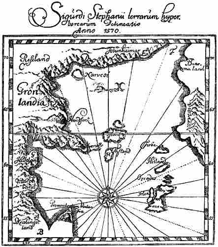
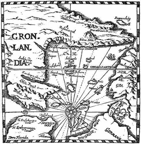
Icelandic representation of the northern and western lands as connected
with one another, by Sigurd Stefansson, circa 1590 (Torfæus, 1706).
Cf. G. Storm, 1887, pp. 28, ff.
[Pg 8]Catapults, which are also mentioned in the “King’s Mirror,” had a long beam or lever-arm, at the outer end of which was a bowl or sling, wherein was laid a heavy round stone, or more rarely a barrel of combustible material or the like [cf. O. Blom, 1867, pp. 103, f.]. In the “King’s Mirror” it is also stated that mineral coal (“jarðkol”) and sulphur were thrown; the stones for casting were also made of baked clay with pebbles in it. When these clay balls were slung out and fell, they burst in pieces, so that the enemy had nothing to throw back. The great black ball, which is compared to a sheep’s paunch, and which made such an ugly sound (report ?) when it fell that it frightened the Greenlanders, also reminds one strongly on the “herbrestr” (war-crash, report) which Laurentius Kálfsson’s saga [cap. 8 in “Biskupa Sögur,” i. 1858, p. 798] relates that Þrándr Fisiler,[7] from Flanders, produced at the court of Eric Magnusson in Bergen, at Christmas 1294. It “gives such a loud report that few men can bear to hear it; women who are with child and hear the crash are prematurely delivered, and men fall from their seats on to the floor, or have various fits. Thránd told Laurentius to put his fingers in his ears when the crash came.... Thránd showed Laurentius what was necessary to produce the crash, and there are four things: fire, brimstone, parchment and tow.[8] Men often have recourse in battle to such a war-crash, so that those who do not know it may take to flight.” Laurentius was a priest, afterwards bishop (1323-30) in Iceland; the saga was probably written about 1350 by his friend and confidant, the priest Einar Hafliðason. It seems as though we have here precisely the same notions as appear in the description of the fight with the Skrælings. It is true that this visit of Thránd to Bergen would be later than the Saga of Eric the Red is generally assumed to have been written; but this may have been about 1300. Besides, there is no reason why the story of the “herbrestr” should not have found its way to Iceland earlier.[9][Pg 9] In any case this part of the tale of the Wineland voyages has quite a European air.
For the rest, this feature too seems to have a connection with the “Navigatio Brandani.” It is there related that they approach an island of smiths, where the inhabitants are filled with fire and darkness. Brandan was afraid of the island; one of the inhabitants came out of his house “as though on an errand of necessity”; the brethren want to sail away and escape, but
“the said barbarian runs down to the beach bearing a long pair of tongs in his hand with a fiery mass in a skin[10] of immense size and heat; he instantly throws it after the servants of Christ, but it did not injure them, it went over them about a stadium farther off, but when it fell into the sea, the water began to boil as though a fire-spouting mountain were there, and smoke arose from the sea as fire from a baker’s oven.” The other inhabitants then rush out and throw their masses of fire, but Brendan and the brethren escape [Schröder, 1871, p. 28].
In the narrative of Maelduin’s voyage a similar story is told of the smith who with a pair of tongs throws a fiery mass over the boat, so that the sea boils, but he does not hit them, as they hastily fly out into the open sea [cf. Zimmer, 1889, pp. 163, 329]. The resemblances to Karlsevne and his people flying with all speed before the black ball of the[Pg 10] Skrælings, like a sheep’s paunch, which is flung over them from a pole and makes an ugly noise when it falls, is obvious; but at the same time it looks as though this incident of the Irish myth—which is an echo of the classical Cyclopes of the Æneid and Odyssey (cf. Polyphemus and the Cyclopes), and the great stones that were thrown at Odysseus—had been “modernised” by the saga-writer, who has transferred mediæval European catapults and explosives to the Indians.
The curious expression—used when the Skrælings come in the spring for the second time to Karlsevne’s settlement—that they came rowing in a multitude of hide canoes, “as many as though [the sea] had been sown with coal before the Hóp” [i.e., the bay], seems to find its explanation in some tale like that of the “Imram Brenaind” [cf. Zimmer, 1889, p. 138], where Brandan and his companions come to a small deserted land, and the harbour they entered was immediately filled with “demons in the form of pygmies and dwarfs, who were as black as coal.”
The “hellustein” (flat stone) which lay fixed in the skull of the fallen Thorbrand Snorrason is a curious missile, and reminds one of trolls (cf. Arab myth, chapter xiii.). Features such as that of the Skrælings being supposed to know that white shields meant peace and red ones war have an altogether European effect.[11]
[Pg 11]Another purely legendary feature in the description of the fight is that of Freydis frightening the Skrælings by taking her breasts out of her sark and whetting the sword on them (“ok slettir á sverdit”). As it stands in the saga this incident is not very comprehensible, and appears to have been borrowed from elsewhere. Possibly, as Moltke Moe thinks, it may be connected in some way with the legend of the wood-nymph with the long breasts who was pursued by the hunter. The mention of Unipeds and “Einfötinga-land” shows that classical myths have also been adopted. The idea was, moreover, widely current in the Middle Ages. Thus in the so-called Nancy map of Claudius Clavus (of about 1426) we find “unipedes maritimi” in the extreme north-east of Greenland. In the “Heimslýsing” in the Hauksbók [F. Jónsson, 1892, p. 166] and in the “Rymbegla” [1780] “Einfötingar” are mentioned with a foot “so large that they shade themselves from the sun with it while asleep” (cf. also Adam of Bremen, vol. i. p. 189). But in the Saga of Eric the Red the incident of the Uniped and the pursuit of him are described as realistically as the encounters with the Skrælings. Einfötinga-land is also mentioned in the same manner as Skrælinga-land in its vicinity.
In reading the Icelandic sagas and narratives about Wineland and Greenland one cannot avoid being struck by the remarkable, semi-mythical way in which the natives, the Skrælings, are always spoken of;[12] even Are Frode’s mention[Pg 12] of them appears strange. Through finding the connection between Wineland the Good and the Fortunate Isles, and between the latter again and the lands of the departed, the “huldrelands,” fairylands, and the lands of the Irish “síd,” I arrived at the kindred idea that perhaps Skræling was originally a name for those gnomes or brownies or mythical beings, and that it was these that Are Frode meant by the people who “were inhabiting Wineland”—and further, that when the Icelanders in Greenland found a strange, small, foreign-looking people, with hide canoes and implements of stone, bone and wood, which also looked strange to them, they naturally regarded them as these same Skrælings; and then they may afterwards have found similar people (Eskimo, and perhaps Indians) on the coast of America. It agrees with the view of the Skrælings as a small people that elves and brownies in Norway were small, often only two or three feet high, and that the underground or huldre-folk in Skåne were called “Pysslingar” (dwarfs). This idea that[Pg 13] the Skræling was originally a brownie was strengthened by the discovery of the above-mentioned probable connection between many features in the description of the Skrælings’ appearance in Wineland and the demons, like pygmies and dwarfs, that Brandan meets with in a land in the sea (see p. 10), and the smiths (or Cyclopes) in another island who throw masses of fire at Brandon and Maelduin (see p. 9). That Unipeds and Skrælings are both mentioned as equally real inhabitants of the new countries, and that a Uniped even kills Thorvald Ericson near Wineland, and is pursued, points in the same direction.
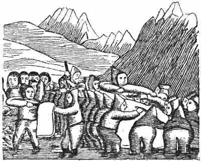
Eskimos cutting up a whale. Woodcut from Greenland,
illustrating a fairy-tale; drawn and engraved by a native
I then asked Professor Alf Torp whether he knew of anything that might confirm such an interpretation of the word Skræling; he at once mentioned the German word “walt-schreckel” for a wood-troll, and afterwards wrote to me as follows:
“The word I spoke about is found in modern German dialects: ‘schrähelein’ ‘ein zauberisches Wesen, Wichtlein’; cf. Middle High German ‘walt-schreckel,’ which is translated by ‘faunus.’ This ‘schrähelein’ (from the Upper Palatinate) agrees entirely both in form and meaning with ‘skrælingr’: the only difference is that one has the diminutive termination ‘*-ilîn’ (primary form ‘* skrahilîn’), the other the diminutive termination ‘-iling’ (primary form ‘* skrahiling’). The primary meaning was doubtless ‘shrunken figure, dwarf.’ From a synonymous verbal root come the synonymous M.H.G. words ‘schraz’ and ‘schrate,’[13] ‘Waldteufel, Kobold.’ This seems greatly to strengthen your interpretation of ‘skrælingr’ as ‘brownie’ or the like. Now, of course, ‘skræling’ means ‘puny person’ or the like, but it is to be remarked that we do not find that meaning in the ancient language.”
It seems to me that this communication is of great importance. It is striking that the word Skræling is never used in the whole of Old Norse literature as a term of reproach or to denote a wretched man, and there must have been plenty of opportunity for this if it had been a word of[Pg 14] common application with its present meaning, and not a special designation for brownies. It only occurs there as applied to the Skrælings of Wineland, Markland and Greenland. Again, the Skrælings in Greenland are called “troll” or “trollkonur” in the Icelandic narratives, and in the descriptions of the Wineland voyages demoniacal properties are attributed to them as to the underground folk. In the fight with the Skrælings they frightened Karlsevne and his people not only with the great magic ball,[14] but also by glamour. And in the “Grönlendinga-þattr” it is related that when the Skrælings came for the second time to trade with Karlsevne,
“his wife Gudrid was sitting within the door by the cradle of her son Snorre, and there walked in a woman in a black gown, rather low in stature, and she had a band on her head, and light-brown hair, was pale and big-eyed, so that no one had seen such big eyes in any human head. She went up to where Gudrid sat, and said: What is thy name? says she. My name is Gudrid, and what is thy name? My name is Gudrid, says she. Then Gudrid, the mistress of the house, stretched out her hand to her, and she sat down beside her; but then it happened at the same time that Gudrid heard a great crash [‘brest mikinn,’ cf. the noise or crash of the great ball in the Saga of Eric the Red] and that the woman disappeared, and at the same moment a Skræling was slain by one of Karlsevne’s servants, because he had tried to take their weapons, and they [the Skrælings] went away as quickly as possible; but they left their clothes and wares behind them. No one had seen this woman but Gudrid.”[15]
This phantasmal Gudrid is obviously a gnome or underground woman; and as she makes both her appearance and disappearance together with the Skrælings it is reasonable to suppose that they too were of the same kind, like the illusions in the battle with the Skrælings. It is further to be remarked that she is short, and has extraordinarily large eyes, exactly as is said of the Skrælings and of huldre- and troll-folk (cf. vol. i. p. 327), and also of pygmies.
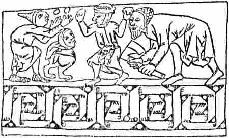
Fight with mythical creatures (From an Icelandic MS.)
On account of the identity of name one might perhaps be tempted to think that it was Gudrid’s “fylgja” (fetch) coming to warn her. But she does nothing of the kind in the saga, nor was there any reason for it, as the Skrælings came to trade with peaceful intentions, and fled as soon as there was disagreement. But the story is obscure and confused, and it is probable that this is a borrowed incident, and that something of the meaning or connection has dropped out in the transfer. Another remarkable feature (which Moltke Moe has pointed out to me) is that while in Eric’s Saga Karlsevne pays for the Skrælings’ furs and red cloth, in the “Grönlendinga-þáttr” he makes “the women carry out milk-food (‘búnyt’) to them” (it was placed outside the house or even outside the fence), “and as soon as the Skrælings saw milk-food they would buy that and nothing else.” Now the natives of America cannot possibly have known milk-food; but on the other hand it happens to be a characteristic of the underground folk that they are fond of milk and porridge (cream-porridge), which is put out for the mound-elves and the “nisse.” Another underground feature comes out in the incident of the five Skrælings in Markland, three of whom “escaped and sank into the earth” (“ok sukku i jorð niðr”). Possibly the statement that the people in Markland “lived in rock-shelters and caves” may have a similar connection.
As the Skrælings of Greenland were dark, it was quite natural that they should become trolls, and not elves, which were fair.
It may also be supposed that the troll-like nature of the Skrælings is shown in the curious circumstance that[Pg 16] Are Frode, speaking of them in Greenland, only mentions dwelling-places and remains of boats and stone implements that they had left behind (see vol. i. p. 260), as a sign that they had been both in the east and west of the country, while the people themselves are never mentioned; this is like troll-folk, who leave their traces without being seen themselves. One might suppose that such a mode of expression agreed best with the current Icelandic view of them as trolls. In a similar way it might be related of the first discoverer of an earlier Norway, inhabited only by supernatural beings, that he found traces both in the east and the west of the land which showed that the kind of folk (“þjóð”) had been there that inhabit Risaland, and that the Norwegians call giants. In this way possibly this passage in Are may be understood (but cf. p. 77); it might be objected that this expression: who “inhabited Wineland” (“hefer bygt”) does not suggest troll-folk, but real human beings; if, however, the existence of these troll-folk is supported by the actual finding of natives, in any case in Greenland (and doubtless also in Markland), then such an expression cannot appear unreasonable. Besides, there would be a general tendency on the part of the rationalising Icelanders, with their pronounced sense of realistic description, to make these trolls or brownies or “demons” into living human beings in Wineland, while the designation of troll still persisted for a long time in Greenland, side by side with Skræling—as a name approximately synonymous therewith. The realistic description of the Uniped affords a parallel to this. One is inclined to think that the Skrælings of the saga have come about through a combination of the original mythical creatures (like the síd-people in the Irish happy lands) to whom at first the name belonged with the Eskimo that the Icelanders found in Greenland, and perhaps the Eskimo and Indians that they found on the north-east coast of North America. It is, as in fact Moltke Moe has maintained in his lectures, by the fusing of materials taken from the world of myth and from[Pg 17] reality that the human imagination is rendered most fertile and creative in the formation of legend. The points of departure may often be pure accidents, resemblances of one kind or another, which have a fructifying effect.
That the Skrælings, from being originally living natives, should later have become trolls or brownies, is an idea that Storm among others seems to have entertained (cf. note, p. 11); but this would be the reverse of what usually happens. That the Eskimo should have made a strange and supernatural impression on the superstitious Norsemen when they first met them is natural, and so it is that this impression should have persisted so long, until it gradually wore off through more intimate acquaintance with them in Greenland; but the contrary, that the supernatural ideas about them should only have developed gradually, although they were constantly meeting them, is incredible.
In Scandinavian literature also we find mythical ideas attached to the Skrælings of Greenland. In the Norwegian “Historia Norwegiæ” (thirteenth century) it is said that when “they are struck with weapons while alive, their wounds are white and do not bleed, but when they are dead the blood scarcely stops running.” The Dane Claudius Clavus (fifteenth century) relates that there were pygmies in Greenland two feet high (like our elves and brownies), and the same is reported in a letter to Pope Nicholas V. (circa 1450), with the addition that they hide themselves in the caves of the country like ants (see next chapter); that is, like underground beings, although this trait may well be derived from knowledge of the Eskimo. Mythical tales about the Greenland Eskimo also appear in Olaus Magnus, and in Jacob Ziegler’s Scondia (sixteenth century) [cf. Grönl. hist. Mind., iii. pp. 465, 501].
A little touch like that of Thorvald Ericson drawing the Uniped’s arrow out of his intestines and saying: “There is fat in the bowels, a good land have we found...” shows how the saga-writer embroidered his romance: Thorvald was[Pg 18] the son of a chief and naturally required a more honourable death than other men. The Fosterbrothers’ Saga and Snorre have the same thing about Thormod Kolbrunarskald at the battle of Stiklestad, when he drew out the arrow and said, “Well hath the king nourished us, there is still fat about the roots of my heart.” But of course there had to be a slight difference; while Thormod receives the arrow in the roots of his heart and has been well treated by the king, Thorvald gets it in his small intestines and has been well nourished by the country. Similar features are found in other Icelandic sagas.
It is a characteristic point that both in the “Navigatio Brandani” and in the “Imram Maelduin” three of the companions perish, or disappear, either through demons or mythical beings. With this the circumstance that in Karlsevne’s voyage three of his companions fall, two by the Skrælings and one by a Uniped, seems to correspond. We may also compare the incident in the “Imram Brenaind” where Brandan and his companions come to a large, lofty and beautiful island, where there are dwarfs (“luchrupán”) like monkeys, who instantly fill the beach and want to swallow them, and devour one of the men (the “crosan”) (cf. the circumstance that in the fight with the Skrælings two men fell, of whom only one is mentioned by name).
When it is related first that Karlsevne found five Skrælings asleep near Wineland, whom they took for exiles (!) and therefore slew, and that in the following year they again found five Skrælings, of whom, however, they only took two boys, while the others escaped, we may probably regard these as two variants of the same story. This feature also has an air of being borrowed in its dubious form, especially in the former passage; but I have not yet discovered from whence it may be derived.
In the “Grönlendinga-þáttr” there is yet another variant. There Thorvald Ericson and his men see three hide-boats on the beach, and three men under each. “Then they divided their people, and took them all except one who got away[Pg 19] with his boat. They killed the eight....” This is altogether improbable. Since one man could run away with his boat, the hide-boats must be supposed to be kayaks, and the men Eskimo; but in that case only one man would have been lying under each; if they were larger boats (women’s boats ?) it would be unlike the Eskimo for three men to lie under each, and in any case one man could not run away with a boat.
The tale of the kidnapped Skræling children also shows incidents and ideas from wholly different quarters that have been introduced into this saga. That the grown-up Skræling was bearded (“skeggjaðr”) agrees, of course, neither with Eskimo nor Indians, but it agrees very well with trolls, brownies and pygmies, and also with the hermits of the Irish legends who were heavily clothed with hair. That this man, with the two women who escaped, “sank down into the earth” has already been mentioned as an underground feature. That the Skrælings of Markland had no houses, but lived in caves, does not sound any more probable; unless indeed this feature is taken from underground gnomes, it may come from the hermits in Irish legends. Thus the holy Paulus [Schröder, 1871, p. 32] dwelt in a cave and was covered with snow-white hair and beard (cf. the bearded Skræling), whom Brandan met on an island a little while before he came to the Terra Repromissionis (cf. the circumstance that Markland lay a little to the north of Wineland). The myth of Hvítramanna-land is derived from Ireland, and has of course nothing to do with the Skræling boys. Storm, it is true, thought they might have told of a great country (Canada or New Brunswick) with inhabitants in the west, which later became the Irish mythical land; but this too is not very credible. The names they gave are obviously not to be relied on: they may be later inventions, from which no conclusion at all can be drawn as to the language of the Skrælings, as has been attempted by earlier inquirers.[16] The two kings’ names, “Avalldamon” and[Pg 20] “Avalldidida” (or “Valldidida”), which are attributed to them, may be supposed to be connected with “Ívaldr” or “Ívaldi.” He was of elfin race, was the father of Idun, who guarded the apples of rejuvenation, and his sons, “Ívalda synir,” were the elves who made the hair for Sif, the spear Gungner for Odin, and Skiðblaðnir for Frey. In Bede he is called “Hewald,” and in the Anglo-Saxon translation “Heávold.”[17] The name “Vætilldi” (nom. “Vætilldr” ?) of the mother of the Skræling boys recalls Norse names; it might be a combination of “vætr” or “vættr” (gnome, sprite, cf. modern Norwegian “vætt,” a female sprite) and “-hildr” (acc., dat. “-hildi”); the word is also written in some MSS. “Vætthildi,” “Vetthildi,” “Vethildi,” “Veinhildi.”
The last tale of Bjarne Grimolfsson who got into the maggot-sea (“maðk-sjár”) bears a stamp of travellers’ tales as marked as those of the Liver-sea. But even this feature seems to have prototypes in the Irish legends; it resembles the incident in the tale of the voyage of the three sons of Ua Corra (twelfth century ?), where the sea-monsters gnaw away the second hide from under the boat (which originally had three hides) [cf. Zimmer, 1889, pp. 193, 199].
It will therefore be seen that the whole narrative of the[Pg 21] Wineland voyages is a mosaic of one feature after another gathered from east and west. Is there, then, anything left that may be genuine? To this it may be answered that even if the romance of the voyages be for the most part invented—to some extent perhaps from ancient lays—the chief persons themselves may be more or less historical. It is nevertheless curious that it should be reserved to father and son first to discover and settle Greenland, and then accidentally to discover Wineland. That to Leif, the young leader, should further be attributed the introduction of Christianity, and that he should thus represent the new faith in opposition to his father, the old leader, who represented heathendom, may also seem a remarkable coincidence, but it may find an explanation in the probability of a new faith being introduced by men of influence, and just as in Norway it was done by kings, so in Greenland it was naturally the work of the future chief of the free state. Although it is strange that such a circumstance should not be mentioned when Leif’s name occurs in the oldest authorities (“Landnáma”), this may thus appear probable. On the other hand, no such explanation can be found for the circumstance that he of all others should accidentally discover America. It would be somewhat different if, as in the “Grönlendinga-þáttr,” Leif had of set purpose gone out to find new land, like his father. It is also curious that in the saga we hear no more either of Leif or his ship on the new voyages, after his accidental discovery, while it is another, Karlsevne, who becomes the hero. It looks as though the tale of Leif had been inserted without proper connection. In the “Grönlendinga-þáttr,” too, this discovery is attributed to another man, Bjarne Herjolfsson, which shows that the tradition about Leif was not firmly rooted. It may be supposed that there was a tradition in Iceland of the discovery of new land to the south-west of Greenland, and this became connected with the legends of the fortunate “Wineland the Good.” Popular belief then searched for a name with which to[Pg 22] connect the discovery, and as it could not take that of the discoverer of Greenland itself, the aged Eric who was established at Brattalid, it occurred to many to take that of his son; whilst others chose another. It is doubtless not impossible that Leif was the man; but what is suggested above, coupled with so much else that is legendary in connection with the voyages of him and the others, does not strengthen the probability of it.
But however this may be, it may in any case be regarded as certain that the Greenlanders discovered the American continent, even though we are without any means of determining how far south they may have penetrated. The statements as to the length of the shortest day in Wineland, which are given in the Flateyjarbók’s “Grönlendinga-þáttr,” are scarcely to be more depended upon than other statements in this romantic tale.
[Pg 23]Incidents such as the bartering for skins with the Wineland Skrælings, and the combat with unfortunate results, seem to refer to something that actually took place; they cannot easily be explained from the legends of the Fortunate Isles, nor can representations of fighting in which the Norsemen were worsted be derived from Greenland. They must rather be due to encounters with Indians; for it is incredible that the Greenlanders or Icelanders should have described in this way fights with the unwarlike Eskimo, or at all events with the Greenland Eskimo, who, even if they had been of a warlike disposition, cannot have had any practice in the art of war. This in itself shows that the Greenlanders must have reached America, and come in contact with the natives there.
The very mention of the countries to the south-west: first the treeless and rocky Helluland (Labrador ?), then the wooded Markland (Newfoundland ?) farther south, and then the fertile Wineland south of that, may also point to local knowledge. It must be admitted that this could be explained away as having been put together from the general experience that countries in the north are treeless, but become more fertile as one proceeds southward; but the names Helluland and especially Markland have in themselves an appearance of genuineness, as also has Kjalarnes. The different saga-writers, in the Saga of Eric the Red and in the Flateyjarbók’s “Grönlendinga-þáttr,” give different explanations of the reason for the name of Kjalarnes, which shows that the name is an old one and that the explanations have been invented later (cf. vol. i. p. 324). A point which agrees remarkably well with the trend of the Labrador coast and may point to a certain knowledge of it, is that Karlsevne steers well to the south-east from Helluland; but this may possibly be[Pg 24] connected with the idea mentioned later in the saga, that Wineland became broader towards the south, and the coast turned eastwards, which was evidently due to the assumption that it was connected with Africa (cf. vol i. p. 326).

Felling trees. Marginal decoration of the Jónsbók (fifteenth century)
The oldest and most original part of Eric’s Saga, as of most other sagas, is probably the lays. Of special interest are the lays attributed to Thorhall the Hunter; they give an impression of genuineness and do not harmonise well with the prose text, which was evidently composed much later. One of the lays, which describes the poet’s disappointment at not getting wine to drink in the new country instead of water, shows that a notion was current that wine was abundant there, and this notion must have come from the myth of the Fortunate Land or Wineland; for, if we confine ourselves to this one saga, the notion cannot have been derived from the single earlier voyage thither that is there mentioned—namely, Leif’s: during his short visit he cannot possibly have had time to make wine, even if he had known how to do so. The lay seems therefore to show that men had really reached a country which was taken to be the “Wineland,” or Fortunate Isles, of legend, but which turned out not to answer to the ideas which had been formed of it. The second lay attributed to Thorhall (see vol. i. p. 326) may also point to the country they had arrived at not being so excessively rich, for they had to cook whales’ flesh on Furðustrandir (and consequently were obliged to support themselves by whaling). This gives us an altogether more sober picture than the prose version of the saga; the latter, moreover, says nothing of whales except the one that made them ill and was thrown out.
[Pg 25]The surest historical evidence that voyages were made to America from Greenland is the chance statement, referred to later, in the Icelandic Annals: that in 1347 a ship from Greenland bound for Markland was driven by storms to Iceland. This reveals the fact that, occasionally at any rate, this voyage was made; and if the sagas about the Wineland voyages must be regarded as romances, or as a kind of legendary poetry—which therefore made no attempt whatever to give a historical exposition of the communication with the countries to the south-west—then many more voyages may have been made thither than the sagas had use for. A prominent feature of the different tales is that of the Greenlanders bringing timber from thence; this appears already in the story of Leif’s discovery of the country—he found various kinds of trees and “mǫsurr,” and brought them home with him—and still more in the tales of the Flateyjarbók, where on each voyage it is expressly stated that they felled timber to load their ships, as though that were their chief object. In the Icelandic geography mentioned on p. 1, there is an addition, probably of late date:
“... It is said that Thorfinn Karlsevne felled wood [in Markland ?] for a ‘húsa-snotra,’ and then went on to seek for Wineland the Good, and arrived where this land was thought to be, but was not able to explore it, and did not settle there ...”[19]
In the Flateyjarbók’s “Grönlendinga-þáttr” it is stated that Karlsevne, in Wineland, cut down timber to load his[Pg 26] ship, and that he had a “húsa-snotra” of “masur” from Wineland. Both accounts show how highly timber was prized in Greenland and Iceland. It is likely enough that this was so, since they had no timber in Greenland but driftwood, dwarf birch and osiers. But in order to find timber the Greenlanders need have gone no farther south than Markland (Newfoundland ?); and this name (perhaps also Helluland) may therefore have the surest historical foundation.
If Adam of Bremen (circa 1070) mentions no more than Wineland, this is doubtless because he has only heard of that legendary country; the belief in its existence may already have been confirmed in his time by the discovery of new lands. More remarkable is the statement of the sober Are Frode (circa 1130) as to the Skrælings who “inhabited Wineland” (“Vínland hefer bygt”). This looks as if Wineland was familiar to him; it may be the mythical name that has passed into a common designation for the countries discovered in the south-west (cf. vol. i. pp. 368, 384). But there is also a possibility that only the mythical country is in question, and that, as suggested above (vol. i. p. 368; vol. ii. p. 16), its inhabitants are merely the Skrælings of myths, since this mythical land and its inhabitants were the best known and most talked of. If this be so, it does not exclude the possibility of Are’s having heard of other, less well known, but actually discovered countries in the south-west, which he does not mention. To make use of a parallel, let us suppose that Utröst with its fairy people was better known in Nordland than the islands to the north with their semi-mythical Lapps. If then we had read of a discovery of Finmark that traces had been found there of the same kind of folk (“þjóð”) who inhabit Utröst, then we should no more be able from this to conclude that Utröst was a real land than that Vesterålen and Senjen, for instance, had not been discovered. It must be remembered that it does not appear with certainty from Are’s words where he got his Wineland from (cf. vol. i. p. 367).
[Pg 27]Another document of a wholly different nature, wherein possibly the name of Wineland is mentioned, has been found—namely, the runic stone of Hönen.
On the estate of Hönen, in Ringerike, there was found at the beginning of last century a runic stone, which was still from to be seen there in 1823, when the inscription was copied. Afterwards the stone disappeared.[20] The drawing made in 1823 is now only known from a somewhat indistinct copy; but from this Sophus Bugge [1902] has attempted to make out the runic inscription, and he reads it thus:
“Ut ok vítt ok þurfa
þerru ok áts
Vínlandi á ísa
í úbygð at kómu;
auð má illt vega,
[at] döyi ár.”
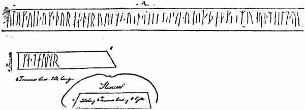
The existing drawing of the runic stone from Hönen, Ringerike (S. Bugge, 1902)
In prose this verse may, according to Bugge, be rendered somewhat as follows:
“They came out [into the ocean] and over wide expanses (‘vîtt’), and needing (‘þurfa’) cloth to dry themselves on (‘þerru’) and food (‘áts’), away[Pg 28] towards Wineland, up into the ice in the uninhabited country. Evil can take away luck, so that one dies early.”
Bugge regards this reading of this somewhat difficult inscription as doubtful; but if it is correct, this verse may be part of an inscription cut upon one or more stones in memory of a young man (or perhaps several) from Ringerike, who took part in an expedition by sea. According to his explanation, they were then driven far out into the ocean in the direction of Wineland, and were lost, perhaps in the ice on the east coast of Greenland (which in the sagas is generally called the uninhabited country, “ubygð”); they abandoned their ship and had to take to the drift-ice. He (or they) to whom the inscription refers thereby met his death at an early age, while at any rate some one must have made his way back and brought the tale of the voyage. Probably there was a commencement of the inscription, now lost, giving the name of the young man, who must certainly have been of good birth; for otherwise, as Bugge points out, a memorial with an inscription in verse would hardly have been raised to him. He or his family belonged to Ringerike, and to the neighbourhood in which the stone was put up.
The form of the runes makes it probable, according to Bugge, that the inscription dates from the eleventh century, and perhaps from the period between 1000 and 1050; scarcely before that, though it may be later. The inscription would thus acquire a value as possibly the earliest document in which Wineland is mentioned. What kind of expedition the inscription records we cannot tell; there is nothing to show that it was a real Wineland voyage; the words seem rather to point to their having been driven against their will out to sea in the direction of “Wineland,” whether we are to regard this as the Wineland of myth or as a historical country; it might well be used figuratively in an epitaph to describe more graphically how far they went from the beaten track. It may equally well have been on a voyage to Ireland, the Faroes, Iceland, or merely to the north of[Pg 29] Norway that the disaster occurred, and they were driven by storms to the Greenland ice; but since it cannot be denied that, as the verse has been translated, the expressions appear somewhat unnatural, it is difficult to form any opinion as to this.[21]
If this runic inscription from Ringerike has been correctly copied and interpreted—which, as has been said, is uncertain—then this and Adam of Bremen’s information from Denmark would show that Wineland was known and discussed in various parts of the North in the eleventh century, long before Icelandic literature began to be put into writing. But strangely enough, in the Norwegian thirteenth-century work, “Historia Norwegiæ,” no mention is made of Wineland, although in other respects the author has made extensive use of Adam of Bremen’s work; he merely states that Greenland approaches the African Islands, by which, as pointed out above (p. 1), he shows clearly enough that Wineland was regarded as belonging to the African Islands, or Insulæ Fortunatæ. The “King’s Mirror,”[22] which gives a detailed description of Greenland, does not mention Wineland, although the author evidently held the view that Greenland approached the universal continent (i.e., Africa) on the south. The knowledge of it must soon have been forgotten in Norway, or it was regarded as a mythical country, while the tradition persisted longer in Iceland.
The last time we meet with the name of Wineland in connection with a voyage is in the “Islandske Annaler,”[23] where it is related in the year 1121 that “Eirikr, bishop of Greenland [also called Eirikr Upsi], went out to seek (leita) Wineland.” But we are not told anything more of this expedition. The use of “leita” shows that Wineland[Pg 30] was not a known country, it can only apply to lands about which legends or reports are current; just in the same way Gardar in the Sturlubók “went to seek (‘fór at leita’) Snælandz” on the advice of his mother, who had second sight (vol. i. p. 255), or Ravna-Floki “fór at leita Gardarshólms” (vol. i. p. 257), and Eric the Red “ætlaði at leita lands þess” which Gunnbjörn had seen, etc. (vol. i. p. 267). As soon as the way was known, it was no longer necessary to “leita” countries. If the voyage is historical, it may have been to seek for the mythical country, the happy Wineland that Bishop Eric set out, as St. Brandan in the legend sought for the Promised Land, and as, 359 years later, the city of Bristol actually sent men out to look for the happy isle of Brazil; but as the coast of America seems to have been known, it may apply to a country there, of which reports had come, and to which the name of the mythical country had been transferred. As Eric is called a bishop, it has been thought that this was a missionary voyage, which met with disaster [cf. Y. Nielsen, 1905, p. 8]; but who was there to be converted in an unknown land, for which one had first to “seek”? It would have to be the unknown Skrælings; but is this really likely, when we hear of no mission to the Skrælings of Greenland? There must have been enough of the latter to convert for the time being, if it had been thought worth the trouble. Nor do we know much more about this Eric Upsi.[24] Probably he was the same man who is called in the Landnámabók “Eirikr Gnupssonr Grönlendinga-byskup.” It is possible that the see of Greenland was founded as early as 1110,[25] and that Eric was the first bishop of Greenland, and went out there in 1112,[26] but he cannot have been solemnly consecrated at Lund, like later bishops after 1124. It is possible that Eric was lost,[Pg 31] for we hear no more of him, and in 1122 and 1123 the Greenlanders made efforts to obtain a new bishop, who was consecrated at Lund in 1124; but it is curious that nothing is then said about any earlier bishop; moreover, the entry in the annals about Eric dates at the earliest from the thirteenth century.
Some years ago it was asserted that a stone with a runic inscription had been found in Minnesota, the so-called Kensington stone. On this is narrated a journey of eight Swedes and twenty-two Norwegians from Wineland as far as the country west of the Great Lakes. But by its runes and its linguistic form this inscription betrays itself clearly enough as a modern forgery, which has no interest for us here [cf. H. Gjessing, 1909; K. Hoegh, 1909; H. R. Roland, 1909; O. J. Breda, 1910].
The name of Wineland occurs extremely rarely in mediæval literature and on maps outside Iceland, and as a rule it is confused with Finland, as already mentioned (vol. i. p. 198), or again with Vindland (Vendland). Ordericus Vitalis (1141) gives “The Orkneys and Finland, together with Iceland and Greenland” as islands under the king of Norway.[27] As the passage seems to be connected with Adam of Bremen, who also erroneously mentions these islands and Wineland as subject to the Norwegians (see vol. i. p. 192), this Finland may be Wineland. It was pointed out in vol i. p. 198, that the Latin “vinum” was translated into Irish as “fín.” Ordericus (1075-1143), who lived in England until his tenth year, and wrote in an abbey in Normandy, may well have had communication with Irishmen. In Ranulph Higden’s “Polychronicon” (circa 1350) the following are described as islands in the outer ocean (surrounding the disc of the earth): first the “Insulæ Fortunatæ” (see vol i. p. 346), immediately afterwards “Dacia” (== Denmark), and to the west of this island “Wyntlandia,” besides “Islandia,” which has Norway to the south and the Polar Sea to the north, “Tile” (Thule) the extreme island on the north-west, and “Noruegia” (Norway). As this “Wyntlandia,” which in the[Pg 32] various editions of Higden’s map is called Witland, Wintlandia, Wineland, etc., is placed out in the ocean on the west, it is possibly connected with the old Wineland which was an oceanic island; but as it is mentioned together with Dacia, it may also be confused with Vindland (Vendland),[28] and the circumstance that the inhabitants are supposed to have sold winds to sailors who came to them may have contributed to this. This may be connected with what Mela [iii. 6] says about the island of Sena in the British Sea, off Brittany (see vol. i. p. 29), where the nine priestesses of the oracle of the Gaulish deity
“set seas and winds in motion through their incantations, change themselves into what animal they please, cure sickness ... know the future and foretell it, but they only assist those sailors who come to ask counsel of them.”
But the wind-selling wizards of the Polychronicon have also evidently been confused with the Finns (Lapps) of Finmark, whom Adam of Bremen had already described as particularly skilled in magic. The Polychronicon is a free revision of an earlier English work, the “Geographia Universalis,” of the thirteenth century. In this “Winlandia” (or “Wynlandia”) and its inhabitants, who sell winds, are described at greater length; it is there placed on the continent on the sea-coast and borders on the mountains of Norway on the east.[29] It is therefore Finland, or perhaps rather the country of the Lapp wizards, Finmark. Thus through similarity of sound three countries may have been confused in the Polychronicon: Wineland, Vindland, and Finland (Finmark). Evidently the “Vinland” to be found on the continent in the map of the world in the “Rudimentum Novitiorum” of Lübeck (1475) refers to Finland, and likewise the “Vinlandia” mentioned in a Lübeck MS. of 1486-1488, which is an extensive island reaching as far as Livonia.[30][Pg 33] Whether we regard Wineland as merely a mythical country, or as a country actually discovered to which the name of the mythical land was transferred, this limited dissemination of it in literature and on maps is striking. It shows that knowledge of the myth, or of the country with the mythical name, belonged to older times, was not very widely spread outside the Scandinavian countries and Ireland, and was afterwards forgotten, in spite of the frequent communication that existed between the intellectual world of the North and that of the South [cf. Jos. Fischer, 1902, pp. 106, ff.].
While probably the name of Hvítramanna-land is still preserved in the fairy-tale of Hvittenland, it is possibly the name of Wineland that has been preserved in that “Vinland” which is mentioned in the Faroese lay of “Finnur hinn Fríði”;[31] but if so, it is the only known instance of its occurrence in popular poetry. The Norwegian jarl’s son, Finnur hinn Fríði (Finn the Fair), courts Ingebjörg, the daughter of an Irish king; she is beautiful as the sun, and the colour of her maiden cheeks is like blood dropped upon snow.[32] She makes answer: “Hadst thou slain the Wine-kings, then shouldst thou wed me.” To Wineland is a far voyage, with currents and mighty billows. But Finn begs his brother, Halfdan, to go with him over the Wineland sea. They hoist their silken sail, and never lower it till they arrive at Wineland. There they found the three Wine-kings. Thorstein, the first, came on a black horse, but Finn tore him off at the navel; the second, Ivint, also came on a black horse. But the third transformed himself into a flying dragon; arrows flew from each of his feathers, and he killed many of their men. The worst was that he shot venom from his mouth under Finn’s coat of mail, who, though he could not be killed by arms, had to die. He then drew a golden ring from his arm and sent it by Halfdan to Ingebjörg,[Pg 34] bidding her live happily. But Halfdan sprang into the air, seized the third Wine-king, and tore him off at the navel. Halfdan sailed back to Ireland, brought Ingebjörg these tidings and the ring, and slept three nights with her, but on the fourth she dies of grief, since she can love no chieftain after Finn. Halfdan had a castle built for himself and passed his years in Ireland, but all his days he mourned for his brother. Although the whole of this legend seems to have no connection with what we know about Wineland, it is[Pg 35] most probable that it is the same name, but that—like the tale itself of the Irish king’s daughter whose cheek was as blood upon snow—it came from Ireland. The name may thus be a last echo of the Irish mythical ideas from which the Wineland of the Icelanders arose.
Map by the Icelander Jón Gudmundsson, born 1574 (Torfæus, 1706)
Curiously enough Helluland is the only one of the names of the western lands that has been widely adopted in Icelandic fairy-tales and legendary sagas. It has to some extent become a complete fairyland, with trolls and giants, and it is located in various places, usually far north, even to the north of Greenland, and sometimes on its north-east coast. In this fairyland was the fjord “Skuggi” (shadow); it is mentioned in Örvarodds Saga (circa 1300), where the hero departs to seek his enemy, the wizard Ǫgmund, in Helluland, and again in Bárðarsaga Snæfellsáss (fifteenth century), in the “Þáttr” of Gunnari Keldugnúpsfífl, in the Hálfdanarsaga Brönufóstra, in the Saga of Hálfdani Eysteinssyni, and in Gest Bárdsson’s Saga.[33]
In the geography which under the name of “Gripla” was included in Björn Jónsson’s “Grönland’s Annaler,” it is said of the countries opposite Greenland:
“Furðustrandir is the name of a land, where is severe frost, so that it is not habitable, so far as people know; south of it is Helluland, which is called Skrælingja-land; thence it is a short distance to Wineland the Good, which some people think goes out from Africa....”
With this may be compared another MS. of the seventeenth century, where we read:
“West of the great ocean from Spain, which some call Ginnungagap, and which goes between lands, there is first towards the north Wineland the Good, next to it is called Markland farther north, thereafter are the wastes [i.e., the wastes of Helluland] where Skrælings live, then there are still more wastes to Greenland.” [Cf. Grönl. hist. Mind., iii. pp. 224, 227.]
From this it looks as if Helluland was regarded as inhabited by Skrælings, which agrees with the reality, if it[Pg 36] is Labrador. But these MSS. belong to the seventeenth century, and may be influenced by the geographical knowledge of later times. In Gripla there is evident confusion, as Furðustrandir has been confounded with Helluland, and the latter with Markland[34].
No record is found of any voyage to Wineland after 1121; but on the other hand there is mention more than two hundred years later of the voyage, referred to above, to Markland from Greenland in 1347. Of this we read in the Icelandic Annals (Skálholts-Annals) for that year: “Then came also [i.e., besides ships from Norway already mentioned] a ship from Greenland, smaller in size than the small vessels that trade to Iceland. It came to Outer Straumfjord [on the south side of Snæfellsnes]; it was without an anchor. There were seventeen men on board [in the Flatey-annals there are eighteen men], and they had sailed to Markland, but afterwards [i.e., on the homeward voyage to Greenland] were driven hither.”
As the Skálholts-Annals were written not many years after this (perhaps about 1362), it must be regarded as quite certain that this ship had been to Markland; but on the homeward voyage, perhaps while she lay at anchor, was overtaken by a storm, so that the cable had to be cut, and was driven out to sea past Cape Farewell right across to the west coast of Iceland. It is not likely that they sailed so far as Markland simply to fish, which they might have done off Greenland; the object was rather to fetch timber or wood for fashioning implements, which was valuable in treeless[Pg 37] Greenland; the driftwood which came on the East Greenland current did not go very far. It is true that they could not carry much timber on their small vessel; but they had to make the best of the craft they possessed, and they could always carry a sufficient supply of the more valuable woods for the manufacture of tools, weapons and appliances. They must for instance have had great difficulty in obtaining wood for making bows; driftwood was of little use for this.
But if this voyage took place in 1347, and we only hear of it through the accident of the vessel getting out of her course and being driven to Iceland, we may be sure that there were many more like it; only that these were not the expeditions of men of rank, which attracted attention, but everyday voyages for the support of life, like the sealing expeditions to Nordrsetur, and when nothing particular happened to these vessels, such as being driven to Iceland, we hear nothing about them. We must therefore suppose that, even if they had to give up the idea of forming settlements in the west, the Greenlanders occasionally visited Markland (Newfoundland or the southernmost part of Labrador ?), perhaps chiefly to obtain wood of different kinds.
In the so-called Greenland Annals, put together from old sources by Björn Jónsson of Skardsá (beginning of the seventeenth century), it is said of the districts on the west coast of Greenland, to the north of the Western Settlement, that they “take up trees and all the drift that comes from the bays of Markland” (cf. vol i. p. 299). This shows that it was customary to regard Markland as the region from which wood was to be obtained. The name itself (== woodland) may have contributed to this view; but the fact that it survived long after all mention of Wineland had ceased may probably be due to communication with the country having been kept up in later times, and to this name being the really historical one on the coast of America.
According to the Icelandic Annals the voyagers from Markland who came to Iceland in 1347, proceeded in the[Pg 38] following year (1348) to Norway. This was no doubt with the idea of getting back to Greenland, as there was no sailing to that country from Iceland, and they would not trust their vessel on another ocean voyage. But in Norway, where they arrived at Bergen, they had a long while to wait. “Knarren,” the royal trading ship, seems to have been the only vessel that kept up communication with Greenland at that time. We know that “Knarren” returned to Bergen in 1346, and did not sail again until 1355. From a royal letter of 1354, which has been preserved, it appears that extraordinary preparations were made for the fitting-out and manning of this expedition, to prevent Christianity in Greenland from “falling away.” Perhaps the presence in Norway of these Markland voyagers from Greenland had something to do with the awakening of interest in that distant country, and perhaps it is not altogether impossible that the intention was not only to secure and strengthen the possessions in Greenland, but also to explore the fertile countries farther west. It cannot be remarked, however, that it brought about any change in the fading knowledge of these valuable regions, and we hear no more of them until their rediscovery at the close of the fifteenth century.
Ebbe Hertzberg, Keeper of the Public Records of Norway, has shown [1904, pp. 210, ff.] that there is a remarkable and interesting similarity between the game of lacrosse, which is played by the Indians of the north-east of North America, and the ancient Norse game, “knattleikr” (i.e., ball-game), so far as we know it from the sagas. It was greatly in favour in Iceland. If Hertzberg is right in his supposition that the Indians may have got this game from the Norsemen, this would lend strong support to the view that the latter had considerable intercourse with America and its natives.
According to Hertzberg’s acute interpretation of the accounts of “knattleikr” in the various sagas, it was played on a large level piece of ground (“leikvǫllr,” i.e., playing-ground), or on the ice, usually by many players. These were divided into two sides, in such a way that those most nearly equal in[Pg 39] strength on each side were paired as opponents and stood near to each other, and the two teams were thus spread in pairs over the whole ground. Each player had a club with which he either struck or caught and “carried” the ball. The club had a hollow or a net in which the ball could be caught and lie. When the ball was set going, the game was for the one who was nearest to seize or catch it, preferably with his club, and to run off with it and try to “carry it out,” i.e., past a goal or mark; but in this his particular opponent tried to hinder him with all his strength and agility. The other players might not interfere directly in the struggle of the two opponents for the ball. If the one who had the ball was so hard pressed by his opponent that he had to give it up, he tried to throw it to one of his own side, who then again had to reckon with his own opponent in his attempt to “carry it out.” This game was much played by the Icelanders; it was apt to be rough, and men were often disabled, or even killed, by their opponents.
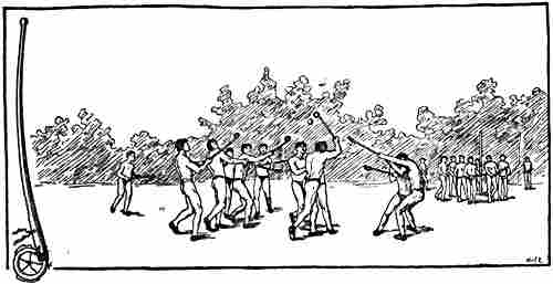
The game of Lacrosse among the Menomini Indians (after W. J. Hoffmann, 1896).
On the left, a “crosse,” about a yard long
Hertzberg shows how the Canadian Indians’ game of lacrosse, which has become the national game of Canada, completely resembles in all essentials this peculiar Norse ball-game from Iceland. The game of lacrosse is, as Professor Y. Nielsen has pointed out [1905], more widely diffused among the Indian tribes of North America than Hertzberg was aware. Dr. William James Hoffman[35] has described it among the Menomini Indians in Wisconsin, the Ojibwa tribe in northern Minnesota, the Dakota Indians on the upper Missouri, and among the Chactas, Chickasaws and kindred tribes farther south. Hoffmann also mentions[Pg 40] that opponents are picked and that the game is played in pairs [1896, i. p. 132]. Among the Ojibwas, he says, the player who is carrying the ball is often placed hors de combat by a blow on the arm or leg; serious injuries only occur when the stakes are high, or when there is enmity between some of the players. Among the more southern tribes, on the other hand, the game is much more violent, the crosse is longer, made of hickory, and it is often sought to disable the runner. This, then, is even more like the Icelandic game.
Hoffmann thinks that the game is undoubtedly derived from one of the eastern Algonkin tribes, possibly in the valley of the St. Lawrence. Thence it reached the Huron Iroquois, and later it spread farther south to the Cherokees, etc. In a similar way it was carried westwards and adopted by many tribes. This then points to its having originated in just those districts where one would have expected it to come from, if it was brought by the Norsemen, as Hertzberg thinks. That the game is so widely diffused in America and has become so much a part of the Indians’ life, even of their religious life, shows that it is very ancient there, and this too supports Hertzberg’s assumption that it is derived from the Norsemen. It is true that Eug. Beauvois[36] has pointed out the possibility of the game having been introduced into Canada by people from Normandy after the sixteenth century; but before such an objection could carry weight, it would have to be made probable that the characteristic Norse game was really played in Normandy; but this is not known. In support of Hertzberg’s view it may also be adduced—a point that he himself has not noticed—that the Icelanders appear to have introduced the same ball-game to another American people with whom they came in touch, namely, the Eskimo of Greenland. Hans Egede [1741, p. 93] says:
“Playing ball is their most usual game, especially by moonlight, and they have two ways of playing: When they have divided themselves into two sides, one throws the ball to another who is on his own side. Those of the other side must endeavour to get the ball from them, and thus it goes on alternately among them....” (The other way of playing mentioned by Egede is more like football.)
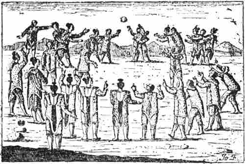
Game of ball among the Eskimo of Greenland (Hans Egede, 1741)
This description, together with Egede’s drawing, from which it appears, amongst other things, that the opponents are arranged in pairs, seems to show that the Eskimo game was very like the Icelanders’ “knattleikr” and the Indians’ “lacrosse”; but with the difference that according to Egede’s account the Eskimo did not use any club or crosse; moreover, from Egede’s drawing it looks as if both men and women took part, as with certain Indian tribes. That there is a connection here appears natural. The most probable explanation may be that the Eskimo as well as the Indians got this ball-game from the Norsemen. That the Eskimo should have learnt it from the whalers after the rediscovery of Greenland in the sixteenth century is unlikely, as also that it should have come to the Indians from the Eskimo round the north of Baffin Bay and through Baffin Land and Labrador; nor is it any more likely that the Icelanders should have learnt it of the Eskimo in Greenland, who again had it from America.
It is in itself a strange thing that the discovery of a country like North America, with conditions so much more favourable than Greenland and Iceland, should not have led to a permanent settlement. But there are many, and in my judgment sufficient, reasons which explain this. We must remember that such an outpost of civilisation as Greenland offered poor opportunities for the equipment of such settlements; the settlers would have to be prepared for continual conflicts with the Indians, who with their warlike capacity[Pg 42] and their numbers might easily be more than a match for a handful of Greenlanders, even though the latter had some advantage in their weapons of iron—and of these too the Greenlanders never had a very good supply, as appears from several narratives. There would also be need of ships, which were costly and difficult to procure in Greenland; the few that were there certainly had enough to do, and could hardly manage more than an occasional trip to Markland for timber. Moreover, as the Greenland settlements themselves and their oversea communications declined after the close of the thirteenth century, so also of course did their communication with America decrease, until it finally ceased altogether.
It would thus appear, from all that has been put forward in this chapter, that Wineland the Good was originally a mythical country, closely connected with the happy lands of Irish myths and legends—which had their first source in the Greek Elysium and Isles of the Blest, in Oriental sailors’ myths, and an admixture of Biblical conceptions. The description of the country has acquired important features from Isidore’s account of the Insulæ Fortunatæ and from older classical literature. This mythical country is to be compared with “Hvítramanna-land” (the white men’s land), “which some call Ireland the Great (‘Irland hit Mikla’).” Of this the Landnáma tells us (cf. vol i. p. 353) that it lay near Wineland, in the west of the ocean, six “dœgr’s” sail west of Ireland (according to the Eyrbyggja Saga it lay to the south-west); the Icelandic chief Are Mársson was driven there by storms, was not allowed to depart, but was baptized there and held in great esteem. Furthermore, the same land is mentioned in the Saga of Eric the Red as lying opposite Markland (cf. vol. i. p. 330). Finally, in the Eyrbyggja Saga there is a tale of a voyage (see later) which evidently had the same country as its object, though it is not mentioned by name. Since Thorkel Gellisson is given as the authority for the story in the Landnáma, the legend[Pg 43] may have reached Iceland about the close of the eleventh century.
This Irish land may also be derived from an adaptation of the ancients’ myth of the western Isles of the Blest,[37] and it evidently corresponds to one of the mythical countries of the Christianised Irish legends. It bears great resemblance in particular to “the Island of Strong Men” (“Insula Virorum Fortium”) in the Navigatio Brandani, which is also called there “the Isle of Anchorites” [Schröder, 1871, pp. 24, 17]. Three generations dwelt there: the first generation, the children, had clothes white as driven snow, the second of the colour of hyacinth, and the third of Dalmatian purple. The name itself, which in Old Norse would become “Starkramanna-land,” shows much similarity of formation; besides which it is the Isle of Anchorites that is in question, and one of the three generations wears white garments; we are thus not far from the formation of a name “Hvítramanna-land.” There is yet another point of agreement, in[Pg 44] that, just as Are Mársson was not allowed to leave Hvítramanna-land, so one of Brandan’s companions had to stay behind on the Isle of Anchorites. It may also be supposed that the name of the White Men’s Land is connected with the White Christ and with the white garments of the baptized; the circumstance of Are Mársson being baptized there points in the same direction.[38] But to this it may be added that various myths and legends show it to have been a common idea among the Irish that aged hermits and holy men were white. The old man who welcomes Brendan to the promised land in the “Imram Brenaind” [cf. Zimmer, 1889, p. 139; Schirmer, 1888, p. 34] has no clothes, but his body is covered with dazzling white feathers, like a dove or a gull, and angelic is the speech of his lips. In the Latin account of Brandan’s life (“Vita sancti Brandani”) the man is called Paulus, he is again without clothes, but his body is covered with white hair,[39] and in both tales the man came from Ireland [cf. Schirmer, 1888, p. 40]. The cave-dweller Paulus on an island in the Navigatio Brandani [Schröder, 1871, p. 32] is without clothes, but wholly covered by the hair of his head, his beard and other hair down to the feet, and they were white as snow on account of his great age. It is evident that the whiteness is often attributed, as in the last instance, to age; but it is also the heavenly[Pg 45] colour, and the white clothing of hair (or feathers) may also have some connection with the white lamb in the Revelation. In the tale of Maelduin’s voyage, which is older than those of Brandan’s, Maelduin meets in two places, on a sheep-island and on a rock in the sea, with hermits wholly covered with the white hair of their bodies—they too were both Irish—and on two other islands, the soil of one of which was as white as a feather, he meets with men whose only clothing was the hair of their bodies[40] [cf. Zimmer, 1889, pp. 162, 163, 169, 172, 178]. In the Navigatio Brandan also meets on the island of Alibius an aged man with hair of the colour of snow and with shining countenance. (Cf. Christ revealing himself among the seven candlesticks to John on the isle of Patmos: “His head and his hairs were white like wool, as white as snow; and his eyes were as a flame of fire” [Rev. i. 14].)
Among the Irish the white colour again forms a conspicuous feature in the description of persons, especially supernatural beings, in ancient non-Christian legends and myths. The name of their national hero Finn means white. To Finn Mac Cumaill there comes in the legend a king’s daughter of unearthly size and beauty, “Bebend” (the white woman), from the Land of Virgins (“Tír na-n-Ingen”) in the west of the sea, and she has marvellously beautiful white hair [cf. Zimmer, 1889, p. 269]. The corresponding maiden of the sea-people, in the “Imram Brenaind,” whom Brandan finds, is also whiter than snow or sea-spray (see vol. i. p. 363). The physician Libra at the court of Manannán, king of the Promised Land, has three daughters with white hair. When Midir, the king of the síd (fairies), is trying to entice away Etáin, queen of the high-king of Ireland, he says: “Oh, white woman, wilt thou go with me to the land of marvels?... thy body has the white colour of snow to the very top,” etc. etc.[41] [cf. Zimmer,[Pg 46] 1889, pp. 273, 279]. A corresponding idea to that of the Irish síd-people, especially the women, being white, is perhaps that of the Norse elves being thought light (cf. “lysalver,” light-elves), or even white. The elf-maiden in Sweden is slender as a lily and white as snow, and elves in Denmark may also be snow-white (cf. also the fact that elves are described as white nymphs, “albæ nymphæ”).
It seems natural that these ideas—of whiteness as specially beautiful, and mostly applied to the “síd” or elves, to the garments of baptism, and to holy men and hermits—led to a name which, in conformity with the Strong Men’s Island of the Navigatio, would become the White Men’s Land, for the mythical western land oversea, where Are Mársson was baptized, but which he could not leave again, and where, according to the Eyrbyggja Saga, the language resembled Irish. This, then, is precisely the “Isle of Anchorites.” The country may have originated through a contact of ideas from the religious world and the profane, original conceptions from the latter having become Christianised. Doubtless the white garments, which were connected with the other world, and which became the heavenly raiment of the Christians, have also played a part. In Plato a white-clad woman (i.e., one from the other world) comes to Socrates in a dream and announces to him that in three days he is to depart. During the transfiguration on the mountain Jesus’ face “did shine as the sun, and his raiment was white as the light” [Matt. xvii. 2], or “his raiment became shining, exceeding white as snow” [Mark ix. 3]. On the basis of this Christian conception the image of the world beyond the grave has taken the form of a fair, shining land, as in the immense literature of visions; and thus too in the Floamanna Saga [Grönl. hist. Mind., ii. p. 103], where Thorgils’s wife Thorey sees in a dream a “fair country with shining white men” (“menn bjarta”), and Thorgils[Pg 47] interprets it to mean “another world” where “good awaits her” and “holy men would help her.”
There is further a possibility that some of the conceptions attached to Hvítramanna-land may be connected with ancient Celtic tales which in antiquity were associated with the Cassiterides (in Celtic Brittany); in any case there is a remarkable similarity between the mention in Eric the Red’s Saga of men who went about in white clothes, carried poles before them, and cried aloud (see vol. i. p. 330), and Strabo’s description (see vol. i. p. 27) of the men in the Cassiterides in black cloaks with kirtles reaching to the feet, who wander about with staves, like the Furies in tragedy. That Strabo should see a resemblance to the Eumenides (Furies) and therefore make his men black, while the Northern author has the Christian ideas and in agreement with the name of Hvítramanna-land gives them white clothes, need not surprise us. Even if Storm [1887] is correct in his supposition that the white men’s banners, or “poles to which strips were attached” (see vol. i. p. 330), are connected with ecclesiastical processions, this may be a later popular modification, just as the white hermits out in the ocean may be a modification of pre-Christian, or at any rate non-religious, conceptions in Ireland.
Reference has been made (p. 32) to the resemblance between the accounts of the inhabitants of Wyntlandia (== Wineland), who were versed in magic, and of the Celtic priestesses in the island of Sena off Brittany. One might be tempted to think that here again there is some connection or other between these Breton priestesses and, on the one hand the Irishmen in Hvítramanna-land, on the other the men of the Cassiterides (near Sena) who were like the Furies. Dionysius Periegetes [510; cum Eustath. 1] relates that on this island of Sena women crowned with ivy conducted nocturnal bacchanals, with shrieks and violent noise (cf. the men in white clothes in Hvítramanna-land, who carried poles and cried aloud). No male person might set foot on the island, but the women went over to the men on the mainland, and returned after having had intercourse with them (cf. vol. i. p. 356). Exactly the same thing is related by Strabo [iv. 198] of the Samnite women on a little island in the sea, not far from the mouth of the Liger (Loire); inspired by Bacchus they honour that god in mysteries and other unusually holy actions. The druids had their sanctuaries on islands, and Mona (Anglesey) was their headquarters. Tacitus [Ann.[Pg 48] xiv. 30] tells of their fanatical women who, in white clothes (grave-clothes), with dishevelled hair and flaming torches, conducted themselves altogether like Furies on the arrival of the Romans.
The circumstance of Hvítramanna-land being, according to the Eyrbyggja Saga, a forbidden land may correspond to that of men being prohibited from setting foot on the priestesses’ island, or again to the way to the Cassiterides being kept secret and to the precautions taken to prevent people from reaching them (cf. vol. i. p. 27). Something similar, it may be added, is told of the rich, fertile island which the Carthaginians discovered in the west of the ocean, and which, under pain of death, they forbade others to visit [Aristotle, Mir. Auscult., c. 85; cf. also Diodorus, v. 20]. That in late classical times there was a confusion between the Cassiterides and the mythical isles in the west appears further from Pliny’s saying [Hist. Nat., iv. 36] that the Cassiterides were also called “Fortunatæ,” and from Dionysius Periegetes making tin, the product of the Cassiterides, come from the Hesperides.
It was mentioned above (vol. i. p. 357) that the name of the promised land, “the Land of Marvels,” was also called in Irish legend the “Great Strand” (“Trág Mór”), or the “Great Land” (“Tír Mór”); “two or three times as large as Ireland” (vol. i. p. 355). It does not seem unlikely that the Icelanders, hearing from Ireland of this great land, should come to call it “Irland hit Mikla” (Ireland the Great); and this seems to be a more natural explanation than Storm’s [1887, p. 65] interpretation of the name as meaning “the Irish colony,” like “Magna Græcia” (the Greek colony in Italy) and “Svíþjód it Mikla” (the Swedish colony in Russia, the name of which may however have been derived from the name of the latter: “Scythia Magna”); on the other hand, he gives an obvious parallel in “Great Han,” the mythical land in the Great Ocean beyond China (Han).
In the Eyrbyggja Saga we read of Björn Asbrandsson,[Pg 49] called Breidvikinge-kjæmpe, and his exploits. He bore illicit love to Snorre Gode’s sister, Thurid of Fróðá, the wife of Thorodd, and had by her an illegitimate son, Kjartan. Finally he had to leave Iceland on account of this love; but his ship was not ready till late in the autumn. They put to sea with a north-east wind, which held for a long time that autumn. Afterwards the ship was not heard of for many a day.
Gudleif Gudlaugsson was the name of a great sailor and merchant; he owned a large merchant vessel. In the last years of St. Olaf’s reign he was on a trading voyage to Dublin; “when he sailed westward from thence he was making for Iceland. He sailed to the west of Ireland, encountered there a strong north-east wind, and was driven far to the west and south-west in the ocean,” until they finally came to a great land which was unknown to them. They did not know the people there, “but thought rather that they spoke Irish.” Soon many hundred men collected about them, seized and bound them, and drove them up into the country. They were brought to an assembly and sentence was to be pronounced upon them. They understood as much as that some wanted to kill them, while others wanted to make slaves of them. While this was going on, a great band of men came on horseback with a banner, and under it rode a big and stately man of great age, with white hair, whom they guessed to be the chief, for all bowed before him. He sent for them; when they came before him he spoke to them in Norse and asked from what country they came, and when he heard that most of them were Icelanders, and that Gudleif was from Borgarfjord, he asked after nearly all the more important men of Borgarfjord and Breidafjord, and particularly Snorre Gode, and Thurid of Fróðá, his sister, and most of all after Kjartan, her son, who was now master there. After this big man had discussed the matter at length with the men of the country, he again spoke to the Icelanders and gave them leave to depart, but although the summer was far gone, he advised them to get away as soon as possible, as the people there were not to be relied upon. He would not tell them his name; for he did not wish his kinsmen such a voyage thither as they would have had if he had not helped them; but he was now so old that he might soon be gone, and moreover, said he, there were men of more influence than he in that country, who would show little mercy to foreigners. After this he had the ship fitted out, and was himself present, until there came a favourable wind for them to leave. When they parted, this man took a gold ring from his hand, gave it to Gudleif, and with it a good sword, and said: “If it be thy lot to reach Iceland, thou shalt bring this sword to Kjartan, master of Fróðá, and the ring to Thurid, his mother.” When Gudleif asked him who he was to say was the sender of these costly gifts, he answered: “Say he sent them who was more a friend of the mistress of Fróðá than of the ‘gode’ of Helgafell, her brother....” Gudleif and his men put to sea and arrived in Ireland late in[Pg 50] the autumn, stayed that winter at Dublin, and sailed next summer to Iceland [cf. Grönl. hist. Mind., i. pp. 769, ff.].
It is clear that Björn Breidvikinge-kjæmpe here is the same as Are Mársson in the Landnáma, who was also driven by storms to Hvítramanna-land, had to stay there all his life, and according to the report of Thorfinn earl of Orkney (ob. circa 1064) had been recognised (by travellers like Gudleif ?), and was much honoured there. This incident of the travellers coming to an unknown island and there finding a man who has been absent a long while has parallels in many Irish legends. Thus it may be mentioned that Brandan, in the Navigatio, comes to the convent-island of Alibius, with the twenty-four Irish monks of old days, and meets there the old white-haired man who was prior of the convent and had been there for eighty years, but who does not tell his name. Brandan asks leave to sail on, but this is not permitted until they have celebrated Christmas there [Schröder, 1871, pp. 15, ff].[42]
The resemblance between the two names “Guð-Leifr” (Gudleif == God-Leif) and “Leifr hinn Heppni” (Leif the Lucky) also deserves notice, as perhaps it is not merely accidental. One sails during the last years of St. Olaf from Ireland to Iceland and is carried south-westwards to Hvítramanna-land; the other sails during the last years of Olaf Tryggvason from Norway to Greenland and is carried south-westwards to Wineland the Good.
It might also be thought to be more than a mere coincidence that, while Leif Ericson is given the surname of “hinn heppni,” a closely related surname is mentioned in connection with Gudleif in the Eyrbyggja Saga, where he is called “Guðleifr Guðlaugsson hins auðga” (i.e., son of Gudlaug the rich). In the one case, of course, it is the man himself, in the other the father, who bears the surname. “Auðigr” means rich, but originally it had the meaning of lucky,[Pg 51] and the rich man is he who has luck with him (cf. further “auðna” == luck, “auðnu-maðr” == favourite of fortune). Gudleif Gudlaugsson also occurs in the Landnámabók, but this surname is not mentioned, nor is anything said about this voyage, in exactly the same way as Leif Ericson is named there, but without a surname and without any mention of a voyage or a discovery; in both cases this is an addition that occurs in later sagas. In spite of the difference alluded to, one may suspect that there is here some connection or other. Possibly it might be that, as Guðriðr is the Christian woman among all the names beginning with Thor- and Freyðis, so the name of Guðleifr, which was placed in association with the Christian Hvítramanna-land, was used because it had a more religious stamp than “happ” and “heppen,” which in any case are as nearly allied to popular belief as to religiosity, and which were associated with the non-Christian Wineland.
The following tale in Edrisi, the Arabic geographer, whose work dates from 1154, bears considerable resemblance to the remarkable story of Gudleif’s voyage.[43]
Eight “adventurers” from Lisbon built a merchant ship and set out with the first east wind to explore the farthest limits of the ocean. They sailed for about eleven days [westwards] and came to a sea with stiff (thick) waves [the Liver-sea] and a horrible stench,[44] with many shallows and little light (cf. precisely similar conceptions, vol. i. pp. 38, 68, 181, 182, note 1). Afraid of perishing there, they sailed southward for twelve days and reached the Sheep-island (“Djazîrato ’l-Ghanam”), with innumerable flocks of sheep and no human beings (cf. Dicuil’s account of the Faroes, and Brandan’s Sheep-island, vol. i. pp. 163, 362). They sailed on for twelve days more towards the south and found at last an inhabited and cultivated island. On approaching this they were soon surrounded by boats, taken prisoners, and brought to a town on the coast. They finally took up their abode in a house, where they saw men of tall stature and red complexion, with little hair on their faces, and wearing their hair long (not curled), and women of rare beauty. Here they were kept prisoners for three days. On the fourth day a man came who spoke to them in Arabic and asked them who they were, why they had come, and what country they came from. They related to him their adventures. He gave them good hopes, and told them that he was the king’s interpreter. On the following day they were brought before the king, who asked them the same questions through the interpreter. On their replying that they had set out with the object of exploring the wonders of the ocean and finding out its limits, the king began to laugh and told the interpreter to explain that his father had once ordered one of his slaves to set out upon that ocean; this[Pg 52] man had traversed its breadth for a month, until the light of heaven failed them and they were obliged to renounce this vain undertaking. The king further caused the interpreter to assure the adventurers of his benevolent intentions. They then returned to prison and remained there until a west wind came. Then they were blindfolded and taken across the sea in a boat for about three days and three nights to a land where they were left on the shore with their hands tied behind their backs. They stayed there till sunrise in a pitiable state, for the cords were very tight and caused them great discomfort. Then they heard voices, and upon their cries of distress the natives, who were Berbers, came and released them. They had arrived on the west coast of Africa, and were told that it was two months’ journey to their native land.
As points of similarity to Gudleif’s voyage it may be pointed out that the Portuguese sail for thirty-five days altogether, to the west and afterwards to the south, and arrive at a country which thus lies south-south-west. Gudleif is carried before a north-east wind towards the south-west and reaches land after a long time. Both the Portuguese and the Icelanders are taken prisoners shortly after arrival; the former are surrounded by boats, the latter by hundreds of men. The Portuguese saw red-complexioned men of tall stature with long hair, the Icelanders saw a tall, stately man with white hair coming on horseback. They had to wait awhile before they were addressed in a language they could understand; the Portuguese being first spoken to by an interpreter in Arabic[45] who gave them good hopes, and afterwards brought them before the king, who assured them of his benevolent intentions; while the Icelanders were sent for by the great chief, who, when they came before him, spoke to them in Norse and was friendly towards them, and after long deliberations spoke to them again, and gave them leave to depart. The Portuguese had to wait in prison for a west wind before they could get away; the Icelanders had to wait for a favourable wind, which was again a west wind. The Portuguese were led away blindfold, obviously in order that they should not find their way back; when the Icelanders left it was enjoined upon them never to return.[Pg 53] The Portuguese came to the west coast of Africa, from whence they afterwards had to sail northward to Lisbon; the Icelanders arrived in Ireland, and sailed thence the next summer northward to Iceland. It seems reasonable to suppose that there is some connection between the two tales; the same myth may in part form the foundation of both, and this again may be allied to the myth alluded to above of the Carthaginians’ discovery of a fertile island out in the ocean to the west of Africa. But there are also striking resemblances between Edrisi’s tale and the description in the Odyssey of Odysseus’s visit to the Phæacians in the western isle of Scheria. On his arrival there Athene warns Odysseus to be careful, as this people is not inclined to tolerate foreigners, and no other men come to them. Odysseus is brought before the king, Alcinous, who receives him in friendly fashion, and tells him that no Phæacian shall “hold him back by force,” and Odysseus relates his many adventures. Finally the Phæacians convey him while asleep across the sea in a boat, carry him ashore at dawn, and go away before he awakes [Od. xiii. 79, ff.]; this corresponds to the Portuguese being taken blindfold across the sea and left bound on the shore, until they are released at sunrise. The promise of the Phæacians, after Poseidon’s revenge for their helping Odysseus, never again to assist any seafarer that might come to them, may bear some resemblance to the incident of Björn Breidvikinge-kjæmpe trying to prevent Icelanders from seeking a land which “would show little mercy to foreigners.”
Moreover, the tales, both of Gudleif’s voyage and of Edrisi’s Portuguese adventurers, resemble ancient Irish myths.
In the “Imram Snedgusa acus meic Riagla” [of the tenth or close of the ninth century, cf. Zimmer, 1889, pp. 213, f., 216], the men of Ross slay King Fiacha Mac Domnaill for his intolerable tyranny. As a punishment, sixty couples of the guilty were sent out to sea, and their judgment and fate left to God. The two monks, Snedgus and Mac Riagail, afterwards set out on a voluntary pilgrimage on the ocean—while the sixty couples went involuntarily—and, after[Pg 54] having visited many islands,[46] reached in their boat a land in which there were generations of Irish, and they met women who sang to them and brought them to the king’s house (cf. Odysseus’s meeting first with the women in the Phæacians’ land, and their showing him the way to the palace of Alcinous). The king received them well and inquired from whence they came. “We are Irish,” they replied, “and we belong to the companions of Columcille.” Then he asked: “How goes it in Ireland, and how many of Domnaill’s sons are alive?” They answered: “Three Mac Domnaills are alive, and Fiacha Mac Domnaill fell by the men of Ross, and for that deed sixty couples of them were sent out to sea.” “That is a true tale of yours; I am he who killed the King of Tara’s son [i.e., Fiacha], and we are those who were sent out to sea. This commends itself to us, for we will be here till the Judgment [i.e., the day of judgment] comes, and we are glad to be here without sin, without evil, without our sinful desires. The island we live on is good, for on it are Elijah and Enoch, and noble is the dwelling of Elijah....”
The similarity to the meeting of Gudleif and the Icelanders with the likewise exiled great man and chief, who did not give his name but hinted at his identity, is evident. If we suppose that the island Gudleif reached was originally the white men’s, or the holy (baptized) men’s land, then it may be possible that the great man’s words to Gudleif about there being men on the island who were greater (“ríkari”) than he is connected with the mention of Elijah and Enoch.
Thus we see a connection between Gudleif’s voyage (and the exiled Breidvikinge-kjæmpe on the unknown island) and Irish myths and legends, the Arabic tale, and finally the[Pg 55] Odyssey. What the mutual relationship may be between Edrisi’s tale and the Irish legends is to us of minor importance. As the Norse Vikings had much communication with the Spanish peninsula[47] it might be supposed that the Norse tale, derived from Irish myths, had reached Portugal; but as the Arabic tale has several similarities to the voyages of Brandan and Maelduin, and to Dicuil’s account of the Faroes (with their sheep and birds), which are not found in the Norse narrative, it is more probable that the incidents in the experiences of the Portuguese adventurers are derived directly from Ireland, which also had close connection with the Spanish Peninsula, chiefly through Norse ships and merchants. We must in any case suppose that the Icelandic tale of Gudleif’s voyage came from Ireland; but it may have acquired additional colour from northern legends.
There is a Swedish tale of some sailors from Getinge who were driven by storms over the sea to an unknown island; surrounded by darkness they went ashore and saw a fire, and before it lay an uncommonly tall man, who was blind; another equally big stood beside him and raked in the fire with an iron rod. The old blind man gets up and asks the strangers where they come from. They answer from Halland, from Getinge parish. Whereupon the blind man asks: “Is the[Pg 56] white woman still alive?” They answered yes, though they did not know what he meant. Again he asks: “Is my goat-house still standing?” They again answered yes, though ignorant of what he meant. He then said: “I could not keep my goat-house in peace because of the church that was built in that place. If you would reach home safely, I give you two conditions.” They promised to accept these, and the blind old man continued: “Take this belt of silver, and when you come home, buckle it on the white woman; and place this box on the altar in my goat-house.” When the sailors were safely come home, the belt was buckled on a birch-tree, which immediately shot up into the air, and the box was placed on a mound, which immediately burst into flame. But from the church being built where the blind man had his goat-house the place was called Getinge [in J. Grimm, ii. 1876, p. 798, after Bexell’s “Halland,” Göteborg, 1818, ii. p. 301]. Similar tales are known from other localities in Sweden and Norway. The old blind man is a heathen giant driven out by the Christian church or by the image of Mary (the white woman); sometimes again he is a heathen exile.
Here we have undeniable parallels to the storm-driven Icelanders’ meeting with the exiled Breidvikinge-kjæmpe, who asks after his native place and his woman, Thurid,[48] and who also sends two gifts home, though with very different feelings and objects. It may be supposed that the Swedish-Norwegian tale is derived from ancient myths, and the Icelandic narrative may have borrowed features, not, of course, from this very tale, but from myths of the same type.
Remarkable points of resemblance both to the voyages of the Irish (Bran’s voyage) to the Fortunate Isles in the west, and to those of Gudleif and of the eight Portuguese (in Edrisi), are found in a Japanese tale of the fortunate isles of “Horaisan,” to which Moltke Moe has called my attention.[49]
This happy land lies far away in the sea towards the east; there on the mountain Fusan grows a splendid tree which is sometimes seen in the distance over the horizon; all vegetation is verdant and flowering in eternal spring, which keeps the air mild and the sky blue; the passing of time is unnoticed, and death never finds the way thither, there is no pain, no suffering, only peace and happiness. Once on a time Jofuku, body physician to a cruel emperor of China, put to[Pg 57] sea on the pretext of looking for this country and seeking for his master the plant of immortality which grows on Fusan, the highest mountain there. He came first to Japan; but went farther and farther out into the ocean until he really reached Horaisan; there he enjoyed complete happiness, and never thought of returning to prolong his tyrant’s life.
The old Japanese wise man, Vasobiove, who had withdrawn from the world and passed his days in contemplative peace, was one day out fishing by himself (to avoid many trivial visits), when he was driven out to sea by a violent storm; he then rowed about the sea, keeping himself alive by fishing. After three months he came to the “muddy sea,” which nearly cost him his life, as there were no fish there. But after a desperate struggle, and finally twelve hours’ hard rowing, he reached the shore of Horaisan. There he was met by an old man whom he understood, for he spoke Chinese. This was Jofuku, who received Vasobiove in friendly fashion and told him his story. Vasobiove was overjoyed on hearing where he was. He stayed there for a couple of hundred years, but did not know how long it was; for where all is alike, where there is neither birth nor death, no one heeds the passing of time. With dancing and music, in conversation with wise and brilliant men, in the society of beautiful and amiable ladies, he passed his days.
But at last Vasobiove grew tired of this sweet existence and longed for death. It was hopeless, for here he could not die, nor could he take his own life, there were no poisons, no lethal weapons; if he threw himself over a precipice or ran his head against a sharp rock, it was like a fall on to soft cushions, and if he threw himself into the sea, it supported him like a cork. Finally he tamed a gigantic stork, and on its back he at last returned to Japan,[50] after the stork had carried him through many strange countries, of which the most remarkable was that of the Giants, who are immensely superior to human beings in everything. Whereas Vasobiove was accustomed to admiration wherever he propounded his philosophical views and systems, he left that country in humiliation; for the Giants said they had no need of all that, and declared Vasobiove’s whole philosophy to be the immature cries of distress of the children of men.
A connection between the intellectual world of China and Japan and that of Europe in the Middle Ages may well be supposed to have been brought about by the Arabs, who penetrated as far as China on their trading voyages, and who, on the other hand, had close communication with Western Europe. Furthermore, it must be remembered how many of our mythical conceptions and tales are more or less connected with India, just as many of the Arabian tales[Pg 58] evidently had their birthplace there [cf. E. Rohde, 1900, pp. 191, ff.]; while on the other side there was, of course, a close connection between India and the intellectual world of China and Japan, as shown by the spread of Buddhism. A transference of the same myths both eastward to Japan and westward to Europe is thus highly probable, whether these myths originated in Europe or in India and the East. It is striking, too, that even a secondary feature such as the curdled, dead sea (cf. “Morimarusa,” see vol. i. p. 99; the stinking sea in Edrisi, vol. ii. p. 51) is met with again here as the “muddy sea” without fish (cf. resemblances to Arab ideas, chapter xiii.).
If we now look back upon all the problems it has been sought to solve in this chapter, the impression may be a somewhat heterogeneous and negative one; the majority will doubtless be struck at the outset by the multiplicity of the paths, and by the intercrossing due to this multiplicity. But if we force our way through the network of by-paths and follow up the essential leading lines, it appears to me that there is established a firm and powerful series of conclusions, which it will not be easy to shake. The most important steps in this series are:
(1) The oldest authority,[51] Adam of Bremen’s work, in which Wineland is mentioned, is untrustworthy, and, with the exception of the name and of the fable of wine being produced there, contains nothing beyond what is found in Isidore.
(2) The oldest Icelandic authorities that mention the name of “Vinland,” or in the Landnáma “Vindland hit Góða,” say nothing about its discovery or about the wine there; on the other hand, Are Frode mentions the Skrælings (who must originally have been regarded as a fairy people).[Pg 59] The name of Leif Ericson is mentioned, unconnected with Wineland or its discovery.
(3) It is not till well on in the thirteenth century that Leif’s surname of Heppni, his discovery of Wineland (“Vinland” or “Vindland”), and his Christianising of Greenland are mentioned (in the Kristni-saga and Heimskringla), but still there is nothing about wine.
(4) It is not till the close of the thirteenth century that any information occurs as to what and where Wineland was, with statements as to the wine and wheat there, and a description of voyages thither (in the Saga of Eric the Red). But still the accounts omit to inform us who gave the name and why.
(5) The second and later principal narrative of voyages to Wineland (the Flateyjarbók’s Grönlendinga-þáttr) gives a very different account of the discovery, by another, and likewise of the later voyages thither.
(6) The first of the two sagas, and the one which is regarded as more to be relied on, contains scarcely a single feature that is not wholly or in part mythical or borrowed from elsewhere; both sagas have an air of romance.
(7) Even among the Greeks of antiquity we find myths of fortunate isles far in the western ocean, with the two characteristic features of Wineland, the wine and the wheat.
(8) The most significant features in the description of these Fortunate Isles or Isles of the Blest in late classical times and in Isidore are the self-grown or wild-growing vine (on the heights) and the wild-growing (uncultivated, self-sown or unsown) corn or wheat or even cornfields (Isidore). In addition there were lofty trees (Pliny) and mild winters. Thus a complete correspondence with the saga’s description of Wineland.
(9) The various attempts that have been made to bring the natural conditions of the North American coast into agreement with the saga’s description of Wineland are more[Pg 60] or less artificial, and no natural explanation has been offered of how the two ideas of wine and wheat, both foreign to the Northerners, could have become the distinguishing marks of the country.
(10) In Ireland long before the eleventh century there were many myths and legends of happy lands far out in the ocean to the west; and in the description of these wine and the vine form conspicuous features.
(11) From the eleventh century onward, in Ireland and in the North, we meet with a Grape-island or a Wineland, which it seems most reasonable to suppose the same.
(12) From the Landnámabók it may be naturally concluded that in the eleventh century the Icelanders had heard of Wineland, together with Hvítramanna-land, in Ireland.
(13) Thorkel Gellisson, from whom this information is derived, probably also furnished Are Frode with his statement in the Islendingabók about Wineland; this is therefore probably the same Irish land.
(14) The Irish happy lands peopled by the síd correspond to the Norwegian huldrelands out in the sea to the west, and the Icelandic elf-lands.
(15) Since the huldre- and síd-people and the elves are originally the dead, and since the Isles of the Blest or the Fortunate Isles of antiquity were the habitations of the happy dead, these islands also correspond to the Irish síd-people’s happy lands, and to the Norwegian huldrelands and the Icelandic elf-lands.
(16) The additional name of “hit Góða” for the happy Wineland and the name “Landit Góða” for huldrelands in Norway correspond directly to the name of “Insulæ Fortunatæ,” which in itself could not very well take any other Norse form. And as in addition the huldrelands were imagined as specially good and fertile, and the underground, huldre- and síd-people or elves are called the “good people,” and are everywhere in different countries associated with the[Pg 61] idea of “good,” this gives a natural explanation of both the Norse names.
(17) The name “Vinland hit Góða” has a foreign effect in Norse nomenclature; it must be a hybrid of Norse and foreign nomenclature, through “Vinland” being combined with “Landit Góða,” which probably originated in a translation of “Insulæ Fortunatæ.”
(18) The probability of the name of Skrælings for the inhabitants of Wineland having originally meant brownies or trolls—that is, small huldre-folk, elves or pygmies—entirely agrees with the view that Wineland was originally the fairy country, the Fortunate Isles in the west of the ocean.
(19) The statement of the Icelandic geography, that in the opinion of some Wineland the Good was connected with Africa, and the fact that the Norwegian work, Historia Norwegiæ, calls Wineland (with Markland and Helluland) the African Islands, are direct evidence that the Norse Wineland was the Insulæ Fortunatæ, which together with the Gorgades and the Hesperides were precisely the African Islands.
(20) Even though the Saga of Eric the Red and the Grönlendinga-þáttr contain nothing which we can regard as certain information as to the discovery of America by the Greenlanders, we yet find there and elsewhere many features which show that they must have reached the coast of America, the most decisive amongst them being the chance mention of the voyagers from Markland in 1347. To this may be added Hertzberg’s demonstration of the adoption of the Icelandic game of “knattleikr” by the Indians. The name of the mythical land may then have been transferred to the country that was discovered.
(21) Hvítramanna-land is a mythical land similar to the wine-island of the Irish, modified in accordance with Christian ideas, especially perhaps those of the white garments of the baptized—as in the Navigatio Brandani in reference to the Isle of Anchorites or the “Strong Men’s Isle” (== Starkra-manna-land)—and of the white hermits.
[Pg 62](22) Finally, among the most different people on earth, from the ancient Greeks to the Icelanders, Chinese and Japanese, we meet with similar myths about countries out in the ocean and voyages to them, which, whether they be connected with one another or not, show the common tendency of humanity to adopt ideas and tales of this kind.
But even if we are obliged to abandon the Saga of Eric the Red[52] and the other descriptions of these voyages as historical documents, this is compensated by the increase in our admiration for the extraordinary powers of realistic description in Icelandic literature. In reading Eric’s Saga one cannot help being struck by the way in which many of the events are so described, often in a few words, that the whole thing is before one’s eyes and it is difficult to believe that it has not actually occurred. This is just the same quality that characterises our Norwegian fairy-tales: all that is supernatural is made so natural and realistic that it is brought straight before one. The Icelanders created the realistic novel; and at a time when the prose style of Europe was still in its infancy their prose narrative often reaches the summit of clear simplicity. In part this may doubtless be explained by their not being merely authors, but men of action; their presentment acquired the stamp of real life and the brevity that belongs to the narrator of things seen. And to this, of course, must be added the fact that as a rule the tales were sifted and abridged by generations of oral transmission. In later times this style became corrupted by European influence.
After I had given, on October 7, 1910, the outlines of this examination of the sagas of the Wineland voyages before the Scientific Society of Christiania, attention[Pg 63] was called in Sweden, by Professor F. Läffler, to the fact that the Swedish philologist, Professor Sven Söderberg, whose early death in 1901 is much to be regretted, had announced views about Wineland similar to those at which I have arrived. The manuscript of a lecture that he delivered on the subject at Lund in May 1898, but which was never printed, was then found, and has been published in the “Sydsvenska Dagbladet Snällposten” for October 30, 1910. As I have thus become acquainted with this interesting inquiry too late to be able to include it in my examination, I think it right to mention it here.
Professor Söderberg thinks, as I do, that there can be no doubt about the Norsemen having discovered a part of North America; but he looks upon the tales of the wine and everything connected therewith as later inventions. He maintains that the name of “Vinland” originally meant grass-land or pasture-land (from the old Norse word “vin” == pasture), therefore something similar to the meaning of Greenland, and that it may have been the name of a country discovered in the west. Curiously enough, I took at first the same view, and thought too that Adam of Bremen might have misunderstood such a word, just as Söderberg thinks; but I allowed myself to be convinced by the linguistic objection that the word “vin” (pasture) seems to have gone out of use before the eleventh century (cf. vol. i. p. 367). However, Söderberg’s reasons for supposing that the word was still in use appear to have weight; and he also makes it probable that the name formed thereby might be Vinland and not Vinjarland. (In support of this Mr. A. Kiær gave me as an example the Norwegian name Vinås.) Professor Söderberg then thinks that Adam of Bremen heard this name in Denmark, and, misinterpreting it as a foreigner to mean the land of wine, himself invented the explanation of the country’s being so called. Söderberg gives several striking examples to show how this kind of “etymologising” was just in Adam’s spirit (e.g., Sconia or Skåne is derived[Pg 64] from Old German “sconi” or “schön”; Greenland comes from the inhabitants being bluish-green in the face, etc.). An example from a country lying near Denmark, which appears to me even more striking than those given by Söderberg, is Adam’s explanation of Kvænland as the Land of Women (cf. vol. i. pp. 186, f., 383), the Wizzi as white people, or Albanians, the Huns as dogs, etc. Söderberg has difficulty in explaining the statement about the unsown corn in Wineland; but if he had noticed Isidore’s description of the Insulæ Fortunatæ with the self-grown vine and the wild-growing corn, he would have found a perfectly natural explanation of this also. If Adam had misunderstood a “Vinland” (== grass-land), and then perhaps Finland (Finmark, cf. vol i. p. 382), as meaning the land of wine, it would be just in his spirit to transfer thither Isidore’s description of the Insulæ Fortunatæ; a parallel case is that in interpreting Kvænland as Womanland he transfers thither the myth of the Amazons and its fables, and this in spite of its being a country on the Baltic about which it must have been comparatively easy for him to obtain information. In the same way he transfers to the “island” of Halagland, mentioned immediately before Wineland, an erroneous account of the midnight sun and the winter night taken from older writers (cf. vol. i. p. 194, note 2). But one reason for thinking that “Vinland” really meant the land of wine as early as that time is the circumstance put forward above (vol. i. p. 365), that at about the same time there occurs a Grape-island in the Navigatio Brandani.
Professor Söderberg then goes through the Icelandic accounts of Wineland, and points out, in the same way as has been done in this chapter, that the oldest authorities have nothing remarkable to report about the country, and do not mention wine there, and he rightly lays stress on this being particularly significant in the case of Snorre Sturlason,
“knowing as we do how prone Snorre is to digress from his proper subject, when he has anything really interesting to communicate. The reason must be that he[Pg 65] did not know anything particularly remarkable about Wineland; and without doubt this is due to his not having known Adam of Bremen. It has, in fact, been shown that Snorre has not a single statement from Adam.”
Later, Söderberg thinks, Adam of Bremen’s fourth book became known in Iceland, and on the foundation of that the tale of Leif’s discovery of the country with the wine and corn arose, and the later sagas developed, especially that of Thorfinn Karlsevne’s voyage, which he thinks in the main “rests on a truthful foundation,” though he points out that a particular feature like that of the two Scottish runners must be “pure invention, or rather ... borrowed from another saga.” If Professor Söderberg had remarked how most of the incidents in this saga are spurious, he would have found even stronger support for his views in this fact.
CHAPTER X
ESKIMO AND SKRÆLING
Of all the races of the earth that of the Eskimo is the one that has established itself farthest north. His world is that of sea-ice and cold, for which nature had not intended human beings. In his slow, stubborn fight against the powers of winter he has learnt better than any other how to turn these to account, and in these regions, along the ice-bound shores, he developed his peculiar culture, with its ingenious appliances, long before the beginning of history. As men of the white race pushed northward to the “highest latitudes” they found traces of this remarkable people, who had already been there in times long past; and it is only in the last few decades that any one has succeeded in penetrating farther north than the Eskimo, partly by learning from him or enlisting his help. In these regions, which are his own, his culture was superior to that of the white race, and from no other people has the arctic navigator learnt so much.
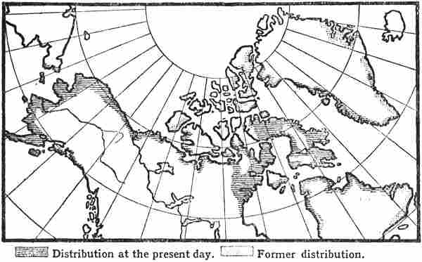
Distribution of the Eskimo (after W. Thalbitzer, 1904)
The north coast of America and the islands to the north of it, from Bering Strait to the east coast of Greenland, is[Pg 67] the territory of the Eskimo. The map (below) shows his present distribution and the districts where older traces of him have been found. Within these limits the Eskimo must have developed into what they now are. In their anthropological race-characteristics, in their sealing- and whaling-culture, and in their language they are very different from all other known peoples, both in America and Asia, and we must suppose that for long ages, ever since they began to fit themselves for their life along the frozen shores, they have lived apart, separated from others, perhaps for a long time as a small tribe. They all belong to the same race; the cerebral formation, for instance, of all real Eskimo from Alaska to Greenland is remarkably homogeneous; but in the far west they may have been mixed with Indians and others, and in Greenland they are now mixed with Europeans. They are pronouncedly dolichocephalic; but have short, broad faces, and by their features and appearance are easily distinguished from other neighbouring[Pg 68] peoples. Small, slanting eyes; the nose small and flat, narrow between the eyes and broad below; cheeks broad, prominent and round; the forehead narrowing comparatively above; the lower part of the face broad and powerful; black, straight hair. The colour of the skin is a pale brown. The Eskimo are not, as is often supposed, a small people on an average; they are rather of middle height, often powerful, and sometimes quite tall, although they are a good deal shorter, and weaker in appearance, than average Scandinavians. In appearance, and perhaps also in language, they come nearest to some of the North American Indian tribes.
From whence they originally came, and where they developed into Eskimo, is uncertain. The central point of the Eskimo culture is their seal-hunting, especially with the harpoon, sometimes from the kayak in open water and sometimes from the ice. We cannot believe that this sealing, especially with the kayak, was first developed in the central part of the regions they now inhabit; there the conditions of life would have been too severe, and they would not have been able to support themselves until their sealing-culture had attained a certain development. Just as in Europe we met with the “Finnish” sea-fishing on a coast that was connected with milder coasts farther south, where seamanship was able first to develop, so we must expect that the Eskimo culture began on coasts with similar conditions, and these must be looked for either in Labrador or on Bering Strait.
As the coasts of Labrador and Hudson Bay are ice-bound for a great part of the year, it is not likely that traffic by sea began there at any very early time; and consequently no particularly favourable conditions existed there for an early development of seamanship. Nor is this the case to any great extent on the east coast of North America farther south, which, with the exception of the Gulf of St. Lawrence, has little protection from the sea, and offers few facilities[Pg 69] for coastal traffic.[53] Nor has it produced any other maritime people or any similar fishing-culture. Again, if the Eskimo culture had arisen there, it would be impossible to understand how they learned to use dogs as draught-animals. It is otherwise on the northern west coast of North America, which is indented by fjords and has many outlying islands, with protected channels between them and the land. Here seamanship might be naturally developed and form the necessary basis for a higher sealing-culture like that of the Eskimo. In addition there is abundance of marine animals which afforded excellent conditions for hunting. Here too we have many different peoples with maritime habits: on the one side the Eskimo northwards along the coast of Alaska; on the other side the Aleutians on the islands extending out to sea, besides Indian tribes along the coast of southern Alaska and British Columbia. Until, therefore, research has produced sufficient evidence for a different view, it must seem most natural that in these favourable regions with a rich supply of marine animals of all kinds we must look for the cradle of the culture that was to render the Eskimo capable of distributing themselves over the whole Arctic world of America. To this must be added that in these regions, by intercourse with people on the Asiatic side of Bering Strait, the seafaring Eskimo may have learnt the use of the dog as a draught-animal, which is an Asiatic, and not an American invention, and which is also of great importance to the whole life and distribution of the Eskimo in the ice-bound regions. We cannot here pursue further the inquiry into the still open question of the origin of the Eskimo and the development of their culture.[54]
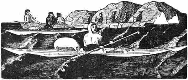
Kayak-fishers and a women’s boat (“umiak”).
Woodcut from Greenland, drawn and engraved by a native
One might get the impression from the map, which shows where older traces of the Eskimo have been found, that they were more numerous and more widely distributed in former times. This is probably a mistake. They are hunters and fishermen who are entirely dependent on the supply of game, and who therefore frequently become nomadic and search for fishing-grounds where they think the prospects are good. Sometimes they settle in a good district for a considerable time, and then they may move again; but sometimes, if exceptionally severe winters chance to come, they may succumb to famine or scurvy. But everywhere they leave behind them their peculiar sites of houses and tents and other traces, and thus these must always be found over larger areas than are actually inhabited by the Eskimo themselves. It might be objected that on the American Arctic Islands they no longer live so far north as older traces of them are found; thus Sverdrup found many relics of[Pg 71] Eskimo in the new countries discovered by him, especially along the sound by Axel Heiberg Land. But these people may, for instance, have migrated eastward to Greenland. If we suppose the reverse to be the case, that the most northerly Eskimo tribe now known, on Smith Sound, had moved westward to Sverdrup’s new islands or to the Parry Islands, then we should have found numerous traces of them in the districts about Smith Sound and Cape York, and might thus have concluded that the Eskimo were formerly more widely distributed towards the north-east.
How early the Eskimo appeared, and came to the most northern regions, we have as yet no means of determining. All we can say is that, as they are so distinct in physical structure, language and culture from all other known races of men, with the exception of the Aleutians, we must assume that they have lived for a very long period in the northern regions apart from other peoples. It would be of special interest here if we could form any opinion as to the date of their immigration into Greenland. It has become almost a historical dogma that this immigration on a larger scale did not take place until long after the Norwegian Icelanders had settled in the country, and that it was chiefly the hordes of Eskimo coming from the north that put an end, first to the Western Settlement, and then to the Eastern. But this is in every respect misleading, and conflicts with what may be concluded with certainty from several facts; moreover, the whole Eskimo way of life and dependence on sealing and fishing forbids their migration in hordes; they must travel in small scattered groups in order to find enough game to support themselves and their families, and are obliged to make frequent halts for sealing. They will therefore never be able to undertake any migration on a large scale.
There can be no doubt that the Eskimo arrived in Greenland ages before the Norwegian Icelanders. The rich finds referred to, amongst others, by Dr. H. Rink [1857, vol. ii.], of Eskimo whaling and sealing weapons and implements of[Pg 72] stone from deep deposits in North Greenland show that the Eskimo were living there far back in prehistoric times.[55] They must originally have come by the route to the north of Baffin Bay across Smith Sound, and must have had at the time of their first immigration much the same culture in the main as now, since otherwise they would not have been able to support themselves in these northern regions.[56] Their means of transport were the kayak and the women’s boat in open water, and the dog-sledge on the ice. Their whaling and sealing were conducted in kayaks in summer, but with dog-sledges in winter, when they hunted the seal at its breathing-holes in the ice, the walrus, narwhale and white whale in the open leads, and pursued the bear with their dogs. In winter they usually keep to one place, living in houses of stone, or snow, but in summer they wander about with their boats and tents of hides to the best places for kayak fishing. In this way they came southward from Smith Sound along the west coast of Greenland to the districts about Umanak-fjord, Disco Bay, and south to the present Holstensborg (the tract between 72° and 68° N. lat.). Here they found an excellent supply of seal, walrus, small-whale and fish, there was catching from kayaks in summer[Pg 73] and on the ice in winter; altogether rarely favourable conditions for their accustomed life, and it is therefore natural that they settled here in large numbers.[57] Some went farther south along the coast; but they no longer found there the same conditions of life as before, the ice was for the most part absent, the walrus became rare, seal-hunting became more difficult in the open sea, and winter fishing from the kayak was not very safe. Southern Greenland therefore had no great attraction, so long as there was room enough farther north. When they came round Cape Farewell to the east coast they found the conditions more what they were used to, although the sealing and whaling were not so good as on the northern west coast.
It has been assumed by several inquirers that the Eskimo immigrated to Greenland by two routes. One branch is supposed to have come southward along the west coast from Smith Sound, as suggested above, while the other branch went northward from Smith Sound and Kane Basin along the coast, where relics of Eskimo are found as far north as 82° N. lat. They thus gradually worked their way round the north of Greenland and turned southward again along the east coast. The Eskimo who formerly lived on the northern east coast, and whom Clavering found there in 1823, are supposed to have come by that route and possibly also the tribe that still lives at Angmagsalik. But in the opinion of some they may have travelled farther south, right round Cape Farewell, and have populated the south-west coast as far north as Ny-Herrnhut by Godthaab. The Dane Schultz-Lorentzen [1904, p. 289][58] thinks that support may be found for this theory of the southern immigration from the east coast in the sharp line of demarcation that exists between the dialect spoken by the Eskimo in Godthaab and northward along the whole west coast, and that spoken to the south and on the east coast; furthermore, there are other points of difference: in the build and fitting together of the kayaks, in the use of partitions between the family compartments on the couches in houses and tents, etc. Although in an earlier work [1891, pp. 8, f.; Engl. ed. pp. 12, ff.] I put forward reasons that are opposed to such an immigration round the north of Greenland, I must admit that there is much in favour of the Eskimo who formerly lived on the northern east coast having come that way; on the other hand, it does not appear to me very likely that this should have been the case with the Eskimo of the southern east coast and of the [Pg 74]west coast. The difference alluded to, at Godthaab, may be accounted for by a later immigration from the north to the northern west coast, which did not come any farther south than this. That the boundary-line between the two kinds of Eskimo should be so sharp just between Ny-Herrnhut and Godthaab, which lie close together on the same peninsula, is easily explained by the fact of the former settlement having always belonged to the recently abandoned German Moravian mission, while the latter was the seat of Egede’s and the later Danish mission. There is always the essential objection to be made against the Eskimo having migrated to the southern east coast round the north of Greenland, that the conditions of life for Eskimo, who live principally by sealing and whaling, were poor on the north coast of Greenland, where there are no seals worth mentioning and few bears; and they can scarcely have got enough musk-oxen to support themselves. Their diffusion to the east coast could not have gone on rapidly. In the ice-bound regions they may have forgotten the use of the kayak, as the Eskimo of Smith Sound had done until thirty years ago, when they became acquainted with it again through a chance immigration from the west. In any case their practice in building and using kayaks must have greatly fallen off. But when the Eskimo came southward on the east coast they again had use for both the kayak for sealing and the women’s boat for travelling, and it is scarcely likely that the craft they produced after such a break in the development should be so near to the women’s boats and handsome kayaks of the northern west coast as we now find them; unless, indeed, we are to suppose that they improved them again through contact with the Eskimo of the northern west coast, but in that case the whole theory appears somewhat strained.
We will now look at what the known historical authorities have to tell us about the Eskimo in Greenland during the early days of the Norse settlement. I have already stated (pp. 12, ff.) that the Norse name “Skræling” for Eskimo must originally have been used as a designation of fairies or mythical creatures. Furthermore, there is much that would imply that when the Icelanders first met with the Eskimo in Greenland they looked upon them as fairies; they therefore called them “trolls,” an ancient common name for various sorts of supernatural beings. This view persisted more or less in after times. Every European who has suddenly encountered Eskimo in the ice-covered wastes of Greenland, without ever having seen them before, will easily understand that they must have made such an impression on people who had the slightest tendency to superstition. The mighty natural surroundings, with huge glaciers, floating[Pg 75] icebergs and drifting ice-floes, all on a vaster scale than anything they had seen before, might in themselves furnish additional food for superstition. Such an idea must from the very beginning have influenced the relations between the Norsemen and the natives, and is capable of explaining much that is curious in the mention of them, or rather the lack of mention of them, in the sagas, since they were supernatural beings of whom it was best to say nothing.
In connection with what has been said earlier (pp. 12, ff.) as to the Skrælings being regarded as fairies (of whom the name was originally used), it may be adduced that, as Storm pointed out, the word was always translated in Latin by “Pygmæi” in the Middle Ages (cf. above, p. 12). But the Pygmies were precisely “short, undergrown people of supernatural aspect”—that is, like fairies—and the Middle Ages inherited the belief in them from the Greeks and Romans, and, as Moltke Moe has pointed out, the northern Pygmies (Βόρειοι Πυγμαῖοι) were already spoken of in classical times as inhabiting the regions about Thule. But authors like Apollodorus and Strabo denied their existence, and consigned them, together with Dog-headed, One-eyed, One-footed, Mouthless, and other similar beings, to the ranks of fabulous creatures in which classical tradition was so rich. Through St. Augustine the enumeration of these creatures reached Isidore; and from him the knowledge of the Pygmies was disseminated over the whole of mediæval Europe—partly in the same sense, that of a more or less fabulous people from the uttermost parts of the earth; and partly in the sense of a fairy people [cf. the demons in the form of Pygmies in the “Imram Brenaind,” see above, p. 10]. Supported by popular belief in various countries, the latter meaning soon became general. Of this Moltke Moe gives a remarkable example from the Welshman Walter Mapes (latter half of the twelfth century), who in his curious collection of anecdotes, etc. (called “De nugis curialium”),[Pg 76] has a tale of a prehistoric king of the Britons called Herla.[59]
To him came a fairy- or elf-king, “rex pygmæorum,” with a huge head, thick hair and big eyes; the pygmy-king foretells to King Herla something that is to happen, and when this is fulfilled King Herla promises as a mark of gratitude to be present at his wedding. The moment the pygmy-king turns his back he vanishes. Herla comes to the wedding of the fairy-king. Entering a vast cave he comes through darkness to the banqueting-hall inside the mountain, lighted by a multitude of lamps, where he is splendidly entertained. When he returns, believing he has been away for three days, he discovers that he has been absent for several hundred years.
This is a typical elf-myth, with many of the features characteristic of elves and fairies: the low stature, the big, hairy head with large eyes, the gift of prophecy, and the power of making themselves invisible in an instant, their dwelling in caves and mountains far from the light of day, the way thither through darkness and mist, the rapid disappearance of time in the fairy world, etc. But we recognise most of these, and even more fairy features, precisely in the Icelandic descriptions of the Skrælings in Wineland, Markland and Greenland, as appears from what is said about them on pp. 12, ff.; and when, for instance, ugly hair (“ilt hár”) and big eyes are expressly attributed to the Skrælings, this applies neither to Indians nor Eskimo, but it applies exactly to fairies. Further, we may point to the Skrælings of Markland being governed by kings (cf. p. 20), which again does not apply either to Indians or to Eskimo, while the elves and huldre-folk have kings. It was mentioned earlier (p. 20) that the name “Vætilldi” or “Vethilldi” may be Vætthildr, compounded of the word “vættr” or “vettr” (fairy).
Everything points in the same direction, that the Skrælings of Wineland, Markland and Greenland were regarded as a kind of fairy people. Nor can this surprise us when we consider that even the Lapps of Finmark, who lived so near to and were so well known by the Norwegians, were[Pg 77] regarded as a half-supernatural people, and had various magical properties attributed to them.
From the statement quoted earlier from Are Frode’s Íslendingabók (circa 1130) it appears that the Skrælings, or Eskimo, had been in South Greenland before Eric the Red and his men, and that the latter found dwelling-sites and other traces of them, from which they could tell that the same kind of people had been there who “inhabited Wineland and whom the Greenlanders call Skrælings (‘Vinland hefer bygt oc Grönlendingar calla Scrælinga’).” These words of Are have generally been understood to imply that he did not know of any meeting of Norsemen and Skrælings in Greenland, but only in Wineland, and that consequently it must have been after his time that the Norsemen encountered the Eskimo in Greenland. I am unable to read Are’s meaning in this way. He uses the present tense: “calla,” and what one “calls Skrælings” must presumably be a people one knows, and not one that one’s ancestors had met with more than a hundred years ago. In that case we should rather expect it to be those ancestors who “called” them by this nickname.[60] I have already suggested (p. 16) the possibility of a connection between this statement and the view of the Skrælings as trolls; but we have besides a remarkable parallel to Are’s whole account of the first coming of the Icelanders to Greenland and the natives there in his account of the Norwegians’ first settlement of Iceland, where he says that there were Christian men before they came, “whom the Norwegians call (‘calla’) Papar” (i.e., priests). They left behind them traces “from which it could be seen that they were Irish men.” From these words it might be concluded, with as much justification as from the statement about the traces of Skrælings, that the newcomers did not[Pg 78] come in contact with the earlier people; but in the latter case this is incredible, and moreover conflicts with Are’s own words in the passages immediately preceding, according to which the Christians left after the heathen Norsemen arrived. Three kinds of traces are mentioned in each case: the Papar left Irish books, bells and croziers; the Skrælings left dwelling-places, fragments of boats, and stone implements. This may have somewhat the look of a turn of style in the sober Are, who thought it of more value to lay stress on visible signs of this kind than to give a possibly less trustworthy statement about the people themselves. We must also bear in mind how terse and condensed the form of the Íslendingabók is. I therefore read Are’s words as though he meant to say something like the following: “As early as Eric’s first voyage to Greenland they found at once dwelling-places both in the Eastern and Western Settlements, and fragments of boats, and stone implements, so that from this it can be seen that over the whole of that region there had been present the same kind of people who also live in Wineland, and who are the same as those the Greenlanders call Skrælings.” Nothing is said about the waste districts of Greenland, where the Skrælings especially lived, and it is only in passing that Wineland is mentioned in this one passage. Are’s Íslendingabók cannot therefore be used as evidence that the Norsemen had not yet met with the Skrælings of Greenland in Are’s time. As he expressly says that they found “manna vistir bæþe austr oc vestr á lande” (human dwelling-places both east and west in the land—i.e., both in the Eastern and Western Settlements), this, too, shows that the stay of the Eskimo in south Greenland cannot have been merely a short and cursory summer visit; but there must have been many of them who stayed there a long time, for otherwise they would hardly have left remains so conspicuous and distributed over so wide an area as to be mentioned with such emphasis as this.
That Eskimo were living on the south coast of Greenland when the Icelanders[Pg 79] arrived there may also possibly be concluded from the mention, in the list of fjords of the Eastern Settlement in Björn Jónsson’s “Vetus chorographia,” of an “Ütibliks fjord” [Grönl. hist. Mind., iii. p. 228; F. Jónsson, 1899, p. 319], which does not sound Norwegian and may recall the Eskimo “Itiblik,” a tongue of land. As Finnur Jónsson [1899, p. 276] points out, the name of the fjord in Arngrim Jónsson’s copy of the same list is “Makleiksfjörðr,” and both names may be misreadings of a man’s name ending in “-leikr,” from which the fjord was called (in the same way as Eiriks-fjörðr, etc.); but as “Ütiblik” has such a pronounced Eskimo sound, it appears to me more probable that “Makleik-” may have arisen through a misreading of this name, which was incomprehensible to Arngrim Jónsson and may have been indistinctly written, rather than that both names should be corruptions, of what? In that case it would afford strong evidence, not only that there were Eskimo in the Eastern Settlement when the Icelanders established themselves there, but also that they had intercourse with them.
The “Historia Norwegiæ” (thirteenth century) shows that a hundred years later the Skrælings of Greenland were known in Norway, and perhaps it is because they there seemed stranger that the Norwegian author mentions them. He says [Storm, 1880, pp. 76, 205]:
“On the other side of the Greenlanders towards the north [i.e., on the northern west coast of Greenland] there have been found by hunters certain small people whom they call Skrælings; when these are struck while alive by weapons, their wounds turn white without blood, but when they are dead the blood scarcely stops running. But they have a complete lack of the metal iron; they use the tusks of marine animals [‘dentibus cetimes,’ here walrus and narwhale tusks] for missiles and sharp stones for knives.”
The curiously correct mention of the Skrælings’ weapons must be derived from a well-informed source, and the statement established the fact that the Norsemen met with the Eskimo of Greenland at any rate in the thirteenth century, while at the same time it may imply that at that time the Skrælings were not generally seen in the settlements of Greenland. The statement as to their wounds, although connected with myth, may further point to there having been conflicts between them and the Norse hunters, who in Viking fashion dealt with them with a heavy hand; but at the same time it discloses the view of the Skrælings as troll-like beings (see p. 17).
[Pg 80]A valuable piece of evidence of the Norsemen having early had intercourse with the Skrælings in Greenland is a little carved walrus, of walrus-ivory, which was found during excavations on the site of a house in Bergen, and which appears to be of Eskimo workmanship.[61] Unfortunately the age of the find has not been determined, nor has it been recorded at what depth it lay; but as it was amongst the deepest finds “right down in the very foundations,” and so far as can be made out from the description much deeper than “a burnt layer, which lay under the remains of the fire of 1413,” this walrus may be of the twelfth, or at the latest of the thirteenth, century. It might, no doubt, have been accidentally found by Greenlanders in a grave or dwelling-site of Skrælings, and afterwards accidentally found on the site of this house in Bergen; but this is assuming a good many accidents, and it is most natural to suppose that the Greenlanders obtained it from the Skrælings themselves, and that it is thus an evidence of intercourse with the latter at that time.
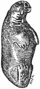
Carved walrus of Eskimo work,
of the twelfth century (?);
found on the site of
a house in Bergen
(after Koren-Wiberg, 1908)
Allusions to Skrælings in Icelandic literature
It is striking that the Skrælings are scarcely ever mentioned in the descriptions of the Norsemen in Greenland in the Icelandic saga literature, and that it is only in one or two places that Greenland Skrælings are mentioned in passing in Icelandic narratives; but at the same time there are detailed descriptions of both peaceful and warlike encounters with the Skrælings in Wineland, and also in Markland (see vol. i. pp. 327, ff.). This is like what we found in Are Frode. The explanation must be that, while the saga-teller could bring out the distant Skrælings of Wineland in large[Pg 81] bodies and as dangerous opponents, quite worthy of mention even for nobles, the harmless and timorous Skrælings of Greenland were too well known to be used as interesting material; they were met with in small, scattered bands, and could be maltreated without any particular danger. They belonged to the commonplace, and commonplace was what a saga-writer had to avoid above all; it is for the same reason that we scarcely hear anything about the Greenlanders’ and other Norsemen’s whaling and sealing and their expeditions for this purpose (e.g., to Nordrsetur); only here and there a few words are let fall about these things, which to us would be of so much greater value than all the tales of fighting and slaughter. But as regards the Skrælings of Greenland there was the additional circumstance that they were heathens; consequently intercourse with them was forbidden by the laws of the Church, and it was therefore best to say nothing about it. Besides, they were always regarded in Iceland as fairies or trolls, and, as we have said, their name was translated by “pygmæi,” and it has been the same with them as with huldre-folk and goblins, who as a rule are not mentioned in the sagas either in Iceland or Norway, though of course they were believed in, and there can have been no lack of “authentic” stories about them. In several passages of Icelandic literature the Skrælings are alluded to as trolls; to kill them was perhaps meritorious, but it was nothing to boast about. In the Floamanna-saga it is related that Thorgils Orrabeinsfostre, on his wonderful voyage along the east coast of Greenland, one morning saw a large sea-monster stranded in a creek, and two troll-hags (in skin-kirtles) were tying up big bundles of it; he rushed up, and as one of them was lifting her bundle he cut off her hand so that her burden fell, and she ran away. They may be regarded as Eskimo. It is true that this saga is so full of marvels and inventions (cf. vol. i. p. 281) that we cannot attribute much historical value to it, but it shows nevertheless the way in which they were looked upon.[Pg 82] In another passage of this description Thorgils saw two “women,” which must mean the same. It is stated that “they vanished in an instant” (“þær hurfu skjótt”), just like the underground beings. In the description of the voyage of Björn Einarsson Jorsalafarer (given in Björn Jónsson’s Annals of Greenland) it is related that when in 1385 the same Björn (together with three other vessels) on his way to Iceland was driven out of his course to Greenland, and had to stay there till 1387, he rescued on a skerry two “trolls,” a young brother and sister, who stayed with him the whole time [Grönl. hist. Mind., iii. p. 438]. These, then, were Skrælings in the Eastern Settlement; but the designation troll is here used as a matter of course, although nothing troll-like is related of them.
It may further be mentioned that in legendary tales and in many of the fanciful sagas we hear of trolls in Greenland, who may originally have been derived from the Skrælings, but who have acquired more of the troll- or giant-nature of fairy-tale. In the tale of the shipwreck of the Icelandic chief Björn Thorleifsson and his wife on the coast of Greenland,[62] the two were saved by a troll man and a hag who each took one of them in panniers on their shoulders and carried them to the homestead enclosure at Gardar. In the “Þáttr af Jökli Búasyni” Jökul is wrecked in the fjord “Öllum Lengri” on the east coast of Greenland, which was peopled by trolls and giants, and where a friendly troll woman helps him to slay King Skrámr, etc. [Grönl. hist. Mind., iii. p. 521]. It will be seen that here there is nothing left of the Skrælings’ nature, but the usual Norse ideas of trolls and giants predominate.
The most important records of Skrælings in Greenland in older times, in addition to the works named above and the Íslendingabók, are: the “Icelandic Annals,” where they are mentioned in one year, 1379, besides the allusion to the voyage from Nordrsetur in 1267 (cf. vol. i. p. 308), Ivar Bárdsson’s description of Greenland [Grönl. hist. Mind., iii. p. 259], and finally Gisle Oddsson’s Annals, where they are called “the people of America” [Grönl. hist. Mind., iii. p. 459; G. Storm, 1890a, p. 355].
As the Norsemen, at all events during early days in Greenland, were to a great extent dependent on keeping cattle, as they had been in Iceland, they must have stayed a good deal at their homesteads within the fjords; while the Eskimo, being engaged in fishing and sealing, kept to the[Pg 83] outer coast. And even if the latter, after the arrival of the Icelanders in the country, had lived scattered along the southern part of the coast, there may thus have been little contact between them and the Norsemen.
From the statements cited earlier (vol. i. pp. 308, f.) about the Nordrsetur expeditions we may conclude that the Greenlanders came across Skrælings in those northern districts. It is true that the expression “Skrælingja vistir” has usually been interpreted as Skræling sites or abandoned dwelling-places; but in this account a distinction is made between “Skrælingja vistir” and “Skrælingja vistir fornligar.” The latter are old dwelling-places that have been abandoned, while the former must be dwelling-places still in use. In the account of the voyage to the north, about 1267, we read that at the farthest north there were found some old Skræling dwelling-places (“vistir fornligar”), while farther south, on some islands, were found some “Skrælingja vistir”—that is, inhabited ones. In agreement with this it is also stated of the men who came from the north in 1266 that
“they saw no ‘Skrælingja vistir’ except in [i.e., farther north than in] Kroksfjardarheidr, and therefore it is thought that they [the Skrælings] must by that way have the shortest distance to travel wherever they come from. From this one can hear [adds Björn Jónsson] how carefully the Greenlanders took note of the Skrælings’ places of abode at that time.”
It is clear enough that this refers to dwelling-places in use and not to old sites, for this is absolutely proved by the expression that “they have the shortest distance to travel...”; and we thus see that the Skrælings were found in and in the neighbourhood of Kroksfjord,[63] but on the other hand not in the extreme north, where only old sites left by them were found;[64] and from this the conclusion was drawn[Pg 84] that they could not come from the north, but by the route through Kroksfjord, wherever their original home may have been. As they cannot well have come from inland, nor from out at sea either, this statement may give one the impression of something semi-supernatural. It is significant that the Skrælings themselves are not spoken of here either; this may be due to the fact that there was nothing remarkable in meeting with them; what, on the other hand, was interesting was their distribution in the unknown regions farther north.
It was remarked in an earlier chapter (vol. i. p. 297) that the runic stone, found north of Upernivik, shows that Norsemen were there in the month of April, perhaps about 1300, and possibly it may also point to intercourse with the Eskimo. It was further mentioned (vol. i. p. 308) that the finding in 1266 “out at sea” of pieces of driftwood shaped with “small axes” (stone axes ?) and adzes (i.e., the Eskimo form of axe), and with wedges of bone imbedded in them, shows that there were Eskimo on the east coast of Greenland at that time. It is true that nothing is said as to what part of the sea the driftwood was found in; but from the context it must have been between the west coast of Greenland and Iceland; so that in any case it was within the region of the East Greenland current, and it cannot very well be supposed that these pieces of driftwood came from anywhere but the east coast of Greenland, unless indeed they should have come all the way from Bering Strait or Alaska. The way in which they are spoken of shows that they were regarded as something out of the common, which was not due to Norsemen.
The brevity of Icelandic literature in all that concerns the Skrælings is again striking when we compare it with the information about the Eskimo that appears in the maps[Pg 85] and literature of Europe in the fifteenth century. Claudius Clavus in his description of the North (before the middle of the fifteenth century) speaks of Pygmies (“Pigmei”) in the country to the north-east of Greenland; they were one cubit high, and had boats of hide, both short and long (i.e., kayaks and women’s boats), some of which were hanging in the cathedral at Trondhjem (see further on this subject under the mention of Claudius Clavus). He further speaks of “the infidel Karelians,” who “constantly descend upon Greenland in great armies.”[65] The name may be derived, as shown by Björnbo and Petersen, from the Karelians to the north-east of Norway on older maps and have been transferred to the west, and it may then perhaps also have been confused with the name of Skræling.
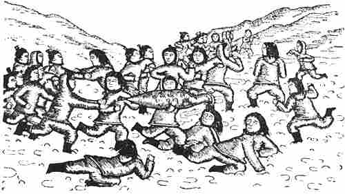
Eskimo playing ball with a stuffed seal. Woodcut from Greenland
illustrating a fairy-tale, drawn and engraved by a native
Michel Beheim, who travelled in Norway in 1450, gives in his poem about the journey [Vangensten, 1908, p. 18] a mythical description of the Skrælings (“schrelinge”), who are only three “spans” high, but are nevertheless dangerous opponents both on sea and land. They live in caves which they dig out in the mountains, make ships of hides, eat raw meat and raw fish, and drink blood with[Pg 86] it. This points to his having found in Norway ideas about the Skrælings as supernatural beings of a similar kind to those already mentioned.
In a letter to Pope Nicholas V. (1447-1455) it is related [cf. G. Storm, 1899]: “And when one travels west [from Norway] towards the mountains of this country [Greenland], there dwell there Pygmies in the shape of little men, only a cubit high. When they see human beings they collect and hide themselves in the caves of the country like a swarm of ants. One cannot conquer them; for they do not wait until they are attacked. They live on raw meat and boiled fish.” This resembles what is said about the Pygmies in Clavus, but as additional information is given here, it is probable that both Clavus and the author of this letter, and perhaps also Beheim, have derived their statements from older sources, perhaps of the fourteenth century, which either were Norwegian or had obtained information from Norway. The description of the Pygmies and how they fly on the approach of strangers points to knowledge of the Eskimo and their habits. The idea about caves is, perhaps, more likely to be connected with pixies and fairies, who lived in mounds and caves (cf. pp. 15, 76); but reports of the half-underground Eskimo houses may also have had something to do with it. It is possible that the common source may be the lost work of the English author Nicholas of Lynn, who travelled in Norway in the fourteenth century (cf. chapter xii. on Martin Behaim’s globe).
Archbishop Erik Walkendorf (in his description of Finmark of about 1520) has a similar allusion to the Eskimo, which may well have the same origin. He transfers them to the north-north-west of Finmark, like the Pygmies on Claudius Clavus’ map. He says: “Finmark has on its north-north-west a people of short and small stature, namely a cubit and a half, who are commonly called ‘Skrælinger’; they are an unwarlike people, for fifteen of them do not dare to approach one Christian or Russian either for combat or parley. They live in underground houses, so that one can neither examine them nor capture them. They worship gods” [Walkendorf, 1902, p. 12].[66]
We thus see that while Icelandic literature, subsequent to Are Frode, affords scarcely any information about the Greenland Skrælings themselves, it is a Norwegian author, as early as the thirteenth century, who makes the first statements about them and their culture; and a Danish author of the fifteenth century, whose statements may originally have[Pg 87] been derived from Norway (like those in the letter to the Pope and in Walkendorf), mentions no other inhabitants of Greenland but the Eskimo (Pygmies and Karelians);[67] but they are still referred to as semi-mythical and troll-like beings.
The explanation must doubtless be sought in a fundamental difference in the point of view. To the Icelandic authors, brought up as they were in saga-writing (and for the most part priests), the life and struggles of their ancestors in Greenland were the only important thing, while ethnographical interest in the primitive people of the country, the heathen, troll-like Skrælings, was foreign to them. To this must be added the reasons already pointed out (p. 81). In Norway, on the other hand, kinship with the Icelandic Norsemen in Greenland was more distant, and interest in the strange, outlandish Skrælings was correspondingly greater. Here also different intellectual associations, and intercourse with a variety of nationalities, caused on the whole a greater awakening of the ethnographical sense.
A remarkable exception is the “King’s Mirror” (circa 1250), which makes no mention of the Skrælings, although a good deal of space is devoted to Greenland and the Greenlanders. But this, as it happens, throws light upon the curious silence on the Skrælings in Icelandic literature. From the “Historia Norwegiæ,” which seems to have been written approximately at the same time as or soon after the “King’s Mirror” (perhaps between 1260 and 1264), it appears, as we have said, that the Greenland Skrælings were known in Norway at that time; and in that case it is incredible that the well-informed author of the “King’s Mirror,” who shows such intimate knowledge of conditions in Greenland, should not have heard of them. If he, nevertheless, does not allude to them, it appears that this must be for a similar reason to that which caused them to be so little mentioned in Icelandic literature. That the Skrælings should have been[Pg 88] spoken of in a missing portion of the “King’s Mirror,” which perhaps was never finished by the author, is improbable, as the account of Greenland and its natural conditions seems to be concluded.[68]
Concerning the “King’s Mirror” as a whole one ought to be cautious in drawing conclusions from its silence on various subjects; from its mentioning whales in the Iceland sea and seals in Greenland but not in Norway one might conclude that neither whale nor seal occurred in Norway; and the same is the case with the aurora borealis, which is only mentioned in Greenland.
If we attempt to sum up what we may conclude from the historical sources as to the Eskimo or Skrælings of Greenland during the first centuries of the Norse settlement there, something like the following is the result: When Eric the Red arrived in Greenland he found everywhere along the west coast traces left by the Skrælings, but whether and to what extent he met with the people themselves we do not hear. The probability is that the primitive people retired from those parts of the coast, the Eastern and Western Settlements, where the warlike and violent Norsemen established themselves; while they continued to live in the “wastes” to the north. The Historia Norwegiæ (besides the accounts of the voyages to the north from Nordrsetur in 1266 and 1267) shows that the Norsemen met with them[Pg 89] there, but at the same time speaks of immediate fighting. The mythical tale of Thorgils Orrabeinsfostre (p. 81) also points in the latter direction, as does the myth in Eric the Red’s Saga of the Greenlanders in Markland stealing Skræling children. We have further the stories in Claudius Clavus and Olaus Magnus of hide-boats and Eskimo (Pygmies) that were captured at sea. This points to the Norsemen of that early time having looked upon the Skrælings as legitimate spoil, wherever they met them. Doubtless upon occasion the latter may have offered resistance or taken revenge, as may be shown by the statement in the Icelandic Annals of the “harrying” in 1379; but as a rule they certainly fled, as is their usual habit. I have myself seen on the east coast of Greenland how the Eskimo take to their heels and leave their dwellings on the unexpected appearance of strangers, and this has been the common experience of other travellers in former and recent times. It is not likely that the ancient Norsemen, when they came upon a dwelling-place thus suddenly abandoned, had any hesitation about appropriating whatever might be useful to them; unless indeed a superstitious fear of these heathen “trolls” restrained them from doing so. It is therefore natural that the Skrælings avoided that part of Greenland where the Norsemen lived in large numbers. But where they came in contact we may suppose that friendly relations sometimes arose between Eskimo and European at that time, as has been the case since; nor can the Norsemen of those days have been so inhuman as to make this impossible; and gradually as time went by the relations between them probably became altogether changed, as will be discussed in the next chapter, particularly when imports from outside ceased and the Norsemen were reduced to living wholly on the products of the country; they then had much to learn from the Eskimo culture, which in these surroundings was superior.
In course of time the Eskimo of North Greenland grew in numbers, partly by natural increase—which may have[Pg 90] been constant there, where their catches were assured for the greater part of the year, and they were free from famine and ravaging diseases—and partly perhaps through a fresh gradual immigration from the north. They therefore slowly spread farther to the south, and gradually the whole of the southern west coast received a denser Eskimo population, probably after the Norsemen of the Western and Eastern Settlements had declined in prosperity and numbers, so that they no longer appeared so formidable, and at the same time they undoubtedly behaved in a more peaceful and friendly fashion, in proportion as their communication with Europe fell off, and their imaginary superiority to the Skrælings proved to be more and more illusory.
We have still to speak of the Skrælings whom the Greenlanders, according to the sagas, are said to have met with in Wineland. G. Storm [1887] maintained that they must have been Indians, which of course seems natural if we suppose, with him, that the Greenlanders reached southern Nova Scotia; but in recent years several authors have endeavoured to show that they were nevertheless Eskimo.[69] From what has been made out above as to the romantic character of these sagas it may seem a waste of time to discuss a question like this, since we have nothing certain to go by; especially when, as already mentioned, the name of Skræling may originally have been used of the pixies who were thought to dwell in the Irish fairyland, the land of the “síd,” which was called Wineland. But even if this origin of the name be correct, it does not prevent later encounters with the natives of America (besides those of Greenland) having contributed to make the Skrælings of Wineland more realistic, and given them features belonging to actual experience.
The description of them in these “romance-sagas” may thus be considered of value, in so far as it may represent the common impression of the natives[Pg 91] of the western countries, with whom the Greenlanders may have had more intercourse than appears from these tales; but even so we cannot in any case draw any conclusions from it with regard to the distribution of Indians or Eskimo on the east coast of America at that period. If it could really be established, as it cannot, that the Wineland Skrælings of the saga were Eskimo, then this alone would lead to the conclusion that the Greenlanders on their voyages had not been so far south as Nova Scotia, but at the farthest had probably reached the north of Newfoundland. If the authors mentioned have thought themselves justified in concluding that the Greenlanders found Eskimo in Nova Scotia, because the natives of Wineland are called Skrælings and are consequently assumed to be the same people with the some culture as those in Greenland, they cannot have been fully alive to the difficulty involved in its being impossible for the Skrælings of Nova Scotia, with its entirely different natural conditions, to have had the same arctic whaling and sealing culture as the Skrælings of Greenland, even if they belonged to the same race. For we should then have to believe that they had reached Nova Scotia from the north with their culture, which was adapted for arctic conditions. They would have to have dislodged the tribes of Indians who inhabited these southern regions before their arrival, although they possessed a culture which under the local conditions was inferior, and were doubtless also inferior in warlike qualities. In addition, these Eskimo with their Eskimo culture in Nova Scotia must have completely disappeared again before the country was rediscovered 500 years later, when it was solely inhabited by Indian tribes. We are asked to accept these various improbabilities chiefly because the word “Skræling”—which, it most be remembered, was not originally an ethnographical name, but meant dwarf or pixy—is used of the people both in Wineland and Greenland, because the word “keiplabrot” is used by Are Frode (see vol. i. p. 260), and because in two passages of Eric the Red’s Saga, written down about 300 years after the “events,” the word “huðkeipr” is used of the Skrælings’ boats in Wineland, while in four passages they are called “skip” (i.e., vessel), and in another merely “keipana.” It appears to me that this is attributing to the ancient Icelanders an ethnographical interest which Icelandic literature proves to have been just what they lacked (see above, pp. 80, ff.). In any case there is no justification for regarding these tardily recorded traditions as ethnographical essays, every word of which has a scientific meaning; and for that they contain far too many obviously mythical features. It is not apparent that any of the authors mentioned has decided of what kind of hide the Skrælings in southern Nova Scotia, or even farther south (“where no snow fell”), should have made their hide-boats.
Opportunities of supporting themselves by sealing cannot have existed on these Southern coasts. The species of seal which form the Eskimo’s indispensable condition of life farther north are no longer found. The only species of seal which occurs frequently on the coast of Nova Scotia is, as Professor Robert Collett informs me, the grey seal (Halichœrus grypus), which is also found on the coast of Norway and is caught, amongst other places, on the Fro Islands. But this seal cannot have been present in sufficiently large numbers in southern[Pg 92] Nova Scotia or farther south to fulfil the requirements of the ordinary Eskimo sealing culture. They must therefore have adopted hunting on land as their chief means of subsistence, like the Indians; but what then becomes of the similarity in culture between the Skrælings of Greenland and Wineland, which is just what should distinguish them from the Indians? The very foundation of the theory thus disappears. Professor Y. Nielsen [1905, pp. 32, f.] maintains that the Skrælings of Nova Scotia need only have had “transport boats” or “women’s boats” of hides, and that “what is there related of them does not even contain a hint that they might have used kayaks.” This makes the theory even more improbable. If these Skrælings were without kayaks, which are and must be the very first condition of Eskimo sealing culture on an open sea-coast, then they cannot have had seal-skins for women’s boats or clothes or tents either. They must then have covered these boats with the hides of land animals; but what? True, it is known that certain Indian tribes used to cover their canoes with double buffalo hides, a fact which the authors mentioned cannot have remarked, since they regard hide-boats as decisive evidence of Eskimo culture; moreover, the Irish still cover their coracles with ox-hides; but neither buffaloes nor oxen were to be found in Nova Scotia; are we, then, to suppose that the natives used deer-skin? The whole line of argument than leads us from one improbability to another, as we might expect, seeing it is built up on so flimsy a foundation.
The Greenlanders may well have called the Indians’ birch-bark canoes “keipr” or “keipull” (a little boat); but it is still more probable that as the details of the tradition became gradually obliterated in course of time, the designation of the Skræling boat came to be that which was used for the only boats known in later times to be peculiar to the Skrælings, namely, the hide-boats of Greenland. In addition to this, hide-boats were also known from Ireland, while the making of boats of birch-bark was altogether strange to the Icelanders. Besides, if we are to attach so much importance to a single word, “huðkeipr,” which plays no part in the narrative, what are we to do with the Skrælings’ catapults (“valslǫngur”) and their black balls which made such a hideous noise that they put to flight Karlsevne and his men?—these are really important features of the description, to say nothing of the glamour. If these, like many other incidents of the saga, are taken from altogether different quarters of the world, it is scarcely unreasonable to suppose that a word like “huðkeipr” is borrowed from Greenland and from Irish legend.
The names which according to the saga were communicated by the two Skræling children captured in Markland, and which are supposed to have lived in oral tradition for over 250 years, have no greater claim to serious consideration. Everything else that these children are said to have related is demonstrably incorrect; the tale of Hvítramanna-land is a myth from Ireland (cf. pp. 42, ff.); the statement attributed to them that in their country people lived in caves is improbable and obviously derived from elsewhere (cf. p. 19);[70] is it, then,[Pg 93] likely that the names attributed to them should be any more genuine? W. Thalbitzer [1905, pp. 190, ff.] explains these names as misunderstood Eskimo sentences, and supposes them to mean: Vætilldi, “but do wait a moment”; Vægi, “wait a moment”; Avalldamon, “towards the uttermost”; Avaldidida, “the uttermost, do you mean?” As we are told that the two Skræling boys learned Icelandic, Thalbitzer must suppose the men to have misinterpreted these sentences as names during the homeward voyage from Markland to Greenland, and then he must make the Skrælings die shortly afterwards, before the misunderstanding could be explained. After that these meaningless names must have lived in practically unaltered form in oral tradition for several hundred years, until they were put into writing at the close of the thirteenth century. It appears to me that such explanations of the words as are attempted on p. 20 have a greater show of probability. In addition, as pointed out in the same place, the “bearded” Skræling and their “sinking into the earth” are mythical features which are associated with these Skrælings.
While the points that have been mentioned are incapable of proving anything about Eskimo, there are other features in the saga’s description of the Skrælings of Wineland which would rather lead us to think of the Indians: that they should attack so suddenly in large numbers without any cause being mentioned seems altogether unlike the Eskimo, but would apply better to warlike Indians. We are told that the Skrælings attacked with loud cries; this is usual in Indian warfare, but seems less like the Eskimo. During the fight with the Skrælings Thorbrand Snorrason was found dead with a “hellustein” in his head. Whether this means a flat stone or a stone axe (as Storm has translated it [1887, 1899]), it is in any case not a typical Eskimo weapon; while a stone axe used as a missile might be Indian. But, as stated above, there is too much romance and myth about the whole tale of the Wineland voyages to allow of any certain value being attached to such details. I have already (p. 23) maintained that the description of hostilities with the natives, in which the Greenlanders were worsted, cannot be derived from Greenland, but may be due to something actually experienced. In that case this, too, points rather to the Indians.[71]
William Thalbitzer [1904, pp. 20, f.] has adduced, as a possible evidence of the more southerly extension of the Eskimo in former times, the fact that the name[Pg 94] “Nipisiguit,” of a little river in New Brunswick (46° 40′ N. lat.), bears a strong resemblance to the Eskimo place-name “Nepisät” in Greenland, and he also mentions another place-name, “Tadoussak,” which has a very Eskimo look. But in order to form any opinion we should have to know the language of the extinct Indian tribes of these parts, as well as the original forms of the names given. They are now only known from certain old maps; but we cannot tell how they got on to those maps.
The Eskimo are one of the few races of hunters on the earth who with their peculiar culture have still been able to hold their own fairly well in spite of contact with European civilisation; the reason for this is partly that they live so far out of the way that the contact has been more or less cursory, partly also, as far as Greenland is concerned, that they have been treated with more or less care, and it has been sought to protect them against harmful European influences. In spite of this it has not been possible to prevent their declining and becoming more and more impoverished. The increase of their population in recent years might doubtless give a contrary impression; but here other factors have to be reckoned with. When the Eskimo first came in contact with European culture, it was, as will be shown in the next chapter, their own culture which in these surroundings gained the upper hand as soon as communication with Europe was cut off. This would happen again if European and Eskimo could be left to themselves, entirely cut off from the outer world. But as this is impossible, the Eskimo culture is doomed to succumb slowly to our trivial, all-conquering European civilisation.
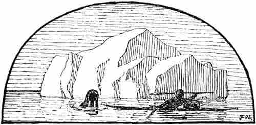
CHAPTER XI
THE DECLINE OF THE NORSE SETTLEMENTS IN GREENLAND
The Eastern and Western Settlements in Greenland seem, as we have said, to have grown rapidly immediately after the discovery of the country and the first settlement there. Their flourishing period was in the eleventh, twelfth, and part of the thirteenth centuries; but in the fourteenth they seem to have declined rapidly; notices of them become briefer and briefer, until they cease altogether after 1410, and in the course of the following hundred years the Norse population seems to have disappeared entirely. The causes of this decline were many.[72] It has been thought that it was chiefly due to an immigration into Greenland on a large scale of Eskimo, who gradually overpowered and exterminated the Norsemen; but, as will be shown later, there is no ground for believing this; even if hostile encounters took place between them, these cannot have been of great importance.
[Pg 96]In the first place the decline must be attributed to changes in the relations with Norway. From the “King’s Mirror” (cf. vol. i. p. 277), amongst other authorities, we see that the Greenlanders doubtless had to manage to some extent without such European wares as flour and bread; they lived mainly by sealing and fishing, and also by keeping cattle, which gave them milk and cheese. But there were many necessary things, such as iron for implements and weapons, and to some extent even wood[73] for larger boats and ships, which had to be obtained from Europe, besides the encouragement and support which were afforded in many ways by communication with the outer world. This was not of small moment to people who lived in isolation under such hard conditions, at the extreme limit at which a European culture was possible; it wanted little to turn the scale. It is therefore easy to understand that as soon as communication with the mother country declined, the conditions of life in Greenland became so unattractive that those who had the chance removed elsewhere, and doubtless in most cases to Norway.
But at the same time there was certainly a physiological factor involved. For the healthy nourishment of a European cereals (hydro-carbons) are necessary, and there can be no doubt that a prolonged exclusive diet of meat and fat will in the case of most Europeans reduce the vital force, and not least the powers of reproduction. This agrees with my own experience and observation under various conditions, as, for instance, during ten consecutive months’ exclusive diet of meat and fat. It is also confirmed by physiological experiments on omnivorous animals. The Greenlanders were reduced to living by sealing, fishing, and keeping cattle; milk, with its sugar of milk, was their chief substitute for the hydro-carbons in cereals; besides this, they no doubt[Pg 97] collected crowberries, angelica and other vegetables; but even during the short summer this cannot have been sufficient to counterbalance the want of flour. It is therefore probable that their powers of reproduction underwent a marked decrease, and they became a people of small fecundity. The Eskimo have had thousands of years for adapting themselves through natural selection to their monotonous flesh-diet, since those among them who were best fitted for it had the better chance of producing offspring; there is certainly a great difference between individuals in this respect; some of us are by nature more vegetarian, while others are more carnivorous. It is therefore natural that the present-day Eskimo should be better suited for this diet; but it is none the less striking that the rate of productiveness among them is also low.
As, then, the Greenlanders’ communications with Norway fell off more and more, their imports of corn and flour finally ceased altogether. Their cattle-keeping must then have declined as well, since they would have little opportunity of renewing their stock or getting other kinds of supplies, when bad years intervened and the greater part of the stock had to be slaughtered or died of hunger. Consequently the people became still more dependent on sealing; and thereby the cattle must have been neglected. In this way their diet would become even less varied, since milk would be lacking, and their reproduction would be further restricted. Add to this that their average proficiency in sealing, at first in any case, was doubtless not to be compared with that of the Eskimo, and that they were without salt for preserving their catch, which therefore had to be dried or frozen. They were thus not able to lay up a large provision, and were always more and more dependent on occasional catches. It is easy to understand that their power of resistance was not great, when bad seasons for sealing occurred, or when they were ravaged by disease, and it is not surprising if the population decreased.
[Pg 98]The cessation of the communication of Greenland with Iceland and Norway came about in the following way: between 1247 and 1261, during the reign of Håkon Håkonsson, Greenland voluntarily became subject to the Norwegian crown, whilst before this it had been a free State like Iceland. In 1294, trade with the tributary countries of Norway, Greenland among them, was declared a sort of royal monopoly or privilege, which the king could farm out to Norwegian subjects. The result of this was that only the king’s ships—and of these there was as a rule only one, called “Knarren,” for the Greenland traffic—were permitted to sail there for the purposes of trade,[74] and this was the beginning of the end. Even before that time communication with Greenland was rare. Thus we read in the “King’s Mirror” that people seldom went there. But now, when the royal trading ship was practically the only one that made the voyage, things were to be much worse. Frequently several years were occupied on one trip. As some time elapsed also between each voyage, it will be understood that, at the best, the communication was not lively. But when it occasionally happened that “Knarren” was wrecked, things were still worse. That the communication may have been defective as early as the beginning of the fourteenth century is seen from a letter from Bishop Arne, of Bergen, to Bishop Tord in Greenland, of June 22, 1308, wherein it is taken for granted that the death of King Eric nine years before, in 1299, was not yet known in Greenland. In the middle of the fourteenth century, for instance, “Knarren” returned to Bergen in 1346 safe and sound and with a very great quantity of goods; but perhaps did not sail again until 1355, and we hear nothing of her return before 1363 (?). In 1366 we hear that “Knarren” was again fitted out; but she was wrecked north of Bergen in the[Pg 99] following year, probably on the outward voyage. In the year following a new trading ship must actually have arrived with the new bishop, Alf; but it is stated that Greenland had then been without a bishop for nineteen years. In 1369 the Greenland ship seems again to have been sunk off Norway.[75]
It looks as if these voyages of “Knarren” became rarer and rarer, until at the beginning of the fifteenth century (1410) they presumably ceased altogether; in any case, we hear no more of them. Even though the Greenland traffic may have paid, it cost money to fit out “Knarren,” and when there was so much doing in other quarters, it was not always easy to procure the necessary funds. Another reason for the decline was the growing influence and power of the Hanseatic League over trade and navigation in Norway. Together with the Victualien Brethren and the adherents of the captive King Albrekt of Sweden, the Leaguers took and sacked Bergen in 1393. In 1428 the town was again taken by the Hanseatic League. It may easily be understood that events of this kind had a disturbing and perhaps entirely paralysing effect on the Greenland traffic, which had its headquarters in this town. Moreover, Norway had before this been much weakened by the Black Death, which visited the country in 1349. It raged with special virulence in Bergen; but there is no notice of the disease having spread to Greenland; perhaps that country was spared through “Knarren” not having sailed there before 1355, and probably no other ship having made the voyage in the interval. In 1392 there was again a severe pestilence throughout Norway, and many people died. In that year too a great many ships were wrecked. There were thus a number of misfortunes at that time, and the people of Norway had enough to occupy them in their own affairs. Another circumstance unfavourable to the communication with Greenland was the union of Norway with Denmark, and for a time with Sweden. The[Pg 100] seat of government was thereby removed to Copenhagen, and interest in Norway, and especially in its so-called tributary countries, was further greatly diminished by the larger claims of Denmark and Sweden.
It is reasonable to suppose that under such conditions the settlements in Greenland, which were almost entirely cut off, must have decayed; comparatively few, perhaps, were able to get a passage, and left the country by degrees; but the people declined in numbers; they adopted an entirely Eskimo mode of living, and mixed with the Eskimo, who perhaps at the same time spread southwards in greater numbers along the west coast of Greenland. It was remarked in the last chapter that the Norsemen, when they arrived in the country, evidently looked down upon the stone-age, troll-like Skrælings, whom they could hunt and ill-use with impunity; with their iron weapons, their warlike propensities, and their larger vessels, they may perhaps have been able to maintain this imaginary superiority in the early days, so long as they still had some kind of supplies from abroad. But it is obvious that these relations must have been fundamentally changed when this communication gradually ceased, and they were reduced, without any support from Europe, to make the best of the country’s resources; then the real superiority of the Eskimo in these surroundings asserted its full rights, and the Greenlanders had to begin to look upon them in a very different light. It is therefore perfectly natural that from this very fourteenth century a fundamental change in the relations between Norsemen and Skrælings set in. And that such was the case seems to result in many ways from the meagre information we possess.
In the Annals of Bishop Gisle Oddsson, written in Iceland in Latin before 1637, we read under the year 1342 [G. Storm, 1890a, pp. 355, f.; Grönl. hist. Mind., iii. p. 459]:
“The inhabitants of Greenland voluntarily forsook the true faith and the religion of the Christians, and after having abandoned all good morals and true[Pg 101] virtues turned to the people of America (‘ad Americæ populos se converterunt’); some also think that Greenland lies very near to the western lands of the world. From this it came about that the Christians began to refrain from the voyage to Greenland.”
It is not known from whence Gisle Oddsson took this statement. As the expression “the people of America” (“Americæ populi”) is a curious one, and as the statements in the bishop’s annals following that quoted above are entirely myths and inventions taken from Lyschander’s “Grönlands Chronica” (but originally derived from Saxo and Adam of Bremen), Storm regarded the whole account as spurious and lacking any mediæval authority. Interpreting, curiously enough, “ad Americæ populos se converterunt” to mean that the Greenlanders had emigrated to America, Storm supposes that this may be a hypothesis “formed to explain the disappearance from Greenland of the old Norwegian-Icelandic colony.” But the meaning of the passage can scarcely be interpreted otherwise than as translated above, that the Greenlanders had forsaken Christianity, given up good morals and virtues, and had been converted to the belief and customs of the American people (i.e., the Skrælings). The people of America must be a strained expression the bishop has used to denote the heathen Skrælings (who inhabited Greenland and the American lands) in contradistinction to the Christian Europeans. Greenland was frequently regarded in Iceland in those times as a part of America (cf. the map, p. 7). Hans Egede, for example, thought the natives of Greenland were “Americans.” In other words, the statement simply means that in 1342 a report came that the Greenlanders were associating amicably with the heathen Skrælings (which was forbidden by the ecclesiastical law of that time), and had begun to adopt their mode of life; which, in fact, is extremely probable.
The question is, then, from whence Gisle Oddsson may have derived this, which is not known from any other source. Storm thought it out of the question that it was taken from[Pg 102] Lyschander (from whom the same annals have borrowed so much else); but we cannot be so sure of this. After having related the volcanic eruption and disasters in Iceland in 1340 (also recorded by Gisle Oddsson), Lyschander continues:
“Norway and Sweden and Greenland also
They were hereafter well able to perceive
That such things boded ill to them.
These kingdoms they came into the hands of the Dane,
And Greenland went astray on the strand,
Not long after these times.”
Whatever may be meant by this strained, obscure expression about Greenland (is “strand” a misprint for “stand”—“went astray in its condition” ?), it might at any rate be interpreted to mean that its inhabitants had been converted (gone astray) to a heathen religion (the people of America); “not long after these times” (i.e., after 1340) may thus have been made into 1342. But the mention of a definite date—which, it may be remarked, would suit very well for the time when the Greenlanders passed into Eskimo in larger numbers, at any rate in the Western Settlement (cf. Ivar Bárdsson’s description, see below, p. 108)—may possibly indicate that some ancient authority or other is really the foundation for the statement, and perhaps also for the lines quoted from Lyschander. Finn Magnussen [Grönl. hist. Mind., iii. p. 459] thinks that Gisle Oddsson may have derived much information from the archives and library of Skálholdt cathedral, which was burnt in 1630.
Whether genuine or not, this statement may correctly describe the fate of the Greenland settlements. Deserted by the mother country, and left to their own resources, the Greenlanders were forced to adopt the Eskimo mode of life, and became absorbed in them. This took place first in the more northerly and more thinly populated Western Settlement, and later in the Eastern Settlement as well. The Eskimo with their kayaks and their sealing appliances were the superiors of the Greenlanders in sealing (as appears from[Pg 103] the account of Björn Jorsalafarer), and their mode of life was better suited to the conditions of Greenland; it is therefore incredible that their culture should not gain the upper hand in an encounter, under conditions otherwise equal, with that of Europeans, even though there were certain things that they might learn of the Europeans, especially the use of iron.[76] Furthermore, the Greenlanders’ stock of cattle, goats and sheep had, as we have seen (p. 97), greatly declined owing to the long severance from Europe, and for this reason also they were obliged to adopt more of the Eskimo way of life. But then their places of residence within the fjords, far from the sealing-grounds, were no longer advantageous, and by degrees they entirely adopted the Eskimo’s more migratory life along the outer coast. Then, again, the Eskimo women were probably no less attractive to the Northerners of that time than they are to those of the present day, and thus much mixture of blood gradually resulted. The children came to speak the Eskimo language, and took at once to a wholly Eskimo way of life, just as at the present day the children of Danes and Eskimo in Greenland do. As the Norsemen at that time must also have been very inferior to the Eskimo in numbers, they must by degrees have become Eskimo both physically and mentally; and when the country was rediscovered in the sixteenth and seventeenth centuries there were only Eskimo there, while all traces of the Norwegian-Greenland culture seemed to have disappeared.
Ruins of church at Kakortok in the Eastern Settlement (after Th. Groth)
Let us suppose that we could repeat the experiment and plant a number of European sealers in Baffin Land, for instance, with their women, together with a greater number of Eskimo, and then cut off all communication with the civilised world. Can we have any doubt as to the kind of culture we should find there if we could come back after two hundred years? All the inhabitants would be Eskimo, and we should find few traces of European culture.
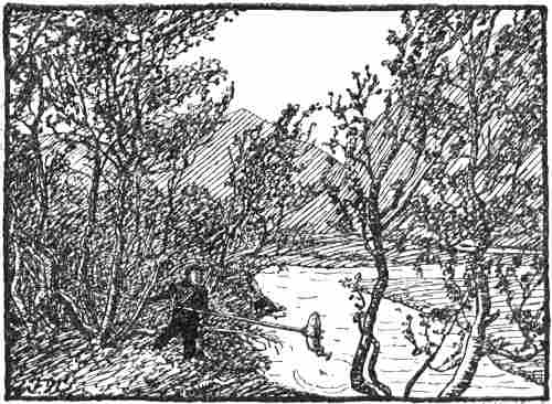
Salmon-fishing in Vazdal by Ketils-fjord in the Eastern Settlement
(see map, vol. i. p. 265), where the “birch forest” is as high as 20 ft.
From a photograph by Dr. T. N. Krabbe (A. S. Jensen, 1910)
It would doubtless seem reasonable to expect that the descendants of the ancient Norsemen of Greenland and of the Eskimo with whom they became absorbed should have shown signs in their external appearance of this descent, when discovered in the sixteenth and seventeenth centuries; but unfortunately we have no descriptions of them from that time which allow of any conclusions being drawn on the subject. It is true that Hans Egede says [1741, p. 66] that the Eskimo of Greenland “have broad faces and thick lips, are flat-nosed and of a brownish complexion; though some of them are quite handsome and white”; but nothing definite can be concluded from this, and in the period after Egede’s arrival the natives on the west coast became so mixed that it is now hopeless to look for any of the original race. It is, however, remarkable that Graah found in[Pg 105] 1829-1831 Eskimo on the east coast of Greenland, many of whom struck him as resembling Scandinavians in appearance—a fact which he sought to explain by European sailors having perhaps been wrecked there.
But if it is now difficult to prove in this way the partially Norse descent of the natives on the southern west coast of Greenland, it is to be expected that there should be many vestiges in their myths and fairy-tales which would give evidence of this. And this is precisely what we find. In an earlier work [1891, pp. 207, ff.; Engl. ed., pp. 248, ff.] I think I have pointed out numerous features in their tales that bear a resemblance to the Norse mythical world, and that must have been derived from thence; and many more might be adduced. The similarities are sufficiently numerous to bear witness to a quite intimate intellectual contact, and are in full agreement with what we should expect. But it may seem strange that their religious ideas did not show more Christian influence, especially when we see that even so late as 1407 Christianity was powerful enough in the Eastern Settlement for a man to be burnt for having seduced another’s wife by witchcraft. There are, however, many features in their conceptions of another world, of which Egede speaks, which appear to be necessarily of Christian origin; we must suppose, too, that Christian education was at a very low ebb in Greenland at the close of the fourteenth century, and soon ceased altogether.
Only a few words in the language of the Greenland Eskimo on the southern west coast have been shown to be of Norse origin. Hans Egede himself pointed out the following: “kona” (== wife, Old Norse kona), “sava” or “savak” (== sheep, O.N. sauðr, gen. sauða), “nisa” or “nisak” (== porpoise, O.N. hnísa), “kuanek” (== angelica, O.N. hvǫnn, plur. hvannir). Some of these words recur in Labrador Eskimo, but may have been introduced by the Moravian missionaries from Greenland. We may also mention the name the Eskimo of southern Greenland apply to[Pg 106] themselves, “karālek” or “kalālek,” which may come from the word Skræling (which in Eskimo would become “sakalālek”). This, as the Eskimo told Egede, was the name the ancient Norsemen had called them by; otherwise the Eskimo call themselves “inuit” (== human beings); and curiously enough “kalālek” is not used by the Eskimo of northern Greenland; on the other hand, it is known to the Labrador Eskimo, but may have been brought by the missionaries, although the latter asserted that it was known when they came. It is perhaps of more importance that, according to H. Rink, a similar word (“kallaluik,” “katlalik” or “kallaaluch,” for chief or shaman) occurs in the dialects of Alaska.
Through all the notices of Greenland and its condition, especially those from religious sources, there runs after the fourteenth century a cry of apostasy, which is ominous of this mixture of the Norsemen with the Skrælings: we see it in the doubtful statement from 1342 about their conversion to “the people of America”; a little later, according to Ivar Bárdsson’s account (see p. 108), the heathen Skrælings were predominant in the Western Settlement; furthermore, the trading ship was fitted out in 1355 to prevent the “falling away” of Christianity [Grönl. hist. Mind., iii. p. 122]; Björn Einarsson’s account (see below, p. 112) concludes with the statement that when he was there (1386) “the bishop of Gardar was lately dead, and an old priest ... performed all the episcopal ordinations” [Grönl. hist. Mind., iii. p. 438]; after that time no bishop came to Greenland; and finally the papal letter of 1492-93 describes the Greenlanders as a people abandoned by bishop and priest, for which reason most of them had fallen from the Christian faith, although they still preserved a memory of the Christian church service (see later).[77] This may all point in the same[Pg 107] direction: that the Norsemen in Greenland became more and more absorbed by the Eskimo.
Of course there may have been occasional hostile encounters between the Eskimo and Norsemen in Greenland, especially as the latter, as pointed out in the last chapter, must frequently have acted with a heavy hand when they had the power. But that the Eskimo should have carried on a regular war of extermination, which resulted in the complete destruction first of the Western and then of the Eastern Settlement, as has been generally assumed until quite recently—this is incredible to any one who knows the Eskimo and considers what their conditions of life were. Where should they have developed this warlike propensity which was afterwards foreign to them, and where should they have had training in the art of war? This idea of the destruction of the settlements by hostilities is the result mainly of three statements about Greenland, of which one is very improbable and on many points impossible, another deals possibly with an actual attack, and the third is demonstrably false. We must here examine these notices a little more closely.
In 1341 Bishop Hákon of Bergen sent a priest, Ivar Bárdsson, to Greenland. He was for a number of years steward of the bishop’s residence at Gardar, and is said also to have visited the Western Settlement. We do not know for certain how long he was in Greenland, but in 1364 he again appears in Norway [cf. G. Storm, 1887, p. 74]. There exists in Danish a description of the fjords, more especially of the Eastern Settlement, which, according to its own words, must to a great extent be derived from oral communications of this Ivar (see below). These must originally have been taken down by another Norwegian, in Norwegian, and were thence translated into Danish [cf. F. Jónsson, 1899, p. 279]. There is thus a double possibility that the third-hand version we possess may contain many errors and misconceptions, of which, in fact, it bears evident marks. After speaking of[Pg 108] the fjords in the Eastern Settlement, it says of the Western Settlement and of the journey thither:[78]
“Item from the Eastern Settlement to the Western is a dozen sea-leagues and all is uninhabited, and there in the Western Settlement stands a great church which is called Stensness Church; this church was for a time a cathedral and the see of a bishop.[79] Now the Skrælings possess the whole Western Settlement; there are indeed horses, goats, cattle and sheep, all wild, and no people either Christian or heathen.
“Item all this that is said above was told us by Iffuer bort [or Bardsen], a Greenlander, who was steward of the bishop’s residence at Gardum in Greenland for many years, that he had seen all this and he was one of those who were chosen by the ‘lagmand’ to go to the Western Settlement against the Skrælings to expel the Skrælings from the Western Settlement, and when they came there they found no man, either Christian or heathen, but some wild cattle and sheep, and ate of the wild cattle, and took as much as the ships could carry and sailed with it home [i.e., to the Eastern Settlement], and the said Iffuer was among them.
“Item there lies in the north, farther than the Western Settlement, a great mountain which is called ‘Hemelrachs felld’ [or ‘Himinraðz fjall,’ cf. vol. i. p. 302], and farther than to this mountain must no man sail, if he would preserve his life from the many whirlpools which there lie round the whole sea.”
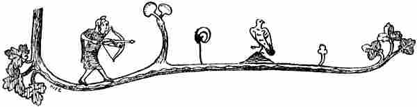
From an Icelandic MS. of the fourteenth century
Strangely enough no author has expressed a doubt of the credibility of this description, although as usually interpreted it contains an impossibility, which must strike any one on a closer examination. It is still commonly interpreted as though Ivar Bárdsson had found the whole Western Settlement destroyed by Eskimo.[80] But if this was so, how could he have found there wild cattle, sheep, horses and goats? The whole Western Settlement must then have been destroyed the summer that he was there; for the wild cattle could not possibly have supported themselves through the winter[Pg 109] in Greenland; evidently the author, who was unacquainted with the conditions in Greenland, did not think of this. Besides, can any one who knows the Eskimo imagine that they slaughtered the men, but not the cattle? This represented food to them, and that is what they would first have turned their attention to. It is not stated which fjord of the Western Settlement it was that Ivar visited; but in any case it is hardly to be supposed that it was all the fjords, which thus would all have been destroyed at the same time. The conclusion that Ivar found the whole Western Settlement laid waste is therefore in any case unfounded; it can at the most have been one fjord, or perhaps only one homestead (?). If there should really be some historical foundation for the description of Ivar Bárdsson’s voyage, then it may perhaps be interpreted in an altogether different way. The people of the Western Settlement, where the conditions for keeping cattle were far less favourable than farther south in the Eastern Settlement, undoubtedly became earlier absorbed among the Eskimo and went over to their mode of living. This may also be what is alluded to in the perhaps approximately contemporary statement of 1342, already quoted (p. 101), which says that the Greenlanders “turned to the people of America.” It is possible that it was just this same state of things that was the cause of Ivar’s being sent to expel the Skrælings from the Western Settlement. When he arrived in the summer at the fjord which he possibly visited, the people may therefore, in Eskimo fashion, have been[Pg 110] absent on sealing expeditions somewhere out on the sea-coast and living in tents, while the cattle were turned out at pasture round the homesteads.[81] This would explain how they came to be found alive. The men of the Eastern Settlement then, with or against their better conscience, stole and carried off the property of the half-Eskimo men of the Western Settlement during their absence, and when the latter returned they found their homesteads plundered, not by Eskimo but by Greenlanders. But it is perhaps very questionable whether the whole account of this voyage is particularly historical. The statement about the whirlpools, for one thing, is mythical, pointing to an idea that this was near the end of the earth, and in the description immediately following like and unlike are mixed together in a way that is calculated to arouse doubt. We read thus:
“Item in Greenland there are silver-mines [which are not found there], white bears having red spots on the head [sic!].... Item in Greenland great tempests never come. Item snow falls much in Greenland, it is not so cold there as in Iceland and Norway, there grows on high mountains and down below fruit as large as some apples and good to eat, the best wheat that can be grows there.”[82]
As will be seen, one absurdity succeeds another. It may be objected that as it is not stated that this last paragraph is due to Ivar the Greenlander, it may have been added later; but it contains an admixture of statements that must come from Greenland—e.g., about the white bears, whales’ tusks (i.e., of walrus or narwhale), walrus hides, soapstone (steatite), of which they make pots, and large vessels; it is also stated that “there are many reindeer,” and it seems probable that it is all derived from the same untrustworthy source.
To what has here been said some will object that, even if this description ascribed to Ivar Bárdsson bears evident[Pg 111] marks of being inexact, it shows at any rate that in Norway, when it was taken down, the view prevailed that the Western Settlement had been destroyed by an attack of the Skrælings. But nothing of the kind is really stated in the account (cf. above, p. 108, note 3); and the possibly contemporary statement (of 1342 ?) which has already been given (p. 100) shows that in Iceland, at any rate in the seventeenth century, the contrary view prevailed, unless indeed we are to explain this statement as having arisen through a misunderstanding of Lyschander.
Under the year 1379 the so-called “Gottskalks Annáll” (of the second half of the sixteenth century) has a statement which cannot be regarded as certain, as it is not found in the other Icelandic annals, but which may have been taken from older sources. It reads [G. Storm’s edition of Islandske Annaler, 1888, p. 364]:
“The Skrælings harried the Greenlanders and killed of them eighteen men and took two boys and made slaves of them.”
It is possible that this may have some historical foundation, and in that case it doubtless refers to some collision or attack, perhaps at sea, in which the Eskimo were superior and the Greenlanders were defeated, which latter circumstance is the reason of our hearing something about it; in the contrary case it would not have been reported. That the Eskimo took two boys is conceivable if they were quite young, so that they could be trained for sealing; they would thus provide an increase of the capital of the community. It is not unlikely that rumours of some such collisions as this may have contributed to form the ideas prevalent in Norway as to the formidable character of the Skrælings,[83] while at the same time there existed ideas of their flying from Europeans, which appear in the reports of the Pygmies[Pg 112] (cf. the letter to the Pope, about 1450, and Walkendorf, above, p. 86). Whether the encounter referred to took place in the Western or in the Eastern Settlement (or perhaps in Nordrsetur ?) we do not know. If we are to place any reliance on Ivar Bárdsson’s description, we must suppose that the Western Settlement and its fate were little known at that time. But that friendly relations between the Greenlanders and the Eskimo may have prevailed also in the Eastern Settlement later than this seems to result from the account of the widely travelled Icelander Björn Einarsson Jorsalafarer’s stay in Greenland from 1385 to 1387. On a voyage to Iceland in 1385 he was in distress, and was driven out of his course to the Eastern Settlement with four ships, which all arrived safe and well in Iceland in 1387.[84] It seems that there was a difficulty in feeding all these crews, but Björn is said to have had the district of Eric’s fjord handed over to him while he was there (?), and received as a contribution 130 fore-quarters of sheep (?). There is also related a fable that on his coming there and going down to the sea to look for seals he happened to witness a combat between a polar bear and a walrus, “who always fight when they meet,[85] and he afterwards killed them both.”
“Then Björn the franklin found maintenance for his people through one of the largest rorquals being driven ashore, with a marked harpoon belonging to Olaf of Isafjord in Iceland, and finally it was also of importance that he came to the assistance of two trolls [i.e., Eskimo], a young brother and sister, on a tidal skerry [i.e., one that was under water at high tide]. They swore fidelity to him, and from that time he never was short of food; for they were skilled in all kinds of hunting, whatever he wished or needed. What the troll girl liked best was when Solveig, the mistress of the house, allowed her to carry and play with her boy who had lately been born. She also wanted to have a linen hood like the mistress, but made it for herself of whale’s guts. They killed themselves, and threw themselves into the sea from the cliffs after the ships, when they were not allowed to sail with the franklin Björn, their beloved master, to Iceland.”
[Pg 113]The description of Björn Einarsson’s voyage is full of extravagances and anything but trustworthy; but his stay in Greenland with the four ships is certainly historical; and the description of the two young Eskimo has many features so typical of the Eskimo—such as the girl’s fondness for children, her making a hood of whale’s guts, and their superior skill in sealing—that they show without doubt that at that time there was intercourse with the Eskimo in the Eastern Settlement.
From an existing royal document of 1389 it appears that, when Björn and his companions came from Iceland to Bergen in 1388, they were prosecuted for illegal trading with Greenland, which was a royal monopoly; but they were acquitted, since they had been driven there in great distress and were obliged to trade in order to obtain food [Grönl. hist. Mind., iii. pp. 139, f.].
A document to which much weight has been attached is a papal letter which has been preserved, from Nicholas V. in 1448 to the two bishops of Iceland. It is there said of Greenland, amongst other things [Grönl. hist. Mind., iii. p. 170]:
“From the neighbouring coasts of the heathens the barbarians came thirty years ago with a fleet, attacked the people living there [in Greenland] with a cruel assault, and so destroyed the land of their fathers and the sacred edifices with fire and sword that only nine parish churches were left in the whole island [Greenland], and these are said to be the most remote, which they could not reach on account of the steep mountains. They carried the miserable inhabitants of both sexes as prisoners to their own country, especially those whom they regarded as strong and capable of bearing constant burdens of slavery, as was fitting for their tyranny. But since, as the same complaint adds,[86] in the course of time most of them have returned from the said imprisonment to their own homes, and have here and there repaired the ruins of their dwellings, they long to establish and extend divine service again, as far as possible....” Then follows a lengthy discourse on their religious needs, and what might be done to relieve them, without costing the rich Papacy anything.
As the barbarians here must undoubtedly mean the[Pg 114] Eskimo, it has been regarded as a historical fact that the latter about 1418 made a devastating attack on the Eastern Settlement, and this document has thus lent weighty support to the general opinion that the Greenland settlements perished as the result of an Eskimo war of extermination. But the letter itself shows such obvious ignorance of conditions in Greenland, especially with regard to the Eskimo, that there must be some doubt about the complaint on which it is based. To begin with, it is in itself unlikely that the peaceful and unwarlike Eskimo, who can have had no practice in warfare, since they had previously had no one to fight with, except walruses and bears, should have come with a “fleet” and made an organised attack in large masses, and destroyed people and houses and churches in the Eastern Settlement. Even if they might have been provoked to resistance or even revenge by ill-usage on the part of the Greenlanders, or perhaps have coveted their iron implements, it is an impossibility that they should have organised themselves for a campaign. But it is added that they carried off the inhabitants of both sexes to use them as slaves; for what work?—in sealing they were themselves superior, in preparing skins and food their women were superior; and other work they had none. To a Greenland Eskimo it would be an utterly absurd idea to feed unnecessary slaves, and it betrays itself as of wholly European origin. The statement that after the incursion only nine parish churches were left also betrays ignorance; as pointed out by Storm, there were never more than twelve, even in the flourishing period of the Settlement, and by about 1418 there were certainly not nine in all. Furthermore, the letter is not addressed to the two bishops really officiating in Iceland, but to the two impostors, the German Marcellus and his confederate Mathæus, who by means of false representations had induced Pope Nicholas V. to consecrate them bishops of Iceland [cf. G. Storm, 1892, p. 399]. The probability is that the two impostors themselves composed the complaint from Greenland which was[Pg 115] the cause of the papal letter, and which thus did not reach the Pope until thirty years after the alleged incursion; their object must have been to obtain further advantages. The papal document of 1448 must therefore be entirely discarded as historical evidence so far as its statements about Greenland are concerned.
Consequently the only possibly historical statement left to us, to prove that the Eskimo took the offensive, is that of their “harrying” in 1379; but from this we can doubtless only conclude that at the most there was a collision between Eskimo and Greenlanders. It has also been adduced that the Eskimo of Greenland have a few legends of fighting with the ancient Norsemen, and one which tells how the last of the Norsemen was slain. It must, however, be remembered that these legends were taken down in the last century, when the Eskimo had again been in contact with Europeans for several hundred years, and when Norwegians and Danes had been living in the country for over a hundred years. Some of the legends certainly refer to recent collisions with Europeans, and it is not easy to say what value can be attached to the others as evidence of an extermination of the last Norsemen. It is also to be remarked that the Norsemen, or Long-Beards, are not spoken of with ill-will in these legends, but rather with sympathy, which is difficult to understand if there had been such hatred as would account for a war of extermination. Add to this that the particular encounter which led to the last Long-Beard being pursued and slain arose, according to the tale, quite accidentally, which is difficult to imagine if it was the conclusion of a lengthy war of extermination, in which homestead after homestead and district after district had been harried and laid waste. The legends of the Eskimo cannot therefore be cited as evidence of the probability of any such war.
It has been said that even if such warlike proceedings would be entirely incompatible with the present nature, disposition and way of thinking of the Greenland Eskimo,[Pg 116] it may formerly have been otherwise. But in any case no long time can have elapsed between the alleged final overthrow of the Eastern Settlement, perhaps about 1500, and the rediscovery of Greenland in the sixteenth century. It is not likely that the Eskimo should have so completely changed their nature in the few intervening years; those whom the discoverers then found seem, from the accounts, to have strikingly resembled those we find later. And if one reads Hans Egede’s description of the Eskimo among whom he lived and worked, it appears absolutely impossible that the same people two hundred years earlier should have waged a cruel war of extermination against the last of the Norsemen.
There is, it is true, a possibility, as Dr. Björnbo has pointed out to me, that the mixture of race which gradually took place between Eskimo and Norsemen may for a time have produced a mixed type, which possessed a more quarrelsome disposition than the pure Eskimo, and may have inherited the not very peaceful habits of the Norsemen, and that in this way, for instance, a possible attack in 1379 may be explained. But this can only have been the case at the beginning of the period of intermixture, and the type must have changed again in proportion as the Eskimo element in race and culture became preponderant.[87]
The allusion to the Pygmies of Greenland in the letter to Nicholas V., quoted above (p. 86), gives us the Eskimo as we are accustomed to see them; and the description of[Pg 117] these small men, a cubit high, who fly in a body at the sight of strangers, gives a surer and truer picture of the Skrælings than when they are represented as warlike and dangerous barbarians. The statements about the Pygmies in Claudius Clavus also enable us to see how the Norsemen sometimes treated the Eskimo, when they caught them
“at sea in a hide-boat, which now hangs in the cathedral at Trondhjem; there is also a long boat of hides [i.e., a women’s boat] which was also once taken with such Pygmies in it.”
But that these little Pygmies, a cubit high, were regarded as formidable warriors, engaged in exterminating the Norsemen, is difficult to believe,[88] even though Michel Beheim attributes warlike qualities to them (cf. p. 85). Walkendorf, who had so carefully collected all traditions about Greenland, describes (circa 1520) the Skrælings as an “unwarlike” and harmless people (see above, p. 86). It is impossible to reconcile this with a tradition of a war of extermination.
There are therefore good grounds for supposing that Arne Magnussen was approximately correct when he said in 1691 [Grönl. hist. Mind., iii. p. 138]:
“It is probable that owing to the daily increase of the ice and its drifting down from the Pole, it thus befell Greenland, and the Christian inhabitants either died of hunger or were constrained to practise the same Vitæ genus as the savages, and thus degenerated into their nature.”
In the year 1406 the Icelanders Thorstein Helmingsson, Snorre Thorvason and Thorgrim Solvason, in one ship, were driven out of their course to Greenland. “They sailed out from Norway, and were making for Iceland. They stayed there [in Greenland] four winters” [cf. Islandske Annaler, ed. Storm, 1888, p. 288]. While they were there, in the following year [1407]
“a man named Kolgrim was burnt in Greenland for that he lay with Thorgrim Solvason’s wife, who was the daughter of a ‘lagmand’ of high standing in Iceland. This man got her consent by black art; he was therefore burnt[Pg 118] according to sentence; nor was the woman ever after in her right mind, and died a little later.”
In 1408 one of the Icelanders married in Greenland, which is of interest from the fact that several documents bearing witness to the marriage are extant. In 1410 “Thorstein Helmingsson and Thorgrim Solvason and Snorre Thorvason and the rest of their crew sailed to Norway.” Whether this was in their own ship we do not know; but as they sailed to Norway and not to Iceland it is doubtless most probable that their ship was destroyed and that they had to wait these four years for a passage to Norway. In 1411[89] a small vessel was wrecked on the coast of Iceland; on board her came Snorre Thorvason from Norway. His wife, Gudrun, had during his absence married another man in 1410. She “now rode to meet him. He received her kindly.” “Snorre took his wife to him again, but they only lived a little while together before he died, and she then married Gisle [the other man] again.”
This is the last certain information we have of any voyage to the ancient settlements of Greenland. After that time all notices cease. As Holberg says [Danm. Hist., i. 531], after the time of Queen Margaret the succeeding kings had so much to do that they had no time to think of old Greenland.[90]
In 1431 King Eric of Pomerania complained to the English king, Henry VI., of the illegal trading which the English had carried on for the previous twenty years (that is, since 1411) with “Norway’s Lands and Islands”: Iceland, Greenland, the Faroes, Shetland, the Orkneys, Helgeland and Finmark; and of the acts of violence and piratical[Pg 119] incursions, with fire and rapine, that they had committed in this period, by which they had carried off many ships laden with fish and other goods, and many people had perished.[91] As early as 1413 King Eric’s ambassador to the English king, Henry V., had made a strong protest against all foreign and unprivileged trade with these countries. On Christmas Eve, 1432, a treaty was signed between the two kings, whereby Henry VI. engaged himself to make good all the damage the English had caused to King Eric’s subjects in the said countries, and all the people who during those twenty years had been violently carried off were, by the direction of the English king, wherever they might be found in his dominions, to receive payment for their services and to return freely to their native places. Further, the old prohibition of trading with the Norwegian tributary lands was renewed. The same prohibition was renewed and enforced on the English side by Henry VI. in 1444, and by a new treaty between him and Christiern I., concluded at Copenhagen, July 17, 1449; but this was only to remain in force till Michaelmas 1451. After that time the English merchants, some of whom no doubt were Norwegians established at Bristol, seem to have seized upon nearly the whole of the trade with Iceland, and often conducted themselves with violence there. But in 1490 this trade was made free on certain conditions.
These negotiations give us an insight into the state of things in Northern waters at that time. At the same time there were difficulties with the Hanseatic League, which tried to seize upon all trade.
Among these so-called Norwegian tributary countries was Greenland, which is mentioned with the others in the complaint of 1431; but whether this means that the English extended their trading voyages, which frequently became piratical expeditions, so far, we do not know; in any case it is not impossible, although of course the voyage to Iceland[Pg 120] with its rich fisheries was much more important. We know that this was carried on from Bristol in particular, where, as has been said, many Norwegians were established.
The statements about Greenland contained in the papal letter of 1448 were, as we have seen, false. Perhaps not very much more weight is to be attached to the story, in Peyrere’s “Relation du Groënland” (Paris, 1647), of Oluf Worm of Copenhagen having found in an old Danish MS. a statement that about 1484 there were more than forty experienced men living at Bergen, who were in the habit of sailing to Greenland every year and bringing home valuable goods; but as they would not sell their wares to the Hanse merchants, the latter revenged themselves by inviting them to a supper and killing them all at night. This then was said to be the end of the Greenland voyage, which had to cease thenceforward, because no one knew the course any more [cf. Grönl hist. Mind., iii. pp. 471, f.]. The story as given here is in many respects improbable; but even if the forty or more men and the annual voyage are exaggerations, there are other indications that about that time there may have been some sort of communication with Greenland or the countries to the west of it, as will be mentioned later. The royal monopoly of the Iceland trade was no longer in force, and the same may have applied to Greenland. It is then conceivable that merchants may have gone there; and if their trading prospered they had every reason to keep it as secret as possible, lest others should interfere with their livelihood. This would explain why such voyages are not mentioned by historical authorities. Just then, too, was an uneasy time, with a sort of war of privateers between England and Denmark-Norway, which was not concluded until the provisional peace of 1490; there were thus many pirates and privateers in Northern waters, who may well have extended their activity upon occasion to the remote and unprotected Greenland, where they could plunder with[Pg 121] even greater impunity than in Iceland, and perhaps they increased the ruin of the settlements there.
Of great interest is a letter from Pope Alexander VI.[92] of the first year of his papacy, 1492-1493, which was written in consequence of a Benedictine monk named Mathias having applied to the Pope to be appointed bishop of Greenland, and declared himself willing to go there personally as a missionary to convert the apostates. The letter runs:
“As we are informed, the church at Gade [i.e., Gardar] lies at the world’s end in the land of Greenland, where the people, for want of bread, wine and oil, live on dried fish and milk; and therefore, as well as by reason of the extreme rarity of the voyages that have taken place to the said land, for which the severe freezing of the waters is alleged as the cause, it is believed that for eighty years no ship has landed there; and if such voyages should take place, it is thought that in any case it could only be in the month of August, when the same ice is dissolved; and for this reason it is said that for eighty years or thereabouts no bishop or priest has resided at that church. Therefore, and because there are no Catholic priests, it has befallen that most of the parishioners, who formerly were Catholics, have (oh, how sorrowful!) renounced the holy sacrament of baptism received from them; and that the inhabitants of that land have nothing else to remind them of the Christian religion than a corporale [altar-cloth] which is exhibited once a year, and whereon the body of Christ was consecrated a hundred years ago by the last priest who was there.” For this reason, “to provide them with a fitting shepherd,” Pope Alexander’s predecessor, Innocent VIII., had appointed the Benedictine monk Mathias bishop of Gade [Gardar], and he “with much godly zeal made ready to bring the minds of the infidels and apostates back to the way of eternal salvation and to root out such errors,” etc. Then follow exhortations to the Curia, the chancellors, and all the religious scriveners under pain of excommunication to let the said Mathias, on account of his poverty, escape all expenses and perquisites connected with the appointment and correspondence, etc.
The statements in the letter agree remarkably well with what we gather from other historical sources. In 1410—that is, eighty-two years before the date of the letter—the last ship of which we have any notice arrived in Norway from Greenland (see above, p. 118). This agrees with the statement in the letter that no ship had been there for eighty[Pg 122] years. In 1377 the last officiating bishop of Gardar died, and six years later the news reached Norway, that is, 109 years before the date of the letter. This agrees with what is said about the altar-cloth being used a hundred years before by the last priest (“ultimo sacerdote,” perhaps meaning here bishop ?) at the administration of the sacrament. The assertion that it was not until August that Greenland became free of ice and that voyages could be made thither also shows a certain local knowledge; for it was not till late in the summer, usually August, that “Knarren” was accustomed to sail from Bergen to Greenland.
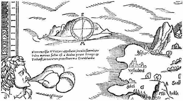
A portion of Gourmont’s map of 1548, with the north-west coast of Iceland and the rocky island of Hvitserk
Whether news had recently arrived from Greenland at the time the letter was written does not appear from the words of the letter, and cannot, in my opinion, be inferred therefrom, though Storm [1892, p. 401] thought it could. The only thing which might point to this is the story of the altar-cloth being exhibited once a year; but this, of course, may be a tradition which goes back to the last ship, eighty years before.
[Pg 123]Meanwhile we meet with obscure information in other quarters about a possible communication with Greenland at that time. In a map of Iceland, printed in Paris in 1548 by Hieronymus Gourmont,[93] a rocky island is marked to the north-west of Iceland, with a compass-card and a Latin inscription. This, as A. A. Björnbo has pointed out,[94] is of interest; it reads in translation:
“The lofty mountain called Witsarc, on the summit of which a sea-mark was set up by the two pirates (piratis), Pinnigt and Pothorst, to warn seamen against Greenland.”
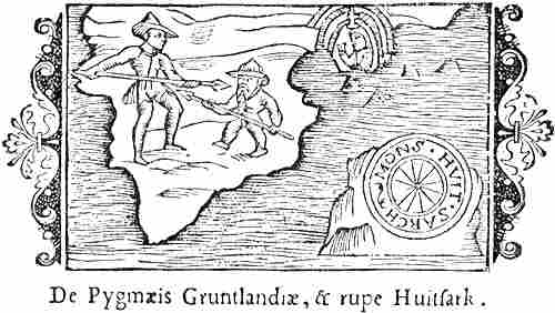
The rock Hvitserk, and a fight with a Greenland Pygmy (Olaus Magnus, 1557)
The map is a modified copy of Olaus Magnus’s well-known large chart of 1539, on which the island with the compass-card is found, but not the inscription.
It is possibly a fuller version or adaptation of the substance of this inscription, or of the source from which it is taken, that is met with again in Olaus Magnus’s work on the Northern peoples, of 1555, where he says of “the lofty[Pg 124] mountain ‘Huitsark,’ which lies in the middle of the sea between Iceland and Greenland”:
“Upon it lived about the year of Our Lord 1494 two notorious pirates (piratæ), Pining and Pothorst, with their accomplices, as though in defiance and contempt of all kingdoms and their forces, since, by the strict orders of the Northern kings, they had been excluded from all human society and declared outlaws for their exceedingly violent robberies and many cruel deeds against all sailors they could lay hands on, whether near or far.”... “Upon the top of this very high rock the said Pining and Pothorst have constructed a compass out of a considerable circular space, with rings and lines formed of lead; thereby it was made more convenient for them, when they were bent on piracy, as they thus were informed in what direction they ought to put to sea to seek considerable plunder.”
It may be the expression “piratæ,” which might be used both of an ordinary pirate and of a privateer or freebooter, which misled Olaus Magnus into constructing this wonderful story. The mere fact that, both in his map of 1539 and in his work of 1555, he makes Hvitserk, which of course was in Greenland, into a rocky island out at sea between Greenland and Iceland, where no island is to be found, is enough to shake one’s belief in the trustworthiness of this strange report. His incomprehensible story of the compass constructed there does not make things any better. G. Storm [1886, p. 395] thought it might have come about in this way: that Olaus Magnus, who was no great sailor or geographer, read on a chart a note about Pining’s voyage to Greenland, and saw in its proximity the name Hvitserk and a compass-card in the middle of the sea; and then, without understanding its real meaning, he made it an island and gave it his own explanation. Björnbo and Petersen [1909, pp. 250, 251] have, it is true, pointed out that something of the same sort is told of the North Cape by Sivert Grubbe, who accompanied Christian IV. on his voyage to Finmark, and who writes in his journal (in Latin) on May 12, 1599: “We sailed past the North Cape. On the top of this mountain is a compass cut into the rock.” But as they “sailed past,” Grubbe cannot have been up and seen this compass;[Pg 125] it may therefore be supposed that a similar error is at the base of this improbable statement; it is difficult to see what value for mariners such a compass could have. But notwithstanding Olaus Magnus’s fantastic story, Pining and Pothorst may really have been in Greenland. The former must be the Norwegian nobleman Didrik Pining, who together with Pothorst (“Pytchehorsius”) is said to have distinguished himself during the later years of Christiern I., “not less as capable seamen than as matchless freebooters” (piratæ). He was much employed by Christiern I. and King Hans against the English and sometimes against the Hanseatic League, and is mentioned by several historical authorities.[95] He seems also to have extended his activity upon occasion to the Spaniards, Portuguese and Dutch, for about 1484 he captured, off the English coast or off Brittany and in the Spanish Sea, three Spanish or Portuguese ships, and brought them to the king at Copenhagen. In a treaty which was concluded in 1490 between King Hans and the Dutch it is expressly stipulated that Didrik Pinning and a certain Busch were to be excluded from the peace. Didrik Pining is spoken of as lord over Iceland, or perhaps over the eastern and southern part, in 1478; but on the death of Christiern I. in 1481, another was appointed as “hirdstjore” (or stadtholder), and it is stated in the letter of appointment, issued by the council at Bergen in 1481, that Pining had “gone out of Iceland”; but a few years later he is again mentioned as hirdstjore there. When in 1487 King Hans took possession of Gotland, Pining accompanied him thither, doubtless as commander of the Danish-Norwegian squadron; he is called “Skipper Pining,” which corresponds to commodore or admiral in our time (cf. Christiern I.’s “Skipper Clemens”). In July 1489 Didrik Pining was among the Norwegian noblemen who paid homage[Pg 126] at Copenhagen to the king’s son, Christiern (II.) as heir to the kingdom of Norway; and in August and September 1490 he took part in the settlement of a suit concerning a large inheritance at Bergen; but in two Icelandic laws or edicts of that time, 1489 and 1490, the so-called “Pining’s Laws,” he is described as “‘hirdstjore’ over the whole of Iceland,” and a later chronicler speaks of him as one of the most famous men in Iceland, and he says that “he was in many ways a serviceable man and put many things right that were wrong.” It must be the same Didrik Pining who was appointed in 1490 governor of Vardöhus, and it may be supposed that he was commander-in-chief on sea and land in northern waters.
We hear of Pining, and his associate Pothorst, in an old (Icelandic ?) report which, together with Ivar Bárdsson’s description of Greenland, was found in an old book of accounts in the Faroes, and which in an English translation was included in “Purchas his Pilgrimes” (London, 1625, vol. iii.), where we read:
“Item, Punnus [corruption of Pinning] and Potharse, have inhabited Island certayne yeeres, and sometimes have gone to Sea, and have had their trade in Groneland. Also Punnus did give the Islanders their Lawes, and caused them to bee written. Which Lawes doe continue to this day in Island, and are called by name Punnus Lawes.”
As this last statement agrees with the two “Pining’s Laws” mentioned above, there may also be some truth in the voyages to Greenland. An unexpected confirmation of this recently came to light in the discovery of a document by Louis Bobé [1909] at Copenhagen; it is a letter, dated March 3, 1551, from Burgomaster Carsten Grip, of Kiel, to King Christiern III. Grip was, as we are told in the letter, the king’s commissioner for the purchase of books, paintings, and the like. He tells the king that he has not found any valuable books or suitable pictures, but sends him two maps of the world,
“from which your majesty may see that your majesty’s land of Greenland[Pg 127] extends on both maps towards the new world and the islands which the Portuguese and Spaniards have discovered, so that these countries may be reached overland from Greenland. Likewise that they may be reached overland from Lampeland [i.e., Lapland], from the castle of Vardöhus, etc.[96] This year there is also published at Paris in France a map of your majesty’s land of Iceland and of the wonders there to be seen and heard of; it is there remarked that Iceland is twice as large as Sicily, and that the two skippers [‘sceppere,’ i.e., commodores or admirals] Pyningk and Poidthorsth, who were sent out by your majesty’s royal grandfather, King Christiern the First, at the request of his majesty of Portugal, with certain ships to explore new countries and islands in the north, have raised on the rock Wydthszerck [Hvitserk], lying off Greenland and towards Sniefeldsiekel in Iceland on the sea, a great sea-mark on account of the Greenland pirates, who with many small ships without keels (‘szunder bodem’) fall in large numbers upon other ships,” etc.
It seems, as Dr. Björnbo has suggested,[97] that the Paris map here spoken of may be Gourmont’s of 1548, mentioned above. But Grip’s letter contains information about the despatch of the expedition and about the Eskimo kayaks, which cannot be taken from the inscription attached to Hvitserk on that map. The statement about the Eskimo (the Greenland pirates) recalls what Ziegler says in his work “Scondia” (1532) of the inhabitants of Greenland, that “they use light boats of hide, safe in tossing on the sea and among rocks; and thus propelling themselves they fall upon other ships” [Grönl. hist. Mind., iii. p. 499]. It also has some resemblance to what Olaus Magnus says in his later work of 1555 of the Greenland “pirates, who employ hide-boats and an unfair mode of seamanship, since they do not attack the upper parts of merchant ships, but seek to destroy them by boring through the hull from outside, down by the keel,” etc. These statements may be derived from mythical accounts of the Greenland Eskimo, which have come down by some channel we do not know of. Something of the sort may have appeared on some now lost map, from which Grip may have taken it; but his statement as to the two[Pg 128] skippers having been sent out by Christiern I. shows that in any case there was in his day a tradition of the voyage of Pining and Pothorst. We must therefore assume that they were despatched on a voyage of discovery by Christiern I. (some time before 1481, when he died), probably at the request of the well-known King Alfonso V. of Portugal (1438-1481). As Hvitserk must be on the coast of Greenland, they seem, in agreement with the other sober statement in Purchas, to have really reached Greenland, perhaps more than once, and to have traded by barter with the natives, which may have ended, as it frequently did later, in skirmishes brought about by the encroachments of the Europeans. This last possibility would explain Grip’s statement about the Greenland pirates attacking in many small ships without keels, as also the mythical statements of Ziegler and Olaus Magnus. Nor is it impossible that Pining may have set up some sea-mark or other there. All this sounds more probable than Olaus Magnus’s wonderful story. But nevertheless it does not appear to me that the authorities now known justify us in altogether rejecting the latter and the date 1494. As there is mention in 1491 of a new “hirdstjore” in Iceland, we must suppose that Pining was either dead or had left the island; if we compare with this the fact that Pining was excluded from the peace that King Hans concluded in 1490 with the Dutch, and thus in a way became an outlaw to the latter, and that in the same year a provisional peace was made with the king of England, by which, of course, all privateering against English subjects on the part of Norwegians and Danes was strictly forbidden, we may possibly perceive a connection. Pining and Pothorst were not able to break themselves of old habits, and thus had both the English king and their own, besides the Dutchmen, against them, and were compelled to fly the country as outlaws. This would also agree with Olaus Magnus’s words, that they were outlawed by the strict edict of the northern kings (“aquilonarium regum severissimo edicto”). It may be supposed[Pg 129] that, like the outlawed Eric the Red 500 years before, they took refuge in distant Greenland, which they already knew. But finally they may have come to grief; for among the many “pirates” who “met with a miserable death, being either slain by their friends or hanged on the gallows or drowned in the waves of the sea,” Paulus Eliæ mentions “Pyning” and “Pwthorss.”[98]
We have yet to mention certain obscure statements about another Northern sailor of this time, Johannes Scolvus (Jón Skolv ?).[99] The Spanish author Francesco Lopez de Gomara, who was a priest in Seville about 1550, and published his “Historia de las Indias” (i.e., America) in 1553, says there of “la Tierra de Labrador”:
“Hither also came men from Norway with the pilot [‘piloto,’ i.e., navigator] Joan Scoluo, and Englishmen with Sebastian Gaboto.”
As, according to Storm’s showing [1886, p. 392], Gomara met Olaus Magnus “in Bologna and Venice” (perhaps about 1548), and says himself that the latter had given him much information about Northern waters and the sea-route from Norway, the statement about Scolvus may also be due to him.
An English State document—probably of 1575, and written on the occasion of the preparations for Frobisher’s first voyage (1576)—gives a brief survey of earlier attempts to find the North-West Passage,[100] and mentions among others[Pg 130] Scolvus. This the historians who have written about him have not noticed. After stating that Sebastian [should be John] Cabotte was sent out by King Henry VII. of England in 1496 [should be 1497] to find the passage from the North Sea [i.e., the Atlantic Ocean] to the South Sea [i.e., the Pacific], and that “one Gaspar Cortesreales, a pilot of Portingale,” had visited these islands on the north coast of North America in 1500, the document continues:
“But to find oute the passage oute of the North Sea into the Southe we must sayle to the 60 degree, that is, from 66 unto 68. And this passage is called the Narowe Sea or Streicte of the three Brethren [i.e., the three brothers Corte-Real]; in which passage, at no tyme in the yere, is ise wonte to be found. The cause is the swifte ronnyng downe of sea into sea. In the north side of this passage, John Scolus, a pilot of Denmerke, was in anno 1476.”
Then follows a story of a Spaniard who in 1541 is said to have been on the south side of this passage with a troop of soldiers, and to have found there some ships that had come thither with goods from Cataya (China). Complete impossibilities, like this last story, are thus blended together with statements that have a sure historical foundation, like the voyage of Gaspar Corte-Real. As the statement about Scolus or Scolvus contains things that are not found in Gomara, it seems to be derived from another source; the date in particular is remarkable. That Scolus is a pilot from Denmark, while the pilot Scolvus in Gomara came from Norway, is perhaps immaterial, as of course Norway and Denmark were under a common king, who resided in Denmark.
On an English map of 1582 (after Frobisher’s voyages), which is attributed to Michael Lok, there is a country to the north-west of Greenland, upon which is written: “Jac. Scolvus Groetland.” As the name is here written Jac. Scolvus, it is not likely that it can be derived from the document we have quoted of 1575. The corresponding country on Mercator’s map of 1569 is inscribed: “Groclant, insula cuius incole Suedi sunt origine” (island whose inhabitants[Pg 131] are Swedes by descent). It may seem as if this inscription also was connected with Scolvus, and we thus get the third Scandinavian country as his native land; but this word “Suedi” may be derived from Olaus Magnus, who happens to have often used it in the sense of Scandinavians—i.e., Swedes and Norwegians.
In 1597 the Dutchman Cornelius Wytfliet in his description of America (“Continens Indica”) states that its northern part was first discovered by “Frislandish” fishermen [i.e., from the imaginary Frisland of the Zeno map], and subsequently further explored about 1390 during the voyage of the brothers Zeno (which is fictitious).
“But [he continues] the honour of its second discovery fell to the Pole Johannes Scoluus (Johannes Scoluus Polonus), who in the year 1476—eighty-six years after its first discovery—sailed beyond Norway, Greenland, Frisland, penetrated the Northern Strait, under the very Arctic Circle, and arrived at the country of Labrador and Estotiland.”
Estotiland is another fictitious country on the notorious Zeno map (a fabrication from several earlier maps). Apart from this introduction of the Zeno voyage the statement contains nothing that has not already appeared in Gomara and in the English document of 1575, with the exception that Scolvus is called a Pole (Polonus), but this, as pointed out by Storm [1886, p. 399], must be due to a misreading of “Polonus” for “piloto.”[101] As Norway is named first among the countries beyond which the voyage extended, it may have started from thence in Wytfliet’s authority.[102]
On the L’Ecuy globe, of the sixteenth century, there is written in Latin between 70° and 80° N. lat. and in long.[Pg 132] 320°:[103] “These are the people to whom the Dane Johannes Scovvus penetrated in the year 1476.” The description of Scolvus as a Dane may indicate the same source as the English mention of him in 1576.[104]
Finally it may be mentioned that Georg Horn in his work “Ulysses peregrinans” (Louvain, 1671), after speaking of voyages of the Icelanders (Thylenses) to “Frisland or Finmark” (sic!), to Iceland, Greenland, Scotland, and Gotland under “auspiciis Margaretæ Semiramis Dan., Sued., Norv.,” and then of the voyages of the Zenos in the year 1390, says:
“Joh. Scolnus Polonus discovered under the auspices of Christian I., King of the Danes, the Anian-strait and the country Laboratoris in the year 1476.”
The Anian-strait was the mythical strait between Asia and north-western America, which was talked about and[Pg 133] which appeared upon maps more than a hundred years before Bering Strait was discovered by the Russian Deshenev in 1648. But the name may sometimes have been extended to the whole of the strait, called above, p. 130, the Strait of the Three Brethren, which was assumed to go north of America to the Pacific. What is new in Horn’s statement is that the voyage is said to have been made under the auspices of Christiern I.; it may be supposed that he knew enough of the history of Denmark to draw this conclusion from the date 1476.
This is what is known from old sources about this Scolvus and his voyage. It must be remembered that the name of Labrador (in various forms) was used on the maps of the sixteenth century both for Greenland and Labrador, and was originally the name of the former. It is therefore most probable that the statements about Scolvus’s voyage referred in the first instance to Greenland, which in the first part of the sixteenth century was known as Labrador.
To sum up what has been said above, we have, on the one hand, statements, from wholly different sources, of one or more voyages to Greenland under the leadership of Pining and Pothorst, in the time of Christiern I.—i.e., before 1481; on the other hand, we have statements, probably from several, but at least from two sources independent of each other, about a voyage, also to Greenland, with the pilot Johannes Scolvus, from Denmark or more probably from Norway, in the time of Christiern I., and this is even referred to a particular year, 1476. One is therefore led to conclude, as G. Storm has already done, that we are here concerned with the same voyage or voyages to Greenland, which were made under the leadership of the two “skippers” and freebooters Pining and Pothorst, with Johannes Scolvus (Jón Skolvsson ?) as pilot or navigator. In some authorities of Scandinavian origin the voyage was connected with the names of the real leaders, while in Southern authorities it[Pg 134] was connected with that of the pilot or navigator, in the same way as, for instance, the name of William Barentsz was associated with the voyages in which he took part, instead of those of Hemkerck and the other leaders. There seem thus to be sufficiently good historical documents in support of at least one expedition having reached Greenland in the latter part of the sixteenth century, possibly sent out by Christiern I. in 1476, and perhaps there were more. Possibly it was rumours of this new communication with Greenland that awoke a desire in the monk Mathias to go there as bishop.
But then we hear no more of it. For a while longer bishops continued to be appointed to Greenland, a land which was no longer known to any one, and to these bishops least of all. Thus ends the history of the old Greenland settlements. Notices of them become rarer and rarer, with long intermissions, until after this time they cease altogether, and we know no more of the fate of the old Norsemen there.
“The standing-stone on the mound bears no mark,
and Saga has forgotten what she knew.”
CHAPTER XII
EXPEDITIONS OF THE NORWEGIANS TO THE WHITE SEA,
VOYAGES IN THE POLAR SEA, WHALING AND SEALING
EXPEDITIONS TO THE WHITE SEA
Even if Ottar was perhaps not the first Norwegian to reach the White Sea, his voyage is in any case a remarkable exploring expedition, whereby both the North Cape and the White Sea became known, even in the literature of Europe, nearly seven hundred years before Richard Chancellor reached the Dvina in the ship “Edward Buonaventura” in 1553, from which time the discovery of this sea has usually been reckoned.
In Ottar’s time, or soon after, the Norwegian king asserted his sovereignty over all the Lapps as far as the White Sea, and in the Historia Norwegiæ it is said that Hálogaland reached to Bjarmeland. The headland Vegistafr is mentioned in the Historia Norwegiæ, in the laws, and elsewhere, as the boundary of the kingdom of Norway towards the Bjarmas (Beormas). This may have been on the south side of the Kola peninsula by the river Varzuga, already mentioned,[Pg 136] or by the river Umba (see the map, vol. i. p. 170).[105] After Ottar’s time the Norwegians more frequently undertook expeditions, doubtless for the most part of a military character, to the White Sea and Bjarmeland. We hear about several of them in the sagas.
Eric Blood-Axe marched northward, about 920, into Finmark and as far as Bjarmeland, and there fought a great battle and gained the victory. His son, Harold Gråfeld, went northward to Bjarmeland one summer about 965 with his army, and there ravaged the country and had a great fight with the Bjarmas on “Vinu bakka” [i.e., the river bank of the Dvina (Vina)], in which King Harold was victorious and slew many men; and then laid the country waste far and wide, and took a vast amount of plunder. Of this Glumr Geirason speaks:
“Eastward the bold-spoken king
intrepidly stained his sword red,
north of the burning town;
there I saw the Bjarmas run.
For the master of the body-guard good spear-weather
was given on this journey,
on Vina’s bank; the fame
of a young noble travelled far.”
At that time, then, the Norwegians must have reached the Dvina and discovered the east side of the White Sea, which was still unknown to Ottar. They had thus proved it to be a gulf of the sea. The Bjarmas probably lived along the whole of its south side as far as the Dvina, and the name of “Bjarmeland” was now extended to the east side also, and thus became the designation of the country round the White Sea. As a people of strange race of whom they knew little, the Norwegians regarded the Lapps as skilled in magic; but it was natural that the still less known and more distant Bjarmas gradually acquired an even greater reputation for magic, and in these regions stories of trolls and giants were located. The Polar[Pg 137] Sea was early called “Hafsbotn,” later “Trollebotten,” and the White Sea was given the name of “Gandvik,” to which a similar meaning is attributed, since it is supposed to be connected with “gand” (the magic of the Lapps); but the name evidently originated in a popular-etymological corruption of a Karelian name, Kanðanlaksi, as already shown (vol. i. pp. 218, f., note).
Snorre Sturlason (ob. 1241) included in the Saga of St. Olaf a legend from Nordland about an expedition to Bjarmeland, supposed to have been undertaken in 1026 by Thore Hund, in company with Karle and his brother Gunnstein from Hálogaland, men of the king’s bodyguard. The tale may be an indication that at that time more peaceful relations had been established between the Nordlanders and the Bjarmas. They went in two vessels, Thore in a great longship with eighty men, and the brothers in a smaller longship with about five-and-twenty. When they came to Bjarmeland, they put in at the market-town;[106] the market began, and all those who had wares to exchange received full value. Thore got a great quantity of skins, squirrel, beaver and sable. Karle also had many wares with him, for which he bought large quantities of furs. But when the market was concluded there, they came down the river Vina; and then they declared the truce with the people of the country at an end. When they were out of the river, they held a council of war, and Thore proposed that they should plunder a sanctuary of the Bjarmas’ god Jomale,[107] with grave mounds, which he knew to be in a wood in that part of the country.[108] They did so by night,[Pg 138] found much silver and gold, and when the Bjarmas pursued them, they escaped through Thore’s magical arts, which made them invisible. Both ships then sailed back over Gandvik. As the nights were still light they sailed day and night until one evening they lay to off some islands, took their sails down and anchored to wait for the tide to go down, since there was a strong tide-rip (whirlpool) in front of them (“rǫst mikil var fyrir þeir”). This was probably off “Sviatoi Nos” (the sacred promontory), where Russian authorities speak of a strong current and whirlpool. Here there was a dispute between the brothers and Thore, who demanded the booty as a recompense for their having escaped without loss of life owing to his magical arts. But when the tide turned, the brothers hoisted sail and went on, and Thore followed. When they came to land at “Geirsver” (Gjesvær, a fishing station on the north-west side of Magerö)—where we are told that there was “the first quay as one sails from the north” (i.e., east from Bjarmeland)—the quarrel began again, and Thore suddenly ran his spear through Karle, so that he died on the spot; Gunnstein escaped with difficulty in the smaller and lighter vessel; but was pursued by Thore, and finally had to land and take to flight with all his men at Lenvik, near Malangen fjord, leaving his ship and cargo.
Even if this expedition is not historical, the description of the voyage and the mention of place-names along the route nevertheless show that these regions were well known to Snorre’s informants; and journeys between Norway and Bjarmeland cannot have been uncommon in Snorre’s time or before it. Many things show that the communication with Gandvik and Bjarmeland continued through the whole of the Middle Ages, and was sometimes of a peaceful, sometimes of a warlike character; but of the later voyages only three are, in fact, mentioned in Norwegian authorities: one of them was undertaken by the king’s son Håkon Magnusson about[Pg 139] 1090; of this expedition little is known. In Håkon Håkonsson’s time we have an account[109] of another expedition to Bjarmeland in the year 1217, in which took part Ǫgmund of Spånheim from Hardanger, Svein Sigurdsson from Sogn, Andres of Sjomæling from Nordmör, all on one ship, and Helge Bograngsson and his men from Hálogaland, on[Pg 140] another. Svein and Andres went home with their ship the same autumn; but Ǫgmund proceeded southward through Russia to the Suzdal kingdom in East Russia, on a tributary of the Volga. Helge Bograngsson and his Nordlanders stayed the winter in Bjarmeland; but he came in conflict with the Bjarmas and was killed. After this Ǫgmund did not venture to return that way, but went on through Russia to the sea (i.e., the Black Sea) and thence to the Holy Land. He came safely home to Norway after many years.
Bjarmas and Skridfinns fighting on ski and riding reindeer (after Olaus Magnus, 1555)
When the rumour of what had happened to Helge and his men reached home, a punitive expedition was decided on. The king’s officers in Nordland, Andres Skjaldarbrand and Ivar Utvik, placed themselves at the head of it; and they came to Bjarmeland with four ships in the year 1222, and accomplished their purpose; “they wrought great havoc in plunder and slaughter and obtained much booty in furs and burnt silver.” But on the homeward voyage Ivar’s ship was lost in the whirlpool at “Straumneskinn,” and only Ivar and one other escaped. “Straumneskinn” is probably Sviatoi Nos (see p. 138).
This is the last Norwegian expedition to Bjarmeland of which Norwegian accounts are known; but that the White Sea traffic continued, though it was never very active, may be concluded from other sources. The name of the Bjarmas themselves disappears after the middle of the thirteenth century, when it is related that a number of Bjarmas fled before the “Mongols” and received permission from King Håkon to live in Malangen fjord. After that time in the districts near the Dvina we only hear of Karelians and their masters the Russians of Novgorod.
That there was considerable navigation, probably combined with piratical incursions, between the north of Norway and the countries to the east, may also appear from a provision of the older Gulathings Law, where in cap. 315, in a codex of 1200-1250, we find:
“The inhabitants of Hálogaland are to fit out thirteen twenty-seated and one[Pg 141] thirty-seated ship in the southern half, but six in the northern half; since they [i.e., the inhabitants of the northern half] have to keep guard on the east.”
This keeping guard might, it is true, refer to Kvæns in Finmark, but it seems rather to point to ships coming from the east. In the negotiations of 1251, between the Grand Duke of Novgorod (Alexander Nevsky) and Håkon Håkonsson, there is express mention of disturbances from the east in Finmark, and after that time we hear more frequently of hostile incursions of Karelians and Russians in Finmark; they may have come by land, but occasionally also by sea.
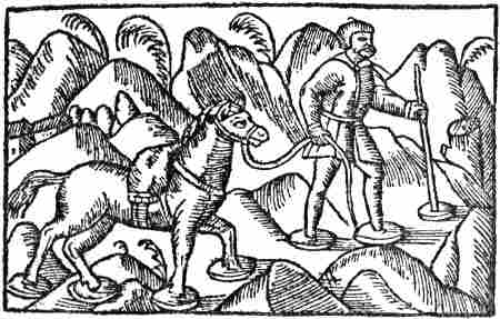
On snow-shoes through the border-lands of Norway (Olaus Magnus, 1555)
A treaty of 1326 between Norway and Novgorod shows that Norwegian merchants traded with the people of Novgorod on the White Sea. The erection of the fortress of Vardöhus, as early as 1307, also shows the importance attached to these eastern communications, and the fortress certainly afforded them a fixed point of support. Thus about 1550 we see that “Vardöhus weight” (mark and pound) had penetrated into northern Russia and was generally used in the North Russian fish and oil trade. The Norwegians chiefly bought furs in Bjarmeland, but what they exported thither is not mentioned in the Norwegian notices; it may even at that time have been to some extent fish, which in later times was the most important article of export to North Russia from the north of Norway.
As G. Storm [1894, p. 100] has pointed out, the Russian chronicles tell of many hostile expeditions by sea between Norway and the White Sea in the fifteenth century. In 1412 the inhabitants of “Savolotchie” (the countries on the[Pg 142] Dvina) made a campaign against the Norwegians. A complaint from Norway of 1420 shows that the attack was directed against northern Hálogaland, without informing us whether it was made by land or by sea. Some years later, in 1419, the Norwegians made a campaign of reprisal and came
“with an army of 500 men in trading-vessels and sloops and ravaged the Karelian district about the Varzuga [on the Kola peninsula on the north side of the White Sea] and many parishes in Savolotchie [on the Dvina], amongst others St. Nikolai [at the mouth of the Dvina], Kigö and Kiarö [in the Gulf of Onega], and others. They burned three churches and cut down Christians and monks, but the Savolotchians sank two Norwegian sloops, and the rest fled across the sea.”[110] “In 1444 the Karelians went with an army against the Norwegians, and fought with them, and in 1445 the Norwegians came with an army to the Dvina, ravaged Nenoksa [in the gulf off the mouth of the Dvina] with fire and sword, killed some and carried off others as prisoners; but the inhabitants on the Dvina hastened after them, cut down their ‘voivods’ [leaders, chiefs] Ivar and Peter, and captured forty men who were sent to Novgorod.”[110]
This will be sufficient to show that the White Sea voyage remained familiar in Norway. This communication increased about the beginning of the sixteenth century, and this had a decisive influence on the so-called rediscovery of the White Sea by the English.
In reading Otter’s narrative and the earliest Norse accounts of voyages to Bjarmeland it must strike us that the Bjarmas we hear about seem to have possessed a surprisingly high degree of culture. As Professor Olaf Broch has also pointed out to me, this may be an indication that a comparatively active communication had existed long before that time along the Dvina and the Volga between the people of the White Sea and those on the Caspian and the Black Sea (by transport from the Volga to the Don). In those early times, before the Russians had yet established themselves in the territory of the upper Volga, this communication may have passed to the east of the Slavs through Finnish-speaking peoples the whole way from the lower Volga and the Finnish Bulgarians (cf. the Mordvin tribes of to-day).
[Pg 143]It appears to me that various statements in Arabic literature may indicate such a connection.[111] The Arabs received information about northern regions through their commercial communications with the Mohammedan Finnish nation of the Bulgarians, whose capital Bulgar lay on the Volga[112] (near to the present town of Kazan), and was a meeting-place for traders coming up the river from the south and coming down the river from the north. Special interest attaches to the mention of the mysterious people “Wîsu,” far in the north. This is evidently the same name as the Russian Ves[113] for the Finnish people who, according to Nestor[114] (beginning of the twelfth century), lived by Lake Byelo-ozero (the white lake) in 859 A.D. They are mentioned together with Tchuds, Slavs, Merians and Krivitches, and were doubtless the most northerly of them, possibly spreading northwards towards the White Sea. They are probably the same people that Adam of Bremen [iv., c. 14, 19] calls “Wizzi” (see vol. i. p. 383; vol. ii. p. 64), and possibly those Jordanes calls “Vasinabroncæ,”[115] who together with “Merens” (Merians ?) and “Mordens” (Mordvins ?) were subdued by Ermanrik, king of the Goths. But the Arabic Wîsu seems sometimes to have been a common name for all Finnish (and even Samoyed) tribes in North Russia and on the coast of the Polar Sea.
According to Jaqût,[116] Ahmad Ibn Fadhlân (about 922 A.D.)[117] stated in his work that
[Pg 144]“the King of the Bulgarians had told him that behind his country, at a distance of three months’ journey, there lived a people called Wîsu, among whom the nights [in summer] were not even one hour long.” Once the king is said to have written to this people, and in their answer it was stated that the people “Yâǵûǵ and Mâǵûǵ [on the Ob ?] lived over three months’ journey distant from them [i.e., the Wîsu] and that they were separated from them by the sea” (?). The Yâǵûǵ and Mâǵûǵ lived on the great fish that were cast ashore. The same is told by Dimashqî (ob. 1327) about the Yâǵûǵ and Mâǵûǵ, and by Qazwînî (thirteenth century) about the people “Yura” on the Pechora.
Jaqût (ob. 1229) in his geographical lexicon[118] has an article on
“‘Wîsu’ situated beyond Bulgar. Between it and Bulgar is three months’ journey. The night is there so short that one is not aware of any darkness, and at another time of year, again, it is so long that one sees no daylight.” In his article on “Itil” Jaqût says: “Upon it [the river Itil or Volga] traders travel as far as ‘Vîsu’[119] and bring [thence] great quantities of furs, such as beaver, sable and squirrel.”
Al-Qazwînî (ob. 1283) says:[120]
“The beaver is a land- and water-animal, which dwells in the great rivers in the land of ‘Isu’ [i.e., Wîsu, cf. al-Bîrûnî], and builds a home on the bank of a river.” He further relates that “the inhabitants of ‘Wîsu’ never visit the land of the Bulgarians, since when they come thither the air changes and cold sets in—even if it be in the middle of summer—so that all their crops are ruined. The Bulgarians know this, and therefore do not permit them to come to their country.” Qazwînî also gives the information that “Wîsu” is three months’ journey beyond Bulgar, and continues: “The Bulgarians take their wares thither for trade. Each one lays his wares, which he furnishes with a mark, in a certain spot and leaves them there. Then he comes back and finds a commodity, of which he can make use in his own country, laid by the side of them. If he is satisfied with this, he takes what is offered in exchange, and leaves his wares behind; if he is not, he takes his own away again. In this way buyer and seller never see one another. This is also the proceeding, as we have related, in the southern lands, in the land of the blacks.” The same story of dumb trading with a people in the north is met with again in Abu’lfeda (ob. 1321) and Ibn Batûta (cf. also Michel Beheim, later, p. 270).
Ibn Batûta (1302-1377) has no name for this people, any more than Abu’lfeda; but he calls their country “the Land[Pg 145] of Darkness,” and has an interesting description of the journey thither.[121]
He himself, he says, wished to go there from Bulgar, but gave it up, as little benefit was to be expected of it. “That land lies 40 days’ journey from Bulgar, and the journey is only made in small cars[122] drawn by dogs. For this desert has a frozen surface, upon which neither men nor horses can get foothold, but dogs can, as they have claws. This journey is only undertaken by rich merchants, each taking with him about a hundred carriages [sledges ?], provided with sufficient food, drink and wood; for in that country there is found neither trees, nor stones nor soil. As a guide through this land they have a dog which has already made the journey several times, and it is so highly prized that they pay as much as a thousand dinars [gold pieces] for one. This dog is harnessed with three others by the neck to a car [sledge ?], so that it goes as the leader and the others follow it. When it stops, the others do the same.... When the travellers have accomplished forty days’ journey through the desert, they stop in the Land of Darkness, leave their wares there, and withdraw to their quarters. Next morning they go back to the same spot ...” and then follows a description of the dumb barter, like that in Qazwînî. They receive sable, squirrel and ermine in exchange for their goods. “Those who go thither do not know with whom they trade, whether they be spirits or men; they see no one.”[123]
Of special interest for our subject is the following statement in Abû Hâmid (1080-1169 or 1170) which may point to the peoples on the shores of the Polar Sea having obtained steel for their harpoons and sealing weapons from Persia:
“The traders travel from Bulgâr to one of the lands of the infidels which is called Îsû [Wîsu], from which the beaver comes. They take swords thither which they buy in Âdherbeiǵân [Persia], unpolished blades. They pour water often over these, so that when the blades are hung up by a cord and struck, they ring.... And that is as they ought to be. They buy beavers’ skins with these blades. The inhabitants of Îsû go with these swords to a land near the darkness and lying on the Dark Sea [the northern Atlantic or the Polar Sea] and sell these swords for sables’ skins. They [i.e., the inhabitants of that country] again take some of these blades and cast them into the Dark Sea. Then Allâh lets a fish as big as a mountain come up to them, etc. They cut up its flesh for days and months, and sometimes fill 100,000 houses with it,” etc. [Cf. Jacob, 1891, p. 76; 1891a, p. 29; Mehren, 1857, pp. 169, f.]
It is not credible that the swords which rang in this way[Pg 146] were harpoons, as Jacob thinks. We must rather suppose that they were rough (“unpolished”) steel blades, which were used for making harpoons and lances (for walrus-hunting and whaling). The blades having water poured over them must doubtless mean the tempering of the steel, through which, when it was afterwards hung up by a cord, it came to give the true ring. Although Abû Hâmid is no trustworthy writer, it seems that there must be some reality at the base of this statement; and we here have information about some of the wares that the traders carried to Wîsu, and that were derived from their commercial intercourse with Arabs and Jews. The people to whom the inhabitants of Wîsu or Vesses took the steel blades must have been fishermen on the shore of the Polar Sea, who carried on seal- and walrus-hunting, and perhaps also whaling, and this is what is referred to by the fish that Allâh sends up. They may have been Samoyeds (on the Pechora), Karelians, Tver-Finns, and even Norwegians. It might be objected that sables cannot be supposed to have been obtained from the last-named; but this is doubtless not to be taken too literally. Ibn Ruste (circa 912 A.D.) thus says that the Rûs (Scandinavians, usually Swedes) had no other occupation but trading in sables, squirrel and other furs, which they sold to any one who would buy them.
It seems to result from what may be trustworthy in these statements that there was fairly active commercial intercourse from Bulgar with the Vesses and with the peoples on the White Sea, and perhaps in districts near the Polar Sea. A shortest night of one hour would take us to a little north of the mouth of the Dvina. In the land of the Vesses by Lake Byelo-ozero there was an easy way across from the Volga’s tributary Syexna to Lake Kubenskoye, which has a connection with the Dvina; and there was also transit to the river Onega. There was thus easy communication along the great rivers; but besides this the traders seem also to have travelled overland with dogs; this was probably when going north to Yugria and the country of the Pechora, in the same way as traders in our[Pg 147] time generally go there with reindeer. The trade in furs was then, as in antiquity, the powerful incentive; it was that too which chiefly attracted the Norwegians to Bjarmeland.
It is not likely that the Arabs themselves reached North Russia; one would suppose rather that travelling Jews assisted as middlemen in the trade with these regions. But the finding of Arab coins on the Pechora would point to Arab trade having penetrated through intermediaries to the shores of the Polar Sea.[124]
THE POLAR EXPEDITION OF THE FRISIAN NOBLES AND KING HAROLD’S VOYAGE TO THE WHIRLPOOL
Among mediæval voyages to the North there remain yet to be mentioned Harold Hardråde’s expedition[125] and the voyage of the Frisian nobles, related by Adam of Bremen in the descriptions already given (vol. i. pp. 195, f.). That the latter voyage must be an invention, and cannot contain much of historical value, is obvious (cf. vol. i. p. 196). The whole description of the abyss or maelstrom is taken from Paulus Warnefridi (as will be seen by a comparison of the descriptions on pp. 157 and 195, vol. i.); the Cyclopes of marvellous stature, as well as the treasures of gold that they guard, are originally derived from classical literature, although Adam may have taken them from earlier mediæval authors, and Northern ideas about the giants in the north in Jotunheim may have helped to localise the story.[126] The great darkness, the stiffened sea, chaos and the gulf of the abyss at the uttermost end of the world or of the ocean are all classical conceptions,[Pg 148] and the description itself of the dangers of the voyage, of the darkness that could scarcely be penetrated by the eyes, etc., is just what we find in classical literature, and in many points bears great resemblance to the poem of Albinovanus Pedo, for example (see vol. i. p. 82). It is possible, of course, that there may be thus much historical truth in the story, that some Frisian nobles made a voyage to the Orkneys or perhaps to Iceland, but even this is doubtful, and the rest is demonstrably invention. In spite of this Master Adam asserts that Archbishop Adalbert in person had told him all this, and that it happened in the days of his predecessor, Archbishop Alebrand, who had the story from the travellers’ own lips; for they returned to Bremen and brought thank-offerings to Christ and to their saint “Willehad” for their safety. One might suppose that these nobles themselves had invented the story and told it to the archbishop;[127] but it does not seem likely that they were acquainted with Paulus Warnefridi’s description of the maelstrom, and the Cyclopes with their treasures in the north seem also to be learned embroidery; they might have heard oral tales about them, but in any case we may doubtless suppose that the story has been much “improved” by Adam. There is a mediæval folk-song about the dangers of sailors at sea which may also be supposed to have contributed to the description.
Be that as it may, this story must weaken our confidence in Adam’s credibility, or rather in his critical sense. If his narrative of a voyage which started from his own adopted town of Bremen not long before his time is so untrustworthy, what are we to think of his statement about the experienced Norwegian king Harold’s expedition to explore the extent of the ocean? No doubt it may appear as though he had his information about this voyage from the Danish king Svein,[Pg 149] who is mentioned as his authority for the statements immediately preceding, and so far this information might have a good source; but it has received precisely the same decoration as the other voyage, with the mist or darkness that shuts out the uttermost end of the world, and the vast gulf of the abyss which was narrowly escaped. This is certainly of older origin, and he has not even given himself the trouble to make a little alteration in the dangers of the two stories. Another thing that weakens our confidence in his statements is his saying that the Danish king had told him that all the sea beyond the island of Winland was filled with intolerable ice and immeasurable darkness. It may doubtless be supposed that classical conceptions had even at that time created superstitions of this kind in the North, and thus King Svein may have told him this; but it must be more probable that all these ancient book-learned ideas are due, not to the unlearned and travelled monarch, but to the well-read magister, who moreover himself quotes in the same connection Marcianus’s words about the congealed sea beyond Thule.
It would be entirely in Adam’s vein if some accidental resemblance or association had given him an opportunity of making use in this way of ideas he had from his learned reading, just as the name of Kvænland gave him the chance of bringing in the myths of the Amazons, Cynocephali, etc. (cf. vol. i. p. 383). It was pointed out earlier (vol. i. pp. 195, 197) that the statements about the sea “beyond this island” and about Harold’s voyage are possibly a later addition by Adam himself, which has been inserted in the wrong place; “this island” might then mean Thyle (Iceland) and not Winland. Whether we regard the latter as a newly discovered country in America or as the Insulæ Fortunatæ, it is difficult to understand why precisely the sea on the other side of this island should be particularly associated with the ancient conceptions of the dark or misty, and the congealed or ice-filled sea; ice and darkness are nowhere connected in this way with Wineland in later authorities. It is true that in Arabian myth there[Pg 150] are islands in the west near the Sea of Darkness (cf. chapter xiii.) and that the Promised Land in Irish myth is surrounded by darkness (== fog) like the Norwegian huldrelands and the Icelandic elflands; but if Adam got his ideas in this way, it would only show more conclusively how mythical his narrative is. If Adam confused the names of Vinland and Finland (i.e., Finmark) (cf. vol. i. pp. 198, 382; vol. ii. p. 31), it would also be natural for him to imagine that beyond it were ice and darkness.
The view has been held that the whirlpool in which King Harold and the Frisian nobles were nearly drawn down was of Scandinavian or Germanic origin [cf. S. Lönborg, 1897, pp. 173, f.]. It seems undoubtedly to correspond to the Norse “Ginnungagap” [cf. G. Storm, 1890, pp. 340, ff.]; but it is a question how early this idea arose. I have already (vol. i. pp. 11, 12, 17) pointed out the probable connection between it and the Greek Tartaros (and Anostos) or Chaos, and have shown (vol. i. pp. 158, f.) that Paulus Warnefridi took his whirlpool from this source, and called it Chaos. But now it is evident, as we have seen, that Adam took his description of the whirlpool from Paulus, and thus we have the full connection. It may also be mentioned as curious that Lucian in his Vera Historia tells of just such an abyss:
“We sailed through a crystal-clear, transparent water until we were obliged to stop before a great cleft in the sea.... Our ship was near being drawn down into this abyss, if we had not taken in the sails in time. As we then put our heads out and looked down, we saw a depth of a thousand stadia, before which our minds and senses stood still....” Finally with great difficulty they rowed across a bridge of water that stretched over the abyss [Wieland, 1789, iv. p. 222].
With this may be compared that in the Irish legend (Imram Maelduin) Maelduin and his companions came to a sea like green glass, so clear that the sun and the green sand of the sea were visible through it. Thence they came to another sea which was like fog (clouds), and it seemed to them that it could hardly support them or their boat; they saw in the sea beneath them people adorned with jewels and a delightful land, etc.; but when they also saw down below a huge monster which devoured a whole ox, they were seized with fear and trembling, for they thought they would not be able to get across this sea without falling through to the bottom, because it was as thin as cloud; but they came over it with great danger [cf. Zimmer, 1889, p. 164].
[Pg 151]Although, as already mentioned (vol. i. p. 362), Lucian does not seem to have been read in western Europe before the fourteenth century, I cannot get away from the impression that in some oral way or other (cf. vol. i. pp. 362, f.) there must be a connection between the Irish tale (written down long before Adam of Bremen’s work) and the above-mentioned fable (as well as many others) which Lucian reproduces, whether the connection be with Lucian himself or with the authors he parodies. But then it will not be rash to conclude further that there may also be a connection between the cleft in the sea or profound abyss of Lucian or of Greek fable, from which mariners escaped with difficulty, and Adam’s whirlpool, which King Harold avoided by turning back.
But it is also conceivable that the various currents in northern waters may have furnished food for these constantly recurring ideas about maelstroms and whirlpools. Such maelstroms appear also in Irish legends. In the “Imram Brenaind” [cf. Zimmer, 1889, p. 134] it is related that:
One day the voyagers saw on the ocean deep, dark currents [whirlpools] and their ships seemed to be drawn into them with the force of the storm. In this great danger all eyes were turned upon Brandan. He spoke to the sea, saying that it should be satisfied with drowning him alone, but spare his comrades. Thereupon the sea became calm, and the rushing of the whirlpool ceased immediately; from that time until now it has done no harm to others.
The Historia Norwegiæ places “Charybdis, Scylla, and unavoidable whirlpools” in the north in “Hafsbotn” (cf. later). This must have been a general idea in Norway; for about one hundred years later, in 1360, the Englishman, Nicholas of Lynn, who travelled in Norway in the middle of the fourteenth century, wrote his lost work, “Inventio Fortunata,” on the northern countries and their whirlpools from 53° to the North Pole; but unfortunately we do not know its contents.[128] The conceptions of these whirlpools may doubtless be connected with reports of dangerous currents[Pg 152] in the north. The Moskenström by the Lofoten Islands may in particular have given rise to much superstition at an early time. In winter with a westerly wind it runs at a rate of as much as six miles an hour, and with a rising tide it may be altogether impassable. It may set up a high topping sea, which breaks over the whole current so that it can be heard three or four miles off.[129] In later times there are terrifying descriptions of this dangerous current. Thus Olaus Magnus (1555) says that between Roest and Lofoten
“is so great an abyss, or rather Charybdis, that it suddenly swamps and swallows up in an instant those mariners who incautiously approach” (see the illustration, vol. i. p. 158).... “Pieces of wreckage are very seldom thrown up again, and if they come to light, the hard material shows such signs of wear and chafing through being dashed against the rocks, that it looks as if it were covered with rough wool.” And the natural force here manifested exceeds all that is related of Charybdis in Sicily and other wonders.
The Englishman, Anthony Jenkinson, who made a voyage to the White Sea in 1557, writes of it:[130]
“Note that there is between the said Rost Islands & Lofoot, a whirle poole called Malestrand, which from halfe ebbe untill halfe flood, maketh such a terrible noise, that it shaketh the ringes in the doores of the inhabitants houses of the sayd Islands tenne miles off. Also if there commeth any Whale within the current of the same, they make a pitifull crie. Moreover, if great trees be caried into it by force of streams, and after with the ebbe be cast out againe, the ends and boughs of them have bene so beaten, that they are like the stalkes of hempe that is bruised.”
Schönnerböl in 1591 gives a more detailed description of the current, in which the same things are reported
of the iron ring “in the house door ... it is shaken hither and thither by the rushing of the current”; of the whale, who when “he cannot go forward on account of the strong stream, gives a great cry, as it were a great ox, and then he is gone...”; and, finally, of great trees, spruce or fir, which disappear in this current, and when at last they come up again, “then all the boughs, all the roots and all the bark is torn off, and it is shaped as though it had been cut with a sharp axe.” He says that “many people are of the opinion that there[Pg 153] is a whirlpool in this current or immediately outside it”; and “when the stream is strongest, one can see the sun and the sky through the waves, since they go as high as other high mountains.”[131]
Peder Claussön Friis gives a similarly exaggerated description of the current (circa 1613), sometimes using the same expressions as the authors quoted. The resemblance between these various descriptions is so great that it cannot easily be explained merely by their reporting the same oral tradition; what they have in common must rather be derived from an older written source (Nicholas of Lynn ?), which again has adopted ancient mythical conceptions. It is strange how few more recent ideas have been added even in Schönneböl, who was sheriff of Lofoten and Vesterålen for at least twenty years (from 1570), and must have had plenty of opportunity for gathering information on the spot; but it is the usual experience that everything that could be got from old books was preferred. That stories of the Moskenström may have been known in Adam of Bremen’s time is highly probable, perhaps even Paulus Warnefridi had heard of it (cf. vol. i. p. 158).
When we have shorn Adam’s tale of all borrowed features, is there enough left to make it possible that the Norwegian king Harold undertook a voyage out into the ocean? It is not easy to form a definite opinion on this, but the probability must be that King Svein or the Danes told some such story, which was then adorned by Master Adam. As the voyage was supposed to have taken place recently, it must be Harold Hardråde who was intended, otherwise one might be led to think of Harold Gråfeld’s celebrated voyage to Bjarmeland.[132][Pg 154] What the object may have been, and what direction the voyage took, we do not know. As Adam says it was to explore “the breadth of the northern ocean” (“latitudinem septentrionalis oceani”), one must suppose that in his opinion it set out from Norway northward or north-westward over the ocean towards its uttermost limit, since according to the maps and ideas of that time he imagined the ocean as surrounding the disc of the earth like a ribbon (see vol. i. p. 199), and he may then have sailed across this to find out its extent.[133] But it is quite possible, as P. A. Munch [1852, ii. pp. 269, ff.] suggested, that Master Adam may have heard something about a northward voyage undertaken by Harold, during which he had been exposed to some danger in the Saltström or the Moskenström;[134] or if it was a voyage to Bjarmeland (Harold Gråfeld’s ?) that he heard of, then it might be the[Pg 155] current at Sviatoi Nos or Straumneskinn, often spoken of in the sagas, that Adam has made into the whirlpool.
WHALING AND SEALING VOYAGES OF THE NORWEGIANS IN THE POLAR SEA
The skill of the Norwegians as fishermen, whalers and sealers had, of course, a great deal to do with the development of their seamanship and ability to travel and support themselves along unknown and uninhabited shores. The accurate knowledge of the many species of seals and whales shown in the “King’s Mirror,” to which no parallel is met with earlier in the literature of the world, proves how important the hunting of these animals must have been; for otherwise so much attention would not have been paid to them.[135] When in speaking of the greater whales a distinction is made between those that are shy and keep away from the hunters, and those that are tamer and easier to approach, and when the longest of all (“reyðr”) is mentioned as being specially tame and easily caught, we can only regard this as showing that whaling was also carried on in the open sea; that is, not in a merely accidental fashion, as when the whales entered narrow fjords where they could be intercepted, or when they ran aground.
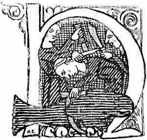
Cutting up a whale
(from an Icelandic MS. of the fourteenth century
of Magnus Lanabóter’s Icelandic Land Law)
[Pg 156]From Ottar’s statement to King Alfred (cf. vol. i. p. 172)—that “in his own land [i.e., Norway] there is the best whaling. They are forty-eight cubits long, and the largest are fifty cubits long”—we may conclude that the Norwegians, and perhaps the Lapps also, hunted the great whales as early as the ninth century, and doubtless long before that time, while King Alfred does not seem to have known of any such whaling being practised in England.[136] We are not told in what way the whale was caught in those days, but from statements elsewhere it is probable that the Norwegians had several methods of taking whales, as is the case even to the present day in Norway: one way was with the harpoon and harpoon-line in open waters, that is, without cutting off the whale’s escape with nets.
The Arab cosmographer, Qazwînî (of the thirteenth century), quoting the Spanish-Arabic writer Omar al-’Udhrî[137] (of the eleventh century), says that the Norsemen in Irlânda (Ireland).
“hunt young whales, and they are very great fish. They hunt their young and eat them.... Of the method of catching them al-’Udhrî relates that the hunters collect in their ships. They have a great iron hook [i.e., harpoon] with sharp teeth, and on the hook a strong ring, and in the ring a stout rope. When they come to a young one, they clap their hands and make a noise. The young one is amused by the clapping of hands and approaches the ship, delighting therein. Thereupon one of the seamen approaches and scratches its forehead, which the young one likes. Then he lays the hook to the middle of its head, takes a heavy iron hammer and gives three blows with all his force upon the hook. It does not heed the first blow, but with the second and third it makes a great commotion, and sometimes it catches some part of the ship with its tail, and knocks it to pieces, and it continues in violent agitation until it is overcome by exhaustion. Then the crew of the ship draw it to shore with their combined force. Sometimes the mother notices the movements of the young one, and pursues them. Then they have a great quantity of crushed onions in readiness,[Pg 157] and throw it into the water. When the whale perceives the smell of the onions it finds it detestable, turns round and retreats. Then they cut the flesh of the young one in pieces and salt it.[138] And its flesh is white as snow, and its skin black as ink.”[139]
This is, clearly enough, a layman’s naive description of whaling with harpoon and harpoon-line in open waters, a method which had therefore already been introduced into Ireland by the Norwegians at that time. It may consequently be regarded as certain that the Norwegians were acquainted with harpooning. That this was very usual appears also from the “King’s Mirror” and the ancient Norwegian laws, where whaling and whale-harpoons (“skutill”) are often mentioned.
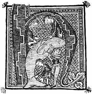
Cutting up a whale (from an Icelandic MS.)
On the west coast of Norway, in the neighbourhood of Bergen, there is still practised to-day another method of catching whales which must be very ancient. When the great whales enter certain fjords which have a narrow inlet, their escape is cut off by nets, and they are shot with poisoned arrows from bows which entirely resemble the crossbows of the Middle Ages. The arrows used are old and rusty, and convey bacteria from one whale to another. When the whale has been hit by these arrows it is rapidly weakened from blood-poisoning, so that it may easily be harpooned and then killed by lances, after which it is cut up and divided among the inhabitants of the fjord, according to ancient, unwritten rules. In spite of the blood-poisoning, the whale’s flesh and blubber are eaten, and are regarded as very valuable provisions. I have myself often taken part in this kind of whaling. Possibly Peder Claussön[Pg 158] Friis [cf. Storm, 1881, p. 70] refers to a similar method of whaling when he says that
“in ancient times many expedients or methods were used for catching whales, which ... on account of men’s unskilfulness have fallen out of use.”
They had “a spear with sharp irons, so that it could not be pulled out again.” This was hurled into the whale, which died in a short time, or became so weakened that it could be drawn to land;
“which whales were then cut up and divided among those who had shot, and him who owned the land, or him who had first found the whale driven in, according to the provisions of the law.”
We must suppose that this iron was poisoned with bacteria from former whales, in a similar way to the arrows mentioned above, whereby the animal’s wound was infected. However, Peder Claussön’s description of the hunt is evidently taken in great measure from older literary sources, since similar descriptions are found as early as in Albertus Magnus (ob. 1280) [De animalibus, xxiv. 651], and in Vincent of Beauvais [Speculum universalis, i. 1272]. In all three authors the whale dives after being struck, and tosses about on the bottom or rubs itself against it, thereby driving the spear farther in; but in Peder Claussön it does so in order to “get rid of the shot,” while in Albertus it is on account of salt water getting into the wound, and in Vincentius the salt water penetrates and kills the wounded whale. As the descriptions of Albertus and Vincentius evidently refer to ordinary harpoon-whaling, it may be doubtful whether Peder Claussön’s statement really relates to a method of catching different from the usual one with harpoon and line, although one is disposed to believe that it does. He also mentions in the same place other whales that they could “pursue with boats and drive into bays and small fjords, and kill them there with hand-shot and bow-shot.” This may be supposed to refer to a method similar to that mentioned above, with poisoned arrows; but, on the other hand, it may relate to a third method of taking small whales, which was certainly[Pg 159] practised from very early times in Norway, and which consists in schools of small whales being driven into bays and inlets, where they are intercepted with nets and driven ashore.
The method of whaling with poisoned arrows or throwing-spears must, as has been said, be very ancient. Whether it was invented by the Norwegians themselves, or whether they did not rather learn it from the older hunter-people of Norway, the “Finns,” is difficult to determine. Nor do we know how ancient whaling in general may be in the North; it may date from early times, though Ottar’s mention of it is the earliest known in literature.
It is evident that a high development of seamanship, skill in hunting, and resourcefulness were required before men could venture to encounter the great whales of the ocean in open fight with free sea-room, where the whale was not crippled by having run aground or into narrow fjords with no outlet. This whaling in the open sea demanded the invention of special appliances, of which the harpoon with its line was of special importance. It may be possible, though it is not certain, that the Norwegians were the first Europeans to practise this kind of whaling, and as, from numerous documents, we may conclude that whaling was actively carried on by the Normans in Normandy as early as the tenth and eleventh centuries, one is inclined to suppose that it was the Normans who first introduced the method of harpoon and line there,[140] and then passed it on to the Basques. But we ought not to lose sight of the fact[Pg 160] that there are other possibilities, since the harpoon was probably known to and used on smaller marine animals by the neolithic people of Europe, and the taking of larger fish with harpoon and line was known in the Mediterranean in antiquity,[141] as appears, for instance, from Polybius’s description of the catching of swordfish at Scyllæum (on the Straits of Messina), which is reproduced in Strabo, i. 24:
“A common look-out man goes at their head, while they collect in many two-oared boats to lie in wait for the fish; two in each boat. One of them rows, the other stands in the bow with a spear, while the look-out man gives warning of the appearance of the fish; for the animal swims with a third of its body above water. As soon as the boat has reached the fish, the spearman pierces it by hand, and immediately draws the spear out of its body again, with the exception of the point; for this is provided with barbs, and is purposely attached loosely to the shaft, and has a long line fastened to it. This is paid out after the wounded fish, until it is tired by floundering and attempts at flight; then it is drawn to land, or taken into the boat if it is not very large.” No better description of harpoon-fishing is to be found in the Middle Ages. The dolphin was to the Greeks Poseidon’s beast, and they did not take it; but from Oppian’s account we see that the barbarian fishermen on the coast of Thrace had no such scruples, but caught dolphins with harpoons to which a long line was attached [cf. Noël, 1815, p. 42].
If the Iberian people of the western Mediterranean practised this kind of fishing, the Basques may also have been acquainted with it. But if they used the harpoon on swordfish and small whales, the further step to using it for the Biscay whale was not insuperable to these hardy seamen, and they may thus have themselves developed their methods of whaling without having learnt from the Normans, even if no evidence is forthcoming of their having been acquainted with whaling so early as the[Pg 161] latter.[142] It may also be supposed that the Norsemen in the beginning, far back in grey antiquity, took their harpoon-fishing from the south, just as they obtained the form of their craft to some extent from the Mediterranean.
Thus, although we cannot regard it as certain that the Norwegians introduced the knowledge of whaling with the harpoon and line in Normandy, it is in any case probable that they were particularly active in practising and developing this method, and we may conclude that they must have been acquainted with whaling before they came there, since we see that the whalers of Normandy bore the Scandinavian name of “walmanni.”[143] If they had learnt their whaling in the foreign land, it goes without saying that they would also have taken the name from thence, and it is extremely improbable that they should have acquired a Scandinavian designation for an[Pg 162] occupation the knowledge of which they had not brought with them from their native land.
The Normans also took with them the knowledge of whaling as far as the Mediterranean. In Guillelmus Appulus’s description (of about 1099-1111) of the Norman conquest of southern Italy it is related[144] that when Robert Guiscard comes to the town of Regina in Calabria he hears
“the rumour that there is a fish not for from the town in the waves of the Adriatic, a great one with an immense body, of an incredible aspect, which the people of Italy had not seen before. The winds of spring, on account of the fresh water, had driven it thither. It was captured by the ingenuity of the leader [i.e., Robert] by means of various arts. It swam into a net made of fine ropes, and when it was completely entangled in the nets with the heavy iron, it dived down to the depths of the sea, but at last it was hit by the seamen in various projecting places, and with much pains dragged ashore. There the people look at it as a strange monster. Then it is out in pieces by order of the leader. Thereof he obtains for himself and his men much food, and also for the people who dwelt on the coasts of Calabria. And the Apulian people also have a share of it.”
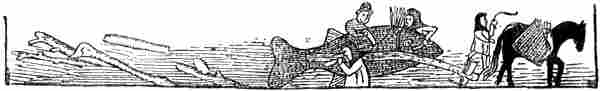
Cutting up a whale (from an Icelandic MS. of the sixteenth century).
It looks as though the author’s view was that the whale was caught with nets and killed by the throwing of lances, which is not impossible; but it may also be supposed that the poetical description is somewhat misleading, and that the “nets with the heavy iron” were the harpoon with its line (?).
It may be regarded as doubtful whether the harpooning of great whales in open waters was ever so actively carried on and brought to such perfection during the Middle Ages in Norway, Iceland and Greenland as was evidently the case in Normandy and especially among the Basques, from whom[Pg 163] later the English and the Dutch learned it. As in those days there was abundance of whales to be caught on the Norwegian coast (the nord-caper was then numerous there), this kind of whaling would not tempt the Norwegians to seek better hunting-grounds along other coasts in northern waters. On the other hand, it is evident that practice in whaling must have been of great importance to them, wherever they settled in these regions.
Albertus Magnus (ob. 1280), who gives a detailed description of the harpoon and of whaling (cf. above, p. 158), has also the following description of walrus-hunting:
“Those whales which have bristles, and others, have very long tusks,[145] and by them they hang themselves up on stones and rocks when they sleep. Then the fisherman approaches, and tears away as much as he can of the skin from the blubber by the tail, and makes fast a strong rope to the skin he has loosened, and he binds the ropes fast to rings fixed in the rocks or to very strong posts or trees. Then he throws large stones at the fish and wakes it. When the fish is[Pg 164] awake and wants to go back [into the sea], it pulls its skin off from the tail along the back and head, and leaves it behind there. And afterwards it is caught not far from the spot, when it has exhausted its strength, as it floats bloodless upon the sea, or lies half-dead on the shore.”
He also tells us that walrus-rope[146] was commonly sold at the fair at Cologne, which shows that walrus-hunting must have acquired great importance at that time. It can only have been carried on by the Norwegians (and Icelanders ?), the Finns or Lapps, the peoples of the north coast of Russia, and the Greenlanders. It is unlikely that the ropes were brought all the way from Russia by land to Cologne; they must rather have come from Norway. The Norwegians obtained a certain quantity of walrus-rope (“svarðreip”) through the trade with Greenland, and perhaps with North Russia, but they probably got most from their own hunting in northern waters. The quantity of walrus they could kill in Finmark would not be sufficient to satisfy the demand, and, as suggested earlier (vol. i. p. 177), they must certainly have sought fresh hunting-grounds, above all eastwards in the Polar Sea.
Norse-Icelandic literature does not tell us that the Norwegians in their voyages to Bjarmeland went any farther east than “Gandvik” (the White Sea) and the Dvina. But it is to be noted that the sagas as a rule only mention the expeditions of chiefs, with warlike exploits, fighting and slaughter of one kind or another; while peaceful trading voyages, which were certainly numerous, are not spoken of, nor walrus-hunting and hunting expeditions in general, since such occupations were not usually followed by chiefs. We cannot therefore expect to find anything in the sagas about countries or waters where there were no people, and where only hunting was carried on.
From Ottar, however, who was not a saga-writer, we learn that walrus-hunting was practised, and doubtless very perseveringly, in the ninth century (vol. i. p. 176), and that even at that time he went in pursuit of it as far as the White Sea.[Pg 165] It is thus extremely improbable that such hardy hunters should have stopped there, and not continued to move eastward, where there was such valuable prey to be secured. We must suppose that at least they reached the west coast of Novaya Zemlya, where there were walrus and seal in abundance. That such was the case is just as probable as the reverse is improbable, and as it is improbable that expeditions of this kind should have found mention in the sagas. That the Norwegians knew Novaya Zemlya may perhaps be concluded from the mediæval Icelandic geography (cf. vol. i. p. 313; vol. ii. p. 1), according to which the land extended northward from Bjarmeland round the north of Hafsbotn (the Polar Sea) as far as Greenland, making the latter continuous with Europe (cf. the map, p. 2). The knowledge that the west coast of Novaya Zemlya extended northwards into the unknown may have given rise to such an idea. It was general in Scandinavia and Iceland in the latter part of the Middle Ages, whilst Adam of Bremen speaks of Greenland as an island, like Iceland and other islands in the northern ocean. The discovery of “Svalbard” (Spitzbergen ?) in 1194 may, as we shall see directly, have lent support to the belief in this connection by land.
Saxo Grammaticus in his Danish history, of the beginning of the thirteenth century, also has mythical tales of voyages to Bjarmeland. Amongst others the legendary king Gorm and Thorkel Adelfar on a mythical voyage to the north and east came first to Hálogaland, then to “Hither Bjarmeland,” which had steep shores and much cattle, and then to a land with continual cold and heavy snow, without any warmth of summer, rich in impenetrable forests, which was without produce of the fields, full of beasts unknown elsewhere, and where many rivers rushed through rocky beds. This land was “Farther Bjarmeland.”[147] If we except the forests this description suits Novaya Zemlya better than the Kola peninsula; but it is extremely doubtful whether any real knowledge of[Pg 166] these regions lies at the root of Saxo’s mythical tales, in which, for instance, the travellers come to the river of death and the land of the dead. The designation Farther Bjarmeland may nevertheless point to a land having been known beyond the often-mentioned Bjarmeland.
In the old legendary sagas there is frequent mention of “the Farther Bjarmeland,” which lay to the north or north-east of the real Bjarmeland (Permia), and where there was a people of gigantic size and immense riches. This fabulous country may, it is true, be entirely mythical, perhaps originally derived from ancient Greek myths; but on the other hand it may be the knowledge of Novaya Zemlya that has influenced the formation of the myths about it. However this may be, we may be sure that the voyages of the Norwegian hunters in those days extended into the eastern Polar Sea far beyond the limits of Ottar’s voyage, and much farther than the chance mentions in the sagas of more or less warlike expeditions of chiefs to the White Sea would indicate.
A notice that is extant relating to the year 1194 shows better than anything else that the Norwegians probably made extensive voyages in the Polar Sea, and the mention of it is purely fortuitous. In the “Islandske Annaler” (in six different MSS.) it is briefly stated of the year 1194: “Svalbarðs fundr” or “Svalbarði fundinn” (Svalbard was discovered); but that is all we are told; surely no great geographical discovery has ever been more briefly recorded in literature. Svalbarði means the cold edge or side, and must here mean the cold coast. In the introduction to the Landnámabók we read about this land:
“From Reykjanes on the south side of Iceland it is five [in Hauk’s Landnáma three] dœgr’s sea [i.e., sail] to Jolldulaup in Ireland to the south, but from Langanes on the north side of Iceland it is four dœgr’s sea to Svalbard on the north in Hafsbotn,[148] but it is one dœgr’s sail to the uninhabited parts of Greenland from Kolbeins-ey in the north.”
[Pg 167]As will be seen, Svalbard is spoken of, here and in the Annals, as a land that is known. It is also mentioned in Icelandic legendary sagas of the later Middle Ages.
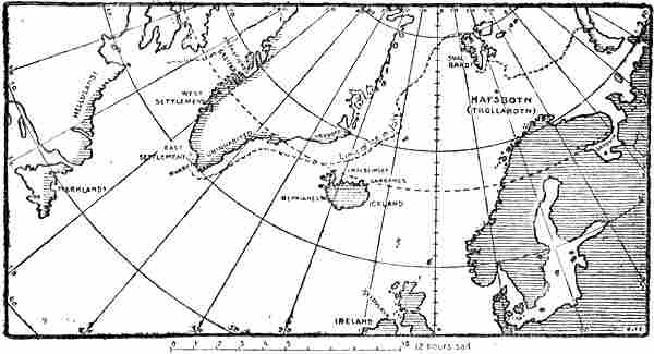
Countries and seas discovered by the Norwegians and Icelanders. The shaded coasts were probably all known
to them. The scale gives “dœgr”-sailing, reckoning 2° (or 120 geographical miles) to each “dœgr’s” sail
The Historia Norwegiæ says of a country in the north:[149]
“But in the north on the other side of Norway towards the east there extend various peoples who are in the toils of heathendom (ah, how sad), namely the Kiriali and Kwæni, horned Finns[150] and both Bjarmas. But what people dwell beyond these we do not know for certain, though when some sailors were trying to sail back from Iceland to Norway, and were driven by contrary winds to the northern regions, they landed at last between the Greenlanders and the Bjarmas, where they asserted that they had found people of extraordinary size and the Land of Virgins (‘virginum terram’), who are said to conceive when they taste water. But Greenland is separated from these by ice-clad skerries (‘scopulis’).”
[Pg 168]And in a later passage we read:
“The fourth part [of Norway] is Halogia, whose inhabitants live in great measure with the Finns [Lapps], and trade with them; this land forms the boundary of Norway on the north as far as the place called Wegestaf, which divides it from Bjarmeland (‘Biarmonia’); there is the very deep and northerly gulf which has in it Charybdis, Scylla, and unavoidable whirlpools; there are also ice-covered promontories which plunge into the sea immense masses of ice that have been increased by heaving floods and are frozen together by the winter cold; with these traders often collide against their will, when making for Greenland, and thus they suffer shipwreck and run into danger.”
It may seem probable that this description of a country in the north referred to Svalbard; and the naive allusion to glacier-ice plunging from the land is most likely to be derived from voyagers to the Polar Sea; for it seems less probable that it should be merely information about Greenland transferred to the North. Storm, it is true, dated the Historia Norwegiæ between 1180 and 1190, that is, before the discovery of Svalbard according to the Annals; but later writers place it in the thirteenth century, even as late as 1260 (see vol. i. p. 255). The ideas of the people of great size and of the Land of Virgins are obviously taken from Adam of Bremen, and may be a literary ornament.
There have been different opinions as to what country Svalbard was. Many have thought that it might be the northern east coast of Greenland; Jan Mayen has also been mentioned; while others, like S. Thorlacius, a hundred years ago (1808), supposed that it was “the Siberian coasts of the Arctic Ocean, lying to the east of Permia (Bjarmeland), that the ancient Norsemen included under the name of Svalbard, i.e., the cold coast.” Gustav Storm [1890, p. 344] maintained that Svalbard in all probability must be Spitzbergen,[151] and many reasons point to the correctness of this supposition.
No certain conclusion can be drawn about Svalbard from the passage quoted from the Landnámabók. “On the north in Hafsbotn” must mean in some northerly direction; for it is only the chief points of the compass, north, south and[Pg 169] west, that are mentioned, and no intermediate points; for one course alone, from Bergen to Hvarf in Greenland, the direction “due west” is given, which must be true west.[152] Langanes is said to lie on the north side of Iceland instead of on the north-east, from Reykjanes to Ireland the course was south, instead of south-east, etc. The points of the compass are evidently used in the same way as is still common in Norway; “in the north of the valley” may be used even if the valley bends almost to the west. The Landnáma’s statement (Sturlubók) that it is four “dœgr’s sea” from Snæfellsnes “west” to Greenland (i.e., Hvarf) then agrees entirely with the common mode of expression that I have found among the arctic sailors of our day in Denmark Strait, where they never talk of anything but sailing east or west along the edge of the ice, even though it is north-east and south-west; we sail westward from Færder to Christianssand, or we travel south from Christiania to Christianssand. Consequently “on the north in Hafsbotn” means the same as when we say north in Finmark (cf. Ottar’s directions, vol. i p. 171), or even north in the White Sea, and speak of sailing north to Jan[Pg 170] Mayen. As Langanes in particular, the north-east point of Iceland, is mentioned as the starting-point, we should be inclined to think that Svalbard was supposed to lie in a north-easterly direction; it is true that the course to Ireland is calculated from Reykjanes and not from the south-east point of Iceland; but this may be because the voyage was mostly made from the west country.
The distances given in these sailing directions in the Landnámabók are even less accurate than the points of the compass. From Stad in Norway to the east coast of Iceland is said to be seven “dœgr’s” sail, while from Snæfellsnes to Hvarf is four “dœgr,” from Reykjanes to Ireland three or five “dœgr,” from Langanes to Svalbard four “dœgr,” and from Kolbeins-ey to the uninhabited parts of Greenland one “dœgr.” The actual distances are, however, approximately: from Norway to Iceland 548 nautical miles, from Snæfellsnes to Hvarf 692, from Reykjanes to Ireland 712, from Langanes to Spitzbergen 840 (from Langanes to Jan Mayen 288), and from Mevenklint to the east coast of Greenland 184 nautical miles. It is hopeless to look for any system in this; the distances from Iceland to Greenland and from Iceland to Ireland are given as being much less (4⁄7 and 3⁄7 or 5⁄7) than the distance from Norway to Iceland, whereas in reality they are considerably more. In the fourth part of the “Rymbegla” [1780, p. 482] a “dœgr’s” sail is given as equal to two degrees of latitude, that is, 120 nautical miles (or twenty-four of the old Norwegian sea-leagues), but according to the measurements given there would be 80 nautical miles in a “dœgr’s” sail between Norway and Iceland, 172 between Iceland and Greenland, and 236 (or 144) between Iceland and Ireland. These measurements of distance are therefore far too uncertain to be of any use in finding Svalbard. According to the scale in the “Rymbegla” it would be two and a half “dœgr” to Jan Mayen, and seven “dœgr” to Spitzbergen from Langanes.[153]
[Pg 171]The old Norwegians imagined Hafsbotn [or Trollabotn][154] as the end (“botn”) of the ocean to the north of Norway and north-east of Greenland, as far as one could sail to the north in the Polar Sea. But Svalbard lay according to the Landnámabók in the north of Hafsbotn; and if one tries to sail northward in summer-time, either from Langanes, the north-east point of Iceland, or from Norway, endeavouring to keep clear of the ice, it will be difficult to avoid making Spitzbergen. If one followed the edge of the ice northwards from Iceland in July, it would infallibly bring one there. Such a voyage would correspond to the sailing directions from Snæfellsnes when they steered west to the edge of the ice off Greenland, and then followed it south-westwards round Hvarf. On the other hand, it would be impossible to arrive at the northern east coast of Greenland without venturing far into the ice, and it is not likely that the ancient Norsemen would have done this unless they knew that there was land on the inside and consequently hunting-grounds (cf. vol. i. p. 286). No doubt one might make Jan Mayen; but it is difficult to suppose that this little island should have been given such a name, which is only suited to the coast of a larger country. The conclusion that Svalbard was not the northern east coast of Greenland seems also justified from the latter being mentioned[Pg 172] immediately afterwards in Hauk’s Landnámabók under the name of “the uninhabited parts of Greenland,” one “dœgr’s” sail north of Kolbeins-ey (see vol i. p. 286; vol. ii. p. 166).
As has already been said, the Norwegians (cf. Historia Norwegiæ and the “King’s Mirror”) and Icelanders (cf. the mediæval Icelandic geography) thought that “land extended from Bjarmeland to the uninhabited parts in the north, and as far as the beginning of Greenland,” that is, round the whole of the north of Hafsbotn. From several legendary sagas of the fourteenth and fifteenth centuries we can see that Svalbard was in fact reckoned among these uninhabited parts in the north, which were reached by sailing past Hálogaland and Finmark, and northward over Dumbshav (see map, p. 34).
Thus, in Samson Fagre’s Saga [of about 1350] we read in the thirteenth chapter, “On the situation of the northern lands”:
“Risaland lies east and north of the Baltic, and to the north-east of it lies the land that is called Jotunheimar, and there dwell trolls and evil spirits, but from thence until it meets the uninhabited parts of Greenland goes the land that is called Svalbard; there dwell various peoples.” [Grönl. hist. Mind., iii. p. 524.]
The outcome of what has been advanced above will be briefly: there can be no doubt, from the sober statement in the Icelandic Annals and in the Landnáma, that the land of Svalbard really was discovered, even though the date need not be accurate; and it may further be regarded as probable that this land was Spitzbergen.
It may be supposed that it was discovered accidentally by a ship on the way between Iceland and Norway, as stated in the Historia Norwegiæ, being driven by storms to the north of Hafsbotn; but the mention of the country in the Landnámabók may indicate that the voyage was made more than once, and that knowledge of the country cannot in any case have been limited to an accidental discovery of this sort. It is more probable that the Norwegians and Icelanders carried[Pg 173] on seal- and walrus-hunting northwards along the edge of the ice in the Polar Sea, and in that case it was unavoidable that they should arrive at Svalbard or Spitzbergen. And when it was once discovered they must often have resorted to it; for the valuable walrus was at that time very plentiful there.
As we nowhere find mention of these sealing expeditions of the Norwegians in the Polar Sea, except in Ottar’s narrative, it may be difficult to show certain evidence of their having taken place; but the Russians’ seal-hunting in the Polar Sea, of which we hear as early as the sixteenth century, can in my opinion scarcely be explained in any other way than as a continuation in the main of the Norwegians’ sealing. When the English, and later the Dutch, came to the Murman coast and the coasts eastwards as far as the Pechora, Vaigach and Novaya Zemlya, they found fleets of Russian smacks engaged in fishing and walrus-hunting; most of them were from the Murman coast, some from the White Sea, and a few from the Pechora. Stephen Burrough thus found in June 1556 no less than thirty smacks in the Kola fjord, which had come sailing down the river, on their way to fishing- and sealing-grounds to the east. These smacks sailed well with the wind free, could also be rowed with twenty oars, and had each a crew of twenty-four men.
Pistorius[155] refers to Andrei Mikhow as saying that the “Juctri” (Yugrians in the Pechora district) and “Coreli” (Karelian) on the coast of the Polar Sea hunted seals and whales, of whose skins they made ropes, purses, and ...? (“redas, bursas et coletas”), and used the blubber (for lighting ?) and sold it. They also hunted walrus (called by Mikhow by its Norwegian name “rosmar”),[156] the tusks of which they sold to the Russians. The latter kept a certain quantity for their own use, and sent the rest to Tartary and Turkey. The[Pg 174] hunting was said to proceed in a curious fashion; the walruses, which were very numerous, clambering up on to the mountain-ridges and there perishing in great numbers.[157] The Yugrians and Karelians then collected the tusks on the shore. Is there here some confusion with stories of the collection of mammoth tusks?
What was said earlier (p. 145) from an Arabian source about steel blades being sold to the peoples on the coast of the Polar Sea in North Russia seems to point to sea-hunting having been well developed in these regions as early as the twelfth century; for otherwise steel for hunting appliances could not have been a common article of commerce.
That Norwegians and Russians often met in northern waters may apparently be concluded from the words already quoted from Erik Walkendorf, about 1520 (cf. p. 86), that fifteen of the Skrælings did not venture to approach a Christian or Ruten (i.e., Russian). As he places the land of the Skrælings north-north-west of Finmark, this seems to be a legend that is brought into connection with the Polar Sea. Of walrus-tusks he says that “these are costly and greatly prized among the Russians.” Unless this is taken from older literary sources (?), one might suppose that it was information he himself had obtained in Finmark, and it might then point to the Norwegians having sold walrus-tusks to the Russians.
The fact that, as mentioned above, a Russian author of the sixteenth century (Mikhow) uses the Norwegian name “rosmar” seems also to point to Russian connection with the Norwegians in the arctic fisheries. In addition to this, the Russian word “morsh” for walrus is evidently the same as the Lappish “moršša” (Finnish “mursu”), and may originally be the same word as “rosmar” (“rosmhvalr”). For it is striking that the same letters are present in “morsh” or “moršša” as in “rosm(hvalr),” or in “rosmar”; there[Pg 175] is only a transference of consonants, which is often met with in borrowed words in different languages.
I asked Professor Konrad Nielsen what he thought about this, and whether he could imagine any Finnish-Ugrian origin of the word, or whether any similar word was known, for instance, in Samoyed. He considers that my assumption may “be quite well founded.”[158] He has consulted Professor Setälä of Helsingfors about it, and the latter thinks that if the word was borrowed from Finnish into Russian, there is nothing to prevent its being connected with the Norse rosm(hvalr)—the latter would then, of course, be the primary form. Similar metatheses are found in other Norse loan-words in Finnish. Konrad Nielsen thinks that “the Lappish word is pretty certainly borrowed from Finnish, so that the idea of its Norse origin meets with no difficulty from that quarter.” And as to the possible Russian origin of the word, he has spoken to the Slavic authority, Professor Mikkola, who informs him that in popular language the Russian word is only found in the most northern dialects, and there is no point of connection in other Slavic languages, so that he regards it as probable that it is not originally a Slavic word. No Finnish-Ugrian etymology for the word can, according to Konrad Nielsen, be put forward. “In Samoyed,” he says, “the name for walrus is only known as far as Jura-Samoyed (the most western dialect of Samoyed) is concerned: ‘t’ewot’e,’ ‘tiut’ei.’ I have compared this with the Lappish name for seal, ‘dævok’—‘davak’—‘dævkka.’ In this I see evidence that the Lapps (contrary to Wiklund’s view) were acquainted with the Polar Sea and its animals before they came to Scandinavia.” He also draws my attention to the fact that “the Finnish ‘norsu’ (in the older language also ‘nursa’), ‘elephant,’ seems to be connected with ‘mursu,’ which is easily explained by the analogous use of walrus-tusks and elephant-tusks.”
Professor Olaf Broch also considers my assumption probable, and has submitted the question of the etymology of the Russian “morsh” to Professor Berneker, who may doubtless be regarded as the first authority in questions of this kind. He replies that a “wild” etymologist might connect the word with a series of words in Slavic languages which express various movements; but[Pg 176] the Russian word, being so definitely localised, must doubtless be derived from the North-Finnish linguistic region. Whether the Finnish “mursu,” Lappish “moršša,” “morša,” can be referred to a metathesis of Old Norse rosmhvalr, Danish rosmer, etc., Professor Berneker is unable to determine. “But with loan-words all sorts of anomalies take place, and no rules can be laid down.”
If we compare these various utterances of such eminent authorities, it appears to me that there are paramount reasons for regarding the Russian-Finnish name for walrus as of Norse origin. But in that case it also becomes probable that the Norwegians were the pioneers in walrus-hunting along the coasts of the Polar Sea, and that both the Finnish peoples and the Russians learned from them.
It will doubtless be difficult to find a natural explanation of the peoples on the northern coasts of Russia having from the first developed their arctic sea-hunting with large craft, unless we suppose that they learned it from the Norwegians, and that it is thus a continuation of the methods of the latter. It should also be remembered that the Kola peninsula as far as the White Sea itself was reckoned a tributary country of Norway (cf. p. 135), and that the name of the Murman coast means simply the Norwegians’ coast. None of the peoples on the north coast of Russia can have been a seafaring people very far back, as is shown by their boats and appliances; and it is difficult to believe that they should have been able to develop independently a system of navigation on a coast presenting such unfavourable conditions; no doubt they could have done so with small boats, originally river-boats,[159] but not with larger craft; this they must most[Pg 177] probably have learned from their nearest seafaring neighbours, the Norwegians, who were masters at sea.
It is remarkable that already as early as in Adam of Bremen white bears (polar bears) are mentioned as occurring in Norway (cf. vol. i. pp. 191, f.). That this might be due to the connection with Iceland and Greenland, even at that time, is perhaps possible, but not very probable, as these countries are mentioned separately by Adam. The white bears in Norway may rather point to a connection with the Polar Sea and to the Norwegians having practised sealing there.
It is perhaps due to the same connection of the Norwegians with the Polar Sea that we find on the Italian Dalorto’s map of 1325 (see next chapter) and on several later maps the statement that there are white bears in northern Norway. Probably polar bears’ skins were brought to the south from Norway as an article of commerce and the Norwegians may have obtained the skins partly by their own hunting in the Polar Sea, partly by the trade with Greenland, and partly, no doubt, by that with the peoples on the north coast of Russia. The Arab Ibn Sa’id (thirteenth century) mentions white bears in the northern islands, amongst them the island of white falcons (i.e., Iceland). “These bears’ skins are soft, and they are brought to the Egyptian lands as gifts.” In the “Geographia Universalis” of the thirteenth century (see next chapter) the white bears in Iceland are described. It was a common idea in southern Europe in the Middle Ages that Greenland, and sometimes also Iceland (cf. Fra Mauro’s map), lay to the north of Norway, or they were made continuous with it, and even a part of it.
The Venetian Querini, who was wrecked on Röst Island and travelled south through Norway in 1432, says that he saw a perfectly white bear’s skin at the foot of the Metropolitan’s chair in St. Olaf’s Church at Trondhjem.[160] As Greenland was under the jurisdiction of the Archbishop of Trondhjem, this skin may have been a gift from pious Greenlanders, as perhaps were also the Eskimo hide-canoes mentioned by Claudius Clavus (cf. p. 85). In Norse literature polar bears are always connected with Icelanders or Greenlanders, who sometimes brought them alive as gifts to kings.
We may thus conclude from what has been advanced above that the hunting of whales, seals, and particularly walrus was of great importance to the Norwegians in ancient times, and for the sake of the last they certainly made extended expeditions in the Arctic Ocean. It may therefore be difficult to understand how it came about that this sea-hunting declined[Pg 178] to such an extent in more recent times that we hear nothing about the Norwegians’ hunting in the Polar Sea, while in the sixteenth century fleets from the northern coasts of Russia were engaged in fishing and walrus-hunting; and Peder Claussön Friis is able to say of whaling in Norway (about 1613):
“In old time many expedients or methods were used in these lands [i.e., Norway] for catching whales ... but on account of men’s unskilfulness they have fallen out of use, so that they now have no means of hunting the whale unless he drifts ashore to them.”
This seems to show that the Norwegians’ whaling in open sea had really gone out of practice, for otherwise this author must have known of it; on the other hand, whale-hunting in the fjords, which were closed by nets, has continued to our time. Walrus-hunting (as well as sealing) appears to have been still carried on in Finmark in Peder Claussön Friis’s time.
His description of the animal and its hunting is in part accompanied by stories similar to those in Olaus Magnus and Albertus Magnus (see p. 163), and he mentions the great strength of walrus-hide ropes, and their use “for clappers in hanging bells, item for shore-ropes and other ropes, and for the screws on the quay at Bergen, with which the dried fish is screwed into barrels, and for such other uses as no hawser or cable can so well serve for.” This shows that these ropes must have been widely employed and that there must have been considerable hunting of walrus. According to an order of Christian IV., dated from Bergenhus Castle, July 6, 1622, fifteen walrus-hides were to be bought yearly for the King’s service,[161] and from K. Leem’s description it seems that walrus was still hunted in Finmark in his time (1767). He says too [1767, p. 302] that “even the Sea-Lapps of the Varanger-Fiord formerly practised whaling, using for that purpose appliances invented and made by themselves.” To this is added in a note by Gunnerus: “The same thing may also be said in our time of the Lapps in Schjerv-island and of a few peasants in Nordland, especially in Ofoten.”
But in none of these accounts is there any hint that the Norwegians carried on their hunting beyond the limits of the country, as Ottar did in the ninth century.
The decline of this productive hunting may have come about through the concurrence of many circumstances. Hostile[Pg 179] relations with the Karelians and Russians on the east may have had some influence on it; as the latter in increasing numbers took up the same hunting in their smacks, the eastward waters may have become unsafe for the Norwegians, who, though superior in seamanship, were inferior in numbers. But a more important factor was the rapid growth of the fisheries on the home coasts in Finmark after the fourteenth century, which may have claimed all available hands, leaving none over for fishing in more distant waters. Besides which the influence of the Hanseatic League no doubt contributed; then, as later, they learned to prefer the valuable trade in dried fish to fitting out vessels for the more uncertain and dangerous hunting in the Polar Sea, which they knew nothing about. Finally came the royal edict of April 1562, which enforced Bergen’s monopoly in the trade with Finmark, whereby the dead hand was laid upon this part of the country, as formerly upon Greenland. In those days a corresponding displacement of the arctic fisheries must have taken place from Norway to north Russia, as in the last century again a displacement took place in the contrary direction, when the Russian hunting in the Arctic Ocean and Spitzbergen ceased and the Norwegians again became the only hunters in these waters.
It was a concatenation of unfortunate accidents that produced the gradual decline of the voyages of the Norwegians and of their unrestricted command of all northern waters from the White Sea, and probably also Novaya Zemlya and Spitzbergen, over all the northern islands, Shetland, the Orkneys (to some extent the Hebrides, Man and Ireland), the Faroes, Iceland, and as far as Greenland, and probably also for a time the north-east coast of America. Unfavourable political conditions had a great deal to do with this, not the least of them being the long union with Denmark, with the removal of the seat of government to Copenhagen, which was extremely unfavourable to the interests of Norwegian commerce. To this was added the growing power of the Hanseatic League[Pg 180] in Norway, the effect of which was as demoralising to all activity in the country as it was paralysing to our navigation. But not the least destructive were the royal monopolies of trade with the so-called tributary countries of the kingdom; like all State monopolies, they laid their dead hand upon all private enterprise. In this way the Norwegian command of northern waters received its death-blow; while the mercantile fleets of other nations, especially the English, came to the fore, to a large extent by making use of Norwegian seamanship and enterprise; thus the English seaport of Bristol seems to have had many Norwegians among its citizens, who certainly found there better conditions to work under than at home.
The mass of knowledge the Norwegians had acquired about the northern regions, before their time entirely unknown, was to a great extent forgotten again; and at the close of the Middle Ages all that remained was the communication with Iceland and the knowledge of the neighbouring seas, besides the continuance of the connection between the White Sea and Norway; while the voyage to Greenland, to say nothing of America, was forgotten, at any rate by the mass of the people.
The development of humanity often proceeds with a strangely lavish waste of forces. How many needless plans and unsuccessful voyages, how much toil and how many human lives would not a knowledge of the Norwegians’ extensive discoveries have been able to save in succeeding ages? How very different, too, might have been the development of many things, if by the chances of an unlucky destiny the decline of Norwegian navigation had not come just at a time when maritime enterprise received such a powerful impetus among more southern nations, especially the Portuguese, then the Spaniards, later the French, the English and the Dutch. By their great discoveries it was these nations who introduced a new era in the history of navigation, and also in that of polar voyages. But if Norwegian seamanship had still been at its height at that time, then certainly the Scandinavians of Greenland would once more have[Pg 181] sought the already discovered countries on the west and south-west, and the Greenland settlements might then have formed an important base for new undertakings, whereby a new period of prosperity for Norwegian navigation and Norwegian enterprise might have been introduced. This was not to be; it was only reserved for the Norwegians to be the people who showed the way to the other nations out from the coasts and over the great oceans.
CHAPTER XIII
THE NORTH IN MAPS AND GEOGRAPHICAL WORKS OF THE MIDDLE AGES
At the beginning of the Middle Ages and down to the fifteenth century the cartography of the Greeks, which had reached its summit in the work of Ptolemy, was entirely unknown in Europe; while the early Greek conceptions (those of the Ionian school) of the disc of the earth or “œcumene” as a circle (called by the Romans “orbis terrarum,” the circle of the earth) round the Mediterranean—and externally surrounded by the universal ocean—had persisted through the late Latin authors, and probably also through Roman maps. At the same time Parmenides’ doctrine of zones (cf. vol. i. pp. 12, 123) remained prevalent owing to its enunciation by Macrobius, and maps exhibiting this doctrine were common until the sixteenth century. These two conceptions became the foundation of the learned view and representation of the world, and consequently also of the North, throughout the greater part of the Middle Ages. It was the age of speculation, not of observation. The Scandinavians were the first innovators in geography,[Pg 183] by going straight to nature as it is, unfettered by dogmas. The Italian and Catalan sailors followed later with their portulans (sailing-books) and compass-charts.
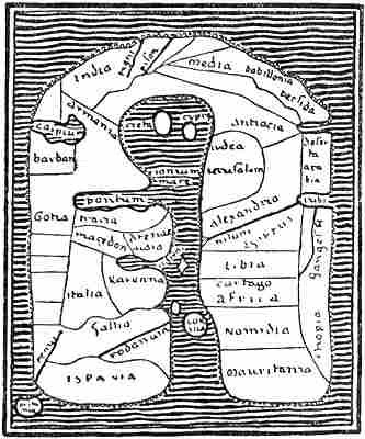
Map of the world from Albi in Languedoc, also called
the Merovingian map (eighth century). The east is at the
top,the Mediterranean in the middle, and the universal
ocean outside, with its three bays: the Caspian Sea, the
Persian Gulf and the Red Sea
The wheel-map type
We find what is perhaps the oldest known Christian map of the world (cf. vol. i. p. 126) in the “Christian Topography” of Cosmas Indicopleustes.[162] An attempt is made to combine the Roman classical view of the world, as lands grouped round the Mediterranean, with Cosmas’s pious conception of it as formed on the same rectangular plan as the Jews’ tabernacle. A map of the world of somewhat similar form is found in a MS. (by Orosius and Julius Honorius) of the eighth century, preserved in the library at Albi in Languedoc. But these attempts must be regarded as accidental. Typical of that time were the so-called wheel- or T-maps, the shape of which was due especially to Isidore Hispaliensis (cf. vol. i. pp. 151, ff.). The circular Roman maps of the world seem already to have had a tendency to a tripartition of the world: Europe, Asia and Africa. Sallust (in the “Bellum Jugurtinum”) indicates something of the sort, and Orosius’s geographical system[Pg 184] seems to be founded upon a map of this kind. In St. Augustine we first find the division of the T-map clearly expressed. This dogmatic-schematic form was fixed by Isidore, according to whom the round disc of the earth surrounded by the outer ocean was to be compared to a wheel (or an O), divided into three by a T.[163] Mechanical map-forms after this prescription (cf. vol. i. pp. 125, 150) were common during the whole of the first part of the Middle Ages until the fourteenth century; indeed they circulated and exercised influence far into the sixteenth; but sometimes, in accordance with the four corners of the earth in the Bible, the maps were given a square form instead of a[Pg 185] round. In spite of the fact that most authors, among them Isidore himself, expressly declare that the earth had the form of a globe, this does not seem to have been anything more than a purely theoretical doctrine, for in cartographical representations, through the whole of the Middle Ages to about the close of the fifteenth century, there is never any hint of projection, or of any difficulty in transferring the spherical surface of the earth to a plane, which had been so clearly present to the minds of the Greeks.
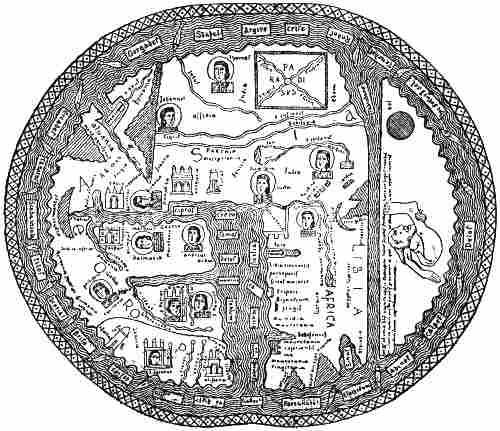
Beatus map, from Osma, 1203. The east is at the top
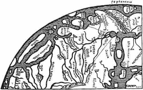
Northern Europe on Heinrich of Mainz’s map, at Cambridge (1110)
Sallust-maps
The wheel-maps were, as we have said, from the first purely formal; but by degrees an attempt was made to bring into the scheme real geographical information, although the endeavour to approach reality in the representation is scarcely to be traced. To this type of map belongs the so-called Beatus map, which the Spanish monk Beatus (ob. 798) added to his commentary on the Apocalypse, and which was reproduced in very varying forms, ten of which have been preserved. The original map, which is not known, was probably round, but in the reproductions the circle of the earth is sometimes more or less round (as in the illustration, p. 184), sometimes oblong (cf. vol. i. p. 199), and sometimes four-sided with rounded corners [cf. K. Miller, ii., 1895]. Jerusalem was frequently placed in the centre of the wheel-maps, Paradise (often with Adam and Eve at the time of the Fall, or with the four rivers of Paradise) in the extreme east of Asia, which is at the top of[Pg 186] the map, and the Mediterranean (Mare magnum), which forms the stem of the T, pointing down (cf. vol. i. p. 150). The cross-stroke of the T was formed by the rivers Tanais (with the Black Sea) and Nile. In the band of ocean surrounding the disc of the earth the oceanic islands were distributed more or less according to taste, and as there happened to be room. Thus in the version of the Beatus map here given, from Osma in Spain (of 1203), Scandinavia appears as an island (“Scada insula”) by the North Pole, as in the Ravenna geographer (cf. the map, vol. i. p. 152), and the “Orcades” (the Orkneys) and “Gorgades” (the fabulous islands of the Greeks to the west of Africa) are placed on the north-east of Asia. The so-called Sallust-maps, drawn up from Sallust’s description of the world in the Bellum Jugurtinum [cf. K. Miller, iii., 1895, pp. 110, ff.], were another type of very formal wheel-maps that were still current in the fourteenth century.
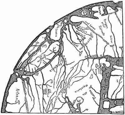
Northern Europe on the Hereford map (circa 1280)
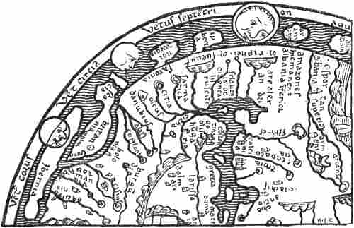
Northern part of the Psalter map (thirteenth century)
But by degrees many changes were introduced into the strict scheme. The outer coast-line of the continents was in parts indented by bays and prolonged into peninsulas, and the islands were given a less formal shape. Such attempts appear, for instance, in Heinrich of Mainz’s map, which is taken to have been drawn in 1110 [cf. K. Miller, iii., 1895, p. 22], and the closely related “Hereford map” of about 1280 by Richard de Holdingham [cf. K. Miller, iv., 1896; Jomard, 1855]. Some resemblance to these maps is shown by the “Psalter” map in London, of the second half of the thirteenth century, and the closely related “Ebstorf” map of 1284 [cf. K. Miller, iii. pp. 37, ff.; iv. p. 3; v.]; and it is quite possible that they may all be derived from the same original source; there is in particular a great resemblance in their representation of Britain and Ireland. On the first three of these maps Scandinavia or Norway (“Noreya” or “Norwegia”) forms a peninsula with gulfs on the north and south sides. On Heinrich’s map there is beyond this an island or peninsula, called “Ganzmir,” a name which occurs again on the Hereford map (cf. vol. i. p. 157); Miller explains it as a corruption of Canzia, Scanzia (Scandinavia). On the “Lambert” map in the Ghent codex of before 1125 [cf. K. Miller, iii., 1895, p. 45], “Scanzia,” also with the name “Norwegia,” is represented as a peninsula with narrow gulfs running up into the continent on each side. “Island” (or “Ysland”) appears on Heinrich’s and the Hereford maps as an island near Norway. On the Ebstorf map[Pg 188] “Scandinavia insula” and “Norwegia” are also shown as islands. Many fabulous countries, such as “Iperboria” (the land of the Hyperboreans), “Arumphei” (on the Psalter map, i.e., the land of the Aremphæans, cf. vol. i. p. 88), etc., appear as peninsulas or islands in the northern regions on several of these maps; on the other hand, neither Greenland nor Wineland occurs on any of them.
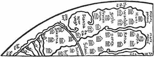
Northern Europe on the Lambert map at Ghent (before 1125)
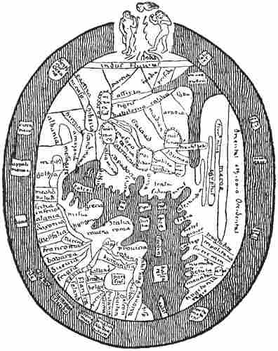
Ranulph Higden’s map of the world, in London (fourteenth century)
Ranulph Higden’s map of the world, which accompanied his already mentioned work, “Polychronicon” (of the first part of the fourteenth century), is more fettered by the scheme of the wheel-maps in the form of the outer coast-line and of the islands. He took his vows in 1299, was a monk of St. Werburg’s Abbey at Chester, and died at a great age in 1363. Various reproductions of his map are known, but they display little sense of realistic representation. “Scandinavia” is placed in Asia on the Black Sea, together with the Amazons and Massagetæ, and to the north of it “Gothia” (Sweden ?). Islands in the ocean off the coast of northern Europe are called “Norwegia,” “Islandia,” “Witland” (or “Wineland,” etc.), with “gens ydolatra,” “Tile” (Thule) and “Dacia” (Denmark) with “gens bellicosa” somewhere near the North Pole. In spite of this representation on the map, the Polychronicon (cf. above, p. 31) contains various statements about the North, which may point to a certain communication with it, or may be echoes of Northern writers. Higden to a large extent copied an earlier work, the “Geographia Universalis,” a sort[Pg 189] of geographical lexicon by an unknown author of the thirteenth century,[164] which is for the most part based on earlier writers, especially Isidore. Both works are practically untouched by the knowledge of the North that had already appeared in King[Pg 190] Alfred and in Adam of Bremen, and show how much ignorance could still prevail in learned quarters on many points connected with these regions. The “Geographia” speaks of “Gothia,” or lower Scythia, as a province of Europe, but obviously confuses Sweden (the land of the Götar) and Eastern Germania (the land of the Goths). Norway (“Norwegia”) was very large, far in the north, almost surrounded by the ocean; it bordered on the land of the Goths (Götar), and was separated from Gothia (Sweden) on the south and east by the river Albia (the Göta river). The inhabitants live by fishing and hunting more than by bread; crops are few on account of the severity of the cold. There are many wild beasts, such as white bears, etc. There are springs that turn hides, wood, etc., into stone; there is midnight sun and corresponding winter darkness. Corn, wine and oil are wanting, unless imported. The inhabitants are tall, powerful and handsome, and are great pirates. “Dacia”[165] was divided into many islands and provinces bordering on Germania. Its inhabitants were descended from the Goths (Götar ? cf. Jordanes, vol. i. p. 135), were numerous and finely grown, wild and warlike, etc. “Svecia” (the land of the Svear) is also mentioned. That part of it which lay between the kingdoms of the Danes and of the Norwegians was called Gothia. Svecia had the Baltic Sea on the east and the British Ocean on the west, the mountains and people of Norway on the north, and the Danes on the south. They had rich pastures, metals and silver mines. The people were very strong and warlike, they once ruled over the greater part of Asia and Europe.
“‘Winlandia’ is a country along the mountains of Norway on the east, extending on the shore of the ocean; it is not very fertile except in grass and forest; the people are barbarously savage and ugly, and practise magical arts, therefore they offer for sale and sell wind to those who sail along their coasts, or who are becalmed among them. They make balls of thread and tie various knots[Pg 191] on them, and tell them to untie three or more knots of the ball, according to the strength of wind that is desired. By making magic with these [the knots] through their heathen practices, they set the demons in motion, and raise a greater or less wind, according as they loosen more or fewer knots in the thread, and sometimes they bring about such a wind that the unfortunate ones who place reliance on such things perish by a righteous judgment.”
It is possible that the name “Winlandia” itself is a confusion of Finland (i.e., the land of the Finns [Lapps], Finmark) with Vinland (cf. above, p. 31); although the description of the country must refer to the former. It may be supposed that a misunderstanding of the name was the origin of the myth of selling wind being connected with it. The idea persisted, and the same myth is given so late as by Knud Leem [1767, p. 3] from an anonymous book of travels in northern Norway.
Of Iceland the “Geographia” says:
“‘Yselandia’ is the uttermost part of Europe beyond Norway on the north.... Its more distant parts are continually under ice by the shore of the ocean on the north, where the sea freezes to ice in the terrible cold. On the east it has Upper Scythia, on the south Norway, on the west the Hibernian Ocean.... It is called Yselandia as the land of ice, because it is said that there the mountains freeze together to the hardness of ice. Crystals are found there. In that region are also found many great and wild white bears, that break the ice in pieces with their claws and make large holes, through which they plunge down into the water and take fish under the ice. They draw them up through the said holes, and carry them to the shore, and live on them. The land is unfertile in crops except in a few places.... Therefore the people live for the most part on fish and hunting and meat. Sheep cannot live there on account of the cold, and therefore the inhabitants protect themselves against the cold and cover their bodies with the skins of the wild beasts they take in hunting.... The people are very stout, powerful, and very white (‘alba’).”
In Higden’s Polychronicon Gothia is also spoken of as lower Scythia, but among the provinces of Asia, although it is said that it lies in Europe; it has on the north Dacia and the Northern Ocean. But the geographical confusion in this work is greater; as already mentioned (p. 31), the countries of the Scandinavians are described together with the Insulæ Fortunatæ, Wyntlandia, etc., as islands in the outer ocean. The disagreement between Higden’s text and his map gives us an[Pg 192] insight into how little weight was attached at that time to the relation between maps and reality; they are for the most part merely graphic schemes. Probably Higden’s map was partly copied from an older one, and the desirability of bringing it into better agreement with his text did not occur to him.
The so-called “Anglo-Saxon mappamundi” or “Cottoniana” (reproduced vol. i. pp. 180, 183), which is in the British Museum, occupies a position of its own among early mediæval maps. Its age is uncertain; it may at the earliest date from the close of the tenth century, but possibly it is as late as the twelfth [cf. K. Miller, iii., 1895, p. 31]. It exhibits no agreement with the text of Priscian (Latin translation of Dionysius Periegetes, see vol. i. p. 114), to which it is appended. Many of the names might rather be derived from Orosius, there is also great resemblance to Mela (cf. vol. i. pp. 85, ff.), and in some ways to the mediæval maps already mentioned, although the representation of the North is different. Probably an older, perhaps Roman (?) map formed the basis of it. Name-forms like Island, Norweci[166] (Norwegia), Sleswic, Sclavi, may remind us of Adam of Bremen, but they may also be older. This map is doubtless less formal than the pronounced wheel-map type, but it does not bear a much greater resemblance to reality, although the form of Britain, for instance, may show an effort in that direction. The peninsula which has been given the name of Norweci (Norway) has most resemblance to Jutland, and the name seems to have been misplaced. No doubt it ought rather to have been attached to the long island lying to the north, which has been given the names Scridefinnas and Island. The representation has great resemblance to Edrisi’s map (cf. p. 203), where Denmark forms a similar peninsula, and Norway a similar long island, with two smaller islands to the east of Denmark, which is also alike. The “Orcades Insule” are given a wide extension on the Cottoniana map, and Tyle (Thule) lies to the north-west of Britain, as it should[Pg 193] do according to Orosius. This map does not therefore indicate, any more than the others, any particular increase of knowledge of the North, and compared with King Alfred’s work it is still far behind in the dark ages.
The zone-maps, already alluded to, which are derived from Macrobius (cf. vol. i. p. 123), gave a formal representation of the earth of a peculiar kind, which was common throughout the whole of the Middle Ages; they may be regarded as mathematical geography more than anything else. The earth is divided in purely formal fashion into five zones, two of which are habitable: our temperate zone and the unknown temperate zone of the antipodes (in the southern hemisphere); and three uninhabitable: the torrid zone with the equatorial ocean, and the two frigid zones, north and south. These conceptions also reached the North at an early time, and are mentioned in the “King’s Mirror,” amongst other works, although its author thought that the inhabited part of Greenland really lay in the frigid zone. A zone-map from Iceland is also known of the thirteenth century. Another of the fourteenth century and a kind of wheel-map of the twelfth century, but with geographical names only without coast-lines, are also found in Icelandic MSS., besides a small wheel- and T-map.[167] Otherwise it is not known that maps were drawn in the North during the Middle Ages. A purely formal wheel- and T-map is known from Lund before 1159 [see Björnbo, 1909, p. 189]. Another Danish wheel-map of the sixteenth century is known [see Björnbo, 1909, p. 192], and Björnbo reproduces [1909, pp. 193, ff.] two wheel-maps of 1486 from Lübeck, belonging to Professor Wieser, where the lands and islands of the North are drawn as round discs (with names) in the outer universal ocean.
THE ARAB GEOGRAPHERS OF THE MIDDLE AGES
If we turn now from the intellectual darkness of Christian Western Europe in the early Middle Ages to contemporary Arabic literature, it is as though we entered a new world; not least is this shown in geographical science, where the authors follow quite different methods. Through their contact with the intellectual world of Greece in the Orient, the Arabs kept alive the Greek tradition; they had translations in their own language of Euclid, Archimedes, Aristotle, the now lost work of Marinus of Tyre, and others, and of special importance to their geographical knowledge was their acquaintance with Ptolemy’s astronomy and geography, which had been forgotten in Europe, and which first became known there through the Arabs (cf. vol. i. p. 116). They were also acquainted with Greek cartography. To this education in Greek views and interests was added the fact that they had better opportunities than any other nation of collecting geographical knowledge; through their extensive conquests and through their trade they reached China on the east—where for a considerable time their merchants had fixed colonies, first in Canton (in the eighth century), and later, in the ninth century, even in Khânfu (near Shanghai)[168]—and the western coasts of Europe and Africa on the west, the Sudan and Somaliland (and even Madagascar) on the south, and North Russia on the north. In spite of the religious fanaticism which in the seventh century made them an irresistible nation of conquerors, they had civilisation enough to remember that “the ink of science is worth more than the blood of martyrs,” and there flourished among them a remarkably copious literature, with an endless variety of works, from the ninth century through the whole of the Middle Ages.
Although the Arabs never attained the Greeks’ capacity for scientific thinking, their literature nevertheless reveals an[Pg 195] intellectual refinement which, with the dark Middle Ages of Europe as a background, has an almost dazzling effect. The Arab geographers have a special gift for collecting concrete information about countries and conditions, about peoples’ habits and customs, and in this they may serve as models; on the other hand sober criticism is not their strong side, and they had a pronounced taste for the marvellous; if classical writers, and still more the learned men of the European Middle Ages, had blended together trustworthy information and fabulous myth more or less uncritically, the Arabs did so to an even greater degree, and we often find in them a truly oriental splendour in the mythical; thus it must not surprise us to hear of whales two hundred fathoms long and snakes that swallow elephants in the same author (Ibn Khordâḏbah) who says that the earth is round like a sphere, and that all bodies are stable on its surface because the air attracts their lighter parts [thus we have the buoyancy of the air], while the earth attracts towards its centre their heavy parts in the same way as the magnet influences iron [a perfectly clear description of gravitation].
Chiefly on account of the language the new fund of geographical knowledge, which, together with much that is mythical, is contained in the rich literature of the Arabs, did not attain any great importance in mediæval Europe; on the other hand the Arabs exercised more influence through the geographical myths and tales which they brought orally from the East to Europe, and, as we have seen, the world of Irish myth, amongst others, was influenced thereby.
The ideas of the Arabs about the North are, in most cases, very hazy. Putting aside the partly mythical conceptions that they had derived from the Greeks (especially Ptolemy), they obtained their information about it chiefly in two ways: (1) by their commercial intercourse in the east with Russia—chiefly over the Caspian Sea with the towns of Itil and Bulgar[169][Pg 196] on the Volga—they received information about the districts in the north of Russia, and also about the Scandinavians, commonly called Rûs, sometimes also Warank. (2) Through their possessions in the western Mediterranean, especially in Spain, they came in contact with the northern peoples of Western Europe, the Scandinavian Vikings (“Maǵûs”) in particular, and in that way acquired information.
“Maǵûs”[170] means in the west the same northern people, the Scandinavians, whom in the east the Arabs called Rûs or Warangs, which word they may have got from the Greek “Varangoi” (Βάραγγοι) and the Russian “Varyag.”
All that the Arab authors of the oldest period have about the North, and that is not taken from the Greeks, they got through their commercial connections with Russia; but it is not until the ninth century and later that anything worth mentioning appears, and even in the tenth and eleventh centuries their ideas on the subject are very much tinged with myth. Professor Alexander Seippel in his work “Rerum Normannicarum fontes Arabici” [1896], printed in Arabic, has collected the most important statements about the North in mediæval Arabic literature, and has been good enough to translate parts of these, which I give in the following pages. I have also made some additions from other sources. In an earlier chapter (pp. 143, ff.) several Arabic authors have already been quoted on the connection with Northern Russia.
The imperfection of Arabic script and its common omission of vowels easily give rise to all kinds of corruptions and misunderstandings; this is especially fatal to the reproduction of foreign words and geographical names, which explains the great uncertainty that prevails in their interpretation.
In the oldest Arab writers, of the ninth century and later, there is little or no knowledge of the North. We are only told in some of their works that furs come from there, and that the ocean in the north is entirely unknown. Abu’l-Qâsim Ibn Khordâḏbah (ob. 912), a Persian by descent and the Caliph’s[Pg 197] postmaster in Media, thus relates in his “book of routes and provinces” (completed about 885):[171]
“As concerns the sea that is behind [i.e., to the north of] the Slavs, and whereon the town of Tulia [i.e., Thule] lies, no ship travels upon it, nor any boat, nor does anything come from thence. In like manner none travels upon the sea wherein lie the Fortunate Isles, and from thence nothing comes, and it is also in the west.” “The Russians,[172] who belong to the race of the Slavs [i.e., Slavs and Germans], travel from the farthest regions of the land of the Slavs to the shore of the Mediterranean (Sea of Rum), and there sell skins of beaver and fox, as well as swords” (?).
The Russian merchants also descended the Volga to the Caspian Sea, and their goods were sometimes carried on camels to Bagdad.[173]
Ibn al-Bahlûl, 910 A.D.
Qodâma
There was no great change in knowledge of the North in the succeeding centuries. Ibn al-Faqîh, about 900 A.D., has nothing to say about the North. He mentions in the seventh climate women who “cut off one of their breasts and burn it at an early age so that it may not grow big,”[174] and he says that Tulia (Thule) is an island in the seventh sea between Rumia (Rome) and Kharizm (Khwarizm in Turkestan), “and there no ship ever puts in.” Ibn al-Bahlûl, about 910 A.D., gives information after Ptolemy about the latitudes of the northern regions and mentions two islands of Amazons, one with men[Pg 198] and one with women, in the extreme northern ocean [Seippel, 1896]. Qodâma Ibn Ǵafar (ob. 948 or 949 A.D.) says of the encircling ocean (the Oceanus of the Greeks) in which the British Isles lie that
“it is impossible to penetrate very far into this ocean, the ships cannot get any farther there; no one knows the real state of this ocean.” [Cf. De Goeje in Ibn Khordâdhbeh, 1889, p. 174.]
Abû ‘Alî Ahmad Ibn Ruste, about 912 A.D., says of the Russians (“Rûs,” that is, Scandinavians, usually Swedes) that they live on an island, which is surrounded by a sea, is three days’ journey (about seventy-five miles) long, and is covered with forest and bogs; it is unhealthy and saturated to such a degree that the soil quakes where one sets foot on it. They come in ships to the land of the Slavs and attack them, etc. They have neither fixed property, nor towns, nor agriculture; their only means of support is the trade in sable, squirrel and other skins, which they sell to any one who will buy them. They are tall, of handsome appearance, and courageous, etc.[175] Probably there is here a confusion of various statements; the ideas about the unhealthy bog-lands are doubtless connected with northern Russia, and the trade in sables can scarcely be referred to the Swedes on the Baltic.[176]
The well-known historian, traveller and geographer, Abu’l Hasan ‘Alî al-Mas‘ûdî (ob. 956), in his book (allegorically entitled “Gold-washings and Diamond-mines”) repeats certain Arab astronomers who say
“that at the end of the inhabited world in the north there is a great sea, of which part lies under the north pole, and that in the vicinity of it there is a town [or land] which is called Tulia, beyond which no inhabited country is found.” He mentions two rivers in Siberia: “the black and the white Irtish; both are considerable, and they surpass in length the Tigris and Euphrates; the distance between their two mouths is about ten days. On their banks the Turkish tribes Kaimâk and Ghuzz have their camps winter and summer.”
He also states that the black fox’s skin, which is the most valuable of all, comes from the country of the Burtâsians[Pg 199] (a Finnish people in Russia, Mordvins ?), and is only found there and in the neighbouring districts. Skins of red and white foxes are mentioned from the same locality, and he gives an account of the extensive trade in furs, whereby these skins are brought to the land of the Franks and Andalusia [i.e., Spain], and also to North Africa, “so that many think they come from Andalusia and the parts of the land of the Franks and of the Slavs that border upon it.”[177] He also has a statement to the effect that before the year 300 of the Hegira [i.e., 912 A.D.] ships with thousands of men had landed in Spain and ravaged the country.
“The inhabitants asserted that these enemies were heathens, who made an inroad every two hundred years, and penetrated into the Mediterranean by another strait than that whereon the copper lighthouse stands [i.e., the Straits of Gibraltar]. But I believe (though Allah alone knows the truth) that they come by a strait [canal] which is connected with Mæotis [the Sea of Azov] and Pontus [the Black Sea], and that they are Russians [i.e., Scandinavians] ... for these are the only people who sail on these seas which are connected with the ocean.”[178]
This is evidently the ancient belief that the Black Sea was connected through Mæotis with the Baltic.
The celebrated astronomer and mathematician, Abu-r-Raihân Muhammad al-Bîrûnî (973-1038, wrote in 1030),[179] a Persian by birth, is of interest to us as the first Arabic author who uses the name “Warank”[180] for Scandinavian, and mentions the Varangians’ Sea or Baltic.
[Pg 200]In his text-book of the elements of astronomy he says that from “the Encircling Ocean” [the Oceanus of the Greeks], out into which one never sails, but only along the coast, “there proceeds a great bay to the north of the Slavs, extending to the vicinity of the land of the Mohammedan Bulgarians [on the Volga]. It is known by the name of the Varangians’ Sea (‘Baḥr Warank’), and they [the Varangians] are a people[181] on its coast. Then it bends to the east in rear of them, and between its shore and the uttermost lands of the Turks [i.e., in East Asia] there are countries and mountains unknown, desert, untrodden.”
Al-Bîrûnî also has a very primitive map of the world as a round disc in the ocean, indented by five bays, of which the Varangians’ Sea is one [cf. Seippel, 1896, Pl. I]. The peoples who are beyond the seventh climate, that is, in the northernmost regions, are few, says he, “such as the Îsû [i.e., Wîsû], and the Warank, and the Yura [Yugrians] and the like.”
The Arabs of the West came in contact with the North through the Norman Vikings, whom they called Maǵûs (cf. p. 55), and who in the ninth century and later made several predatory expeditions to the Spanish Peninsula. Their first attack on the Moorish kingdom in Spain seems to have taken place in 844, when, amongst other things, they took and sacked Seville. After that expedition, an Arab writer tells us, friendly relations were established between the sultan of Spain, ‘Abd ar-Raḥmân II., and “the king of the Maǵûs,” and, according to an account in Abu’l-Khaṭṭâb ‘Omar Ibn Diḥya[183] (ob. circa 1235), the former is even said to have sent an[Pg 201] ambassador, al-Ġazâl, to the latter’s country. Ibn Diḥya says that he took the account from an author named Tammâm Ibn ‘Alqama (ob. 896), who again is said to have had it from al-Ġazâl’s own mouth. It is obviously untrustworthy, but may possibly have a historical kernel. The king of the Maǵûs had first sent an ambassador to ‘Abd ar-Raḥmân to sue for peace (?); and al-Ġazâl accompanied him home again, in a well-appointed ship of his own, to bring the answer and a present. They arrived first at an island on the borders of the land of the Maǵûs people.[184] From thence they went to the king, who lived on a great island in the ocean, where there were streams of water and gardens. It was three days’ journey or 300 [Arab] miles from the continent.
“There was an innumerable multitude of the Maǵûs, and in the vicinity were many other islands, great and small, all inhabited by Maǵûs, and the part of the continent that lies near them also belongs to them, for a distance of many days’ journey. They were then heathens (Maǵûs); now they are Christians, for they have abandoned their old religion of fire-worship,[185] only the inhabitants of certain islands have retained it. There the people still marry their mothers or sisters, and other abominations are also committed there [cf. Strabo on the Irish, vol. i. p. 81]. With these the others are in a state of war, and they carry them away into slavery.”
This mention of many islands with the same people as those established on the continent may suit the island kingdom of Denmark; but Ireland, with the Isle of Man, the Scottish islands, etc., lies nearer, and moreover agrees better with the 300 miles from the continent.
We are next told of their reception at the court of the king and of their stay there, and especially how the handsome and wily Moorish ambassador paid court in prose and verse to[Pg 202] the queen,[186] who was very compliant. When Ibn ‘Alqama asked al-Ġazâl whether she was really so beautiful as he had given her to understand, that prudent diplomatist answered: “Certainly, she was not so bad; but to tell the truth, I had use for her....” When he was afraid his daily visits might attract attention, she laughed and said:
“Jealousy is not among our customs. With us the women do not stay with their husbands longer than they like; and when their consorts cease to please them, they leave them.” With this may be compared the statement for which Qazwînî gives aṭ-Ṭartûshi (tenth century) as authority, that in Sleswick the women separate from their husbands when they please [cf. G. Jacob, 1876, p. 34].
After an absence of twenty months, al-Ġazâl returned to the capital of the sultan ‘Abd ar-Raḥmân. In the excellence of its realistic description and the introduction of direct speeches this tale bears a remarkable resemblance to the peculiar method of narration of the Icelandic sagas.
The best known of the western Arab geographers is Abû ‘Abdallâh Muḥammad al-Idrîsî (commonly called Edrisi), who gives beyond comparison the most information about the North. He is said to have been born in Sebta (Ceuta) about 1099 A.D., to have studied in Cordova, and to have made extensive voyages in Spain, to the shores of France, and even of England, to Morocco and Asia Minor. It is certain that in the latter part of his life he resided for a considerable time at the court of the Norman king of Sicily, Roger II., which during the Crusades was a meeting-place of Normans, Greeks and Franks. According to Edrisi’s account, Roger collected through interpreters geographical information from all travellers, caused a map to be drawn on which every place was marked, and had a silver planisphere made, weighing 450 Roman pounds, upon which were engraved the seven climates of the earth, with their countries, rivers, bays, etc.[187] Edrisi[Pg 203] wrote for him his description of the earth in Arabic, which was completed in 1154, and was accompanied by seventy maps and a map of the world. Following the Greek model, the inhabited world, which was situated in the northern hemisphere, was divided into seven climates, extending to 64° N. lat.; farther north all was uninhabited on account of the cold and snow. Edrisi describes in his great work the countries of the earth in these climates, which again are divided each into ten sections, so that the book contains in all seventy sections.[188]
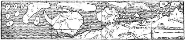
Edrisi’s representation of Northern Europe, put together, and much reduced, from eight of his maps. (Chiefly after Seippel’s reproduction [1896] and after Lelewel [1851].) Some of the Arabic names are numbered on the map and given below according to Seippel’s reading
(1) “Khâlia” (empty); (2) the first part of the 7th climate; (3) “ǵazîrat Birlânda” (the island of Birlânda, by a common error for Ireland); (4) “kharâb” (desert); (5) the island of “Dans” or “Vans” (Seippel reads Wales); (6) “ǵazîrat Angiltâra” (the island of England); (7) “ǵazîrat Sqôsia” (the island, or peninsula, of Scotland); (8) “al-baḥr al-muslim ash-shamâlî” (the dark northern ocean); (9) “ǵazîrat Islânda” (the island of Iceland); (10) “ǵazîrat Dânâmarkha” (the island, or peninsula, of Denmark); (11) “Hrsns” (Horsens); (12) “Alsia” (Als ?); (13) “Sliaswiq”; (14) “Lundûnia” (Lund); (15) “sâḥil arḍ Polônia” (the coast of Poland); (16) “Derlânem” (Bornholm ?); (17) “Landsu(d)den” (in Finland); (18) “Zwâda” (Sweden); (19) “nahr Qutalw” (the Göta river); (20) “ǵazîrat Norwâga” (the island of Norway); (21) may be read “Trônâ” (Trondheim); (22) “‘Oslô” (Oslo); (23) “Siqtûn”; (24) “bilâd Finmark” (the district of Finmark); (25) “Qalmâr”; (26) “Abûda” (Åbo ?); (27) “mabda’ nahr D(a)n(a)st” (the beginning of the river Dniestr ?); (28) “arḍ Tabast” (the land of Tavast); (29) “Daġwâda” (Dagö ?); (30) “ǵazîrat Amazânûs er-riǵâl al-maǵûs” (the island of the male heathen Amazons); (31) “ǵazîrat Amazânûs an-nisâ” (the island of the female Amazons)
[Pg 204]On the outside of all is the Dark Sea [i.e., Oceanus, the uttermost encircling ocean], which thus forms the limit of the world, and no one knows what is beyond it. After describing Angiltâra [England] with its towns, Edrisi continues:
“Between the end of Sqôsia [Scotland], a desert island [i.e., peninsula],[189] and the end of the island of Irlânda is reckoned two days’ sail to the west. Ireland is a very large island. Between its upper [i.e., southern, as the maps of the Arabs had the south at the top] end and Brittany is reckoned three and a half days’ sail. From the end of England to the island of Wales (?)[190] one day. From the end of Sqôsia to the island of Islânda two-thirds of a day’s sail in a northern direction. From the end of Islânda to the great island of Irlânda one day. From the end of Islânda eastward to the island of Norwâga [Norway] twelve miles (?).[191] Iceland extends 400 miles in length and 150 in breadth.”
Dânâmarkha is described as an island, round in shape and with a sandy soil; on the map it is connected with the continent by a narrow isthmus. There are “four chief towns, many inhabitants, villages, well protected and well populated ports surrounded by walls.” The following towns are named: “Alsia” [Als ?], “Tordîra” or “Tondîra” [Tönder], “Haun” [Copenhagen], “Horsnes” [Horsens], “Lundûna” [Lund], “Slisbûlî” [Sliaswiq ?]. From “Wendilskâda,” written “Wadî Lesqâda” [Vendelskagen], it is a half-day’s sail to the island of “Norwâġa” [Norway]. An island to the east of Denmark and near Lund is called on the map “Derlânem” [Bornholm ?].
[Pg 205]On the continent to the south of Denmark is the coast of “Polônia” [Poland], and to the east of it, also on the continent, is “Zwâda” [Sweden], and a town “Gûta” [Götaland], also “Landsu(d)den” [in Finland]. We have further the river “Qutelw” [the Göta river], on which is the town of “Siqtun.” There is also “Qîmia” [Kemi ?]. Farther east is “bilâd Finmark” [the district of Finmark],[192] where we still find the river Qutelw with the town of “Abûda” [Åbo ?] inland, and “Qalmâr” on the coast near another outlet of the Göta river. These two towns are
“large but ill populated, and their inhabitants are sunk in poverty; they scarcely find the necessary means of living. It rains there almost continually.... The King of Finmark has possessions in the island of Norwâġa.”
Next on the east comes the land of “Tabast” [Tavast] with “‘Daġwâda’ [Dagö ?], a large and populous town on the sea.” In the land of Tabast
“are many castles and villages, but few towns. The cold is more severe than in Finmark, and frost and rain scarcely leave them for a moment.”
Farther east Esthonia and the land of the heathen are also mentioned.
“As regards the great island of Norwâġa [Norway], it is for the most part desert. It is a large country which has two promontories, of which the left-hand one approaches the island of Dânâmarkha, and lies opposite to the harbour that is called Wendilskâda, and between them the passage is short, about half a day’s sail; the other approaches the great coast of Finmark. On this island [Norwâġa] are three inhabited towns,[193] of which two are in the part that turns towards Finmark, the third in the part that approaches Dânâmarkha. These towns have all the same appearance, those who visit them are few, and provisions are scarce on account of the frequent rain and continual wet. They sow [corn] but reap it green, whereupon they dry it in houses that are warmed, because the sun so seldom shines with them. On this island there are trees so great of girth as are not often found in other parts. It is said that there are some wild people living in the desert regions, who have their heads set immediately upon their shoulders[Pg 206] and no neck at all. They resort to trees, and make their houses in their interiors and dwell in them. They support themselves on acorns and chestnuts. Finally there is found there a large number of the animal called beaver; but it is smaller than the beaver [that comes] from the mouth of Russia” [i.e., no doubt, from the mouths of the Russian rivers].
“In the Dark Sea [i.e., the outer encircling ocean] there are a number of desert islands. There are, however, two which bear the name of the Islands of the Heathen Amazons. The western one is inhabited solely by men; there is no woman on it. The other is inhabited solely by women, and there is no man among them. Every year at the coming of spring the men travel in boats to the other isle, live with the women, pass a month or thereabouts there, and then return to their own island, where they remain until the next year, when each one goes to find his woman again, and thus it is every year. This custom is well known and established. The nearest point opposite to these islands is the town of Anhô (?). One can also go thither from Qalmâr and from Daġwâda [Dagö ?], but the approach is difficult, and it is seldom that any one arrives there, on account of the frequency of fog and the deep darkness that prevails on this sea.”
Edrisi says that there are many inhabited and uninhabited islands in the Dark Sea to the west of Africa and Europe; indeed, according to Ptolemy “this ocean contained 27,000 islands.” He mentions some of them. There is an island called “Sâra,” near the Dark Sea.
“It is related that Ḏu’l-Qarnain (Alexander the Great ?) landed there before the deep darkness had covered the surface of the sea, and spent a night there, and that the inhabitants of the island attacked him and his companions with stones and wounded many of them [cf. the Skrælings’ attack in Eric the Red’s Saga, and the island of smiths in the Navigatio Brandani, vol. i. p. 328; vol. ii. p. 9]. Another island in the same sea is called the Isle of Female Devils (‘ǵazîrat as-sa’âlî’), whose inhabitants resemble women more than men; their eyeteeth protrude, their eyes flash like lightning, their cheeks are like burnt wood; they speak an incomprehensible language and wage war with the monsters of the ocean....”
He also mentions the Isle of Illusion (“ǵazîrat khusrân” == “Villuland,” cf. vol. i. p. 377), of great extent, inhabited by men of brown colour, small stature, and with long beards reaching to their knees; they have a large (broad)[194] face and long ears [cf. the ideas of the Pygmies, dwarfs, underground people and[Pg 207] brownies], they live on plants that the earth produces of itself. There was a further large island “al-Ġaur,” with abundance of grass and plants of all kinds, where wild asses and oxen with unusually long horns lived in the thickets. There was the Isle of Lamentation (“ǵazîrat al-mustashkîn”), which was inhabited, and had mountains, rivers, many trees, fruits and tilled fields; but where there was a terrible dragon, of which Alexander freed the inhabitants. On the island of “Kalhân” in the same sea the inhabitants have the form of men but animal heads; another island was called the Isle of the Two Heathen Brothers, who practised piracy and were changed into two rocks. He also names the Island of Sheep and “Râka,” which is the Island of Birds (cf. pp. 51, 55).
“To the islands in this sea belongs also the island of ‘Shâsland’ [presumably Shetland, perhaps confused with Iceland], the length of which is fifteen days’ journey, and the breadth ten. It had three towns, large and populous; ships put in and stayed there to buy ambra (amber ?) and stones of various colours; but the majority of the inhabitants perished in dissensions and civil war which took place in the country. Many of them removed to the coast of the European continent, where large numbers of this people still live....”
What is here said about this island is approximately the same as Edrisi elsewhere states about the island of Scotland, following the “Book of Wonders,” which is attributed to Mas’ûdî.
It will be seen that he has a very heterogeneous mixture of islands in this western ocean. Some of them, like the Island of Sheep and that of Birds, as already suggested (p. 55), probably came from Ireland, and this whole archipelago is evidently related to the numerous islands of Irish legend, and points to an ancient connection, which may have consisted in reciprocal influence; while many of these conceptions travelled from the east through the Arabs to western Europe and Ireland, the Arabs again may have received ideas from the Irish and from western Europe and carried them to the east. Thus Edrisi relates that, according to the author [Mas’ûdî] of the “Book of Wonders,” the king of France sent a ship (which[Pg 208] never returned) to find the island of Râkâ; we may therefore conclude that the Arabs had this myth from Europe. That many of these islands are inhabited by demons and little people, who resemble the northern brownies and the Skrælings, is interesting, and shows that whether the myths came from the Irish to the Arabs or vice versa, there were in this mythical world various similar peoples who may have helped to form the epic conceptions of the Skrælings of Wineland (cf. pp. 12, 75).
Edrisi’s map of the world is to a great extent an imitation of Ptolemy’s, but shows much deviation, which may resemble the conceptions of Mela, for instance. It might seem possible that Edrisi was acquainted with some Roman map or other. In his representation of the west and north coast of Europe, for instance, there are also remarkable resemblances to the so-called Anglo-Saxon map of the world (cf. vol. i. p. 183; vol. ii. p. 192); this may point to both being derived from some older source, perhaps a Roman map (?).[195]
Abu’l-Hasan ‘Alî Ibn Sa‘îd (1214 or 1218-1274 or 1286) says (in his book: “The extent of the earth in its length and breadth”)[196] of Denmark (the name of which he corrupts to “Ḥarmûsa”) that from thence are obtained true falcons (for hunting):
“Around it are small islands where the falcons are found. To the west lies the island of white falcons, its length from west to east is about seven days and its breadth about four days, and from it and from the small northern islands are obtained the white falcons, which are brought from here to the Sultan of Egypt, who pays from his treasury 1000 dinars for them, and if the falcon arrives dead the reward is 500 dinars. And in their country is the white bear, which goes out into the sea and swims and catches fish, and these falcons seize what is left over by it, or what it has let alone. And on this they live, since there are no [other][Pg 209] flying creatures there on account of the severity of the frost. The skin of these bears is soft, and it is brought to the Egyptian lands as a gift.”
He speaks of the women’s island and the men’s island which are separated by a strait ten miles across, over which the men row once a year and stay each with his woman for one month. If the child is a boy, she brings it up until it reaches maturity, and then sends it to the men’s island; the girls stay on the women’s island.
“To the east of these two islands is the great Saqlab island [i.e. the Slavs’ island, which is Edrisi’s Norwâġa], behind which there is nothing inhabited in the ocean either on the east or north, and its length is about 700 miles, and its width in the middle about 330 miles.” Then he says a good deal about the inhabitants, amongst other things that they are still heathens and worship fire, and on account of the severity of the cold do not regard anything as of greater utility than it. This is evidently the same error as in Ibn Diḥya, due to the designation of “Maǵûs” (== Magian) for heathen (cf. p. 201).
Zakarîyâ Ibn Muḥammad al-Qazwînî (ob. 1283) has in his cosmography[197] several statements about the North, some of which have already been referred to (vol. i. pp. 187, 284; vol. ii. p. 144). Of the northern winter he has very exaggerated ideas. Even of the land of “Rûm” [the Roman, especially the Eastern Roman Empire; in a wider sense the countries of Central Europe] he says that winter there has become a proverb, so that a poet says of it:
“Winter in Rûm is an affliction, a punishment and a plague; during it the air becomes condensed and the ground petrified; it makes faces to fade, eyes to weep, noses to run and change colour; it causes the skin to crack and kills many beasts. Its earth is like flashing bottles, its air like stinging wasps; its night rids the dog of his whimpering, the lion of his roar, the birds of their twittering and the water of its murmur, and the biting cold makes people long for the fires of Hell.”
He says of the people of Rûm [i.e., the Germanic peoples of Central Europe] that “their complexion is for the most part fair on account of the cold and the northern situation, and their hair red; they have hardy bodies, and for the most part are given to cheerfulness and jocularity, wherefore the astronomers place them under the influence of the planet Venus.”
[Pg 210]Of the cold in “Ifranǵa” [the land of the Franks, Western Europe] he says that it
“is quite terrible, and the air there is thick on account of the excessive cold.”[198]
“‘Burǵân’ [or ‘Bergân,’ as the first vowel is doubtful] is a land which lies far in the north. The day there becomes as short as four hours and the night as long as twenty hours, and vice versa [cf. Ptolemy on Thule, vol. i. p. 117]. The inhabitants are heathens [‘Maǵûs’] and worshippers of idols. They make war on the Slavs. They resemble in most things the Franks [West Europeans]. They have a good understanding of all kinds of handicraft and ships.”
Professor Seippel considers it not impossible that there may here be a corruption of the Arabic Nurmân [== Normans] to Burǵân, and to a layman this looks probable. In any case Burǵân cannot here, as elsewhere in Arab authors, be Bulgar [the Bulgarians]; on the other hand it might be the Norwegian town of Bergen. In any case the description seems to suit the Norwegians best, and the mention of Ptolemy’s latitude for Thule (the longest night of twenty hours) also points to this. That they are said to be heathens is due again to the name “Maǵûs” (cf. pp. 201, 209).
Qazwînî also[199] tells us that
“Warank is a district on the border of the northern sea. For from the ocean in the north a bay goes in a southerly direction, and the district which lies on the shore of this bay, and from which the bay has its name, is called Warank. It is the uttermost region on the north. The cold there is excessive, the air thick, and the snow continuous. [This region] is not suited either for plants or animals. Seldom does any one come there, because of the cold and darkness and snow. But Allâh knows best [what is the truth of the matter].”
As mentioned above (p. 199), elsewhere in Arab writers the Varangians’ Sea undoubtedly meant the Baltic; but here, as is also suggested by Professor Seippel, one might be tempted to think that it is Varanger or the Varanger-fjord in Finmark that is intended.[200] It may also be recalled that Edrisi already[Pg 211] knew the name of Finmark. But as Qazwînî has such exaggerated ideas of the cold in Rûm and in Ifranǵa, he may also be credited with such a description of the regions on the Baltic.[201] No importance can be attached to the statement that the bay proceeds from the northern ocean in a southerly direction, as ideas of that kind were general.
Mahmûd ibn Mas ûd ‘ash-Shîrâzî (ob. 1310) has the following about the northern regions:[202]
“Thus far as regards the islands: you may know that in that part [of the sea] which goes into the north-western quarter [of the earth] and is connected with the western ocean there are three, whereof the largest is the island ’Anglîsî‘ [or ’Anglisei‘ (-island), probably England], and the smallest the island Irlânda. The most handsome of hunting-birds—those that are known by the name of ’sunqur‘ [hunting-falcons]—are only found on it [this island]. The middlemost of them is the island of Orknia.” Probably Ireland and Iceland are here thrown together under the name of Irlânda, as elsewhere falcons are especially attributed to the latter. “The longest day reaches twenty hours where the latitude is 63° [cf. Ptolemy, vol. i. p. 117]. There is an island that is called Tûlê. Of its inhabitants it is related that they live in heated bathrooms [literally, warm baths] on account of the severe cold that prevails there. This is generally considered to be the extreme latitude of inhabited land.” It appears to be Norway that is here meant by Thule.
Shîrazî says that “the sea that among the ancients was called Mæotis is now called the Varangians’ Sea, and these are a tall, warlike people on its shore. And after the ocean has gone past the Varangians’ country in an easterly direction[Pg 212] it extends behind the land of the Turks, past mountains which no one traverses and lands where no one dwells, to the uttermost regions of the land of the Chinese, and because these are also uninhabited, and because it is impossible to sail any farther upon it [the ocean], we know nothing of its connection with the eastern ocean.”
Shams ad-dîn Abû ‘Abdallâh Muḥammad ad-Dimashqî (1256-1327) in his cosmography has little of interest about the North, and his ideas on the subject are obscure.
“The habitable part of the earth extends as far as 665⁄12°;[203] the regions beyond, up to 90°, are desert and uninhabited; no known animals are found there on account of the great quantity of snow and the thick darkness, and the too great distance from the sun.... It is the climate of darkness.” It lies in the middle of the seventh climate, which surrounds it as a circular belt, and “around it the vault of heaven turns like the stone in a mill.”
“The sea beyond the deserts of the Qipdjaks [southern Russia, Turkestan and western Siberia] in latitude 63° has a length of eight days’ journey, with a breadth varying to as little as three. In this sea there is a great island [probably Scandinavia], inhabited by people of tall stature, with fair complexions, fair hair and blue eyes, who scarcely understand human speech.[204] It is called the Frozen Sea because in winter it freezes entirely, and because it is surrounded by mountains of ice. These are formed when the wind in winter breaks the waves upon the shore; as they freeze they are cast upon the icy edges, which grow in layers little by little, until they form heights with separate summits, and walls that surround them.”[205]
He has besides various strange fables about the northern regions and the fabulous creatures there. Of the sea to the north of Britain he says that its coasts
“turn in a north-westerly direction, and there is the great bay that is called the Varangians’ Sea, and the Varangians are an inarticulate people who scarcely understand human speech, and they are the best of the Slavs, and this arm of the sea is the Sea of Darkness in the north.”
[Pg 213]Afterwards the coasts extend farther still to the north and west, and lose themselves in the climate of Darkness, and no one knows what is there.
Of the whales he says that in the Black Sea a kind of whale is often seen which the ignorant assert to have been carried by angels alive into Hell, to be used for various punishments, while others think it keeps at the bottom of the sea and lives on fish;
“then Allâh sends to it a cloud and angels, who lift it up out of the sea and cast it upon the shore for food for Yâǵûǵ and Mâǵûǵ. The whales are very large in the Mediterranean, in the Caspian Sea(!) and in the Varangians’ Sea(!), as also off the coasts of Spain in the Atlantic Ocean.”
There is preserved an “abstract of wonders” (oldest MS. of 1484),[206] by an unknown Arab author, which gives a picture of the Arabs’ mythical ideas in the tenth century. It also tells of islands in the west, which are of interest to us on account of their resemblance to many of the mediæval mythical conceptions of Western Europe.
“In the great ocean is an island which is visible at sea at some distance, but if one tries to approach it, it withdraws and disappears. If one returns to the place one started from, it is seen again as before. It is said that upon this island is a tree that sprouts at sunrise, and grows as long as the sun is ascending; after midday it decreases, and disappears at sunset. Sailors assert that in this sea there is a little fish called ‘shâkil,’ and that those who carry it upon them can discover and reach the island without its concealing itself. This is truly a strange and wonderful thing.”
This is evidently the same myth as that of the Lost Isle, already referred to (Perdita, cf. vol. i. p. 376), and of the Norwegian huldrelands, etc. It also bears resemblance to legends from China and Japan. The tree is the sun-tree of the Indian legends, which was already introduced into the earliest versions of the Alexander romance (Pseudo-Callisthenes, circa 200 A.D.), and which is met with again in the fairy-tales and mythical conceptions of many peoples.[207] Possibly it is this same tree that grows on the mountain Fusan in the Japanese happy land Horaisan, and which is sometimes seen over the sea horizon (see p. 56).
“The island of ‘as-Sayyâra.’ There are sailors who assert that they have often seen it, but they have not stayed there. It is a mountainous and cultivated island, which drifts towards the east when a west wind is blowing, and vice versa.[Pg 214] The stone that forms this island is very light.... A man is there able to carry a large mass of rock.” This floating island resembles those met with in tales from the Faroes and elsewhere (cf. vol. i. pp. 375, f.). Even Pliny [Nat. Hist., ii. c. 95] has statements about floating islands, and Las Casas, in 1552-61 [Historias de las Indias in “Documentos ineditos,” lxii. p. 99], says that in the story of St. Brandan many such islands (?) are spoken of in the sea round the Cape Verde Islands and the Azores, and he asserts that “the same is mentioned in the book of ‘Inventio fortunata,’” that is, by Nicholas of Lynn [cf. de Costa, 1880, p. 185].
“‘The Island of Women.’ This is an island that lies on the borders of the Chinese Sea. It is related that it is inhabited only by women, who become pregnant by the wind, and who bear only female children; it is also said that they become pregnant by a tree, of which they eat the fruit.[208] They feed on gold, which with them grows in canes like bamboo.” This myth, as will be seen, resembles Adam of Bremen’s tale of the land of women, Kvænland (vol. i. p. 186). Myths of women’s islands are, moreover, very widespread; they are found in various forms in classical authors (p. 47), in Arab writers (cf. above, pp. 197, 206), in Indian legends, among the Irish (vol. i. pp. 354, 357), among the Chinese, etc. It is partly the Amazon idea that appears here, partly the happy land desired by men.
Through an apparently small thing the Arabs possibly exercised more than in anything else a transforming influence upon the navigation, geography and cartography of Europe; for it was probably they who first brought to Europe the knowledge of the magnetic needle as a guide. We know that the Chinese were acquainted with it, at any rate in the second century A.D., and used it for a kind of compass for overland journeys. Whether they also used it at sea we do not know, but it may readily be supposed that they did. That the Arabs through their direct commercial intercourse with the Chinese became acquainted with this discovery at an early date seems probable; but curiously enough we hear nothing of it in Arabic literature before the thirteenth century. As the Arabs and Turks after that date used the Italian word “bossolo” for compass (bussol), it has been thought that they may have derived their knowledge of it, not from China, but from Italy; but it seems more reasonable to suppose that, while they had their first knowledge of the magnetic needle from China, they[Pg 215] obtained an improved form of the compass from Italy, and with it the Italian word.
COMPASS-CHARTS
We do not know how early the magnetic needle’s property of pointing to the north became known in Europe and used for finding the way at sea. The first mention of it is found at the close of the twelfth century in the works of the Englishman Alexander Neckam, professor in Paris about 1180-1190, and of the troubadour Guyot de Provins from Languedoc. The latter, in a satirical poem of about 1190, wishes the Pope would imitate the immutable trustworthiness of the polar star by showing the steadiness of the heavenly guide; for sailors come and go by this star, which they are always able to find, even in fog and darkness, by a needle rubbed with the ugly brown lodestone; stuck in a straw and laid upon water, the needle points unfailingly to the north star. As late as in 1258 Dante’s teacher, Brunetto Latini, saw as a curiosity in the possession of Roger Bacon at Oxford a large and ugly lodestone, which was able to confer on an iron needle the mysterious power of pointing to the star; but he thinks that it cannot be of any use, for ship-masters would not steer by it, nor would sailors venture to sea with an instrument which was so like an invention of the devil. As always when the progress of humanity is at stake, orthodoxy and religious prejudice raises its head. It is certain that the use of the compass-needle must have been known in the Mediterranean at the beginning of the thirteenth century, and probably even in the twelfth. It has been alleged that the compass was known long before that time, even in the eleventh and tenth centuries; but no proof of this has been found, and it does not appear very probable.[209] How early the compass, or lodestone, was known in the North[Pg 216] is uncertain. We only know that when the Hauksbók was written, at the beginning of the fourteenth century, it was at any rate known in Iceland (cf. vol. i. p. 248); but it may of course have been known before that time, and it does not appear that any long time elapsed between the instrument’s being known in the Mediterranean and its reaching the Scandinavians.
When the compass came into general use on Italian ships in the thirteenth century, it naturally led to the development of an entirely new type of map, the Italian sea-charts or compass-charts, which were to be of fundamental importance to all future cartography. The mediæval maps of the world already mentioned were learned representations which were of no practical use to the navigator. The Greeks had drawn land-maps which were also of no great use at sea, and we do not know that they had sea-charts. On the other hand sailing-books (“peripli”), which gave directions for coasting voyages, were in use far back in antiquity. In the Middle Ages sailing-books, called “portolani,” which gave information about harbours, distances, etc., were an important aid to the navigator, especially in the Mediterranean. It was the Italians before all others who at that period developed navigation. When coasting was to some extent replaced by sailing in open sea, after the compass came into use, sea-charts became a necessary adjunct to the written sailing-books or portolani. How early they began to be developed is unknown; we only know that charts were in use on Italian ships in the latter half of the thirteenth century;[210] and we must suppose that they were employed long before that time. Whether, as some have maintained, there was a connection between these charts and the maps of the Greeks is doubtful, though there may indeed have been an indirect connection through the Arabs, among whom Edrisi, for instance, seems perhaps to have exercised some influence. But in any case it is certain that the Italians[Pg 217] of the Middle Ages were not acquainted with Greek cartography, and this may in a way be regarded as an advantage; for they were thus obliged to invent their own mode of representation. For Greek thought the chief thing was to find the best expression for the system of the world and the “œcumene,” to solve problems such as the reduction of a spherical to a plane surface by projection, etc.; while the sense of accurate detail was less prominent. The Italian sailor and cartographer went straight to nature, unhindered by theory, and to him it appeared a matter of course to set down on the map coasts and islands as accurately as possible according to the course sailed and the distance, without reflecting that sea and land form a spherical surface.
The Italian sea-charts seem especially to have been developed in the republics of northern Italy, Genoa and Pisa, and to some extent Venice. Later the Catalans of the Balearic Isles and of Spain (Barcelona and Valencia) also learned the art, probably from Genoa. The charts have been justly admired for their correct and detailed representation of the coasts known to the Italians and the seamen of the Mediterranean; the world had never before produced any parallel to such a representation. It shows that the sailors of that time were masters in the use of their compass,[211] and in making up their reckoning. The remarkable thing is that the first known compass-charts, of the beginning of the fourteenth century, were already of so perfect a form that there was little to add to or improve in them in later times. It looks as though this type of chart suddenly sprang forth in full perfection, like Athene from the brain of Zeus, without our knowing of any forerunner; it held the field with its representation of the coasts of the Black Sea, the Mediterranean, and Western[Pg 218] Europe almost unaltered through three centuries. There is something puzzling in that. We must suppose in any case that these charts were developed through many smaller special charts throughout the whole of the thirteenth century, but even that seems a short period for the development of a representation so complete as this, which thenceforward became almost stereotyped. It is principally the coasts that are represented, with many names, while inland there are comparatively few, which of course is natural in sea-charts.
As Italian trade did not extend farther north than Flanders and England (from whence came wool), it is also characteristic of the compass-charts that their detailed representation of the coast extends to the south of England and to Sluis in Flanders, and to the mouth of the Scheldt. Farther than this the Italian ships did not sail; beyond this boundary began the commercial domain of the Hanseatic League. The delineation on the compass-charts of the greater part of Ireland, northern England, Scotland, the north coast of Germany, Denmark, the Baltic and Scandinavia has an entirely different character from that of the more southern coasts. The coast-lines are there evidently drawn in a formal way, and more or less hypothetically; the names (chiefly those of a few ports, bishops’ sees and islands) are also strikingly few. It is clearly seen that these coasts cannot have been drawn from actual compass courses and reckonings; they are sketches based on second- or third-hand information. For this reason too the shape of the northern countries may be subject to considerable variation in the different types of compass-charts.
We know little of the sources from which they may have obtained their delineation of the North; probably they were many and of different kinds. A glance at the maps reproduced (pp. 226, 232) will convince one that their image of the North differed greatly from that which we find on the wheel-maps, and from that which was probably shown on the maps of antiquity. It is a decisive step in the direction of reality, although the representation is still imperfect. In a whole series of these[Pg 219] charts the image of the North shows certain typical features. The coast of Germany and Jutland goes due north from Flanders, thus coming much too near Britain, and the North Sea becomes nothing but a narrow strait. Even on the earliest charts (Dalorto’s chart, p. 226) the shape of Jutland is quite good. Norway, the coasts of which are indicated by chains of mountains, is placed fairly correctly in relation to Jutland, but is put too far to the west and too near to England. It is also made too broad. The Skagerak appears more or less correctly, but the Danish islands, including Sealand, usually as a round island, are placed in the Cattegat to the north-east of Jutland. This greatly distorts the picture. Sweden is much too small, and is given too little extension to the south; the Baltic has a curious form: it extends far to the east and has a remarkable narrowing in the middle, through the German coast making a great bend to the north towards Sweden. Gotland lies in the great widening of its inner portion. The Gulf of Bothnia seems to be unknown. The islands to the north of Scotland: Shetland (usually called “scetiland,” “sialanda” or “stillanda”), the Orkneys, and often Caithness as an island, come to the west of Norway, frequently placed in a somewhat arbitrary fashion, and in the wrong order. “Tille” (Thule), the round island off the north-east coast of Scotland, is a characteristic feature on many compass-charts. Its origin is uncertain, but possibly it may be connected with the Romans having thought they had seen Thule to the north of the Orkneys (?) (cf. vol. i. p. 107). The names in the North are in the main the same on most of the compass-charts,[212] and one cartographer has copied another; by this means also many palæographic errors have been introduced, which are afterwards repeated. As an example: the Baltic is originally called “mar allemania,” this is read by Catalan draughtsmen as “mar de lamanya,” also written “de lamãya,” and thus we get “mar de la maya” (cf. pp. 231, 233). Another[Pg 220] example: Bergen is originally called “bergis” (cf. p. 221), a draughtsman corrupts this to “bregis,” and that becomes the name of the town in later charts (cf. p. 232). Whence these names first came we do not know; partly, no doubt, from sailors, and partly from literary sources. The latter must be true of names in the interior. There are also various legends or inscriptions on these charts, e.g., in Norway, in Sweden, in the Baltic, on the islands in the Northern Ocean, and in Iceland. Many of these legends can be certainly proved to have a literary origin. Some of them (e.g., that attached to Norway) may be derived in part from the Geographia Universalis. Others are connected with such authors as Giraldus Cambrensis, Higden, and others. Certain resemblances to Arabic writers, especially Edrisi, might also be pointed out; but it is uncertain whether these are not due in part to their being derived from a common source.
The first known compass-chart, the so-called “Carte Pisane,” of about 1300,[213] goes no farther north than to the coast of Flanders and southern England. But the compass-chart[214] drawn by the Genoese priest Giovanni da Carignano (ob. 1344), evidently a little after 1300, already gives a delineation of Great Britain, Ireland, the Orkneys and Scandinavia, with the Baltic. That these regions are only represented hypothetically, and do not belong to the compass-chart proper, is also indicated by their partly lying outside the network of compass-lines. It is in the main a land map, with many names in the interior of the continents, but the delineation of the known coasts (to the south of Flanders) is evidently taken from the sea-charts. The representation of the British Isles and of the North reminds one a good deal of the Cottoniana map (cf. vol. i. p. 183), and of Edrisi’s representation (cf. p. 203);[215] as an example: it is[Pg 221] difficult to suppose that the western inclination of Scotland should have come about independently on each of the three maps. There is also considerable resemblance to Edrisi in the names on other parts of the chart; but Carignano has no hint of Edrisi’s “Island,” nor of the Cottoniana’s island of Tylen (Thule). Whether his Scandinavia is a peninsula, as usually asserted, and not rather a long island, as on the two maps in question, is uncertain, since the delineation has suffered a good deal and is indistinct in the inner part of the Baltic. To judge from a photograph of the chart [Ongania, Pl. III.] it appears to me most probable that it was an island, which then has considerable resemblance to the island of Norwâġa [Norway] in Edrisi. Names that are legible on this island or peninsula are: “noruegia,” “finonia” [Finmark or Finland], “suetia”; also “bergis” [Bergen], “tromberg” [Tönsberg], “uamerlant” [Vermeland], “scarsa” [Skara on Lake Vener], “kundgelf” [Kungelf], “scania” [Skåne], “lendes” [Lund], “stocol” [Stockholm], etc. On the two islands in the Baltic there are “scamor” [i.e., “scanior” ? Skanör] and “gothlanda” [Gotland]. Many of these names appear here for the first time in any known authority. Carignano may have taken them from older unknown maps, but he may also in some way or other have received information from the North; possibly, for instance, he may have had the names of ports, etc., from sailors. His representation of the western part of Scandinavia, with three long peninsulas (cf. Saxo), is curious; of these the[Pg 222] eastern, with “scania,” might be south Sweden with Skåne; the central one with “tromberg” [Tönsberg] might be Vestfold and Grenmar, and the western with Bergen might be western Norway. The smaller peninsula to the north might be Tröndelagen [the district of Trondhjem] (cf. also Historia Norwegiæ, below, p. 235).
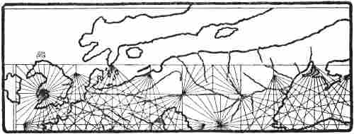
Northern portion of Carignano’s chart (a few years later than 1300)
Between the years 1318 and 1321 the Venetian Marino Sanudo wrote a work, “Liber secretorum fidelium crucis” (the Book of Secrets for Believers in the Cross), to rouse enthusiasm for a new crusade, and himself presented a copy of it with a dedication to the Pope at Avignon, which is probably one of the two now preserved at the Vatican. The work is accompanied by several charts which must have been drawn by the well-known cartographer Pietro Vesconte in 1320, since an atlas bearing his name has been found in the Vatican with charts that completely correspond.[216] Among them is a circular map of the world of the wheel type, but on which the forms of the coasts from the compass-charts are introduced. Scandinavia is there represented as a peninsula with a mountain chain (Kjölen ?) along the middle (see map, p. 223), and the names “Gotilandia,” “Dacia,” “Suetia,” “Noruega” may be read. On the continent is written “Guenden [Kvænland, or else == “Suenden” == Sweden ?] vel Gotia”; and on the coast to the north of the peninsula is “Liuonia” and to the south of it “Frixia” [Friesland]. As Kretschmer has shown, Scandinavia was originally drawn (in both atlases) as an island, but was afterwards connected with the continent by a narrow isthmus. This representation of Scandinavia as a peninsula resembles that on many of the wheel-maps mentioned above (see pp. 185, ff.). It also bears a strong resemblance to the view of Saxo (beginning of the thirteenth century), who says:[217]
[Pg 223]“Moreover the upper arm of the ocean [i.e., the southern arm, the Baltic, as the south is supposed to be at the top of the map], which cuts through and past Dania, washes the south coast of Gothia [Götaland, i.e., Sweden] with a bay of fair size; but the lower [northern] branch, which goes past the north coast of Gothia and Noruagia, turns towards the east with a considerable widening, and is bounded by a curved coast. This end of the sea was called by our ancient primæval inhabitants Gandvicus. Between this bay and the southern sea lies a little piece of continent, which looks out upon the seas washing it on both sides. If nature had not set this space as a limit to the two almost united streams, the arms of the sea would have met one another, and made Suetia and Noruagia into an island.”
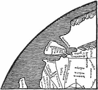
Northern Europe in Vesconte’s mappamundi (1320)
in the Vatican (Kretschmer, 1891)
It seems not improbable that the delineation on Vesconte’s map may have a connection with this description; it has also very nearly the same forms of names. The regions far in the north and east on his map are pure fancy, and the “rifei montes” are still found there.
Eight other MSS. (in various libraries) of Sanudo’s work are known, accompanied by maps, and six of them have the circular mappamundi; but the reproductions differ considerably one from another, especially in the representation of the northern coast of Europe.[218] The mappamundi in the MS. in Queen Christina’s collection in the Vatican (Codex Reginensis, 548), and the exactly similar map in the MS. at Oxford, have a remarkably good delineation of the Scandinavian Peninsula (see map, p. 224), with the names “Suetia” [Svealand], “Gotia” [Götaland], and “Scania” on the east, “Noruegia”[Pg 224] on the west, “Finlandia” and “Alandia” [Åland, or perhaps Hallandia ?] in the extreme north-east. On the continent is written “Kareli infideles,” “Estonia,” “Liuonia,” etc. In the Baltic are two islands, “Gotlandia” in the middle, and “Ossilia” [Ösel] farthest in. The shape of Jutland [with the names “Dacia” and “Jutia”], the direction of the coast of northern Europe and the Baltic, with Scandinavia parallel to it, remind one a good deal of Edrisi’s map, of the Cottoniana and also of Carignano’s map. Evidently there is here new information which Vesconte did not possess when he drew the map previously mentioned; the correct placing of the names in Sweden and Norway is especially striking. These names, as also “Jutia,” occur in Saxo in approximately the same forms (cf. also Historia Norwegiæ). Marino Sanudo, according to his own statement, had himself sailed from Venice to Flanders, and had also travelled in Holstein and Slavonia. He was thus able to collect geographical information, and, as suggested by Björnbo [1909, pp. 211, f.], may have received communications from North German priests whose picture of the North had been formed by the study of Adam of Bremen and Saxo; but there does not appear to me to be any necessity for such a hypothesis, he may just as well have received direct information from people who knew the localities, while doubtless the names are to a great extent literary. If we suppose that it was Pietro Vesconte who drew all the maps, he may have derived his information about the North through Sanudo himself; but in that case it[Pg 225] would be strange that he did not use it for his first map. We must therefore suppose that it was after this that their real collaboration began.
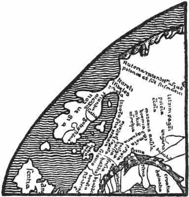
Northern Europe in the mappamundi in the MS. of
Sanudo’s work at Oxford (Björnbo, 1910, p. 123)
But here we come upon another difficulty, and this is the third entirely different form of the delineation of the North that is found in the corresponding mappamundi in the MS. of Sanudo at Paris. There the Scandinavian Peninsula is divided in an unaccountable way into several islands, the largest of which bears the name “scania de regno dacie” or “scãdinaua.” To the north of it is a long island, “gotlandia,” which has been read by some “yrlandia” or “yslandia,” and made into Iceland [as in Thoroddsen, i., 1897, p. 84]. “Noruegia” is written outside the border of the map to the north of Jutland [called “dacia”], and the name “prouincia noruicie” is placed on the west coast of Jutland, which has been given a fantastic extension towards the north with many bays. An island in the ocean to the north of Russia [“rutenia”] is marked “kareli infideles.” The whole of this representation is in complete disagreement with the other Sanudo maps, and it is difficult to understand that Vesconte can have also drawn this one, although in other respects it may bear much resemblance to the rest from his hand. One might be inclined to think that some other man had tinkered at this part of the map, introducing ideas which he entirely misunderstood.
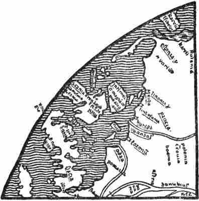
Northern Europe in the mappamundi in the Paris MS.
of Sanudo’s work (Björnbo, 1910, p. 123)
A remarkable thing about it is that it is, perhaps, the first that has a legend about the North. For on the large island in the Baltic (?) we read: “In hoc mari est maxima copia aletiorum” [in this sea is the greatest abundance of [Pg 226]herrings ?]. In the opinion of Björnbo this may allude to the herring fishery in the Sound.[219]
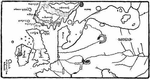
The North on Dalorto’s map of 1325. The network of compass-lines is omitted
for the sake of clearness. Only a few of the names are given
The type which is first known from Angellino Dalorto’s map of 1325 (or 1330 ?), and from that of 1339 signed Angellino Dulcert, which is undoubtedly by the same man, was of fundamental importance to the representation of the North on the Catalan compass-charts. It has been thought that he belonged to a well-known Genoese family named Dalorto, and that the first map was drawn in Italy, while the latter was certainly drawn in Majorca, either by a copyist who corrupted the name of Dalorto to Dulcert, or by himself, who in that case must be supposed to have given his name a more Catalan sound on settling in Majorca. But in any case these maps had Italian models; this appears clearly in the form of the names [cf. Kretschmer, 1909, pp. 118, f.].
The two maps are much alike. The oldest, of 1325[Pg 227] (1330 ?),[220] gives a more complete representation of the North and of the Baltic than any earlier map known (see illustration). In its names it shows a connection both with Carignano’s map and with Marino Sanudo, but new names and fresh information have been added, the delineation of Great Britain and Ireland is more correct, and there is also a more reasonable representation of Scandinavia and of the extent of the Baltic than on Carignano’s map. Amongst new names in the North may be mentioned “trunde” [Trondhjem, cf. “Throndemia” in the Historia Norwegiæ], and “alogia” for a town on the west side of Norway; this is evidently Halogia [Hálogaland], a form of the name which was used, for instance, in the Historia Norwegiæ and by Saxo. Another name in the far north, and again at the south-western extremity of Norway, is “alolandia” (see illustration, p. 226). One might suppose that the form of the name and its assignment to these two places are due to a confusion of the name Hálogaland with Hallandia (in Saxo) and “alandia” on the Sanudo-Vesconte map (see p. 224).
It will be seen that Norway, which is represented as a pronouncedly mountainous country,[221] has on this map been given a great increase of breadth, so that its west coast is brought to the same longitude as the west coast of Great Britain. In the legends attached to Norway we read that from its deserts are brought “birds called gilfalcos” (hunting falcons), and in the extreme north is the inscription:
“Here the people live by hunting the beasts of the forest, and also on fish, on account of the price of corn which is very dear. Here are white bears and many animals.”
The substance of this may be derived in the main from the Geographia Universalis (cf. pp. 189, f.; see also p. 177). Islands in the ocean to the west of Norway are: farthest north,[Pg 228] “Insula ornaya” [the Orkneys]; farther south, “sialand” [Shetland, “Insula scetiland” on the map of 1339, and “silland” or “stillanda” on later maps]. The resemblance to “shâsland,” the name of an island in Edrisi (cf. above, p. 207), is great, but it cannot be supposed that we have here a corruption of Iceland. At the north-eastern corner of Scotland is the round island, “Insula tille” (cf. p. 219).
In the ocean to the west of Ireland we find for the first time on this map an island called “Insula de montonis siue de brazile.” This island is met with again on later compass-charts under the name of “brazil” as late as the sixteenth and seventeenth centuries.[222] It is evidently the Irish fortunate isle “Hy Breasail,” afterwards called “O’Brazil,” that has found its way on to this map, or probably on to the unknown older sources from which it is drawn. On this and the oldest of the later maps the island has a strikingly round form, often divided by a channel.
The Irish myth of Hy Breasail, or Bresail,[223] the island out in the Atlantic (cf. vol. i. p. 357), is evidently very ancient; the island is one of the many happy lands like “Tír Tairngiri” [the promised land]. In the opinion of Moltke Moe and Alf Torp the name may come from the Irish “bress” [good fortune, prosperity], and would thus be absolutely the same as the Insulæ Fortunatæ. The Italians may easily have become acquainted with this myth through the Irish monasteries in North Italy, unless indeed they had it through their sailors, and in this way the island came upon the map. The form “brazil” may have arisen through the cartographer connecting the name with the valuable brazil-wood, used for dyeing. The channel dividing the island of Brazil on the maps may be the river which in the legend of Brandan ran through the island called “Terra Repromissionis,” and which Brandan (in the Navigatio) was not able to cross. It is probably the river of death (Styx), and possibly the same that became the river at Hop in the Icelandic saga of Wineland (see vol. i. p. 359). We thus find here again a possible connection, and this strengthens the probability that Brazil was the Promised Land of the Irish, which on the other hand helped to form Wineland.
[Pg 229]On later compass-charts several isles of Brazil came into existence. As early as in the Medici Atlas (1351) an “Insula de brazi” appears farther south in the ocean, to the west of Spain, and on the Pizigano map (1367) and the Soleri map (1385) there is to the west of Brittany yet a third “brazir,” afterwards commonly called “de manj,” or “maidas,” etc.[224] The name “Insula de montonis” is difficult to understand. If we may believe it to be an error for “moltonis” (or perhaps “moutonis,” a latinisation of the French “mouton” ?), it might mean the sheep island of the Navigatio Brandani, which was originally Dicuil’s Faroes (cf. vol. i. p. 362). Thus this name also carries us to Ireland.[225]
At the same time another Irish mythical conception has found its way on to the map of 1325, and faithfully attends the isle of “Brazil” on its progress through all the compass-charts of later times; this is the fortunate lake, “lacus fortunatus,” with its islands, “insulle sc̄i lacaris” [Lough Carra or Lough Corrib ?], which were so numerous that there was said later to be one for every day of the year. On Perrinus Vesconte’s map of 1327 the same lake with its many islands is found, and as far as I can read the greatly reduced reproduction[Pg 230] in Nordenskiöld’s Periplus (Pl. VII.) the words are: “gulfo de issolle CCCLVIII.[226] beate et fortunate” (the gulf of the 358 blessed and happy islands), as also found on some later maps.[227] I have not had an opportunity of examining the map of the British Isles in the same draughtsman’s atlas of 1321, to see whether this happy lake and the isle of Brazil are given there; the gulf with the 358 islands is stated to be on Vesconte-Sanudo maps [cf. Harrisse, 1892, pp. 57, f.], which I have also had no opportunity of consulting.
Angellino Dulcert’s (Dalorto’s) map of 1339[228] differs somewhat from the map of 1325 (1330 ?) in its delineation of the North, in that Norway is given a narrower and more rectangular form, with only those four headlands on the south side which are largest on the map of 1325, while the country with the smaller headlands to the west of these is cut away, whereby the narrower shape is brought about.[229]
Dalorto’s maps of 1325 and 1339 furnish the prototype for the representation of the North in later compass-charts; and this persists without important alteration until well into the fifteenth century. But while later Italian charts (cf. Pizigano’s of 1367) more closely resemble the Italian Dalorto map of 1325, the Majorca map of 1339 represents the type of the later Catalan charts. In the one preserved at Modena, and dating from about 1350,[230] the Catalan compass-chart is combined with the representation of the world of the wheel-maps. We find the picture of the North to be the same in all its main outlines; but here a new feature is added, in that Iceland appears as a group of eight islands in the far north-west, out on the margin of the map, with the note: “questas illes son appellades islandes” (these islands are called Icelands). The southernmost island is called “islanda,” the others have incomprehensible names (“donbert,” “tranes,” “tales,” “brons,” [Pg 231] “bres,” “mmau...,” “bilanj” [?]); but the name of Greenland is not found. In the ocean to the north of Norway there is “Mare putritum congelatum” [the putrid, frozen sea]. This is evidently the idea of the stinking Liver Sea (as in Arab myths, cf. p. 51), combined with that of the frozen sea. On the approximately contemporary Catalan compass-chart (see the reproduction, pp. 232-233), preserved in the National Library at Florence (called No. 16), we find the same group of islands called “Island,” with a long inscription (see p. 232; cf. also Björnbo and Petersen, 1908, p. 16), which is partly illegible, but wherein it is stated that “the islands are very large,” that “the people are handsome, tall and fair, the country is very cold,” etc. The name of Greenland does not occur on this chart either.[231]
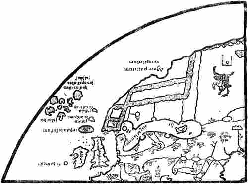
North-western Europe on the wheel-shaped compass-chart at Modena (circa 1350).
The network of compass-lines, names and legends omitted. Mountains indicated by shading
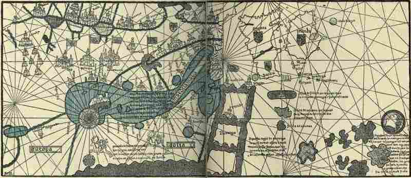
North-western Europe on the anonymous Catalan mappamundi of the middle of the fourteenth century, in the National Library
at Florence. Reproduced mainly from a tracing of the original made by Dr. A. A. Björnbo. The text of the names and legends has
been somewhat enlarged to render it legible in the reduced reproduction. In the legend on the Baltic the erroneous “gronlandia”
is given, while the original has “gotlandia” (according to O. Vangensten)
[Pg 234]The same type of Catalan charts includes Charles V.’s well-known mappamundi, or “Catalan Atlas,” of 1375, as well as Mecia de Viladeste’s chart of 1413,[232] and many others.[233]
We find a different representation of the North, especially of the Scandinavian Peninsula, in the anonymous atlas of 1351, preserved at Florence and commonly called the “Medicean Marine Atlas,”[234] which is an Italian, probably a Genoese, work. The North is here represented on a map of the world[Pg 235] and on a map of Europe (reproduced pp. 236, 260). The representation to a great extent resembles the Dalorto type. Its division of western Scandinavia into three great promontories no doubt recalls the Carignano map to such an extent that one may suppose it to have been influenced by some Italian source of that map; but in the names it shows more resemblance to the Dalorto maps: the delineation of the Baltic and of the peninsula corresponding to Skåne is practically the same, it perhaps resembles in particular the Modena map and the anonymous map at Florence (cf. pp. 232, 233). Jutland, on the other hand, has been greatly prolonged and given a different shape. The three great tongues of land in Norway, with a smaller one on the east near Denmark, may correspond to the four headlands on the south coast of Norway on the Dalorto maps (cf. especially that of 1339). Through these being considerably increased in size, and the bays between them being enlarged, the west coast of Norway has been moved even farther to the west than on the map of 1325, and has been given a somewhat more westerly longitude than Ireland. On the map of Europe “C. trobs” [“capitolum tronberg” ? i.e., Tönsberg] is written on the first bay [like “trunberg” on the Dalorto map], “c. bergis” [“capitolum bergis,” i.e., the see of Bergen] and “c. trons” (?) [the see of Trondhjem] on each of the two other bays. Finally, “alogia,” which on the Dalorto map is marked as a town on the northern west coast of Norway, to the north of Nidroxia [Nidaros], has followed the west coast and is placed on the westernmost tongue of land. How the whole of this delineation came about is difficult to say. One might be tempted to think that it was through a misunderstanding of a description of Norway, like that we find in the Historia Norwegiæ, where the country is described as divided into four parts, the first being the land on the eastern bay near Denmark, the second “Gulacia” [Gulathing], the third “Throndemia,” the fourth “Halogia.”[235][Pg 236] The map of the world in the Medici atlas is drawn in the same way as the compass-charts. It has no names of towns in Scandinavia, and the westernmost tongue of land is without a name (see the reproduction). On the other hand, the name “alolanda” occurs inland in eastern Norway, and is there obviously a corruption of “Hallandia” (cf. p. 227). This mappamundi is interesting from the fact that it makes the land-masses of the continent extend without a limit on the north, whereas Africa is terminated by a peninsula on the south.
The north-western portion of the mappamundi in the Medicean Marine
Atlas (1351). The degrees are here inserted after the maps of Ptolemy
The map of the Venetian Francesco Pizigano, of 1367, resembles Dalorto’s of 1325 in its delineation of the North; the south side of Norway has somewhat the same rounded form with seven headlands, and “Alogia” is a town on the west coast.
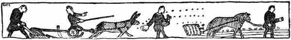
From the Bayeux tapestry, eleventh century
VIEWS OF THE NORTH AMONG THE NORTHERN PEOPLES
It has been already pointed out that, while the oldest northern authority, Adam of Bremen, regarded the countries of the North, outside Scandinavia, as islands in the ocean surrounding the earth’s disc (in agreement with the learned view and with the wheel-maps), the Scandinavians, unfettered by learned ideas, assumed that Greenland was connected with the continent, for the reason, amongst others, that, as the author of the “King’s Mirror” expresses it, continental animals such as the hare, wolf and reindeer could not otherwise have got there. But, as we have seen, this land communication could only be supposed to exist on the far side of Gandvik (the White Sea) and the Bjarmeland (Northern Russia) that they knew, and to go round the north of the sea that lay to the north of Norway. Thus the sea came to be called Hafsbotn (i.e., the bay or gulf of the ocean). We find the clearest expression of this view in the Icelandic geography already referred to, which may in part be attributed to Abbot Nikulás Bergsson of Thverá[236] (cf. vol. i. p. 313; vol. ii. pp. 1, 172), and where we read:
“Nearest Denmark is lesser Sweden [so called to distinguish it from ‘Sviþjóð it Mikla,’ Russia], there is Öland, then Gotland, then Helsingeland, then Vermeland, then two Kvænlands, and they are north of Bjarmeland. From Bjarmeland uninhabited country extends northward as far as Greenland. South of Greenland is Helluland,” etc. [cf. the continuation, above, p. 1]. In a variant of this geography in an older MS. we read: “North of Saxland is Denmark. Through Denmark the sea goes into ‘Austrveg’ [the countries on the Baltic]. Sweden lies east of Denmark, but Norway on the north. To the north of Norway is Finmark. From thence the land turns towards the north-east, and then to the east[Pg 238] before one comes to Bjarmeland. This is tributary to the Garda-king [the king of Gardarike]. From Bjarmeland the land stretches to the uninhabited parts of the north, until Greenland begins. To the south of Greenland lies Helluland,” etc.
We have yet a third, later and more detailed variant in the so-called “Gripla,” given in vol. i. p. 288.
The belief in this land connection with Greenland may have originated in, or at any rate have been considerably strengthened by, the discovery of countries such as Novaya Zemlya, Svalbard (Spitzbergen ?), and the northern uninhabited parts of the east coast of Greenland[237] (cf. above, pp. 165, ff.). In addition to this, those sailing the Polar Sea came across pack-ice wherever they went in a northerly direction, closing in the sea and making it like a gulf, and it must therefore have been natural to believe in a continuous coast which connected the countries behind the ice, and which held this fast. The belief in a land connection seems to have been so ingrained that it can scarcely have rested on nothing but theoretical speculations, but must rather have been supported by tangible proofs of this kind.
It was to be expected that the countries on the north of Hafsbotn should become fairylands in popular belief, Jotunheimr and Risaland, inhabited by giants. Even Saxo (beginning of the thirteenth century) says that to the north of Norway
“lies a land, the name and position of which are unknown, without human civilisation, but rich in people of monstrous strangeness. It is separated from Norway, which lies opposite, by a mighty arm of the sea. As the navigation there is very unsafe, few of those who have ventured thither have had a fortunate return.”
As it can hardly be the Christian settlements in Greenland that Saxo refers to as a land without human civilisation, we must doubtless suppose that his land in the north is a confusion of the eastern uninhabited tracts of Greenland with Jotunheimr, as in Icelandic ideas. For Adam of[Pg 239] Bremen already had giants (Cyclopes) on an island in the north, and we have seen that there were similar conceptions in the Historia Norwegiæ (cf. p. 167).
A mediæval Icelandic tale [inserted in Björn Jónsson’s Greenland Annals] says of Halli Geit that
“he alone succeeded in coming by land on foot over mountains and glaciers and all the wastes, and past all the gulfs of the sea to Gandvik and then to Norway. He led with him a goat, and lived on its milk; he often found valleys and narrow openings between the glaciers, so that the goat could feed either on grass or in the woods.”
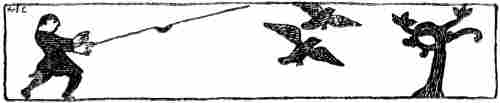
From the Bayeux tapestry, eleventh century
Ideas of this kind led to the view held by some that there was land as far as the North Pole, which appears in an Icelandic tract, included in the “Rymbegla” [1780, p. 466]. Of a bad Latin verse, there reproduced, it is said:
“Some will understand this to mean that he [i.e., the poet] says that land lies under ‘leidarstjarna’ [the pole star], and that the shores there prevent the ring of the ocean from joining [i.e., around the disc of the earth]; with this certain ancient legends agree, which show that one can go, or that men have gone, on foot from Greenland to Norway.”
But the mediæval learned idea of the Outer Ocean surrounding the whole disc of earth also asserts itself in the North, and appears in Snorre’s Heimskringla and in the “King’s Mirror,” amongst other works. This ocean went outside Greenland, which was connected with Europe, and made the former into a peninsula. In the work already referred to, “Gripla” (only known in a late MS. in Björn Jónsson of Skardsá, first half of the seventeenth century), we read, in continuation of the passage already quoted (p. 35): “Between Wineland and Greenland is Ginnungagap, it proceeds from the sea that is called ‘Mare oceanum,’ which surrounds the whole world.” Since Wineland [i.e., the Insulæ Fortunatæ], as already stated (pp. 1, ff.), was by some, evidently[Pg 240] through a misunderstanding, made continuous with Africa,[238] it is clear that the Outer Ocean must be supposed to go completely round both Greenland and Wineland (cf. the illustration, p. 2). Thus it was also natural to suppose that there was an opening somewhere between these two countries, through which the Outer Ocean was connected with the inner, known ocean between Norway, Greenland, etc.[239]
At least as old as the Norsemen’s conceptions of countries beyond the ocean in the North was probably the idea of the great abyss, Ginnungagap, which there forms the boundary of the ocean and of the world, and which must be derived from the Tartarus and Chaos of the Greeks (cf. p. 150). When the Polar Sea (Hafsbotn) was closed by the land connection between Bjarmeland and Greenland, it was natural that those who tried to form a consistent view of the world could no longer find a place for the abyss in that direction; and G. Storm [1890] is certainly right in thinking that it was for this reason that Ginnungagap was located in the passage between Greenland and Wineland; since, no doubt, the idea was that this “gap” in some way or other was connected[Pg 241] with the void Outer Ocean. But this view is first found in the very late copy (seventeenth century) of “Gripla,” and of the somewhat older map of Gudbrand Torlaksson [Torlacius] of 1606 [Torfæus, 1706; Pl. I., p. 21], where “Ginnunga Gap” is marked as the name of the strait between Greenland and America. What Ginnungagap really was seems never to have been quite clear, different people having no doubt had different ideas about it; but when, as here, it is used as the name of a strait through which the Outer Ocean enters, it cannot any longer be an abyss; at the most it may have been a maelstrom or whirlpool, which, indeed, is suggested by the whirlpool on Jón Gudmundsson’s map (cf. p. 34). But even this interpretation of the name became effaced, and in another MS. of the seventeenth century (see p. 35) it is simply used as a name for the great ocean to the west of Spain (that is, the Atlantic).
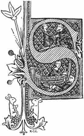
From an Icelandic MS. of 1363
On the other hand we have seen (pp. 150, ff.) that ideas of whirlpools in the northern seas appear to have been widely spread in the Middle Ages. There is a possibility, as already hinted (vol. i. p. 303), that when in Ivar Bárdsson’s description of the northern west coast of Greenland “the many whirlpools that there lie all over the sea” are spoken of, it was thought that here was the boundary of the ocean and of the world, and that it was formed by the many whirlpools, or abysses in the sea. In that case these cannot be regarded merely as maelstroms like the Moskenström, but more like the true Ginnungagap. But this is extremely uncertain; it may[Pg 242] again have been one of those embellishments which were often used in speaking of the most distant regions.
Saxo Grammaticus (first part of the thirteenth century) in the preface to his Danish history gives geographical information about Scandinavia and Iceland, to which we have already referred several times. He does not mention Greenland. He says himself that he has made use of Icelandic literature to a large extent; but he has also mingled with it a good deal of mythical material from elsewhere.
Beyond comparison the most important geographical writer of the mediæval North, and at the same time one of the first in the whole of mediæval Europe, was the unknown author who wrote the “King’s Mirror,”[240] probably about the middle of the thirteenth century.[241] If one turns from contemporary or earlier European geographical literature, with all its superstition and obscurity, to this masterly work, the difference is very striking. Even at the first appearance[Pg 243] of the Scandinavians in literature, in Ottar’s straightforward and natural narrative of his voyage to King Alfred, the numerous trustworthy statements about previously unknown regions are a prominent feature, and give proof of a sober faculty of observation, altogether different from what one usually meets with in mediæval literature. This is the case to an even greater degree in the “King’s Mirror,” and the difference between what is there stated about the North and what we find less than two hundred years earlier in Adam of Bremen is obvious. Apart from the fact that the whole method of presentation is inspired by superior intelligence, it shows an insight and a faculty of observation which are uncommon, especially at that period; and in many points this remarkable man was evidently centuries before his time. Although well acquainted with much of the earlier mediæval literature, he has liberated himself to a surprising extent from its fabulous conceptions. We hear nothing of the many fabulous peoples, who were still common amongst much later authors, nor about whirlpools, nor the curdled and dark sea, but instead we have fresh and copious information about the northern regions, and it comes with a clearness like that which already struck us in Ottar. We have a remarkably good description of the sea-ice, its drift, etc. (cf. vol. i. pp. 279, f.); we have also a description of the animal world of the northern seas to which there is no parallel in the earlier literature of the world (cf. pp. 155, ff.). No less than twenty-one different whales are referred to fully. If we make allowance for three of them being probably sharks, and for two being perhaps alternative names for the same whale, the total corresponds to the number of species that are known in northern waters. Six seals are described, which corresponds to the number of species living on the coasts of Norway and Greenland. Besides these the walrus [“rostung”] is very well described. But even the author of the “King’s Mirror” could not altogether avoid the supernatural in treating of the sea. He describes in the seas of Iceland the enormous monster “hafgufa,” which[Pg 244] seems more like a piece of land than a fish, and he does not think there are more than two of them in the sea. This is the same that the Norwegian fishermen now call the krake, and certainly also the same that appears in ancient oriental myths, and that is met with again in the Brandan legend as the great whale that they take for an island and land on (cf. p. 234). In the Greenland seas the “King’s Mirror” has two kinds of trolls, “hafstrambr” [a kind of merman], with a body that was like a glacier to look at, and “margygr” [a mermaid], both of which are fully described. There is also mention in the Greenland seas of the strange and dangerous “sea-fences,” which are often spoken of in the sagas [and about which there is a lay, the “hafgerðinga-drápa”]. The author does not quite know what to make of this marvel, for “it looks as if all the storms and waves that there are in that sea gather themselves together in three places, and become three waves. They fence in the whole sea, so that men cannot find a way out, and they are higher than great mountains and like steep summits,” etc. It is probable that the belief in these sea-fences is derived from something that really took place, perhaps most likely earthquake-waves, or submarine earthquakes, which may sometimes have occurred near volcanic Iceland. But it is curious that in the “King’s Mirror” these waves are connected with Greenland. They might also be supposed to be connected with the waves that are formed when icebergs capsize.
Marginal drawing in the Flateyjarbók (1387-1394)
The principal countries described are Ireland, Iceland and Greenland; but it is characteristic of the author that the farther north he goes, away from regions commonly known, the freer his account becomes from all kinds of fabulous[Pg 245] additions. In Ireland he is still held fast by the superstition of the period, and especially by the priests’ fables about themselves and their holy men, and by the English author Giraldus Cambrensis.[242] In Iceland, as a rule, he is free of this troublesome ballast, and gives valuable information about the glaciers of Iceland, glacier-falls, boiling springs, etc. In his opinion the cold climate of Iceland is due to the vicinity of Greenland, which sends out great cold owing to its being above all other lands covered with ice; for this reason Iceland has so much ice on its mountains. Although he thinks it possible that its volcanoes are due to the fires of Hell, and that it is thus the actual place of torment, and that Hell is therefore not in Sicily, as his holiness Pope Gregory had supposed, he nevertheless has another and more reasonable explanation of the origin of earthquakes and volcanoes. They may be due to hollow passages and cavities in the foundations of the land, which by the force either of the wind or of the roaring sea may become so full of wind that they cannot stand the pressure, and thus violent earthquakes may arise. From the violent conflict which the air produces underground, the great fire may be kindled which breaks out in different parts of the country. It must not be thought certain that this is exactly how it takes place, but one ought rather to lay such things together to form the explanation that seems more conceivable, for
“we see that from force [‘afli’] all fire comes. When hard stone and hard iron are brought together with a blow, fire comes from the iron and from the force with which they are struck together. You may also rub pieces of wood together until fire comes from the labour that they have. It is also constantly happening that two winds arise from different quarters, one against the other, and if they meet in the air there is a hard shock, and this shock gives off a great fire, which spreads far in the air,” etc.
[Pg 246]This idea of a connection between labour (friction) and force (motion), and this explanation of the possible origin of volcanoes are surprising in the thirteenth century, and seem to bring the author centuries in advance of his time; we here have germs of the theory of the conservation of energy.
His statements about Greenland are remarkable for their sober trustworthiness. He gives the first description of its inland ice:
“But since you asked whether the land is thawed or not, or whether it is covered with ice like the sea, you must know that there are small portions of the land which are thawed, but all the rest is covered with ice, and the people do not know whether the country is large or small, since all the mountains and valleys are covered with ice, so that no one can find his way in. But in reality it must be that there is a way, either in those valleys that lie between the mountains, or along the shores, so that animals can find a way, for otherwise animals cannot come there from other countries, unless they find a way through the ice and find the land thawed. But men have often tried to go up the country, upon the highest mountains in various places, to look around them, to see whether they could find any part that was thawed and habitable, but they have not found any such, except where people are now living, and that is but little along the shore itself.”
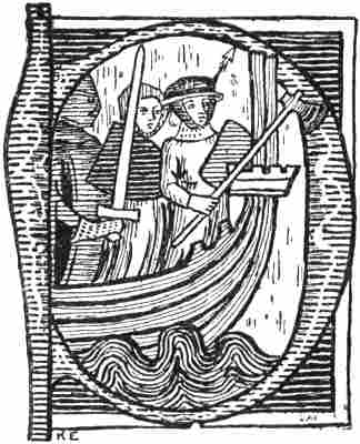
Norwegian MS. of the Gulathings law. Fourteenth century
This, as we see, is an extremely happy description of the mighty ice-sheet. He also describes the climate of the country, both the fine weather that often occurs in summer, and its usually inclement character, which causes so small a proportion of the country to be habitable.
“The land is cold, and the glacier [i.e., the great ice or inland ice] has this nature, that he sends out cold gusts which drive away the showers from his face, and he usually keeps his head bare. But often his near neighbours have to suffer for it, in that all other lands which lie in his neighbourhood get much bad weather from him, and all the cold blasts that he throws off fall upon them.”
[Pg 247]Though in simple and everyday words, this really expresses the idea that Greenland and the neighbouring regions are disproportionately cold, and that, in part at any rate, this is due to the glaciers of Greenland, which have a refrigerating effect (as an anticyclonic pole of maximum cold). This is to a certain degree correct. In crossing Greenland in 1888 we found that a pole of cold [anticyclone] lies over the inland ice, which gives off cold air. Scientific greatness does not always depend on erudition or acute learned combinations; it is just as often the result of a sound common-sense.
The allusion in the “King’s Mirror” to the Norse inhabitants of Greenland and their life has already been quoted in part (vol. i. p. 277); curiously enough the Skrælings are not mentioned. The author gives a graphic description of the aurora borealis, and attempts to explain its cause. As already noted (p. 155), it is curious that he should speak of it as something peculiar to Greenland, when he must of course have known it well enough in Norway.
The cosmography of the “King’s Mirror” is based on older mediæval writers, especially Isidore. The spherical form of the earth and the course of the sun are mentioned, as is Macrobius’s doctrine of zones. In the frigid zones the cold has attracted to itself such power that the waters throw off their nature and are changed to ice, and all the land and sea is covered with ice. They are usually uninhabitable, but nevertheless the author considers that Greenland lies in the north frigid zone. He thinks that “it is mainland, and connected with other mainland,” as already mentioned, because it has a number of terrestrial animals that are not often found on islands. It
“lies on the extreme side of the world on the north, and he does not think there is land outside ‘Heimskringla’ [the circle of the world, ‘orbis terrarum’] beyond Greenland, only the great ocean which runs round the world; and it is said by men who are wise that the strait through which the empty ocean flows comes in by Greenland, and into the gap between the lands (‘landa-klofi’), and thereafter with fjords and gulfs it divides all countries, where it runs into Heimskringla.”
[Pg 248]This is, as we see, the same idea as already (p. 240) referred to, that the Outer Ocean runs in through a sound between Greenland and another continent to the south, evidently Wineland, which is thus here again regarded as part of Africa (cf. p. 1).
It is moreover striking that neither Wineland, Markland, nor Helluland is mentioned in the “King’s Mirror,” and Bjarmeland, Svalbard, etc., are also omitted. Thus it does not give any complete description of the northern lands, but it must be remembered that what we know of the work is only a fragment, and perhaps it was never completed.
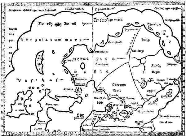
The Nancy map. A copy, of 1427, of Claudius Clavus’s first map of the North.
The lines of latitude and longitude are omitted for the sake of clearness
CLAUDIUS CLAVUS
Clavus’s maps
The credit of having introduced the name of Greenland, with the ancient Norsemen’s geographical ideas about the extreme North, into cartography belongs, so far as is known,[Pg 249] to the Dane Claudius Claussön Swart, usually called in Latin Claudius Clavus (sometimes also Nicolaus Niger). He was born in Funen, travelled about Europe, and, as shown by Storm [1891, pp. 17, f.], was probably the “Nicolaus Gothus” who is mentioned at Rome in January 1424, and who is reported to have there given out that he had seen a copy of Livy in the monastery of Sorö, near Roskilde (which was probably a romance on his part). We are told that he was a man of acute intelligence, but a rover and unsteady. His subsequent history is unknown. As a supplement to Ptolemy’s Geography, which just at that time (1409) was becoming known in Western Europe in a Latin translation, he made, probably in Italy, two maps of the North, with accompanying descriptions. The maps must have been drawn either by himself or with his help. They are the first maps known in Western Europe which are furnished, after the model of Ptolemy (or Marinus), with lines of latitude and longitude,[243] and they thus mark the beginning of a more scientific cartography and geography in Western Europe.[244]
His first map (the Nancy map) must have been drawn between the years 1413 and 1427, probably between 1424 and 1427; but it can never have been widely known, as it has exercised no noticeable influence on the cartography of the succeeding period. The French cardinal Filastre (ob. 1428), who was staying in Rome in 1427, became[Pg 250] acquainted with it there, and made a reduced copy of it, which, together with a copy of the accompanying text, he had bound up with his copy of the Latin translation of Ptolemy’s Geography with maps. This work was not rediscovered at Nancy until 1835, when it was published; the map is therefore usually called the Nancy map. Clavus’s second map, which seems to have been drawn later than that just mentioned, has on the other hand had considerable influence on the cartographical representation of the northern regions through a period of two centuries.
A copy of the later map was first brought to light by Nordenskiöld at Warsaw in 1889 [1889, p. xxx.]; since then several copies have been rescued from oblivion, while the text accompanying the map was accidentally discovered in 1900 by Dr. A. A. Björnbo in a mediæval MS. at Vienna [Björnbo and Petersen, 1904]. The original map is lost; but except as regards details of no great consequence there can now be no doubt as to what it was like.
The reproductions (pp. 248 and 251) will give an idea of the representation of the North on the two maps. As far as Ptolemy’s map extended (cf. vol. i. pp. 118, f.), it will be seen that its coast-lines and islands are almost slavishly adhered to on both maps. To this the Nancy map adds a Scandinavia, with Iceland, the east coast of Greenland, and a northern land connection between the latter and Russia. On the later map Scandinavia has been given a somewhat altered form, and Greenland has a west coast. The Nancy map has few names, many more being mentioned in the text, especially in Denmark. Even as regards Denmark they are evidently to a great extent taken from an older itinerary like that of Bruges [“Itinéraire Brugeois,” cf. Storm, 1891, p. 19]. Some of the names on the map, like “bergis,” “nidrosia,” etc., may be taken from older compass-charts; both texts have the northern form “Bergen.” Headlands, bays and islands (on the coasts of Norway, Iceland and Greenland), for which he had no names (and which moreover are due to the free imagination of the draughtsman), have been designated in the Nancy text by Latin numerals (“Primum,” “Secundum,” etc.), or are simply named after each other (in Iceland), a sure sign that Clavus neither knew nor had heard anything about these coasts.
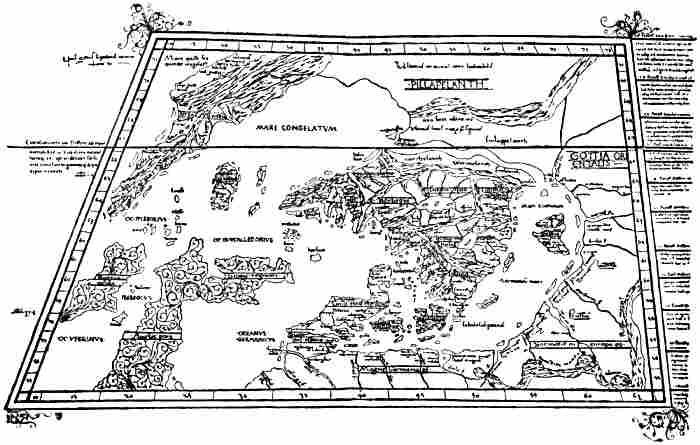
Copy, of about 1467, of Claudius Clavus’s later map. The copy was executed by Nicolaus Germanus.
Owing to the map being transferred to the latter’s trapezoidal projection, with converging meridians,
Greenland, for instance, has been given a very oblique appearance
[Pg 252]On his later map Clavus has made up for the want of names in an astonishing way. On some of the coasts he has continued to use Latin numerals for bays, etc., but side by side with this on the shores of the Baltic and in Sweden he has used Danish numerals, such as, “Förste aa fluuii ostia” (First river, river-mouth), “Anden aa” (Second river) ..., etc. The southerners, who did not understand Danish, of course regarded these as names, and subjected them to all sorts of corruptions. Matters became worse when in Gotland and Norway he used as the names of headlands and rivers the words of a meaningless rigmarole: “Enarene,” “apocane,” “uithu,” “wultu,” “segh,” “sarlecrogh,” etc. (evidently corresponding to children’s rigmaroles like “Anniken, fanniken, fiken, foken,” etc.)[245] In Iceland he used the names of the runic characters for headlands and rivers; but most remarkable of all are his names in Greenland, alternately for headlands and the mouths of rivers(!). If, as shown by Björnbo and Petersen, these are read continuously from the most northern headland on the east coast round the south of the country, the following verse in the dialect of Funen is the result:
“Thær boer eeynh manh secundum [== ij ?][246] eyn Gronelandsz aa,
ooc Spieldebedh mundhe hanyd heyde;
meer hawer han aff nidefildh,
een hanh hawer flesk hinth feyde.
Nordh um driuer sandhin naa new new.”
[Pg 253]
(There lives a man (in ?) a Greenland river,
and Spieldebedh is his name;
he has more vermin (?)
than he has fat bacon, etc.)
The verse, as pointed out by Axel Olrik, is evidently an imitation or travesty of the folk-songs, and, as Karl Aubert has shown,[247] its prototype must certainly have been the first verse of the same folk-song that is now known in Sweden by the name of “Kung Speleman”:
“Dher bodde een kjempe vid Helsingborg,
Kung Speleman månde han heta,
Visst hade han mera boda sölf,
Än andra flesket dhet feta.
Uren drifver noran, och hafvet sunnan för noran.”
(There lived a giant by Helsingborg,
King Fiddler was his name.
Sure he had greater store of silver
Than others of fat bacon, etc.)
This method of fabricating geographical names adopted by Clavus recalls the designation of the notes in the mediæval scale, for which the words of a Latin hymn were used, and it seems likely that this is what he has imitated. But his mystification, with all these strange names which no one in Southern Europe understood, and which in course of time underwent many corruptions, has caused a good deal of trouble; many intelligent men have racked their brains to discover learned etymological interpretations of their origin, until Björnbo’s lucky find of the later text of Clavus solved the riddle.
Björnbo and Petersen, who by their valuable work on Claudius Clavus with a reproduction of this text have the credit of throwing light on the relation between his first and second maps, have put forward the view that Clavus must have made his first map (the Nancy map) with its Latin text in Italy; but curiously enough they think he entirely rejected the Italian compass-charts as unsuitable for the representation of the North, and constructed his delineation of the northern regions independently of them, as an addition[Pg 254] to Ptolemy’s coast-lines, simply from information he had derived from northern sources. After this we are to suppose that, in order to extend his geographical knowledge, he went back to Denmark; and since the authors place reliance on Clavus’s assertion (in his later text) that he had seen the places himself, they even credit him with having made a voyage of geographical exploration, first to Norway (Trondhjem) and then to Greenland. And then he is supposed to have drawn his later map, and written the text for it (in Latin), in the North.
I have come to an entirely different conclusion. His older map must be based, in my opinion, not only on Ptolemy, but to a great extent on Italian maps. His later map and text, I consider, show beyond doubt that he cannot have been either in Norway or Greenland, and I cannot find a single statement in the Vienna text, or any coast-line in his later map, which shows that he was outside Italy in the period between the two works. Doubtless the delineation of Denmark, especially Sealand, is more detailed in the second map; but the additions do not disclose any more local knowledge than might be attributed to Clavus as a native of Funen before his first map was drawn, even though he had not then ventured to change the form of Ptolemy’s Scandia, which to him, of course, became Sealand. After this first attempt, however, he may have gained courage to launch out further with his knowledge. He may also have discovered a few fresh pieces of information, in the papal archives, for instance. Besides this, he may, of course, have received oral communications from people from the northern countries; but even of this I am unable to find sure signs. In consideration of the imaginative tendencies shown by Clavus in his distribution of names, and to some extent in the coast-lines on his map, which perhaps may also have asserted themselves in his statement that he had seen a complete MS. of Livy in Sorö monastery,[248] we shall[Pg 255] scarcely be insulting him if we believe his statements (in two passages of the Vienna text) that he himself had seen Pygmies from a land in the North, and Karelians in Greenland, to be rhetorical phrases, calculated to strengthen the reader’s confidence, and to mean at the outside that he had seen something about these people in older authorities.
After having heard my reasons, Björnbo and Petersen have in all essentials come round to my views. In particular they agree with me that Clavus cannot have been in Greenland, but that the delineation of that country on his later map is based on the Medicean map of the world, which will be mentioned later. I therefore consider it superfluous to combat any further here the reasons given in their work for their former view.
Claudius Clavus’s task must have been to supplement the newly discovered atlas of Ptolemy by what he knew of the North; and to this end his maps were drawn, either by himself or by a professional draughtsman in Italy from his instructions. The text was prepared after each of the maps, as a description of it; and the latitudes and longitudes are taken from the map [cf. Björnbo and Petersen, 1904, p. 130]. With the superstitious respect of the period for older learned authorities in general, and for Ptolemy in particular, he did not venture to alter the latter’s coast-lines or latitudes as far as they extended; even in the Danish islands he has done so with hesitation, thus Sealand in his first sketch [the Nancy map] has still the same form as Scandia in Ptolemy, etc. He then added to the latter’s coast-lines what he knew or could get together from other quarters.
His first map [the Nancy map] may presuppose the following sources, besides Ptolemy’s various maps of Northern Europe; Pietro Vesconte’s mappamundi (circa 1320) in Marino Sanudo’s work,[249] and the anonymous mappamundi,[Pg 256] now preserved in the so-called Medicean Marine Atlas, of 1351, at Florence.[250] In addition to these, either the Bruges itinerary itself [Itinéraire Brugeois, cf. Storm, 1891, p. 19], or one of its earlier sources. Possibly he also had, in part at all events, a tract [in Icelandic ?] that is included in the fourth part of the “Rymbegla” [1780]; that he also knew of the Icelandic sailing directions, as assumed by Björnbo and Petersen, I regard as less certain, although not impossible; perhaps it would be safer to suppose that he may have seen some statements from Ivan Bárdsson’s description of Greenland, in an itinerary, for instance. I have not been able to find any certain indication of his having been acquainted with the Icelandic geography mentioned on p. 237; perhaps he may rather have known of the land connection between Greenland and Russia from some tale or other, or from a legendary saga;[251] from the same source (or from Ivar Bárdsson’s description ?) may also be derived the name Nordbotn (cf. p. 171, note 1), which is not known in the Icelandic geography, but which seems most probably to be a legendary form. Certain names, such as those of the bishops’ sees in Norway and Iceland, Clavus may easily have found in the papal archives in Rome.
In the first place, exactly following Ptolemy, the draughtsman has marked Ireland with the islands around it and six[Pg 257] Hebrides to the north-east, Scotland with the island of Dumna and the archipelago “Orcadia” to the north (the island of Ocitis a little farther east), and the south coast of Thule farther north; next Jutland with its small islands round about, and with the large island of Scandia, which, of course, became Sealand (he has added Funen and a number of other islands); finally the coast of Germany and Sarmatia eastwards to 63° N. lat., and with the same number of river-mouths as in Ptolemy. As this coast does not extend nearly so far to the east as does the Baltic on the compass-charts, it resulted that Clavus’s Baltic became much shorter than that of the charts, and its shape had to be altered to suit Ptolemy’s coast-line. Then, at its northern end, the draughtsman has placed possibly Pietro Vesconte’s Scandinavian peninsula, going out towards the west (see the two maps, pp. 223, 224); but as he saw Norway on the compass-charts extending west as far as to the north of Scotland, where on Ptolemy’s map he found Thule, it was natural that he should take the latter to be the southern point of Norway, and he was obliged to move Vesconte’s peninsula farther to the west. Its south coast may have been drawn with the Medici map, or a similar one, as model. As the southern coast of the Baltic was moved far to the south, after Ptolemy, and Jutland was given a different and smaller form than on the Medici map, besides a marked inclination to the east, and as Skåne had to be near Sealand (Scandia), the draughtsman was obliged to move the peninsula corresponding to Skåne about five degrees to the south. The south coast of the peninsula on the north of Scotland on the Medici map (see pp. 236, 260) corresponded very nearly to the south coast of Thule (with an east-south-easterly direction) on Ptolemy’s map; it lay in an almost corresponding latitude, but on account of the puzzling prolongation of Scotland to the east on Ptolemy’s map, it had to be moved a good fifteen degrees of longitude to the east. Thule was thus united to Norway[252] and its south coast was given exactly the[Pg 258] same shape as the south coast of the peninsula in question, with three arched bays (the broadest on the east) and a projecting point towards the south-east. The coast between this promontory and Skåne may then have been drawn with the same number of four large bays as on the Medici map: a deeper one farthest west, then a broad peninsula, next two wide, open bays, with a narrow peninsula between them, and finally a smaller bay opposite Sealand. The “Halandi” of the Nancy map is thus brought to the corresponding place with the “Alolanda” of the Medici map (p. 236).[253]
Thus far it may be fairly easy to compare the maps; but then Norway according to most of the compass-charts ought not to have any considerable farther extension to the west, while on the other hand Northern ideas demanded a Greenland in the far west, as well as a land in the north between that and Russia. With the latter the westernmost tongue of land in Norway on the Medicean mappamundi[254] agrees remarkably well. The southern point of Clavus’s Greenland has also the same length in proportion to the west coast of Ireland, and about the same breadth, as on this map. There was also an extensive mass of land in the north. According to various representations, such as those of Vesconte’s mappamundi, Saxo’s description (cf. p. 223), and others, there[Pg 259] should be a gulf on the north side of the Scandinavian Peninsula. According to representations like that of the Lambert map at Ghent (cf. p. 188), this arm of the sea had the same form as that on the south side of Scandinavia, and there should only be a narrow isthmus between these two arms of the sea, connecting the peninsula with the mainland (cf. Saxo). On the Nancy map, too, the north coast of Scandinavia is drawn almost exactly like the south coast, with the same number of promontories and bays, which correspond very nearly even in their shape. In this way Clavus’s “Nordhindh Bondh” [Norðrbotn], also called “Tenebrosum mare” [i.e., the dark sea] or “Quietum mare” [the motionless sea], may have originated. This remarkable bay is connected on his map with the Baltic by a canal (which is also mentioned in the Vienna text). By this means Scandinavia really becomes an island. Clavus cannot have acquired such an idea from any known source, although, as already mentioned, Saxo says that it is nearly an island (p. 223); but similar conceptions seem to have arisen in Italy (cf. above on Pietro Vesconte’s mappamundi, p. 223).
Scandinavia on the map of Europe in the Medici Atlas (of 1351).
The scales of latitude and longitude are here added from Ptolemy’s
maps. The network of compass-lines is omitted
The south coast of Norway [with “Stauanger”] and the southern point of Greenland retained on Clavus’s map the same relation of latitude, a difference of 1½°, as the corresponding localities on the Medici map, with very nearly the same degrees of latitude as on the latter, if we there employ a scale of latitude calculated upon this map’s representation of Spain (the Straits of Gibraltar) and France (Brittany), and use Ptolemy’s latitudes for these countries. This has been done in the reproduction of the Medicean mappamundi on p. 236.[255] The scale of longitude is calculated in the same[Pg 260] proportion to the latitude as in Ptolemy. In some tract like that included in the fourth part of the “Rymbegla” [1780, p. 466] Clavus may have found that Bergen lay in latitude 60° and so placed the town on the west coast of Norway in this latitude according to his own scale (on the right-hand side of the Nancy map, see p. 474). In relation to the south coast of Norway Bergen was thus brought ¾° farther south than “c. bergis” on the Medici map (above). Calculated according to Ptolemy’s scale of latitude (on the left-hand side of the Nancy map), Bergen was consequently placed in Clavus’s text in 64°, while the southern point of Greenland is placed in 63° 15′,[256] a difference in latitude of 45′ (in the Vienna text the difference is 35′), while in reality it is 38′; a remarkable[Pg 261] accidental agreement. According to Clavus’s own scale of latitude on the right-hand side of the Nancy map, we get the following latitudes: Bergen 60°, the southern point of Greenland 59° 15′, Stavanger 58° 30′. In reality the latitudes of these places are: 60° 24′, 59° 46′, and 58° 58′. This agreement is remarkable, as a displacement of the scale of latitude half a degree to the north on the Nancy map would give very nearly correct latitudes.[257] The mutual relation between the latitudes of the three places may, as we have seen, be explained from the Medici map, but hardly from a possible acquaintance with the Icelandic sailing directions; for according to these Bergen and the southern point of Greenland would be placed in the same latitude, since we are told that from Bergen the course was “due west to Hvarf in Greenland.”[258] The Medici map may also give a natural explanation of places like Bergen and the southern point of Greenland having been given by Clavus a latitude so much too northerly (even in the Nancy map), and of the southern point of Greenland having only half a degree more westerly longitude than the west coast of Ireland.[259]
[Pg 262]Iceland lay, according to the Bruges itinerary, midway between Norway and Greenland, precisely as on the Nancy map. Between Norway and Iceland, according to the same itinerary, lay “Fareö” [Færö], and the fabulous island “Femöe,” “where only women are born and never men.”
After speaking of the “third headland” in 71° on the east coast of Greenland, the Nancy text goes on:
“But from this headland an immense country extends eastward as far as Russia. And in its [i.e., the country’s] northern parts dwell the infidel Karelians (‘Careli infideles’), whose territory (‘regio’) extends to the north pole (‘sub polo septentrionalis’) towards the Seres[260] of the east, wherefore the pole [‘polus’ == the arctic circle ?], which to us is in the north, is to them in the south in 66°.”
It is probable, as suggested by Björnbo and Petersen, that these “Careli infideles” are identical with those who are found almost in the same place, in the ocean to the north of Norway, on one of the maps in Marino Sanudo’s work (in the Paris MS., see above, p. 225), and who on other maps belonging to that work are placed on the mainland to the north-east of Scandinavia. As pointed out by Storm, “Kareli” are also[Pg 263] mentioned together with Greenland and “Mare Gronlandicum” in the Bruges itinerary.
Björnbo and Petersen maintain that Claudius Clavus has here consciously put forward a new and revolutionary view which was a complete break with the cosmogony of the whole of the Middle Ages, since according to the latter the disc of the earth was entirely surrounded by sea to the south of the North Pole, as represented on the wheel-maps. I think this is attributing to Clavus rather too much original thought, of which his maps and text do not otherwise give evidence. It is, of course, correct that the idea of land, and inhabited land, too, at the North Pole, or to the north of the Arctic Circle, did not agree with the general learned conception of the Middle Ages; but the same idea had already been clearly enough expressed in Norwegian-Icelandic literature. Even the Historia Norwegiæ has inhabited land beyond the sea in the north, and the Icelandic legendary sagas and Saxo have it too. In addition to these, the tract included in the “Rymbegla” says distinctly (see above, p. 239) that this land in the opinion of some lies under the pole-star (cf. Clavus’s expression: “sub polo septentrionalis”). The fact that the continent on the Medicean map of the world extended boundlessly on the north into the unknown (whereas Africa ended in a peninsula on the south) must have confirmed Clavus in the view that the land reached to the pole. To this was added, what perhaps weighed most with him, the fact that such a view did not conflict with Ptolemy, whose continent also had no limit on the north.
On the connecting land in the north is written, on the Nancy map: “Unipedes maritimi,” “Pigmei maritimi,” “Griffonii regio vastissima,” and “Wildhlappelandi.” As these names are not mentioned in Clavus’s text, it is uncertain whether the fabulous creatures may not be to some extent additions for which he is not responsible.
After the map was drawn, with its bays and headlands, and the coast of Scandinavia provided with a suitable number[Pg 264] of islands, Claudius Clavus set himself to describe it; where he had no names from earlier sources, he numbered the headlands, bays and islands, “Primum,” “Secundum,” etc.
A remarkable thing about the Nancy map is that it has two divisions of latitude: one according to Ptolemy on the left-hand side of the map, and another according to Clavus himself, on a scale four degrees lower, on the right-hand side. According to the latter, Roskilde would have a longest day of seventeen hours (through a transposition the Nancy map gives seventeen hours thirty minutes), which, as pointed out by Björnbo [1910, p. 96], exactly agrees with what Clavus may have learnt from a Roskilde calendar (“Liber daticus Roskildensis”) of 1274. Björnbo has also remarked that Bergen is given a remarkably correct latitude, 60° (the correct one is 60° 24′), and thinks it possible that there may have been a Bergen calendar which Clavus has used. But a more likely source, unnoticed by Björnbo, is to be found, as mentioned on p. 260, in the “Rymbegla” tract, where the latitude of Bergen is given as 60°. It is true that the same tract gives the latitude of Trondhjem (Nidaros) as 64°, which does not agree with the Nancy map, where there is a difference of only 2° between Bergis and Nidrosia. Even though it is probable that Clavus was acquainted with some such tract, with which his statement as to land at the North Pole also agrees, it may have been a somewhat different version from that which found its way into the “Rymbegla,” and perhaps the latitude of Trondhjem was not mentioned there. On the other hand, he may have found, there or elsewhere, the latitude of Stavanger given, 1½° farther south than Bergen (?).
If we assume that Clavus, even in the construction of his first map, made use of the Medicean map of the world, and that his Greenland is the most westerly peninsula of the latter’s Norway, it will seem strange that he did not also draw the west coast of that peninsula, which would naturally become the west coast of Greenland. It is true that the Nancy map is only a copy, but as the west coast of Greenland is not mentioned[Pg 265] in the copy of Clavus’s text either, we are bound to believe that he did not include it. The margin on the western side of Clavus’s first map was evidently determined by that of Ptolemy’s map of the British Isles, and follows precisely the same meridian. Thus there was no room for the Medici map’s peninsula corresponding to Clavus’s Greenland. As already stated, it is difficult to get away from the belief that the Medici map was used for the east coast of Greenland, the south coast of Norway, etc.; the resemblances are too great, and otherwise inexplicable (cf. p. 261, note 3).
After the first map was drawn, Clavus may have made further cartographical studies in Italy, and may thus have become acquainted with other compass-charts, especially those of the Dalorto type. At the same time he may have obtained a new and more accurate determination of the latitude of Trondhjem, probably by the length of its longest day. As Trondhjem was an archbishopric, it is not unlikely that he found such a piece of information in the papal archives at Rome. He may then naturally have wished to bring his map more into agreement with his new knowledge, and this may have led to his later map, which is now known to us through several somewhat varying copies. To this he then wrote a new text (the Vienna text), which in all important points resembles the former, but has various additions and alterations. The later map has not the double scale of latitude on any of the copies known, but curiously enough only Ptolemy’s degrees. Besides a more accurate delineation of Jutland and the Danish islands, especially Sealand, Bornholm and Gotland are drawn in closer resemblance to the Medici map; the south coast of Scandinavia has been altered to agree more with compass-charts of the Catalan type. In particular the south coast of Norway has been given the four characteristic promontories (as on the Dalorto map of 1339, and on the Modena map, etc.; cf. the reproductions, pp. 226, 231), and Bergen (“Bergis”) has been placed at the head of the westernmost of the three bays thus formed, which is[Pg 266] also a peculiarity of the maps of this type (the Catalan chart of 1375 has five promontories with four bays, cf. Nordenskiöld, 1896, Pl. XI.). The other two diocesan towns, Stavanger and Hamar, are placed at the heads of the other two bays to the east, and Stavanger has thus lost the remarkably correct position in relation to Bergen and the south point of Greenland which it had on the older map. Trondhjem has been placed at the extremity of the westernmost promontory, possibly because there had been found a more correct determination of the latitude of the town, which was to be fitted into Ptolemy’s graduation; thereby the shape of Norway has become still narrower and farther removed from reality.
From the “lac scarsa” (Lake Skara, i.e., Vener) with its river is derived the great lake “Vona” (Vener) in the centre of Scandinavia on all the copies of Clavus’s later map, from which the river “Vona” (also mentioned in the Vienna text) runs into the deep bay by “Aslo” (Oslo) and the island of “Tunsberg.” A connection, especially with Dalorto’s map of 1339, seems again to be implied by Clavus’s statement in the Vienna text that on Lister Ness “white falcons are caught” (“Liste promontorium, ubi capiuntur falcones albi”). On Dalorto’s map there is a picture of a white falcon on the headland to the west of that which Clavus has made into Lister, and the words “hic sunt girfalcos” (here are hunting falcons). That Clavus has moved the hawks to a headland farther east is of small importance. Either he may have taken his hawks from Dalorto’s or a similar map, or else they are derived from an older common source.
Through the alteration of the south coast of Norway, it became necessary to separate it from Thule, which again became an island as originally in Ptolemy; but on the copies of the map it has in addition the name “Bellandiar,” which may be a corruption of Hetlandia (Shetland). The north-west coast of Norway has also been given a form which agrees better with the compass-charts, although it has a much more east-north-easterly direction than even on the Modena map;[Pg 267] but this was, of course, necessary to make room for the sea “Nordhenbodnen” (Nordbotn). That the compass-charts might lead to something resembling Clavus’s last form of Scandinavia, and especially of the south coast of Norway, is shown by the map of Europe in Andrea Bianco’s atlas of 1436, which must have been drawn without knowledge of Clavus’s work. If on this map we move the coast of the Baltic farther south and Skåne also, which would be necessitated by a better knowledge of Denmark (and by the alteration of the map following Ptolemy), and draw the coast-line of Norway towards the east-north-east from the south-western promontory (instead of making it go in a northerly direction), we shall get a Scandinavia of very similar type to that in Clavus’s later map.
The north-western portion of the map of Europe in Andrea Bianco’s
atlas of 1436. The compass-lines are omitted
Björnbo and Petersen have maintained in their monograph that Clavus must have been in Norway before he drew this map, and that amongst other things his remarkably correct latitude for Trondhjem must be due to his own observation of the length of the day at the summer solstice. Storm [1889, p. 140] seems also to have supposed that Clavus may really have been in Norway. To me it appears that his map and text are conclusive evidence against his ever having been there; for a man who had sailed to Trondhjem along the coast of Norway could not possibly have produced a cartographical representation of the country so entirely at variance with reality as Clavus has done, however ignorant we may suppose him. The fact in itself that “Trunthheim” (Trondhjem) or “Nedrosia” is placed at the extremity of[Pg 268] the south side of the south-western promontory of the country is extraordinary. If he had come there asleep he could not have got any such idea; and for a man who had sailed in through the long channel of the Trondhjem fjord up to the town it is incredible. It is equally incredible that a man who had sailed along the coast from Stavanger and Bergen to Trondhjem could place the latter town in a latitude 10′ to the south of Bergen, and only 10′ to the north of Stavanger. We are not justified in attributing to Clavus such an entire lack of power of observation, especially if we are to suppose him capable of determining with remarkable accuracy the length of the longest day at Trondhjem. That Trondhjem is placed to the west of Bergen and Stavanger, that the Dovrefjeld is called a high promontory, while on the Nancy map it was inland, that Hamar (“Amerensis”) is put on the sea-coast, etc., all shows the same want of knowledge of the country and its configuration. The names he may have taken from an itinerary or other sources, and, as already suggested, it is not unlikely that he may have found in the papal archives a fairly correct statement of the latitude (or length of the longest day) of Trondhjem, which was an archbishop’s see. That the towns he gives are just those that are the heads of dioceses is perhaps an indication of a connection with the Vatican.
Clavus tells us further that
“Norway has eighteen islands, which in winter are always connected with the mainland, and are seldom separated from it, unless the summer is very warm,” and that “‘Tyle’ [Thule] is a part of Norway and is not reckoned as an island, although it is separated from the land by a channel or strait, for the ice connects it with the land for eight or nine months, and therefore it is reckoned as mainland. The same applies to the sea ‘Nordhinbodnen’ [Nordbotn], which separates ‘Wildlappenland’ from ‘Vermenlandh’[261] and ‘Findland’ by a long strait, since the countries are united by almost eternal ice.”
This discloses an extraordinary lack of knowledge of Northern conditions. Such a connection of the islands[Pg 269] with the mainland by ice occurs, of course, nowhere on the whole outer coast of Norway from Færder to the Murman Coast. On the other hand, the Gulf of Bothnia and the Åland archipelago are frozen over for a long time in winter, and it might be supposed that Clavus had heard reports of this. But I have not been able to discover any source from which he may have derived these fables. Most probably they are embellishments of the same kind as the eighteen islands of Norway, that form an arbitrary decoration of the coast-line of his map, a circumstance which does not hinder him from describing them as real. Clavus has used the ice as a transition between the representation of his older map, where Thule was part of the mainland, and that of the later one, where it was made into an island.
At the northernmost limit of Norway, between two places called “Ynesegh” and “Mestebrodh,” Clavus connected the Polar Sea (“Nordhinbodhn”) by a narrow channel with the Gotland Sea [the Baltic], and a little farther north, in 67°, he says that
“the uttermost limit is marked with a crucifix, so that Christians shall not venture without the king’s permission to penetrate farther, even with a great company.” “And from this place westwards over a very great extent of land dwell first Wildlappmanni [Wild Lapps, i.e., Mountain Lapps, Reindeer Lapps ? cf. vol. i. p. 227], people leading a perfectly savage life and covered with hair, as they are depicted; and they pay yearly tribute to the king. And after them, farther to the west, are the little Pygmies, a cubit high, whom I have seen after they were taken at sea in a little hide-boat, which is now hanging in the cathedral at Nidaros; there is likewise a long vessel of hides, which was also once taken with such Pygmies in it.”
Two things are to be remarked about this assertion that he himself had seen these Pygmies (one might suppose in Norway): (1) if he had really seen a captive Eskimo brought to Norway (by whom ?), he could hardly have been ignorant that this remarkable native was from Greenland, and not from a fabulous northern land. And (2), how could he then give their height as no more than a cubit, like the Pygmies of myth? It appears to me that in one’s zeal to defend Clavus,[Pg 270] one would thus have to attribute to him two serious falsehoods, instead of a more innocent rhetorical phrase about having seen this, that, and the other.
Clavus’s statement about the Pygmies’ small hide-boats, and the long hide-boat, that hung in Trondhjem cathedral, is, however, of great interest from the fact that this is the first mention in literature of the two forms of Eskimo boat: the kayak and the women’s boat (“umiak”). Perhaps he got this from the same unknown source (in the Vatican ?) in which he found the statement of the latitude of Trondhjem (?). In the fact that the Wild Lapps are mentioned first, and after them the Pygmies, Clavus’s text again bears a great resemblance to the anonymous letter to Pope Nicholas V. (of about 1450). In the northernmost regions (to the north-west of Norway) this letter mentions [cf. Storm, 1899, p. 9]
“the forests of Gronolonde, where there are monsters of human aspect who have hairy limbs, and who are called wild men.”... “And as one goes west towards the mountains of these countries, there dwell Pygmies,” etc. (cf. above, p. 86).
Michael Beheim also mentions “Wild lapen,” who live in the forests to the north of Norway, and who carry on a dumb barter of furs with the merchants, like that described by the Arab authors as taking place in the country north of Wîsu (cf. p. 144), and he goes on to speak of the Skrælings, three spans high, etc. (cf. above, p. 85). Beheim’s statement differs from Clavus’s text, and this again from the letter to Nicholas V., so that one cannot be derived from the other. It is therefore most probable, as suggested already (p. 86), that they have all drawn from some older source, and it may be supposed that this was Nicholas of Lynn. We have seen that there are other points in Clavus that lead one’s thoughts in the same direction.
Clavus proceeds:
“The peninsula of the island of Greenland stretches down from land on the north which is inaccessible or unknown on account of ice. Nevertheless, as I have seen, the infidel Karelians daily come to Greenland in great armies (bands of warriors, ‘cum copioso exercitu’), and that without doubt from the other side[Pg 271] of the North Pole. Therefore the ocean does not wash the limit of the continent under the Pole [Arctic Circle ?] itself, as all ancient authors have asserted; and therefore the noble English knight, John Mandevil, did not lie when he said that he had sailed from the Indian Seres [i.e., China ?] to an island in Norway.”
If we compare this with the “Rymbegla” tract already mentioned [1780, p. 466], we see that these are much the same ideas as there expressed. We read there
“that it is the report of the same men that the sea is full of eternal ice to the north of us and under the pole star, where the arms of the Outer Ocean meet....”
When it is there stated that
“those shores [under the pole star] hinder the ring of the ocean from coming together [i.e., round the earth]” ... and “that one can go on foot ... from Greenland to Norway” [cf. above, p. 239],
this is evidently something similar to what Clavus says; but the latter’s words as to the voyage which he attributes to Mandeville from the Indian Seres to Norway being more probable because there is land at the North Pole are somewhat incomprehensible.
John Mandeville’s book about a voyage through many lands to the far east and China dates from between 1357 and 1371, and is put together from various accounts of voyages, with the addition of all kinds of fables. Mandeville does not himself claim to have made any such voyage from China to Norway; on the other hand, he has much to say, in chapter xvii., about the possibility of sailing round the world, which he declares to be practicable, and if ships were sent out to explore the world, one could sail round the world, both above and below. He says that when he was young he heard of a man who set out from England to explore the world, and who went past India and the islands beyond it where there are more than five thousand islands, and so far did he travel over sea and land that he finally came to an island where he heard them calling to the ox at the plough in his own language, as they did in his own country. This island afterwards proved to be in Norway.[262]
Clavus’s assertion that he himself saw (“ut uidi”) Karelians in Greenland is impossible. As it is expressly stated that there was land at the North Pole, and as it is not mentioned that these Karelians had hide-boats like the Pygmies, the meaning[Pg 272] must be that their armies came marching by the land route, which, of course, is an impossibility, which, if he had been in Greenland, would make him a worse romancer than if we suppose his “ut uidi” to mean that he had seen something of the sort stated in a narrative; but even this may be doubtful. In the Bruges itinerary [cf. Storm, 1891, p. 20] or some similar older authority, which we know he may have used, he may have seen “Kareli” beyond Greenland spoken of as “in truth a populus monstrosus.” We have already said that on the maps accompanying Marino Sanudo’s work he may have seen “Kareli infideles” marked on the mainland to the north-east of Norway, or even on an island out in the northern sea, and he would then naturally have connected the Karelians of the itinerary with these Karelians north of Norway. If we add to this that on the Medicean map of the world he saw the mass of the continent extending from Scandinavia and the peninsula corresponding to Greenland, northwards into the unknown, and that in the “Rymbegla” tract he saw mention of land at the North Pole—then, indeed, his whole statement seems to admit of a perfectly natural explanation.
His lack of knowledge of the conditions in Greenland appears again in his speaking of Pygmies and Karelians as two different peoples, one apparently on the sea, and the other marching in armies on land; and in his mentioning hide-boats as something peculiar to the former in the fabulous northern country, while he does not say that the Karelians in Greenland had boats or went to sea. If he had only spoken to people who had been in Greenland, he could hardly have avoided hearing of the Skrælings who come to meet every traveller in their hide-boats.
Map constructed by Dr. Björnbo after Clavus’s later description (the Vienna text).
(Björnbo and Petersen, 1904, Pl. II.)
It is an important difference between Clavus’s first and second maps (and also between his first and second texts) that on the latter Greenland is given a west coast. Its form bears an altogether striking resemblance to the west coast of the corresponding peninsula on the Medicean mappamundi, so that there can be no doubt that this coast is copied from[Pg 273] it.[263] This is notably the case if we confine ourselves to Björnbo and Petersen’s reconstruction of the coast after the text of Clavus, from which it appears plainly enough that there are the same number of bays as on the Medici map; they are closest together near the southern point of the country; then come two larger bays to the north, then a very broad bay, longer than the two others together, and then a straighter coast-line to the north of that (cf. p. 236). The east coast of Greenland has in part been provided with corresponding bays, although this coast is almost straight on the Medici map; but this answers to the north coast of Scandinavia on the Nancy map having very nearly the same indentations as the south coast. In taking the Medici map as the foundation of Clavus’s Greenland coast we also have a natural explanation of the relation between his distribution of names on the east coast and the[Pg 274] west. In his later text it is striking that his description of the east coast of Greenland does not reach farther than to his “Thær promontorium” in 65° 35′, while the description of the west coast goes as far north as 72°. This might seem to be connected with real local knowledge, since the latitude 65° 35′ on the east coast agrees in a remarkable way with the latitude of Cape Dan, 65° 32′, where the coast turns in a more northerly direction. To the north of this the coast is usually blocked with ice, and this place has therefore frequently been given as the northern limit of the known east coast, and probably it was there that the Icelanders first arrived off the land on their voyage westward to the Greenland settlements. But this is one of those accidental coincidences that sometimes occur, and that warn us to be careful not to draw too many conclusions from evidence of this nature.[264] We find the explanation in the Medici map (p. 236), where the east coast of the peninsula corresponding to Greenland does not go farther north than to about the same latitude as the promontory on the south side of the broad bay already referred to on the west coast, which promontory Clavus calls “Hynth” [“Hyrch”]; it lies in 65° 40′. As Clavus’s coast from this point of the east coast northward had no map to depend on, he did not venture to go farther in his description this time, though in the Nancy text he goes to 71° with his northernmost cape.
The Medicean map of the world gives us at the same time a simple explanation of Clavus’s designations for the two most northerly points on the west coast of Greenland. If we confine ourselves to the scale of latitude for the Medici map, which, as stated above (p. 259), we have found by using Ptolemy’s latitudes for more southern places on the map[Pg 275] (Gibraltar and Brittany), and which is inserted in the left-hand margin of the reproduction, p. 236, we shall find the following: just at the spot of which Clavus declares: “New, the uttermost limit of the land which we know on this side, lies in 70° 10′,”[265] the heavy colouring of the land on the Medici map comes to an end (judging from the photograph in Ongania, Pl. V.). Farther to the north extends the coast of the lightly coloured mass of land; but just at this point, in 72°, where Clavus has his “ultimus locus uisibilis” [last point visible][266] this coast-line disappears into the oblique frame which cuts off the upper left-hand corner of the map. The agreement is here so exact and so complete that it would be difficult to find any way out of it.
Björnbo and Petersen have asserted that Iceland, on the later map and in the Vienna text, has been given a position more in agreement with the sailing directions than on the Nancy map. I cannot see the necessity for this supposition, as it has almost exactly the same position in relation to the southern point of Greenland and to Norway in both works; the chief difference is merely that the longitude of all three countries is made 3° farther east in the later work (and the latitude of the southern points of Iceland and Greenland is put somewhat farther south), and that the east coast of Greenland has a more oblique north-eastward direction than the corresponding north-east coast on the Medici map, with the direction of which the Nancy map agrees fairly well. In this way it is brought nearer to Iceland; but that this should be due to a knowledge of the sailing directions seems very uncertain, and is not disclosed, so far as I can see, elsewhere in the later work. The only things I have found which might possibly[Pg 276] point to northern authorities having been consulted since the production of the Nancy work, are the accurate latitude of Trondhjem, already referred to, and the island of “Byörnö” between Iceland and Greenland. The latter might be the Gunnbjörnskerries (or Gunnbjarnar-eyar) mentioned, amongst other places, in Ivar Bárdsson’s description of Greenland; but the abbreviation of the name is curious. Perhaps the island may be due to some oral communication, or an erroneous recollection of something the author may have heard of in Denmark in his youth.
On the whole we shall be compelled after all to detract considerably from Claudius Clavus’s reputation as a Northern traveller and cartographer. His journey did not extend farther north than the Danish islands, and perhaps Skåne. On the other hand, he was in Italy, where he drew his maps or had them drawn, and where he also found his most important authorities. His chief merit as a cartographer is that he is the first we know of to have adopted Ptolemy’s methods, and that he gave the name of Greenland to the westernmost tongue of land in Norway on the Medicean mappamundi, and altered this a good deal with the help of other compass-charts and Vesconte’s mappamundi, to make it agree better with the ideas of the North which he may have acquired to some extent in his youth through legendary tales, and later through Saxo and other writers.
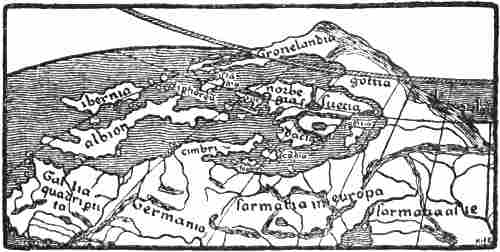
North-western portion of Nicolaus Germanus’s first revision of Ptolemy’s
map of the world (after 1466). (J. Fischer, 1902, Pl. I.)
Nicolaus Germanus, circa 1460-1470
Claudius Clavus’s later map of the North exercised for a long period a decisive influence on the representation of Scandinavia and to some extent of Greenland. This was chiefly due to the two well-known cartographers, Nicolaus Germanus and Henricus Martellus.[267] The former must have become acquainted with Clavus’s map soon after 1460, and included copies of it in the splendid MSS. of Ptolemy’s Geography which proceeded from his workshop at Florence. In these copies, of which several are known (cf. p. 251), he[Pg 277] has redrawn Clavus’s map in the trapezoidal projection invented by himself, whereby his Greenland has been given a more oblique position than the Greenland of the original map and the corresponding peninsula on the Medici map. He also introduced this Greenland into his map of the world [cf. J. Fischer, 1902, Pl. I., III.; Björnbo, 1910, p. 136]; but, in order to make it agree better with the learned mediæval view of the earth’s disc surrounded by ocean, he surrounded it by sea on the north, so that it came to form a long and narrow tongue of land projecting from northern Russia, instead of the northern mass of land extending to the North Pole according to Clavus. But this long peninsula does not seem to have entirely satisfied this priest’s erudite ideas of the continent, and on later maps (which were printed after his death in the Ulm editions of Ptolemy of 1482 and 1486) he shortened it so much that it became a rounded peninsula to the north of Norway, with the name “Engronelant,”[268] and at the same time he moved Iceland out into the ocean to the north-west. This apparently quite arbitrary alteration may perhaps be due to a desire to bring the map as far as possible into agreement with the learned dogma of the continent [cf. Björnbo, 1910, pp. 141, ff.]; but older conceptions of Greenland may also have contributed[Pg 278] towards it [cf. J. Fischer, 1902, pp. 87, ff.]. We have already seen that Adam of Bremen regarded Greenland as an island “farther out in the ocean opposite the mountains of Suedia” (see vol i. p. 194), and in his additions to the copy of Ptolemy, Cardinal Filastre (before 1427) states that Greenland lay to the north of Norway; we find the same view in the letter of 1448 from Pope Nicholas V. (see above, p. 113).[269] It is also somewhat remarkable that on the Genoese mappamundi of 1447 (or 1457) there occurs a peninsula north of Scandinavia just at the place where Clavus’s Greenland should begin (see p. 287).[270] On Fra Mauro’s mappamundi (1457-59) there[Pg 279] are several peninsulas to the north of Scandinavia, some of which proceed from Russia (see p. 285).
Map of the North by Nicolaus Germanus (before 1482), after Claudius
Clavus, but with Greenland transferred to the north of Norway
The cartographer Henricus Martellus, who succeeded Nicolaus Germanus, again adopted Clavus’s form of Greenland, wholly or in part, on his maps dating from about 1490.
In this way there arose on the maps of the close of the Middle Ages two types of the North: one with Greenland in a comparatively correct position to the west of Iceland, though far too near Europe and connected therewith, and another type with “Engronelant” as a peninsula to the north of Norway. The latter remained for a long time the usual one in all editions of Ptolemy, in other cartographical works and on many globes. After the rediscovery of Greenland we even get sometimes two delineations of this country on the same map, one to the north of Norway and the other in its right place in the west.
Greenland seems to have been given a wholly different form on a Catalan compass-chart from Majorca, of the close of the fifteenth century, where in the Atlantic to the west of Ireland and south-west of Iceland [“Fixlanda”] there is an island called “Illa verde” [the green isle]. It seems, as assumed by Storm [1893, p. 81], that the name must be a translation of Greenland, which is called in the Historia Norwegiæ “Viridis terra.” The representation of Iceland [“Fixlanda”] on this map is incomparably better than on all earlier maps, and gives proof of new information having come from thence. As the place-names point to an English source, it is possible that the cartographer may have received information from Bristol, which city was engaged in the Iceland trade and fisheries, and his island, “Illa verde,” may be due to an echo of reports about the forgotten Greenland in the west. It is worth remarking that the island is connected with the Irish mythical “Illa de brazil,” which lay to the west of Ireland and which appears in this map twice over in its typical round form (cf. above, p. 228).[271] If we remember that this[Pg 280] happy isle is in reality the Insulæ Fortunatæ, and that in the Historia Norwegiæ (see above, p. 1) it is said that Greenland [“Viridis terra”] nearly touches the African Islands (i.e., Insulæ Fortunatæ), then we possibly have an explanation of this juxtaposition. But as it is said in the same passage that Greenland forms the western end of Europe, we cannot suppose that the cartographer was acquainted with this work. The probability is, no doubt, that Greenland [Illa verde] together with Brazil or the Insulæ Fortunatæ had become transformed into mythical islands out in the ocean.
Part of a Catalan compass-chart of the fifteenth century,
preserved at Milan. (Nordenskiöld, 1892, Pl. 5)
On another compass-chart, bound up in a Paris MS. of Ptolemy of the latter part of the fifteenth century, a similar island (or peninsula ?), with the same round island to the south of it, is seen to project southwards from the northern border of the chart out into the Atlantic, and a little farther east than the Insulæ Fortunatæ. On the island is written: “Insula uiridis, de qua fit mentio in geographia” [the[Pg 281] green island, of which mention is made in the geography].[272] We do not know what geographical work may here be meant; Björnbo suggests that it might be the lost work of Nicholas of Lynn, who again may have used the Historia Norwegiæ. It is striking that the island, besides being connected with a round island like Brazil, but without a name, is placed on this map near the Insulæ Fortunatæ.
This “green island,” which thus is probably a remnant of old Greenland, occurs again in various forms and in various places on many sixteenth-century maps.
It is not surprising that information about the northern lands made its appearance also on the maps of this time, as we know that the North was visited more frequently, and sometimes by eminent southerners, from the year 1248, when the well-known Matthew Paris, who, amongst other things, drew a map of England remarkable for his time, visited Norway. Rather is it strange that the direct knowledge thus obtained did not leave more definite traces. Early in the fifteenth century (some year between 1397 and 1448) a Byzantine, Cananos Lascaris, travelled in the North and wrote about it (in Greek). He mentions amongst other things that in Bergen, the capital of Norway (“Bergen Vagen”), money was not used in trading [this must have been due to scarcity of coin]; but in Stockolmo, the capital of Sweden, they had money of alloyed silver. Bergen had a month of daylight from June 24 to July 25. He also says that he himself went to the land of the Ichthyophagi (fish-eaters), “Islanta,” from “Inglenia,” and stayed there for twenty-four days. The people were strong and powerfully built, they lived only on fish, and they had a summer day of six months [cf. Lampros, 1881].
It would take us too far here to attempt a mention of all the fifteenth-century maps which have a different representation of the North; but perhaps some of the mappemundi in wheel-form, which were still current at this time, ought[Pg 282] to be referred to. We saw that on Vesconte’s map of the world accompanying Marino Sanudo’s work the coast-lines of the compass-charts in the Mediterranean, etc., had already been introduced. On the Modena map (p. 231) this has also been carried out as regards the North. In the fifteenth century we have various wheel-maps, of which some seem to be more antiquated. Lo Bianco’s round mappamundi, in his atlas of 1436, is connected with the compass-charts of that time. Johannes Leardus’s round mappamundi, in many editions of 1448 and earlier,[273] likewise shows a strong affinity to the compass-charts, although there is little detail in the delineation of the North. The same is the case with the anonymous round mappamundi in a codex in the Library of St. Mark at Venice [cf. Kretschmer, 1892, atlas, Pl. III., No. 13], but this map has also points of similarity to Vesconte’s mappamundi in Sanudo’s work, and, amongst other things, it has the same mountain-chain along the north coast of the continent, and the same form of the Baltic.
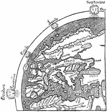
Europe on the mappamundi in the Geneva MS. of Sallust
of about 1450. (The south should be at the top)
The round mappamundi in a MS. of Mela of 1417 at Rheims[274][Pg 283] is, on the whole, of a very antiquated type, but its image of the North seems more modern, and it has the same mountain-chain along the north coast of the continent as Vesconte’s map. The “Sallust” map at Geneva, of about 1450, is also antiquated, but its Baltic resembles the compass-charts, and the two mountain ridges, one along the north coast of the continent, the other parallel with it in the interior, strongly recall Vesconte’s map of the world. On the other hand, the connection by water between the Baltic and Mæotis (the Sea of Azov) is evidently derived from an earlier age (cf. p. 199). Out in the ocean to the north-west and west of Norway lie four islands. Björnbo supposes [1910, p. 75] that the two[Pg 284] more northerly of these may correspond to Adam of Bremen’s Greenland and Wineland, but this must be very uncertain.[275]
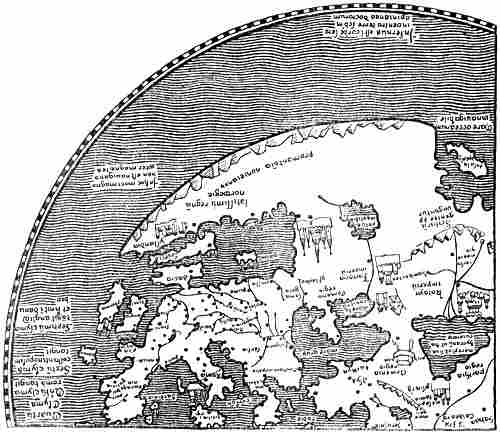
North-western portion of Andreas Walsperger’s mappamundi (of 1448).
Most of the names are omitted. (The south should be at the top)
A curious delineation of the North is found on the round mappamundi which was drawn at Constance in 1448 by the Benedictine monk Andreas Walsperger of Salzburg [cf. Kretschmer, 1891a]. The map is in most respects imperfect and antiquated, but shows also more recent, particularly German, influence.
The Mediterranean and the Baltic are disproportionately large, and the mass of land between them has been contracted. There are many mediæval mythical conceptions, and items showing possible influence by Adam of Bremen [cf. Miller, iii. 1895, p. 147]. Thus in northern Asia we have “Cenocephali” and Cannibals [“Andropophagi”], bearded women, Gog, Magog, etc. In Norway we read: “Here demons often show themselves in human shape and render service to men, and they are called trolls.” Claudius Clavus also speaks of trolls in Norway. In the northern ocean to the north-west of Norway is written: “In this great sea there is no sailing on account of magnets.” This is evidently the widely distributed mediæval myth of the magnet-rock, which attracted all ships with iron in them; in Germany it occurs in the legend of Duke Ernst’s wanderings in the Liver Sea, and it is doubtless derived from the Arabian Nights. On the mainland to the north-east of Norway we read that “here under the North Pole the land is uninhabitable on account of the excessive cold which produces a condition of continual frost....” In the extreme north of the ocean, near the Pole, is written: “Hell is in the heart or belly of the earth according to the opinion of the learned.”
“Palus meotidis” [the Sea of Azov] is marked as a lake due east of the Baltic. Along the north coast of Europe (and Norway) is indicated a ridge of mountains, somewhat similar to that in the Sanudo-Vesconte maps of the world. The delineation of Denmark (“dacia,” with “koppenhan” and “londoma,” i.e., Lund), the straight south coast of the Baltic, and a long-shaped island called “Suecia” (with “Stocholm” and “ipsala”) on the north, remind us a good deal of Edrisi’s map (p. 203), and also somewhat of the Cottoniana (vol. i. p. 183). To the north of the island of Suecia “the very great kingdom of Norway [‘Norwegie’]” projects to the west as a long peninsula bounding the Baltic, with “brondolch” [Bornholm ?] and “nydrosia metropolis” [the capital Nidaros] as towns on its south coast, and with the land of “Yslandia” [Iceland] and the town of “Pergen” [Bergen] on its extreme promontory.
Another peculiar type of the round mappamundi is the so-called Borgia map of the fifteenth century (after 1410). Its representation of Europe, with the Mediterranean on the[Pg 285] southern side of the earth’s disc, is very imperfect and far removed from reality. The same is the case with its delineation of the North, but curiously enough its Scandinavia, which is different from that of the compass-charts, and in which Skåne forms a peninsula on the south, to the east of Denmark, has a greater resemblance to reality than that of other maps of this time. This map, too, has a chain of mountains along the north coast of the continent, as in the Vesconte maps [see Nordenskiöld, 1897, Pl. XXXIX.].
North-western portion of Fra Mauro’s mappamundi
(of 1457-59), preserved at Venice. The legends and most
of the names are omitted. (The south should be at the top)
[Pg 286]The best known fifteenth-century map of the world is that of Fra Mauro (1457-59), which is also drawn in wheel-form and is preserved at Venice. The coast-lines are taken to a great extent from the compass-charts, but a great deal of new matter has been added. As regards Norway, this consists of information from Querini’s voyage in 1432, as well as from other sources which are unknown to us; this is indicated by, amongst other things, an inscription on the sea to the north of Russia [“Permia”], which relates that a short time before two Catalan ships had sailed thither [cf. Vangensten, 1910]. On this map the Scandinavian Peninsula has been given a more reasonable extension to the north; but the west coast is very imaginatively supplied with peninsulas and islands, while the ocean outside is full of fabulous islands and contains many legends.
Denmark [“Datia”] has been made into an island (which is also called “Isola islandia”), and the Baltic [“Sinus germanicus”] has been widened into an inland sea with islands. In its northern part is a note that on this sea the use of the compass is unknown [cf. Vangensten, 1910]. Could this inscription be due to a misunderstanding like that on the Walsperger map in the ocean to the north-west of Norway, that it could not be navigated on account of magnets (cf. p. 283)? There is no hint of the name of Greenland on this map; on the other hand, Iceland appears in three or four different places: besides Denmark, as mentioned above, there is in northern Norway or Finland a peninsula named “Islant,” “where wicked people dwell, who are not Christians”; also a large island, “Ixilandia,” north-west of Ireland, and finally an intricate peninsula in the middle of Norway called “Isola di giaza” [i.e., the island of ice]. On the north of Norway or Finland a peninsula projects into the Polar Sea with the name of “Scandinabia.” The map does not contribute anything new of importance about the North, but points to a few fresh pieces of information about Norway, which are not to be traced in the older compass-charts; thus Bergen comes nearly in its right place on the west coast, and Marstrand appears to the east of Christiania fjord.
A picture of the North of a wholly different type is given on the elliptical Genoese mappamundi [of 1447 or 1457], which is still more fantastic than any of those hitherto mentioned. The Scandinavian Peninsula has a very long extension to the west, and ends in a promontory projecting northwards. To the north of this Scandinavia there is another fantastic peninsula where Lelewel thinks he can read the name[Pg 287] “Grinland,” which is probably due to a misunderstanding, since, as pointed out by Björnbo [1910, p. 80], the name cannot be seen on the much-damaged original, or on Ongania’s photographic reproduction [Fischer-Ongania, Pl. X.]. Many imaginary islands are scattered about in the sea round these peninsulas.
Northern Europe on the Genoese mappamundi of 1447 or 1457
Behaim’s globe, 1492
Towards the close of the fifteenth century the discovery was made of representing the surface of the earth, with land and sea, on globes. It was evidently the efforts of Toscanelli that led to the general adoption of this mode of representation, which had been used by the Greeks at an early time (cf. vol. i. p. 78); in 1474 he announced that his idea of the western route to India could best be shown on a sphere. Columbus seems to have taken a globe with him on his voyage of 1492, according to his own words in the ship’s log. The oldest known terrestrial globe that is preserved was made in 1492 by the German Martin Behaim (born at Nuremberg in 1459).[276] He spent much time in Portugal, and also in the Azores, after making a distinguished marriage with a native of those islands, a sister-in-law of Gaspar Corte-Real’s sister. But it was during a visit to his native town (1490-93) that he constructed his globe. The sources of Behaim’s representation of the North[Pg 288] were principally Nicolaus Germanus’s mappamundi in the Ulm editions of Ptolemy, of 1482 and 1486, where Greenland is placed to the north of Norway, and Marco Polo’s travels, which speak of the northern regions of Asia. Besides these a name like “tlant Venmarck” (the land of Finmark), for instance, points to a use of the same older authority as in the anonymous letter to Pope Nicholas V., of about 1450,[Pg 289] where in the existing French translation there is mention of “lieux champestres de Venmarche” [the plains of Finmark].[277] Thus we are here again led to the lost work of Nicholas of Lynn, “Inventio fortunata” (1360), as the possible source. That it really was this work that was used seems also to result from the fact that the countries about the North Pole on Behaim’s globe bear a remarkable resemblance to Ruysch’s map of 1508, where this note is given at the North Pole:
“In the book ‘De Inventione fortunata’ it may be read that there is high mountain of magnetic stone, 33 German miles in circumference. This is surrounded by the flowing ‘mare sugenum,’ which pours out water like a vessel through openings below. Around it are four islands, of which two are inhabited. Extensive desolate mountains surround these islands for 24 days’ journey, where there is no human habitation.”
Northernmost Europe and the north polar regions on Behaim’s globe, 1492
What is new in Behaim’s picture of the North is chiefly this circle of land and islands around the North Pole, which he evidently took from Nicholas of Lynn, and which is not represented on any older map known to us. It consists of a continuous mass of land proceeding from his Greenland-Lapland to the north of Scandinavia, and extending eastward nearly to the opposite side of the Pole, where the Arctic Ocean (“das gefroren mer septentrional”) to the north of the continent becomes an enclosed sea. On the other side of the Pole are two large islands and a number of smaller ones. On one of the large islands is a picture of an archer in a long dress attacking a polar bear (which may be connected with myths about Amazons ?), and on the other side is written: “Hie fecht man weisen valken” [here they catch white falcons]. It might be supposed that this was derived from statements about Scandinavia or Iceland (cf. e.g., the legends of the compass-charts); but, as assumed by Ravenstein [1908, p. 92] and Björnbo [1910, p. 156], it is more likely to come from Marco Polo’s travels, where the Arctic coast of Siberia is spoken of. The many correct names, in a German form, in Martin Behaim’s Scandinavian North point to the possibility of his also having received oral[Pg 290] information, though they may equally well be derived from older German maps.
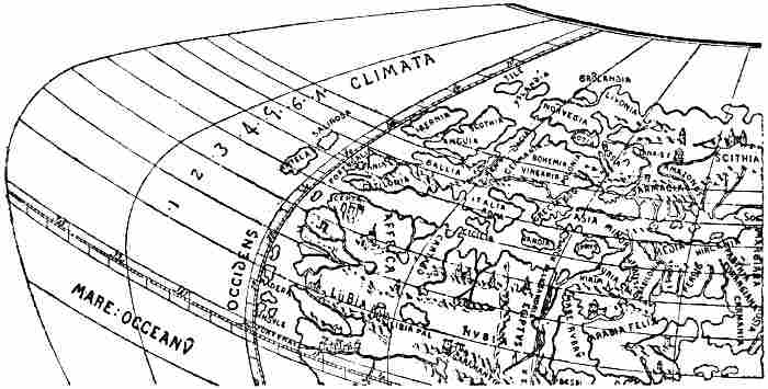
A portion of the Laon globe of 1493. (After d’Avezac.)
Almost contemporary with Behaim’s globe is the so-called Laon globe of 1493, which was accidentally discovered in a curiosity shop at Laon some years ago. It gives a wholly different representation of the North, more in agreement with the usual maps of the world of the Nicolaus Germanus type, with sea at the pole round the north of the continent, which terminates approximately at the Arctic Circle. The Scandinavian Peninsula (called “Norvegia”) has a form somewhat resembling this type; but to the north of it “Gronlandia” appears as an island, with a land called Livonia projecting northward on the east, and two islands, Yslandia and Tile, on the west. Nothing is known of the origin of the Laon globe, or of the sources of its representation of the North.
Such were the geographical ideas of the North at the close of the Middle Ages, when the period of the great discoveries was at hand; they were vague and obscure, and the mists had settled once more over large regions which had been formerly known; but out in the mists lay mythical islands and countries in the north and west.
CHAPTER XIV
JOHN CABOT AND THE ENGLISH DISCOVERY OF NORTH AMERICA
Over the cloud-bridge of illusion lies the path of human progress. The greatest achievements in history have been brought about more by the aid of ideas than of truth. Religious illusions have ennobled the rude masses and raised them to higher forms of society; in the domain of science intuition and hypothesis have led to fresh victories, as also in geographical exploration; there too illusions, like a fata Morgana, have impelled men forward to great discoveries.
It is true that Columbus’s plan was based on the correct idea that the world was round; but if he had known the real distance of India—if he had not been fettered by the ancient dogmas of the Greeks about the great extension of the continent to the east, and their low estimate of the earth’s circumference, which made India appear so enticingly near—if he had not believed in myths of lands in the west—he certainly would never have been the discoverer of a new world.
The people of the Middle Ages lived, as we have seen, to[Pg 292] a great extent on remnants of the geographical knowledge and conceptions of the Greeks. It was the age of superstition and speculation; with the exception of the Norsemen and the Arabs, and in some degree also the Irish monks, there was during the earlier part of this period no enterprise that broke through the bounds of the known, except in the mythical world of fancy. It was not until the Crusades that the horizon began to be widened. The eastern trade of the Italian republics and the development of capable Italian seamen were of great significance. At an early date they made discoveries along the west coast of Africa. Of even greater importance was it that the Portuguese learned seamanship from them, and no doubt from the Arabs as well, and displayed great enterprise on the ocean along the shores of Africa, finding groups of islands in the west, and finally the Azores in 1427; but these must have been discovered earlier, since similar islands occur on Italian maps of the fourteenth century (cf. the Catalan Atlas of 1375).
When Ptolemy’s work, and through it the geography of the Greeks, became known in Western Europe at the beginning of the fifteenth century, it created a greater stir in the learned world than even the discovery of America did later; the circle of geographical ideas was greatly changed, and the world was regarded with new eyes as a sphere. The doctrine of the possibility of circumnavigating the earth was especially framed and scientifically established by the celebrated astronomer Toscanelli of Florence. But this was not a new doctrine; for the Greeks, Eratosthenes and Posidonius, for example (cf. vol. i. pp. 77, 79), had already announced it clearly enough, and even in the Middle Ages it was not forgotten. We saw that Mandeville, the writer of fabulous narratives, fully understood the possibility of sailing round the globe, and related ancient tales about such a voyage (cf. p. 271). But at the close of the fifteenth century the idea was seriously taken up by two men of action, both Genoese. One of them was Columbus, the other Cabot. Whether the latter had already conceived[Pg 293] the idea before the first voyage of Columbus we do not know for certain, but it is not improbable; the thought was latent in the age, and many must have come near it. Another force impelling men to the western voyage, and perhaps as powerful a one as these scientific speculations, was the belief in the mythical world of enticing islands that lay out in the ocean to the west of Europe and Africa; the Isles of the Blest of the Greeks and the Atlantis of Plato, conceptions, originally derived from the East, which were still alive, though in other forms. There lay Antillia, the Isle of the Seven Cities, mythical islands of the Arabs, and the Irish legendary world, Brandan’s isles and many others; some of them had had a part in creating the Norse idea of Wineland and the White Men’s Land; now they were given a fresh lease of life, and power over the imagination of Western Europe. Possibly in connection with echoes of tales of the Norsemen’s discoveries—coming from Iceland to Bristol, and thence to the continent—these mythical islands helped to form a widespread belief in countries in the far west across the ocean. The fact that the Portuguese, as has been said, really found islands, the Azores, out in the Atlantic in 1427, also contributed to establish this belief. From these islands many expeditions set out in the course of the fifteenth century to search for new lands farther west.[278]
From the beginning of the fifteenth century Bristol was in frequent communication with Iceland, both for the fishery and for trade. As already pointed out, this was certainly due in no small degree to the number of Norwegians who had settled in the town. Sailors and merchants returning from voyages to Iceland doubtless brought thence many tales of marvels and of unknown islands and countries out in the ocean; legends of the Icelanders’ voyages to Greenland and Wineland may have served to entertain the winter evenings in Bristol.[279] It was therefore surely not an accident that attempts[Pg 294] to find land in the west should originate precisely in this enterprising sea-port.
On the maps of the fourteenth and fifteenth centuries there lay out in the ocean to the west of Ireland the Isle of Brazil (cf. p. 228). It was the Irish fortunate isle Hy Breasail, of which it is sung:
“On the ocean that hollows the rocks where ye dwell,
A shadowy land has appeared, as they tell;
Men thought it a region of sunshine and rest,
And they called it O’Brazil—the isle of the blest.
From year unto year, on the ocean’s blue rim,
The beautiful spectre showed lovely and dim;
The golden clouds curtained the deep where it lay,
And it looked like an Eden, away, far away.”
[Gerald Griffin.]
We have seen that on certain maps this round fabled isle was brought into connection with an “Insula verde,” probably Greenland, and this conception of the latter probably came from Iceland by way of England. We do not know what myths were associated with Brazil at that time; but the belief in it was so much alive that ships were sent out from Bristol to search for the island. A contemporary account of such an attempt made in 1480 has come down to us:[280]
“On the 15th of July [25th of July N.S.] ships ... [belonging to ?] ... and John Jay junior, of 80 tons burthen, sailed out of the port of Bristol [to navigate][Pg 295] as far as the island of Brazil [“insulam de Brasylle”] on the west side of Ireland, ploughing the seas by ... and ... Thlyde [Thomas Lyde or Lloyd ?] is the most expert seaman in the whole of England, and on the 18th of September [27th of September N.S.] the news reached Bristol that after having sailed the seas for about 9 months they had not discovered the island, but on account of storms had returned to the port ... in Ireland to allow the ships and men to rest.”
Parts of the MS. being illegible, it does not appear whether John Jay, junior, was one of the leaders of the expedition or (as Harrisse thinks) one of the owners of the ships, but in any case we must suppose that the Thomas Lyde mentioned above was the actual leader or navigator. The “nine months” (“9 menses”) must either be a clerical error for two months or for nine weeks, either of which would fit the dates given, while nine months is meaningless. This must at any rate have been a serious attempt to find lands in the west, twelve years before Columbus’s discovery of the West Indies; and this was not the last attempt made from Bristol to find this happy land, for in 1497 Ayala, the Spanish Minister in London, writes:
“For the last seven years the Bristol people have equipped every year two, three, or four caravels to go in search of the islands of Brazil and of the Seven Cities,[281] following the imagination of this Genoese.”
“This Genoese” is Giovanni Caboto, or John Cabot, as he was called in England. We find only a few casual statements about this man, who was to give England the right of discovery to a new continent, and who, together with his fellow townsman, Columbus, forms the great turning-point in the history of discovery; for the most part an impenetrable obscurity rests upon his life and activity.[282] As he is[Pg 296] often called, e.g., in letters from the contemporary Spanish Ambassadors in London, “this Genoese,” or “a Genoese like Columbus,” we must suppose that he was born in Genoa; but from existing State documents of the republic of Venice it appears that Joanni Caboto obtained his freedom in Venice on March 28, 1476, after having lived there fifteen years, which was the legal period necessary to enable a foreigner to become a citizen of the republic.[283] From the statements of contemporaries we must conclude that John Cabot was a capable seaman and navigator, with a good knowledge of charts and cartography; he also constructed a globe to illustrate his voyages. This is no more than was to be expected of a Genoese, trained in the Venetian school, which at that time was the foremost in seamanship. It may, therefore, be regarded as probable that John Cabot was familiar with the leading ideas of the geographical world of his time. Thus, while still living at Venice, he may have heard of the idea of reaching Eastern Asia by sailing to the west, which was put forward, notably by Toscanelli, as early as 1474, and in this way it is possible that, independently of Columbus, he may have thought of accomplishing this voyage to the fabulous riches of the East by a shorter route than that which the Portuguese sought to the south of Africa. In support of this it may be mentioned that in 1497 he himself told the Minister of Milan in London, Raimondo di Soncino, that
“he had once been at Mecca, whither spices were brought by caravans from distant lands, and that those who brought them, when asked where the said[Pg 297] spices grew, answered that they did not know, but that other caravans came to their home with this merchandise from more distant lands, and these [other caravans] again say that it is brought to them from other regions situated far away.” Soncino adds that “Cabot reasons thus—that if the eastern people tell those in the south that these things come from places far distant from them, and so on from hand to hand, then, granting the earth to be round, the last people must obtain them in the north-west; and he says it in such a way that, as it does not cost me more than it costs, I too believe it....”[284]
It is not improbable that Cabot may have thought that as, on account of the spherical form of the earth, the circumference of the lines of latitude decreases towards the north, the shortest way over the western ocean to the east coast of Asia must lie along the northern latitudes (cf. Posidonius, vol. i. p. 79). But we cannot lose sight of the fact that Cabot did not advance this until long after the first voyage of Columbus, and it is, therefore, uncertain whether the idea occurred to him before or after that time. When this journey to Mecca took place we do not know.
Pedro de Ayala, the Spanish Minister in London, says in a letter to Ferdinand and Isabella of Spain, in 1498, that Cabot is “another Genoese like Columbus, who has been in Seville and Lisbon, endeavouring to obtain help for this discovery” [i.e., of land in the west]. The question is whether this “who” refers to Columbus or Cabot. The latter appears more likely, as it seems superfluous for the Minister to inform Ferdinand and Isabella that Columbus had been in Seville. But here again we do not learn when Cabot may have made this journey to Spain and Portugal, whether before or after Columbus’s voyage in 1492. In any case it may point to his having been occupied for a long time with plans of this sort.
Nor do we know when John Cabot came to England; but perhaps it was about 1490 that he settled in Bristol. If he really came there with ideas of making for Asia across the western ocean, he certainly found a favourable soil for such plans in the port which had already sent out ships in 1480 to look for the island of Brazil. But it is also very possible that[Pg 298] these plans occurred to him after he had heard of this expedition, and had become familiar at first hand with the ideas of western lands which dominated the minds of the sailors of Western Europe (Englishmen and Portuguese) of that time. With the many fresh arguments he brought with him from Italy and the Mediterranean countries, it cannot have been difficult for him to induce the merchants of Bristol to make fresh attempts to find these countries in the west or north-west; and, to judge from Ayala’s letter of 1497 about the expeditions sent out annually for the previous seven years, he seems to have been persistent.
We do not know whether Cabot himself took part in the attempts made after 1490. None of them seems to have met with any success before 1497, for otherwise it would have been mentioned. But it was while the people of Bristol were occupied with such enterprises that Cabot’s great fellow-countryman, Columbus, made his remarkable voyage across the ocean farther to the south, in 1492, and found a new world, which he took to be India. With that came the awakening with which the time was pregnant. The news of the achievement, which fired all the adventurers of Europe, must soon have reached Bristol, and put new life and a wider purpose into the old plans.[285] That Cabot now became the soul of these[Pg 299] plans is clear enough from all the facts, and we see from existing public documents that at the beginning of 1496 he was making special efforts to get an important expedition sent out, and was applying to the King of England for protection and letters patent to assure to himself and his three sons, Lewis, Sebastian and Sancto, the profit of the discoveries he expected to make on this expedition, which was to consist of five ships.
The letters patent were accorded on March 5 (14th N.S.), 1496,[286] and give Cabot and his sons the right under the English flag
“to sail in all parts, regions and bays of the sea, in the east, west and north, with five ships or vessels of whatever burthen or kind, and with as many men as they wished to take with them, at their own expense, and to find, discover and investigate whatever islands, countries, regions or provinces belonging to heathens or infidels, in whatsoever part of the world they might be, which before that time were unknown to all Christians.” They also had the right as vassals or governors of the King of England, to take possession of whatsoever towns, camps or islands they might discover and be in a position to capture and occupy. They were to give the king a fifth part of all merchandise, profits, etc., of this voyage or of each voyage, as often as they came to Bristol, to which port alone they were bound to return. They were exempted from all duty on goods they might bring from newly discovered lands, and were given a monopoly of all trade and traffic with them. Furthermore, all English subjects, both by land and sea, were ordered to afford the said John, his sons, heirs and assigns, good assistance, “both in fitting-out their ships or vessels, and in supplying them with provisions which were paid for with their own money.”
As the south is not mentioned among the regions which might be explored, and as the new countries might not be known to Christians, it is clear that Cabot is here enjoined not to frequent those waters where the Spaniards and Portuguese had just made their most important discoveries, and[Pg 300] thus run the risk of bringing England into conflict with the Spanish or Portuguese Crown.
As the letters patent bear the same date (March 5) and are to some extent couched in the same terms as Cabot’s petition, they must have been granted as the result of previous negotiation and agreement between Cabot and the King, and must therefore contain Cabot’s plans for the new voyage, which were thus already formed in March 1496, when he had doubtless made at all events some preparations for the expedition.
That Cabot’s plans had been spoken of at the English Court as early as January of that year appears from an existing letter from Ferdinand and Isabella of Spain to the Spanish Ambassador in England, Dr. Ruy Gonzales de Puebla. The letter is dated March 28 (April 6, N.S.), 1496, and is an answer to a letter, now lost, of January 21 (30, N.S.) from the Ambassador. The answer is as follows:
“You write that one like Columbus has come to propose to the King of England another enterprise like that of the Indies, without prejudice to Spain or Portugal. He has full liberty. But we believe that this enterprise was put in the way of the King of England by the King of France in order to divert him from other business. Take care that the King of England be not deceived in this or any other matter. The French will try as much as they can to lead him into such enterprises; but they are very uncertain undertakings, and are not to be commenced for the moment. Moreover they cannot be put into execution without prejudice to us and to the King of Portugal.”[287]
It will be understood from this that Cabot’s plans had attracted attention in London, and that great importance was attached to them; consequently they must have been discussed for some time before the granting of letters patent. For this reason also, we must suppose that Cabot was prepared for his expedition in March 1496. It seems therefore unlikely that this was the expedition which did not leave until the year following that in which he applied for the letters patent, all the more so as the expedition of 1497 consisted of only[Pg 301] one ship.[288] If we may interpret Ayala’s words of 1498 literally, that Bristol had sent out ships yearly for the seven previous years to search for the island of Brazil, etc., then we must suppose that Cabot actually set out in 1496 with the projected expedition of five ships, but for some reason or other turned back without having accomplished his object. After having been unfortunate in so large an undertaking, Cabot may have found it less easy to enlist support for a fresh attempt in 1497, and was thus obliged to content himself with one small ship and a scanty crew (eighteen men).[289] It may also be supposed that as the earlier expeditions consisting of several ships had failed to find the land they were looking for, Cabot as a practical seaman wished to make a pioneer expedition with a small swift-sailing craft and a picked crew, before again embarking on a large and costly undertaking. He was more independent, and could sail farther and more rapidly to the west, than when he was tied by having to keep a fleet of several ships together.
Cabot’s sons, who are mentioned in the letters patent, may have taken part in the voyage of 1496; on the other hand, it is less probable that they were among the eighteen men in 1497.[290] It is true that his son Sebastian claimed to have been present as one of the leaders of the expedition, but he also claimed to have made the voyage alone, so that no weight can be attached to his words. In any case, he must have been very young at that time, and he cannot have played any[Pg 302] important part. Nor is a word said about him in a single one of the letters from contemporary foreign ambassadors in London, and in Pasqualigo’s letter of August 23, 1497, we are told of John Cabot after his return that “in the meantime [i.e., until his next voyage] he is staying with his Venetian wife and his sons in Bristol.” This does not seem to show that any of the sons had been with him; and the protest of the Wardens of the Drapers’ Company of London (see later) against Sebastian as a navigator points in the same direction.
Not a line have we from Cabot’s own hand either about this important voyage of 1497 or any other. We hear that he made maps of his discoveries; but these too have been lost, like so many other maps that must have been drawn during this period before 1500.[291] We can, therefore, only draw our conclusions from the statements of others, some contemporary and some later.
The most important documents giving trustworthy information about John Cabot’s voyage in 1497 are the following:
(1) The three letters from his two compatriots in London: one from the Venetian, Lorenzo Pasqualigo, to his two brothers in Venice, dated August 23 (September 1, N.S.), 1497; and two letters from the Milanese Minister, Raimondo di Soncino, to the Duke of Milan, dated August 24 (September 2, N.S.) and December 18 (27), 1497.
(2) An entry in the accounts of the King of England’s privy purse, from which we see that Cabot was back in London by August 10 (19, N.S.), 1497.
(3) The map of the world, drawn in 1500, by the well-known Spanish pilot, Juan de la Cosa.
(4) A Bristol chronicle by Maurice Toby, written in 1565, but from older sources.
[Pg 303]Besides these may be mentioned a legend on the map of the world of 1544 which, according to what is written on it, was the work of Sebastian Cabot. But even if this be correct, the legend is of no great value, as he cannot be regarded as a trustworthy authority.[292]
Lorenzo Pasqualigo writes on August 23 (September 1, N.S.), 1497, to his two brothers in Venice, amongst other things:
“Our Venetian, who set out with a little ship from Bristol to find new islands, has returned, and says that he has discovered 700 leagues [Italian nautical leagues] away the mainland of the kingdom of the Great Khan (‘Gran Cam’) [China], and that he sailed 300 leagues along its coast and landed, but saw no people; but he brought here to the King some snares that were set up to catch game, and a needle for making nets, and he found some trees with cuts in them, from which he concluded that there were inhabitants. Being in doubt he returned to the ship,[293] and was three months on the voyage, and this is certain; and on the way back he saw two islands on the right hand, but would not land so as not to lose time, as he was short of provisions. He says that the tides are sluggish and do not run as here [i.e., in England]. The King has promised him next time ten ships fitted out according to his desires, and has given him as many prisoners to take with him as he has asked, except those who are in prison for high treason; and he has given him money to enjoy himself with in the meantime, and now he is with his Venetian wife and his sons at Bristol. His name is Zuam Talbot [sic, for Cabot], and he is called the Grand Admiral and great honour is shown him, and he goes dressed in silk and the Englishmen run after him like madmen, but he will have nothing to do with any of them, and so [do] many of our vagabonds. The discoverer of these things has planted on the soil he has found the banner of England and that of St. Mark, as he is a Venetian; so that our flag has been hoisted far away” [cf. Harrisse, 1882, p. 322].
The Minister, Raimondo di Soncino, writes on August 24 (September 2, N.S.), 1497, to the Duke of Milan, amongst other things:
“Some months ago (‘sono mesi passate’) his majesty the King [of England] sent out a Venetian who is a good sailor, and has much ability in finding islands,[Pg 304] and he has returned safely and has discovered two very large and fertile islands, and found as it seems the seven cities[294] 400 leagues to the west of the island of England. His majesty the King here will on the first opportunity send him with fifteen or twenty ships...” [cf. Harrisse, 1882, p. 323].
On December 18 (27), 1497, Soncino again writes to the Duke more fully about Cabot’s voyage:
“Perhaps amongst Your Excellency’s many occupations it may not be unwelcome to hear how this Majesty has acquired a part of Asia without drawing his sword. In this kingdom is a Venetian called Messer Zoanne Caboto, of gentle bearing, very skilful in navigation, who, seeing that the most serene Kings, first of Portugal and then of Spain, had taken possession of unknown islands, proposed to himself to make a similar acquisition for the said Majesty. After having obtained the royal privilege, which assured to him the use of the dominions he might discover, while the Crown retained the sovereignty over them, he gave himself into the hands of fortune with a small ship and eighteen men, and sailed from Bristol, a port on the west of this kingdom; and after passing Ireland farther west, and then steering to the north, he began to sail towards the eastern regions [i.e., westwards to the lands of the Orient, thus making for the east coast of Asia], leaving (after some days) the pole-star on his right hand; and after a good deal of wandering (‘havendo assai errato’) he finally came to the land (‘terra ferma’), where he raised the royal banner and took possession of the country for this Highness, and after having taken some tokens [of his discovery] he returned. As the said Messer Zoanne [John] is a foreigner and poor, he would not be believed, if his crew, who are nearly all English and belong to Bristol, had not confirmed the truth of what he said. This Messer Zoanne has the description of the world on a chart, and also on a solid sphere which he has made, showing on it where he has been; and in travelling towards the East he went as far as to the land of the Tanais [i.e., Asia], and they say that the country there is excellent and temperate, and expect that brazil-wood (il brasilio) and silk[295] grow there, and they declare that this sea is full of fish which can be caught not only with the seine, but[Pg 305] also with a dip-net [or bow-net ?], to which is fastened a stone to sink it in the water, and this I have heard related by the said Messer Zoanne. And the said Englishmen, his companions, say that they took so many fish that this kingdom will no longer have any need of Iceland, from which country there is a very great trade in the fish they call stockfish. But Messer Zoanne has set his mind on higher things, and thinks of sailing from the place he has occupied, keeping along the coast farther to the east, until he arrives opposite to an island called Cipango [i.e., Japan], lying in the equinoctial region, where he thinks that all the spices of the world, as well as jewels, are to be found.” Then follows the reference to his visit to Mecca, already cited (p. 296). The letter continues: “And what is more, this Majesty, who is prudent and not prodigal, has such confidence in him on account of what he has accomplished, that he gives him a very good subsidy, as Messer Zoanne himself tells me. And it is said that his Majesty will shortly fit out some ships for him, and will give him all the criminals to go out to this land and form a colony, so that they hope to establish in London an even greater emporium of spices than that at Alexandria. The principals in this enterprise belong to Bristol; they are great sailors, and now that they know where to go, they say that the voyage thither will not take more than fifteen days, if they have a favourable wind on leaving Ireland. I have also spoken with a Burgundian of Messer Zoanne’s company, who confirms all this, and who wishes to return thither, because the Admiral (for this is the title they give Messer Zoanne) has given him an island; and he has given another to his barber [surgeon ?] from Castione,[296] a Genoese, and both consider themselves counts, nor do they reckon Monsignor the Admiral for less than a prince. I believe some poor Italian monks who have been promised bishoprics will also go on this voyage. And if I had made friends with the Admiral when he was about to sail, I should at least have got an archbishopric; but I thought the benefits that Your Excellency has reserved for me were more certain...” [cf. Harrisse, 1882, pp. 324, ff.].
As confirming and to some extent supplementing what is said in these letters, we have various statements in the letters of the two Spanish Ambassadors about the voyage in the following year (see later); they both say that the newly discovered country lay not more than four hundred Spanish leagues distant.
In Maurice Toby’s Bristol chronicle of 1565, we read of the year 1497:
“This year, on St. John the Baptist’s day, the land of America was found by the merchants of Bristowe in a shippe of Bristowe called the ‘Mathew,’ the which said shippe departed from the port of Bristowe the second day of May, and came home again the 6th of August next following.”[297]
[Pg 306]Of course this chronicle was written long after the voyage took place; but it is extremely probable that it was taken from older sources; for it agrees in every way (both as to the length of the voyage and the time of the return) with the contemporary statements of the Italian Ministers, with whose letters the author of the chronicle cannot possibly have been acquainted. I can, therefore, see no reason why this statement should not be correct. But the most important authorities are the letters referred to.
If we compare all this we shall get a fairly complete idea of the voyage of 1497. After sailing round the south of Ireland, probably in the middle of May according to our calendar, Cabot would at first have held a somewhat northerly course. If this is correct, he may have done so for several reasons: unfavourable winds, which in May are prevalent from the south-west; the idea that great-circle sailing would prove the shortest way;[298] fear of encroaching on the waters of the Spaniards and Portuguese to the south; finally, perhaps, an idea that the course to Asia was shorter in northern latitudes (?). But we cannot tell what reasons decided him, nor whether he steered very far to the north at all; for it must be remembered that in speaking to a foreign Minister he may have had good reason for making his course appear somewhat northerly, lest it might be said that the lands he had arrived at were those discovered by the Spaniards. In any case, it was not long before he made for the west as rapidly as possible towards his goal, and we cannot, therefore, suppose that he went very far north. And it is expressly stated in Soncino’s first letter that the lands lay to the west of England, and in the letters of the Spanish Ambassadors in the following year we read that, after having seen the direction taken by Cabot, they thought that the land he had found was that belonging[Pg 307] to Spain, or was “at the end of that land.” This again does not point to any northerly course.
Many writers have thought that from Soncino’s statements about the courses a conclusion might be drawn as to where on the American coast Cabot made the land; but this is impossible. In the first place Soncino’s words are anything but definite; besides which, of course, Cabot could not steer in a straight line across the Atlantic, but with the frequent contrary winds of May and June was obliged to shape many courses, and often had to beat; in fact, we are told as much in Soncino’s words, “havendo assai errato.” Every one who has had experience of the navigation of sailing ships knows how difficult it is under such conditions to make way in the precise direction one wishes, however good one’s reckoning may be; currents and lee-way set one far out of the reckoned course, and on a voyage so long as across the Atlantic the lee-way may be considerable. Whether Cabot was able to correct his reckoning by the aid of astronomical observations (with a Jacob’s staff or an astrolabe) we do not know, but we hear nothing of latitudes, so that it is not very probable (cf. also Columbus’s gross error in latitude). Especially during the first part of the voyage currents and prevailing winds may have set Cabot to the north-east; but he may also have encountered, particularly during the latter part of the voyage in June, heavy north-westerly gales which set him still farther to the south, and he may thus have had a southerly lee-way. In addition, as Dawson has so strongly insisted, the error of the compass must have set him to the south. Whether Cabot was aware of the error, and remarked its variation during the westward voyage, we do not know; it is possible, since we know that Columbus remarked this variation during his first voyage; but in any case, Cabot doubtless paid as little attention to it as Columbus in his navigation. Unfortunately we do not know the amount of the error at that time, but by examining the relation between the true direction of the coast-lines and those we find on the most trustworthy[Pg 308] compass-charts (especially the Cantino chart) of a little later than 1500 (which are drawn in ignorance of the error), I have attempted to reconstruct the distribution of the error in the Atlantic Ocean at that time (cf. chart below); of course, this is purely hypothetical. According to this, during Cabot’s voyage westwards the error would have varied from about 6° east at Bristol to about 30° west off the coast of America. If we suppose that he was able to follow a magnetic western course the whole way from the south coast of Ireland, then he must have passed quite to the south of Cape Race in Newfoundland. But we are told that he first held somewhat to the north, though we do not know how much, and, on the other hand, his lee-way may have set him at least as far to the south. The assertion that the course mentioned by Soncino must have brought Cabot to land in Labrador or Newfoundland is thus untenable. Nor does it agree with Soncino’s allusion to the country as excellent and temperate, and one where dye-wood and silk might be expected to grow. If this be explained away as due to the usual propensity of discoverers at that time to exhibit the newly found countries in the most favourable light, which is very possible, it is not so easy to explain why we do not hear a word about their having encountered ice on the voyage. If on his western voyage Cabot came to Labrador or the north-east coast of Newfoundland some time in June, it is improbable that he should not have seen icebergs, and it is equally unlikely that the Italian Ministers should not have mentioned this, which to them would be a great curiosity, if they had heard of it; we see, too, that later, in descriptions of Sebastian Cabot’s alleged voyage, the ice is mentioned above all else. Even if John Cabot might have[Pg 309] kept quiet about the ice, lest it should cool the hopes raised by his narrative, it is not likely that his crew would have done so, if they had met with it. But although other statements of the crew are reported, we do not hear a single word about ice, nor even of icebergs, which are common enough on the Newfoundland Banks at that time of the year, and would be an entirely new experience even to Bristol sailors who were accustomed to the voyage to Iceland. From this we must suppose that in the course of his beating to the west Cabot was set so far to the south of the Newfoundland Banks that he did not encounter icebergs, and that he first made land somewhere farther west.[299]
Hypothetical chart of the variation of the compass in the Atlantic, circa 1500
According to the Bristol chronicle already quoted (Toby, 1565), and according to a legend on the map of 1544, which is ascribed to the collaboration of Sebastian Cabot, it was on St. John’s Day (July 3, N.S.) that the first land was discovered. In spite of Harrisse’s objections[300] it does not appear to me unlikely that this may be correct. If he sailed on May 2 (11), he was fifty-three days at sea. Supposing that he landed at Cape Breton, the distance in a straight line on the course indicated is about 2200 nautical miles. Consequently he would have made an average of forty-two miles a day in the desired direction. This is doubtless not very fast sailing, but agrees with just what we should expect, since he often had to beat, and “wandered a good deal,” in the words of Soncino.
For determining the question, what part of North America it was that Cabot discovered, it appears to me there is no trustworthy document but La Cosa’s map of the world[Pg 310] of 1500.[301] The Basque cartographer, Juan de la Cosa, who owned and navigated Columbus’s ship in 1492, and who was afterwards entrusted with many public undertakings, enjoyed a reputation in Spain as a map-maker and sailor. He was commissioned by the Spanish Crown to produce a map of the world, and we must suppose that for this work he was provided with all the maps and geographical information that were available in Spain. From a letter of July 25, 1498, to Ferdinand and Isabella of Spain, from Ayala, the Spanish[Pg 311] Minister in London, we know that the latter had obtained a copy of “the chart or mapa mundi” that John Cabot had made in order to set forth his discoveries of 1497; and there can be no doubt that a copy of this was also sent to Spain, as Ayala says he believes their Majesties already had the map. It may, therefore, be regarded as a matter of course that La Cosa was in possession of this map when, less than two years later, he was about to make his own, and that it is from this source and no other that he derived his information about the English discoveries. We do not know of any other map being sent from England to Spain during these two years, and there is no ground whatever for assuming that La Cosa’s information may be derived from Cabot’s voyage of 1498, which in any case must have been a failure.
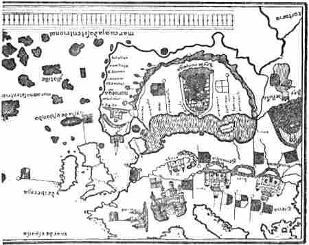
North-western portion of Juan de la Cosa’s map of 1500. Only a few of the names are given; the network of compass-lines is omitted
For the understanding of La Cosa’s map it must be remarked[Pg 312] first of all that it is a compass-chart, and that it takes no notice of the magnetic variation on the American coast. This explains the fact that, for instance, lines of coast which in reality run from west to south-west, are made to appear on the chart as running from west to east. Furthermore, the latitude of the coast of North America is made too northerly, through coasts which, for instance, lie magnetic west of Ireland, being placed on the chart true west of it. In this way Cape Breton (or Cape Race in Newfoundland ?) can be brought to about the same latitude as the south of Ireland, whereas in reality it lies nearly 5° farther south.
The coast marked with five English flags is, of course, the land discovered by Cabot. That La Cosa had a map of this district is further shown by the details, which distinguish it from his delineation of the remainder of the North American coast, but which give it a resemblance to that part of South America which is marked with Spanish flags and of which he had a map. Curiously enough only part of the English district has names; we must suppose that this is the coast that Cabot is said to have sailed along. La Cosa’s representation of the rest of the North American coast is doubtless guesswork, although it has features which bear a remarkable resemblance to reality; but it is not altogether impossible that he may have had oral or written reports of later voyages (?), which are unknown to us.
La Cosa’s map is in complete agreement with the statements in the letters of Pasqualigo, Soncino, and the two Spanish Ambassadors. Soncino says that the country lies four hundred Italian leagues to the west of England, while both Puebla and Ayala say that they believe the distance to be no more than four hundred Spanish leagues. On the other hand, according to Pasqualigo, Cabot said that at a distance of seven hundred Italian leagues he had discovered the mainland of the kingdom of the Great Khan, and that he had sailed [i.e., after having sailed ?] three hundred leagues along the coast. It has been thought that there is here a disagreement[Pg 313] between the four hundred leagues of the three first-named and the seven hundred of Pasqualigo, but if we interpret it, in what must be the most reasonable way, as meaning that the distance of seven hundred leagues does not refer to the nearest land, but to the most distant, where Cabot thought that he had at last come within the boundaries of the kingdom of the Great Khan (China) and did not venture to go farther, then we have complete agreement, since the three hundred leagues he must first have sailed along the coast must be deducted in order to get the distance from England to the nearest land. The length of a Venetian “lega,” or a Spanish “legua,” cannot be precisely determined. If we assume [cf. Kretschmer, 1909, pp. 63, ff.] that between 20 and 17½ went to a degree of latitude, each league would correspond to between 3 and 3.43 geographical miles (minutes), or between 5.6 and 6.3 kilometres. According to the former estimate (three miles), four hundred leagues will be about equal to 1200 miles, and seven hundred leagues to about 2100 miles.[302] The first distance is, at any rate, a good deal too small, while the second is too great. This may easily be explained by Cabot, or his crew, having naturally wished to make the voyage to the newly discovered country appear as little deterrent as possible, and, therefore, having underestimated the distance, while, desiring to make the country itself as large as possible, they greatly over-estimated the length of their sail along the coast. That the voyagers really supposed the distance to the newly discovered land to be four hundred leagues from Ireland agrees also with Soncino’s statement that the Bristol sailors thought the voyage would not occupy more than fifteen days from Ireland.
La Cosa’s map is drawn as an equidistant compass-chart, and we can therefore make ourselves a scale of miles by using the distance between the Equator and the Tropic. In this way[Pg 314] we find that the easternmost headland, “Cauo de Ynglaterra” (Cape England), on the coast discovered by Cabot lies four hundred leagues from Ireland, while the distance from it to the most western headland with a name, “Cauo descubierto” (the discovered cape), is about three hundred leagues.[303] Furthermore this coast lies on the map due west of Bristol and southern England, as it should according to Soncino’s first letter.
There is thus full agreement between this map and all the contemporary information we have of the voyage, and there is no room for doubt that its names represent John Cabot’s discoveries of 1497, which thus extended from Cauo de Ynglaterra on the east (with two islands, Y. verde and S. Grigor, to the east of it) to Cauo descubierto on the west. But it seems to me that this tract must be either the south coast of Newfoundland or the south-east coast of Nova Scotia, and Cauo de Ynglaterra must be either Cape Race or Cape Breton; the latter is more probable;[304] this also agrees best with all[Pg 315] the documents we possess and involves fewest difficulties. It might then seem probable that Cabot first arrived off the land at Cauo de Ynglaterra or Cape Breton,[305] and that he sailed westward (magnetic) from there to explore the newly discovered country. The main direction of the coast of Nova Scotia is about W.S.W., and if we suppose that the compass error at Cape Breton was then about 28° W., which I have found in another way[306] (cf. above, p. 308; it is now[Pg 316] 25° W.), this will mean that the coast extended a little to the north of west by compass, which exactly agrees with La Cosa’s map. On account of contrary winds, and of the care necessary in sailing along an unknown coast, the voyage may have proceeded slowly, and Cabot greatly over-estimated his distances, which is not an uncommon thing with explorers in unknown waters, ever since the days of Pytheas. Finally, about three hundred miles on, Cabot came to the south-western point of Nova Scotia, which at first he must have taken for the end of the land. But as he certainly would be bent upon deciding this, he may have continued to sail across the mouth of the Bay of Fundy until he again sighted land, the fertile coast of smiling Maine, stretching westward as far as the eye could reach, and he would then have thought that he had surely arrived at the coast of the mainland of the vast kingdom of the Great Khan. Here it must have been that he landed, as related by Pasqualigo and Soncino,[307] and saw signs of inhabitants, but met with none. He may, of course, have landed earlier at Cape Breton or in Nova Scotia without finding trace of inhabitants, and said nothing about it; for he was not looking for an uninhabited country, but the wealthy Eastern Asia. It may also very well be the spot where he first found signs of men that is called Cauo descubierto; for it is striking that on La Cosa’s map this name is not placed on any projecting headland of the coast, but in front of a comparatively deep gulf, which in that case might be the mouth of the Bay of Fundy. And it is in the sea to the west of this bay, across which Cabot sailed, that La Cosa has placed his[Pg 317] “mar descubierta por jnglese” (sea discovered by the English). La Cosa’s “mar” will then be probably the whole gulf between Cape Sable and Cape Cod.[308]
Cabot now thought he had found what he so eagerly sought. He was not provisioned for any long stay, and with his small crew he could not expose himself to possible attacks of the inhabitants of the country. Consequently he had good reason for turning back. To provide himself with the necessary water, and perhaps wood, for the homeward voyage would not take long. Food was a greater difficulty, and we are told that he was so short of it that on the way back he would not stop at new islands; it is true that we hear of abundance of fish, but this cannot have been sufficient. He then returned to Cauo de Ynglaterra, and thence homewards as quickly as possible.[309] The distance from Cape Breton past the southern point of Nova Scotia to the coast of Maine is 420 geographical miles. There and back, with a cruise in the open sea towards Cape Cod, it might be 1200 miles. If we suppose Cabot to have taken twenty days to do it, including the time occupied in going ashore, this will be sixty miles a day, which may seem a good deal; but if on the way back he had a favourable wind and was able to sail a somewhat straight course, it is possible; and, in that case, he may have been back at Cape Breton or Cauo de Ynglaterra about July 14 (23), and then have laid his course for home east by compass out to sea. This course took him off Newfoundland, and he had the island of Grand Miquelon, with Burin Peninsula to the east of it [“S. Grigor” on La Cosa’s map ?], in sight on his starboard bow, or on his right hand, as Pasqualigo says. As[Pg 318] he was afraid of more land in that direction, which would be awkward to come near, especially when sailing at night, he bore off to the south-east, where he knew from the outward voyage that there was open water. After a time, thinking himself safe, he again set his course east by compass, but then had fresh land, Avalon Peninsula, ahead or on his starboard bow, and again had to bear off. He took this for another large island [“Y. verde”], but would not land, both on account of shortness of provisions, and because he wanted to be home as soon as possible with the news of his discovery, and to prepare a larger expedition to take possession of the new country.[310] To be quite sure of encountering no more land, Cabot may then have borne off well to the south-east, thus reaching the Newfoundland Banks on the south, and keeping quite clear of the icebergs which are found farther north. For his eastern voyage he was well served by the wind, since nearly all the winds in this part of the Atlantic are between south and west or north-west in July and the beginning of August. He was further helped by the current to some extent, and may, therefore, very easily have made the homeward voyage in twenty-three days, and sailed back into the port of Bristol about the 6th (15th) of August, 1497. That Cabot cannot have taken much more than twenty days on the return voyage also appears from the statement already[Pg 319] quoted of the Bristol sailors, that they could make the voyage in fifteen days.[311]
The view of John Cabot’s voyage of 1497 set forth above agrees also with the map of the world of 1544, which is attributed to the collaboration of Sebastian Cabot, but which the latter in any case cannot have seen or corrected after it was engraved, probably in the Netherlands, and by an engraver who did not understand Spanish, the language of the map [cf. Harrisse, 1892, 1896; Dawson, 1894]. Its delineation of the northern east coast of North America is for the most part borrowed from the representation on French maps of Cartier’s discoveries in the Gulf of St. Lawrence (cf. Deslien’s map of 1541). Cape Breton is called “Prima tierra vista,” and in the inscription referring to the northern part of the American coast,[312] the import of which must apparently be derived from Sebastian Cabot, we read:
“This land was discovered by Joan Caboto Veneciano and Sebastian Caboto his son in the year 1494 [sic] after the birth of our saviour Jesus Christ, the 24th of June in the morning; to which they gave the name ‘Prima Tierra Vista,’ and to a large island which is near the said land they gave the name of St. John, because it was discovered the same day” [i.e., St. John’s Day].[313]
[Pg 320]The remainder of this legend—that the natives wear the skins of animals, that the country is unfertile, that there are many white bears, vast quantities of fish, mostly called bacallaos, etc. etc.—cannot refer, as Harrisse appears to think, to this land (Cape Breton) which was first discovered, but to the northern regions of the new continent as a whole. It is characteristic of this map, as of the earlier French ones, that Newfoundland is cut up into a number of small islands. If the view is correct that Y. Verde and S. Grigor on La Cosa’s map are also parts of Newfoundland, it may explain the fact of Sebastian Cabot having no difficulty in bringing this map, or his father’s, into agreement with the French ones, since he must have thought that a number of “islands,” discovered later, had been added.
Northern portion of the map of the world of 1544, attributed to Sebastian Cabot
No island of St. John is to be found on La Cosa’s map, but there is a Cauo S. Johan not far from Cauo de Ynglaterra and close to the island that is called Illa de la trinidat. That the name is attached to a cape instead of to an island may be due to a transposition in the course of repeated copyings.[Pg 321] On the Portuguese map of Pedro Reinel, of the beginning of the sixteenth century (that is, only a few years after 1497), Cape Breton is marked without a name, but an island lies off it, called “Sam Johã” [St. John]; on Maggiolo’s map of 1527 there is “C. de bertonz,” with an island, “Ja de S. Ioan,” in the same place; and on Michael Lok’s map, in Hakluyt’s “Divers Voyages,” 1582, we have “C. Breton” with the island of “S. Johan,” lying off it, and on Cape Breton Island (or Nova Scotia), called Norombega, is written “J. Cabot, 1497” (see p. 323). There seems thus to have been a definite tradition that it was here that John Cabot made the land, and St. John may then be the little Scatari Island which lies on the outside of Cape Breton Island [cf. Dawson, 1897, pp. 210, ff.]. That the “I. de S. Juan” on the map of 1544 lies on the inside of “Prima tierra vista” and answers to the Magdalen Islands is of minor importance; we do not even know whether Sebastian Cabot can be made responsible for it, as it may be due to a confusion on the part of the draughtsman. More importance must be attached on this point to the agreement between the earlier maps of 1500, 1527, and that of Reinel (compared with Lok’s map in Hakluyt), than to the map of 1544.[314]
Portion of Pedro Reinel’s map, beginning of the sixteenth century
[Pg 322]John Cabot returned to Bristol at the beginning of August, probably about the 6th (15th, N.S.). He naturally hastened to London to tell the King of his discovery, and we know that he must have been there on the 10th (20th) August, for there is an entry in the accounts of the King’s privy purse:
“10 August, 1497. To hym that found the new isle, £10.”
This cannot be called an exaggerated regal payment for discovering a new continent, even though £10 in the money of that time corresponds to about £120 now. Later in the same autumn Cabot was granted a pension from the King of £20 a year.
Meanwhile, as the letters already quoted show, his [Pg 323]discovery attracted much attention in England, and gave rise to great expectations.
Portion of Michael Lok’s map, London, 1582
What Cabot accomplished by his voyage of 1497 was in the first place to prove the existence of a great country beyond the ocean to the west of Ireland, which country he himself assumed to belong to Asia and to be part of China. Besides this he discovered great quantities of fish off the newly discovered coast; a discovery which was soon to create a great fishery, carried on by several nations, off Newfoundland, and one which surpassed the Iceland fishery, hitherto the most important. But John Cabot evidently had little idea of the importance of this last discovery. He had, as Soncino says, “set his mind on higher things,” for he thought that by following the coast of the mainland farther to the west he would be able to reach the wealthy Cipango (Japan) and the Spice Islands in the equatorial regions.
Here we have in brief the plan of his next voyage. Cabot[Pg 324] himself had great expectations and saw a brilliant future before him, when he would rule as a prince over newly conquered kingdoms which he would make subject to the English Crown. And, as we have seen, he was liberal in distributing islands to his barber, to a Burgundian, etc.
At the beginning of 1498 Cabot obtained new letters patent, dated February 3, in the thirteenth year of Henry VII.’s reign.[315] These letters are in John Cabot’s name alone (his sons are not mentioned this time).
They give him the right of taking at his pleasure six English ships in any English port, of 200 tons or under, with their necessary equipment, “and theym convey and lede to the Londe and Iles of late founde by the seid John in oure name and by oure commaundemente, payng for theym and every of theym as and if we should in or for our owen cause paye and noon otherwise.” And the said John might further “take and receyve into the seid shippes and every of theym all suche maisters maryners pages and our subjects, as of their owen free wille woll goo and passe with hym in the same shippes to the seid Londe or Iles,” etc. etc.
It thus seems as if this not very prodigal king had on second thoughts considerably reduced his first plan of sending a fleet of ten, fifteen or twenty ships with all the prisoners of the realm.
The most important documents on this voyage are:
(1) Two contemporary letters, written before the return of the expedition, by the older Spanish Ambassador in London, Ruy Gonzales de Puebla, and the younger contemporary Spanish Minister in London, Pedro de Ayala, to Ferdinand and Isabella of Spain. The latter’s is dated July 23 (August 3, N.S.), 1498; the former’s is undated, but of about the same time.
(2) A narrative in the so-called “Cottonian Chronicle”[316] (the contents of which are the same as in Robert Fabyan’s Chronicle) undoubtedly refers to this voyage of 1498[Pg 325] and not, as many have assumed, to the voyage of 1497. It appears to be a contemporary notice of 1498, written before the return of the expedition.
These documents contain all that we know with certainty about John Cabot’s voyage of 1498.
The Spanish Ambassador, Ruy Gonzales de Puebla, writes in 1498 to Ferdinand and Isabella of Spain (probably in July):
“The King of England sent five armed ships with another Genoese like Columbus to search for the island of Brasil and others near it,[317] and they were provisioned for a year. It is said that they will return in September. Seeing the route they take to reach it, it is what Your Highnesses possess. The King has spoken to me at various times about it, he hopes to derive great advantage from it. I believe that it is not more than 400 leagues distant from here” [cf. Harrisse, 1882, p. 328].
Pedro de Ayala writes, July 25, 1498:
“I believe Your Highnesses have heard how the King of England has fitted out a fleet to discover certain islands and mainland that certain persons, who sailed out of Bristol last year, have assured him they have found. I have seen the chart that the discoverer has drawn, who is another Genoese like Columbus, who has been in Seville and Lisbon to try to find some one to help him in this enterprise. The people of Bristol have sent out yearly for the last seven years a fleet of two, three or four caravels to search for the island of Brasil and the Seven Cities, following the fancy of this Genoese. The King has determined to send out an expedition because he is certain that they found land last year. One of the ships, on which a certain Fray Buil sailed, recently came into port in Ireland with great difficulty, the ship being wrecked.
“The Genoese continued his voyage. After having seen the course he has taken and the length of the route, I find that the land they have found or are looking for is that which Your Highnesses possess, because it is at the end of that which belongs to Your Highnesses according to the convention with Portugal. It is hoped that they will return in September. I will let Your Highnesses know of it. The King of England has spoken to me at various times about it; he hopes[318] to derive great advantage from it. I believe the distance is not more than 400 leagues. I told him I believed the lands that had been found belonged to Your Highnesses, and I have given him a reason for it, but he would not hear of it. As I believe Your Highnesses are now acquainted with everything, as well as with the chart or mapa mundi that he [i.e., this Genoese] has drawn, I do not send it yet, though[Pg 326] I have it here, and it seems to me very false to give out that it is not the islands in question.”
According to the Cottonian Chronicle, the King
“at the besy request and supplicacion of a Straunger venisian [i.e., John Cabot], ... caused to manne a ship ... for to seche an Iland wheryn the said Straunger surmysed to be grete commodities,”[319] and it was accompanied by three or four other ships of Bristol, “the said Straunger” [i.e., Cabot] being leader of this “Flete, wheryn dyuers merchauntes as well of London as Bristowe aventured goodes and sleight merchaundises, which departed from the West Cuntrey in the begynnyng of Somer, but to this present moneth came nevir Knowlege of their exployt.”[320]
Hakluyt, in “Divers Voyages” (1582) [cf. Hakluyt, 1850, p. 23], has a rather fuller version of this account, quoted from Robert Fabyan, where we read that the ships from Bristol were
“fraught with sleight and grosse merchandizes as course cloth, Caps, laces, points, and other trifles, and so departed from Bristowe in the beginning of May: of whom in this Maior’s time returned no tidings.”[321]
“This Mayor” would be William Purchas, who was Lord Mayor of London until October 28 (November 6, N.S.), 1498. Thus, if this is correct, the expedition had not yet returned in the late autumn.
The information contained in Ayala’s letter, that one of Cabot’s ships had put in to Ireland, is the last certain intelligence we have of this expedition, which was looked forward[Pg 327] to with such great hopes. John Cabot now disappears completely and unaccountably from history, and his discovery, which the year before had attracted so much attention, seems to have been more or less forgotten in the succeeding years, and is never referred to in the later letters of the Spanish Ambassadors in London. It may, therefore, seem reasonable to suppose that the expedition disappeared without leaving a trace. The probability of this is confirmed by the fact that two years and a half later, in March 1501, Henry VII. again granted letters patent, for the discovery of lands, to three merchants of Bristol and three Portuguese, without mentioning Cabot; it is merely stated that all former privileges of a similar kind were cancelled. But according to some old account books from Bristol, found at Westminster Abbey, John Cabot’s royal pension of £20 a year was paid as late as the administrative year beginning September 29, 1498. This, as Harrisse and others think, shows that Cabot returned from the voyage and was still alive in that year. But this seems to be uncertain evidence. The money need not have been paid to him personally; it may have been paid to his wife or his sons or other representatives during his absence on the voyage, and we cannot conclude anything certain from it. As the pension is not entered in the following years, it seems rather to show that Cabot was really lost, and the money was only paid during the first year of his absence.
It has been supposed that the following is another proof of the participators in the voyage of 1498 having returned: the accounts of Henry VII.’s privy purse for 1498 show that on March 22 and April 1 the King advanced money (sums of £20, £3, and 40s. 5d., in all about £650 in the money of the present day) to Launcelot Thirkill (who seems to have had a ship of his own), Thomas Bradley and John Carter, who were all going to “the new Isle.” Probably these men may have fitted out their own ships to accompany Cabot’s expedition; but we do not know whether they sailed. This is probably the same Launcelot Thirkill who, according to an[Pg 328] old document, was in London on June 6, 1501, when he and three others whose names are given (perhaps his sureties) were “bounden in ij obligations to pay” £20 to the King before next Whitsuntide. Possibly it was this loan received from the King for the voyage, which he then had to repay. If he really started, it may be supposed that his ship was the one that put back to Ireland; and this document is therefore no certain proof of any of the other four ships having ever returned. For that matter they may all have been lost in the same gale. But in the year 1501 the ship that returned from Gaspar Corte-Real’s expedition is reported to have brought back to Lisbon a broken gilt sword of Italian workmanship from the east coast of North America; and it is also stated that two Venetian silver rings had been seen on a native boy from that country. It has been assumed that these objects may have belonged to some of the participators in John Cabot’s expedition of 1498, which in that case must have reached America, and there met with some disaster.
It is difficult to say more of this voyage. That John Cabot should have returned after having reached America, and after having sailed a greater or less distance along the coast without finding the riches he was in search of, appears to me unlikely. Such an assumption would provide no explanation of the complete silence about him. As the foreign Ministers had followed this expedition with so much attention, we might surely expect them to say something about its having disappointed the great expectations that were formed of it; and in any case it was unlikely that the whole should be buried in complete silence, which, on the other hand, is easily comprehensible if nothing more was heard of the expedition, since it may all have been forgotten for other things which claimed attention. Thus the story of Giovanni Caboto, the discoverer of the North American continent, ends, as it began, in obscurity. He was too early with his discovery. England had not yet developed her trade and navigation sufficiently to be able to follow it up and avail[Pg 329] herself of it; this was not to come until about eighty years later.
But John Cabot’s discovery was not altogether unheeded in the years that followed; it was considered of sufficient importance for his son, Sebastian Cabot, by appropriating the honour of it, to acquire much fame and reputation in his day as a great discoverer and geographer. But whether he ever made discoveries on the east coast of North America is very doubtful; indeed, it is not even certain that he ever undertook a voyage to these regions. There can be no doubt that he himself asserted he had done so repeatedly and to different men, though his various utterances, so far as we know them, agree imperfectly. We see, too, that as early as 1512 he had the reputation of being acquainted with north-western waters, since he obtained an appointment in the service of King Ferdinand of Aragon on account of the remarkable knowledge he claimed to possess of “la navigacion á los Bacallaos” (the voyage to Newfoundland) [cf. Harrisse, 1892, p. 20]. But Sebastian Cabot seems, on the whole, to have been one of those men who are more efficient in words than deeds. It was the habit of the time to be not too scrupulous about the truth, if one had any advantage to gain from the contrary, and Sebastian was evidently no better than his age. If his utterances are correctly reported, he endeavoured, when his father had long been dead and forgotten, to claim for himself the honour of his voyages, in which he succeeded so well that for many centuries he, and not his father, was regarded as the discoverer of the continent of America. In the legend on the map of the world of 1544, it is true, he was modest enough to share the honour with his father, and this legend is at the same time the only evidence which might point to Sebastian as having been present on that occasion; but, as we have already seen, no great importance can be attached to it, and it is not confirmed by contemporary statements about the voyage. His assertion that he had been in north-western waters is in direct conflict with statements in the protest made on March[Pg 330] 11, 1521, by the Wardens of the Drapers’ Company of London against King Henry VIII.’s attempt to obtain contributions towards an expedition to “the newe found Iland” (the coast of North America) in 1521 under the command of Sebastian Cabot. The protest says:
“... And we thynk it were to sore aventr to joperd V shipps wt men and goods vnto the said Iland vppon the singuler trust of one man callyd as we vnderstond Sebastyan, whiche Sebastyan as we here say was neur in that land hym self, all if he maks reports of many things as he hath hard his Father and other men speke in tymes past,” etc.
This statement is clear enough, and, coming as it does from men who were acquainted with his father’s services, it cannot be disregarded. It is also confirmed by a remarkable statement in Peter Martyr’s narrative (in 1515) of an alleged voyage of Sebastian Cabot (see later), which concludes:
“Some of the Spaniards deny that Cabot [i.e., Sebastian] was the first discoverer of the land of Bacallaos, and assert that he had not sailed so far to the west.”
This might point to his really having made a voyage, but, in the opinion of the Spaniards, never having reached the coast of North America.
The immediate consequence of John Cabot’s discovery of the continent of North America was probably that the practical merchants of Bristol, who were accustomed to fishing ventures in Iceland, at once sent out vessels to take advantage of the great abundance of fish that John Cabot had found in 1497 and that had evidently made so deep an impression on his crew that they told every one about it. But the English fishermen were soon followed, and, indeed, outstripped, by Portuguese, Basque and French (chiefly Breton) fishermen, and thus arose the famous Newfoundland fisheries. The cause of the fishermen of Portugal and other countries having followed so soon was doubtless the discovery of Newfoundland by the Portuguese Corte-Real on his voyages of 1500 and 1501 (see next chapter).
But of the development of this fishery we hear little or[Pg 331] nothing in literature; just as in the Icelandic literature of earlier times these fishing expeditions of ordinary seamen are passed over; in the first place, they were not “notable” travellers, and in the second, men of that class in all ages have preferred to avoid advertising their discoveries for fear of competition.
From various documents and statements we may conclude that fresh expeditions were sent out from Bristol in 1501 and the following years; but these were Anglo-Portuguese undertakings and may have been occasioned, at any rate in part, by the discoveries of the Portuguese, although, of course, the knowledge of Cabot’s voyage may have had some significance.[322]
On March 19 (28), 1501, Henry VII. issued letters patent to Richard Warde, Thomas Ashehurst and John Thomas, merchants of Bristol, who were in partnership in the enterprise with three Portuguese from the Azores, John and Francis Fernandus [i.e., João and Francisco Fernandez] and John Gunsolus [João Gonzales ?].[323] They were given the right for[Pg 332] ten years “to explore all Islands, Countries, Regions, and Provinces whatever, in the Eastern, Western, Southern, and Northern Seas, heretofore unknown to Christians,” and all former privileges of this kind, granted to “any foreigner or foreigners,” were expressly cancelled. This last provision must refer to the letters patent granted to Cabot in 1496 and 1498.
That this new expedition from Bristol really took place and returned before January 1502, seems to result from the accounts of Henry VII.’s privy purse, where on January 7, 1502, there is an entry: “To men of Bristoll that found Thisle £5.”[324] In 1502 there was possibly a new expedition, as in the same accounts there is an entry of September [24], 1502: “To the merchants of Bristoll that have bene in the Newfounde Lande, £20.”[324] According to a document of December 6, 1503, Henry VII. further granted on September 26, 1502, to the two Portuguese, ffranceys ffernandus [Francisco Fernandez] and John Guidisalvus [Gonzales ?] a yearly pension of ten pounds each, for the service they had done to the King’s “singler pleasur as capitaignes unto the new founde lande.”
[Pg 333]Hakluyt states (1582) in “Divers Voyages” [1850, p. 23], after Robert Fabyan’s Chronicle, that in the seventeenth year of the reign of Henry VII. [i.e., August 22, 1501, to August 21, 1502][325]
“were brought unto the king three men, taken in the new founde Iland, that before I [i.e., Fabyan ?] spake of in William Purchas time, being Maior.[326] These were clothed in beastes skinnes, and ate rawe fleshe, and spake such speech that no man coulde understand them, and in their demeanour like to bruite beastes, whom the king kept a time after. Of the which vpon two yeeres past after I [i.e., Fabyan] saw two apparelled after the maner of Englishmen, in Westminster pallace, which at that time I coulde not discerne from Englishemen, till I was learned what they were. But as for speech, I heard none of them vtter one worde.”[327]
These natives must have been brought back from the expedition of 1501 or from that of 1502 (if the latter returned[Pg 334] before August 21 ?). They were most likely Eskimo, since Indians with their darker skin could scarcely have looked like Englishmen. It might even be supposed that they came from Greenland, and were descendants of the Norsemen there, in which case their resemblance to Englishmen is most naturally explained.
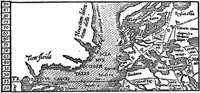
North-western portion of Robert Thorne’s map, of 1527 (copy of a Spanish map of the world)
On December 9 (18), 1502, Henry VII. again granted letters patent to Thomas Ashehurst, Joam Gonzales, Francisco Fernandes and Hugh Elliott for a voyage of discovery to parts not hitherto found by English subjects. That this projected expedition took place in 1503 is possibly shown by an entry in the accounts of the King’s privy purse: “1503, Nov. 17. To one that brought hawkes from the Newfounded Island. 1.L.” [cf. Harrisse, 1882, p. 270].
It seems that it must be the same voyage to the north-west that is mentioned by Robert Thorne of Bristol in his letter of 1527 to Henry VIII.’s Ambassador in Spain. Thorne was then living in Seville, and was interested in Indian enterprises. He tries to induce Henry VIII. to send an expedition to the Indies by way of the Polar Sea, and sends with his project a rough copy he has had made of a Spanish mappamundi. He says that he has inherited the “inclination or desire of this discoverie” from his
“father, which with another marchant of Bristow named Hugh Eliot, were the discoverers of the New found lands, of the which there is no doubt, (as nowe[Pg 335] plainely appeareth) if the mariners would then have bene ruled, and followed their Pilots minde, the lands of the West Indies (from whence all the gold commeth) had bene ours. For all is one coast, as by the Carde appeareth, and is aforesayd.”
On the map the northern east coast of America extends uninterruptedly to the north (see the reproduction), and upon it is written: “the new land called laboratorum,” and along the coast there is: “the land that was first discovered by the English.” It might appear as though it was really the present Labrador that was then discovered; but this is hardly the case; what we see on the map is probably Greenland,[328] which is here moved over to America as on other Spanish maps, and the east coast of which is given a northerly direction as on Ruysch’s map of 1508.
It is possible that another expedition set out in 1504; for in the accounts of the King’s privy purse we find an entry on April 8, 1504, of £2 “to a preste that goeth to the new Islande.” We see thus that there is a probability of many expeditions having left England for the west and north-west at this time, and that thus Greenland, Newfoundland, and doubtless also Labrador had been reached by the English; and this would explain their being recorded on Spanish maps as discoverers of the northern part of the east coast of America. But we have no further information about these voyages.
Just as we have seen that the note on Robert Thorne’s map of 1527 (that the English had discovered the northern part of the east coast of America) must probably refer to the expedition of 1501 or to one in the following year, so it is doubtless discoveries of the same voyages that are alluded to on Maggiolo’s compass-chart of 1511 (see reproduction, p. 359), where a peninsula to the north of Labrador is marked as “Terra de los Ingres” [the land of the English]. On later maps, such as Verrazano’s of 1529, Ribero’s of 1529 (see reproduction, p. 357), the Wolfenbüttel map of 1530, and[Pg 336] others, Labrador is marked as having been discovered by the English, sometimes, indeed, with the addition that they came from Bristol. As already mentioned, no hint is to be found in trustworthy documents of Sebastian Cabot’s having taken part in these expeditions or having been in any way connected with them, and there is therefore no ground for assuming this. And the remarkable thing is that even his father’s name is not mentioned in connection with them, though it was so few years since he had sailed from the same port.
We find, however, in various works of the sixteenth century records of voyages to northern or north-western waters, supposed to have been made by Sebastian Cabot; which may be due, directly or indirectly, to himself. Formerly there was a tendency to connect these statements with John Cabot’s voyages of 1497 and 1498 [cf. Harrisse], but this assumption seems to have little probability. G. P. Winship [1899, pp. 204, ff.], on the other hand, has pointed out with good reason that according to Sebastian Cabot’s own words the voyage was undertaken by himself in the years 1508-9; but even this appears to me uncertain; in any case I doubt that he reached America.
We hear of a voyage to the north-west said to have been undertaken by Sebastian Cabot from Peter Martyr (in his Decades, 1516), from the Venetian Minister to Spain, Contarini, especially in a report to the Venetian Senate in 1536, from Ramusio (1550-1554 and 1556), from Gomara (1553), and from Antonio Galvano (1563).[329]
We may expect the most trustworthy of these authorities to be Peter Martyr, who was the oldest, and who knew Sebastian Cabot personally; but certain main features of the voyage are to some extent common to all the accounts. If we compare these, the voyage is said to have taken place somewhat in the following manner: the expedition, consisting[Pg 337] of two ships with three hundred men,[330] was according to Peter Martyr fitted out at Sebastian’s own cost, but according to Ramusio it was sent out by the King. They sailed so far to the north (according to Gomara, even in the direction of Iceland) that in the month of July they found enormous masses of ice floating on the sea; daylight was almost continuous, and the land was in places free of ice which had melted away. According to the various accounts Cabot is said to have reached 55°, 56°, 58°, or 60°.[331]
According to Galvano they first “sighted land in 45° N. lat. and then sailed straight to the north until they came to 60° N. lat., where the day is eighteen hours long [sic], and the night is very clear and light. There they found the air cold and great islands of ice [icebergs ?] but no bottom with soundings of seventy, eighty, or one hundred fathoms,[332] but they found much ice which terrified them.”
When, according to Peter Martyr, their hopes of making their way to the west in these northern latitudes were thus annihilated by the ice, they sailed back to the south and south-west along the North American coast, as far as the latitude of Gibraltar, 36° (according to Peter Martyr), or to 38° (according to Gomara and Galvano), while according to Ramusio’s anonymous informant they sailed as far as Florida.[333] From thence the expedition returned to England.
With regard to the date of this voyage, we are told in the continuation of Peter Martyr’s Decades [Dec. vii], written in 1524 (published 1530), that “Bacchalaos [i.e., Newfoundland, or the northern east coast of America] was discovered from England by Cabot sixteen years ago.” According to[Pg 338] this the voyage took place in 1508. In Contarini’s report of 1536 [cf. Winship, 1900, p. 36] it is said of Sebastian Cabot’s voyage that on his return he “found the King dead, and his son cared little for such an enterprise.” As Henry VII. died on April 21, 1509, it would be during the autumn of that year that Cabot returned; but then he must have sailed before April, which is unlikely, at any rate if it is a question of a voyage up into the ice to the north or north-west, such as is described. That he should have sailed in the previous year and not returned until after the King’s death is still more improbable.
These accounts contain so many improbabilities, and to some extent impossibilities, that it is on the whole extremely doubtful whether Sebastian Cabot ever made such a voyage to the north-west. That he did so is contradicted in the first place by the already quoted protest against Sebastian of the Wardens of the Drapers’ Company, which was issued in the name of the various Livery Companies of London, and which is of great significance, as it was written so soon after the events are supposed to have taken place that they must have been in the memory of most people; and it must have been easy for the King to inquire into the justification of the protest (cf. above, p. 330).
The map of 1544, which is attributed to the collaboration of Sebastian Cabot, may also point to his having never sailed along the northern part of the coast of America, since, according to the custom of that time, the coast of Labrador is made to run to the east and north-east. This agrees with the statement of Ramusio’s anonymous informant, that Sebastian had to turn back because in 56° N. lat. he found the land turning eastward (Galvano says the same). This is evidently derived from the study of maps. As such a delineation of the coast had not yet occurred on maps of Peter Martyr’s time, it is natural that this reason for turning back is also absent from his account.
In addition to all this, there are in the various accounts[Pg 339] several statements which we must suppose to be really derived from Sebastian Cabot, but which are evidently untruthful. Thus Ramusio’s anonymous guest attributes to Sebastian the words that his father was dead when the news of the discovery of Columbus reached England, and that it was then Sebastian conceived the plan of his voyage which he submitted to the King. That, as stated by Peter Martyr, he should have fitted out two ships with crews of three hundred men at his own expense, is extremely improbable. He is also reported to have told Peter Martyr that he
“called these countries Baccallaos, because in the seas about there he found such great quantities of certain large fish—which might be compared to tunny [in size], and were thus called by the inhabitants—that sometimes they stopped his ships.”
These are nothing but impossibilities. In the first place, he never gave the name of Bacallaos; in the second, the inhabitants cannot have called the fish so, if by inhabitants is meant the native savages. These statements are, therefore, of the same kind as that of the masses of fish stopping the ships. Peter Martyr further relates that he said of these regions that
“he also found people in these parts, clad in skins of animals, yet not without the use of reason.” He says also that “there are a great number of bears in these parts, which are in the habit of eating fish; for, plunging into the water where they see quantities of these fish, they fasten their claws into their scales, and thus draw them to land and eat them, so that (as he says) the bears are not troublesome to men, when they have eaten their fill of fish. He declares also that in many places of these regions he saw great quantities of copper among the inhabitants.”
The statement about the bears may come from older literary sources, and resembles a similar statement in the Geographia Universalis (see above, p. 191). That the inhabitants have copper and are clad in skins may be derived from reports of the various voyages.
From what we have been able to conclude as to Sebastian Cabot’s character, it seems reasonable to suppose that, in consequence of his position as Pilot Major in Spain, he was[Pg 340] acquainted with the various maps and accounts of voyages in western and north-western waters, and that from this knowledge he constructed the whole story of his alleged voyage; he was then incautious enough to magnify his exploits to such an extent that he made the whole story improbable; for his claim was nothing less than that he had first discovered land as far north as between 55° and 60°, that is to say, to about Hudson Strait, and then sailed along and discovered the whole coast of North America to about 36° N. lat., that is, to Cape Hatteras or Florida; in other words, a voyage of discovery to which we have no parallel in history, and it is truly remarkable that we should have had no certain information about it, while we have so much about other expeditions which step by step discovered the various parts of this same extent of coast.
Sebastian Cabot seems to have laid claim to having made yet another voyage in north-western waters, unless, indeed, it is the same one again with variations. In the third volume of his “Navigationi et Viaggi,” etc., published at Venice 1556, Ramusio says (writing in Venice, June 1553) that
“Sebastian Gabotto, our Venetian, a man of great experience, etc., wrote to me many years ago.” Sebastian is said to have sailed “along and beyond the land of New France, at the charges of Henry VII., King of England. He told me that after having sailed a long time west by north [ponente e quarta di Maestro] beyond these islands, lying along the said land, as far as to sixty-seven and a half degrees under our pole [i.e., the North Pole], and on June 11th [20th] finding the sea still open and without any kind of impediment, he thought surely by that way to be able to sail at once to Cataio Orientale [China], if the mutiny [malignità] of the master and mariners had not compelled him to return.”[334]
As will be seen, this statement is altogether different from those previously mentioned; but such assertions as that Cabot had got so far to the north-west by June 11, and found the sea[Pg 341] free of ice in 67½° N. lat., are not of a kind to strengthen our confidence. It might seem to be the same voyage that is referred to in a statement of Richard Eden, which he may have had from Sebastian Cabot himself. In the dedication (written in June 1553) of Eden’s translation of the fifth part of Sebastian Munster’s “Cosmographia” we read that
“Kinge Henry the viij. about the same yere [i.e., the eighth year] of his raygne, furnished and sent forth certen shippes vnder the gouernaunce of Sebastian Cabot yet liuing, and one Syr Thomas Perte, whose faynt heart was the cause that that viage toke none effect; yf (I say) such manly courage whereof we haue spoken, had not at that tyme bene wanting, it myghte happelye haue comen to passe, that that riche treasurye called Perularia, (which is now in Spayne in the citie of Ciuile, and so named, for that in it is kepte the infinite ryches brought thither from the newe found land of Peru) myght longe since haue bene in the town of London.”[335]
As Peru is mentioned, it might doubtless appear as though a voyage to South America were in question; but we often see that the western countries beyond the sea were spoken of as a continuous possession (cf. Robert Thorne’s letter, above, p. 334), and it may therefore refer to the same alleged expedition as is spoken of by Ramusio; for both Ramusio and Eden have evidently the same statements from Sebastian Cabot, and the latter can hardly have spoken of two expeditions which were both unsuccessful merely because his companions failed him.
If this is correct, the voyage took place in the eighth year of Henry VIII.’s reign, i.e., April 16, 1516, to April 15, 1517[336]; but, as Harrisse contends, it is very doubtful whether the voyage was made at all. It is true that a poem of Henry VIII.’s time also speaks of an English expedition which may have taken place at this time, and which failed on account of the cowardice of the crew. Robert Thorne, too, as we have seen (p. 335), tells of a voyage made by his father and Hugh Eliot, on which the sailors would not “follow their pilot’s mind.”[Pg 342] It may, indeed, have occurred on several voyages that the crews refused to proceed farther, and for that matter these statements need not refer to the same voyage; but at the same time it is by no means incredible that Sebastian Cabot may have heard of such an expedition, and, when it was more appropriate than the ice, used it as an explanation of his not having discovered the north-west passage to China. We know that Sebastian Cabot was in the service of Spain (and appointed “Pilot Major”) in 1515, and that he was occupied with plans of a voyage to the north-west for the King of Spain; for Peter Martyr writes of him in that year that he was impatiently looking forward to March 1516, when he had been promised a fleet with which to complete his discoveries [cf. Winship, 1900, p. 71]. As Ferdinand of Aragon died on January 23, 1516, nothing came of this voyage, and as we hear nothing of Sebastian Cabot before February 5, 1518, when he was appointed Pilot Major by Charles V., it is not impossible that in the meantime he may have been in England, and have taken part in an English expedition; but no record of his having come to England is extant, and it would hardly agree with the protest against him of the Drapers’ Company a few years later.
There may yet be mentioned the attempts made by Henry VIII. in 1521 to prepare an expedition to north-western waters under the command of Sebastian Cabot, chiefly at the expense of the merchants of London, which, however, evoked a powerful protest against Sebastian on the part of these merchants (see above, p. 330). It is true that, upon pressure from the King, they afterwards declared themselves willing to give a smaller sum, but the expedition never came to anything. Sebastian Cabot was at that time, as he had been since 1512, in the service of Spain, and he remained so until in 1547 he again took up his abode in England and entered the service of the English King. In December 1522 Sebastian Cabot informed the Venetian Minister in Spain, Contarini, that he had been in England three years before[Pg 343] [i.e., in 1519], and that the Cardinal there [i.e., Wolsey, who was trying on behalf of Henry VIII. to get together the expedition of 1521] had endeavoured to persuade him to undertake the command of a fleet which was almost ready [sic!], for the discovery of new lands; but he had replied that, as he was in the service of Spain, he must first obtain the permission of the Emperor; and that he had then written to the Emperor, requesting him not to grant such permission, but to recall him. This Sebastian asserted that he had done on account of his desire of serving his own city of Venice; for in 1522 and later he was carrying on treacherous intrigues with Contarini to enter the Venetian service, presumably with the hope of a high salary. Thus, wherever we are able to check Sebastian Cabot’s utterances, they prove to be extremely untrustworthy.
Even, if, therefore, there was no lack of attempts after 1500 to follow up John Cabot’s great and important discoveries in the west, it is nevertheless surprising how little persistence seems to have been shown. The love of discovery and adventure which had been so prominent a feature of the Northern Viking nature had not yet awakened in earnest among the English people. England’s mercantile marine was at that time still comparatively unimportant, it had not the strength for such great enterprises or for colonisation. The earliest voyages were mainly the work of a foreigner, an Italian, and the later ones were in part undertaken by Portuguese; they did not grow naturally from the English people themselves. Cabot’s plan was like an exotic flower springing up in immature soil, and more than half a century before its time. Another factor was doubtless the disappointment of the King and of the merchants; they had ventured their money in fitting out ships in the hope of immediate profit. What they were looking for was the way to the rich East of Asia, where mountains of spices lay ready to hand, and gold and precious stones in heaps, only waiting to be picked up. What they found was nothing but new, unknown[Pg 344] countries on the ocean, inhabited by wandering tribes of hunters, countries the opening up of which demanded much time and labour. All this had scarcely more than a geographical interest for the time being, and for that they cared little.
CHAPTER XV
THE PORTUGUESE DISCOVERIES IN THE NORTH-WEST
VOYAGES OF THE BROTHERS CORTE-REAL
The Portuguese, who in the fifteenth century were the most enterprising of seafaring peoples as regards discoveries, had, as already stated, made various attempts to find new countries out in the ocean to the west of the Azores, from which islands the majority of the expeditions proceeded. It was therefore to be expected that the important discoveries of Columbus should encourage them to fresh attempts of this kind; it was also natural that such enterprises should originate especially in the Azores. From what has been stated above (p. 128), it appears that the King of Portugal (Alfonso V.) induced Christiern I. to send out expeditions (Pining and Pothorst) to search for new islands and lands in the North. It seems probable that the King of Portugal was informed of the results of these expeditions, and that in this way the Portuguese may have known of the existence of Greenland or of countries in the north-west. In the same way, as we have seen (p. 132, note 2), the fact that the earliest literary[Pg 346] allusions to Scolvus seem to be derived from Portugal may be explained.
Possible Portuguese enterprises in the western regions were barred by the claim of the Spanish Crown to the dominion over all lands to the west of a certain boundary, and in the final treaty of Tordecillas, June 7, 1404, between Portugal and Spain, this boundary was fixed by the Pope at 370 leagues (about 1200 geographical miles) to the west of the Cape Verde Islands, and it was to follow the meridian from pole to pole. All that lay to the west of this meridian was to belong to Spain, while Portugal had the right to take advantage of all lands to the east. Thereby the Portuguese were debarred from the search for India and China to the west. These enterprising seafarers must therefore have had every reason to find out whether there were any countries on their side of the boundary-line, and it may be supposed that their attention would naturally be drawn in the direction of the north-western lands (Greenland) of which they had already heard.
And, in fact, such voyages were undertaken from Portugal (and the Azores ?) about 1500; but the accounts of them are meagre and casual, and have been interpreted in very different ways.
In order to enable one to form as unbiased a view as possible of these voyages, it will be necessary to begin by reviewing the most important contemporary documents which may contain statements of value; and afterwards to summarise what may be concluded from these documents.
On October 28, 1499, King Manuel of Portugal issued at Lisbon to João Fernandez letters patent (preserved in the Portuguese State archives, Torre do Tombo) for discoveries, evidently in the north-west, in which it is said:
“We [the King] make known to all who may see this our letter, that Joham Fernamdez [now written João Fernandez] domiciled in our island of Terceira [Azores] has told us that he, in God’s and our service, will work and travel and try to discover certain islands of [for ?] our conquest at his own cost, and we, seeing his good will and purpose, promise him and hereby give him de facto—in addition to taking him into our service—the mark of our favour and the privilege[Pg 347] of Governor over every island or islands, both inhabited and uninhabited, that he may discover and find for the first time, and this with such revenues [taxes], dignities, profits and interests as we have given to the Governors of the islands of Madeira and others, and for this observance and our remembrance we command that this letter be given him, signed by us and sealed with our attached seal.”[337]
On May 12, 1500, King Manuel granted to Gaspar Corte-Real letters patent, as follows:
“We [i.e., the King] make known to all who may see this deed of gift, that forasmuch as Caspar Cortereall, a nobleman of our household, has in times past made great endeavours at his own charges for ships and men, employing his own fortune and at his personal danger, to search for and discover and find certain islands and mainland, and in future will still continue to carry this into effect, and in this way will do all that he can to find the said islands and lands, and bearing in mind how much he deserves honour and favour and promotion in our service, to our honour, and to the extension of our realms and dominions through such islands and lands being discovered and found by our natives [i.e., Portuguese], and through the said Gaspar Corte-Reall thus performing so much labour, and exposing himself to so great danger; we are therefore pleased to decree that, if he discovers and finds any island, or islands, or mainland, he be granted by our own consent and royal and absolute power, the concession and gift, with the privilege of Governor and its attendant rights, etc. ... over whatsoever islands or mainland he may thus find and discover, etc. ... and we decree that he and his heirs in our name and in the name of our successors shall hold and govern those lands or islands, which are thus found, freely and without any restriction, as has been said.... The said Caspar Cortereall and his heirs shall have one quarter free of all that they can thus obtain [i.e., realise] in the said islands and lands at what time soever...” [Cf. Harrisse, 1883, pp. 196, f.].
An order is preserved dated April 15, 1501, from King Manuel to the master of the bake-house at the city gate of La Cruz to deliver biscuits to Gaspar Corte-Real, and further, a receipt of April 21, 1501, for the biscuits, signed by Gaspar Corte-Real himself, proving that the latter was in Portugal on that date.[338]
Pietro Pasqualigo, the Venetian Minister at Lisbon, wrote as follows to the Council at Venice on October 18, 1501:
“On the 9th of this month there arrived here one of the two caravels which the said King’s majesty sent last year to discover lands in the direction of the northern regions (verso le parte de tramontana), and they have brought seven[Pg 348] men, women, and children from the country discovered, which is in the north-west and west, 1800 miglia distant from here. These men resemble gypsies in appearance, build, and stature. They have their faces marked in different places, some with more, others with fewer figures. They are clad in the skins of various animals, but chiefly of otter; their speech is entirely different from any other that has ever been heard in this kingdom, and no one understands it. Their limbs are very shapely, and they have very gentle faces, but their manners and gestures are bestial, and like those of savage men. The crew of the caravel believe that the land alluded to is mainland, and that it is joined to the other land which was discovered last year in the north by the other caravels belonging to this majesty, but they were unable to reach it, for the sea was frozen over with the great masses of snow, so that it rose up like land. They also thought that it was connected with the Andilii [Antilles], which were discovered by the sovereign of Spain, and with the land of Papaga [Brazil], newly found by a ship belonging to this king, on her way to Calcutta. The grounds for this belief are, in the first place, that after having sailed along the coast of the said land for a distance of six hundred miglia and more, they found no end to it; and further because they say they found many very great rivers which there fell into the sea. The second caravel, that of the commander (caravella capitania), is expected from day to day, and from it the nature and condition of the aforesaid land will be clearly understood, since it went farther along the coast in order to discover as much of it as possible. This royal majesty has been much rejoiced by this news, for he thinks that this land will be very profitable for his affairs in many respects, but especially because it is so near to this kingdom that it will be easy to obtain in a short time a very great quantity of timber for making ships’ masts and yards of, and to get a sufficient supply of male slaves for all kinds of labour, for they say that that country has many inhabitants, and is full of pine-trees and other excellent wood. The news in question has rejoiced his majesty so much that he has given orders that the ships are to sail to the said place, and for the increase of his Indian fleet, in order to conquer it more quickly, as soon as it is discovered; for it seems that God is with his majesty in his undertakings, and brings all his plans to accomplishment.” [Cf. Harrisse, 1883, pp. 209, ff.].
On October 19, 1501, Pietro Pasqualigo writes to his brothers at Venice:
“On the 8th of this month there arrived here one of the two caravels which this most serene majesty sent last year to discover lands in the north under Captain Gaspar Corterat [sic]; and they state that they found land two thousand miglia from here between north-west and west, which before was not known to any one; along the coast of this land they sailed perhaps six hundred or seven hundred miglia without finding an end to it; therefore they believe that it is a continent which is continuous with another land that was discovered last year in the north [by some other caravels], which caravels could not reach the end of it, because the sea was frozen and there was an infinite quantity of snow. They believed it also on account of the great number of rivers that they found there, and that[Pg 349] certainly would not be so numerous or so large on an island. They say that this land has many inhabitants, and that their houses are made of great wooden poles, which are covered on the outside with skins of fish [i.e., seals ?]. They have brought seven men, women, and children from thence and fifty more are coming in another caravel, which is hourly expected. These are of similar colour, build, stature, and appearance to gypsies, clad in skins of various animals, but mostly otter; in the summer they turn the skin in, in winter the reverse. And these skins are not sewed together in any way, and not prepared, but they are thrown over the shoulders and arms just as they are taken off the animals. The loins are fastened together with strings made of very strong fish sinews. Although they seem to be savages, they are modest and gentle, but their arms, legs, and shoulders are indescribably well shaped; they have the face marked [tattooed] in the Indian fashion, some with six, some with eight, and some with no figures [lines ?]. They speak, but are understood by no one; I believe they have been addressed in every possible language. In their country they have no iron, but make knives of certain stones, and spearheads in the same way. They have brought from thence a fragment of a broken gilt sword, which was certainly made in Italy. A boy among them wore in his ears two silver rings, which seem without doubt to have been made in Venice. This induced me to believe that it is a continent, for it is not a place to which ships can ever have gone without anything having been heard of them.[339] They have a very great quantity of salmon, herring, cod, and similar fish. They have also great abundance of trees, and above all of pine-trees for making ships’ masts and yards of. For this reason it is that this most serene King thinks he will derive the greatest profit from the said land, not only on account of the trees for shipbuilding, of which there is much need, but also on account of the men, who are excellent labourers, and the best slaves that have hitherto been obtained; this seems to me to be a thing worth giving information about, and if I hear anything more when the commander’s caravel (caravella capitania) arrives, I will also communicate it.” [Cf. Harrisse, 1883, pp. 211, f.].
Alberto Cantino, Minister at Lisbon of Duke Ercule d’Este of Ferrara, wrote to the Duke as follows, on October 17, 1501:
“It is already nine months since this most serene King sent two well-equipped ships to the northern regions (alle parte de tramontana) with the object of finding out whether it was possible to discover lands and islands in those parts; and now on the 11th of this month one of these ships has safely returned with a cargo, and brought people and news, which I have thought it my duty to communicate to Your Excellency, and thus I write here below accurately and clearly all that the captain [of the ship] reported to the King in my presence. First he stated that after leaving the port of Lisbon they sailed for four months at a stretch[Pg 350] always with the same wind, and towards the same pole, and in all that time they never saw anything. When they had entered the fifth month and still wished to proceed, they say that they encountered immense masses of snow frozen together, floating on the sea and moving under the influence of the waves. On the top of these [ice-masses] clear fresh water was formed by the power of the sun, and ran down through little channels hollowed out by itself, wearing away the foot [of the ice] where it fell. As the ships were already in want of water they approached in boats, and took as much as they required; and for fear of staying in that place on account of the danger, they were about to turn back, but impelled by hope they consulted as to what they could best do, and determined to proceed for a few days yet, and they resumed their voyage. On the second day they found the sea frozen, and being obliged to abandon their purpose, they began to steer to the north-west and west, and they continued on this course for three months, always with fair weather. And on the first day of the fourth month they sighted between these two points of the compass a very great land, which they approached with the greatest joy; and many great rivers of fresh water ran through this region into the sea, and on one of them they travelled for a legha [== about three geographical miles] inland; and when they went ashore they found a quantity of beautiful and varied fruits, and trees, and pines[Pg 351] of remarkable height and size, that would be too large for the masts of the largest ship that sails the sea. Here is no corn of any kind, but the people of the country live, they say, on nothing but fishing and hunting animals, of which the country has abundance. There are very large stags [i.e., caribou, Canadian reindeer] with long hair, whose skin they use for clothes and for making houses and boats; there are also wolves, foxes, tigers [lynxes ?], and sables. They declare, what seems strange to me, that there are as many pelerine falcons as there are sparrows in our country; and I have seen them, and they are very handsome. Of the men and women of that place they took about fifty by force, and have brought them to the King; I have seen, touched, and examined them. To begin with their size, I may say that they are a little bigger than our countrymen, with well-proportioned and shapely limbs, while their hair is long according to our custom, and hangs in curly ringlets, and they have their faces marked with large figures like those of the Indians. Their eyes have a shade of green, and, when they look at you, give the whole face a very wild aspect. Their speech is not to be understood, but it is without harshness, rather is it human. Their conduct and manners are very gentle, they laugh a good deal, and show much cheerfulness; and this is enough about the men. The women have small breasts and a very beautiful figure, and have a very attractive face; their colour may[Pg 352] more nearly be described as white than anything else, but that of the males is a good deal darker. Altogether, if it were not for the wild look of the men, it seems to me that they are quite like us in everything else. All parts of the body are naked, with the exception of the loins, which are kept covered with the skin of the aforesaid stag. They have no weapons, nor iron, but all the work they produce is done with a very hard and sharp stone, and there is nothing so hard that they cannot cut it with this. This ship came thence in one month, and they say that it is 2800 miglia [miles] distant; the other consort has decided to sail along this coast far enough to determine whether it is an island or mainland, and thus the King is awaiting the arrival of this [the consort] and the others [i.e., his companions] with much impatience, and when they have come, if they communicate anything worthy of Your Excellency’s attention, I shall immediately inform you of it...” [cf. Harrisse, 1883, pp. 204, ff.].
Portion of the “Cantino” map of 1502, preserved at Modena. The network of compass-lines omitted
At the request of the Duke of Ferrara Cantino had a map made at Lisbon, chiefly for the purpose of representing the Portuguese discoveries, and sent it to the Duke in 1502. In a letter to the Duke, dated November 19, 1502, he mentions having already sent it. This map, commonly called the Cantino map, and now preserved at Modena, gives a remarkably good representation of southern Greenland, which is called “A ponta de [asia]” [i.e., a point of Asia]. On its east coast are two Portuguese flags to show that it is a Portuguese discovery, one flag somewhat to the north of the Arctic Circle, the other a little to the west of the southern point, and this coast bears the following legend:
“This country, which was discovered by the command of the most highly renowned prince Dom Manuel, King of Portugal, is a point of Asia (esta a ponta d’asia). Those who made the discovery did not land but saw the land, and could see nothing but precipitous mountains. Therefore it is assumed, according to the opinion of the cosmographers, to be a point of Asia.”
To the west of Greenland on the same map a country is marked, called “Terra del Rey de portuguall” (the Land of the King of Portugal); it answers approximately to Newfoundland, possibly with the southern part of Labrador (?). The north and south ends are marked with two Portuguese flags, and the country bears the following legend:
“This land was discovered by command of the most exalted and most renowned royal prince Dom Manuel, King of Portugal; Gaspar de Corte-Real, a nobleman[Pg 353] of the said King’s household, discovered it, and when he had discovered it, he sent [to Portugal] a ship with men and women taken in the said land, and he stayed behind with the other ship, and never returned, and it is believed that he perished, and there are many masts [i.e., trees for masts].”
On January 15, 1502,[340] King Manuel gave Gaspar’s brother, Miguel Corte-Real, fresh letters patent as follows:
“We make known to all who may see this letter that Miguell Cortereall, a nobleman of our household and our head doorkeeper [chamberlain ?], now tells us that, seeing how Gaspar Cortereall, his brother, long ago sailed from this city with three ships to discover new land, of which he had already found a part, and seeing that after a lapse of time two of the said ships returned to the said city [Lisbon], and five months have elapsed without his coming,[341] he wishes to go in search of him, and that he, the said miguell corte-reall, had many outlays and expenses of his own in the said voyage of discovery, as well as in the said ships, which his said brother fitted out the first time for that purpose [i.e., for the first voyage], when he found the said land, and likewise for the second [i.e., the second voyage], wherefore the said gaspar cortereall in consideration of this promised to share with him the said land which he thus discovered and ... which we had granted and given to him by our deed of gift, for which the said gaspar cortereall asked us before his departure, etc.” Therefore Miguel claimed his share of the lands discovered by his brother, which he obtained from the King by these letters patent, as well as the right to all new islands and lands he might discover that year (1502), besides that which his brother had found.[342]
Two legends on the anonymous Portuguese chart of about 1520 are also of interest.[343] On the land “Do Lavrador” [i.e., Greenland] is written:
“This land the Portuguese saw, but did not enter.”
[Pg 354]On Newfoundland, called “Bacalnaos,” is written:
“To this land came first Gaspar Corte Regalis, a Portuguese, and he carried away from thence wild men and white bears. There is great abundance of animals, birds, and fish. In the following year he suffered shipwreck there, and did not return, and his brother, Micaele, met with the same fate in the next year.”
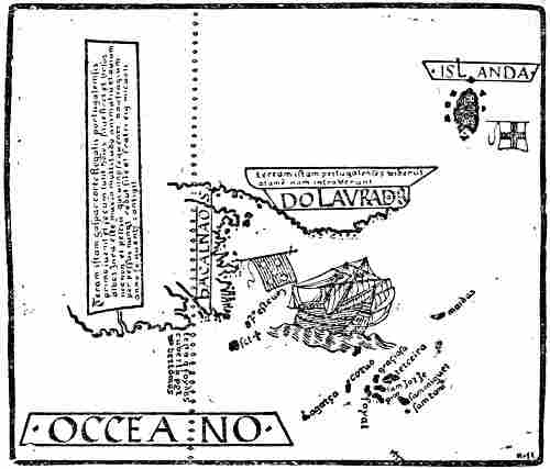
Portion of an anonymous Portuguese chart of about 1520, preserved at Munich.
The network of compass-lines omitted
In addition to this may also be mentioned the various maps of Portuguese origin of 1502 or soon after, especially the Italian mappamundi, the so-called King map of about 1502 (p. 373), which must be a copy of a Portuguese map, where Newfoundland is called Terra Corte Real.
Besides these documents contemporary with the voyages, or of the years immediately succeeding, there are also several much later notices of them in Gomara (1552), Ramusio (1556), Antonio Galvano (1563) and Damiam de Goes (1566), but as these were written so long after, we will leave them on one side for the present.
When we endeavour to form an opinion as to the[Pg 355] Portuguese voyages of these years on the basis of the oldest documents, the first thing that must strike us is that there are indications of several voyages, and of the discovery of two wholly different countries, which must undoubtedly be Greenland and Newfoundland. As it is expressly stated on the Cantino map, on the Portuguese chart of about 1520, and in many other places, that Newfoundland was discovered by Gaspar Corte-Real, while his name is not mentioned in a single place in these documents in connection with Greenland (or Labrador), and as Pasqualigo’s letter to the Council of Venice expressly says that that land was seen the previous year (1500) by “the other caravels [l’altre caravelle] belonging to this majesty,”[344] the logical conclusion must be that it was not Gaspar Corte-Real who saw Greenland in the year 1500, but some other Portuguese. It may be in agreement with this that on the King map (of about 1502) Newfoundland is called Terra Cortereal (see p. 373), while the island which clearly answers to Greenland is called Terra Laboratoris. One might be tempted to suppose that both lands were named after their discoverers, one, that is, after Corte-Real, the other after a man who is described as “laborator.” The generally accepted view that it was Gaspar Corte-Real who saw Greenland on his voyage of 1500 is thus unsupported by the above-mentioned documents.
On the other hand, we seem to be able to conclude from the royal letters patent to Miguel Corte-Real that Gaspar made two voyages, one in 1500, and another in 1501, and that it was the same country (i.e., Newfoundland) that he visited on both occasions. This is also confirmed by the legend on the Portuguese chart of about 1520. If it was not he who on[Pg 356] the first voyage, in 1500, saw Greenland without being able to approach it, we must conclude that yet another expedition, on which Greenland was sighted, left Portugal in the year 1500. One is then inclined to suppose that this was commanded by the same João Fernandez, to whom the King gave letters patent as early as October 1499. This supposition becomes still more probable when we take it in conjunction with what has already been said as to the possible origin of the name of Labrador (see p. 331). We must suppose that this is the same man from the Azores who, under the name of John Fernandus, took part in the Bristol enterprise of 1501, and who is further mentioned in documents of as early as 1492, together with another man from the Azores, Pero de Barcellos, and is described as a “llavorador.” These men would already at that time have been engaged in making discoveries at sea.
If we compare the legend attached to Labrador (Greenland) on Diego Ribero’s Spanish map of 1529 with the corresponding legend on the anonymous Portuguese chart of about 1520 this will also confirm our supposition. While on the latter we read that “the Portuguese saw the land, but did not enter it,” Ribero’s map has: “this land was discovered by the English, but there is nothing in it that is worth having.” As this part of Ribero’s map is evidently a copy of the Portuguese maps, we may conclude Ribero’s alteration of the legend to mean that doubtless the land was first sighted by the Portuguese, but that it was the English who first succeeded in landing there, and in this way were its real discoverers. If we add to this the statement on the sixteenth-century Portuguese chart preserved at Wolfenbüttel, that the land was discovered by Englishmen from Bristol, and that the man who first gave news of it was a “labrador” from the Azores, then everything seems to be in agreement.
We may hence suppose the connection to be somewhat as follows: having obtained his letters patent in October[Pg 357] 1499, João Fernandez fitted out his expedition, and sailed in the spring of 1500; he arrived off the east coast of Greenland and sailed along it, but the ice prevented him from landing. We have no information at all as to where else he may have been on this voyage. But having returned to Portugal, perhaps after a comparatively unsuccessful expedition, and finding furthermore that the King had issued letters patent to Gaspar Corte-Real, whose voyage had been more successful, Fernandez may have despaired of finding support for fresh enterprises in Portugal, and have turned at once to Bristol, where he took part in getting together an Anglo-Portuguese undertaking, and was thus the “llavorador” who first brought news of Greenland.
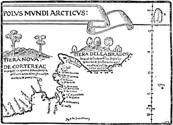
Portion of Diego Ribero’s map of 1529. (Nordenskiöld, 1897)
It must, of course, be admitted that the hypothesis here put forward of the voyage and discovery of João Fernandez is no more than a guess; but it seems more consistent than any of the explanations hitherto offered, and, as far as I can see, it does not conflict on any point with what contemporary documents have to tell us. It may be supposed that here, as so frequently has happened, the name of the discoverer,[Pg 358] João Fernandez, has been more or less forgotten. His memory has perhaps only been preserved in the name Labrador itself—originally applied to Greenland, but afterwards transferred to the American continent[345]—whilst all the Portuguese discoveries in the north have been associated in later history with the other seafarer, Gaspar Corte-Real, who was of noble family and belonged to the King’s household, and who came from the same island of the Azores, Terceira.
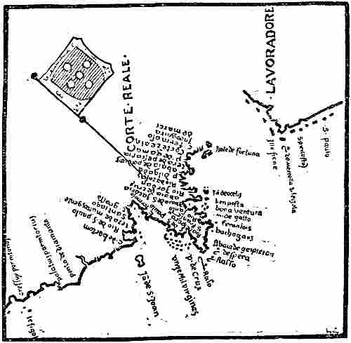
Portion of Maggiolo’s map of 1527 (Harrisse, 1892). Compass-lines omitted
[Pg 359]Gaspar Corte-Real belonged to a noble Portuguese family from Algarve and was born about 1450. He was the third and youngest son of João Vaz Corte-Real, who for twenty-two years, since 1474, had had a “capitanerie” as Governor of the Azores—first at Angra in the island of Terceira, later in São Jorge—and died in 1496.[346] Gaspar probably spent a part of his youth in the Azores, which were altogether “a hot-house of all kinds of ideas of maritime discovery”; he certainly became familiar at an early age with narratives of the numerous earlier attempts, and with the many plans of new ocean voyages which were discussed by the adventurous sailors of those islands. As already mentioned, the German, Martin Behaim, was also living in the Azores (cf. p. 287).
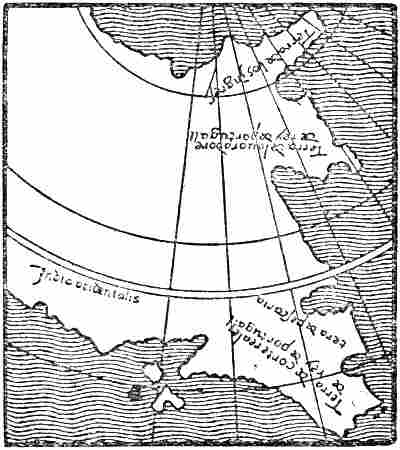
The newly discovered north-western lands made continuous
with Asia, on Maggiolo’s map of 1511. (Harrisse, 1900)
From the letters patent of May 1500, we see that Gaspar Corte-Real had at his own expense been trying even before that time to discover countries in the ocean, but as no more is said about it, the attempt was doubtless unsuccessful. It was pointed out above that from the King’s letters patent[Pg 360] to his brother Miguel it looks as though Gaspar had made two voyages to the land he had discovered, which is also confirmed by the legend referred to on the anonymous Portuguese chart of about 1520. On the other hand, nothing is said about this voyage in the letters of the two Italian Ministers, nor on the Cantino map. It may seem natural to conclude that Gaspar, after having obtained his letters patent in May 1500, set out on an expedition, the expenses of which were defrayed by himself and his brother Miguel in partnership (cf. the letters patent to the latter).
On his first voyage of 1500 Gaspar had already discovered a part of Newfoundland; but we know nothing of what else he may have accomplished on this expedition. He must have returned to Lisbon by the same autumn.
Encouraged by his success he then set out again with a larger expedition in 1501, after April 21, at which date he was still in Lisbon. This time the expenses were again borne by himself and his brother Miguel in partnership. According to the King’s letters patent of January 1502, he had three ships on this voyage, of which two returned. This does not agree with the letters of the two Italian Ministers, which distinctly say that he left with two ships. But these letters, it is true, do not mutually agree in their statements as to the ship that had returned: Pasqualigo says that the ship arrived at Lisbon on October 9 in one of his letters, on the 8th in the other, and that it brought seven natives; while Cantino says that the ship arrived on October 11 and brought fifty natives to the King. As Pasqualigo says that the other ship was expected daily with fifty natives, it has been thought (cf. Harrisse) that this was the ship referred to by Cantino; but in that case it is puzzling that two Ministers in the same city should have heard of two different ships, and that they should both be ignorant of more than one ship having arrived, although there was an interval of no more than two or three days between each ship’s arrival, and they are both writing a week after that time. Besides, both mention that the[Pg 361] second ship, and only one, is expected, and Pasqualigo calls it the commander’s caravel (caravella capitania). We may readily suppose that it is the arrival of the same ship that is alluded to by the two Ministers (no importance need be attached to the discrepancy of dates, since we see that Pasqualigo alters the date of his ship’s arrival from one letter to the other). They may both have heard of fifty natives having been captured, of which they had seen some (seven, for instance); but while Cantino understood that the whole fifty had arrived, Pasqualigo thought that only the seven he had seen had come, while the other fifty were expected on the next ship. Considerable weight must be attached to the fact that in the legend on the Cantino map, which must evidently have been drawn from Portuguese documents, only one ship is mentioned as having returned. The chief difficulty is that this is in direct conflict with the King’s later letters patent to Miguel. We should then have to suppose that the statement in this document as to three ships having sailed and two returned is due to a clerical error or a lapse of memory, which may seem surprising. But the question is, after all, of minor importance. The main point is that Gaspar Corte-Real’s ship never returned.
In estimating the degree of trustworthiness or accuracy to be attributed to Pasqualigo’s and Cantino’s statements about the voyage, it must be remembered that they are both only repeating what they have heard said on the subject in a language not their own, and that when the letters were written they had probably seen no chart of the voyage or of the new discoveries. Cantino says that he was present when the captain of the ship gave his account to the King, and that he is writing down everything that was then said; so that perhaps he had only heard the narrative once, and without a chart, which easily explains his obvious errors; it is no difficult matter to fall into gross errors and misunderstandings in reproducing the account of a voyage which one hears in this way told even in one’s own language. Pasqualigo does[Pg 362] not tell us how he had heard about the voyage, but it may have been on the same occasion. The letters of the two Italians reproducing the Portuguese narrative cannot therefore be treated as exact historical documents, every detail of which is correct.
Cantino says in his letter (of October 1501) that Gaspar Corte-Real had sailed nine months before, that is, in January 1501. Pasqualigo says that he left in the previous year, which agrees with Cantino, since the civil year at that time began on March 25. But the existing receipt of April 21, 1501, from Gaspar Corte-Real proves with certainty that the two Italians were mistaken on this point. It may be supposed that they regarded the expeditions of the two consecutive years as a connected voyage (?), but even this will not agree with Cantino’s nine months. According to Cantino’s letter, Corte-Real on leaving Portugal held a northerly course (“towards the pole” are the words), and Pasqualigo says something of the same kind; but this is scarcely to be taken literally, for otherwise we should have to suppose that from Portugal he sailed northward towards Iceland; besides which, Pasqualigo says in both his letters that the land discovered was between north-west and west. Cantino’s statement about the ice might give us firm ground for determining Corte-Real’s route; if it were not unfortunately the case that there are here two possibilities, and that Cantino’s words do not agree well with either of them. The description of the ice points most probably to Corte-Real’s having first met with icebergs; he may have come upon these in the sea off the southern end of Greenland, and as in continuing his course he found the “sea frozen,” he may have reached the edge of the ice-floes. As nothing is said about land, we must suppose that he did not sight Greenland. It is a more difficult matter when, by changing his course to the north-west and west, he finally in this direction sighted land, which according to the description, and the Cantino map, must have been Newfoundland. To arrive there from the Greenland ice he[Pg 363] would have had to steer about west-south-west by compass, and in fact Newfoundland (Terra del Rey de portuguall) lies approximately in this direction in relation to the southern point of Greenland on the Cantino map. But it may be, of course, that Cantino’s statement of the direction is due to a misunderstanding;[347] he may have heard that the newly found land lay to the north-west and west from Lisbon, as Pasqualigo says.
Another possibility is that it was on the Newfoundland Banks that Corte-Real met with icebergs; but in that case he must have held a very westerly course, almost west-north-west, all the way from Lisbon, and there would then be little meaning in the statement that he altered his course to north-west and west to avoid the ice, even if we take into account the possibility of the variation of the compass having been 20° greater on the Newfoundland Banks than at Lisbon. Another difficulty is that on the Newfoundland Banks he would hardly have found “the sea frozen,” if by this ice-floes are meant; for that he would have had to be (in June ?) farther to the north-west in the Labrador Current. In neither case would he have been very far from land, so that the times mentioned, three months with a favourable wind from the ice to land, and four months from Lisbon, are out of proportion.[348]
Thus Cantino’s words cannot be brought into agreement with facts; but at the same time many things point to its having been the Greenland ice that Corte-Real first met with in 1501. Doubtless it might be objected that he is said in the previous year to have already found part of Newfoundland,[Pg 364] and in that case he would be likely to make straight for it again; but Pasqualigo’s letter gives one the impression that Gaspar Corte-Real may have been interested in finding out whether the land he had found was mainland and continuous with the country (Greenland) which in the previous year (1500) had been seen by the other caravels (João Fernandez ?), and thus it may have been natural that he should first steer in that direction, but he was then forced by the ice westward towards the land he himself had discovered.
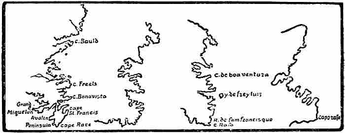
Modern map Cantino map Reinel’s map King map
The eastern coast-line of Newfoundland, with possibly the southern part of Labrador
That it was really Newfoundland, and not the coast of Labrador farther north, that Corte-Real arrived at, appears plainly enough from the maps (the Cantino map, the King map, etc.), and may also be concluded from the descriptions in the letters of Pasqualigo and Cantino. We read, amongst other things, that many great rivers ran through that country into the sea. The east coast of Labrador has no rivers of importance, with the exception of Hamilton River; but the entrance to this is by a long estuary, Hamilton Inlet and Lake Melville, up which they would hardly have sailed. On the other hand, there are in Newfoundland several considerable rivers falling into the sea on the east coast, up the mouths of which Gaspar Corte-Real might have sailed. The allusion[Pg 365] to the country as fertile, with trees and forests of pines of remarkable height and size, and to there being abundance of timber for masts, etc., also agrees best with Newfoundland. In addition, the coast-line of the country, both on the Cantino map and on later Portuguese maps, agrees remarkably well with the coast-line along the east and north-east sides of Newfoundland.
The statement in Pasqualigo’s letter of October 18, that they sailed “along the coast of the said land for a distance of six hundred miglia and more,” which agrees with the extent of the coast on the Cantino map, must be an exaggeration. It is a common error to exaggerate the distance during a voyage along a coast so indented as that of Newfoundland, where Corte-Real may perhaps have sailed in and out of bays and inlets.
Galvano on G. Corte-Real
As already stated, Gaspar Corte-Real’s voyages are mentioned in several works of the sixteenth century, but as these were written so long after the events took place, no particular importance can be attached to them in cases where they conflict with the earlier documents. The allusions to Gaspar Corte-Real in the Spanish author Gomara and the Italian Ramusio seem for the most part to be derived from Pietro Pasqualigo’s letter of October 19, 1501, to his brothers at Venice, which was published for the first time as early as 1507. The Portuguese Antonio Galvano says in his “Tratado” (1563) that Gaspar Corte-Real sailed in 1500
“from the island of Terceira with two ships, fitted out at his own expense, and travelled to the region that is in the fiftieth degree of latitude, a land which is now called by his name. He returned safely to Lisbon; but when he again set out, his ship was lost, and the other ship returned to Portugal.”
This, it will be seen, agrees remarkably well with the conclusions we arrived at above; but as Galvano spent the greater part of his life in the East Indies, and only came home to end his days in a hospital at Lisbon, no great importance can be attached to his statements [cf. Harrisse, 1900, p. 35], except in so far as they reproduce a Portuguese tradition.
[Pg 366]Damiam de Goes, in his “Chronica do Felicissimo Rei dom Emanuel” (Lisbon, 1566), has a more detailed account of Gaspar Corte-Real’s voyage of 1500, and of the land he visited. He says:
“He sailed from the port of Lisbon at the beginning of summer, 1500. On this voyage he discovered in a northerly direction a land which was very cold, and with great forests, as all those [countries] are that lie in that quarter. He gave it the name of Terra verde [i.e., green land]. The people are very barbaric and wild, almost like those of Sancta Cruz [i.e., Brazil], except that they are at first white, but become so weather-beaten from the cold that they lose their whiteness with age and become almost dark brown. They are of middle height, very active, and great archers, using sticks hardened in the fire for throwing-spears, with which they make as good casts as though they had points of good steel. They clothe themselves in the skins of beasts, of which there is abundance in that country. They live in caves, and in huts, and they have no laws. They have great belief in omens; they have marriage, and are very jealous of their wives, in which they resemble the Lapps, who also live in the north from 70° to 85°.... After he [Gaspar Corte-Real] had discovered this land, and sailed along a great part of its coast, he returned to this kingdom. As he greatly desired to discover more of this province, and to become better acquainted with its advantages, he set out again immediately in the year 1501 on May 15 from Lisbon; but it is not known what happened to him on this voyage, for he was never seen again, nor did there come any news of him” [Cf. Harrisse, 1883, p. 233].
The last statement, that Corte-Real disappeared without any more being heard of him, shows that De Goes was not well informed, in spite of his being chief custodian (Guarda m’or) of the Torre do Tombo, where the State archives were kept at Lisbon. His whole account may therefore be of doubtful value as a historical document. His description of the newly discovered land and of the inhabitants may be derived from other statements, or from literary sources, and is of the same kind as we often meet with in accounts of natives in the authorities of that time. It appears that the cold country, Terra verde, with great forests and wild, barbaric people, must be the Greenland (Gronolondes) that is referred to in the anonymous letter of about 1450 to Pope Nicholas V.[349][Pg 367] Most of what is said about these natives would apparently suit the Eskimo quite as well as the Indians, but as we do not know from whence the whole is derived, it is not easy to form an opinion as to which people is really referred to in the description. The remarkable statement that the natives are at first white, but turn brown through the cold, will hardly suit the Indians, but might apply to the Eskimo, who at an early age have a very fair skin, perhaps quite as light as the Portuguese.
What is said of the natives in the letters of Pasqualigo and Cantino seems on the whole to suit the Eskimo better than the Indians; typical Eskimo features are: that they had boats covered with hides (it is true that Cantino says stags’ hides, i.e., reindeer hides, but this must be a misunderstanding);[350] also houses (i.e., tents) of long poles covered with fish skin (i.e., sealskin); that the colour of their skin was rather white than anything else, that they laughed a good deal and showed much cheerfulness. It may seem somewhat surprising that the Eskimo should be “a little bigger than our countrymen” (i.e., the Italians), but, in the first place, it may have been particularly good specimens of the race that were exhibited, and in the next place the Eskimo are a race of medium stature, and, perhaps, on an average, quite as tall as Italians and Portuguese. That they were naked with the exception of a piece of skin round the loins answers to the indoor custom of the Eskimo. Pasqualigo’s description: that they were clothed in the skins of various animals, mostly otter, and that the skins were unprepared and not sewed together, but thrown over the shoulders and arms as they were taken from the animals, conflicts with the words of Cantino, and is, no doubt, due to a misunderstanding; it does not sound probable. If it is correct, Pasqualigo and Cantino must have seen different natives.
It is probable that there were Eskimo in the north-east of Newfoundland at that time, and that the natives may have been brought from thence or from southern Labrador.
[Pg 368]Of all known maps the Cantino map undoubtedly gives the most complete and trustworthy representation of the Portuguese discoveries of 1500 and 1501 in the north-west; we know, too, that it was executed with an eye to these, at Lisbon, and immediately after the return thither of those who had taken part in the later voyage. We may consequently suppose that the cartographer availed himself of the sources then at his disposal. He may either himself have had access to log-books, with courses and distances, and to the original sketch-charts of the voyages, or he may have used charts that were drawn from these sources. But he used in addition maps and authorities of a more learned kind, as appears, for instance, in the legend attached to Greenland, where he speaks of the opinion of cosmographers, and says that this country is a point of Asia. It is clear, as pointed out by Björnbo [1910, p. 167], that Greenland was connected on the map with Scandinavia, which is called “Parte de assia,” but the upper edge of the map has been cut off, so that this land connection is lost,[351] as is the last part (asia) of the inscription on Greenland. The basis of this idea of a land connection must have been a map of Clavus’s later type; while the delineation of Greenland itself is evidently new. In fact, it is here placed for the first time very nearly at a correct distance from Europe, and with Iceland in a relatively correct position; and in addition to this it has been given a remarkably good form. If we assume that the variation of the compass was unknown, and that the coasts were laid down according to the courses sailed by compass as though they were true, then the southern point of Greenland comes just where it should, if the variation during the voyage from Lisbon averaged 11° west. The Portuguese flags on the coast indicate that the Portuguese sailed along the east coast of Greenland from[Pg 369] north of the Arctic Circle of the map to past Cape Farewell (without landing, according to what the legend says), and its direction on the map is explained by a variation of about 14° west. The remarkably good representation of Greenland with the characteristic form of the west coast cannot possibly be derived from the Clavus maps, where Greenland is a narrow tongue of land with its east and west coasts running very nearly parallel. The west coast has been given a form approximately as though it were laid down from courses sailed with a variation increasing towards the north-west from 20° to nearly 30° (cf. p. 371). It is also characteristic that while the east coast is without islands, a belt of skerries is shown on the north along the west coast. It may seem a bold assumption to attribute this to pure chance and the caprice of the draughtsman, even though it may be pointed out that he has given the west coast of Norway a similar curved form with a belt of skerries outside (as on the Oliveriana map, p. 375). If the cartographer was acquainted with the representation of Greenland on the Clavus maps, the probability becomes still greater that he had definite authority for his west coast, since it differs from that of the Clavus maps. It is true that the Portuguese flags on the map and the statement in the legend that the Portuguese did not land on the coast do not seem to point to their having sailed any considerable distance to the north along the west coast, for otherwise there would doubtless be mention of this; but there may have been lost authorities for the Cantino map, which were based upon voyages unknown to us, as well as to the cartographer.[352]
[Pg 370]If we may suppose that the lighter tone of the sea off the east coast of Greenland and over to Norway (on the original map) represents ice-floes, then this again gives evidence of a knowledge of these northern waters which we cannot assume to have been derived merely from Portuguese voyages on which the east coast of Greenland was sighted; it must have had other sources, unknown to us.
There can be no doubt that the “Terra del Rey de portuguall” of the Cantino map is the east coast of Newfoundland, which, through the variation of the compass being disregarded, is given a northerly direction. If we draw the east coast of Newfoundland from Cape Race to Cape Bauld on approximately the same scale as that of the Cantino map, and turn the meridian to the west as far as the variation may have been at that time (about 20° at Cape Race, and 4° or 5° more at Belle Isle Strait), we shall have a map (see p. 364) the coast-line of which bears so great a resemblance to that of the Cantino map that it is almost too good to believe it not to be in part accidental (the Newfoundland coast on Reinel’s map is also very nearly the same as that of the Cantino map). The resemblance is so thorough that we might even think it possible to recognise the various bays and headlands; but perhaps a part of the southern coast of Labrador has been included in the Cantino map. According to the scale attached to the map, in which each division represents fifty miglia, the distance between the south-eastern point of the country and the northern[Pg 371] Portuguese flag is seven hundred miglia, which thus corresponds to the six hundred or seven hundred miglia that Pasqualigo says the Portuguese sailed along the coast. If we divide the map into degrees according to the distance between the tropic and the Arctic Circle, the extent of the country will be about eleven degrees of latitude. On Reinel’s map the length of Newfoundland from north to south is between ten and eleven degrees of latitude. The distance from Cape Race to Belle Isle Strait corresponds in reality to about 5½°, that is, fairly near the half.

Reconstruction of an equidistant chart on which the coasts are
laid down from magnetic courses without regard to the variation
Both Greenland and Newfoundland lie too far north on the Cantino map. The southern point of Greenland lies in about 62° 20′ N. lat., instead of 59° 46′, while Cape Race, the south-eastern point of Newfoundland, lies in about 50° N. lat., instead of 46° 40′. It is unnecessary to assume that the too northerly latitude of Greenland is derived from the Clavus map, where its southern point lies in 62° 40′ N. lat., since a natural explanation of the position both of this point and of Cape Race is provided by the way in which the Cantino map is drawn. It is, in fact, an equidistant compass-chart, which takes no account of the surface of the earth being spherical and not a plane, and on which the courses sailed have been laid down according to the points of the compass, presumably in ignorance of the variation of the needle. If we try to draw a map of the same coasts in the same fashion, using the correct distances, and taking the courses as starting from Lisbon, and the variation to be distributed [Pg 372]approximately as given on p. 308,[353] we shall then get a map in its main outlines as here represented. The southern point of Greenland comes in about 62° 20′, or the same as on the Cantino map, and Cape Race comes still farther to the north than on it. The distance from Lisbon to Greenland is almost exactly the same on both maps, and this seems to point to remarkable capabilities of sailing by log and compass, while, on the other hand, astronomical observations were probably not used. The distance between Lisbon and Newfoundland (Terra del Rey de portuguall) is on the Cantino map a little longer than reality,[354] and the southern end of the latter is brought so far to the south that it would correspond to an average variation of about 4° west, instead of 10°, during the voyage from Lisbon. Newfoundland accordingly comes farther west in relation to Greenland, and its southern end farther south than it should do on a map constructed like this one. But we do not know whether the course from which the position of Newfoundland is laid down was taken as going directly to that country from Lisbon; perhaps, for instance, it went first up into the ice off Greenland, and in that case a greater error is natural. If we lay down the West Indian islands (and Florida) on our sketch-map according to the same method, we shall get them in a similar position to that of the Cantino map, except that there they have a far too northerly latitude, and the distance from Lisbon is much too great; but this is due to the Spanish maps which served as authorities; for we know that even Columbus was guilty of gross errors in his determination of latitude,[355] and on La Cosa’s map they lie for the most part to the north of the tropic.
[Pg 373]The representation of the Portuguese discoveries in the north-west evidently varied a good deal even on early maps, and sometimes diverged considerably from the Cantino map; Greenland especially was given various forms, while Newfoundland was more uniform in the different types of map. This, again, strengthens the supposition that these countries were discovered on various voyages, and not by the same man.
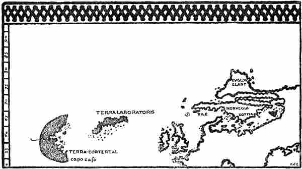
North-western portion of the “King” map, an anonymous Italian mappamundi of about 1502.
Scandinavia, with Greenland (“Evglovelant”) to the north of it, is of the type of Nicolaus
Germanus’s maps; Newfoundland and the Greenland (“Terra Laboratoris”) discovered by the
Portuguese and shown as an island, are taken from a Portuguese source. Compass-lines omitted
Thus, on the so-called King map—an Italian mappamundi of about 1502, which was probably taken from Portuguese sources—Newfoundland, called Terra Cortereal, lies in about the same place and has the same form as on the Cantino map (its southern point is called capo raso), while Greenland, called Terra Laboratoris, lies farther south than on the Cantino[Pg 374] map and has become a long island, the south-east coast of which should doubtless correspond to the east coast of Greenland on the Cantino map, but has a very different direction and form, and has in addition many islands to the south of it. A similar, but still more varied, representation is found on another Italian mappamundi, the so-called “Kunstmann, No. 2.” If Greenland and Newfoundland were both discovered by Gaspar Corte-Real and on the same voyage, and if these discoveries formed the basis both of the Cantino map and of the prototype of the King map, then it would be incomprehensible how the representation of one of these countries should vary so much, and not that of the other.[356]
The so-called Oliveriana map, an anonymous Italian compass-chart of a little later than 1503, shows more resemblance to the representation of Greenland on the Cantino map; but here that of Newfoundland is very different from what we find on the other maps, as its east coast is remarkably short and the south coast extends a long way to the west, in the same direction as the coast discovered by the English on La Cosa’s map of 1500;[357] but the names have no resemblance to those of that map, unless the island “Groga Y” should be La Cosa’s “S. Grigor” (?), which however lies farther east, while the island corresponding to “Groga” is called by La Cosa “I. de la trinidat.” “Cauo del marco” might also remind us of the Venetian Cabot. Dr. Björnbo thinks, as mentioned above (p. 369), that the prototype of[Pg 375] the Greenland on the Oliveriana map was Gaspar Corte-Real’s own admiral’s chart of his voyage of 1500. It seems to me possible that Björnbo may be right, in so far as the representation may be derived from the Portuguese expedition which sighted Greenland in 1500; but, from what has been advanced above, this was not commanded by Corte-Real, but more probably by João Fernandez. As the Newfoundland of the map has so little resemblance to reality and to the usual Portuguese representations [cf. also Björnbo, 1910, p. 315], it is improbable that the prototype of the map was due to Gaspar Corte-Real. Moreover one cannot imagine that mythical islands such as “Insula de labrador,” “Insula stille,” etc., were drawn by him; in such a case they would have to be explained as later additions from another source.
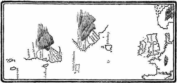
Northern portion of an anonymous Italian chart, a little later than 1503.
In the Oliveriana Library at Pesaro. Compass-lines omitted
We saw from the letters of the two Italian Ministers that King Manuel was very well satisfied with the discoveries of Gaspar Corte-Real, and expected great advantages therefrom, both on account of the trees for masts and of the slaves, etc.; he therefore awaited his return with impatience. But he waited in vain. Gaspar Corte-Real never returned. Whether he fell fighting with the natives on an unknown coast, or whether he plunged into the mists and ice of the unknown north, there[Pg 376] to find a cold grave, or was lost in a storm on the homeward voyage across the Atlantic, will never be revealed.
As he did not return, his brother, Miguel Corte-Real, fitted out a new expedition in the hope, on the one hand of going to help his brother, and on the other of making fresh discoveries. On January (?) 15, 1502 (or 1503 ?), he obtained letters patent from King Manuel (see p. 353). On May 10, according to Damiam de Goes, he sailed from Lisbon with two ships, and nothing more was heard of him. Antonio Galvano, on the other hand, says that he had three ships, and that these arrived in Newfoundland (Terra de Corte-Real), but there separated and went into different inlets
“with the arrangement that they should all meet again on August 20th. The two other ships did so, and when they saw that Miguel Corte-Real’s ship did not come at the appointed time, nor for some time after that, they returned to Portugal, and never since was any more news heard of him, nor did any other memory of him remain; but the country is called to this day the Land of the Corte-Reals.”[358]
“The King felt deeply the loss of the two brothers, and, moved by his royal and compassionate feeling, he caused in the year 1503[359] two ships to be fitted out to go and search for them. But it could never be discovered how either the one or the other (of the brothers) was lost.”
If this account of Galvano’s is correct, then the last relief expedition returned without having accomplished its purpose. As to what discoveries it may have made, we hear nothing, nor do we see any trace of them on the maps, unless, indeed, the hint of an extension of Newfoundland to the north on the so-called Pilestrina map of about 1511 (see p. 377) may be due to this expedition or to the ship that returned from Miguel Corte-Real’s voyage of 1502. On Pedro Reinel’s map (p. 321) there is marked a land answering to Cape Breton, with a coast extending westward from it. It is possible that this may be[Pg 377] derived from these expeditions, and in the same way all the Portuguese names along Newfoundland, the coast-line of which must be taken from the same source as the Cantino map. It is, however, more probable that the names are due to Portuguese fishermen; though there is also a possibility that Reinel’s additions may be referred to the Anglo-Portuguese expeditions from Bristol in 1501 and the following years. His island, Sam Joha [St. John], points, as has been said (p. 321), to a possible connection with John Cabot’s discoveries.
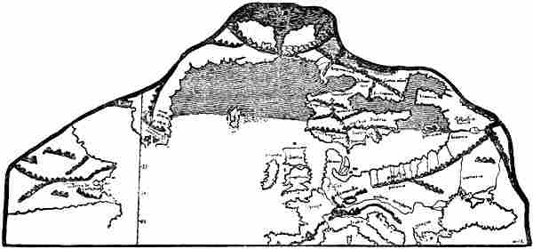
Northern portion of an Italian map, possibly drawn by Pilestrina, 1511.
Only a few of the names are given. (Björnbo and Petersen, 1908)
When neither of the brothers returned, the eldest brother, Vasqueanes Corte-Real—who held very high positions both at the King’s Court and as Governor of the islands of São Jorge and Terceira in the Azores—wished “to fit out ships at his own expense in order to go out and search for them. But when he asked the King to excuse his absence, his Majesty could not consent to his going further in the matter, and insisted that it was useless, and that all had been done that could be done” (De Goes). Thus the spirit of the capable and enterprising Portuguese for further exploration in these difficult northern waters seems to have become cooled, and we do not hear much more of official expeditions despatched from Portugal to find other new countries in that quarter. Meanwhile[Pg 378] Newfoundland (Terra de Corte-Real) continued through the whole of the sixteenth century to be regarded as a province under the Portuguese Crown, and the post of its Governor, with special privileges, was hereditary in the family of Corte-Real, until Manuel Corte-Real II., the last of the male line, fell fighting by the side of King Sebastian, in the fatal battle of Kas-rel-Kebir in 1578.[360]
The Portuguese seem for a long time to have kept up the connection with Newfoundland, more especially in order to avail themselves of the rich fisheries that had been discovered there. But of this it is only by the merest accident that history has anything to relate. It appears as though this fishery became active immediately after Corte-Real’s discovery; for we see that as early as 1506 King Manuel gave orders that the fishermen on their return from Newfoundland to Portugal were to pay one-tenth of the proceeds in duties [cf. Kunstmann, 1859, p. 69].
CONCLUSION
If we would discover how a watercourse is formed, from the very first bog-streams up in the mountain, we must follow a multitude of tiny rills, receiving one fresh stream after another from every side, running together into burns, which grow and grow and form little rivers, till we come to the end of the wooded hillside and are suddenly face to face with the great river in the valley below.
A similar task confronts him who endeavours to explore the first trickling rivulets of human knowledge; he must trace all the minute, uncertain, often elusive beginnings, follow the diversity of tributaries from all parts of the earth, and show how the mass of knowledge increases constantly from age to age, sometimes reposing in long stretches of dead water, half choked with peat and rushes, at other times plunging onward in foaming rapids. And then he too is rewarded; the stream grows broader and broader, until he stands beside the navigable river.
But a simile never covers the whole case. The latter task is rendered not only wider, but incomparably more difficult, by the fact that the brooks and rivers whose course is to be followed are even more intricate and scarcely ever flow in an open stream. True knowledge is so seldom undiluted; as a rule it is suffused with myths and dogmatic conceptions, often to such a degree that it becomes entirely lost, and something new seems to have arisen in its place.
[Pg 380]For one thing, man’s power of grasping reality varies greatly; in primitive man it is clouded to a degree which we modern human beings can hardly understand. He is as yet incapable of distinguishing between idea and reality, between belief and knowledge, between what he has seen and experienced and the explanation he has provided for his experience.
But even with those who have long outgrown the primitive point of view imagination steps in, supplying detail and explanation wherever our information fails us and our knowledge falls short; it spreads its haze over the first uncertain outlines of perception, and the distant contours are sometimes wholly lost in the mists of legend.
This is a universal experience in the history of intellectual life. In the domain to which this work is devoted, it makes itself felt with perhaps more than its usual force.
The inquiry embraces long periods. In all times and countries we have seen the known world lose itself in the fogs of cloudland—never uniformly, it is true, but in constantly changing proportions. Here and there we have a glimpse, now and again a vision over wider regions; and then the driving mists once more shut out our view. Therefore all that human courage and desire of knowledge have wrested in the course of long ages from this cloudland remains vague, uncertain, full of riddles. But for this very reason it is all the more alluring.
We saw that to the eyes of the oldest civilisation in history and down through the whole of antiquity, the North lay for the most part concealed in the twilight of legend and myth; here and there genuine information finds its way into literature, but is again effaced. At the beginning of the Middle Ages the dark curtain thickens.
Again there is a glimmer of light, first from the intermingling of nations at the time of the migrations, then from new trading voyages and intercourse, until the great change is brought about by the Norsemen, who with their remarkable power of expansion overran western and southern Europe[Pg 381] and penetrated the vast unknown solitudes in the North, found their way to the White Sea, discovered the wide Polar Sea and its shores, colonised the Faroes, Iceland and Greenland, and were the first discoverers of the Atlantic Ocean and of North America.
As early as in the writings of King Alfred and Adam of Bremen the Norsemen’s initiatory knowledge of this new northern world made its way into European literature.
No doubt the mists closed again, much of the knowledge gained was forgotten even by the Norsemen themselves, and in the latter part of the Middle Ages it is mostly mythical echoes of this knowledge that are to be traced in the literature of Europe and that have left their mark on its maps. None the less were the discoveries of the Norsemen the great dividing line. For the first time explorers had set out with conscious purpose from the known world, over the surrounding seas, and had found lands on the other side. By their voyages they taught the sailors of Europe the possibility of traversing the ocean. When this first step had been taken the further development came about of itself.
It was in the Norsemen’s school that the sailors of England had their earliest training, especially through the traffic with Iceland; and even the distant Portuguese, the great discoverers of the age of transition, received impulses from them.
Through all that is uncertain, and often apparently fortuitous and chequered, we can discern a line, leading towards the new age, that of the great discoveries, when we emerge from the dusk of the Middle Ages into fuller daylight. Of the new voyages we have, as a rule, accounts at first hand, less and less shrouded in mediævalism and mist. From this time the real history of polar exploration begins.
Cabot had then rediscovered the mainland of North America, Corte-Real had reached Newfoundland, the Portuguese and the English were pushing northward to Greenland and the ice. And this brings in the great transformation of ideas about the Northern World.
[Pg 382]It is true that as yet we have not passed the northern limits of our forefathers’ voyages; and that views of the arctic regions are still obscure and vague. While some imagine a continent at the pole, others are for a wreath of islands around it with dangerous currents between them, and others again reckon upon an open polar sea. There is obscurity enough. But new problems are beginning to shape themselves.
When it became apparent to the seamen of Europe that the new countries of the West were not Asia, but part of a new continent, the idea suggested itself of seeking a way round the north—as also round the south—of this continent, in order to reach the coveted sources of wealth, India and China: the problem of the North-West Passage was presented—a continuation on a grand scale of the routes opened up by the Norsemen towards the north-west.
But equally present was the thought that perhaps there was another and shorter way round the north of the old world; and the problem of the North-East Passage arose. The working out of this problem was simply a continuation of the north-eastern voyages of the Norwegians to the White Sea.
In this way were born the two great illusions, which for centuries held the minds of explorers spellbound. They could never be of value as trade-routes, these difficult passages through the ice. They were to be no more than visions, but visions of greater worth than real knowledge; they lured discoverers farther and farther into the unknown world of ice; foot by foot, step by step, it was explored; man’s comprehension of the earth became extended and corrected; and the sea-power and imperial dominion of England drew its vigour from these dreams.
What a vast amount of labour lies sunk in man’s knowledge of the earth, especially in those remote ages when development proceeded at such an immeasurably slower pace, and when man’s resources were so infinitely poorer. By the most manifold and various ways the will and intelligence of man achieve their object. The attraction of long[Pg 383] voyages must often enough have been the hope of finding riches and favoured lands, but deeper still lay the imperious desire of getting to know our own earth. To riches men have seldom attained, to the Fortunate Isles never; but through all we have won knowledge.
The great Alexander, the conquering king, held sway over the greater part of the world of his day; the bright young lord of the world remained the ideal for a thousand years, the hero above all others. But human thought, restless and knowing no bounds, found even his limits too narrow. He grew and grew to superhuman dimensions, became the son of a god, the child of fortune, who in popular belief held sway from the Pillars of Hercules, the earth’s western boundary, to the trees of the sun and moon at the world’s end in the east; to whom nothing seemed impossible; who descended to the bottom of the sea in a glass bell to explore the secrets of the ocean; who, borne by tamed eagles, tried to reach heaven, and who was fabled by Mohammedans and Christians to have even attempted to scale the walls of Paradise itself—there to be checked for the first time: “Thus far and no farther.” No man that is born of woman may attain to the land of heart’s desire.
The myth of Alexander is an image of the human spirit itself, seeking without intermission, never confined by any bounds, eternally striving towards height after height, deep after deep, ever onward, onward, onward....
The world of the spirit knows neither space nor time.
FINIS
LIST OF THE MORE IMPORTANT WORKS REFERRED TO
1876 ADAM of Bremen: Adami Gesta Hamburgensis Ecclesiae Pontificum ex recensione Lappenbergii. Editio altera. “Scriptores Rerum Germanicarum.” Hannoverae, 1876.
1862 ADAM of Bremen: Om Menigheden i Norden o. s. v. Overs. af P. W. Christensen. Copenhagen, 1862.
1893 ADAMS von Bremen Hamburgische Kirchengeschichte. Übers. von J. C. W. Laurent. 2. Aufl. Leipzig, 1893.
1839 AELIANUS (Claudius): Varia. “Vermischte Nachrichten,” Werke, Bd. I, übers. von Ephorus Dr. Wunderlich. “Griech. Prosaiker in neuen Uebers.,” hgb. v. Tafel, Osiander, und Schwab, Bd. 182. Stuttgart, 1839.
1894 AHLENIUS (Karl): Pytheas’ Thuleresa, “Språkvetenskapliga Sällsk. i Upsala Förhandl.,” I, 1882-94, pp. 101-124, in “Upsala Universitets Årsskrift,” 1894.
1900 AHLENIUS (K.): Die älteste geographische Kenntnis von Skandinavien. “Eranos,” III, 1898-1899. Upsala, 1900.
1859 ALFRED, King: Anglo-Saxon Version of Orosius. Ed. by JOSEPH BOSWORTH, London, 1859. As to Ottar, see also HENRY SWEET: An Anglo-Saxon Reader, Oxford, 1884; R. RASK in “Skandinaviske Litteraturselskabs Skrifter,” XI, Copenhagen, 1815, with Danish transl. and notes; G. PORTHAN: “Kgl. Vitterh. Hist. o. Antique Acad. Handl.” VI, Stockholm, 1800, with Swedish transl. and notes.
1845 d’AVEZAC (M. P.): Les Iles fantastiques de l’océan occidental au moyen-âge. Paris, 1845.
1887 AVIENUS (Rufus Festus): Rufi Festi Avieni Carmina. Ed. Alfred Holder, Innsbruck, 1887.
BATÛTA (Ibn): Voyages d’Ibn Batoutah, Texte arabe et traduction par DEFRÉMERY et SANGUINETTI.
1902 BAUMGARTNER (A.): Island und die Färöer. 3 Aufl. Freiburg, 1902.
1876 BAUMSTARK (Anton), See TACITUS.
1880 BAUMSTARK (A.): Ausführliche Erläuterung des besondern völkerschaftlichen Theiles der Germania des Tacitus. Leipzig, 1880.
1904 1905 BEAUVOIS (Eug.): “Journal de la Société des Américanistes de Paris,” 1904, No. 2; 1905, No. 2.
1897 1906 BEAZLEY (C. Raymond): The Dawn of Modern Geography, I, 1897; II, 1901; III, 1906, London.
1898 BEAZLEY (C. R.): John and Sebastian Cabot. London, 1898.
1902 BÉRARD (Victor): Les Phéniciens et l’Odyssée. I, 1902; II, 1903. Paris.
1880 BERGER (Hugo): Die geographischen Fragmente des Eratosthenes. Leipzig, 1880.
1887-93 BERGER (H.): Geschichte der wissenschaftlichen Erdkunde der Griechen. I, 1887; II, 1889; III, 1891; IV, 1893. Leipzig.
1904 BERGER (H.): Mythische Kosmographie der Griechen. Appendix to Roscher’s “Mythol. Lexikon.” Leipzig, 1904.
1878 BETHMANN (L.) and WAITZ(G.), see PAULUS WARNEFRIDI.
1909 BJÖRNBO (Axel Anthon): Adam af Bremens Nordensopfattelse. “Aarb. f. nord. Oldk o. Hist.” Copenhagen, 1909.
1910 BJÖRNBO (A. A.) Cartographia Groenlandica. Indledning og Perioden til Aar 1576. Medd. om Grönland, XLVIII, 1. Copenhagen, 1911.
1910a BJÖRNBO (A. A.): Die echte Corte-Real-Karte. “Peterm. Geogr. Mitt.” 1910, II.
1904 BJÖRNBO (A. A.) and PETERSEN (Carl S.): Fyenboen Claudius Claussön Swart o.s.v. “Kgl. Danske. Vid. Selsk. Skr.” 6. R., hist. filos. Afd. VI. 2. Copenhagen, 1904.
1908 BJÖRNBO (A. A.) and PETERSEN (C. S.): Anecdota Cartographica Septentrionalia. Havnia, 1908.
1909 BJÖRNBO (A. A.) and PETERSEN (C. S.): Der Däne Claudius Claussön Swart. Innsbruck, 1909.
1867 BLOM (O.): Om Kongespeilets Affattelsestid. “Aarb. f. nord. Oldk. o. Hist.” Copenhagen, 1867.
1901 BOAS (Franz): Eskimo of Baffin Land and Hudson Bay. “Bull. Amer. Mus. Nat. Hist.” XV, 1901.
1909 BOBÉ (Louis): Aktstykker til Oplysning om Grönlands Besejling. “Danske Magazin,” 5. R., VI. Copenhagen, 1909.
1859 BOSWORTH (J.), see King ALFRED.
1910 BREDA (O. J.): Rundt Kensington-stenen. “Symra,” VI. Decorah 1910.
1877 BRENNER (Oskar): Nord- und Mitteleuropa in den Schriften der Alten. Zuang. Diss. München, 1877.
1909 BRÖGGER (A. W.): Den Arktiske Stenalder i Norge. “Vid. Selsk. Skr.” II Hist. filos. Kl., 1909. No. 1. Christiania.
1896 BRUUN (Daniel): Arkæologiske Undersögelser i Julianehaabs Distrikt, 1895. “Medd. om Grönland,” XVI. Copenhagen, 1896.
1902 BRUUN (D.): Det höie Nord. Copenhagen, 1902.
1899 BUGGE (Alexander): Vore forfædres opdagelsesreiser i Polaregnene. “Kringsjå,” XI. Christiania, 1899.
1900 BUGGE (A.): Contributions to the History of the Norsemen in Ireland, III. “Vid.-Selsk Skr.,” II Hist. filos. Kl. 1900. Christiania, 1901.
1904-06 BUGGE (A.): Vikingerne. Billeder fra vore forfædres liv. I, 1904; II, 1906. Christiania.
1905 BUGGE (A.): Vesterlandenes Indflydelse på Nordboernes og særlig Nordmændenes ydre Kultur o. s. v. i Vikingetiden. “Vid.-Selsk. Skr.” II Hist. filos. Kl. 1904, No. 1. Christiania, 1905.
1908 BUGGE (A.): Nordlands skiftende Skjæbne. “Hist. Tidsskrift.” 4. R., V. Christiania, 1908.
1890 BUGGE (Sophus): Bidrag til Nordiske Navnes Historie. “Arkiv för Nordisk Filologi,” VI. Lund, 1890.
1896 BUGGE (S.): Germanische Etymologien, Beiträge 3. “Gesch. d. Deutschen Sprache in Literatur,” XXI. Halle, 1896.
1902 BUGGE (S.): Norges Indskrifter med de yngre Runer. Hönen-Runerne fra Ringerike. Christiania, 1902.
1904 BUGGE (S.): Foranskudts, især i Navne. “Arkiv. för Nordisk Filologi,” XXI. Lund, 1904.
1907 BUGGE (S.): Om nordiske folkenavne hos Jordanes. “Fornvännen.” Stockholm, 1907.
1910 BUGGE (S.): Der Runenstein von Rök in Ostergötland, Schweden. Hgb. durch Magnus Olsen. Stockholm, 1910.
1883 BUNBURY (E. H.): A History of Ancient Geography. London, 1883.
1904 CALLEGARI (G. V.): Pitea di Massilia. “Rivista di Storia Antica,” VII, 4; VIII, 2; IX, 2. Padova, 1904.
1866 CHRIST (Wilhelm): Avien und die ältesten Nachrichten über Iberien und die Westküste Europa’s. “Abhandl. d. Philos.-Philol. Classe d. K. Bayerischen Akad. d. Wiss.,” XI. München, 1866.
1867 COLLINSON (Richard): The three Voyages of Martin Frobisher, 1576-8. London, 1867.
1880 COSTA (B. F. de): Arctic Exploration. “Journ. of the American Geogr. Soc. of New York,” XII. 1880.
1828 CROKER (T. Crofton): Fairy Legends and Traditions of the South of Ireland. London, 1828.
1890 CRUSIUS (O.): Hyperboreer in “Roscher’s Mythol. Lexikon,” I, 2. Leipzig, 1890.
1871 CUNO (J. G.): Forschungen im Gebiete der Alten Völkerkunde. Berlin, 1871.
1882 DAAE (Ludvig): Didrik Pining. “Hist. Tidsskrift” 2. R. III. Christiania, 1882.
1888 DAAE (L.): Italieneren Francesco Negris Reise i Norge 1664-1665. “Hist. Tidsskrift” 2. R. VI. Christiania, 1888.
1894 DAWSON (Samuel Edward): The Voyages of the Cabots in 1497 and 1498; with an attempt to determine their landfall and to identify their island of St. John. “Proc. and Trans. of the R. Soc. of Canada 1894,” XII. Ottawa, 1895.
1896 DAWSON (S. E.): The Voyages of the Cabots in 1497 and 1498. A sequel etc. “Proc. and Trans. of the R. Soc. of Canada.” 2 Ser. II, 1896.
1897 DAWSON (S. E.): The Voyages of the Cabots. Latest Phases of the Controversy. “Proc. and Trans. of the R. Soc. of Canada.” 2 Ser. III, 1897.
1673 DEBES (Lucas Jacobsön): Færoe et Færoa Reserata. Det er: Færöernis oc Færöeske Indbyggeris Beskrivelse o. s. v. Copenhagen, 1673.
1849 DELISLE (L.): Des Revenus Publics en Normandie au Douzième Siècle. “Bibliothèque de l’École des Chartes.” IIIe Série, I. Paris, 1849.
1881 DESIMONI (Cornelio): Intorno a Giovanni Caboto Genovese etc. “Atti della Società Ligure di Storia Patria.” Genova, 1881.
1897 DETLEFSEN (D.): Zur Kenntniss der Alten von der Nordsee. “Hermes,” XXXII. Berlin, 1897.
1904 DETLEFSEN (D.): Die Entdeckung des germanischen Nordens im Altertum. “Quellen u. Forsch. z. alten Gesch. u. Geographie.” Hgb. v. W. Sieglin. H. 8. Berlin, 1904.
DICUIL, see LETRONNE.
1870 DICUIL: De mensura orbis terræ, ed. Parthey. Berlin, 1870.
1890 DIODORUS SICULUS: Bibliotheca Historica. Ed. F. VOGEL. Leipzig, 1890.
1881 DOZY (R.): Recherches sur l’Histoire et Littérature de l’Espagne. 3. éd. Paris, Leyde, 1881.
1836 EDRISI: Géographie d’Edrisi. Trad. par P. A. JAUBERT. “Recueil de Voyages et de Mémories publ. p. l. Soc. de Géographie.” V. Paris, 1836.
1866 EDRISI: Description de l’Afrique et de l’Espagne par Edrisi. Publ. avec trad. par R. Dozy et M. J. de Goeje. Leyden, 1866.
1741 EGEDE (Hans): De gamle Grönlands nye Perlustration eller Naturel-Historie. Kiöbenhafn, 1741.
1794 EGGERS (H. P.): Om Grönlands Österbygds sande Beliggenhed. “Det kgl. danske Landhusholdnings Selskabs Skrifter.” IV. Copenhagen, 1794.
1845 EINHARDI: Vita Caroli magni, ed. B. H. PERTZ. Hannover, 1845.
1891 EIRIKS Saga Rauda, og Flatöbogens Groenlendingaþáttr o. s. v. ved Gustav Storm. “Samfund til Utg. af gammel nordisk Literatur,” XXI. Copenhagen, 1891.
ERATOSTHENES, see BERGER.
1897 FABRICIUS (A.): Nordmannertogene til den Spanske Halvö. “Aarb. f. Nord. Oldk. og Hist.” 2. R. XII. Copenhagen, 1897.
1865 FAQÎH (Ibn al-): Kitâb al-buldân. Ed. M. J. de Goeje. Lugduni-Batavorum, 1865.
1910 FERNALD (M. L.): Notes on the Plants of Wineland the Good. “Rhodora,” Journal of the New England Botanical Club. XII. Boston, 1910.
1872 FISCHER (M. P.): Documents pour servir à l’Histoire de la Baleine des Basques. “Ann. d. Sciences Nat. Zoologie.” XV. Paris, 1872.
1886 FISCHER (Theobald): Beiträge zur Geschichte der Erdkunde und der Kartographie in Italien im Mittelalter. Samml. Mittelalterl. Welt- und Seekarten italienischen Ursprungs. F. Ongania. Venice, 1886.
1842-48 FORBIGER (Alb.): Handbuch der alten Geographie. I, 1842; II, 1844; III, 1848. Leipzig.
1823 FRÄHN (C. M.): Ibn-Foszlan’s und anderer Araber Berichte über die Russen älterer Zeit. St. Petersburg, 1823.
1881 FRIIS (Peder Claussön): Samlede Skrifter, utg. av Gustav Storm. Christiania, 1881.
1883 GEELMUYDEN (H.): De gamle Kalendere, særlig Islændernes. “Naturen,” VII. Christiania, 1883.
1883a GEELMUYDEN (H.): Den förste Polarexpedition. “Naturen,” VII. Christiania, 1883.
1825 GEIJER (E. G.): Svea Rikes Häfder. I. Upsala, 1825.
1898 GEMINI Elementa Astronomiae. Ed. C. Manitius. Leipzig, 1898. (Greek, with German transl.)
1895 GERLAND (G.): Zu Pytheas Nordlandsfahrt. “Beiträge zur Geophysik,” II. Stuttgart, 1895.
1909 GJESSING (Helge): Runestenen fra Kensington. “Symra,” V. Decorah, 1909.
1891 GOEJE (M. J. de): La légende de Saint Brandan. “Actes du Huitième Congrès internat. des Orientalistes, 1889.” Leiden, 1891.
1901-04 v. GRIENBERGER: Die nordischen Völker bei Jordanes. “Zeitschrift für Deutschen Altertum.” XLV, 1901, XLVII, 1904. Berlin.
1854 GRIMM (Jacob): Deutsche Rechtsalterthümer. 2. Ausg. Göttingen, 1854.
1875-78 GRIMM (J.): Deutsche Mythologie. 4. Ausg. I, 1875; II, 1876; III, 1878. Berlin.
1880 GRIMM (J): Geschichte der Deutschen Sprache. I. 4. Ausg. Leipzig, 1880.
1863 GRÖNDAL (B.): Folketro i Norden, “Ann. f. Nord. Oldk. o. Hist.” Copenhagen, 1863.
1838-45 “Grönlands Historiske Mindesmærker.” Utg. af d. Kgl. Nordiske Oldskrift-Selskab. Copenhagen, 1838-1845.
1889 GUDMUNDSSON (Valtýr): Privatboligen paa Island i Sagatiden; samt delvis det övrige Norden. Copenhagen, 1889.
1884 GUICHOT Y SIERRA (Alejandro): Supersticiones populares, recojidas en Andalucia y comparados con las Portuguesas. “Biblioteca de las tradiciones populares Españolas.” Madrid, 1884.
1889 GULDBERG (Gustav A.): En kort historisk Udsigt over Hvalfangsten i ældre Tider. “Folkevennen.” N. R. XIII. Christiania, 1889.
1890 GULDBERG (G. A.): Om Skandinavernes hvalfangst. “Nord. Tidsskrift.” Stockholm, 1890.
1894 GÜNTHER (S.): Adam von Bremen, der erste deutsche Geograph. “Sitzungsberichte der Königlich böhmischen Gesellschaft der Wissenschaften Phil. histor. Kl.” 1894.
1850 HAKLUYT (Richard): Divers Voyages touching the Discovery of America and its Islands Adjacent. Hakluyt Society. London, 1850.
1903 HAKLUYT (R.): The Principal Navigations, etc. Hakluyt Society. Glasgow, 1903.
1907 HAMBERG (Axel): Om eskimaernes härkomst och Amerikas befolkande. “Ymer,” XXVII. Stockholm, 1907.
1855 HAMMERSHAIMB (V. U.): Færöiske Kvæder. 2. hefte. Copenhagen, 1855.
1891 HAMMERSHAIMB (V. U.): Færöisk Anthologi, I. Copenhagen, 1891.
1907 HANSEN (Andr. M.): Oldtidens Nordmænd Ophav og Besætning. “Gammel Norsk Kultur i Tekst og Billeder,” Norsk Folkemuseum. Christiania, 1901.
1908 HANSEN (A. M.): Om Helleristningerne. Foren. t. norske Fortidsmindesmærkers Bevaring, Aarsbog. 1908.
1909 HANSEN (A. M.): Peder Claussön om Sjöfinnernes Sprog. “Maal og Minne.” Christiania, 1909.
1882 HARRISSE (Henry): Jean et Sebastian Cabot, leur origine et leurs voyages, etc. “Recueil de voyages et de documents,” etc. I. Paris, 1882.
1883 HARRISSE (H.): Les Corte-Real et leurs voyages au Nouveau-Monde. “Rec. de voy. et de doc.,” etc. III. Paris, 1883.
1892 HARRISSE (H.): The Discovery of North America. London, 1892.
1896 HARRISSE (H.): John Cabot the Discoverer of North America and Sebastian his Son. London, 1896.
1900 HARRISSE (H.): Découverte et évolution cartographique de Terre-Neuve et des Pays Circonvoisins, 1497-1501-1769. London, Paris, 1900.
1892-96 “Hauks bôk,” utg. af det kgl. Nordiske Oldskrift-Selskab (ved Finnur Jónsson). Copenhagen, 1892-96.
1904 HEFFERMEHL (A. V.): Presten Ivar Bodde o. s. v. Hist. Skrifter tilegn. Prof. Ludvig Daae o. s. v. af Venner og Diciple. Christiania, 1904.
1878 HEIBERG (Jacob): Lappische Gräber-schädel. “Archiv for Math. og Naturvid.,” III. Christiania, 1878.
1905 HELLAND (Amund): Finmarkens Amt. “Norges Land og Folk,” XX. Christiania, 1905.
1908 HELLAND (A.): Nordlands Amt. “Norges Land og Folk,” XVIII. Christiania, 1908.
1893 HERGT (Gustav): Die Nordlandfahrt des Pytheas. Inaug.-Diss. Halle, 1893.
1901 HERRMANN (Paul): Erläuterungen zu den ersten neun Büchern der Dänischen Geschichte des “Saxo Grammaticus,” I. Leipzig, 1901.
1904 HERTZBERG (Ebbe): Nordboernes gamle Boldspil. Hist. Skrifter tilegn. Prof. Ludwig Daae o. s. v. af Venner og Diciple. Christiania, 1904.
1880 “Historia Norwegiæ,” see STORM, 1880.
1909 HOEGH (Knut): Om Kensington og Elbow Lake-stenene. “Symra,” V. Decorah, 1909.
1865 HOFMANN (Conrad): Ueber das Lebermeer. “Sitzungsber. d. königl. bayer. Akad. d. Wissenschaften,” II, 1. München, 1865.
1909 HOLAND (R. Hjalmar): Kensington-stenens sprog og runer. “Symra,” V. Decorah, 1909.
1883 HOLM (G. F.): Beskrivelse af Ruiner i Julianehaabs Distrikt, der er undersögte i Aaret 1880. “Medd. om Grönland,” VI. Copenhagen, 1883.
1894 HOLZ (Georg): Beiträge zur deutschen Altertumskunde. H. 1. Über die Germanische Völkertafel des Ptolemaeus. Halle, 1894.
1870 HOMEYER (C. G.): Die Haus- und Hofmarken. Berlin, 1870.
1904 IRGENS (O.): Et Spörsmaal, vedkommende de gamle Nordmænds översöiske fart. “Skrifter utg. av Bergens hist. Forening,” Nr. 10. Bergen, 1904.
1888 “Islandske Annaler” indtil 1578. Udg. f. d. “Norske hist. Kildeskriftfond” ved Gustav Storm. Christiania, 1888.
1891 JACOB (Georg): Welche Handelsartikel bezogen die Araber des Mittelalters aus den nordisch-baltischen Ländern? 2. Ausg. Berlin, 1891.
1891a JACOB (G.): Die Waaren beim arabisch-nordischen Verkehr im Mittelalter. Berlin, 1891.
1892 JACOB (G.): Studien in arabischen Geographen. IV. Berlin, 1892.
1896 JACOB (G.): Ein arabischer Berichterstatter aus dem 10. Jahrhundert etc. Artikel aus Qazwînîs Athâr al-bilâd. 3. verm. u. verb. Aufl. Berlin, 1896.
1866 JACUT’S Geographisches Wörterbuch. Hgb. v. F. Wüstenfeld. Leipzig, 1866.
1898 1902 JAKOBSEN (Jakob): Færöiske Folkesagn og Æventyr. Copenhagen, 1898-1902.
1901 JAKOBSEN (J.): Shetlandsöernes stednavne. “Aarb. f. nord. Oldk. o. s. v.” 1901.
1900 JANTZEN (Hermann): Saxo Grammaticus. Die ersten neun Bücher der dänischen Geschichte, uebersetzt und erläutert. Berlin, 1900.
1892-96 JÓNSSON (Finnur), see “Hauks bôk.”
1893 JÓNSSON (F.): En kort Udsigt over den Islandsk-Grönlandske Kolonis Historie. “Nord. Tidsskrift.” Stockholm, 1893.
1894 JÓNSSON (F.): Den oldnorske og oldislandske Litteraturs Historie. I, 1894; II 1. 1898; II 2, 1901. Copenhagen. 1901
1897 JÓNSSON (F.): Sigurdarkvida en Skamma. “Aarb. f. Nord. Oldk.” o. s. v. 2 R., XII. Copenhagen, 1897.
1899 JÓNSSON (F.): Grönlands gamle Topografi efter Kilderne. “Medd. om Grönland,” XX. Copenhagen, 1899.
1900 JÓNSSON (F.): Landnámabók. Copenhagen, 1900.
1882 JORDANIS Romana et Getica, rec. Th. Mommsen, “Monumenta Germaniae Historica.” Berolini, 1882.
1884 JORDANES Gothengeschichte. Übers. v. Wilhelm Martens. I. W. Wattenbach: “Die Geschichtschreiber der deutschen Vorzeit. 6. Jahr.” I. Leipzig, 1884.
1879 JOYCE (P. W.): Old Celtic Romances. London, 1879.
1903 KÄHLER (Friedrich): Forschungen zu Pytheas’ Nordlandsreisen. Stadtgymnasium zu Halle a. S. Festschrift z. Begrüss. d. 47 Vers. Deutscher Philologen u. Schulmänner im Halle. 1903.
1839 1868 KEYSER (R.): Om Nordmændenes Herkomst og Folkeslægtskab, “Samlinger til det norske Folks Sprog og Historie,” VI, 1839. Reprinted in “Samlede Afhandlinger.” Christiania, 1868.
1865 KHORDÂDHBEH (Ibn): Le Livre des Routes et des Provinces. Trad. par C. BARBIER DE MEYNARD. Paris, 1865.
1889 KHORDÂDHBEH (Ibn): Kitâb al-Masâlik wa’l-mamâlik, auctore Abn’l-Kâsim ... Ibn Khordâdhbeh, etc. “Bibliotheca Geographorum Arabicorum,” ed. M. J. de Goeje, VI. Lugduni-Batavorum, 1889.
1883 KOCH (John): Die Siebenschläferlegende, ihr Ursprung und ihre Verbreitung. Leipzig, 1883.
1869 KOHL (J. G.): Die erste Deutsche Entdeckungsfahrt zum Nordpol. “Peterm. geogr. Mitt.,” 1869.
1880 KOHL (J. G.): Documentary History of the Discovery of the State of Maine. “Maine Historical Soc. Collections.” Portland, 1880.
1908 KOHLMANN (Phipp Wilhelm): Adam von Bremen. “Leipzigs Historische Abhandlungen.” X. Leipzig, 1908.
1908 KOHT (Halvdan): Om Haalogaland og Haalöyg-Ætten. “Hist. Tidsskrift,” 4. R. VI. Christiania, 1908.
1909 KOHT (H.): Sagnet om Hvítramannaland. “Hist. Tidsskrift,” 4. R. VI. Christiania, 1909.
1909 KRABBO (Hermann): Nordeuropa in der Vorstellung Adams von Bremen. “Hansische Geschichtsblätter.” Heft. 1. Leipzig, 1909.
1891 KRETSCHMER (Konrad): Marino Sanudo der Ältere und die Karten des Petrus Vesconte. “Zeitschr. d. Gesellsch. f. Erdkunde z. Berlin.” XXVI. 1891.
1891a KRETSCHMER (K.): Eine neue mittelalterliche Weltkarte der vatikanischen Bibliothek. “Zeitschr. d. Gesellsc. f. Erdkunde z. Berlin,” XXVI. 1891.
1892 KRETSCHMER (K.): Die Entdeckung Amerika’s in ihre Bedeutung für die Geschichte des Weltbildes. “Festschr. d. Gesellsch. f. Erdkunde z. Berlin.” 1892.
1897 KRETSCHMER (K.): Die Katalanische Weltkarte der Biblioteca Estense zu Modena. “Zeitschr. d. Gesellsch. f. Erdkunde z. Berlin,” XXXII. 1897.
1909 KRETSCHMER (K.): Die italienischen Portolane des Mittelalters. Veröff. d. Instituts f. Meereskunde u. d. geogr. Instituts a. d. Universität Berlin, XIII. 1909.
1859 KUNSTMANN (Fr.): Die Entdeckung Amerikas nach den ältesten Quellen geschichtlich dargestellt. “Monum. saec. Kgl. Bayerischen Akad. d. Wissensch.” München, 1859.
1894 LAFFLER (L. Fr.): Om de Östskandinaviska Folknamnen hos Jordanes. “Bidrag till Kännedom om de Svenska Landsmålen ock Svensk Folklif,” XIII, No. 9. Stockholm, 1894.
1907 LÄFFLER (L. Fr.): Anmärkningar till professor Sophus Bugges uppsats “Om nordiske Folkenavne hos Jordanes.” “Fornvännen,” 1907. Stockholm.
1870 “LAGENIENSIS”: Irish Folk Lore. Glasgow, 1870.
1881 LAMPROS (S. P.): Cananos Lascaris and Basileios Batatzes, two Greek travellers of the 14th and 15th centuries. “Parnassos,” V. Athens, 1881. (In Greek.)
1888 LANCARBANENSI (Caradoco): Vita Gildae, in “Monumenta Germaniae Historica,” 4to. “Auctores antiguissimi,” XIII, III: Chronica Minora, Sæc. IV, V, VI, VII, ed. Th. Mommsen. Berolini, 1888.
1900 “Landnámabók” utg. av det kgl. nordiske Oldskrift-Selskab, ved Finnur Jónsson. Copenhagen, 1900.
1838 LAPPENBERG (I. M.): Von den Quellen, Handschriften und Bearbeitungen des Adam von Bremen. “Archiv. der Gesellsch. f. ältere deutsche Geschichtskunde.” VI. Hannover, 1838.
1876 LAPPENBERG, see Adam of Bremen.
1767 LEEM (Knud): Beskrivelse over Finmarkens Lapper. Copenhagen, 1767.
1852 LELEWEL (Joachim): Géographie du Moyen Âge. Breslau, 1852. Atlas, 1851.
1814 LETRONNE (A.): Recherches Géographiques et Critiques sur le livre de Mensura Orbis Terræ, etc. par Dicuil. Paris, 1814.
1872 LIEBRECHT (Felix): Sanct Brandan. Ein lateinischer und drei deutsche Texte. Herausg. von Schröder. “The Academy,” III, 1872.
1689 LILLIENSKIOLD (Hans Hansen): Speculum boreale, 1689. MS. (No. 948-949) in the Thott Collection in the Royal Library at Copenhagen. Copy in the collections of the Norwegian Historical MSS. Commission.
1897 LÖNBORG (Sven Erik): Adam af Bremen och hans skildring af Nordeuropas Länder och Folk. Akad. Afh. Upsala, 1897.
1861 MAÇOUDI: Les Prairies d’or. Par C. Barbier de Meynard et Pavet de Courteille. “Coll d’ouvr. orient. Soc. Asiatique.” Paris, 1861.
1896 MAÇOUDI: Le livre de l’avertissement et de la revision. Par Carra de Vaux. “Coll. d’ouvr. orient. Soc. Asiatique.” Paris, 1896.
1883 MANDEVILLE (John): The Voiage and Travaile of Sir John Maundevile. Ed. by J. O. Halliwell. London, 1883.
1893 MARKHAM (Clements R.): Pytheas, the Discoverer of Britain. “Geogr. Journal,” I. London, 1893.
1893 MARKHAM (C. R.): The Journal of Christopher Columbus and Documents relating to the Voyages of John Cabot and Gaspar Corte Real. The Hakluyt Society, LXXXVI. London, 1893.
1897 MARKHAM (C. R.): Fourth Centenary of the Voyage of John Cabot 1497. “Geogr. Journal,” IX. London, 1897.
1895 MARX (Friedrich): Aviens ora Maritima. “Rheinisches Museum für Philologie,” N. F. L. Frankfurt, 1895.
1901 1902 MATTHIAS (Franz): Über Pytheas von Massilia und die ältesten Nachrichten von den Germanen. Wissensch. Beilage z. “Jahresbericht des Königl. Luisengymnasiums zu Berlin.” Programm No. 62, 1901: Programm No. 64, 1902. Berlin.
1855 MAURER (Konrad): Die Bekehrung des Norwegischen Stammes zum Christenthume. München, 1855.
1874 MAURER (K.): I. Grönland im Mittelalter. II. Grönlands Wiederentdeckung. “Die zweite Deutsche Nordpolarfahrt,” 1869-1870. I. Leipzig, 1874.
1874a MAURER (K.): Island von seiner ersten Entdeckung etc. München, 1874.
1857 MEHREN (A. F.): Fremstilling af de Islamitiske Folks almindelige geographiske Kundskaber, o. s. v. “Ann. f. nord. Oldk. o. Hist.” Copenhagen, 1857.
1874 MEHREN (A. F.): Manuel de la Cosmographie du Moyen Âge. Copenhague, 1874.
1902 MEISSNER (R.): Die Strengleikar. Halle a. S., 1902.
1822 MELA (Pomponius): Jordbeskrivelse. Ovs. a. J. H. Bredsdorff. Copenhagen, 1822.
1895 METELKA (J.): O neznámêm dosud vydáni mapy Islandu Olaa Magna zr. 1548. “Sitzungsber. d. kgl. böhmischen Gesellsch. d. Wissensch., Cl. f. Philos., Gesch. u. Philol.” Jahrg. 1895. Prag, 1896.
1895-97 MEYER (Kuno) and NUTT (Alfred): The Voyage of Bran son of Febal to the Land of the Living. I, 1895; II, 1897. London.
1853 MICHELSEN (A. L. J.): Die Hausmarke. Jena, 1853.
1895-98 MILLER (Konrad): Mappe mundi. Die ältesten Weltkarten, I-III, 1895; IV-V, 1896; VI, 1898. Stuttgart.
1892 MOGK (E.): Die Entdeckung Amerikas durch die Nordgermanen. “Mitt. d. Vereins f. Erdkunde z. Leipzig.” 1892.
1882 MOMMSEN (Th.), see JORDANES
1895 MOMMSEN (Th.), see SOLINUS.
1893 MUCH (Rudolf): Goten und Ingvaeonen. “Beitr. z. Gesch. d. Deutschen Spr. u Lit.” XVII. Halle, 1893.
1895 MUCH (R.): Germanische Völkernamen. “Zeitsch. f. Deutsches Altertum,” XXXIX. Berlin, 1895.
1895a MUCH (R.): “Alokiai Beitr. z. Gesch. d. Deutschen Spr. u. Lit.,” XX. Halle, 1895.
1905 MUCH (R.): Deutsche Stammeskunde. “Sammlung Göschen.” Leipzig, 1905.
1870-1900 MÜLLENHOFF (Karl): Deutsche Altertumskunde. I, 1870; II, 1887; III, 1892; IV, 1900. Berlin.
1889 MÜLLENHOFF (K.): Beovulf. Berlin, 1889.
1892 MÜLLENHOFF (K.): and SCHERER (W.): Denkmäler Deutscher Poesie und Prosa. 3. Ausg. Berlin, 1892.
1909 MÜLLER (Sophus): De forhistoriske Tider i Europa. “Verdens Kulturen” ved Aage Friis, II. Copenhagen, 1909.
1851 MUNCH (P. A.): Det norske Folks Historie. Christiania, 1851.
1852 MUNCH (P. A.): Geographiske Oplysninger om de i Sagaerne forekommende skotske og irske Stedsnavne. “Ann. f. Nord. Oldk. o. Hist.” Copenhagen 1852.
1860 MUNCH (P. A.): Chronica Regum Manniæ ed. Christiania, 1860.
1895 MURRAY (John): A Summary of the Scientific Results, etc. Historical Introduction. “Challenger’s Report,” Summary, I. London, 1895.
1890 NANSEN (Fridtjof): På ski over Grönland, Christiania, 1890. (Engl. transl.) “The First Crossing of Greenland,” London, 1890.
1891 NANSEN (F.): Eskimoliv. Christiania, 1891. (Engl. transl., “Eskimo Life,” London, 1893.)
1905 NIELSEN (Yngvar): Nordmænd og Skrælinger i Vinland. “Hist. Tidsskrift,” 4. R. III: and in “Norsk geogr. Selsk. Årbog.” 1905.
1892 NIESE (B.): Entwickelung der Homerischen Poesie. Berlin, 1882.
1837 NILSSON (Sven): Några Commentarier till Pytheas’ fragmenter om Thule. “Physiographiska Sällskapets Tidsskrift,” I, 1837. Lund, 1837-1838.
1838 NILSSON (S.): Einige Bemerkungen zu Pytheas Nachrichten über Thule (from Swedish). “Zeitschr. Alterthumwiss.” 1838.
1862 1865 NILSSON (S.): Skandinaviske Nordens Ur-Invånare. Bronsålderen. 2. utg. Stockholm, 1862. Tillägg, 1865. In German translation: “Die Ureinwohner des scandinavischen Nordens.” Das Bronzealter. 2. Ausg. Hamburg, 1866.
1815 NOEL (S. B. J.): Histoire Generale des Pêches Anciennes et Modernes. Paris, 1815.
1889 NORDENSKIÖLD (A. E.): Facsimile Atlas. Stockholm, 1889.
1892 NORDENSKIÖLD (A. E.): Bidrag til Nordens äldsta Kartografi. Utg. af “Svenska Sällsk. f. Antr. o. Geogr.” Stockholm, 1892.
1897 NORDENSKIÖLD (A. E.): Periplus. Stockholm, 1897.
1899 NYSTRÖM (J. F.): Geografiens och de Geografiska Upptäckternas Historia, till Början af 1800-Talet. Stockholm, 1899.
1905 OLSEN (Magnus): Det gamle norske önavn Njarðarlog. “Forh. i Vid. Selsk.” Christiania, 1905.
1909 OLSEN (M.): Peder Claussön om Sjöfinnernes Sprog. “Maal og Minne.” Christiania, 1909.
ONGANIA, see TH. FISCHER.
1878 PAULUS WARNEFRIDI: Historia Langobardorum. Ed. L. Bethmann et G. Waitz. Script. Rer. Langob. et Italic. Saec. VI-IX. “Monumenta Germaniae Historica.” Hannover, 1878.
1878 PESCHEL (Johannes): Das Märchen vom Schlaraffenlande. “Beitr. z. Gesch. d. Deutschen Spr. u. Lit.,” V. Halle, 1878.
1866 PLINII (C.) Secundi: Naturalis Historia. Rec. D. Detlefsen. Berolini, 1866.
1881 PLINIUS: Die Naturgeschichte des Cajus Plinius Secundus. Übs. v. G. C. Wittstein. Leipzig, 1881.
1893 PLUTARCH: Moralia, ed. BERNARDABIS. V. Leipzig, 1893.
1753 PONTOPPIDAN (Erich): Det förste Forsög paa Norges Naturlige Historie. Copenhagen, 1753.
1800 PORTHAN (H. G.), see King ALFRED.
1829 PROCOPIUS: Des Prokopius von Cäsarea Geschichte seiner Zeit; III og IV, Gothische Denkwürdigkeiten. Ubers. von P. F. Kanngiesser. Greifswald, 1829 og 1831.
1905 PROCOPIUS: Procopii Caesariensis opera omnia. Recognovit Jacobus Haury, Leipzig, 1905.
1838 PTOLEMAEUS (Claudius): Claudii Ptolemæi Geographiæ libri octo. Ed. F. G. Wilberg. Essendiæ, 1838.
1907 PULLÈ (F. L.) and LONGHENA (M.): Illustrazione del Mappamondo Catalano della Biblioteca Estense di Modena. “VI Congresso Geografico Itaniano, Venezia, 1907.” Venezia, 1908.
1848 QAZWÎNÎ: Zakarija b. Muhammed b. Mahmud el-Caswini’s Kosmographie. Hgb. von F. Wüstenfeld. Göttingen, 1848.
1893 QVIGSTAD (J. K.): Nordische Lehnwörter in Lappischen. “Forhandl. i Vid. Selsk.” Christiania, 1893.
1909 QVIGSTAD (J. K.): Peder Claussön om Sjöfinnernes Sprog. “Maal og Minne.” Christiania, 1909.
1837 RAFN (C. Chr.): Antiquitates Americanae. Copenhagen, 1837.
1900 RANISCH (Wilhelm): Die Gautreksaga. “Palaestra,” XI. Berlin, 1900.
1815 RASK (R.), see King ALFRED.
1860 RAVENNA GEOGRAPHER: Ravennatis Anonymi Cosmographia et Guidonis Geographican. Ed. M. Pinder et G. Parthey. Berolini, 1860.
1908 RAVENSTEIN (E. G.): Martin Behaim, his Life and his Globe. London, 1908.
1895 REEVES (Arthur Middleton): The Finding of Wineland the Good. London, 1895.
1892 REINACH (Salomon): L’étain celtique. “L’Anthropologie,” III. Paris, 1892.
1852-57 RINK (H.): Grönland, geografisk og statistisk beskrevet. Copenhagen, 1852-57.
1866 RINK (H.): Eskimoiske Eventyr og Sagn. Copenhagen, 1866.
1871 RINK (H.): Om Eskimoernes Herkomst. “Aarb. f. nord. Oldk. o. Hist.” Copenhagen, 1871.
1885 RINK (H.): Om de eskimoiske Dialekter som Bidrag til Bedömmelsen af Spörgamaalet om Eskimoernes Herkomst og Vandringer. “Aarb. f. nord. Oldk. o. Hist.” Copenhagen, 1885.
RINK (H.): The Eskimo Dialects as serving to determine the Relationship between the Eskimo Tribes. Anthrop. Inst. of Great Britain and Ireland, XV.
1887 1891 RINK (H.): The Eskimo Tribes. “Medd. om Grönland,” XI. Copenhagen, 1887; and “Supplement” to XI. 1891.
1900 ROHDE (Erwin): Der Griechische Roman und seine Vorläufer. 2. Aufl. Leipzig, 1900.
1892 RUGE (Sophus): Die Entdeckungs-Geschichte der Neuen Welt. “Festschrift der Hamburgischen Amerika-Feier,” I. Hamburg, 1892.
1892 RUGE (S.): Die Entwickelung der Kartographie von Amerika bis 1570. “Peterm. geogr. Mitt.” Erg. heft No. 106. Gotha, 1892.
1886 1790 RYDBERG (Viktor): Undersökningar i Germanisk Mythologi. Stockholm, 1886. “Rymbegla” sive rudimentum compasti ecclesiatici veterum islandorum. Ed. Stephanus Biörnonis. Havniæ, 1780.
1853 SAN-MARTHE: Die Sagen von Merlin. Halle, 1853.
1877 SARS (J. Ernst): Udsigt over den norske Historie. Christiania, I-IV, 1877 (2. utg.)—1891.
SAXO GRAMMATICUS, see HERRMANN and JANTZEN.
1873 SCHIERN (Frederik): Om Oprindelsen til Sagnet om de guldgravende Myrer. Ovs. over det Kgl. Danske Vid.-Selsk. Forh. Copenhagen, 1873.
1888 SCHIRMER (Gustav): Zur Brendanus-Legende. Habilitationsschrift. Leipzig, 1888.
1881 SCHLIEMANN (H.): Ilion. Leipzig, 1881.
1851 SCHOOLCRAFT (Henry R.): Historical and Statistical Information respecting the History, Condition and Prospects of the Indian Tribes of the United States. Philadelphia, 1851.
1901 SCHRADER (O.): Reallexikon der Indogermanischen Altertumskunde. Strassburg, 1901.
1871 SCHRÖDER (Carl): Sanct Brandan. Erlangen, 1871.
1890 SCHUCHHARDT: Schliemanns Ausgrabungen im Lichte der heutigen Wissenschaft. Leipzig, 1890.
1904 SCHULTZ-LORENTZEN: Eskimoernes Indvandring i Grönland. “Medd. om Grönland,” XXVI. Copenhagen, 1904.
1898 SCHWEIGER-LERCHENFELD (A. v.): Der Bernstein als Handelsartikel bei den Alten. “Oesterr. Monatschrift für den Orient.” Wien, 1898, No. 12, Anhang.
1884 SCHWERIN (H. H. von): Herodots framställning af Europas Geografi. Lund, 1884.
1905 SCHWERIN (H. H. von): De Geografiska Upptäckternas Historia. Forntiden och Medeltiden. Stockholm, 1905.
1908 SCISCO (L. D.): The Tradition of Hvittramanna-land. “American Historical Magazine,” III. 1908.
1896 SEIPPEL (Alexander): Rerum Normannicarum fontes Arabici. Fasc. I. Christiania, 1896. (In Arabic.)
1886 SERBILLOT (Paul): Légendes, croyances et superstitions de la Mer. Paris, 1886.
1908-09 SIRET (Louis): Les Cassitérides et l’empire Colonial des Phéniciens. “L’Anthropologie,” XIX, 1908; XX, no. 2-4. Paris, 1909.
1899 SNORRE STURLASON: Kongesagaer oversat av G. Storm. Christiania, 1899.
1909 1910 SOLBERG (O.): Die Wohnplätze auf der Kjelminsel in Süd-Waranger. “Vid. Selsk. Skr.,” II, 1909, No. 7. Christiania, 1910.
1907 SOLBERG (O.): Beiträge zur Vorgeschichte der Ost-Eskimo. “Vid. Selsk. Skr.,” II, No. 2. Christiania, 1907.
1895 SOLINI (C. Julii): Collectanea rerum memorabilium, ed. Th. Mommsen. Berolini, 1895.
1905 STEENSBY (H. P.): Om Eskimokulturens Oprindelse. Copenhagen, 1905.
1889 STEENSTRUP (Japetus): Nogle Bemerkninger om Ottar’s Beretning til Kong Alfred om Hvalros- og Hvalfangst i Nordhavet på hans Tid. “Hist. Tidsskr.,” 6. R. II. Copenhagen, 1889.
1876 STEENSTRUP (Johannes C. H. R.): Normannerne, I. Copenhagen, 1876.
1899 STEENSTRUP (K. I. V.): Om Österbygden. “Medd. om Grönland,” IX. Copenhagen, 1899.
1880 STORM (Gustav): “Monumenta Historica Norvegiæ.” Latinske Kildeskrifter til Norges Historie i Middelalderen, udgivne ved G. Storm. Christiania, 1880.
1881 STORM (G.): see Peder Claussön FRIIS.
1886 STORM (G.): Om Betydningen av “Eyktarstadr” i Flatöbogens Beretning om Vinlandsreiserne. “Arkiv. f. Nord. Filologi,” III. Christiania, 1886.
1887 STORM (G.): Studier over Vinlandsreiserne, Vinlands Geografi og Ethnografi. Reprinted from “Aarb. for Nord. Oldk. o. Hist.” 1887. Copenhagen, 1888.
1888 1889 STORM (G.): Studies on the Vineland Voyages. Extracts from “Mém. d. l. Soc. Royale d. Antiquaires du Nord,” 1888. Copenhagen, 1889.
1888 STORM (G.): see “Islandske Annaler.”
1888 STORM (G.): Om Kilderne til Lyschanders “Gröndlandske Cronica.” “Aarb. for Nord. Oldk. o. Hist.” Copenhagen, 1888.
1888a STORM (G.): Om det i 1285 fra Island fundne “Nye Land.” “Hist. Tidsskr.” 2. R. VI. Christiania, 1888.
1889 1891 STORM (G.): Den danske Geograf Claudius Clavus eller Nicolaus Niger. “Ymer.” Stockholm, 1889, 1891.
1890 STORM (G.): Ginnungagap. “Arkiv f. Nord. Filologi,” VI. (N. F. II). Lund, 1890.
1890a STORM (G.): Om Biskop Gisle Oddsöns Annaler. “Arkiv f. Nord. Filologi,” VI. (N. F. II). Lund. 1890.
1891 STORM (G.): see Eiriks Saga Rauða.
1892 STORM (G.): Nye Efterretninger om det gamle Gröland. “Hist. Tidsskr.,” 3. R. II. Christiania, 1892.
1893 STORM (G.): Columbus på Island og vore Forfædres Opdagelser i det nordvestlige Atlanterhav. “Norske geogr. Selsk. Aarbog,” IV. Christiania, 1893.
1894 STORM (G.): Om opdagelsen av “Nordkap” og veien til “det Hvite Hav.” “Norske geogr. Selsk. Aarbog.” V. Christiania, 1893-94.
1895 STORM (G.): Utg. av Historisk-topografiske Skrifter om Norges og norske Landsdele forfattede i Norge i det 16de Aarhundrede. Christiania, 1895.
1899 STORM (G.): Et brev til pave Nicolaus den 5te om Norges beliggenhet og undre. “Norske geogr. Selsk. Aarbog,” X. Christiania, 1899.
1899a STORM (G.): Erik den Rödes Saga eller Sagaen om Vinland, oversat. Christiania, 1899.
1899 STORM (G.): see SNORRE STURLASON.
1856 STRABO’S Erdbeschreibung, übs. v. A. Forbiger. Stuttgart, 1856-58.
1877 STRABONIS Geographica. Recogn. Aug. Meineke. Leipzig, 1877.
1776 STRÖM (G.): Beskrivelse over Söndmör. Soröe, 1776.
1910 SYDOW (C. W. von): Tors Färd till Utgård. “Danske Studier,” 1910.
1870 TACITI (C. Cornelii): Agricola. Ovs. a. H. W. Ottesen. Christiania, 1870
1881 TACITI (Cornelii): Germania. Erb. v. A. Baumstark. Leipzig, 1881.
1873 TACITUS (Cornelius): Germania Antiqva, etc. Ed. Karolus Muellenhoffivs. Berolini, 1873.
1873 TACITUS (C.): Die Germania des Tacitus. Übs. v. Anton Baumstark. Freiburg in Br., 1876.
1892 TARDUCCI (Francesco): Di Giovanni e Sebastiano Caboto. “R. Deputazione Veneta di Storia Patria.” Venezia, 1892.
1894 TARDUCCI (F.): H. Harrisse e la Fama di Sebastiano Caboto. “Revista Storica Italiana,” XI. fasc. IV. Torino, 1894.
1904 THALBITZER (William): A phonetical study of the Eskimo Language. “Medd. om Grönland,” XXXI. Copenhagen, 1904.
1905 THALBITZER (W.): Skrælingerne i Markland og Grönland, deres Sprog og Nationalitet. “Overs. over Kgl. Danske Vid. Selsk. Forh.,” No. 2. Copenhagen, 1905.
1908-10 THALBITZER (W.): Bidrag til Eskimoernes Fortidshistorie. “Geogr. Tidsskrift,” XIX, 1908; XX, 1909-1910. Copenhagen.
1822 THEOPHRASTUS: Historia Plantarum. German transl. Naturgeschichte der Gewächse, ed. R. Sprengel. Altona, 1822.
1882 THOMSEN (Vilhelm): Ryska Rikets Grundläggning genom Skandinaverna. Ofvers. ved Sven Söderberg. “Ur Vår Tids Forskning,” XXX. Stockholm, 1882.
1897 THORODDSEN (Th.): Geschichte der Isländischen Geographie, I, 1897; II, 1898. Leipzig.
1889 TOMASCHEK (Wilhelm): Kritik der ältesten Nachrichten über den skythischen Norden. “Sitzungsber. d. Philos.-Hist. Cl. d. R. Akad. d. Wiss.” Wien, CLXX, 1889.
1843 THUE (H. J.): Om Pytheas fra Marseille og hans Reiser til det nordlige Europa. “Nor,” II. Christiania, 1843.
1908 VANGENSTEN (Ove C. L.): Michel Beheims Reise til Danmark og Norge i 1450. “Vid.-Selsk. Skr.,” 1908, II, No. 2. Christiania.
1910 VANGENSTEN (Ove C. L.): Middelalderens Norges-Karter. “Norske Geogr. Selsk. Aarb.,” 1910. Christiania.
1898 VAUX (Carra de): L’Abrégé des Merveilles, traduit de l’Arabe. Paris, 1898.
1856 VIGFÚSSON (Gudbrand): Safn til sǫgn Islands og Islenzkra Bókmenta að fornu og nýju. Copenhagen, 1856.
1878 VIGFÚSSON (G.): Sturlunga saga. Oxford, 1878.
1844 WACKERNAGEL (Wilh.): Geographie des Mittelalters. “Zeitschr. f. Deutsches Alterthum,” IV. Leipzig, 1844.
1902 WALKENDORF (Erik): Finmarkens Beskrivelse. Utg. av K. H. Karlsson og Gustav Storm. “Norske Geogr. Selsk. Aarb.,” XII, 1900-1901. Christiania, 1902.
1833 WELCHER (F.G.): Die Homerischen Phäaken und die Inseln der Seligen. “Rhenisches Museum für Philologie,” I. Bonn, 1833.
1789 WIELAND (C. M.): Lucians von Samosata Sämtliche Werke, IV, Wahre Geschichte. Leipzig, 1789.
1895 WIKLUND (K. B.): Om kvänerna och deras nationalitet. “Arkiv f. nord. Filologi,” XII. Lund, 1895.
1854 WUTTKE (H.): Cosmographia Aethici Istrici. Leipzig, 1854.
1837 ZEUSS (Kaspar): Die Deutschen und die Nachbarstämme. München, 1837.
1889 ZIMMER (Heinrich): Keltische Beiträge. “Zeitschr. f. Deutsches Alterthum,” XXXIII. Berlin, 1889.
1891 ZIMMER (H.): Über die frühesten Berührung der Iren mit den Nordgermanen. “Sitzüngsber. der Berliner Akademie,” 1891.
1893 ZIMMER (H.): Nennius Vindicatus. Über Entstehung, Geschichte und Quellen der Historia Brittonum. Berlin, 1893.
1909 ZIMMER (H.): Über direkte Handelsverbindungen Westgalliens mit Irland im Altertum und frühen Mittelalter. “Sitzüngsber. d. Kgl. Preussischen Akad. d. Wissenschaften.” Berlin, 1909.
INDEX
Aasen, I., i. 352; ii. 9
Abalus, Island of, i. 70, 71, 72, 73, 118, 365
Ablabius, i. 129, 142, 144, 155
Abû Hâmid, ii. 145, 146
Abyss, at the edge of the world, i. 12, 84, 157-9, 195, 199; ii. 150, 154, 240
Adam of Bremen, i. 21, 59, 84, 112, 135, 159, 179, 182, 183, 184-202, 204, 206, 229, 252, 258, 303, 312, 353, 362, 363, 365, 367, 382-4; ii. 2, 11, 26, 29, 31, 32, 58, 63, 64, 65, 101, 143, 147-54, 165, 168, 177, 192, 214, 224, 237, 238, 240, 243, 278, 284
“Adogit,” Northern people, i. 131-3, 143, 194
Ææa, Isle of, i. 13
Ælian, i. 12, 16, 17
Æningia, i. 101, 104
Æstii (see Esthonians)
Æthicus Istricus, i. 154-5, 187, 188
“Ætternis stapi” (the tribal cliff), i. 18-9
Africa, Supposed connection with Wineland, i. 326; ii. 1-2, 29, 61, 240, 248, 280
Agathemerus, i. 44
Agricola, i. 107-8, 117
Agrippa, i. 97, 106
Ahlenius, K., i. 43, 93, 104, 112, 131
Aithanarit, i. 144, 153, 154
Alani, i. 188, 383
Albertus Magnus, ii. 158, 163, 178, 234
Albi, mappamundi at, ii. 183
Albion (see Britain), i. 38, 39, 117
Aleutians, ii. 69, 71
Alexander the Great, i. 19, 182, 363; ii. 57, 206, 207, 213
Alexander VI., Pope, Letter from, on Greenland (1492-3), ii. 106, 121-2
Alexander, Sir William, ii. 3
Alfred, King, i. 104, 160, 169-81, 204, 252; ii. 156, 243
Al-Gazâl, voyage to the land of the Magǵûs, ii. 200-2
Algonkin tradition, ii. 7-8, 93;
lacrosse among, ii. 40
Alociæ, i. 118, 119, 132
Amalcium (northern sea), i. 98-9, 105
Amazons, i. 20, 87, 88, 112, 114, 150, 154, 159, 160, 186, 187, 189, 198, 356, 383; ii. 64, 188, 197, 206, 209, 214
Amber, i. 14, 19, 22, 23, 27, 31-4, 70, 71, 72, 96, 101, 106, 109-10; ii. 207
Amdrup, Captain, i. 290
America, discovered by the Norsemen, i. 234, 248, 312; ii. 22, 61, 63
Ammianus Marcellinus, i. 44, 123
Anaxagoras, i. 12
Anaximander of Miletus, i. 11
Anaximenes, i. 11, 128
Angles, i. 180
Anglo-Portuguese expeditions of 1501, ii. 331-2, 357;
of 1502, ii. 332-4;
of 1503, ii. 334-5;
of 1504, ii. 335
Angmagsalik, Greenland, i. 261, 263, 282, 290, 291; ii. 73
“Anostos,” The gulf, i. 17, 158; ii. 150, 240
Ants, fabulous, i. 154, 336; ii. 197
Apollo, worshipped among the Hyperboreans, i. 16, 18, 19
Apollonius of Rhodes, i. 19, 44
Appulus, Guillelmus, ii. 162
Arabs, i. 362, 366; ii. 57;
their trade with North Russia, ii. 143-7, 194;
their culture, ii. 194-5;
possible exchange of ideas with the Irish, ii. 207;
Arab geographers, ii. 194-214
Arab myths, i. 382; ii. 10, 51, 197, 206-8, 213-4;
affinity to Irish, ii. 207
Arctic, origin of the word, i. 8;
Arctic Circle, i. 53, 55-7, 62, 76, 117
Arctic Ocean, Voyages in, i. 287; ii. 177 (see also Polar Sea)
[Pg 398]Are Frode (Islendingabók), i. 165-6, 201, 253-4, 257, 258-60, 312, 313, 331, 332, 353, 354, 366, 367, 368; ii. 11, 16, 26, 58, 60, 77-8, 82, 86, 91
Are Mársson, voyage to Hvítramannaland, i. 331-2, 353-4, 377; ii. 42, 43, 46, 50
Argippæans, i. 23, 88, 114, 155
Arimaspians, i. 16, 19, 98
Arimphæi, i. 88; ii. 188
Aristarchus of Samos, i. 47, 77
Aristeas of Proconnesus, i. 19
Aristotle, i. 28, 40, 41, 44, 76, 182; ii. 48, 194
Arnbjörn Austman, lost in Greenland, i. 283
Arngrim Jónsson, i. 263; ii. 79
“Arochi” (or “Arothi”; see Harudes), i. 136, 148
Asbjörnsen, i. 381
Askeladden, Tale of, i. 341
Assaf Hebræus, ii. 200
Assyria, supposed communication with the North, i. 35, 36
“Astingi,” or “Hazdingi” (Haddingjar, Hallinger), i. 104
Athenæus, i. 46, 351
Atlamál en grœnlenzku, i. 273
Atlantic Ocean, i. 10, 39, 40, 77, 78, 252, 315, 316, 346; ii. 154, 293, 307, 308
Atlantis, i. 376; ii. 293
Aubert, Karl, ii. 253
“Augandzi,” i. 136
Austlid, Andreas, i. 340
Avallon, Isle of, i. 72, 365-6, 379; ii. 20
d’Avezac, M. P., i. 362; ii. 216, 290
Avienus, Rufus Festus, i. 37-42, 68, 83, 123, 128, 130
Aviones, i. 95, 118
Ayala, Pedro de, adjunct to the Spanish Ambassador in London, ii. 295, 297, 298, 299, 301, 310, 311, 324, 325-6
Azores, discovered, ii. 292;
expeditions from, ii. 293, 345, 346, 347
“Bacallaos,” name for Newfoundland, ii. 329, 337, 339
Bacon, Roger, ii. 215, 249
Baffin Land, i. 322, 323; ii. 41
Baffin’s Bay, i. 248, 250, 304, 305, 308, 309; ii. 41, 72
Bahlûl, Ibn al-, ii. 197
Balcia, Island of, i. 71, 72, 99, 100, 101, 185
Balder, i. 372
Baltic, amber from, i. 14, 22, 32, 34, 35, 96;
ancient names for, and ideas of, i. 93, 99, 100, 105, 109, 121, 131, 167, 169, 185; ii. 210, 211, 219;
representation of in mediæval cartography, ii. 219, 224, 227, 257, 269, 284, 286;
overland communication with the Black Sea, i. 244; ii. 199
Basilia, island, i. 70, 71, 99
Basques, as whalers, ii. 159-62
Bastarni (Bastarnæ), i. 111, 112, 113, 114
Batûta, Ibn, ii. 144, 145
Baumgartner, A., i. 193
Baumstark, A., i. 113
Baunonia, Island of, i. 70, 98
Bavarian geographer, The, i. 167
Bayeux tapestry, i. 239, 248, 249; ii. 237, 239
Bears, Polar, i. 191, 192, 323; ii. 72, 112, 177, 191
Beatus map, i. 198, 199; ii. 184, 185-6
Beauvois, E., ii. 40, 90
Beazley, C. R., ii. 215, 295
Bede, i. 151, 184, 193, 194, 199; ii. 20, 156
Behaim, Martin, ii. 86, 287-9, 359, 372
Beheim, Michel, i. 226; ii. 85, 86, 111, 117, 144, 270
Belcæ, or “Belgæ,” i. 89, 92
Benedikson, E., i. 59
Beormas, i. 171, 173-5, 214, 218, 219, 222; ii. 135 (see also Bjarmas)
Beowulf, i. 234, 372
Bérard, V., i. 348, 371, 379
Bergen, ii. 80, 120, 122, 125, 157, 169, 178, 210, 220, 221, 222, 260, 261, 264, 265, 266, 281, 286
Berger, H., i. 11, 12, 43, 75
“Bergos,” island, i. 106, 107
Bering Strait, i. 212, 223; ii. 68, 69, 84
Berneker, Prof., ii. 175-6
“Berricen” (or “Nerigon”), i. 53, 57-8, 106, 107
Bethmann and Waitz, i. 139
Bexell, ii. 56
Bianco, Andrea, map of Europe (1436), ii. 267, 282
Bible, The, i. 125, 126, 153, 184, 338, 358, 363; ii. 45, 46, 184, 185
Birds, used to find position at sea, i. 250-1, 257, 318
Bîrûnî, ii. 199, 200
Bishops of Greenland, i. 273, 283; ii. 29, 30-1, 98-9, 106, 108, 113-4, 121, 122, 134
Biskupa Sögur, i. 284; ii. 8
Bjarmas (see also Beormas), ii. 135-40, 167
Bjarmeland (Northern Russia), i. 173-5, 288; ii. 135-42, 154, 164, 165, 166, 168, 172, 237, 268;
“Farther Bjarmeland,” ii. 165-6
[Pg 399]
Bjarne Grimolfsson, Wineland voyager, i. 319, 320, 326, 329, 330; ii. 20
Bjarne Herjulfsson, traditional discoverer of Wineland, i. 314, 317, 334; ii. 21
Bjarneyjar (Bear-islands), Greenland, i. 301, 302, 304, 321, 322, 323, 335, 336
Björn Breidvikingekjæmpe, i. 360; ii. 49-50, 53, 54, 56
Björn Einarsson Jorsalafarer, ii. 82, 106, 112, 113
Björn Jónsson of Skardsá (Annals of Greenland), i. 263, 282-3, 288, 292, 295, 299, 301, 308, 309, 321, 377; ii. 35, 37, 82, 83, 239
Björn Thorleifsson, shipwrecked in Greenland, ii. 82
Björnbo, Dr. A. A., i. 200, 201, 202, 297; ii. 2, 31, 32, 116, 123, 127, 132, 147, 154, 193, 220, 221, 223, 224, 225, 226, 233, 234, 240, 249, 250, 253, 261, 262, 264, 273, 277, 278, 281, 283, 284, 287, 289, 332, 353, 368, 369, 370, 374, 375
Björnbo and Petersen, i. 226; ii. 85, 123, 124, 127, 219, 231, 234, 249, 250, 252, 253, 254, 255, 256, 258, 262, 263, 267, 273, 275, 277, 377
Bláserkr (Greenland), i. 267, 291-6
Blom, O., ii. 8
Boas, F., ii. 69, 70
Boats of hides (coracles, &c.), in the Œstrymnides, i. 38, 39;
Scythians, Saxons, &c., i. 154, 242;
Greenlanders’, i. 305;
Irish, ii. 92;
Skrælings’, in Wineland, i. 327; ii. 10, 19;
in Trondhjem cathedral, ii. 85, 89, 117, 269, 270;
in Irish tales, i. 336; ii. 20;
in Newfoundland (?), ii. 367;
Eskimo, see Kayaks and Women’s Boats
Bobé, Louis, ii. 126
Borderie, A. de la, i. 234
Borgia mappamundi, ii. 284-5
Bornholm, i. 169, 180; ii. 204, 265
Bothnia, Gulf of, i. 169, 187; ii. 269;
in mediæval cartography, ii. 219
“Boti,” i. 87
Bran, Voyage of, i. 198, 354, 356, 365, 370; ii. 56
Brandan, Legend of, i. 281-2, 334, 337, 344, 345, 358-364, 366, 376; ii. 9, 10, 13, 18, 19, 43-5, 50, 51, 61, 64, 75, 151, 206, 214, 228-9, 234
Brattalid, in Greenland, i. 268, 270, 271, 275, 317, 319, 320, 331
Brauns, D., i. 377; ii. 56
“Brazil,” Isle of (Hy Breasail, O’Brazil, &c.), i. 3, 357, 379; ii. 30, 228-30, 279, 294-5, 318;
expeditions to find, ii. 294-5, 301, 325
Breda, O. J., ii. 31
Brenner, O., i. 58
Brinck (Descriptio Loufodiæ), i. 378
Bristol, trade with Iceland, ii. 119, 279, 293;
Norwegians living at, ii. 119, 180;
expeditions sent out from, ii. 294-5, 298, 301, 304, 325, 326, 327, 330, 331
Britain, i. 193, 234, 240, 241;
visited by Pytheas, i. 49, 50-3;
Cæsar on, i. 79-80;
Mela on, i. 97;
Pliny on, ii. 106;
Ptolemy on, i. 117;
in mediæval cartography, ii. 220, 227
Brittany, cromlechs in, i. 22;
tin in, i. 23, 26, 27, 29-31, 38-42
Broch, Prof. Olaf, ii. 142, 175, 176
Brögger, A. W., i. 14
Brönlund, Jörgen, i. 2-3
Bruun, D., i. 164, 270, 271, 274, 275
Bugge, Prof. A., i. 136, 137, 138, 146, 163, 164, 166, 170, 173, 234, 245, 246, 258, 297, 304; ii. 7, 55, 80, 168, 201
Bugge, Sophus, i. 93, 94, 103, 132, 134, 135, 136, 138, 146, 148, 207, 273; ii. 27, 28, 175
Bulgarians of the Volga, ii. 142-5, 195, 200, 210
Bunbury, E. H., i. 30, 107
“Burgundians” (== Bornholmers ?), i. 169, 180
Burrough, Stephen, ii. 173
Cabot, John, i. 3, 115, 312; ii. 130, 295-330, 333, 343, 374, 377;
settles at Bristol, ii. 297;
voyage of 1496, ii. 299-301;
voyage of 1497, ii. 301-23;
voyage of 1498, ii. 311, 324-8, 349;
his discovery premature, ii. 343
Cabot, Sebastian, ii. 129, 130, 295-6, 299, 301-2, 308, 319, 326, 329, 330, 332, 333, 336-43;
reported voyage of 1508-9, ii. 336-40;
doubtful voyage of 1516 or 1517, ii. 340-2;
his credibility, ii. 296, 298, 303, 329, 338-40;
map of 1544, attributed to, ii. 303, 309, 310, 314-5, 319-20
Cæsar, C. Julius, i. 39, 40, 79-80, 92, 242
Callegari, G. V., i. 43, 58, 59
Callimachus, i. 375
Callisthenes (Pseudo-), ii. 213, 234
Calypso, i. 347, 355, 370; ii. 43
“Cananei,” i. 154-5
[Pg 400]
Canary Isles, i. 117, 348-50, 362, 376; ii. 2
Canerio map (1502-07), ii. 368
Cannibalism, among the Irish, Scythians, Celts, Iberians, i. 81;
Issedonians, i. 81;
Massagetæ, i. 81, 148;
in Scandinavia, i. 149
Cantino, Alberto, his map of 1502, ii. 316, 350-1, 355, 361, 362, 364, 365, 368-74;
his letter of Oct. 1501, ii. 349-52, 360, 361, 362, 363, 367, 372
Canto, Ernesto do, ii. 331
Cape Breton, i. 324, 329, 335; ii. 309, 312, 314, 315, 316, 317, 319, 321, 322;
John Cabot’s probable landfall in 1497, ii. 314-15
Capella, Marcianus, i. 123, 126, 184, 188, 195, 197, 334
Carignano, Giovanni da, compass-chart by, ii. 220-2, 227, 235
“Carte Pisane,” ii. 220
Carthage, Sea-power of, i. 45, 75
Caspian Sea, i. 10, 74, 76, 122; ii. 142, 183, 195, 197, 213
Cassiodorus, i. 120, 128-30, 132, 137, 138, 142, 154, 155, 203
Cassiterides, i. 23, 24, 25, 27-9, 89; ii. 47, 48
Catalan Atlas, mappamundi of 1375, ii. 233, 266, 292
Catalan compass-chart at Florence, ii. 231, 232-3, 235
Catalan compass-chart (15th century) at Milan, ii. 279, 280
Catalan sailors and cartographers (see Compass-charts), ii. 217
Catapult, used by the Skrælings, i. 327; ii. 6-8, 92
Cattegat, The, i. 93, 100, 101, 102, 105, 169, 180
“Cauo de Ynglaterra” on La Cosa’s map, ii. 314-5, 317, 321-2;
probably Cape Breton, ii. 314;
or Cape Race (?), ii. 321-2
Celts, i. 19, 41, 42, 68, 81, 208;
early Celtic settlement of the Faroes, i. 162-4;
of Iceland, i. 167, 258;
possible Celtic population in Scandinavia, i. 210;
mythology of the, i. 379
Chaldeans, i. 8, 47
Chancellor, Richard, ii. 135
Chinese myths of fortunate isles, i. 377; ii. 213
Christ, The White, ii. 44, 45, 46
Christ, Wilhelm, i. 14, 37
Christianity introduced in Iceland, i. 260, 332;
introduced in Greenland, i. 270, 272, 357, 332, 380;
decline of, in Greenland, ii. 38, 100-2, 106, 113, 121
Christian IV. of Denmark, ii. 124, 178
Christiern I. of Denmark, ii. 119, 125, 127, 128, 132, 133, 134, 345
Chukches, i. 212
Church, ii. 301
Cimbri, i. 14, 21, 82, 85, 91, 94, 99, 100, 101, 118, 145
Cimmerians, i. 13, 14, 21, 79, 145
Circumnavigation, Idea of, i. 77, 79; ii. 271, 291-3, 296-7
Clavering, ii. 73
Clavus, Claudius, i. 226, 303; ii. 11, 17, 85, 86, 89, 117, 248-76, 284;
his Nancy map and text, ii. 249, 250, 253, 255-69;
his later map and Vienna text, ii. 250, 251, 252-3, 254, 265-76;
his methods, ii. 252-3, 259-61;
his influence on cartography, ii. 276-9, 335, 368, 369, 370, 371
Cleomedes, i. 44, 52, 53, 55, 57, 134
Codanovia, island, i. 91, 93-4, 103
Codanus, bay, i. 90-5, 101, 102, 103, 105, 118
Collett, Prof. R., i. 345; ii. 91
Collinson, R., ii. 129
Columbus, i. 3, 77, 79, 115, 116, 312, 376; ii. 291, 292, 293, 294, 295, 296, 297, 300, 307, 310, 325
Compass, Introduction of, i. 248; ii. 169, 214, 215-6;
variation of, ii. 217, 307-8, 370-1
Compass-charts, ii. 215-36, 265, 279, 280, 282, 308, 313;
development of, ii. 215-8;
limits of, ii. 218
Congealed or curdled sea, beyond Thule, i. 65-9, 70, 100, 106, 121, 165, 181, 195, 363, 376; ii. 149, 200, 231
Connla the Fair, Tale of, i. 371
Contarini, G., ii. 303, 336, 337, 338, 342, 343
Converse, Harriet Maxwell, i. 377
Cornwall, Tin in, i. 23, 29, 31
Corte-Real, Gaspar, ii. 130, 328, 330, 331, 332, 347-53, 354, 357, 358-66, 373;
letters patent to (1500), ii. 347;
voyage of 1500, ii. 360;
voyage of 1501, ii. 347-53, 360-75;
his fate, ii. 353, 375;
his discoveries, ii. 354-5, 362, 364
Corte-Real, João Vaz, unhistorical expedition attributed to, ii. 359
Corte-Real, Miguel, ii. 353, 360, 361;
letters patent to, ii. 353, 355, 376;
voyage of 1502 or 1503, ii. 353, 376;
probably reached Newfoundland, ii. 376;
his fate, ii. 376
[Pg 401]
Corte-Real, Vasqueanes, refused leave to search for his brothers, ii. 377
Corte-Real, Vasqueanes IV., reported expedition of, in 1574, ii. 378
Cosa, Juan de la, map by, ii. 302, 309-18, 321, 374;
represents Cabot’s discoveries of 1497, ii. 311-2
Cosmas Indicopleustes, i. 126, 127, 128; ii. 183
Costa, B. T. de, ii. 129, 214
“Cottoniana” mappamundi, i. 180, 182, 183; ii. 192-3, 208, 220, 284
Cottonian Chronicle, ii. 303, 324, 326
Crassus, Publius, visits the Cassiterides, i. 27
Crates of Mallus, i. 44, 78-9
Croker, T. Crofton, i. 379
Cromlechs, Distribution of, i. 22, 239
Cronium, Mare, i. 65, 100, 106, 121, 182, 363, 376
Crops, in Thule, i. 63;
in Britain, i. 63;
in Greenland, i. 277
Cuno, J. G., i. 59
Cwên-sæ̂, i. 169
Cyclopes, i. 189, 196; ii. 10, 147, 148, 238
Cylipenus, i. 101, 104, 105
Cynocephali, i. 154-5, 159, 187, 189, 198, 383
Cystophora cristata (bladder-nose seal), i. 276, 286
Daae, L., i. 226; ii. 125, 129
Dalorto (or Dulcert), Angellino, ii. 226-30;
his map of 1325, ii. 177, 219, 226, 229, 235, 236;
his map of 1339 (Dulcert), ii. 229, 230, 235, 265, 266
Damastes of Sigeum, i. 16
Danes, i. 94, 121, 136, 139, 142, 143, 145, 146, 153, 167, 169, 180, 188, 245; ii. 115, 161
Darkness, Sea of, i. 40-1, 192, 195, 199, 363, 382; ii. 149, 204, 206, 212
Dauciones, i. 120, 121
Davis Strait, i. 269
Dawson, S. E., ii. 295, 307, 319, 321
Debes, Lucas, i. 375
Delisle, L., ii. 161
Delos, i. 375
Delphi, i. 18, 19
Democritus, i. 127
Denmark, i. 82, 94, 180, 185, 234; ii. 179, 201, 204, 205, 208, 237;
called “Dacia” on mediæval maps, ii. 188, 190, 222, 225;
representation of, in mediæval cartography, ii. 219, 225, 235, 250, 286
Denys, Nicolas, ii. 3
Desimoni, C., ii. 325
Deslien’s map of 1541, ii. 322
Detlefsen, D., i. 43, 70, 71, 72, 83, 84, 85, 93, 97, 99, 102, 119
Dicæarchus, i. 44, 73
Dicuil, i. 58, 160, 162-7, 252, 362; ii. 43, 51, 229
Dihya, Ibn, ii. 200-1, 209
Dimashqî, ii. 212-3
Diodorus Siculus, i. 23, 29-30, 44, 50, 51, 52, 58, 63, 71, 80, 87, 90, 346; ii. 48
Dionysius Periegetes, i. 114-5, 123, 356; ii. 47, 48, 192
Dipylon vases, i. 236-7
Disappearing (fairy) islands, i. 370, 378-9; ii. 213
Disc, Doctrine of the earth as a, i. 8, 12, 126, 127, 153, 198; ii. 182
Disco Bay, Greenland, i. 298, 300, 301, 302, 306, 307; ii. 72
“Dœgr” (== half a 24 hours’ day), used as a measure of distance, i. 287, 310, 322, 335; ii. 166, 169, 170, 171
Dogs as draught-animals, ii. 69, 72, 145, 146
Down Islands (Duneyiar), i. 285, 286
Dozy, R., ii. 55, 200, 201
Dozy and de Goeje, ii. 51, 204
Drapers’ Company, Protest of, against Sebastian Cabot, ii. 302, 330, 338, 342
Draumkvæde, i. 367, 381
Driftwood, in Greenland, i. 299, 305, 307, 308; ii. 37, 96
Drusus (The elder Germanicus), i. 83
“Dumna,” island, i. 106, 117; ii. 257
Dumont d’Urville, i. 376
Dvina, river, i. 173, 174, 222; ii. 135, 136, 137, 142, 146, 164, 176
Eastern Settlement of Greenland, i. 263, 265, 267, 271, 272, 274, 275, 276, 296, 301, 302, 307, 310, 311, 321; ii. 71, 82, 90, 107, 108, 112, 116;
decline of, ii. 95-100, 102
Ebstorf map, i. 102, 191; ii. 187
Edda, The older (poetic), i. 273
Edda, the younger (Snorra-Edda), i. 273, 298, 304, 342, 364
Eden, Richard, ii. 341
Edrisi, i. 182, 382; ii. 51-53, 202-8, 209, 210, 216;
his map, ii. 192, 203, 208, 220, 284
Egede, Hans, ii. 40, 41, 74, 101, 104, 105, 106
Egil Skallagrimsson’s Saga, i. 175, 218
Egyptian myths, i. 347
Einar Sokkason, i. 283, 294
Einar Thorgeirsson, lost in Greenland, i. 284
[Pg 402]
Einhard, i. 167, 179, 180, 185
Elk (achlis), i. 105, 191
Elymus arenarius (lyme-grass), ii. 5
Elysian Fields, i. 347, 349, 351
Empedocles, i. 12, 127
England (see Britain), Arab geographers on, ii. 204, 211;
maritime enterprise of, ii. 180, 294-5, 343;
in mediæval cartography, ii. 218
English State document (1575) on North-West Passage, ii. 129-30, 132
“Engronelant,” ii. 277, 279, 373
d’Enjoy, Paul, i. 377
Eratosthenes of Cyrene, i. 20, 29, 44, 47, 52, 55, 61, 73, 75-7, 78, 82, 115; ii. 292
Eric Blood-Axe, ii. 136
Eric of Pomerania, ii. 118, 119
Eric the Red, i. 252, 256, 259, 262, 280, 288, 293, 318-21, 324, 330, 337, 344, 368; ii. 22, 77, 88;
discovers Greenland, i. 260, 263, 266-70
Eric the Red, Saga of, i. 260, 266, 273, 291, 292, 293, 296, 310, 313, 314, 318, 322, 331, 332-5, 337, 338, 342, 343, 367, 382; ii. 4, 6, 8, 10, 11, 14, 15, 22, 23, 24, 42, 43, 50, 59, 61, 89, 91, 206;
its value as a historical document, ii. 62
Eric’s fjord (Greenland), i. 267, 268, 271, 275, 317, 318, 319, 321; ii. 112
Eric Upsi, bishop of Greenland, ii. 29-31
Eridanus, river, i. 31, 32, 34, 42
Eruli, i. 21, 94, 136, 137-8, 139-49, 153, 235, 245
Erythea, i. 9
Erythræan Sea, i. 10
Eskimo, i. 19, 51, 150, 212, 215, 216, 223, 231-2, 260, 298, 306, 307, 308, 309, 310, 368; ii. 10, 12, 16, 17, 19, 66-94, 102-6, 107, 111-2, 113-6, 333, 366-7;
fairy-tales and legends of, ii. 8, 105, 115;
ball-game among, ii. 40-1;
distribution of, ii. 66-74;
racial characteristics of, ii. 67-8;
their culture, ii. 68-9, 91-2;
Norse settlers absorbed by, ii. 100, 102-105, 106, 107-11, 117;
unwarlike nature of, ii. 114, 115-6
Esthonians (Æstii, Osti), Esthonia, i. 69, 72, 104, 109, 131, 167, 169, 170, 181, 186; ii. 205
“Estotiland,” fictitious northern country, ii. 131
Eudoxus, i. 46
Eyrbyggja-saga, i. 313, 376; ii. 42, 46, 48, 50
Fabricius, A., ii. 55
Fabyan, Robert, Chronicle (quoted by Hakluyt), ii. 303, 324, 326, 333
Fadhlân, Ibn, ii. 143
Fairies, Names for, i. 372-3
Fairylands, Irish, i. 357, 370-1, 379; ii. 60;
Norwegian, i. 369-70, 378; ii. 60, 213;
laudatory names for, i. 374;
characteristics of, i. 375-9; ii. 213-4
Faqîh, Ibn al-, ii. 197
Farewell, Cape, i. 261, 267, 280, 282, 284, 288, 291, 295, 307, 316; ii. 73
Faroes, The, i. 254, 255, 257, 316, 324, 362; ii. 51, 229, 262;
discovered by the Irish, i. 162-4, 233;
Irish monks expelled from, i. 252, 253;
early Celtic population in, i. 164, 253
Felix, The monk, in mediæval legend, i. 381
Fenni (Finns), i. 109, 112, 113, 114, 120, 149, 203
Ferdinand and Isabella of Spain, letter from, ii. 300
Fernald, M. L., ii. 3, 5-6
Fernandez, João (called “Lavorador”), ii. 331-2, 356;
letters patent to (1499), ii. 346, 356;
probably sighted Greenland (1500), ii. 356, 357, 375;
took part in Bristol expedition (1501), ii. 331, 356, 357;
Greenland (Labrador) named after him, ii. 358
Filastre, Cardinal, ii. 249-50, 278
Finland (see Kvænland), i. 206, 209, 210, 214;
the name confused with Vinland, i. 198, 382; ii. 31, 191;
and with Finmark, i. 382; ii. 191, 205;
in mediæval cartography, ii. 224
Finmark, i. 61, 173, 175, 177, 191, 198, 204, 210, 213, 220, 222, 225; ii. 86, 141, 163, 164, 172, 178, 179, 205, 211, 237;
the name confused with Finland, i. 382; ii. 32, 191, 205;
in mediæval cartography, ii. 221
“Finn,” The name, i. 198, 205-7, 210
“Finnaithæ” (Finnédi, Finvedi) (see Finns), i. 135, 137, 189, 198, 203, 204, 206, 382
Finn mac Cumhaill, i. 363; ii. 45
Finns, i. 109, 112, 113, 114, 120, 135, 136, 137, 149, 171, 173-8, 189, 198, 203-32, 382; ii. 68, 143;
Horned Finns, ii. 167
“Finns,” in southern Scandinavia, i. 103, 203, 205, 206-11; ii. 159
Finn’s booths (Finnsbuðir), in Greenland, i. 283, 296, 305
[Pg 403]
“Finnur hinn Friði,” Faroese lay of, ii. 33-4
Fisher, J., ii. 33, 121, 229, 249, 276, 277, 278, 279, 281
Fischer, M. P., ii. 161
Fischer, Theobald, ii. 216, 220, 230, 234
Fishing Lapps, i. 204, 205, 207, 218, 221, 223-32
Flateyjarbók, i. 254, 283, 313, 304, 317, 318, 324, 329, 331, 334, 338, 340, 343, 344, 359, 360; ii. 4, 14, 15, 18, 21, 22, 23, 25, 59, 61
Fletcher, Giles, i. 226
Floamanna-Saga, i. 280, 281; ii. 46, 81
Floating islands, Legends of, i. 375-7; ii. 213-4
Floki Vilgerdarson, sails to Iceland, i. 255, 257, 269
Florus, L. Annæus, i. 350
Forbiger, A., i. 58, 102
Forster, i. 179
Fortunate Isles (Insulæ Fortunatæ), i. 117, 198, 334, 345-53, 367, 370, 372, 373, 382-4; ii. 1-6, 24, 31, 42, 55, 59-61, 64, 191, 228, 280, 304
Fortunate Lake, Irish myth of, ii. 229-30
Foster-Brothers’ Saga, i. 276, 320; ii. 9, 18
Frähn, C. M., ii. 143, 145
Franks Casket, The, i. 176
Freydis, daughter of Eric the Red, i. 320, 328, 332, 333; ii. 11, 51
Friesland, Frisians, i. 95, 153, 205
Friis, J. A., i. 372
Friis, Peder Claussön, i. 224, 227-9, 232, 369; ii. 153, 158, 178, 268
Frisian noblemen’s polar expedition, i. 195-6, 200, 383; ii. 147-8
Frisius, Gemma, ii. 129, 132
Frisland, fabulous island south of Iceland, i. 377; ii. 131
Fritzner, ii. 9
Furðustrandir, i. 273, 312, 313, 322, 323, 324, 325, 326, 334, 336, 337, 339, 357; ii. 24, 36
Fyldeholm (island of drinking), i. 352
Gadir (Gadeira, Gades, Cadiz), i. 24, 27, 28, 30, 36, 37, 66, 79
Galvano, Antonio, ii. 336, 337, 338, 354, 364, 376
Gandvik (the White Sea), i. 218-9, 228; ii. 136-8, 164, 223, 237, 239
Gardar, discoverer of Iceland, i. 255-7, 263
Garðar, Greenland, i. 272, 273, 275, 311; ii. 106, 107, 108, 121, 122
“Gautigoth” (see Goths), i. 135
Gautrek’s Saga, i. 18-9
Geelmuyden, Prof. H., i. 52, 54, 311; ii. 23
Geijer, E. G., i. 60, 102, 111, 131, 205, 207
Gellir Thorkelsson, i. 366
Genoese mappamundi (1447 or 1457), ii. 278, 286, 287
Geminus of Rhodes, i. 43, 44, 53, 54, 57, 63, 64
Geographia Universalis, i. 382; ii. 32, 177, 188-91, 220, 227, 339
Gepidæ, i. 139, 142, 153
Gerfalcons, Island or land of, ii. 208, 227, 266, 289
Germania, i. 69, 71, 73, 87, 90, 95, 101, 108-14, 154, 169;
Roman campaigns in, i. 81, 83, 85, 97
Germanicus, The younger, i. 83
Germanus, Nicolaus, ii. 251, 276-9, 288, 290, 373
Germany, coast of, in mediæval cartography, ii. 219, 257
Gesta Francorum, i. 234
Gilbert, Sir Humphrey, ii. 340
Gildas, i. 234, 364
Ginnungagap, i. 12, 84, 158; ii. 35, 150, 154, 239-41
Giraldus Cambrensis, i. 379; ii. 151, 220, 245
Gisle Oddsson’s Annals, ii. 82, 100-2, 109
Gissur Einarsson, Bishop, i. 285
Gjessing, H., ii. 31
Glæsaria, island, i. 101, 106
Glastonbury, Legend of sow at, i. 378-9
“Gli,” mythical island, i. 364
Globes, used by the Greeks, i. 78;
introduced by Toscanelli, ii. 287;
Behaim’s, ii. 287-9;
Laon globe, ii. 290;
used by Columbus, ii. 287;
and Cabot, ii. 304, 306
Gnomon, The, i. 11, 45-6
Godthaab, Greenland, i. 271, 304, 307, 321; ii. 73, 74
Goe, month of, i. 264, 265
Goeje, M. de, i. 344, 362; ii. 51, 194, 197, 198
Goes, Damiam de, ii. 354, 366, 376, 377
Gokstad ship, i. 246
Gomara, Francesco Lopez de, ii. 129, 130, 131, 336, 337, 354, 364
Gongu-Rólv’s kvæði, i. 356
Göta river, i. 131; ii. 190, 205
Göter (Gauter), i. 120, 135, 141, 144, 147; ii. 190
Goths (Gytoni, Gythones, Getæ), i. 14, 21, 71, 120, 129, 130, 135, 137, 139, 145, 147, 153; ii. 143, 190
[Pg 404]
Gotland, i. 121, 180, 378; ii. 125, 237;
in mediæval cartography, ii. 219, 221, 224, 233, 265
Gourmont, Hieronymus, map of Iceland, ii. 122-3, 127
Graah, Captain, i. 297; ii. 104
Grail, Legends of the, i. 382
Grampus, i. 50-1
Granii, i. 136
Grape Island (Insula Uvarum), i. 358, 361, 363, 365, 366
Greenland, i. 184, 192, 194, 197, 199, 200, 201, 215, 223, 252, 315-21, 322; ii. 1, 5, 12, 25, 36, 38, 40-2, 66-94, 95-134, 167, 169, 177, 244, 345, 366;
Eskimo of, ii. 71-5;
discovered and settled by Norwegians, i. 258-78;
estimated population of settlements, i. 272;
conditions of life in i. 274-8, 319; ii. 96-7;
voyages along the coasts of, i. 279-311;
glaciers (inland ice) of, i. 288-95, 301, 308; ii. 246-7;
decline of Norse settlements in, ii. 90, 95-100;
last voyage to (from Norway), ii. 117;
last ship from, ii. 118;
geographical ideas of, ii. 237-40, 246-8, 254-5, 259-62, 270-6, 278, 279, 280;
east coast of, i. 271-2, 279-96, 308; ii. 168, 170, 171, 238;
uninhabited parts (ubygder) of, i. 279-311, 320, 321; ii. 28, 166, 172;
sixteenth-century discovery of, ii. 315, 332, 335, 352, 363, 364, 375;
called Labrador, ii. 129, 132, 133, 315, 335, 353;
in sixteenth-century maps, ii. 368-75
Gregory of Tours i. 234
“Greipar,” in Greenland, i. 298, 299, 300-1, 304
Grettis-saga, i. 313, 367
Griffins, i. 19, 254; ii. 263
Grim Kamban, i. 253
Grimm, J., i. 18, 94, 95, 355, 372; ii. 45, 56
Grimm, W., i. 373
Grip, Carsten, letter to Christiern III., ii. 126-8
Gripla, i. 288; ii. 35-6, 237, 239, 241
Gröndal, B., i. 371, 375
Grönlands historiske Mindesmærker, i. 262, 263, 271, 281, 282, 283, 284, 285, 288, 292, 294, 295, 296, 297, 298, 299, 300, 301, 302, 304, 305, 311, 333, 359, 377; ii. 1, 9, 14, 17, 22, 25, 31, 35, 46, 79, 82, 86, 100, 102, 106, 108, 112, 113, 117, 119, 120, 125, 127, 172, 237, 278
Grönlendinga-þáttr (see Flateyjarbók)
Groth, Th., ii. 103
Grottasongr, i. 159
Gudleif’ Gudlaugsson, story of his voyage, ii. 49-50, 53-4;
compared with Leif Ericson, ii. 50-1
Gudmund Arason’s Saga, i. 284
Gudmundsson, Jón, map by, ii. 34, 241
Gudmundsson, V., ii. 25
Gudrid, wife of Karlsevne, i. 318, 319, 320, 321, 329, 330, 333; ii. 14-5, 51
Guichot y Sierra, A., i. 376
Gulathings Law, ii. 140
Gulf Stream, i. 251; ii. 54
Gunnbjörnskerries, i. 256, 261-4, 267, 280; ii. 276
Gunnbjörn Ulfsson, i. 256, 261-4, 267, 280, 296
Gustafson, Prof. G., i. 237, 240
Gutæ, i. 120
Guta-saga, i. 378
Gutones (see Goths), i. 70, 71, 72, 72, 93
Gytoni (see Goths), i. 71
Hægstad, Prof. M., ii. 242
Hægstad and Torp (Gamal-norsk Ordbog), ii. 9
Hæmodæ (“Acmodæ,” “Hæcmodæ”), i. 90, 106
“Hafsbotn” (the Polar Sea), i. 283, 303; ii. 137, 151, 165, 166, 167, 168, 171, 172, 237, 240
Hakluyt. R., i. 226; ii. 129, 132, 152, 261, 319, 321, 326, 333
Håkon Håkonsson’s Saga, i. 299; ii. 139, 141
Halichoerus grypus (grey seal), i. 217; ii. 91, 155
Halli Geit, Tale of, ii. 239
Hallinger, i. 104, 247
Hallstatt, i. 24, 36
Hâlogaland (Hålogaland, Hâlogi, Halgoland, Halagland, Halogia, Helgeland), i. 61, 62, 64, 132, 135, 138, 175, 179, 194, 197, 200, 231, 247, 264, 381, 383; ii. 64, 137, 139, 140, 142, 165, 168, 172;
in mediæval cartography, ii. 227, 236
Halsingia, or Alsingia, i. 104
Hamberg, Axel, ii. 69
Hammershaimb, V. U., i. 356, 375; ii. 33
Hamy, ii. 220, 223, 229, 230, 234
Hanno, i. 37, 88, 350; ii. 45
Hans (John), king of Denmark, ii. 125, 128
Hanseatic League, ii. 99, 119, 125, 179, 218
Hansen, Dr. A. M., i. 149, 192, 206, 207, 208, 218, 221, 222, 228, 229, 230, 236-7, 239
Harold Fairhair, i. 253-4, 255, 258
[Pg 405]
Harold Gråfeld, ii. 136, 153, 154
Harold Hardråde, i. 185, 195, 201, 283, 383; ii. 147, 199;
his voyage in the Polar Sea, i. 195; ii. 148-54
Harpoons, i. 214-7, 277; ii. 145-6, 156-63
Harrisse, Henry, ii. 132, 230, 293, 294, 295, 296, 297, 300, 302, 303, 304, 305, 309, 314, 315, 319, 320, 326, 327, 329, 331, 332, 333, 334, 336, 341, 347, 348, 349, 353, 358, 359, 360, 365, 374
Harudes (Charydes, Charudes, Horder), i. 85, 118, 136, 143, 148, 246
Hauksbók, i. 188, 251, 256, 257, 261, 262, 264, 268, 286, 291, 293, 308, 309, 322, 327, 331, 333, 353, 367, 369; ii. 10, 11, 166, 169, 172, 216, 261
Hebrides (Ebudes, Hebudes), i. 57, 90, 106, 117, 123, 158, 159, 160, 161, 234, 273, 316; ii. 151, 200
Hecatæus of Abdera, i. 8, 9, 10, 15, 16, 98
Heffermehl, A. V., ii. 242
Heiberg, Prof. J., i. 219, 220
Heimskringla, i. 270, 313, 331; ii. 59, 137, 171, 239
Heiner, i. 138
Heinrich of Mainz, map by, ii. 185, 187
Helge Bograngsson, killed in Bjarmeland, ii. 139-40
Heligoland, i. 197
Helland, A., i. 226, 231, 369, 372, 373, 378, 381; ii. 46, 152, 177, 228
Helluland, i. 312, 313, 322, 323, 334, 336, 357; ii. 1, 23, 35-6, 61, 237
Helm, O., i. 14
Helsingland, Helsingers, i. 189; ii. 237
Henry V. of England, ii. 119
Henry VI. of England, ii. 119
Henry VII. of England, ii. 130, 298, 299, 302, 303, 322, 324, 326, 327, 331, 332, 333, 334, 337, 338, 340
Henry VIII. of England, ii. 319, 330, 334, 338, 341, 342, 343
Heraclitus, i. 12
“Herbrestr” (war-crash), ii. 8-9
Hereford map, i. 91, 92, 102, 154, 157, 190; ii. 186, 187
Hergt, G., i. 43, 51, 60, 65, 66, 67, 71, 72
Herla, mythical king of Britain, ii. 76
Hermiones, i. 91, 104
Hermits, in Irish legends, ii. 19, 43-6, 50
Herodotus, i. 9, 12, 20, 23, 24, 27, 31-2, 46, 76, 78, 81, 88, 114, 148, 155, 156, 161, 187
Hertzberg, Ebbe, ii. 38, 39, 40, 61, 93
Hesiod, i. 9, 11, 18, 42, 84, 348
Hesperides, i. 9, 161, 334, 345, 376; ii. 2, 61
Heyman, i. 342; ii. 8
Hielmqvist, Th., i. 381
Hieronymus, i. 151, 154
Higden, Ranulph (Polychronicon), i. 346, 382; ii. 31-2, 288-92, 220;
his mappamundi, ii. 188, 189, 192
Hilleviones, i. 101, 104, 121
Himilco’s voyage, i. 29, 36-41, 68, 83
Himinrað (Hunenrioth, &c.), mountain in Greenland, i. 302-4; ii. 108
Hipparchus, i. 44, 47, 52, 56, 57, 73, 77-8, 87, 116; ii. 197
Hippocrates, i. 13, 88
Hippopods, i. 91
Hirri, i. 101
Historia Norwegiæ, i. 204, 229, 252, 255, 256, 257, 298; ii. 1, 2, 17, 29, 61, 79, 87, 88, 135, 151, 167, 168, 172, 222, 227, 235, 239, 240, 280
Hjorleif, settles in Iceland with Ingolf, i. 166, 252, 254, 255
Hoegh, K., ii. 31
Hoffmann, W. J., ii. 39, 40
Hofmann, C., i. 59
Holand, H. R., ii. 31
Holberg, Ludvig, ii. 118
Holm, G. F., i. 271, 274
Holz, G., i. 85, 102
Homer, i. 8, 10-11, 13, 14, 25, 33, 77, 78, 196, 347, 348, 371; ii. 53, 54, 160
Homeyer, C. G., i. 214
Hönen, Ringerike, Runic stone from, ii. 27-9, 58
Honorius Augustodunensis, i. 375
Honorius, Julius, i. 123; ii. 183
Horace, i. 349, 350-1
Horaisan, Japanese fortunate isle, ii. 56-7, 213
Horder (see Harudes), i. 85, 118, 136, 138, 143, 147, 209, 246
Horn, Georg, (Ulysses peregrinans), ii. 132, 133
Horses, Swedish, i. 135;
in Greenland, i. 276
Hrabanus Maurus, i. 159, 167, 184
“Huldrefolk” (Norwegian fairies), i. 355, 356, 370-3, 381; ii. 12, 60
“Huldrelands” (see Fairylands)
Humboldt, i. 363
Huns, i. 188
Hvarf point, in Greenland, i. 263, 267, 269, 279, 288, 290, 292, 294, 295, 303, 310, 315; ii. 169, 171, 261
Hvergelmer, i. 158, 159
[Pg 406]Hvítramanna-land (the White Men’s Land), i. 312, 313, 330, 353, 366, 368, 376; ii. 2, 19, 42-56, 60, 61, 92;
called Great Ireland, i. 330, 353, 366; ii. 42, 48;
Are Mársson’s voyage to, i. 331-2, 353-4; ii. 42, 46, 50
Hvitserk glacier, in Greenland, i. 283, 286, 288, 291, 292, 294-5, 303; ii. 122, 123, 124, 127, 128
Hyperboreans, i. 13, 15-21, 79, 81, 88, 89, 98, 128, 187, 188, 348; ii. 188
Iberians, in British Isles, i. 26;
in Brittany, i. 30;
cannibalism among, i. 81
Ibrâhîm ibn Ja’qûb, i. 187
Iceland, i. 181-4, 192, 193-4, 197, 201, 248, 251, 262, 263, 267, 278, 285, 286, 289, 295, 305, 308, 324, 337, 353, 362, 374; ii. 43, 49, 102, 112, 169, 170, 191, 211, 242, 244, 245, 281;
discovered by Irish monks, i. 59, 164-7, 233, 258;
identified with Thule, i. 59-60, 164, 193;
fables of ice in, i. 181, 183-4, 193; ii. 191;
Norwegian settlement of, i. 252-8;
called “Gardarsholm,” i. 255;
called “Snowland,” i. 255;
in mediæval cartography, ii. 225, 230, 231, 250, 262, 275, 279, 284, 286
Icelandic Annals (Islandske Annaler), i. 282, 284, 285, 305; ii. 25, 29, 36, 37, 82, 88, 99, 111, 112, 117, 118, 166, 172
Ictis, i. 29
“Illa verde,” on fifteenth and sixteenth century maps, ii. 279-81, 294, 318
Indian myths, i. 19, 92, 351, 356, 363; ii. 57, 213, 214
Indiana, North American, i. 327, 377; ii. 7, 12, 16, 23, 25, 68, 69, 90, 92, 93, 334, 367;
lacrosse among, ii. 39-41, 93
Ingævones, i. 101
Ingimund Thorgeirsson, lost in Greenland, i. 284
Ingolf Arnarson, first Norse settler in Iceland, i. 252, 253, 254, 255, 257, 267
Ingolf’s Fjeld, Greenland, i. 291, 293, 294, 296
Ingram, Dr., i. 179
Ireland (Hierne, Hibernia, Juverna, Ivernia, Ibernia), i. 38, 57, 80, 81, 90, 117, 179, 192, 234, 253, 326; ii. 201, 211, 244, 245;
connection with Iceland, i. 167, 258, 353;
whaling in, ii. 156
Irgens, O., i. 248, 250
Irish monks, i, 162-7, 362; ii. 43;
(“Papar”) in Iceland, i. 254, 258; ii. 77, 78
Irish myths, i. 281-2, 334, 336-9, 353-64, 370, 371; ii. 18, 19, 20, 43-5, 50, 53-4, 56, 60-1, 206, 207, 228-9, 234
Iroquois myth of floating island, i. 377
Isachsen, G., i. 300, 304, 306; ii. 168, 171
Isidorus Hispalensis, i. 44, 102, 151, 159, 160, 167, 184, 187, 345, 346, 347, 352, 353, 367, 382-4; ii. 2, 3-4, 58, 59, 64, 75, 183, 184, 185, 189, 247
Isles of the Blest, The, i. 9, 84, 348, 349, 351, 363, 370; ii. 59
Issedonians, i. 16, 19, 81
Italian sailors and cartographers (see Compass-charts), ii. 217
Itinéraire Brugeois, ii. 250, 256, 262, 263, 272
Itineraries, Roman, i. 116, 123, 153
Ivar Bárdsson’s description of Greenland, i. 262-3, 290, 292, 295, 302, 304; ii. 82, 87, 88, 102, 106, 107-11, 126, 166, 171, 241, 256, 261, 276
Ivar Bodde, probable author of the King’s Mirror, ii. 242
Jacob, G., i. 187, 284; ii. 145, 157, 202
Jakobsen, Dr. J., i. 163, 293, 374
Jan Mayen, i. 287; ii. 168, 169, 171
Japanese myth, ii. 56-8, 213
Jaqût, ii. 143, 144
Jaubert, P. A., ii. 204
Jenkinson, Anthony, ii. 152
Jensen, A. S., ii. 104
Jomard, ii. 220, 229
Jones Sound, i. 304, 306
Jónsbók, Icelandic MS., i. 316, 320, 329; ii. 24
Jónsson, Finnur, i. 166, 198, 256, 258, 260, 262, 265, 266, 273, 301, 305, 314, 331, 367; ii. 79, 107, 108, 167, 237
Jordanes, i. 104, 120, 129-38, 142, 143, 144, 145, 147, 148, 149, 153, 154, 155, 194, 203, 206; ii. 211
Jörgensen, N. P., i. 272, 274-5
Jotunheim, i. 303; ii. 147, 172, 238
Jovius, Paulus, ii. 111
Joyce, P. W., i. 360, 379
Julianehaab, Greenland, i. 267, 271, 274
Jutland, i. 69, 71, 72, 82, 85, 93, 94, 101, 102, 105, 117, 139, 144, 143, 147, 169, 180, 185, 246; ii. 192;
in mediæval cartography, ii. 219, 224, 225, 235, 257, 265
Kähler, F., i. 43, 68
Kandalaks, river and gulf, i. 174, 218-9, 222
[Pg 407]
Kara Sea, i. 212
Karelians (Kirjals), Karelia, i. 175, 218, 219, 220, 222, 223; ii. 85, 137, 140, 146, 167, 173, 174;
“Kareli infideles,” ii. 85, 117, 224, 225, 255, 262, 270, 271, 272
Karlsevne, Thorfinn, i. 260, 313, 318, 319, 331, 333, 336, 346, 354; ii. 14, 15, 18, 23, 25, 65;
voyage to Wineland, i. 320-30, 334-45;
battle with the Skrælings, i. 328; ii. 6-11
“Kassiteros,” Derivation of, i. 25-6
Kayaks, Eskimo, ii. 10, 68, 70, 72, 74, 85, 91, 92, 127, 270
Kemble, John M., i. 364
Kensington stone, Minnesota, ii. 31
Keyser, R., i. 58, 59, 60, 65, 93, 99, 104, 105, 107
Khordâḏbah, Ibn, ii. 195, 196-7
Kiær, A., ii. 63
Kingigtorsuak, Runic stone from, i. 297; ii. 84
King map (circa 1502), ii. 331, 354, 355, 358, 364, 373, 374
Kings Mirror, The, (Konungs-Skuggsjá), i. 3, 272-3, 277, 279-80, 300, 352; ii. 1, 2, 29, 87, 88, 95, 96, 98, 155, 157, 172, 193, 234, 242-8;
authorship of, ii. 242
Kjær, A., i. 324
Kjalarnes, i. 322, 323, 324, 325, 326, 329; ii. 23
Kjelmö, archæological find from, i. 212-9, 224
Kjölen range, i. 102, 224; ii. 222
Kleiven, Ivar, i. 340
“Knarren,” Royal trading ship to Greenland, ii. 38, 98-9, 106, 122
Knattleikr, Norse ball-game, ii. 38-9, 61, 93;
similar to lacrosse, ii. 39
“Kobandoi” (Cobandi), i. 93-4, 118
Koch, J., i. 156
Kohl, J. G., ii. 148, 340, 353
Kohlmann, P. W., i. 194
Koht, H., i. 247; ii. 43
Kola peninsula, i. 173, 174, 217, 223; ii. 135, 142, 165, 176
Koren-Wiberg, Christian, ii. 80
Krabbo, Hermann, i. 202
Krag, H. P. S., i. 340
Kraken, sea monster, i. 375; ii. 234, 244
Kretschmer, K., i. 10, 12, 14, 74, 78; ii. 215, 222, 223, 226, 228, 229, 230, 282, 284, 294, 313, 353
Kristensen, W. Brede, i. 347
Kristni-saga, i. 313, 331, 367; ii. 59
Kröksfjarðarheiðr (Greenland), i. 267, 299, 300-1, 304, 306, 308, 309, 310; ii. 72, 83, 88
Kulhwch and Olwen, Tale of, i. 342; ii. 8
Kunstmann, F., ii. 229, 378
“Kunstmann, No. 2,” Italian mappamundi, ii. 374
Kvænland (Cvenland, Cwênland; Finland), i. 155, 170, 175, 178, 198;
the name mistaken for “Land of Women,” i. 112, 186-7, 383; ii. 64, 214, 237
Kvæns (see Finns), Cwênas, i. 178, 191, 206, 207, 220, 223; ii. 137, 141, 167;
their name confused with “cyon” (dog), i. 155, 188
Labrador, i. 322, 323, 334, 335; ii. 5, 23, 41, 68, 105, 106, 131, 133, 308, 314, 335, 338, 352, 358, 364, 370;
== Greenland, ii. 129, 132, 133, 315, 331, 335;
the name of, ii. 331-2, 357-8
Lacrosse, ii. 38-41;
perhaps derived from Norsemen, ii. 40
Lactantius, i. 127
Læstrygons, i. 13, 78
Läffler, Prof. L. F., i. 132, 134, 136, 297; ii. 63
“Lageniensis,” i. 357, 379; ii. 228
Lagnus, bay, i. 101, 105
Lambert map, ii. 188, 259
Lampros, S. P., ii. 281
Landa-Rolf, i. 285-6
Landegode (Landit Góða), island off Bodō, Norway, i. 369-70, 372, 373, 374; ii. 60
Landnámabók, i. 166, 251, 255, 256, 258, 260, 261, 266, 273, 288, 291, 293, 313, 324, 330, 332, 353, 366, 367, 368, 369, 377; ii. 21, 42, 58, 60, 62, 166, 168, 169, 170, 172
Langebek, i. 179
Langobards, i. 138, 139, 155, 156, 159
Laon globe, ii. 290
Lappenberg, I. M., i. 193, 195, 303
Lapps, i. 61, 113, 150, 171, 173, 177, 190, 191, 203-8, 218, 220, 224-32, 372; ii. 76, 135, 164, 168, 175, 178;
their magic, i. 191, 204, 219, 227, 229; ii. 32, 77, 136, 137;
their archery, i. 227-30;
their languages, i. 228-9
Lascaris, Cananos, travels in the North, ii. 281
Las Casas, ii. 214
Latitude, calculation of, i. 46-8, 64, 76, 78, 116-7; ii. 22, 260, 307;
scale of, on Ptolemy’s and other maps, ii. 259, 260-1, 264, 274-5
Latris, island, i. 101, 105
Laurentius Kálfsson’s saga, ii. 8
Leardus, Johannes, mappamundi by, ii. 282
[Pg 408]
L’Ecuy globe (or Rouen globe), ii. 129, 131-2
Leem, K., ii. 178, 191
Leif Ericson, i. 270, 313, 314, 315-8, 321, 331, 332, 338, 339, 343, 346, 359, 380, 384; ii. 4, 21, 22, 25, 50, 51, 59, 65;
called “the Lucky,” i. 270, 313, 317, 331;
meaning of the name, i. 380-2;
discovers Wineland the Good, i. 313, 317, 332;
rescues the shipwrecked crew, i. 317;
introduces Christianity, i. 317, 332, 380
Lelewel, J., ii. 131, 203, 278, 282, 284, 286
Leucippus, i. 12, 127
Liebrecht, F., ii. 228
Ligurians, i. 41, 42, 114
Lik-Lodin, i. 282-3
Lillienskiold, Hans Hansen, i. 177
Lind, E. H., i. 332
“Liver Sea” (Lebermeer), i. 69, 181, 363; ii. 20, 51, 231
Lok, Michael, Map of 1582, ii. 130, 321, 323
Lönborg, S. E., i. 102, 112, 131, 135, 156, 174, 180, 193, 197; ii. 150
Longest day, calculation of, ii. 52, 54
Lot, F., i. 357, 379
Loth, J., i. 342
Lucian, i. 352, 355, 356, 360, 361, 363, 366, 376; ii. 54, 150
Lugii (Vandal tribe), i. 247
“Lycko-Pār” (“Lykke-Per”), i. 381
“Lykk-Anders,” Tale of, i. 381
Lyschander (Grönlands Chronica), ii. 101, 102, 111
Lytton, Lord, i. 350
Machutus, St., Voyage of, i. 334, 354, 363
Macrobius, i. 123, 126, 184; ii. 182, 193, 247
Maelduin, Voyage of, i. 336-7, 338, 355, 356, 358, 360, 361, 362, 363, 364, 366; ii. 9, 18, 45, 150
Maelstrom, Legends of the, i. 157-9; ii. 138, 150-3, 241
Mæotides, i. 88
Mæotis Palus (Sea of Azov), i. 89; ii. 199, 211, 283, 284
Maggiolo, map by (1527), ii. 321, 335, 358, 359
“Mag Mell” (the happy plain), i. 355, 357, 365, 370
Magnaghi, A., ii. 227, 230
Magnus Barfot’s Saga, i. 197
Magnussen, Finn, ii. 102
Maǵûs, Arab name for Northern Vikings, ii. 55, 196, 200, 201, 209, 210
Maine, coast of, ii. 316, 317
Mair, G., i. 35, 36, 37, 43, 47, 59
Manannán mac Lir, i. 363, 370; ii. 45
Mandeville, Sir John, ii. 271, 292
Manna, i. 338
Mannhardt, W., i. 365
Manuel, King of Portugal, ii. 346, 347, 352, 353, 375, 376, 377, 378
Mapes, Walter, ii. 75-6
Maps (see also Compass-charts), earliest Greek, i. 11, 76, 77, 78; ii. 182;
Ptolemy’s, i. 116-22;
wheel-maps, i. 151; ii. 183-8, 193, 218, 222;
T- and OT-maps, i. 151; ii. 183-4, 193;
Arab maps, ii. 203;
15th century mappemundi, ii. 281-7
Marcianus of Heraclea, i. 123
Margaret, Queen of Denmark, Norway and Sweden, ii. 118, 132
Marinus of Tyre, i. 115, 116, 121, 122; ii. 194, 249
Markham, Sir C. R., i. 43, 58, 64; ii. 295, 336, 373
Markland, i. 299, 305, 307, 312, 313, 322, 323, 324, 329, 334, 335, 336, 338; ii. 1, 19, 22, 23, 36, 37, 42, 61, 92-93, 96, 229, 279;
ship from M. reaches Iceland, ii. 22, 25, 36-8, 61, 229
Martellus, Henricus, ii. 276, 279
Martyr, Peter, ii. 303, 330, 336, 337, 338, 339, 342
Marx, F., i. 37
Massagetæ, i. 81, 148; ii. 188
Massalia, i. 31, 42, 43, 45, 46, 47, 48, 67, 70
Mas’ûdî, ii. 198-9, 207
Matthew Paris, ii. 281
Matthias, Franz, i. 36, 43
Maurenbrecher, B., i. 349
Maurer, K., i. 265; ii. 9
Mauro, Fra, map by, ii. 177, 278, 285, 286
Medici Atlas (1351), i. 362; ii. 229, 234-6, 236, 240, 255, 256, 257, 258, 259, 260, 261, 262, 263, 264, 265, 272-6
Mehren, A. F., ii. 143, 145, 212
Meissner, R., i. 255
Mela, Pomponius, i. 15, 19, 28, 38, 44, 55, 63, 72, 75, 85-96, 97, 101, 103, 114, 118, 131, 144, 155; ii. 32, 192, 208
Melville Bay, i. 305, 310
Mercator, Gerard, ii. 261;
his map of 1569, ii. 130
Meregarto, i. 69, 181-4, 193, 252; ii. 51
Mevenklint (Kolbeins-ey), i. 264, 286, 287; ii. 166, 169, 170, 172
[Pg 409]Meyer, Kuno, i. 198, 354
Michelsen, A. L. J., i. 214
Midgards-worm, i. 364; ii. 234
Mid-glacier (Miðjǫkull), Greenland, i. 267, 288, 290, 293, 294, 295
Midnight sun (long summer day and winter night in the North), i. 14, 45, 53-4, 62, 79, 92, 98, 106, 131, 133-4, 140, 157, 165, 193, 194, 309-11; ii. 144, 190, 212, 281
Mikhow, Andrei, ii. 163, 173, 174
Mikkola, Prof., ii. 175
Miller, K., i. 77, 87, 90, 109, 115, 123, 150, 152, 180, 182; ii. 185, 186, 187, 192, 193, 223, 226, 282, 284
Modena compass-chart, ii. 230-1, 235, 266, 282
Moe, Prof. Moltke, i. 69, 247, 304, 332, 341, 342, 352, 358, 364, 366, 370, 372, 373, 374, 378, 379, 381; ii. 8, 11, 15, 16, 20, 33, 44, 45, 46, 51, 56, 75, 147, 213, 228, 242, 245
Mommsen, T., i. 57, 123, 129, 136, 137, 193; ii. 143
Monopoly of trade with Greenland, ii. 98, 118-9, 179-80;
with Finmark, ii. 179
Montelius, O., i. 239, 241
“Moorbrücken,” i. 36
Mordvins, ii. 142, 143, 199
Morimarusa, i. 99, 100, 105; ii. 58
Moskenström (Lofoten), i. 158; ii. 152-3, 154, 241
“Mǫsurr” (masur), wood from Wineland, i. 317; ii. 5, 25
Much, R., i. 93, 94, 95, 99, 110, 112, 119, 120, 246, 247
Müllenhoff, K., i. 37, 38, 41, 42, 43, 56, 57, 59, 60, 61, 65, 83, 85, 92, 93, 102, 103, 110, 111, 112, 113, 114, 120, 128, 132, 134, 136, 137, 145, 206, 207, 234, 235, 246, 247
Müllenhoff and Scherer, i. 181
Müller, I., i. 83
Müller, S., i. 22
Munch, P.A., i. 50, 132, 134, 136, 146, 179, 180, 205, 246, 247, 258, 331; ii. 154
Muratori, ii. 162
Murman coast, i. 212; ii. 173, 176, 269
Mylius-Erichsen, i. 2, 3
Naddodd Viking, i. 255-7
Nansen, F., First Crossing of Greenland, i. 281, 293
Nansen, F., Eskimo Life, ii. 72, 73, 105
Narwhale, i. 300, 303
Natives of North America, brought to England in 1501 or 1502, ii. 333;
probably Eskimo, ii. 334;
brought to Lisbon by Corte-Real’s expedition, ii. 348, 349, 351-2, 366-7;
perhaps Eskimo, ii. 367
Negri, Francesco, i. 226
Nepos, Cornelius, i. 87
Nestor’s Russian Chronicle, ii. 143
Newfoundland, i. 248, 322, 323, 324, 334, 335; ii. 23, 91, 308, 309, 312, 313, 314, 315, 317, 318, 321, 322, 329, 335, 337, 355, 362, 363, 364, 376;
discovery of, by Corte-Real, ii. 330, 354, 355, 362;
on 16th century maps, ii. 370-5;
fisheries of, ii. 330-1, 378;
called Terra de Corte-Real, ii. 354, 355, 376, 378
Newfoundland Banks, ii. 154, 309, 318, 363
New Land (Nyaland), i. 285-6
Nicholas V., Pope, Letter to, on Greenland, ii. 17, 86, 112, 116, 256, 270, 288, 366;
Letter from, on Greenland (1448), ii. 113-5, 278
Nicholas of Lynn, ii. 86, 151, 153, 214, 249, 256, 261, 270, 289
Nicolayssen, O., i. 375
Nielsen, Prof. Konrad, i. 219, 223; ii. 175
Nielsen, Prof. Yngvar, i. 369; ii. 29, 39, 90, 92, 154
Niese, B., i. 14
Nikulás Bergsson, Abbot, of Thverâ, (Icelandic geographical work), i. 198, 313; ii. 1, 2, 237, 256
Nilsson, Sven, i. 35, 60, 205
“Nisse,” Scandinavian fairy, i. 373, 381; ii. 15
Njál’s Saga, i. 372
Noel, S. B. J., ii. 160, 173
“Nordbotn,” (Norderbondt, Nordhindh Bondh, Nordenbodhn), the Polar Sea, i. 303, 304; ii. 171, 256, 259, 267, 268, 269
Nordenskiöld, A. E., i. 226; ii. 32, 220, 223, 229, 230, 234, 249, 250, 266, 282, 285, 357
Norðrsetur (Greenland), i. 267, 296, 298-307, 308, 309, 300; ii. 83, 88
Norðrsetudrápa, i. 273, 298
Normans, i. 145, 146, 153, 188, 234; ii. 159-62, 200-2
North Cape, i. 171, 172, 174; ii. 124
North Pole, whirlpool at, i. 159;
land at, ii. 239, 263, 272
North Sea, amber from, i. 14, 32, 34, 35
North-West Passage, i. 115; ii. 129, 130, 378
Norway, i. 58, 60-5, 147, 253, 292, 316, 324, 353; ii. 98-100, 169, 170, 204, 237;
[Pg 410]the name of, i. 107, 179;
Jordanes on, i. 136-8;
Solinus MSS. on, i. 161;
Ottar on, i. 170-1, 175-80;
Adam of Bremen on, i. 188, 190-2, 194, 200;
anthropological characteristics in, i. 209-10;
fairylands in, i. 369-70;
whaling in, ii. 155-9;
Edrisi on, ii. 205;
Shîrazî on, ii. 211;
in mediæval cartography, ii. 219, 221, 225, 227, 230, 235-6, 257, 258-61, 265-9, 286
Norwegian seafaring, i. 62, 221, 223, 224, 233-5, 246-52, 287; ii. 135, 140;
decline of, ii. 179-81
Nova Scotia, i. 329, 335, 345; ii. 3, 5, 90, 91, 309, 314-6, 321;
probably discovered by John Cabot, ii. 314-6
Novaya Zemlya, i. 212, 248; ii. 165, 166, 173, 238
Novilara, Carvings on grave-stone at, i. 238, 239
Novgorod, ii. 140, 142
Nydam, Boat from, i. 110, 238, 241, 244, 246
Oceanus, i. 8, 9, 10, 11, 16, 79, 192, 198, 199, 200, 201; ii. 1, 154, 182, 198, 200, 204, 239, 248
Ochon, King of the Eruli, i. 141, 148
Odysseus, i. 13, 78; ii. 53, 54
“Œcumene” (the habitable world), i. 8, 10, 12, 45, 55, 76, 78, 79, 81, 82, 115, 121, 198; ii. 182, 217
Œneæ, or Œonæ (egg-eaters), i. 91, 92, 95, 131, 155
Œstrymnides, i. 28, 37-41;
== Cassiterides, i. 39
Ogygia, i. 182, 347, 355, 363; ii. 43
Olaf the Saint, i. 331; ii. 49, 50, 171
Olaf Tryggvason, i. 270, 316, 321, 339; ii. 50
Olaus Magnus, i. 205, 211, 228; ii. 17, 89, 111, 123, 124, 125, 127, 128, 129, 131, 139, 141, 152, 163, 173, 178
Oliveriana map (circa 1503), ii. 358, 369, 370, 374-5
Olrik, Axel, ii. 252, 253
Olsen, Gunnar, i. 377
Olsen, Prof. Magnus, i. 228, 219, 246, 297
Omar al ’Udhri, i. 284; ii. 156
Ongania (reproductions of maps), ii. 221, 234, 278, 282, 287
Oppert, J., i. 35
Orcades, i. 57, 90, 106, 107, 117, 123, 130, 160, 161, 192, 199, 200; ii. 186, 192, 200
Ordericus Vitalis, i. 382; ii. 31
“Orkan” (or “Orkas”), i. 50-3, 58, 90
Orkneys, i. 52-3, 90, 107, 113, 117, 192, 195, 258; ii. 55, 148;
in mediæval cartography, ii. 219, 228
Orosius, Paulus, i. 38, 44, 123, 151, 169, 184; ii. 183, 192, 193
Oseberg ship, i. 246, 247
Ostiæi, i. 69, 72
Ostiimans (Ostimnians), i. 38, 69, 72
Ost-sæ̂, i. 169
Ostyaks, i. 207; ii. 147
Ottar (Ohthere), i. 170-80, 204, 211, 213, 214, 218, 220, 225, 230, 231, 247; ii. 135-6, 142, 156, 159, 164, 173, 243
Panoti (long-eared), i. 92
Paris, Gaston, i. 359
Parmenides of Elea, i. 12, 123; ii. 182
Pasqualigo, Lorenzo, ii. 301, 302, 303, 312, 314, 316, 317
Pasqualigo, Pietro, Venetian Minister at Lisbon, ii. 347-9, 355, 360, 361, 362, 363, 365, 367, 372
Paulus Warnefridi, i. 136, 139, 155-60, 184, 187, 196, 203, 284; ii. 147, 148, 150, 153
Pechora, river, ii. 144, 146, 147, 173
Pedo, Albinovanus, i. 82-4; ii. 148
“Perdita” (the Lost Isle), i. 376; ii. 213
Permians, i. 174
Peschel, Johannes, i. 352; ii. 147
Peucini, i. 111, 112, 113, 114
Peyrere (Relation du Groënland), ii. 120
Phæacians, i. 347, 371, 378; ii. 53, 54
Philemon, i. 99, 100
Phoca fœtida, i. 177
Phoca grœnlandica (saddleback seal), i. 217, 276
Phoca vitulina, i. 217
Phœnicians, i. 24, 25, 27, 30, 33, 34-6, 40, 41, 99, 233, 249, 346, 349, 362, 376
Pilestrina, map of 1511, attributed to, ii. 374, 376, 377
Pindar, i. 18, 348
Pining, Didrik, ii. 123-9, 133, 345
Pistorius, ii. 173
Pizigano map (1367), ii. 229, 230, 236
Plato, ii. 46, 293
Pliny, i. 15, 19, 20, 26, 28, 30, 33, 37, 38, 44, 52, 53, 55, 57, 58, 65, 70, 71, 72, 75, 84, 85, 87, 93, 96-107, 118, 121, 123, 126, 134, 155, 162, 185, 334, 348, 349, 362, 376; ii. 48, 55, 59, 214
Plutarch, i. 156, 182, 187, 349, 363, 376; ii. 43
[Pg 411]
Polar Sea, i. 169, 172, 195-6, 213, 283, 303; ii. 145, 164, 165, 166, 171, 173, 174, 176, 177, 238
Polo, Marco, ii. 288, 289
Polus (equinoctial dial), i. 46, 48
Polybius, i. 43, 44, 45, 52, 56, 66, 67, 73, 74, 78, 80; ii. 160
Pontoppidan, Erich, i. 375
Porthan, H. G., i. 179
Portolani, ii. 216
Portuguese adventurers, Arab tale of, ii. 51-5
Portuguese chart of about 1520, at Munich, ii. 353, 354, 355, 356
Portuguese, maritime enterprise of, ii. 292-3, 345, 377
Posidonius, i. 14, 23, 27, 52, 79, 115; ii. 292, 297
Pothorst, associate of Pining, ii. 123-9, 133, 345
Priscianus Cæsariensis, i. 123
Procopius, i. 60, 94, 132, 134, 138, 139-50, 154, 194, 203, 372
Promised Land (see Tír Tairngiri and Terra Repromissionis)
Provisioning of Viking ships, i. 268-9
Psalter map, ii. 187, 188
Ptolemy, i. 26, 38, 44, 72, 75, 76, 79, 93, 99, 102, 111, 112, 115-22, 128, 130, 131, 132, 142, 143, 144, 246, 349; ii. 182, 194, 195, 197, 206, 208, 210, 211, 212, 220, 236, 249, 250, 254, 255, 256, 257, 258, 259, 260, 261, 262, 263, 264, 265, 266, 267, 275, 277, 278, 279, 280, 292
Puebla, Ruy Gonzales de, Spanish Ambassador to Henry VII., ii. 300, 324, 325
Pullè and Longhena, ii. 230
Purchas his Pilgrimes, ii. 126
Pygmies, ii. 17, 75, 76, 85, 86, 111, 117, 206, 255, 263, 269, 270
Pythagoras, i. 11, 12
Pytheas, i. 2, 29, 38, 41, 43-73, 74, 75, 77, 78, 80, 81, 82, 90, 92, 97, 100, 106, 116, 165, 172, 193, 234, 246;
date of his voyage, i. 44;
his astronomical measurements, i. 45;
his ship, i. 48;
in Britain, i. 50;
in Thule, i. 53;
on the sea beyond Thule, i. 65;
voyage along the coast of Germania, i. 69
Qazwînî, i. 187, 284; ii. 57, 144, 156, 202, 209-11, 234
Qodâma, ii. 198
Querini’s travels in Norway (1432), ii. 177, 286
Qvigstad, J. K., i. 173, 220, 221, 226, 228, 229, 372; ii. 210
Rafn, C., i. 304, 340; ii. 31, 33, 193
Ragnaricii (see Ranrike), i. 136
Râkâ, island in Arab myth, ii. 207-8
Ramusio, G. B., ii. 298, 303, 337, 338, 339, 340, 341, 354, 364
Ranii, i. 136, 137
Ranisch, W., i. 18
Ranrike, i. 136
Rask, R., i. 179
Raumarici (see Romerike), i. 136
Ravenna geographer, The, i. 144, 152-4, 203
Ravenstein, E. G., ii. 287, 289
Ravn Hlymreks-farer, i. 354, 366
Reeves, A. M., i. 267, 322; ii. 30
Reinach, S., i. 26, 27
Reindeer, i. 175, 176, 191, 204, 212, 217, 226, 227, 230, 276, 277
Reindeer-Lapps, i. 61, 190, 204, 205, 207, 218, 220-32; ii. 269
Reinel, Pedro, map by, ii. 321, 322, 358, 364, 370, 371, 374, 376, 377
Rheims mappamundi in MS. of Mela, ii. 282-3
Rhipæan, or Riphæan, Mountains, i. 13, 16, 79, 81, 88, 89, 98, 101, 128, 189, 190, 191, 194, 200; ii. 223
Riant, Paul, ii. 55
Ribero, Diego, map of 1529, ii. 315, 335, 356, 357, 359
Rietz, i. 373
Rimbertus, i. 167
Rink, H., ii. 8, 69, 70, 71, 106
Rock-carvings, Scandinavian, i. 236-41, 245
Rodulf, Norwegian king, i. 129, 132, 135, 136, 137, 138, 139, 143, 147
Roger II., Norman king of Sicily, ii. 202, 203
Rohde, E., ii. 57, 58, 234
Rök-stone, The, i. 138, 148
Rolf of Raudesand, i. 264, 315
Romerike, i. 136
Romsdal, i. 136, 137, 147
Rördan, Holger (Monumenta Historiæ Danicæ), ii. 129
Ross, H., i. 341, 352; ii. 13, 171
Rudimentum Novitiorum, Map in, ii. 32;
geography in, ii. 189
Rûm (Eastern and Central Europe), ii. 197, 209, 211
Rûs (Scandinavians in Russia), ii. 196, 197, 198, 199
Rusbeas, or Rubeas, promontory, i. 99-100, 102
Russia (see also Bjarmeland), i. 185, 187, 188, 191, 214, 383; ii. 141, 143, 164, 174, 195, 196, 197, 206
Ruste, Ibn, ii. 146, 198
Ruysch’s map (1508), i. 262; ii, 289
[Pg 412]
Rydberg, Viktor, i. 156, 158
Ryger (Ruger, Rugii), i. 136, 138, 147, 179, 209, 246
Rygh, K., i. 173, 304, 323, 324, 369
Rygh, O., i. 304, 324, 374; ii. 211
Rymbegla, i. 188, 249, 287, 322, 335; ii. 11, 167, 170, 239, 240, 256, 260, 263, 264, 271, 272
Sabalingii, i. 72, 118
Sævo, Mons, (or Suevus), i. 85, 101, 102
Sa’id, Ibn, ii. 177, 208-9
Sailing-directions, Icelandic, i. 262, 285, 288, 290; ii. 166, 168-71, 261
St. John, Island of, on sixteenth-century maps, ii. 320-1, 377
St. John, Valley of, New Brunswick, i. 335; ii. 3, 5
St. Lawrence, Gulf of, ii. 68
Sallust, i. 349; ii. 183, 186;
“Sallust map” at Geneva, ii. 282, 283
Samoyeds, i. 212, 223; ii. 143, 146, 175
Samson Fagre’s Saga, ii. 172
Sanali (long-eared), i. 91, 92
San-Marte, i. 365
Santa Cruz, Alonso de, ii. 332
Sanudo, Marino, ii. 222-5, 227, 262, 272, 282
Sargasso Sea, i. 40
Sarmatia, Sarmatians (Slavs), i. 87, 91, 95, 97, 101, 109, 113, 120, 170
Sars, J. E., i. 234, 258
Säve, P. A., i. 374
Savolotchie (the country on the Dvina), ii. 141-2
Saxo Grammaticus, i. 193, 206, 355, 364; ii. 101, 147, 165-6, 221, 222-3, 224, 227, 238, 242, 258, 259, 263
Saxons, i. 145, 153, 154, 180, 235, 242, 245
“Scadinavia,” or “Scatinavia,” i. 93, 101, 102-4, 105, 155, 156
“Scandia” (“Scandza”), i. 102-4, 106, 107, 119, 120, 130-1, 136, 142-4, 153, 155; ii. 254, 257
Scandinavia, regarded as a peninsula, i. 185; ii. 222;
as an island, ii. 186, 188, 225;
representation of, in mediæval cartography, ii. 221-5, 227, 234-6, 250, 258-69, 285, 286;
geography of, in Northern writers, ii. 237-9
Schafarik, i. 185
Schanz, M., i. 83
Schiern, F., i. 191
Schirmer, G., ii. 44
Schlaraffenland, i. 352
Schliemann, H., i. 24
Schönnerböl, ii. 152, 153
Schoolcraft, H. R., ii. 7
Schrader, O., i. 24, 34, 36
Schröder, C., i. 360; ii. 9, 19, 43, 44, 50
Schübeler, Prof., ii. 5
Schuchhardt, C., i. 14
Schultz-Lorentzen, ii. 73
Sciringesheal (Skiringssal), i. 179, 247
Scirri (Skirer), i. 101, 179, 247
Scisco, Dr. L. D., ii. 43
Scolvus, Johannes, ii. 129-33
Scotland, i. 161; ii. 204;
Pytheas in, i. 53-6;
in mediæval cartography, ii. 221, 257
Scottish runners, Karlsevne’s, i. 321, 324-5, 337, 339-43; ii. 65
Scythia, Scythians, i. 13, 16, 19, 20, 23, 69, 70, 71, 81, 85, 87, 88, 89, 95, 97, 98, 99, 101, 114, 153, 154, 185, 187
Sealand, i. 93, 94, 103, 105, 138;
in mediæval cartography, ii. 219, 254, 255, 257, 265
Seals, Sealing, i. 177, 216-9, 224, 276-8, 286-7, 299, 300; ii. 72, 91, 97, 155, 156, 165, 173, 243
“Sea-lung,” i. 66-7
Sébillot, P., i. 377
Seippel, Prof. Alexander, ii. 143, 196, 197, 198, 199, 200, 202, 203, 204, 205, 208, 210, 211
Seleucus, i. 77
Semnones, i. 85
Sena, island off Brittany, i. 29, 356; ii. 32, 47
Seneca, i. 82, 84
Seres, Serica (China), ii. 262, 271
“Sermende” (== Sarmatians ?), i. 170
Sertorius, i. 349-50
Setälä, Prof. E., i. 219; ii. 175
Seven Cities, Isle of the, ii. 293, 295, 304, 325
Seven Sleepers, Legend of the, i. 20, 156, 284
Severianus, i. 127
Shetland Isles, i. 52-3, 57, 58, 67, 90, 106, 107, 117, 161, 163, 179, 192, 234, 257, 292, 374; ii. 207;
in mediæval cartography, ii. 219, 228, 266
Ship-burials, i. 239, 241
Ships, Egyptian, i. 7, 23, 235, 237, 242, 243;
Greek, i. 48-9, 235, 237, 242, 243, 245;
Phœnician, i. 35, 237, 243, 245;
early Scandinavian, i. 110, 236-44;
Viking, i. 236, 238, 241, 242, 243, 246-7;
in Greenland, i. 305
Shîrazî, ii. 211-2
[Pg 413]
“Síd” (Irish fairies), i. 356, 371; ii. 16, 20, 45-6, 60
Sigurd Stefansson’s map of the North, ii. 7
Simonssön, Jón, i. 227
Sinclair, Legends of, in Norway, i. 339-41
Sindbad, i. 159; ii. 57, 234
Siret, L., i. 22, 24, 29
Sitones, i. 111-2
Skaði, Norse goddess, i. 103, 207
Skáld-Helga Rimur, i. 298-9, 300
Skåne, i. 72, 103, 104, 180;
in mediæval cartography, ii. 221, 222, 235, 257, 258, 267, 285
Skaw, The, i. 85, 100, 105, 186; ii. 204
Ski-running, i. 149, 157, 158, 203, 223; ii. 139
Skolte-Lapps, i. 214, 220, 231
Skrælings, in Greenland, i. 260, 298, 308, 312, 327; ii. 17, 77-90, 101, 108, 111, 117;
in Wineland, i. 260, 312, 313, 327-30, 368; ii. 6-11, 26, 60, 90-3, 206, 208;
in Markland, i. 329; ii. 15, 19, 20, 92-3;
in Helluland, ii. 35;
originally mythical beings, ii. 11-20, 26, 60, 75-6;
meaning of the word, ii. 13;
called Pygmæi, ii. 12, 17, 75, 270
Skridfinns (Screrefennæ, Scrithifini, Rerefeni, Scritobini, Scride-Finnas, Scritefini), i. 131-2, 140, 143, 144, 149-50, 153-4, 156-7, 170, 189, 191, 194, 198, 203-8, 210, 221, 222, 223, 382; ii. 139, 192
Skull-measurements, of Scandinavians, i. 209, 211;
of Lapps, i. 219-20;
of Eskimo, ii. 67
Slavs (see also Sarmatians), i. 167, 188, 208, 209, 210; ii. 142, 143, 197, 198
Sleswick, i. 70, 72, 101, 119, 179, 180; ii. 202, 204
Sluggish sea, outside the Pillars of Hercules, and in the North, i. 38, 40-1, 68, 83, 100, 108, 112-3, 130, 165
Smith Sound, i. 304, 306; ii. 71, 72, 73, 74
“Smörland” as a name for fairyland, i. 374
Snæbjörn, Galti, i. 264, 280
Snæfell (Greenland), i. 267, 308, 310
Snæfellsnes (Iceland), i. 257, 262, 267, 288, 290, 293, 294, 295
Snedgus and Mac Riagail, Voyage of, ii. 53-4
Snorre Sturlason, i. 270, 273; ii. 18, 64, 137, 239
Snorre Thorbrandsson, Wineland voyager, i. 313, 319, 320, 326, 327, 333
Söderberg, Prof. Sven, on Wineland, ii. 63-5
Solberg, Dr. O., i. 213, 214, 217, 219, 230, 306; ii. 72, 73, 103
Soleri map (1385), ii. 229
Solinus, C. Julius, i. 52, 55, 57, 64, 66, 99, 123, 126, 151, 160, 184, 189, 193, 348
Soncino, Raimondo di, Milanese Minister in London, ii. 296-7, 298, 301, 302, 303-5, 306, 307, 308, 309, 312, 314, 316, 323
Sörensen, S. A., i. 179
Spain, tin in, i. 23, 31;
suggested origin of the name of, i. 380;
Viking raids in, ii. 199, 200
Spherical form of the earth, Doctrine of, i. 11, 97, 126, 127, 151, 194, 199; ii. 185, 247
Spies, in land of Canaan, i. 339
Spitzbergen, i. 248; ii. 165, 168, 170, 172, 173, 179, 238
Steensby, H. P., ii. 69, 70
Steenstrup, Japetus, i. 172
Steenstrup, Johannes, ii. 161, 162
Stenkyrka (Gotland), Stone from, i. 239, 243
Stjórn (Norwegian version of Old Testament), i. 338; ii. 4
Stokes, Whitley, i. 357
Storm, Gustav, i. 132, 174, 196, 218, 228, 254, 255, 260, 284, 285, 292, 301, 305, 313, 314, 317, 321, 322, 324, 329, 333, 369; ii. 1, 2, 3, 7, 11, 14, 17, 19, 22, 23, 25, 27, 29, 30, 35, 36, 43, 47, 48, 75, 79, 82, 86, 90, 93, 99, 100, 101, 107, 111, 112, 114, 117, 118, 121, 122, 124, 129, 131, 136, 137, 141, 147, 150, 153, 158, 167, 168, 229, 235, 237, 240, 242, 249, 250, 256, 257, 258, 262, 267, 268, 270, 272, 279, 289, 294
Stow, John, Chronicle, ii. 333
Strabo, i. 14, 15, 20, 23, 24, 27, 28, 38, 42, 43, 44, 45, 50, 52, 53, 55, 56, 57, 61, 63, 64, 65, 66, 67, 69, 70, 72, 73, 74, 75, 76, 77, 80-2, 87, 111, 112, 161, 187, 349; ii. 47, 75, 160, 201
Straumsfjord (Wineland), i. 325, 326, 329, 330, 337, 343, 345
Ström, Han (Description of Söndmör), i. 370, 375
Strong Men, Island of, ii. 43, 46, 50, 61
Sturlubók, i. 255, 256, 257, 261, 262, 293, 331, 354, 367, 368; ii. 169, 261
Styx, i. 359, 372
“Suehans” (see Svear), i. 135, 137
Sueones (see Svear), i. 188-9
[Pg 414]
“Suetidi,” i. 136, 137
Suevi (Suebi), i. 87, 108-9
Suhm (Historie af Danmark), ii. 154
Suiones (see Svear), i. 110-2, 236, 238, 244, 245
Sun-dial, i. 46-7
Sun’s altitude, measurement of, i. 249, 250, 309-11; ii. 307
Svalbard (Spitzbergen ?), ii. 165, 166-73, 238
Svear (Swedes, Suiones, Suehans, Sveones, Sueones), i. 110-2, 135, 137, 167, 170, 188-9; ii. 190
Svein Estridsson, King of Denmark, i. 184, 188, 189, 195, 201, 383; ii. 148
Sverdrup, Otto, i. 306; ii. 70, 71
Sviatoi Nos, promontory, i. 171, 174; ii. 136, 138, 140, 155
Svinöi, name of island off Sunnmör, i. 369-70, 378;
island off Nordland, i. 378;
island in the Faroes, i. 375, 378;
probable origin of the name, i. 378
Sweden, i. 71, 101, 112, 134-5, 178, 187, 188-9, 210, 381, 383; ii. 190, 205, 237;
in mediæval cartography, ii. 219, 221, 222, 223
Swedes (see Svear and Göter)
Swedish legends and fairy-tales, ii. 55-6
Sydow, C. W. von, i. 342, 364
Tacitus, i. 69, 71, 83, 95, 104, 107-14, 131, 144, 149, 150, 203, 236, 238, 244, 245; ii. 47
Tanais (the Don), i. 66, 70, 78, 88, 151; ii. 186
Tarducci, F., ii. 295, 304, 319
Tarsis (Tarshish, Tartessos), i. 24, 28, 31, 38
Tartarus, i. 11, 68, 158; ii. 150, 240
Tartûshi, at-, i. 187; ii. 202
Tastris, promontory, i. 101, 105
Terfinnas, i. 171, 173-5, 204, 213, 218; ii. 146
“Terra del Rey de portuguall” on Cantino map, ii. 352, 363, 372;
== Newfoundland, ii. 363, 370
“Terra Repromissionis Sanctorum,” i. 357, 358, 359, 363, 364; ii. 19, 228
Teutones, i. 70, 72, 91, 93, 94
Thalbitzer, W., ii. 19, 67, 70, 73, 88, 90, 93
Thales of Miletus, i. 12, 33, 34, 47
Theodoric, King of the Goths, i. 128, 129, 136, 137, 138, 147
Theopompus, i. 12, 16, 17, 355
Thietmar of Merseburg, i. 229
Thomsen, V., ii. 175, 198, 199
Thor, i. 325, 333, 341, 343, 364;
“Thor-” names, i. 332-3; ii. 51
Thorbjörn Vivilsson, i. 318, 319, 320, 332
Thorbrand Snorrason, killed in Wineland, i. 313, 328, 333; ii. 10
Thore Hund’s expedition to Bjarmeland, ii. 137-8
Thorfinn, Earl of Orkney, i. 354; ii. 50
Thorgils Orrabeinsfostre, sails to Greenland, i. 280-2; ii. 81, 89
Thorgunna, Leif’s mistress, i. 316, 333
Thorhall Gamlason, Wineland voyager, i. 313, 319, 320, 333, 367
Thorhall the Hunter, i. 296, 320, 321, 325-6, 329, 333, 338, 343-4; ii. 24
Thorkel Gellisson, i. 253, 258, 260, 313, 354, 366, 367, 368; ii. 42
Thormod Kolbrunarskald, i. 276; ii. 18
Thorne, Robert, ii. 324, 341;
map by, 334, 335
Thoroddssen, Th., i. 262; ii. 225
Thorolf Kveldulfsson, i. 175, 231
Thorolf Smör, i. 257, 374
Thorsdrápa, i. 219
Thorstein Ericson, i. 249, 317-9, 320, 321, 331, 333;
attempts to find Wineland, i. 318
Thorvald Ericson, i. 318, 320, 329, 332; ii. 4, 13, 17-8
Thorvard, Wineland voyager, i. 320, 332
Three Brethren, Strait of the, ii. 130, 133
Thue, H. J., i. 60
Thule (Tyle, Thyle, Ultima Tile, &c.), i. 123, 134, 147; ii. 75, 149, 188, 192, 197, 198, 200;
visited by Pytheas, i. 53-64;
derivation of, i. 58-9;
== Norway, i. 60;
Mela on, i. 92;
Pliny on, i. 106;
Tacitus, i. 108;
Ptolemy, i. 117, 120, 121;
Jordanes, i. 130;
Procopius, i. 140-4;
Solinus MSS., i. 160-1;
Adam of Bremen, i. 193-4;
Dicuil on (== Iceland), i. 164-7;
Tjodrik Monk (== Iceland), i. 254;
Historia Norwegiæ (== Iceland), i. 255;
in mediæval cartography, ii. 219, 228, 257, 266, 268, 269
Thyssagetæ, i. 88
Tides, on W. coast of France, i. 40;
observed by Pytheas, i. 50;
on coast of N. America, ii. 316
Timæus, i. 44, 51, 70, 71
[Pg 415]
Tin in ancient times, i. 23-31;
derivation of Greek, Celtic and Latin words for, i. 25-7;
tin-trade in southern Britain, i. 68
“Tír fo-Thuin” (Land under Wave), i. 358, 370, 373
“Tír Mor” (The Great Land), i. 357, 367; ii. 48
“Tír na Fer Finn” (the White Men’s Land), ii. 44
“Tír na m-Ban” (Land of Women), i. 354, 355
“Tír na m-Beo” (Land of the Living), i. 357, 371
“Tír na n-Ingen” (Land of Virgins), i. 355, 356, 363; ii. 45
“Tír na n-Og” (Land of Youth), i. 357
“Tír Tairngiri” (Promised Land), i. 357; ii. 228
Tjodhild, wife of Eric the Red, i. 267, 270, 318, 331
Tjodrik Monk, i. 166, 254, 255, 256, 257
Toby, Maurice, Bristol chronicle, ii. 302, 305-6
Torfæus, Tormodus, ii. 7, 32, 34, 154, 241
Torlacius (Gudbrand Torlaksson), ii. 241
Torp, Prof. Alf, i. 25, 26, 27, 58, 59, 94, 107, 148, 181, 183, 210, 304, 361, 371; ii. 13, 14, 228
Toscanelli, ii. 287, 292, 296, 372
Trade-routes to the North in ancient times, i. 14, 21-2, 28, 31, 36, 75, 96
“Trág Mór” (the Great Strand), i. 339, 357, 371; ii. 48
Triads, in legend, i. 337-8; ii. 6
Triquetrum (regula Ptolemaica), i. 47
Trolls, attributes of, i. 327, 344; ii. 10, 14-6, 19, 76
Trondhjem, i. 192; ii. 85, 117, 177, 205, 227, 235, 264, 265, 266, 267, 268, 269, 270
Troy, Bronze in, i. 24, 25
Turcæ, i. 88
Tylor, E. B., i. 380
Tyrker (in Wineland story), i. 341, 343-4, 360; ii. 4
Ua Corra, Navigation of the Sons of, i. 338-9, 355, 361; ii. 20
Unger, C. R., i. 331, 338, 360
Unipeds (Einfötingar, Ymantopodes), i. 189, 329; ii. 11, 13, 17, 263
Urus (aurochs), i. 191
“Uttara Kuru,” i. 19, 351
Vandals, i. 247
Vangensten, O., i. 226; ii. 85, 111, 233, 268, 286
Van Linschoten, i. 376
Varanger Fjord, i. 213, 214, 217, 219, 220; ii. 178, 210-11
Varangians’ Sea (see Warank), ii. 210, 211, 212, 213
Vardöhus fortress, ii. 126, 127, 141
Varzuga, river, i. 174; ii. 135
Vaux, C. de, ii. 213
Velleius, i. 85
Venedi (Wends), i. 101, 113
Vener, Lake, i. 131; ii. 266
Veneti, i. 39, 40, 242
Venusberg myth, i. 355, 371
Verrazano’s map of 1529, ii. 335
Vesconte, Perrinus, map of 1327, ii. 229;
atlas of 1321, ii. 230
Vesconte, Pietro, ii. 222-5, 230, 255, 257, 258, 259, 276, 282, 283, 284, 285
Vigfússon, Gudbrand, i. 258, 314
Viking expeditions, the earliest, i. 234-5;
in Spain, ii. 200
Vikings, origin of the name, i. 244, 245
Viladeste, Mecia de, compass-chart of 1413, ii. 234
“Villuland” (Norse land of glamour), i. 377; ii. 206
Vincent of Beauvais, ii. 158
Vine, Wild, (Vitus vulpina), in N. America, i. 317; ii. 3-4
“Vinili,” i. 136
“Vinoviloth,” i. 136, 203
Virgil, i. 130, 157, 159, 363
Vistula, i. 71, 75, 95, 96, 101, 104, 119, 120, 121, 130, 131, 181
Vogel, i. 235
Volga, ii. 142, 143, 144, 146, 197
Voyage of 1267, to the north of Baffin’s Bay, i. 250, 307-11; ii. 82, 83, 88
Wackernagel, W., ii. 32, 189
Walkendorf, Archbishop Eric, ii. 86, 112, 117, 163, 174
Walrus, ii. 112, 155, 163, 165, 243;
hunting, i. 172, 176-8, 212, 216, 221, 276-8, 287, 300; ii. 72, 163-4, 173-8;
tusks, i. 172, 176, 192, 212, 217, 277, 300, 303; ii. 163, 174;
hide for ropes, i. 172, 176, 212, 277, 303; ii. 164, 178
Walsperger, Andreas, mappamundi by, ii. 283, 284, 286
Warank, Varyag, Varangi (Arab, Russian and Greek name for Scandinavians), ii. 196, 199, 200, 210-1
Wattenzone, Die, i. 68
Welcher, F. G., i. 371
[Pg 416]
Wends, i. 101, 113, 169, 180
Western Settlement of Greenland, i. 266, 271, 272, 300, 301, 302, 307, 311, 321, 322, 334; ii. 71, 90;
decline of, ii. 95-100, 102, 106, 107-111;
visit of Ivar Bárdsson to, ii. 108
West-sæ̂, i. 169, 170
Whales, Whaling, i. 251; ii. 145, 173;
in Bay of Biscay, i. 39; ii. 159, 161;
in Normandy, ii. 159, 161;
Norwegian, i. 172; ii. 155-9, 178, 243;
in Greenland, i. 276, 277; ii. 72;
in Ireland, ii. 156;
in the Mediterranean, ii. 162;
in legend, i. 325-6, 344, 363, 364; ii. 213, 234
Whirlpools (see Maelstrom)
White Men’s Land, The (see Hvítra-manna-land, and Tír na Fer Finn)
White Sea, i. 169, 171, 172, 174, 175, 218-9, 222; ii. 135-42, 164, 173, 179, 237
Wichmann, Prof., i. 219
Wîdsîð, i. 234
Wieland, C. M., i. 352, 362; ii. 54, 150
Wieser, von, ii. 249
Wiklund, K. B., i. 112; ii. 175
“Wildlappenland,” i. 226; ii. 256, 263, 268;
“Wildlappmanni,” ii. 269, 270
Wilhelmi, ii. 366
Wille, Prof. N., ii. 3
William of Malmesbury, i. 378
Wilse, J. N., i. 352
Wineland (Vínland, Vinland, Vindland, Winland, Wyntlandia, etc.), i. 184, 195, 196-8, 201, 249, 260, 273, 312-84; ii. 1-65, 90-3, 110, 154, 188, 190-1, 228, 239, 240, 293, 294, 304;
called “the Good,” i. 313, 353, 369, 373; ii. 60;
vines and wheat in, i. 195, 197-8, 317, 325, 326-7, 345-53, 382-3; ii. 3-6, 59;
== the Fortunate Isles, i. 345-53, 382-4; ii. 1-2, 61;
authorities for the Wineland voyages, i. 312-3;
discovered by Leif Ericson, i. 317;
Karlsevne’s voyage, i. 320-30;
Irish origin of ideas of, i. 167, 258, 353-69; ii. 60;
the name of, i. 353, 367; ii. 61;
summary of conclusions on, ii. 58-62
Winge, Herluf, i. 275
Winship, G. P., ii. 295, 305, 319, 320, 324, 326, 333, 336, 340, 341, 342
“Wîsu” (or “Isû”), Arabic name for a people in North Russia, ii. 143-6, 200, 270
Wizzi, i. 188, 383; ii. 64, 143
Wolf, Jens Lauritzön, i. 364
Wolfenbüttel, Portuguese 16th century map at, ii. 331, 332, 335, 356
Women, Land of (Terra Feminarum), on the Baltic, i. 186-7, 383; ii. 214
Women’s boats (umiaks), Eskimo, ii. 19, 70, 72, 74, 85, 92, 269, 270
Wonders, Book of (Arabic), ii. 207, 213-4
Worcester, Willemus de, ii. 294
Wulfstan, i. 104, 180
Wuttke, H., i. 154
Wytfliet, Cornelius, ii. 131
Xamati, i. 88
Xenophon of Lampsacus, i. 71, 99, 100
Yâǵûǵ and Mâǵûǵ, ii. 144, 212, 213
Ynglinga Saga, i. 135
York, Cape, i. 306; ii. 71
Yugrians, ii. 173, 174, 200
Zarncke, ii. 242
Zeno map, ii. 131, 132
Zeuss, K., i. 112, 120, 145, 234, 235
Ziegler, Jacob, i. 294; ii. 17, 86, 106, 111, 127, 128
Zimmer, H., i. 234, 281, 334, 336, 339, 354, 355, 356, 357, 358, 360, 361, 363, 364, 371; ii. 9, 10, 20, 44, 45, 53, 54, 150, 151
Zizania aquatica (wild rice), in N. America, ii. 5
Zones, Doctrine of, i. 12, 76, 86, 123; ii. 182, 193, 247
PRINTED BY
BALLANTYNE & COMPANY LTD
TAVISTOCK ST. COVENT GARDEN
LONDON
Footnotes:
[1] Cf. Grönl. hist. Mind., iii. pp. 216, 220; G. Storm, 1888, p. 12. The latter part (in parenthesis) does not occur in the oldest MS.
[2] Storm thinks that Sir William Alexander’s “red wineberries” from the south-east coast of Nova Scotia (in 1624) would be grapes, but this is uncertain.
[3] “Vínber” (grapes) are mentioned in the whole of Old Norse literature only in the translation of the Bible called “Stjórn,” in the “Grönlendinga-þáttr,” and in a letter (Dipl. Norv.) where they are mentioned as raisins or dried grapes. In addition, “vínberjakǫngull” (a bunch of grapes) occurs in the Saga of Eric the Red.
[4] Schübeler, Christiania Videnskabs-Selskabs Forhandlinger for 1858, pp. 21, ff.; Viridarium Norvegium, i. pp. 253, f.
[5] It should be mentioned that the American botanist, M. L. Fernald, has recently [1910] made an attempt to locate the Icelanders’ Wineland the Good in southern Labrador, explaining the “vínber” of the Icelandic sagas as a sort of currant or as whortleberry, the self-sown wheat as the Icelanders’ lyme-grass (Elymus arenarius), and the “másurr” as “valbirch.” By assuming “vinber” to be whortleberries he even thinks he can explain how it was that Leif in the “Grönlendinga-Þáttr” was able to fill the ship with “grapes” in the spring (and what of the vine-trees that he cut down to load his ship, were they whortleberry-bushes?). Apart from the surprising circumstance of the Icelanders having called a country Wineland the Good because whortleberries grew there, the explanation is inadmissible on the ground that whortleberries were never called “vinber” (wineberries) in Old Norse or Icelandic. Currants have in more recent times been called “vinbær” in Norway and Iceland, but were not known there before the close of the Middle Ages. In ancient times the Norse people did not know how to make wine from any berry but the black crowberry; but there are plenty of these in Greenland, and it was not necessary to travel to Labrador to collect them. Fernald does not seem to have remarked that the sagas most frequently use the expression “vínviðr,” or else “vínviðr” and “vínber” together, and this can only mean vines and grapes. His explanation of the self-sown wheat-fields does not seem any happier. That the Icelanders should have reported these as something so remarkable in Wineland is not likely, if it was nothing but the lyme-grass with which they were familiar in Iceland. On the other hand, it is possible that the “másurr” of the sagas only meant valbirch. But apart from this, how can the sagas’ description of Wineland—where no snow fell, where there was hardly any frost, the grass scarcely withered, and the cattle were out the whole winter—be applied to Labrador? Or where are Markland or Helluland to be looked for, or Furðustrandir and Kjalarnes? Nor do we gain any more connection in the voyage as a whole. It will therefore be seen that, even if Professor Fernald had been right in his interpretation of the three words above mentioned, this would not help us much; and when we find that these very features of the vine and the wheat are derived from classical myths, such attempts at explanation become of minor interest.
[6] Professor Alexander Bugge has pointed out to me that Schoolcraft [1851, i. p. 85, pl. 15] mentions a tradition among the Algonkin Indians that they had used as a weapon of war in ancient times a great round stone, which was sewed into a piece of raw hide and fastened thereby to the end of a long wooden shaft. The resemblance between such a weapon with a shaft for throwing and the Skrælings’ black ball is distant; but it is not impossible that ancient reports of something of the sort may have formed the nucleus upon which the “modernised” description of the saga has crystallised; although the whole thing is uncertain. This Algonkin tradition has a certain similarity with some Greenland Eskimo fairy-tales [cf. Rink, 1866, p. 139].
[7] As arquebuses or guns had not yet been invented at that time, this strange name may, as proposed by Moltke Moe, come from “fusillus” or “fugillus” (an implement for striking fire) and mean “he who makes fire,” “the fire-striker.”
[8] Evidently saltpetre has been forgotten here, and so we have gunpowder, which thus must have been already employed in war at that time, and perhaps long before.
[9] Moltke Moe has found a curious resemblance to the description of the “herbrestr” given above in the Welsh tale of Kulhwch and Olwen [Heyman: Mabinogion, p. 78], where there is a description of a war-cry so loud that “all women who are with child fall into sickness, and the others are smitten with disease, so that the milk dries up in their breasts.” But this “herbrestr” may also be compared with the “vábrestr” spoken of in the Fosterbrothers’ Saga [Grönl. hist. Mind., ii. pp. 334, 412], which M. Hægstad and A. Torp [Gamalnorsk Ordbog] translate by “crash announcing disaster or great news” [cf. I. Aasen, “vederbrest”]. Fritzner translates it by “sudden crash causing surprise and terror,” and K. Maurer by “Schadenknall.” It would therefore seem to be something supernatural that causes fear [cf. Grönl. hist. Mind., ii. p. 198]. The “Grönlandske historiske Mindesmærker” mention in the same connection “isbrestr” or “jökulbrestr” in Iceland. I have myself had good opportunities of studying that kind of report in glaciers, and my opinion is that it comes from a starting of the glacier, or through the latter skrinking from changes of temperature; similar reports, but less loud, are heard in the ice on lakes and fjords. Burgomaster H. Berner tells me that the small boys of Krödsherred make what they call “kolabrest,” by heating charcoal on a flat stone and throwing water upon it while simultaneously striking the embers with the back of an axe, which produces a sharp report.
[10] Scorium (slag) is also used in mediæval Latin for “corium,” animal’s skin, hide.
[11] The poles that are swung the way of the sun or against it seem incomprehensible, and something of the meaning must have been lost in the transference of this incident from the tale from which it was borrowed. It may be derived from the kayak paddles of the Greenland Eskimo, which at a distance look like poles being swung, with or against the sun according to the side they are seen from. It may be mentioned that in the oldest MS. of Eric the Red’s Saga, in the Hauksbók, the reading is not “trjánum” as in the later MS., but “triom” and “trionum.” Now “triónum” or “trjónum” might mean either poles or snouts, and one would then be led to think of the Indians’ animal masks, or again, of the trolls’ long snouts or animal trunks, which we find again in fossil forms in the fairy-tales, and even in games that are still preserved in Gudbrandsdal, under the name of “trono” (the regular Gudbrandsdal phonetic development of Old Norse “trjóna”), where people cover their heads with an animal’s skin and put on a long troll’s snout with two wooden jaws. But that snouts were waved with or against the sun does not give any better meaning; there may be some confusion here.
[12] It is worth remarking that Gustav Storm, although he did not doubt that the Skrælings of Wineland were really the natives, seems nevertheless to have been on the track of the same idea as is here put forward, when he says in his valuable work on the Wineland voyages [1887, p. 57, note 1]: “It should be remarked, however, that this inquiry [into ‘the nationality of the American Skrælings’] is rendered difficult by the fact that in the old narratives the Skrælings are everywhere enveloped, wholly or in part, by a mythical tinge; thus even here [in the Saga of Eric the Red] they are on the way to becoming trolls, which they really become in the later sagas. No doubt it is learned myths of the outskirts of the inhabited world that have here been at work.” In a later work [1890a, p. 357] he says that it is “certain enough that in the Middle Ages the Scandinavians knew no other people in Greenland and the American countries lying to the south of it than ‘Skrælings,’ who were not accounted real human beings and whose name was always translated into Latin as ‘Pygmæi.’” If Storm had remarked the connection between the classical and Irish legends and the ideas about Wineland, the further step of regarding the Skrælings as originally mythical beings would have been natural.
[13] This is the same word as the Old Norse “skratti” or “skrati” for troll (poet.) or wizard. “Skræa,” “sickly shrunken and bony person,” in modern Norwegian, from north-west Telemarken [H. Ross], is evidently the same word as Skræling; cf. also “skræaleg” and “skræleg”; further, “Skreda” (Skreeaa), “sickly, feeble person, poor wretch,” from outer Nordmör [H. Ross].
[14] It is, perhaps, of importance, as Professor Torp has mentioned to me, that the word “blá” is more often used than “svart” (black), when speaking of trolls and magic, as an uncanny colour. This may have been a common Germanic trait; cf. Rolf Blue-beard.
[15] Grönl. hist. Mind., i. p. 242; G. Storm, 1891, p. 68.
[16] W. Thalbitzer’s attempt [1905, pp. 190, ff.] to explain the words, not as originally names, but as accidental, misunderstood Eskimo sentences, which are supposed to have survived orally for over 250 years, does not appear probable (see next chapter).
[17] Moltke Moe has called my attention to the possibility of a connection between “Avalldamon” and the Welsh myth of the isle of “Avallon” (the isle of apple-trees; cf. vol. i. pp. 365, 379), to which Morgan le Fay carried King Arthur. It is also possible that it may be connected with “dæmon” and “vald” (== power, might). The possibility suggested above seems, however, to be nearer the mark.
The Skrælings of Markland having kings agrees, of course, neither with Indians nor Eskimo, who no more had kings than the Greenlanders and Icelanders themselves. On the other hand, it exactly fits elves and gnomes. The Ekeberg king and other mountain kings are well known in Norway. The elves of Iceland had a king who was subject to the superior elf-king in Norway. The síd-people in Ireland, the pygmies and gnomes in other lands (such as Wales) also have kings. This feature again points, therefore, in the direction of the fairy-nature of the Skrælings, like the name “Vætthildr.”
[18] It might be objected that when it is so distinctly stated that “it was there more equinoctial [i.e., the day and night were more nearly equal in length] than in Greenland or Iceland, the sun there had ‘eykt’ position and ‘dagmål’ position [i.e., was visible between 8 a.m. and 4 p.m.] on the shortest day” [cf. Gr. h. Mind., i. p. 218; G. Storm, 1891, p. 58; 1887, pp. 1, ff.], this shows that the Greenlanders were actually there and made this observation. In support of this view it might also be urged that it was not so very long (about forty years) before the Flateyjarbók was written that the ship from Markland (see later) arrived at Iceland in 1347, and through the men on board her the Icelanders might have got such information as to the length of days. This can hardly be altogether denied; but it would have been about Markland rather than Wineland that they would have heard, and Markland is only once mentioned in passing in the “Grönlendinga-þáttr.” Moreover, it was common in ancient times to denote the latitude by the length of the longest or shortest day (cf. vol. i. pp. 52, 64), and the latter in particular must have been natural to Northerners (cf. vol. i. p. 133). The passage quoted above would thus be a general indication that Wineland lay in a latitude so much to the south of Greenland as its shortest day was longer; they had no other means of expressing this in a saga, nor had they perhaps any other means of describing the length of the day than that here used. It appears from the Saga of Eric the Red that Kjalarnes was reckoned to be in the same latitude as Ireland (see vol. i. p. 326); as a consequence of this we might expect that Wineland would lie in a more southern latitude than the south of Ireland, the latitude of which (i.e., the length of the shortest day) was certainly well known in Iceland. If, therefore, in a tale of the fourteenth century, the position of Wineland is to be described, it is natural that its shortest day should be given a length which according to Professor H. Geelmuyden [see G. Storm, 1886, p. 128; 1887, p. 6] would correspond to 49° 55′ N. lat. or south of it; in other words, the latitude of France, and that was precisely the land that the Icelanders knew as the home of wine, and that they would therefore naturally use in the indication of a Wineland.
[19] Cf. Grönl. hist. Mind., iii. p. 220; Storm, 1887, p. 12. “Húsa-snotra” is explained as a vane or similar decoration on the gable of a house or a ship’s stern [cf. V. Guðmundsson, 1889, pp. 158, ff.]. The statement given above shows that a “húsa-snotra” was something to which great importance was attached, otherwise attention would not have been called to it in this way. And in the “Grönlendinga-Þáttr” [Gr. hist. Mind., i. p. 254] we read that Karlsevne, when he was in Norway, would not sell his “húsa-snotra” (made of “mausurr” from Wineland) to the German from Bremen, until the latter offered him half a mark of gold for it. One might suppose that this ornament (vane-staff) on the prow of a ship or the gable of a house was connected with religious or superstitious ideas of some kind, like the posts of the high seat within the house, or the totem-poles of the North American Indians, which stood before the house.
[20] On the initiative of Professors Sophus Bugge and Gustav Storm, a thorough examination of the spot was made in 1901, the first-named being himself present; but the stone was not to be found.
[21] I cannot accept the conjectures that Professor Yngvar Nielsen thinks may be based upon this inscription [1905].
[22] It is true that only a portion of this work has been preserved, and that Wineland may have been mentioned in the part that has not come down to us (if indeed the work was ever finished); but this is not likely.
[23] Cf. Storm’s edition, 1888, pp. 19, 59, 112, 252, 320, 473.
[24] “Upsi” (or “ufsi”) would mean “big coalfish” or “coalfish.”
[25] It has been generally considered that it was not until 1124, when Bishop Arnaldr was consecrated at Lund. In any case this is the first ordination of which we have any information.
[26] Cf. G. Storm, 1887, p. 26; Reeves, 1895, p. 82.
[27] Cf. Ordericus Vitalis, Hist. Eccles., iii. 1, x. c. 5; Grönl. hist. Mind., iii. p. 428; Rafn, 1837, pp. 337, 460, ff.; A. A. Björnbo, 1909, p. 206.
[28] In a similar fashion Torfæus [1705] confused Vinland and Vindland.
[29] Cf. Polychronicon Ranulphi Higden, etc. Rerum Britanicarum Medii Ævi Scriptores, London, 1865, i. p. 322; Eulogium Historiarum, etc. Rer. Brit. Script., 1860, ii. pp. 78, f.; W. Wackernagel, 1844, pp. 494, f.
[30] Cf. Nordenskiöld, 1889, p. 3; A. A. Björnbo, 1909, pp. 197, 205, 240.
[31] Cf. Hammershaimb, 1855, pp. 105, ff.; Rafn, Antiqu. Americ., pp. 330, ff.
[32] This image of blood upon snow is taken from Irish mediæval texts, as Moltke Moe informs me.
[33] Cf. Grönl. hist. Mind., iii. pp. 516, ff.; Storm, 1887, pp. 37, ff.
[34] G. Storm [1890, P. 347] thinks that something is omitted in Gripla and that it should read: “suðr frá er Helluland, þá er Markland, þat er kallat Skrælingaland” (to the South is Helluland, then there is Markland, which is called Skrælingaland). But this seems doubtful; it would not in any case explain why Furðustrandir is placed to the north of Helluland. When Storm alleges as a reason that Helluland is never mentioned as a place of human habitation, but only for trolls (in the later legendary sagas), he forgets that the Skrælings were trolls, or, as he himself puts it elsewhere [1890a, p. 357], that the Skrælings were not accounted “true human beings.”
[35] The Menomini Indians, Fourteenth Ann. Rep. of the Bureau of Ethnology, 1892-1893. Washington, 1896, vol. i. pp. 127, ff.; cf. also “American Anthropologist,” vol. iii. pp. 134, f., Washington, 1890.
[36] “Journal de la Société des Américanistes de Paris,” 1905, No. 2, p. 319.
[37] Storm’s explanation [1887, pp. 68, ff.]: that it was Dicuil’s account of the discovery of Iceland by Irish monks (see vol. i. p. 164) which formed the basis of the myth of Hvítramanna-land, may appear very attractive and simple; but Storm does not seem to have noticed the connection that exists between the Irish mythical islands in the west and those of classical literature. When he points out the similarity between the six days’ voyage west of Ireland and Dicuil’s statement of six days’ voyage to Iceland (Thule) northward from Britain, it must be remembered that in Dicuil this is merely a quotation from Pliny, and, further, that the six days’ voyage has Britain and not Ireland for its starting-point. In the Saga of Eric the Red Wineland lies six “dœgr’s” sail from Greenland. Cf. that in Plutarch [“De facie in orbe Lunæ,” 941] Ogygia lies five days’ voyage west of Britain, and to the north-west of it are three islands, to which the voyage might thus be one of six days. Let us suppose, merely as an experiment, that Ogygia, the fertile vine-growing island of the “hulder” Calypso, was Wineland, then the other three islands to the north-west might be Hvítramanna-land, Markland and Helluland, which would fit in. The northernmost would then have to be the island on which the sleeping Cronos is imprisoned, with “many spirits about him as his companions and servants” (cf. vol. i. pp. 156, 182). Dr. Scisco [1908, pp. 379, ff., 515, ff.] and Professor H. Koht [1909, pp. 133, ff.] think that Are Mársson may have been baptized in Ireland and have been chief of a Christian tribe on its west coast, where Hvítramanna-land may have been a district inhabited by fair Norsemen.
[38] Since the above was printed in the Norwegian edition of this book, Professor Moltke Moe has found a “Tír na Fer Finn,” or the White Men’s Land, mentioned in Irish sagas of the thirteenth and fourteenth centuries. The white men (fer finn) are evidently the same as the “Albati” (i.e., the baptized dressed in white). Tír na Fer Finn and Hvítramanna-land are consequently direct renderings of the “Terra Albatorum” (i.e., the land of the baptized dressed in white), which is mentioned in earlier Irish literature. The origin of the Icelandic legend about Hvítramanna-land seems thus to be quite clear.
[39] Hermits like this, covered with white hair, also occur outside Ireland. Three monks from Mesopotamia wished to journey to the place where heaven and earth meet, and after many adventures, which often resemble those of the Brandan legend, they came to a cave, where dwelt a holy man, Macarius, who was completely covered with snow-white hair, but the skin of his face was like that of a tortoise [cf. Schirmer, 1888, p. 42]. The last feature might recall an ape.
[40] The resemblance to the hairy women (great apes ?) that Hanno found on an island to the west of Africa and whose skin he brought to Carthage (cf. vol. i. p. 88) is doubtless only accidental. The hair-covered hermits may be connected with stories of hermits and the hairy wild man, “wilder Mann,” “Silvanus,” who, in the opinion of Moltke Moe, is the same that reappears in the Norwegian tale of “Villemand og Magnhild” (== der wilde Mann and Magdelin).
[41] White and snow-white women and maidens are, moreover, of common occurrence also in Germanic legends [cf. J. Grimm, 1876, ii. pp. 803, ff.]. Expressions like white or snow-white to depict the dazzling beauty of the female body also occur in Icelandic literature, just as the lily-white arms are already found in Homer. Cf. further such names as Snjófriðr, Snelaug, Schneewitchen (Snow-white), etc. [Cf. Moltke Moe’s communications in A. Helland, 1905, ii. pp. 641, f.]
[42] Before the convent on this island Brandan and his companions were met by the monks “with cross, and cloaks [white clothes ?], and hymns”; cf. the men in white clothes who cried aloud and carried poles in Eric the Red’s Saga. On the “Strong Men’s Island” they also sang psalms, and one generation wore white clothes.
[43] Cf. Dozy and de Goeje, 1866, p. 223, ff.; de Goeje, 1891, pp. 56, 59. Moltke Moe has called my attention to this resemblance.
[44] The stench may be connected with ideas like those in the “Meregarto,” the sailors stuck fast and rotted in the Liver-sea, see vol. i. p. 181.
[45] As Portugal was at that time under the Moors, Arabic must be regarded as these men’s mother-tongue.
[46] They first drifted to the north-west in the outer ocean, and after three days suffered intolerable thirst; but Christ took pity on them and brought them to a current which tasted like tepid milk. Zimmer’s explanation [1889, p. 216] of this current as the Gulf Stream to the west of the Hebrides is due to modern maps, and is an example of how even the most acute of book-learned inquirers may be led astray by formal representations. That the Irish should have possessed such comprehensive oceanographical knowledge as to regard this ocean-drift as a definitely limited current is not likely, and still less that they should have regarded it as so much warmer than the water inshore as to be compared to tepid milk. The difference in temperature on the surface is in summer (August) approximately nil, and in spring and autumn perhaps three or four degrees; and of course the Irish had no thermometers. Last summer I investigated this very part of the ocean without finding any conspicuous difference. The feature may be derived from Lucian’s Vera Historia, where the travellers come to a sea of milk [Wieland, 1789, iv. p. 188].
[47] It is doubtless due to this communication that an unknown Arabic author (of the twelfth century) relates that the “Fortunate Isles” lie to the north of Cadiz, and that thence come the northern Vikings (“Maǵûs”), who are Christians. “The first of these islands is Britain, which lies in the midst of the ocean, at a great distance to the north of Spain. Neither mountains nor rivers are found there; its inhabitants are compelled to resort to rain-water both for drinking and for watering the ground” [Fabricius, 1897, p. 157]. It is clear that there is here a confusion of rumours of islands in the north—of which Britain was the best known, whence the Vikings were supposed to come—with Pliny’s Fortunate Isles: “Planaria” (without mountains) and “Pluvialia” (where the inhabitants had only rain-water). That the Orkneys in particular should have been intended, as suggested by R. Dozy [Recherches sur l’Espagne, ii. pp. 317, ff.] and Paul Riant [Expéditions et Pèlerinages des Scandinaves en Terre Sainte, Paris, 1865, p. 236] is not very probable. We might equally well suppose it to be Ireland, which through Norse sailors (“Ostmen”) and merchants had communication with the Spaniards from the ninth till as late as the fourteenth century [cf. A. Bugge, 1900, pp. 1, f.]. The Arabic name “Maǵûs” for the Norman Vikings comes from the Greek μάγος; (Magian, fire-worshipper), and originally meant heathens in general.
[48] In one of his lays Björn Breidvikinge-kjæmpe also, as it happens, speaks of Thurid as the snow-white (“fannhvít”) woman.
[49] See D. Brauns: Japanische Märchen und Sagan. Leipzig, 1885, p. 146, ff.
[50] Cf. the resemblance to the second voyage of Sindbad, to the tales in Abû Hâmid, Qaswînî, Pseudo-Callisthenes’ romance of Alexander, Indian tales, etc. [cf. E. Rohde, 1900, p. 192].
[51] The Ringerike runic stone is not given here, as its mention of Wineland is uncertain.
[52] It should be remarked that the beginning of this saga, dealing with the discovery of Greenland by Eric the Red, is taken straight out of the Landnámabók, and is thus much older.
[53] It would be otherwise on the west coast of Greenland, with its excellent belt of skerries; but as the Eskimo could not reach this coast without having developed, at least in part, their peculiar maritime culture, it is, of course, out of the question that this can have been their cradle.
[54] Cf. on this subject H. Rink [1871, 1887, 1891]; F. Boas [1901]; cf. also H. P. Steensby [1905], Axel Hamberg [1907] and others. These authors hold various views as to the origin of the Eskimo, which, however, are all different from that set forth here. While Rink thought the Eskimo came from Alaska and first developed their sea-fishing on the rivers of Alaska, Boas thinks they come from the west coast of Hudson Bay, and Steensby that they developed on the central north coasts of Canada. Since the above was written W. Thalbitzer has also dealt with the question [1908-1910].
[55] This has been definitely and finally proved by the researches of Dr. O. Solberg [1907], referred to in vol. i. (p. 306). It results from these that the oldest stone implements of the Eskimo from the districts round Disco Bay must be of very great age—far older, indeed, than I was formerly [1891, pp. 6, f.; Engl. ed., pp. 8, ff.] inclined to suppose. It results also from Solberg’s researches that, while the Eskimo occupied the districts from Umanak-fjord southward to Egedesminde and Holstensborg (from 71° to 68° N. lat.) during long prehistoric periods, they do not appear to have settled in the more southern part of Greenland until much later. As will be pointed out later (p. 83), it was especially in the districts around Kroksfjarðarheidr that according to the historical authorities the Skrælings were to be found. Since we may assume, as shown in vol. i. p. 301, that this was Disco Bay, the conclusion from historical sources agrees remarkably well with the archæological finds.
[56] Solberg, however, in the researches referred to, has been able to show some development in Eskimo sealing appliances in the course of the period since their first arrival in Greenland, but perhaps chiefly after they had come in contact with the Norsemen and learnt the use of iron.
[57] As will be seen (cf. p. 72), this agrees surprisingly well with the conclusions which Dr. Solberg has reached in another way in the work already mentioned [1907], which was published since the above was written.
[58] Cf. also William Thalbitzer’s valuable work on the Eskimo language [1904].
[59] Cf. Gualteri Mapes, De nugis curialium. Ed. by Thomas Wright, 1850, pp. 14, ff.
[60] If it was the tradition of Karlsevne’s encounter with the Skrælings that was referred to, then of course neither he nor the greater part of his men were Greenlanders, but Icelanders, so that it might equally well have been said that the Icelanders called them Skrælings.
[61] Cf. Christian Koren-Wiberg: “Bidrag til Bergens Kulturhistorie,” Bergen, 1908, pp. 151, f. I owe it to Professor A. Bugge that my attention was drawn to this interesting find.
[62] Jón Egilsson’s continuation of Húngurvaka, Grönl. hist. Mind., iii. p. 469.
[63] It is striking how accurately this agrees with what we have arrived at in an entirely different way with regard to the places inhabited by the Eskimo in ancient times (see p. 73).
[64] From this it cannot, of course, be concluded that they were not living there too at that time; it only shows that the voyagers did not meet with them in the most northerly regions, although they saw empty sites. As the Eskimo leave their winter houses in the spring and lead a wandering life in tents, this need not surprise us.
[65] Cf. Björnbo and Petersen, 1904, pp. 179, 236.
[66] Jacob Ziegler (circa 1532), who probably made use of statements from Walkendorf, confuses the Norsemen and Eskimo in Greenland together into one people, who breed cattle, have two episcopal churches, etc.; but “on account of the distance and the difficulty of the voyage the people have almost reverted to heathendom, and are ... especially addicted to the arts of magic, like the Lapps....” They use light boats of hides, with which they attack other ships [cf. Grönl. hist. Mind., iii. p. 499].
[67] In the account attributed to Ivar Bárdsson, first written down in Norway, the Skrælings also receive a good deal of attention.
[68] William Thalbitzer, the authority on the Eskimo, has lately [1909, p. 14] adduced the silence of the “King’s Mirror” and of the Icelandic Annals on the subject of the Skrælings of Greenland as evidence that the Norsemen had not met with them on their northern expeditions to Nordrsetur; but what has been brought forward above shows that nothing of the kind can be concluded from the silence of the “King’s Mirror” (which, moreover, says nothing about the Nordrsetur expeditions); and why in particular the Icelandic Annals should allude to the Skrælings in Greenland seems difficult to understand. This is no evidence, especially as we see that the Skrælings are mentioned in other contemporary authorities, such as the Historia Norwegiæ, Ivar Bárdsson’s description, the account of the voyages in 1266 and 1267, etc. Besides, in the last authority it is expressly stated that there were Skrælings in Nordrsetur (Kroksfjardarheidr, cf. p. 83).
[69] E. Beauvois, 1904, 1905; Y. Nielsen, 1904, 1905; W. Thalbitzer, 1904, 1905.
[70] As so much weight has been attached to single words in order to prove the similarity of culture between the Skrælings in Wineland and Markland and those in Greenland, it is strange that no notice has been taken of points of difference such as this, that the Skrælings in Markland are said to dwell in caves, while the Greenlanders must have known, at any rate from the dwelling-sites they had found, that the Skrælings in Greenland lived in houses and tents.
[71] If we might suppose (which is not probable) that the missile mentioned on p. 7, note, from a myth of the Algonkin Indians has any connection with the Skrælings’ black ball which frightened Karlsevne’s people, this would be another feature pointing to knowledge of the Indians. Hertzberg’s demonstration that the Indian game of lacrosse is probably the Norse “knattleikr” (pp. 38, ff.) may point in the same direction; for it seems less probable that the transmission, if it occurred, should have been brought about by the Eskimo.
[72] That it was due to changes in the climate, as some have thought, is not the case. The ancient descriptions of the voyage thither and of the drift-ice (cf. for instance, the “King’s Mirror,” vol. i. p. 279) show exactly the same conditions as now.
[73] The driftwood that was washed ashore along the coasts could not possibly suffice for shipbuilding; but they doubtless obtained timber also from Markland (cf. pp. 25, 37).
[74] Existing royal documents show that the prohibition of trade with these tributary countries was again strictly enforced by Magnus Smek in 1348, and by Eric of Pomerania in 1425.
[75] Cf. Islandske Annaler, ed. by Storm, 1888, p. 228.
[76] It is shown by Solberg’s [1907] researches that they did so.
[77] As stated on p. 86, Jacob Ziegler (circa 1532) also says that the people of Greenland “have almost lapsed to heathendom,” etc. Although mythical, this shows a similar tradition.
[78] Cf. Grönl. hist. Mind., iii. p. 258; F. Jónsson, 1899, p. 328.
[79] This seems very doubtful, as it is not known that a bishop ever resided in the Western Settlement.
[80] It is true that this is not stated in the narrative; it is only said that the Skrælings possessed the whole Western Settlement, and that Ivar and his companions found no people there, either Christian or heathen, but only wild cattle; and it may, of course, be doubtful whether the meaning was that the whole settlement had been destroyed by a predatory incursion.
[81] This explanation offers, of course, the difficulty that it would not be applicable to dairy cattle; but in this way of life the settlers may have had to give up milking.
[82] These last ideas may well be supposed to have originated in a confusion with the tales about Wineland.
[83] We find conceptions of the Skrælings as dangerous opponents or assailants in Michel Beheim in 1450 [Vangensten, 1908, p. 18], Paulus Jovius in 1534, Jacob Ziegler in 1532, Olaus Magnus in 1555, and others. But it is evident that these conceptions are to a great extent due to myth and superstition.
[84] Cf. Islandske Annaler, ed. by Storm [1888], pp. 365, f., 414, f. Grönl. hist. Mind., iii. pp. 135, ff., 436, ff.
[85] According to my experience the bear avoids the walrus, and I have never seen a sign of their fighting on land or on the ice.
[86] A complaint previously sent to the Pope, which, however, was false, as will be shown later.
[87] Mention should be made of two other factors, which Dr. Björnbo has suggested to me. It is possible that while the majority of the Norsemen were compelled more and more to adopt the Eskimo mode of life in order to support themselves, some more strong-minded individuals among them, and a few zealous priests, may have resisted stubbornly, and this may have led to fighting such as is spoken of in the legends. Nor must it be forgotten that the relentlessness of the Eskimo is usually accentuated when dealing with individuals who are only a burden to the community without benefiting it; and no doubt some among the Norsemen may have been reduced to such a position after the cessation of imports from abroad, since they were inferior to the Eskimo in skill as fishermen and sealers.
[88] It is true that Clavus mentions the warrior hosts of the infidel Karelians in Greenland; but this is evidently myth or invention (cf. chapter xiii.).
[89] According to another authority it was not till 1413. In any case it looks as if travelling took a good time in those days.
[90] As evidence of the state of things it may be mentioned that we read in the Icelandic Annals [Storm, 1888, p. 290] under 1412: “No tidings came from Norway to Iceland. The queen, Lady Margaret, died....” When communication even with Iceland had fallen off to this extent, we can understand its having ceased altogether with Greenland.
[91] Grönl. hist. Mind., iii. pp. 160, ff.
[92] See G. Storm, 1892, pp. 399-401. The letter was discovered some years ago in the papal archives by a priest from Dalmatia, Dr. Jelič. Cf. also Jos. Fischer, 1902, p. 49.
[93] Published by J. Metelka [1895].
[94] A. A. Björnbo, Berlingske Tidende, 1909; Björnbo and Petersen, 1909, p. 249.
[95] Cf. L. Daae, 1882. Besides the authorities mentioned by Daae, See “Scriptores rerum Danicarum,” ii. 563, where “Puthorse” is mentioned as “pirata Danicus” together with “Pynning.” Cf. also Grönl. hist. Mind., iii. pp. 473, ff.
[96] This was the usual representation at that time; cf. Ziegler’s map of 1532.
[97] A. A. Björnbo, Berlingske Tidende, Copenhagen, July 17, 1909; Björnbo and Petersen, 1909, p. 249.
[98] Monumenta Historiæ Danicæ, ed. Holger Rördam, i. Copenhagen, 1873, p. 28; L. Daae, 1882.
[99] Cf. G. Storm [1886]. B. T. de Costa [1880, p. 170] points out that Hakluyt says that the voyage of this navigator is mentioned by Gemma Frisius and Girava. Gemma Frisius published amongst other works a revised edition of Petrus Apianus’s “Cosmographicus Liber” in 1529. Girava published in 1553 “Dos Libros de Cosmographia,” Milan, 1556. I have not had an opportunity of referring to these authorities; the former, if this be correct, may have given information about Scolvus earlier than Gomara. De Costa also says that on the Rouen globe [i.e., the L’Ecuy globe, see p. 131] in Paris, of about 1540, there is an inscription near the north-west coast of Greenland stating that Skolnus [Scolvus] reached that point in 1476.
[100] Cf. R. Collinson, 1867, pp. 3, f.
[101] Lelewel’s conjecture [1852, iv. p. 106, note 50, 52] that Scolvus’s name was Scolnus and that he came from a little Polish inland town near the frontier of East Prussia, is, as shown by Storm [1886, p. 400], improbable.
[102] Storm [1886, p. 399] thought that Wytfliet might have borrowed from Gomara, and himself invented and added the date 1476, in order to disparage the Spaniards and Portuguese as discoverers; but Storm was not aware that this date, as we have seen, is mentioned in an earlier English source.
[103] Cf. Harrisse, 1892, pp. 286, ff., 658. The inscription reads: “Quii populi ad quos Johannes Scovvus danus pervenit. Ann. 1476.”
[104] Just as the above is at press, I have received a sheet of Dr. Björnbo’s new work [1910, pp. 256, ff.], from which it appears that the inscription mentioned above is already found on Gemma Frisius’s globe engraved by Gerard Mercator, probably 1536-1537 (found at Zerbst, and reproduced for the first time in Björnbo’s work). The inscription is placed on the polar continent, to the north-west of Greenland, and reads: “Quij populi ad quos Jōēs Scoluss danus peruenit circa annum 1476.” Björnbo translates it: “Quij, the people to whom the Dane Johannes Scolvuss (Scolwssen ?) penetrated about the year 1476.” (The interpretation of the word “Quij” as the name of a people may be probable, especially as the same word occurs, as pointed out by Björnbo, as the name of a people on Vopell’s map of the world of 1445.) This is therefore the oldest notice of Scolvus’s voyage at present known, and it may seem possible, though not very probable, that he reached a land to the west of Greenland. The L’Ecuy or Rouen globe (of copper) is evidently a copy of the Frisius-Mercator globe, and has the same inscriptions. It may be to the same source (or to a contemporary work of Gemma Frisius) that Hakluyt referred (cf. above, p. 129, note 2), and several statements in the English document of about 1575 (p. 129) seem also to be derived from it. As Gomara calls Joan Scolvo “piloto,” which is not on the globe (but on the other hand is found in the English document!), and as, further, he has not the dates, he may possibly have had a somewhat different authority. It is interesting to note, as shown by Björnbo, that the Frisius-Mercator globe seems to betray Portuguese associations, and thus its information about Scolvus may also have come from Portugal.
[105] G. Storm [Mon. hist. Norw., 1880, p. 78] thought that “Vegistafr” might be “Sviatoi Nos” at the entrance to Gandvik (the White Sea).
[106] This was the market-place on the bank of the Dvina, presumably the same that the Russians afterwards called Kholmogori, and that lay a little higher up the river than Archangel (founded in 1572).
[107] This is Karelian for heaven or the sky-god; the Kvæns (Finlanders) called their god “Jumala,” and the Finns (Lapps) theirs “Ibmel,” which is the same word. [Cf. G. Storm’s translation of Heimskringla, 1899, p. 322.]
[108] From the account it would look as though Thore Hund was already well acquainted with the country. Even if the tale as a whole is not historical, a feature like this may point to the Norwegians having been in the habit of visiting Bjarmeland, and therefore looking upon it as natural that a man like Thore knew the country.
[109] Håkon Håkonsson’s Saga in Fornmanna-sögur, ix. p. 319.
[110] The Russian chronicles in translation, “Suomi” for 1848.
[111] Professor Alexander Seippel has given me valuable help in the translation of the Arabic authors.
[112] The Volga was often called Itil after the town of that name, but was later named after Bulgar (Bolgar == Volga).
[113] Cf. Frähn, 1823, p. 218.
[114] Chronica Nestoris, ed. Fr. Miklosisch, Vindobonæ, 1860, pp. 9, f.; Nestors russiske Krönike, overs, og forkl. af C. W. Smith, Copenhagen, 1869, p. 29.
[115] Cf. T. Mommsen, 1882, pp. 88, 166.
[116] Jaqut, 1866, i. p. 113; cf. also Mehren, 1857, p. 171.
[117] Ibn Fadhlân’s mission as ambassador from the Caliph al-Muktadir billâh of Bagdad to Bulgar took place, according to his own statements, reproduced by Jaqût (ob. 1229), in the years 921 and 922 A.D. Ibn Fadhlân, like Jaqût, was a Greek by birth.
[118] Jaqut, 1866, iv. p. 944; i. p. 113.
[119] This agrees with reality. Along the Volga one can reach the land of the Vesses on Lake Byelo-ozero.
[120] Al-Qazwînî, 1848, ii. p. 416.
[121] Ibn Batûta, Voyages, etc., par Defrémery et Sanguinetti, ii. pp. 399, ff.
[122] This is doubtless an expression for a conveyance of some kind, which must here have been a sledge.
[123] Cf. Frähn, 1823, pp. 230, ff.
[124] Cf. Peschel, 2nd ed., 1877, p. 107. There has also been found a metal mirror with an Arabic inscription of the tenth or eleventh century at Samarovo in the land of the Ostyaks, where the Irtysh and the Ob join.
[125] Cf. on this subject G. Storm, 1890, pp. 340, ff.; A. A. Björnbo, 1909, pp. 234, ff.
[126] Saxo also has conceptions of half-awake or half-dead (“semineces”) giants in the underworld in the north as guardians of treasures (cf. Gorm’s and Thorkel’s voyage). Moltke Moe thinks they may be derived from ancient notions of the giants as the evil dead, who guard treasures.
[127] Kohl [1869, pp. 11, ff.] supposes that they may have carried on piracy, and invented their story to explain to the bishop how they had come by the booty they brought home and how they had lost their companions, who may have been killed in fighting.
[128] Giraldus Cambrensis also mentions the dangerous whirlpool north of the Hebrides.
[129] Cf. Amund Helland, Lofoten og Vesteraalen. Norges geologiske Undersögelse. No. 23. Christiania, 1897, p. 106.
[130] Hakluyt: Principal Navigations, Glasgow, 1903, ii. p. 415.
[131] Cf. Storm, 1895, pp. 190, f.
[132] It is not impossible that it was of this Norwegian king Harold’s voyage that Adam heard from the Danes; in that case he may readily be supposed to have made a mistake and connected it with the King Harold who was then living, to whom he also attributes a voyage in the Baltic; it is a common experience that many similar incidents in which different persons were engaged collect about one of them. The circumstance that Harold is here mentioned without any term of abuse, with which Adam is elsewhere in the habit of accompanying any mention of him, is perhaps, as already said (vol. i. p. 195, note), of no particular significance. Harold Gråfeld was much in Denmark, and reports of his expedition to Bjarmeland may well have lived there, as in Iceland. If it is this to which Adam’s words refer, this would also explain the curious silence of the Icelandic authorities about Harold Hardråde’s alleged voyage in the Arctic Ocean.
[133] Professor Yngvar Nielsen [1904, 1905] thinks that Adam’s description cannot be explained otherwise than as referring to a voyage to the west, and probably a Wineland voyage. The Icelandic historian Tormodus Torfæus regarded it in the same way two hundred years ago. Professor Nielsen even thinks he can point to the Newfoundland Banks with their “surf caused by the current” (?) as a probable place where King Harold turned back to avoid the gulf of the abyss. I will not here dwell on the improbability of so daring a man as Harold, whom we are to suppose to have sailed across the Atlantic in search of Wineland, being frightened by a tide-race (of which he knew worse at home) on the Newfoundland Banks, so as to believe that he was near the abyss (“Ginnungagap”), and therefore making the long voyage home again without having accomplished his purpose, without having reached land, and without having renewed his supplies—of fresh water, for instance. I can only see that all this is pure guesswork without any solid foundation and far beyond the limits of all reasonable possibility. But in addition, as Dr. A. A. Björnbo [1909, pp. 121, 234, ff.] has clearly shown, the whole of this view becomes untenable if we pay attention to the universal cartographical representation of that time, by which Adam of Bremen was obviously also bound, and in particular it is impossible to conclude from his words that Harold’s voyage should have been made to the west.
[134] Suhm (Historie af Danmark, 1790) was the first to think that the gulf of the abyss was the maelstrom by Mosken.
[135] A peculiarity of the account in the “King’s Mirror” is that whales, seals and walruses are mentioned only in the seas of Iceland and Greenland, and not off Norway, although the Norwegian author most undoubtedly have heard of most of them in his native land. In the same way the northern lights are only spoken of as something peculiar to Greenland. Of the six species of seal that are mentioned, one (“örknselr”) must be the grey seal or “erkn” (Halichoerus grypus), which is common on the coast of the northern half of Norway, but is not found in Greenland.
[136] One might receive a different impression from Bede’s Statement that in Britain “seals are frequently taken (‘capiuntur’), and dolphins, as also whales (‘balenæ’)” [Eccles. hist. gent. Angl. i. c. 1]. But it is uncertain whether this refers to regular hunting of great whales with harpoons in the open sea, or whether it does not rather refer to stranded whales, which must have been of frequent occurrence in those days, to judge from the Norman and later English regulations regarding them.
[137] He belonged to the South Arabian tribe ’Udhra, “die da sterben, wann sie lieben.”
[138] This is exactly what is still done with the whale on the west coast of Norway.
[139] Cf. G. Jacob, 1896, pp. 23, ff.
[140] Louis the Gentle confirms a division of the property of the abbey of St. Dionysius, which the abbot Hilduien had made in 832 [cf. Bouquet, Historiens de France, vi. p. 580]. He says in this document that “we give them this property ... on the other side of Sequana the chapel of St. Audoenus for repairing and clearing fishing nets ... in Campiniago two houses for fish ... the water and fish in Tellis ... and Gabaregium in Bagasinum with all the manorial rights and lands attached, of which part lies in the parish of Constantinus [Coutances] for taking large fish (‘crassus piscis’).” It is probable that “crassus piscis” means Biscayan whale (Balœna Biscayensis or glacialis), which at that time was common on these shores. In that case the people of Côtantin would have carried on whaling as early as the beginning of the ninth century, but of their methods we can form no conclusions.
[141] It is possible that the peoples on the shores of the Indian Ocean (and Red Sea) even in early antiquity caught whales and ate whales’ flesh [cf. Noel, 1815, p. 23]. Strabo [xv. 725, f.; xvi. 767, 773] tells of the great numbers of whales, 23 fathoms long, that Nearchus is said to have seen in this ocean, and says that the Ichthyophagi (fish-eaters) used whales’ bones for beams and rafters in their huts. Strabo thinks [i. 24] that the mention of the monster Scylla (who catches dolphins, seals, etc.) in the Odyssey [xii. 95, ff.] would point to large marine animals having been taken in ancient times; but all this may be very doubtful.
[142] Cf. M. P. Fischer, 1872, pp. 3, ff. In 1202 the merchants of Bayonne bound themselves to pay King John Lackland ten pounds sterling a year for permission to catch whales between St. Michael’s Mount (in Normandy) and a place called Dortemue [cf. Delisle, 1849, p. 131]. This may point to a connection in the whale-fishery between the south of France and Normandy.
[143] Cf. Johannes Steenstrup, 1876, vol. i. p. 188. Professor Steenstrup puts forward the view that it was the Danes who developed this whaling in Normandy. This is scarcely possible. There cannot be much doubt that it was the comparatively valuable Biscay whale or nord-caper that was the chief object of the active whaling on the coast of Normandy, and that was specially called “crassus piscis”; for it was precisely this species of whale which then at certain times of the year appeared in great numbers along the whole French coast, and which the Basques also pursued so actively along the shores of the Bay of Biscay, Brittany and Normandy. The name “crassus piscis” (i.e., the thick or fat fish) would also exactly describe this species, which is remarkable beyond all other whales that occur on the coasts of France for its striking breadth and bulk in proportion to its length, which is about fifty feet. This whale was more valuable than the other great whales that occurred along these coasts, and was in addition much easier to catch. But this species certainly never regularly frequented the shallow Danish waters, any more than other great whales that might be an object of hunting. There is, therefore, scarcely a possibility that Danish Vikings should have brought with them from their native land any experience in hunting great whales. If we may assume that the Normans were already acquainted with the hunting of great whales before they came to Normandy, then it may have been Norwegians who possessed this experience, which, in fact, agrees with the statement of Qazwînî (see above).
[144] Muratori: Script. rer. Ital., v. p. 265. Cf. also Joh. Steenstrup, 1876, i. p. 188.
[145] The text has “culmi” (literally, straw), which gives no sense. We must suppose that something has been omitted in the MS. of Albertus that was used in the printed edition; or else he has taken the description from an older source, which had it correctly, and from which later authors have taken the same expression; for otherwise it is difficult to understand their using it in a reasonable way. Erik Walkendorf (circa 1520) says of the walrus in Finmark: “They have a stiff and bristly beard as long as the palm of a hand, as thick as a straw (‘crassitudine magni culmi’), they have rough bristly (‘hirsuta’) skin, two fingers thick, which has an incredible strength and firmness”; but he says nothing about the method of catching them [Walkendorf, 1902, p. 12]. Olaus Magnus [I, xxi. c. 25] says that walruses (“morsi” or “rosmari”) appear on the northern coast of Norway. “They have a head like an ox, have rough (bristly, ‘hirsutam’) skin, and hair as thick as straw (‘culmos’) or the stalks of corn (‘calamos frumenti’) which stands in all directions. They heave themselves up by their tusks to the tops of rocks as with ladders, in order to eat the grass bedewed with fresh water, and roll themselves back into the sea, unless in the meantime they are overcome by very deep sleep and remain hanging.” Then follows the same story of catching them as in Albertus Magnus. This is done, he says, chiefly for the sake of the tusks, “which were highly prized by the Scythians, Rutens and Tartars,” etc. “This is witnessed also by Miechouita.” This description of Olaus is evidently put together from older statements which we find in Albertus Magnus, in Walkendorf, and in Russian sources, of which he himself quotes Mikhow (who is also mentioned in Pistorius; see below).
[146] This was very valuable on account of its strength, and was much used for ships’ cables, mooring-hawsers, and many other purposes.
[147] Saxo, viii. 287, f.; ed. by H. Jantzen, 1900, pp. 447, ff.; ed. by P. Herrmann, 1901, pp. 385, ff.
[148] In the description of Greenland attributed to Ivar Bárdsson we read: “Item from Langanes, which lies uppermost (or northernmost) in Iceland by the aforesaid Hornns it is two days’ and two nights’ sail to Sualberde in haffsbaane (or haffsbotnen).” [F. Jónsson, 1899, p. 323.]
[149] Monumenta hist. Norv., ed. G. Storm, 1880, pp. 74. f., 79.
[150] In the “Rymbegla” [1780, p. 350] is mentioned, together with other fabulous beings in this part of the world, “the people called ‘Hornfinnar,’ they have in their foreheads a horn bent downwards, and they are cannibals.”
[151] Cf. also A. Bugge, 1898, p. 499; G. Isachsen, 1907.
[152] True north of Langanes there is no land: Jan Mayen lies nearest, N.N.E., and Greenland W.N.W. As the “leidar-stein” (compass) was known in Iceland when Hauk’s Landnámabók was written (cf. vol. i. p. 248), magnetic directions might be meant here, and the variation of the compass may at that time have been great enough to make Greenland lie north (magnetic) of Langanes. In that case it is perhaps strange that Langanes should be mentioned as the starting-point, and not some place that lay nearer; but it might be supposed that this was because one had first to sail far to the east to avoid the ice, when making for the northern east coast of Greenland. A large eastern variation would also agree with Jolldulaup in Ireland lying south of Reykjanes, the uninhabited parts of Greenland lying north of Kolbeins-ey (Mevenklint, see vol. i. p. 286), and the statement in the Sturlubók that from Snæfellsnes it was “four ‘dœgr’s’ sea west to Greenland” [i.e., Hvarf]. But it does not agree with this that from Bergen (or Hennö) the course was “due west” to Hvarf in Greenland; and still less does it agree with its being, according to the Sturlubók, “seven ‘dœgr’s’ sail west from Stad in Norway to Horn in East Iceland.” If these are courses by compass, we must then suppose a large eastern variation between Norway and Iceland, which indeed is not impossible, but which will not accord with a large western variation between Reykjanes and Ireland. The probability is, therefore, that magnetic courses are not intended.
[153] As already mentioned, a “dœgr” was half a day of twenty-four hours, and a “dœgr’s” sail is thus the distance sailed in a day or in a night. One might, perhaps, be tempted to think that here, where it is a question of sailing over the open sea, and where it would therefore be impossible to anchor for the night, as on the coast, a “dœgr’s” sail might mean the distance covered in the whole twenty-four hours [cf. G. Isachsen, 1907]; but it appears from a passage in St. Olaf’s Saga (in “Heimskringla”), amongst others, that this was not the usual way of reckoning; for we read there (cap. 125) that Thorarinn Nevjolfsson sailed in eight “dœgr” from Möre in Norway to Eyrar in south-western Iceland. Thorarinn went straight to the Althing and there said that “he had parted from King Olaf four nights before....” The eight “dœgr” mean, therefore, four days’ and four nights’ sailing. Precisely the same thing appears from the sailing directions given above (p. 166) from Ivor Bárdsson’s description, where four “dœgr’s” sea is taken as two days’ and two nights’ sail.
[154] Sometimes also called Nordbotn (cf. vol. i, pp. 262, 303), perhaps mostly in fairy-tales. This form of the name is still extant in a fairy-tale from Fyresdal and Eidsborg about “Riketor Kræmar” [H. Ross in “Dölen,” 1869, vii. No. 23].
[155] Pistorius, Polonicæ historiæ corpus, 1582, i. 150. I have not had an opportunity of consulting this work. We saw above (p. 163, note) that Olaus Magnus also quotes Mikhow.
[156] Cf. Noël, 1815, p. 215.
[157] The idea may have arisen through a misunderstanding of stories that the walruses often lie in great herds, close together, on the tops of skerries and small islands, and are there speared in great numbers by the hunters.
[158] He calls my attention to two papers by Professor Sophus Bugge [in “Romania,” iii. 1874, p. 157, and iv. 1875, p. 363], in which the etymology of the French word “morse” is discussed. Bugge first seeks to explain the word (precisely as above) as a metathesis for “rosme,” from the Danish “rosmer” == Old Norwegian “rosmáll,” “rosmhvalr.” In the second paper he withdraws this explanation, and says that V. Thomsen has pointed out to him the identity of “morse” with the Russian “morsh,” Polish “mors,” Czeckish “mrž,” Finnish “mursu,” Lappish “morš.” The word would “according to V. Thomsen be rather of Slavic (cf. ‘more,’ sea ?) than of Finnish origin.” After what has been advanced above, this last conclusion may be somewhat improbable. Professor Nielsen also refers to Matzenauer, Cizi slova, p. 257, which I have not had an opportunity of consulting.
[159] Professor Olaf Broch has described to me the peculiar river-boat that is used far and wide in North Russia, and that is evidently a very old type of boat. Broch saw it on the Súkhona, a tributary of the Dvina. The bottom of the boat is a dug-out tree-trunk of considerable size, which can only be found farther up the country. By heating the wood the sides are given the desired shape, and to the dug-out foundation is fastened a board on each side; Broch did not remember whether it was sewed or nailed on. The boat is thus a transitional form between the dug-out canoe and the clinker-built boat. This type of boat may also have reached the shore of the Polar Sea; but there cannot have been timber for building it there.
[160] Cf. A. Helland, Nordlands Amt, 1908, ii. p. 888.
[161] Cf. K. Leem, 1767, p. 216.
[162] The Florentine MS. of it dates from the ninth century.
[163] For this reason they were also called OT-maps, which corresponded to the initial letters of “orbis terrarum.”
[164] The work is preserved in the British Museum in a MS. of the fourteenth century, which unfortunately has not been published. The geographical descriptions in the Eulogium Historiarum of about 1360 (vol. ii. Rerum Britann. Medii Ævi Script., London, 1860, cf. the introduction by F. S. Hayden) may be taken from this work. It is evidently a MS. of the same “Geographia” that W. Wackernagel found in the library at Berne, and of which he published extracts relating to the North [1844]. It is probably the same “Geographia Universalis,” again, that is published in Bartholomæus Anglicus: De proprietatibus rerum, and in Rudimenta Novitiorum, Lübeck, circa 1475.
[165] The name of “Dacia” for Denmark, which frequently occurs on maps of the Middle Ages, arose through a confusion of the name of the Roman province on the Danube with “Dania.”
[166] “Nero,” which appears before this word on the map (see vol. i. p. 183), is crossed out, and was evidently an error.
[167] Cf. Rafn, Antiquités Russes, ii. pp. 390, ff., Pl. IV.; K. Miller, iii., 1895, p. 125.
[168] Cf. M. de Goeje in the “Livre des Merveilles de l’Inde,” ed. by v. d. Lith and Devic, Leiden, 1883-86, p. 295.
[169] Bulgar was the capital of the country of the Mohammedan Bulgarians. These were a Finnish people. From Bulgar or Bolgar comes the name Volga.
[170] For the origin of the name, see p. 55, note.
[171] Cf. Ibn Khordâdhbeh, 1889, pp. xx., 67, 88, 115; 1865, pp. 214, 235, 264.
[172] “Rûs” was the name of the Scandinavians (mostly Swedes) in Russia who founded the Russian empire (“Gardarike” or “Sviþjoð hit mikla”).
[173] Among the four wonders of the world Ibn Khordâḏbah mentions “a bronze horseman in Spain [cf. the Pillars of Hercules], who with outstretched arm seems to say: Behind me there is no longer any beaten track, he who ventures farther is swallowed up by ants.” So De Goeje translates it. It might seem to be connected with the swarms of ants that came down to the shore and wanted to eat the men and their boat on the first larger island out in the ocean that Maelduin arrived at in the Irish legend (cf. vol. i. p. 336); but Professor Seippel thinks it possible that the original reading was “is swallowed up in sand” (and not by ants).
[174] This comes very near to Hippocrates’ words about the Amazons, that the mothers burn away the right breast of their girl children, “thereby the breast ceases to grow and all the strength and fullness goes over to the right shoulder and arm” (cf. also vol. i. p. 87).
[175] Cf. V. Thomsen, 1882, p. 34.
[176] As to the trade in furs, etc., see above, pp. 144, f.
[177] Seippel, 1896; cf. Maçoudi, 1861, p. 275; 1896, pp. 92, f.; 1861, p. 213.
[178] Maçoudi, 1861, pp. 364, f.
[179] Seippel, 1896, pp. 42, 43.
[180] In the Russian chronicles the word is “Varyag” (plur. “Varyazi”), and the Baltic is called “Varyaž’skoye More” (the Varægian Sea). It is the same word as Varæger, Varanger, or Væringer (in Greek Varangoi) for the originally Scandinavian life-guards in Constantinople. The Greek princess Anna Comnena (circa 1100), celebrated for her learning, speaks of the “Varangians from Thule” as the “axe-bearing barbarians.” In a Greek work of the eleventh century, by an unknown author, it is said of Harold Hardråde that “he was the son of the king of ‘Varangia’ (Βαραγγία).” The word is evidently from a Scandinavian root; but its etymology can hardly be regarded as certain. It was probably used originally by the Russians in Gardarike of their kindred Scandinavians, especially the Swedes on the Baltic [cf. Vilhelm Thomsen, 1882, pp. 93, ff.].
[181] The Persian version and as-Shîrâzî add “tall, warlike.”
[182] The Christian Jew Assaf Hebræus’s cosmography, of the eleventh century, was probably written in Arabic, but is only known in a Latin and a Hebrew translation [cf. Ad. Neubauer, in “Orient und Occident,” ed. Th. Benfey, ii., Göttingen, 1864, pp. 657, ff.]. He mentions beyond “Scochia” [Scotland] the land of “Norbe” [Norway] with an archbishopric and ten bishoprics. In these northern lands, and particularly in Ireland, there are no snakes. Many other countries and islands are beyond Britain and the land of “Norve” [Norway], but the island of “Tille” [Thule] is the most distant, far away in the northern seas, and has the longest day, etc. There is the stiffened, viscous sea. Next the Hebrides (“Budis”) are mentioned, where the inhabitants have no corn, but live on fish and milk (cf. vol. i. p. 160), and the Orcades, where there dwell naked people (“gens nuda,” instead of “vacant homines,” see vol. i. p. 161).
[183] Cf. R. Dozy, 1881, pp. 267, ff.
[184] This island may have been Noirmoutier, in the country of the Normans of the Loire (according to A. Bugge).
[185] It is the name “Maǵûs,” from the Greek Μάγος (Magian, fire-worshipper, cf. p. 55), that led the author into this error. Maǵûs was used collectively of heathens in general, but especially of the Norse Vikings [cf. Dozy, 1881, ii. p. 271].
[186] Her name may be read “Bud” (Bodhild ?), or—according to Seippel’s showing—with a trifling correction, “Aud.”
[187] Probably this was made from Edrisi’s design and corresponded to the map of the world in his work. Khalîl aṣ-Ṣafadî (born circa 1296) also relates that Roger and Edrisi sent out trustworthy men with draughtsmen to the east, west, south and north, to draw from nature and describe everything remarkable; and their information was then included in Edrisi’s work. If this is true (which is probably doubtful), these would be real geographical expeditions that were sent out.
[188] Cf. Jaubert’s translation [Edrisi, 1836], where, however, the geographical names must be used with caution. See also Dozy and De Goeje [Edrisi, 1866].
[189] The Arabs have the same word for island and peninsula.
[190] Professor Seippel considers this the probable interpretation of the name, and not “the island of the Danes,” as in Jaubert.
[191] Edrisi reckoned a degree at the equator as 100 Arabic miles, according to which his mile would be fully a kilometre. According to other Arab geographers the degree at the equator has been reckoned as 66⅔ Arabic miles, in which case the mile would be about 1.7 km., or nearly a statute mile.
[192] This name is doubtless a confusion of Finmark and Finland.
[193] Of the names of these towns given on the map there can, according to Seippel’s interpretation, be read with certainty “Oslô” and probably “Trônâ” [Trondheim]. The third name is difficult to determine.
[194] This may be the same idea that we meet with again in the description of the Skrælings in Eric the Red’s Saga, where we are told that they were “breiðir i kinnum.”
[195] As, amongst others, the name “Norveci” is misplaced (in Jutland) in the Cottoniana map (cf. p. 192), one might almost be tempted to suppose that the cartographer had made use of Edrisi’s map without understanding the Arabic names; but this would assume so late a date for the Cottoniana map that it is scarcely probable.
[196] Cf. Seippel, 1896, pp. 138, ff.
[197] Al-Qazwînî, 1848, ii. pp. 356, 334, 412.
[198] Jacob, 1896, pp. 11, f.
[199] Seippel, 1896, p. 44.
[200] It might seem tempting to suppose that the some “Varanger” is connected with “Warank”; but this can hardly be the case. Mr. J. Qvigstad informs me that in his view the name of the fjord must be Norwegian, “and was originally ‘*Verjangr’ (from ‘*Varianger’); thence arose ‘*Verangr,’ and by progressive assimilation ‘Varangr,’ cf. the fjord-names Salangen (from Selangr), Gratangen (from Grytangr), Lavangen (from Lovangr) in the district of Tromsö. In old Danish assessment rolls of the period before the Kalmar war we find ‘Waranger.’” The first syllable must then be the Old Norse “ver” (gen. pl. “verja”) for “vær,” fishing-station, and the name would mean “the fjord of fishing-stations” (“angr” == fjord). In Lappish the Varanger fjord is called “Varjagvuödna” (“vuödna” == fjord), which “presupposes a Norwegian form ‘*Varjang’ (‘*Verjang’). The Lappish forms ‘Varje-’ and ‘Varja-’ are abbreviated from ‘Varjag.’ The district of Varanger is called in Lappish ‘Varja’ (gen. ‘Varjag,’ root ‘Varjag’). Norwegian fjord-names in ‘-angr’ are transferred to Lappish with the termination ‘-ag’; only in more recent loan-words do we find the termination ‘-aηgga’ or ‘-aηggo,’ as in ‘Pors-aηgga.’” O. Rygh thought that the first syllable in “Varanger” might be the same as in “Vardö,” Old Norse “Vargey”; but this may be more doubtful.
[201] Cf. also Jordanes’ description of the great cold in the Baltic (vol. i. p. 131).
[202] Seippel, 1896, pp. 142, 45.
[203] In another passage [c. i. 3] he says that “the habitable part extends ... towards the north as far as 63° or 66⅙°, where at the summer solstice the day attains a length of twenty hours” [cf. Ptolemy, vol. i. p. 117]. But he nevertheless thinks (like the Greeks) that at the north pole the day was six months and the night equally long.
[204] An expression from the Koran, which is used of barbarous peoples (Gog and Magog) who do not understand the speech of civilised men.
[205] Cf. A. F. Mehren, 1874, pp. 19, 158, f., 21, 193.
[206] C. de Vaux, 1898, pp. 69, f.
[207] Cf. Moltke Moe, “Maal og Minne,” Christiania, 1909, pp. 9, ff.
[208] The same ideas also occur in European fairy-tales and generally in the world of mediæval conceptions.
[209] Cf. K. Kretschmer, 1909, pp. 67, ff.; Beazley, iii. 1906, p. 511. It has been asserted that the compass was discovered at Amalfi. This is not very probable, but it seems that an important improvement of the compass may have been made there about the year 1300.
[210] Cf. D’Avezac: Coup d’œil historique sur la projection des cartes géographiques. Paris, 1863, p. 37; Th. Fischer, 1886, pp. 78, f.
[211] How early the error of the compass became known is uncertain. Even if it was known, it seems that at any rate no attention was paid to it at first; and thus the coast-lines were laid down on the charts according to the magnetic courses and not the true ones. Later on a constant error was assumed and the compass was corrected in agreement therewith; but the correction differed somewhat in the various towns where compasses were made.
[212] Björnbo and Petersen [1908, tab. 1, pp. 14, ff.] give a comparison of these names from the most important compass-charts.
[213] Reproduced by Jomard, 1879; Nordenskiöld, 1897, p. 25.
[214] Reproduced by Th. Fischer-Ongania, 1887, Pl. III. [cf. pp. 117, ff.]; Nordenskiöld, 1897, Pl. V. Cf. Björnbo, 1909, pp. 212, f.; Hamy, 1889, pp. 350, f.
[215] That, on the other hand, it should be directly connected with Ptolemy’s representation, as alleged by Hamy [1889, p. 350], is difficult to understand [cf. Björnbo, 1909, p. 213]; but an indirect influence, e.g., through Edrisi’s map, is possible.
[216] Cf. K. Kretschmer, 1891, pp. 352, ff. Vesconte was a Genoese, but resided for a long time at Venice.
[217] Cf. Saxo, ed. H. Jnsen, 1900, pp. 13, ff.; ed. P. Hermann, 1901, p. 12.
[218] On Marino Sanudo and Pietro Vesconte’s maps cf. Hamy, 1889, pp. 349, f., and Pl. VII.; Nordenskiöld, 1889, p. 51; 1897, pp. 17, 56, ff.; Kretschmer, 1909, pp. 113, ff.; Björnbo, 1909, pp. 210, f.; Björnbo, 1910, pp. 120, 122, f.; K. Miller, iii. 1895, pp. 132, ff.
[219] K. Miller [iii., 1895, p. 134] reads “alcuorum” instead of “aletiorum,” which would make it “the greatest abundance of flying creatures” [i.e., birds, which would also be appropriate to the North]. But Miller’s reading is evidently wrong, from what Björnbo has seen on the original.
[220] Cf. A. Magnaghi, 1898. The date is somewhat indistinct on the map, and it is uncertain whether it is MCCCXXV. or MCCCXXX.
[221] The dark shading along the coast and across the country represents mountain chains.
[222] As late as in Jeffery’s atlas, 1776, it is pointed out that this island is very doubtful, but, according to Kretschmer [1892, p. 221], a rock 6 degrees west of the southern point of Ireland still bears the name Brazil Rock on the charts of the British Admiralty (?).
[223] Cf. “Lageniensis,” 1870, pp. 114, ff.; Liebrecht, 1872, p. 201; Moltke Moe in A. Helland, 1908, ii. p. 516.
[224] Kunstmann [1859, pp. 7, ff.] thought that the names of the more southerly islands might be derived from that of the red dye-wood “brasile” or “bresil,” which afterwards gave its name to Brazil. He [1859, pp. 35, f., 41], and after him G. Storm [1887], were therefore misled into the belief that the island to the west of Ireland had also got its name from the same dye-wood; neither of them can have known of the Irish myth about this island. Both connect the appearance of the island on the Pizigano map (1367) with the arrival of the Greenland sailors from Markland in Norway in 1348, not being aware that the island is found on earlier maps. Storm went so far as to suppose that the word “brazil” might have become a term for a wooded island in general, and might thus be an echo of the Norse name Markland (wood-land). J. Fischer [1902, p. 110] has again fallen into the same error, but has remarked that the name was already found on Dalorto’s map of 1339. Kretschmer [1892, pp. 214, ff.] has devoted a chapter to the island of “Brazil,” but abandons the attempt to find the origin of the name and of the island, regarding the derivation from the name of the dye-wood as improbable. Hamy [1889, p. 361], however, noticed the connection of the island with the Irish myth of “O’Brazil.”
[225] Buache read the inscription on the northernmost isle of Brazil on the Pizigano map as “ysola de Mayotas seu de Bracir,” while Jomard makes it “n̊ cotus sur de Bracir.” Kretschmer [1892, p. 219] has examined the map, but can read neither one nor the other, as the text is indistinct. On the other hand, he points out that on Graciosus Benincasa’s map of 1482 the same island has a clearly legible “montorio” (on a map of 1574 “mons orius” is found), which he is equally unable to explain. It may be added that on an anonymous compass-chart of 1384 [Nordenskiöld, 1897, Pl. XV.] a corresponding island is marked “monte orius,” on Benincasa’s map of 1457 “montorius,” and on Calapoda’s map of 1552 “montoriu” [Nordenskiöld, 1897, Pl. XXXIII., XXVI.]. This is evidently our “montonis” on Dalorto’s map of 1325 appearing again.
[226] The number with the preceding words is also evidently given in the line below.
[227] Cf. Th. Fischer, 1886, pp. 42; Hamy, 1889, p. 366; Magnaghi, 1899, p. 2. I have not been able to find this legend on Dalorto’s map of 1339 (in the reproduction in Nordenskiöld’s Periplus, Pl. VIII.), where Magnaghi asserts that it is to be found.
[228] Cf. Hamy, 1888, 1903; Nordenskiöld, 1897, Pl. VIII.; Kretschmer, 1909, p. 188.
[229] This is the same form as on the later maps, pp. 231, 232, 233.
[230] For a description and reproduction of the Modena chart, see Kretschmer, 1897; Pullè and Longhena, 1907.
[231] In the reproduction, pp. 232-233, “gronlandia” is given in the inscription in the Baltic, taken from the reading of Björnbo and Petersen [1908, p. 16]. Mr. O. Vangensten has examined the original at Florence and found that this is a misreading, the correct one being “gotlandia.”
[232] On this chart there is a picture in the Northern Ocean to the west of Norway of a ship with her anchor out by the side of a whale, with the following explanation [cf. Björnbo, 1910, p. 121]: “This sea is called ‘mar bocceano,’ and therein are found great fish, which sailors take to be small islands and take up their quarters on these fish, and the sailors land on these islands and make fires, and cause such heat that the fish feels it and sets itself in motion, and they have no time to get on board and are lost; and those who know this, land on the said fish, and there make thongs of its back and make fast the head of the ship’s anchor, and in this way they flay the skin off it, whereof they make saraianes [ropes ?] for their ships, and of this skin are made good coverings for haystacks.”
We have here a combination of two mythical features. One is the great fish of the Navigatio Brandani, on which they land and make a fire to cook lamb’s flesh, when the fish begins to move, and the brethren rush to the ship, into which they are taken by Brandan, while the island disappears and they can still see the fire they have made two leagues away. Brandan told them that this was the largest of all the fish in the sea; it always tries to reach its tail with its head [like the Midgards-worm, cf. vol. i. p. 364] and its name is Iasconicus. The same myth is referred to in an Anglo-Saxon poem [Codex Exoniensis, ed. Benj. Thorpe, London, 1842, pp. 360, ff.] on the great whale Fastitocalon, where ships cast anchor and the sailors go ashore and make fires, upon which the whale dives down with ship and crew. The idea of such a fish resembling an island is also found in the northern myth of the havguva (cf. the “King’s Mirror”), or krake, and is doubtless derived from the East. Tales of landing on an apparent island which suddenly turns out to be a fish are found in Sindbad’s first voyage, in Qazwînî (where the fish is an enormous turtle), and even in Pseudo-Callisthenes in the second century [iii. 17, cf. E. Rohde, 1900, p. 192].
The second feature of flaying the skin is evidently the same as already found in Albertus Magnus (ob. 1280), and must be referred to fabulous ideas about the hunting of walrus, which was also called whale (see above, p. 163). That walrus-hide was used for ships’ ropes is, of course, well known, but that it should be also used for coverings of haystacks is not likely, as it was certainly far too valuable for that.
[233] Cf. also the anonymous Catalan chart in the Biblioteca Nazionale at Naples, reproduced in Björnbo and Petersen, 1908, Pl. I.
[234] Cf. Nordenskiöld, 1897, pp. 21, 58, Pl. X.; Hamy, 1889, pp. 414, f.; Fischer-Ongania, Pl. V.
[235] Cf. Mon. Hist. Norv., ed. Storm, 1880, p. 77. The circumstance that on one of the Sanudo maps (p. 224) Norway is divided into four peninsulas may be connected with a similar conception.
[236] Cf. Finnur Jónsson [1901, ii. p. 948], who thinks that the part dealing with the northern regions is not due to Nikulás. The hypothesis put forward by Storm, in Grönl. hist. Mind., iii. 219, that it was Abbot Nikolas of Thingeyre, appears less probable.
[237] If the old fishermen of the Polar Sea landed on any of these countries (Novaya Zemlya, Spitzbergen), they would there have found reindeer, which would again have strengthened their belief in the connection by land.
[238] The reason for this might be supposed to be the very name of Wineland, formed in a similar way to Greenland and Iceland, instead of Vin-ey (Wine island). A “land,” if one knew no better, would be more likely to be connected with the continent; whereas, if it had been called “ey,” it would have continued to be an island, as indeed it is in the Historia Norwegiæ (cf. p. 1).
[239] Storm [1890; 1892, pp. 78, ff.] and Björnbo [1909, pp. 229, ff.; 1910, pp. 82, ff.] have put forward views about these ideas of the Scandinavians which differ somewhat from those here given (cf. above, p. 2), but in the main we are in agreement. I do not think Dr. Björnbo can be altogether right in supposing that the Icelanders and Norwegians connected Greenland with Bjarmeland, and Wineland with Africa, because the learned views of the Middle Ages made this necessary; for this view of the world also acknowledged islands in the ocean (cf. Adam of Bremen), perhaps indeed more readily than it acknowledged peninsulas (cf. the wheel-maps). But perhaps, after Greenland and Wineland had been connected with the continents on other grounds, the prevailing learned view of the world demanded that the Outer Ocean should be placed outside these countries, so that they became peninsulas. But we have seen that side by side with this, other views were also held (cf., for instance, the Rymbegla and the Medicean mappamundi, pp. 236, 239).
[240] The name of the work (“Konungs-Skuggsjá” or “Speculum Regale”) had its prototype in the names of those books which were written in India for the education of princes, and which were called Princes’ Mirrors. In imitation of these, “mirror” (speculum) was used as the title of works of various kinds in mediæval Europe.
[241] Various guesses have been made as to who the author may have been and when the work was written. It appears to me that there is much to be said for the opinion put forward by A. V. Heffermehl [1904], that the author may have been the priest Ivor Bodde, Håkon Håkonsson’s foster-father. In that case the work must have been written somewhat earlier than commonly supposed [Storm put it between 1250 and 1260], and it appears that Heffermehl has given good reasons for assuming that it may have been written several years before 1250. Considerable weight as regards the determination of its date must be attached to the circumstance that, in the opinion of Professor Marius Hægstad, a vellum sheet preserved at Copenhagen (new royal collection, No. 235g) has linguistic forms which must place it certainly before 1250, and the vellum must have belonged to a copy of an older MS. On the other hand, Professor Moltke Moe has pointed out in his lectures that the quotations in the “King’s Mirror” from the book of the Marvels of India, from Prester John’s letter, are derived from a version of the latter which, as shown by Zarncke, is not known before about 1300. Moltke Moe therefore supposes that the “King’s Mirror,” in the form we know it, may be a later and incomplete adaptation of the original work. The latter may have been written by Ivar Bodde in his old age between 1230 and 1240.
[242] If Professor Moltke Moe’s view is correct, that the “King’s Mirror,” in the form which we know, is a later adaptation (cf. p. 242, note 2), it may be supposed that the section on Ireland was inserted by the adapter. Presumably a thorough examination of the linguistic forms would determine whether this is probable.
[243] The famous Roger Bacon is said to have already made an attempt, before Ptolemy’s Geography was known, to draw a map according to mathematical determinations of locality; but the map is lost [Roger Bacon, Opus majus, fol. 186-189]. The title of Nicholas of Lynn’s book is said to have been: “Inventio fortunate qui liber incipet a gradu 54, usque ad polum” (i.e., which book begins [in its description] at 54° [and goes] as far as the pole) [cf. Hakluyt, Princ. Nav., 1903, p. 303]. This may show that degrees were already in use at that time (1360) for geographical description.
[244] On Claudius Clavus see in particular Storm’s work of fundamental importance [1880-1891], and the valuable monograph by Björnbo and Petersen [1904, 1909], also A. A. Björnbo [1910]. Cf. further Nordenskiöld [1897, pp. 86, ff.], v. Wieser [Peterm. Mitteilungen, xlv. 1899, pp. 119, ff.], Jos. Fischer [1902, cap. 5], and others.
[245] Cf. Axel Olrik, “Danske Studier,” 1904, p. 215.
[246] This “secundum” in the MS. must doubtless have been inserted by a copyist. Björnbo and Petersen think the original had “ij,” which the copyist took for a Roman numeral and replaced by “secundum.” As it might seem strange that the man lived “‘in’ a river of Greenland,” Axel Olrik thought that the word might have been “wit” (by, or near); but then it becomes more difficult to understand how and why the word should have been replaced by “secundum,” unless the copyist had some knowledge of Danish.
[247] “Danske Studier,” 1907, p. 228.
[248] Many vain searches were afterwards made (in 1451 and 1461) in the monastery of Sorö for this MS. of Livy, and there may therefore be grounds for doubting the statement to be true [cf. Björnbo and Petersen, 1909, pp. 197, f.].
[249] Cf. the maps on pp. 223, 224. As we certainly do not know nearly all the maps that were in use at that time, I regard it as probable that Claudius or his draughtsman had older maps, now lost, of this or a similar type, which resemble the Nancy map even more closely than these two known maps. But of course it is wiser to confine ourselves as far as possible to those we know.
[250] Storm [1891, p. 16] was the first to hold that Clavus made use of Italian compass-charts as his model for the delineation of the south coast of Scandinavia, and that he also took names from them. Björnbo and Petersen have rejected this view, as the names in Clavus’s text are principally taken from other sources, and the Baltic has been given quite a different shape. But the necessity of this change seems to have escaped them, as it was caused by Clavus retaining Ptolemy’s outline for the South coast of the Baltic.
[251] If we assume that the names “Wildhlappelandi,” “Pigmei,” etc., on the Nancy map are due to Clavus himself, he may have had some authority like that of the anonymous letter to Pope Nicholas V. (of about 1450), which Michel Beheim may also have used (see later). From this source he may have obtained the information about the land connection between the land to the north-east of Norway and Greenland. As will be mentioned later (p. 270), it is possible that this source was Nicholas of Lynn.
[252] Storm [1891, p. 15] also maintains that on the Nancy map Thule has been incorporated with Norway, but Björnbo and Petersen [1904, p. 194; 1909, p. 158] think that this must be regarded as “one of the unfortunate results of his desire to reduce all Clavus’s contributions to a single one”; why, we are not told. According to my view there can be no doubt that Storm is right. Clavus has made the south coast of Thule into the southernmost coast of Norway, with its south-eastern point due north of the island of Ocitis, and its south-western point north of the west side of Orcadia, exactly as on Ptolemy’s map. In addition, this coast has the same latitude and longitude as the South coast of Ptolemy’s Thule.
[253] Of course there is always the possibility that Clavus may have had maps of the Medici type which resembled the Nancy map even more closely than that with which we are acquainted.
[254] On this map the tongue of land in question is nameless, while on the map of Europe in the Medicean Atlas it is given the name of “alogia,” which shows it to have been regarded as a part of Norway (see the reproduction, p. 260).
[255] As there is considerable difference between the coast-lines of Europe on Ptolemy’s maps and those on the Medici maps, one’s scale of latitude will vary according to the points one may choose for determining it. The points here given were the first I tried, and as the resulting scale seems to agree remarkably well with Clavus’s later map I have kept to it, although of course Clavus may have proceeded in a somewhat different way in determining the scale on his map; in particular he seems on the older map to have arranged it so that the parallel for 63° passed through the southernmost part of Norway, corresponding to Ptolemy’s Thule. In order better to agree with this (cf. the left-hand scale of latitude of the Nancy map) the degrees of latitude on the map above ought therefore to be increased half a degree, and on the map, p. 236, nearly a degree.
[256] On the Nancy map the southern point of Greenland lies in 63° 30′; but as we do not know how accurately this copy reproduces Clavus’s original map, it is safer to confine ourselves to Clavus’s text.
[257] Gerard Mercator writes that according to a tradition an English monk and mathematician from Oxford [i.e., Nicholas of Lynn] had been in Norway and in the islands of the north, and had described all these places and determined their latitude by the astrolabe [cf. Hakluyt, Principal Navigations, 1903, p. 301]. It is therefore possible that Clavus may have obtained the latitudes of some places, such as Stavanger and Bergen, from his work; but in any case he cannot have got the latitude of the southern point of Greenland from it. Moreover, if he had had such accurate information to depend on, it would be difficult to understand why he retained the incorrect latitudes which he obtained by introducing those of Ptolemy on the Medici map; in his later map, indeed, he has used nothing else.
[258] Cf. Sturlubók and Ivan Bárdsson’s description of Greenland. In Hauk’s Landnáma we read that it was from Hernum (that is, north of Bergen) that they sailed west to Hvarf. According to this, then, the southern point of Greenland would be brought even farther north than Bergen.
[259] Although Dr. Björnbo now admits that the Medici map must have been used for Clavus’s later map, he is still in doubt as to this being the case with the older one (the original of the Nancy map); he is inclined to think that this map may have been constructed from Northern sources, sailing directions, etc. But there appear to me to be too many striking agreements between the Medici map and the Nancy map for such an assumption to be probable; and the following may be given as instances: the number of bays between Skåne and the south coast of Norway, with the deepest bay on the west; the resemblance between the south coast of Norway with its three bays on the Nancy map and the south coast of the corresponding peninsula to the north of Scotland on the Medici map; the high latitude of this south coast on both maps; the agreement in latitude between the southern point of Greenland and that of “alogia” in the Medici map; the remarkable similarity in the relation between the longitudes of these two southern points and the west coast of Ireland on both maps; the mutual relation in latitude between the southern point of Greenland and the south coast of Norway (with Stavanger); the far too northerly latitude of all these places; the east coast of Greenland having the same main direction as the east coast of the corresponding peninsula on the Medici map, etc. To these may be added the similarity in the way the coast-lines are drawn, with round bays. Each of these points of agreement may no doubt be explained, as Björnbo suggests, as a coincidence and as having arisen in another way; but when there are so many of them it must be admitted that a connection is more natural.
[260] “Serica” on Ptolemy’s map of the world lies in the extreme north-east of Asia, and is most likely China.
[261] It seems possible, as Mr. O. Vangensten has suggested to me, that this name may here be due to a confusion of Vermeland with Bjarmeland. Peder Claussön Friis [Storm, 1881, p. 219] says that Greenland extends round the north of the “Norwegian Sea” “eastward to Biarmeland or Bermeland.”
[262] Cf. Mandeville, 1883, pp. 180, 182, 183, f. Mandeville also says that in the opinion of the old wise astronomers the circumference of the world was 20,425 English miles; but he himself maintains that it is 31,500 miles.
[263] That the delineation of this coast is not based upon personal examination, either by Clavus himself or by any possible informant, is also shown by the fact that the coast has not a single real name. Even if we suppose that Clavus, or his possible informant, during the voyage along this coast, had been so unfortunate as not to meet with a single one of the Norse inhabitants who might have communicated names, we cannot very well assume that the crew of the ship on which the voyage was made were totally unacquainted with Greenland; they must certainly have had plenty of names and sea-marks.
[264] It must be remembered that Clavus’s latitudes are throughout too high; his south point of Greenland lies about three degrees too far north, in 62° 40′ instead of 59° 46′. If we carry this reduction to the most northerly point he describes on the east coast, this will lie in about 62° 30′ instead of 65° 35′, and thus the coincidence with Cape Dan disappears. His description of the east coast of Greenland in the Nancy map is quite different.
[265] Such an inscription as this is quite in the style of Clavus’s great prototype, Ptolemy, in whom we often find: “this is the end of the coast of the known land.”
[266] It is worth remarking that Clavus puts his last point visible no less than 1° 50′ (that is, 110 nautical miles) to the north of the limit of the known land. If a statement like this was calculated to be taken as derived from local knowledge, it would not in any case disclose much nautical experience.
[267] On the influence of these men on the cartographical representation of the North, see in particular J. Fischer, 1902.
[268] As shown by Björnbo and Petersen, this is evidently Clavus’s name “Eyn Gronelandz aa” for a river on the east coast of Greenland, which was misunderstood on Clavus’s map and made the name of the country, assisted perhaps by the resemblance in sound with the name Engromelandi (for Ångermanland), which Clavus has on the north side of Scandinavia (p. 248). This resemblance of sound may also have had something to do with the removal of Greenland to the north of Norway.
[269] Cf. Grönl. hist. Mind., iii. p. 168. Björnbo [1910, p. 79] by a slip quotes the letter to Pope Nicholas V. of about the same date, instead of that given above.
[270] According to Lelewel [Epilogue, Pl. 6] this peninsula bears the name of “Grinland,” but this cannot be seen on the somewhat indistinct original [cf. Björnbo, 1910, p. 80; Ongania, Pl. X.].
[271] Storm [1893], and following him J. Fischer [1902, pp. 99, ff.], erroneously regard this island of Brazil as Markland (see above, p. 229).
[272] See J. Fischer, 1902, p. 99. Cf. also Björnbo, 1910, pp. 125, ff., who gives a drawing of the map.
[273] Two editions are reproduced in Nordenskiöld [1897, p. 61] and Ongania [Pl. XIV.].
[274] Reproduced by Nordenskiöld [1897, p. 5] and Lelewel [1851, Pl. XXXIII.]; Miller, 1895, iii. p. 138.
[275] Björnbo, by the way, only speaks of two islands, whereas in Lelewel’s reproduction there are four islands, which is no doubt correct. It seems, too, as though all four could be faintly distinguished in Björnbo’s photographic reproduction [1910, p. 74].
[276] As to Behaim, see in particular Ravenstein, 1908.
[277] Cf. Storm, 1899, p. 5.
[278] Cf. Harrisse, 1892, pp. 655, ff.
[279] As is well known, the possibility has been suggested that during his visit to Iceland in 1477 Columbus may have heard of the Norsemen’s voyages to Greenland, Markland and Wineland, and that this may have given him the idea of his plan. Storm has pointed out, convincingly it seems to me, the untenability of the latter supposition. But it appears to me that he has overlooked the possibility of Columbus having heard tales of these voyages in Bristol, or, still more probably, on a Bristol vessel. As, of course, he must have been able to make himself understood among the other sailors on board, it would be unlikely that he should not have heard such tales, if they were known to his ship-mates.
[280] Willelmus Botoner, alias de Worcester (1415-1484). MS. in Corpus Christi College, Cambridge, No. 210; printed in “Itineraria Symonis Simeonis et Willelmi de Worcestre,” ed. J. Nasmyth, Cambridge, 1778, pp. 223, 267. Cf. H. Harrisse, 1892, p. 659; Kretschmer, 1892, p. 219.
[281] The Island of the Seven Cities was a fabulous island out in the Atlantic which is frequently alluded to in the latter part of the Middle Ages.
[282] As to John Cabot and his voyages, see in particular Henry Harrisse [1882, 1892, 1896, 1900], F. Tarducci [1892, 1894], Sir Clements R. Markham [1893, 1897], Samuel Edward Dawson [1894, 1896, 1897], C. R. Beazley [1898], G. Parker Winship [1899, 1900]. Harrisse amongst recent authors has the special merit of having collected and arranged all the authorities on John and Sebastian Cabot. Unfortunately I am unable to follow him in his conclusions from these authorities as to the voyages of John and Sebastian. It seems to me that, like most other writers, he pays too much attention to later statements, derived directly or indirectly from Sebastian Cabot, while he places too little reliance on what, in my opinion, may be concluded with tolerable certainty from contemporary sources. Sebastian Cabot’s statements on various occasions, so far as we know them, prove to be mutually conflicting, and it looks as if this wily man seldom expressed himself without some arrière-pensée or other, which was more to his own advantage than to that of the truth. My views of John Cabot’s voyage of 1497 on several points agree more nearly with those of S. E. Dawson, and for later voyages with those of G. Parker Winship.
[283] Cf. Harrisse, 1896, pp. 1, ff.
[284] Cf. Harrisse, 1882, p. 325.
[285] The Minister Raimondo di Soncino says in his letter of December 18, 1497, to the Duke of Milan, that Cabot, “after having seen that the Kings of Spain and Portugal had acquired unknown islands, had proposed to obtain a similar acquisition for the King of England.” It cannot be concluded from this that it was not till then that Cabot formed his plans, though probably it was at that time that he first entered into negotiations with the King of England. It is in the same letter that Soncino tells of Cabot’s speculations on seeing caravans arriving at Mecca from the far east with spices, etc. His son, Sebastian Cabot, who evidently on several occasions made it appear as though he himself and not his father had discovered the American continent, is reported (according to the statement of the anonymous guest in Ramusio, see below) to have said that he [i.e., Sebastian] got the idea of his expedition after having heard of the discovery of Columbus, which was a common subject of conversation at the court of Henry VII. But even if Sebastian’s words are correctly reported, which is doubtful, he must demonstrably have been lying, and therefore no weight can be attached to his statement; if he could sacrifice his father to his personal advantage, then no doubt, if he profited by it, he could also sacrifice his birthright in the plan to the advantage of Spain, in the service of which country he then was. Furthermore, Ayala’s letter, quoted above, points to John Cabot having got expeditions sent out from Bristol as early as 1491 to look for land in the west, and besides this we know of such an expedition in 1480.
[286] They are dated March 5, in the eleventh year of the reign of Henry VII. The eleventh year of Henry VII. was from August 22, 1495, to August 21, 1496.
[287] Cf. Harrisse, 1882, p. 315.
[288] It has been suggested that Cabot set out in 1496 and did not return till August 1497 [cf. Church, 1897], but this cannot be reconciled with the statements in the letters of Soncino and Pasqualigo that the expedition had only lasted a few months.
[289] According to Soncino’s letter of December 18, 1497, Cabot was a poor man. In addition to this he was a foreigner, and as such was scarcely looked upon with favour; but on the other hand, the reputation of Italian sailors was great at that time, and he may therefore have been respected for his knowledge of seamanship and cartography, which was not possessed by the sailors of Bristol.
[290] The only ones of these named in the authorities (Soncino’s letter, December 18, 1497) are Cabot’s Italian barber (surgeon ?) from Castione, and a man from Burgundy.
[291] Between 1493 and 1500 at least thirty expeditions went in search of the coast of America. These were all certainly provided with charts, and some of them also produced maps of their discoveries, but not one of these has been preserved. [Cf. Harrisse, 1900, p. 14.]
[292] No importance can be attached in this connection to any of the statements derived at second or third hand from Sebastian Cabot and communicated by Contarini, Peter Martyr, Ramusio, and others. So far as they are worthy of credence, they must refer to one or more later voyages. The statement in the Cottonian Chronicle and in the Fabyan Chronicle refers to the voyage of 1498.
[293] Harrisse’s reproduction of the letter [1882, p. 322] reads: “Vene in nave per dubito ...”; while Tarducci [1892, p. 350] gives: “Vene in mare per dubito ...”, where “mare” is perhaps a misprint for “nave” (?) In any case the meaning must be that Cabot turned back and would not go farther into the country for fear of being attacked by the inhabitants, which might easily have been dangerous for him with his small crew.
[294] That is, the mystical “Island of the Seven Cities” out in the Atlantic.
[295] It is interesting that here we find attributed to the newly discovered country the two features, dye-wood and silk, which were the most costly treasures characteristic of the land that was sought, exactly in the same way as the Norsemen attributed to their Wineland the Good the two features, wine and cornfields (wheat), which were characteristic of the Fortunate Isles. Thus history repeats itself.
[296] Probably Castiglione, near Chivari, by Genoa.
[297] Cf. Encyclopædia Britannica, 9th ed., Edinburgh, 1875, iv. p. 350; and G. P. Winship, 1900, p. 99.
[298] It is by no means improbable that Cabot, who was an expert navigator, knew that great-circle sailing gave the shorter course. For instance, he might easily have seen this from a globe, and we are told that he himself made a globe to illustrate his voyage (cf. p. 304).
[299] It must also be remembered that on the Newfoundland Banks and off the coast of Newfoundland and Nova Scotia fogs are extremely prevalent (in places over 50 per cent. of the days) at the time of year here in question, so that their first sight of land might be accidental.
[300] Harrisse [1896, pp. 63, ff.] does not seem to have remarked that Cabot must necessarily have been longer on the westward voyage, when he had the prevailing winds against him, than on the homeward voyage, when the wind conditions were favourable.
[301] No particular weight, it is true, can be attached to the map of 1544 which is attributed to Sebastian Cabot, or which was at any rate influenced by him, as the statements of this man can never be depended upon. At the same time, the information given on this map to the effect that Cabot first reached land at Cape Breton agrees in a remarkable way with La Cosa’s map, as we shall see directly.
[302] The distance from Ireland to Newfoundland is fully 1600 geographical miles, and to Cape Breton about 1900; but reckoned from Bristol it will be about 280 miles more.
[303] To be perfectly accurate, the distance on La Cosa’s map between Ireland and Cauo de Ynglaterra is 1290 geographical miles; between Bristol and the same cape 1620 miles; while the distance between Cauo de Ynglaterra and the name of Cauo descubierto is 1080 miles. If we reckon 17½ leagues to a degree, these distances correspond respectively to 376, 472 and 315 leagues; while 20 leagues to a degree give 430, 540 and 360 leagues. As the name of Cauo descubierto stands out in the sea to the west of the cape it belongs to, the distance will be less, very nearly 300 leagues. Along the upper margin of the map a scale is provided, each division of which, according to the usual practice, corresponds to 50 miglia. This gives us the distance from Ireland to Cauo de Ynglaterra as 1425 miglia, and from the latter to the name of Cauo descubierto 1200. Reckoning 4 miglia to a legua, these distances will be 356 and 300 leagues.
[304] I here disregard altogether the common assertions that Cabot arrived on the east coast of Newfoundland (at Cape Bonavista, or to the north of it), or even on the coast of Labrador. This cannot possibly be reconciled with La Cosa’s map, nor does it agree with the accounts of Pasqualigo and Soncino, nor, again, with the information on the map of 1544 (by Sebastian Cabot ?), if we are to attach any weight to this. Other trustworthy documents are unknown. No importance can be attributed to the evidence of Cabot’s having arrived in Labrador in 1497 which Harrisse (1896, pp. 78, ff.) thinks may be seen in the circumstance that the English discoveries are placed in the northernmost part of the east coast of North America (between 56° and 60°) on the official Spanish maps of the first half of the sixteenth century; this does not by any means counterbalance La Cosa’s map, which speaks plainly enough. Even if Sebastian Cabot had the superintendence of these later maps, this proves little or nothing. If it was to his interest not to offend the Spaniards by emphasising his father’s discoveries, he would scarcely have hesitated to omit them, or allow them to be moved to the north. For on these very maps (e.g., Ribero’s of 1529) it is claimed that the whole coast to the south-west of Newfoundland (“Tiera nova de Cortereal”) was discovered by Spaniards (Gomez and Ayllon). But in addition to this, in so far as any importance can be attributed to the inscriptions attached to “Labrador” on the Spanish maps, they evidently, like others of the statements attributed to Sebastian Cabot, do not refer to Cabot’s discoveries of 1497, which are found on La Cosa’s map, but to discoveries made on later English voyages from Bristol, on which ice was met with. If the map of 1544 can be attributed to the collaboration of Sebastian Cabot, it further shows clearly enough that he had no knowledge of the northern part of the east coast of America, since he makes it extend to the east and north-east, which is due to Greenland (Labrador) being included in it. The map is a plagiarism of an earlier French one. Harrisse’s view results in complete embarrassment in the interpretation of La Cosa’s map [cf. 1900, p. 21], and he is obliged to abandon the attempt to make anything of it, since, of course, it contradicts all he thinks may be concluded from the much later Spanish maps. Moreover, since Harrisse insists so strongly on the importance of the northerly latitudes of the English discoveries on these maps (and on La Cosa’s) as a proof of their being on the coast of Labrador, it should be pointed out that the latitudes of Newfoundland, for instance, and Greenland, to say nothing of the West Indian islands, vary on the maps; this shows that no weight can be attached to evidence of this kind.
[305] It has been maintained that “Cauo descubierto” must denote the land he first sighted; but the name only means “discovered cape,” and says nothing as to its being discovered first or last. There may indeed have been more about it on Cabot’s original map, and it happens that on La Cosa’s map there is a hole in the parchment just after this name. That it should be the same cape that on “Sebastian Cabot’s” map of 1544 is called “Prima tierra vista” is not likely, as this lies at the extreme east of the promontory of Cape Breton.
[306] For determining this I have to some extent relied on later maps, chiefly the Cantino map, where the direction of the north-eastern coast of Newfoundland gives a magnetic error of between 31° and 38°, and the direction between Cape Farewell and Cape Race gives an error of 28°, which is certainly somewhat too high.
[307] To this it might be objected that he says “the tides are sluggish, and do not run” as in England (“le aque e stanche e non han corso come qui”). The tide is considerable inside the Bay of Fundy, but on the coast of Maine and in the outer waters of Nova Scotia it is slight in comparison with the tide Cabot was acquainted with in the Bristol Channel.
[308] It must always be remembered that La Cosa did not have Cabot’s original chart, on which the coast and the Bay of Fundy may have been represented more in accordance with reality.
[309] La Cosa’s map may point to his having made a cruise in the open sea westward from Cauo descubierto before turning, and having seen the coast extending on, until in the far west it turned southward towards a headland, perhaps Cape Cod, where La Cosa put his westernmost flag. But this seems doubtful, and is only guessing.
[310] That the distance between these islands and Cauo de Ynglaterra is less than half what it ought to be on La Cosa’s map cannot be considered of decisive importance, since, as we have seen, the distances on this map are in general not to be relied on. The name “S. Grigor” must certainly be due to the Englishmen, while “Y. verde” may be due to Cabot or to La Cosa, and may be the same name as is found on compass-charts of the fifteenth century (cf. above, p. 279). La Cosa or Cabot may have taken these two islands to be the same as “Illa verde” and “Illa brazil” on these older charts, and while one of the islands has been given a new name perhaps because there were other islands with the name of Brazil (?), or because this island was nameless on some of the compass-charts; see above, p. 281, the other has been allowed to retain the old name, which was originally a translation of Greenland. This old land of the Norsemen is here brought far to the south, and reduced to a very modest size, being confused with peninsulas of Newfoundland.
[311] As evidence that a homeward voyage of twenty-three days would not be unusually fast sailing for that time, it may be mentioned for comparison that Cartier, in June and July 1536, took nineteen days from Cape Race to St. Malo. Champlain made the same voyage in 1603 in eighteen days, and in 1607 he took twenty-seven days from Canso, near Cape Breton, to St. Malo.
[312] Cf. Dawson, 1897, pp. 209, ff.
[313] Hakluyt [Principal Navigations, London, 1589] gives a corresponding inscription from the copy of this map which at that time was in the queen’s private gallery at Westminster; it was engraved in London in 1549 by the well-known Clement Adams. As in 1549 Sebastian Cabot held a high position with the King of England as adviser on all maritime matters, and especially as cartographer, we must suppose that he was consulted in the publication of so important a map, especially as it was attributed to himself. We may therefore assume that the inscription was revised by Sebastian Cabot. Hakluyt mentions this legend on Clement Adams’s map for the first time in 1584 [cf. Winship, 1900, p. 56] and then says, as in the first edition of Principal Navigations, that the date of the discovery was 1494; but in the 1600 edition of Principal Navigations he corrected it to 1497, for what reason is uncertain [cf. Taducci, 1892, p. 47; Harrisse, 1892, 1896; Winship, 1900, pp. 20, f.]. How the certainly erroneous date 1494 got on to the map of 1544 is unknown; it may be supposed that MCCCCXCIIII is an error of reading or writing for MCCCCXCVII, the two strokes of V being taken to be divided: II [cf. Harrisse, 1896, p. 61].
[314] Another possible explanation is that Cauo de Ynglaterra, Cabot’s most eastern point of the country, was Cape Race in Newfoundland, in spite of Sebastian Cabot’s having placed it at Cape Breton. As has been said, it is very doubtful whether Sebastian Cabot was with his father in 1497, though on the other hand he probably knew his father’s map, and in 1544 had a copy of it, or at any rate of La Cosa’s. Then he saw the French maps representing Cartier’s discoveries, e.g., Deslien’s map of 1541; and it was a question of identifying his father’s discoveries with this map. It would then be perfectly natural to assume that C. de Ynglaterra answered to Cape Breton, which looked like the easternmost point of the mainland in that region, while farther east there was a group of islands which might well answer to S. Grigor and Y. Verde on La Cosa’s map. Perhaps he also had a note to the effect that it was on St. John’s day that the first land was sighted. On his father’s map he found an island of St. John off this promontory, or he knew it from the tradition of Reinel’s and later maps, and so placed his “Prima tierra vista” at Cape Breton. If the view that C. de Ynglaterra is Cape Race be regarded as correct, it might be assumed that Cauo descubierto was really the place where Cabot first made the land, perhaps in the neighbourhood of Cape Breton, and that from thence he sailed eastward, the supposed 300 leagues, along the south coast of Newfoundland. The two islands he discovered to starboard might then be Grand Miquelon and St. Pierre, though this is not very probable, and he would then have sailed between them and the land. But in that case we have a difficulty with the two islands, S. Grigor and Y. Verde, which must then lie east of Cape Race, where no islands exist. That they were icebergs taken for islands is not very likely. It is more probable that, as already suggested, they are the ghosts of the “Illa Verde” and “Illa de Brasil” of earlier compass-charts (of the fifteenth century; see above, pp. 279, 318). But the whole of this explanation seems rather artificial, and the even coast of La Cosa’s map is difficult to reconcile with the extremely uneven coast-line we should get between Cape Breton Island and Cape Race. There is the further difficulty, if La Cosa’s coast was the south coast of Newfoundland, that we should have to assume that John Cabot was aware of the variation of the compass, and allowed for it on his chart.
[315] This would be, according to the reckoning of that time, February 3, 1497, since the civil year began on March 25; in New Style it will therefore be February 12, 1498.
[316] The MS. is preserved in the British Museum. Cf. G. P. Winship, 1900, p. 47.
[317] The text has “vicinidades,” but Desimoni [1881, Pref. p. 15] supposes it to be a misreading for “septe citades,” i.e., “the Seven Cities.”
[318] “Spero” is obviously a slip of the pen for “spera.”
[319] Harrisse’s contention [1896, pp. 129, ff.], that this expression, “surmysed to be grete commodities,” points to the chronicler here having introduced statements about the first voyage, in 1497, is hardly well founded. For Cabot discovered, according to the statements, no commodities (except fish) in 1497; on the other hand, he supposed that by penetrating farther to the west along the coast he would reach these treasures.
[320] Cf. G. P. Winship, 1900, p. 47. In the Cottonian Chronicle this account is given under the thirteenth year of Henry VII.’s reign, which lasted from August 22, 1497, to August 21, 1498. This has led some to think it referred to the voyage of 1497, but that is impossible, as, of course, Cabot had returned before the thirteenth year of Henry’s reign began.
[321] In the note preceding this statement taken from Fabyan, Hakluyt has made Sebastian Cabot leader of the expedition; but there is nothing to this effect in the text.
[322] It was suggested above that the Burgundian who took part in Cabot’s voyage in 1497 may have been from the Azores. It might be supposed that he also accompanied João Fernandez or Corte-Real in 1500, and now took part with Fernandez in the English undertaking, and in this way we should get a connection; but all this is mere guessing.
[323] Possibly the first-named Portuguese was the origin of the name of “Labrador.” On a Portuguese map of the sixteenth century, preserved at Wolfenbüttel, it is stated that the country of Labrador was “discovered by Englishmen from the town of Bristol, and as he who first gave the information was a ‘labrador’ [i.e., labourer] from the Azores, they gave it that name” [cf. Harrisse, 1892, p. 580; 1900, p. 40]. Ernesto do Canto [Archivo dos Açores, xii. 1894] points out that in documents of as early as 1492 there is mention of a João Fernandez who is described as “llavorador,” and who was engaged with another (Pero de Barcellos) in making discoveries at sea. “Llavorador” did not mean merely a common labourer, but one who tilled the ground, an agriculturist, landowner. We are then tempted to suppose that, as Do Canto assumes, this João Fernandez llavorador is John Fernandus, who is mentioned in the letters patent of 1501. The name of Labrador first appears on Portuguese maps (cf. the King map of about 1502), and is there used of Greenland. It may there be due to this João Fernandez (llavorador), who, perhaps, returned to Portugal in 1502, as he is no longer mentioned in the letters patent of December 1502 [cf. Harrisse, 1900, p. 40, ff.; Björnbo, 1910, p. 174]. Possibly he may have accompanied Corte-Real in 1500, or himself made a voyage in that year (see next chapter), before he came to Bristol; of that we know nothing, but in that case the name refers to some such Portuguese voyage, on which we know that Greenland was sighted in 1500, though the voyagers were unable to reach the coast (see next chapter). It may then be supposed that the English expedition from Bristol in 1501, in which João Fernandez took part, did reach the coast of Greenland, and therefore on later maps the discovery was attributed to the English, who not only saw the coast, but also landed on it. The Spanish cosmographer Alonso de Santa Cruz (born 1506) says: “It was called the land of Labrador because it was mentioned and indicated by a ‘labrador’ from the Azores to the King of England, when he sent on a voyage of discovery Antonio [sic] Gabot, the English pilot and father of Sebastian Gabot, who is now Pilot Major (piloto mayor) to Your Majesty” [cf. Harrisse, 1896, p. 80]. As this was written so long after, and in Spain, it is not surprising that Cabot’s voyage of 1497 has been confused with the voyage of 1501, especially as it was not to the interest of Sebastian, who was still in Spain at that time, to correct this. The statement agrees, moreover, with the legend on the Portuguese map at Wolfenbüttel.
[324] Cf. Harrisse, 1896, p. 147.
[325] In the repetition of the same statement (from Fabyan) in Stow’s Chronicle the eighteenth year is given as the date, i.e., August 22, 1502, to August 21, 1503; but it is doubtful which is correct; it appears to me that the text itself must be more original in Hakluyt; but the date occurs in the heading added by himself.
[326] The most natural explanation of this seems to me to be that Fabyan, whom Hakluyt quotes, thought that these savages were taken on the same island [i.e., North America] that John Cabot had discovered [in 1497]; of whose expedition in 1498 he had said that it had not returned during the mayoralty of William Purchas, see above, p. 326. That Hakluyt also interpreted Fabyan’s words thus seems to result from the fact that in his later repetition of this, in “Principal Navigations,” in 1589 and 1599-1600, he has altered the heading, making it the fourteenth (instead of the seventeenth) year of Henry VII. [i.e., August 22, 1498-August 21, 1499] when the three savages were brought to him. Hakluyt must then have misunderstood it to mean that they were taken on the voyage of 1498.
[327] In Hakluyt’s heading to this statement we are told that it was Sebastian Cabot who brought these savages; but his name is not mentioned in the text itself, which appears to be more genuine than the heading, and there is no ground for supposing that Sebastian took part in either of these expeditions of 1501 or 1502; in any case he was not the leader. In Stow’s version [Winship, 1900, p. 95] Sebastian Gabato is introduced into the text as he who had taken the three men; but, as suggested above, Stow’s text seems less original than Hakluyt’s. It is probable that both Stow and Hakluyt may have started from the assumption that it was Sebastian Cabot who made the voyage, and, therefore, that they thoughtlessly introduced his name [cf. Harrisse, 1896, pp. 142, ff.]; on the other hand it appears to me doubtful that his name should already have occurred in Fabyan in this connection.
[328] Greenland is represented on the map conformably to the type that was introduced on some mappemundi after Clavus’s map (cf. p. 278).
[329] As to the works of these authors, see Winship [1900]. Markham [1893] reproduces them (except Contarini’s report of 1536) in translations, which, however, must be used with some caution.
[330] These two ships and the three hundred men occur in Peter Martyr and Contarini, as well as in Gomara and Galvano; while Ramusio only has two ships and says nothing about the crews.
[331] In Peter Martyr’s original account no latitude is given.
[332] The meaning must be that these islands of ice were aground, but that nevertheless a line of one hundred fathoms did not reach the bottom. The ice must consequently have been over one hundred fathoms thick, which, of course, was a remarkable discovery at that time.
[333] This was the name at that time (1550) for the whole south-eastern part of the present United States.
[334] Cf. Winship, 1900, p. 89. Sir Humphrey Gilbert in 1576 repeats the same statement almost word for word, saying that he has taken it from maps, on which Sebastian Cabot had described “from personal experience” the north-west passage to China [cf. Winship, 1900, pp. 17, 52; Kohl, 1869, p. 217].
[335] Cf. Harrisse, 1896, pp. 159, ff.; Winship, 1900, p. 44.
[336] We must then suppose that “Henry VII.” in Ramusio is an error for “Henry VIII.”
[337] Cf. Harrisse, 1883, p. 44.
[338] Cf. Harrisse, 1883, Supplement post scriptum, pp. 6, ff.
[339] As remarked above (p. 328), it is possible that these objects belonged to John Cabot’s unfortunate expedition of 1498.
[340] The document, as reproduced, has 1502. As the civil year at that time began on March 25, the date given would correspond to January 24, 1503, according to our calendar. But, according to the tradition given in later accounts, Miguel Corte-Real sailed in 1502, the year after his brother (cf. the legend on the Portuguese chart of about 1520, p. 354). Either we must suppose that the year or month in the document is an error, or the tradition is incorrect.
[341] These five months are a little difficult to understand. Either they must be reckoned from his departure—if we put that in May 1501, five months will take us to October 1501, but then the other ship had returned (see pp. 347, ff.)—or they must be reckoned from the return of the “two ships” (in October), but that takes us to March 1502. Thus neither gives good sense. Most likely, as in the case of the three ships instead of two, it is an error in the document.
[342] Cf. Harrisse, 1883, p. 214.
[343] Cf. Kohl, 1869, p. 179, Pl. X.; Kretschmer, 1892, Pl. XII.; Björnbo, 1910, p. 212.
[344] It might be objected that Gaspar Corte-Real’s name is not mentioned in the whole letter, and that he might thus have also been in command of these “other caravels”; but in Pasqualigo’s letter to his brothers Gaspar’s name is mentioned, and there too the meaning does not seem to be that he was connected with the discovery in the previous year of the country which could not be approached because of ice; but nothing definite can be concluded on this point from the two letters.
[345] The connection with the latter is evidently brought about by the south coast of the insular Greenland (Terra Laboratoris)—which we meet with first on the King map (p. 373), and which was given a broad form like that of the Greenland coast on the Oliveriana map (p. 375), but even broader—being transferred westward towards America, to the north of the coast of Corte-Real or Newfoundland, as we find it on the anonymous Portuguese chart of about 1520 (p. 354) and on Reinel’s map (p. 321). Maggiolo’s map (see above) forms a transitional type between these maps and the Oliveriana. Greenland (Labrador) was later made continuous with Newfoundland (cf. Ribero’s map of 1529, p. 357), and remained so on maps for a long time (see the map of 1544, p. 320).
[346] The expedition attributed to João Vaz Corte-Real, on which he is said to have discovered Newfoundland as early as 1464 or 1474, is unhistorical, and is a comparatively late invention which is first found in the Portuguese author, Dr. Gaspar Fructuoso, in his “Saudades da Terra” [vi. c. 9], written about 1590 [cf. Harrisse, 1883, pp. 26, ff.]. Father Antonio Cordeyro (Historia Insulana, Lisbon, 1717) says that the discovery was made in company with Alvaro Martins Homen.
[347] It may also be supposed that from the ice off the south-west of Greenland Corte-Real steered north-west and west, and met with the ice in the Labrador Current, and was then obliged to turn southwards along the edge of the ice until he sighted land.
[348] These times given by Cantino for the voyage are, of course, improbable; if we might suppose that he meant weeks instead of months, it would agree with the time naturally occupied on such a voyage. If we add his one month for the homeward voyage to the seven months given above, and if another month be reckoned for the stay in the country, we shall have his nine months for the whole voyage.
[349] That the Eskimo lived in caves in the mountains or underground was a not uncommon idea even in later times; see, for instance, Wilhelmi: Island, Hvitramannaland, Grönland und Finland, 1842, p. 172.
[350] We do not know that the Indians of Newfoundland had hide-boats; but it is not impossible.
[351] This land connection is found on the Canerio map of 1502-1507, which is of the same type as the Cantino map and is an Italian copy, either of the Cantino map itself or of a similar Portuguese map of 1501 or 1502 [cf. Björnbo, 1910, p. 167].
[352] Since I contended, in a preliminary sketch of this chapter, which Dr. A. A. Björnbo read, that the representation of Greenland on the Cantino map was most probably based on a voyage along the west coast as well as the east, Dr. Björnbo [1910a, pp. 313, ff.; 1910, pp. 176, ff.] has examined the delineation of Greenland on the Oliveriana map, and found that it represents discoveries made during a cruise, not only along the east coast, but also along a part of the south-west coast, and he sees in this a partial confirmation of my contention. He thinks it was during Corte-Real’s voyage of 1500 that this cruise was made, and even supposes that the prototype of the Oliveriana map was Corte-Real’s admiral’s chart itself; but this I regard as very doubtful, as will appear from what I have said above regarding the discoveries of 1500. Björnbo thinks that an original map like the Oliveriana map is sufficient to explain the form of the west coast of Greenland on the Cantino map, while the more northern portion has been given a direction in accordance with the Clavus maps. I have admitted to Björnbo the possibility of such an explanation. But the more I look at it, the more doubtful it seems; for the form of the west coast on the Cantino map has, in fact, not the least resemblance to that of the Clavus maps; indeed, the very direction is different, more northerly and more like the real direction, when allowance is made for the probable variation. It appears to me, therefore, that we cannot assume offhand that the Clavus maps could lead to a representation like that of the Cantino map.
[353] Owing to the compass error varying in the course of the voyage, the courses sailed will be more nearly parts of a great circle.
[354] According to the scale of the Cantino map this distance is about 2250 miglia, but according to Pasqualigo’s letters it should be 1800 or 2000, and according to Cantino’s letter 2800 miglia.
[355] This is not the place to discuss what is represented by the coast of the mainland to the west of Cuba on the Cantino map, whether the east coast of Asia, taken from Toscanelli’s mappamundi (or a source like Behaim’s globe), or real discoveries on the coast of North America made by unknown expeditions (?). In any case this coast has nothing to do with Gaspar Corte-Real, and Sir Clements Markham [1893, pp. xlix, ff.] is evidently wrong in thinking that this discoverer on his last voyage (in 1501) may have sailed along this coast.
[356] Yet a third type of representation of Greenland may be said to be found on the so-called Pilestrina map (p. 377), perhaps of 1511 [cf. Björnbo, 1910, p. 210], where Greenland forms a peninsula (from a mass of land on the north) as on the Cantino map, but much broader still. On the south-eastern promontory of Greenland is here written: “C[auo] de mirame et lexame” (i.e., Cape “look at me but don’t touch me”), which may be connected with the Portuguese voyage of 1500, when the explorers saw the coast but could not approach it on account of ice. Finally, I may mention the type of the Reinel map (see p. 321), where Greenland in the form of a broad land has been transferred to the coast of America. On all these maps with their changing representation of Greenland, Newfoundland has approximately the same form and position.
[357] Cf. Harrisse, 1900, pp. 54, f.
[358] That Miguel Corte-Real really reached Newfoundland seems also to result from the legend quoted above from the chart of about 1520, since he would hardly be named on this coast unless there were grounds for supposing that he arrived there; but this again must point to some of the expedition having returned.
[359] If Miguel Corte-Real set out in 1503, and not in 1502 (cf. p. 353, note 1), it must have been in 1504 that the King despatched these fresh ships.
[360] It is reported that in 1574 Vasqueanes Corte-Real IV., father of this Manuel, undertook an expedition to Labrador to find the North-West Passage.

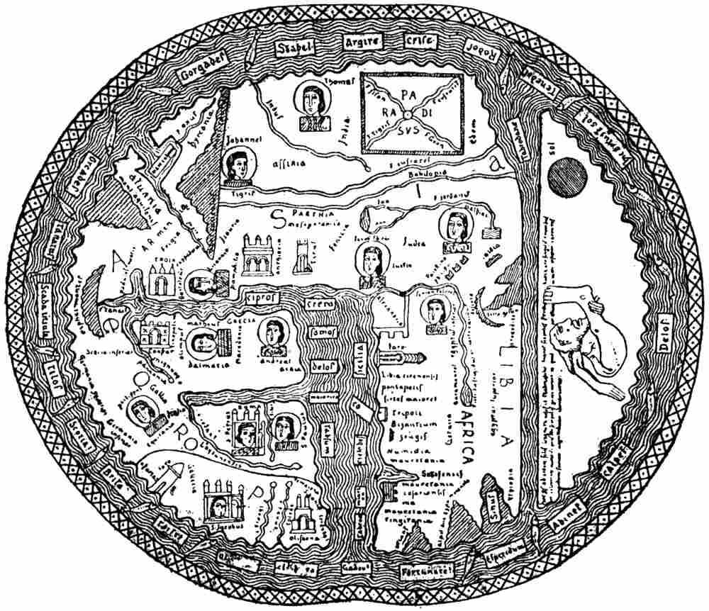