
.
He also was the first discoverer of the gnomon; and he placed some in Lacedaemon on the sun-dials there, as Favorinus says in his Universal History, and they showed the solstices and the equinoxes; he also made clocks. He was the first person, too, who drew a map of the earth and sea, and he also made a globe; Diogenes Laertius, Life of Anaximander
Among the oldest drawings that could be considered as maps are those in Catal Hyük 6200 BC in Anatolia, Turkey, where wall paintings were discovered in 1963. Some other image, inscribed on a mammoth tusk, which was discovered in Ukraine in 1966, was produced about 10000 BC. Maps were found also in Mesopotamia and dated at 3800 BC. These maps were related to the development of the natural resources and to establish land ownership boundaries.
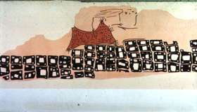
A drawing in Catal Hyük assume to be a map (6200 BC)
The first reference in Western literature of a map is from Herodotus account of the interview between Aristagoras, tyrant of Miletus, and the Spartans. The first Greek assumed to have produced maps was Anaximander 610 BC - 546 BC but none of his maps survived but a reconstruction is shown below. Dikaiarch (or Dicaearchus) of Messina (350-290/85 BC) a Greek geographer introduces to the map making world the notion of latitude and longitude
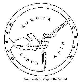
Compare this map with the maps described before and the map around 3000 BC from an Ukrainian silver vase. Later Eratosthenes and Strabo produced the first Maps of the entire known World. Ptolemy (or Claudius Ptolemaeus or Klaudios Ptolemaios) (Πτολεμαίος Κλαύδιος) lived in Alexandria, Egypt, from approx. 87 to probably 170 AD. He created a system of geographical knowledge (Guide to Geography, (Geographia) c. 140 AD) that dominated the field for around 1500 years.
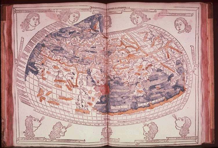
Ptolemy's Map (with 12 winds, 4 more than in the Tower of Winds!, the drawings actually of all Geographia versions produced after c. 1300 AD, the original versions lost)
Large Image from a 1482 version (Lienhart Holle) (c. 900 KB)
He produced a world map (drawings all lost). Eight books in all. The maps were actually produced around 1300 from the description of the text (coordinates) two versions: A) 26 regional maps and B) 64 local maps and 4 general maps.
- He rejected Eratosthenes estimate of size of earth, used instead Posidonius, 3/4 of actual size. Assumed "known world" stretched 180 degrees of longitude (Oecumene).
- He used a regular grid of parallels and meridians, i.e. a coordinate system (before Descartes).
- Supported corrections of scale distortions in other maps, i.e. introduced map projections.
- Mentions use of gnomon and astrolabe for pole star & sun.
- Discounts travel stories.
- Included a gazeteer (data bank) of about 8000 localities with their supposed longitudes and latitudes, and even appropriate captions for the maps. By 1740, only 116 places known.
After the end of the Hellenistic period Ptolemy is considered a Pagan. We have a decline and it will take many centuries to rediscover the work of Ptolemy and to improve the accuracy of the maps. Among such who followed Ptolemy was Cosmas Indicopleustes who as his name says visit India. But he refused the Idea of a spherical world. He introduces religious ideas in his maps. See: The Fourth Book of the Christian Topography of Cosmas Indicopleustes.
Ptolemy's Geography was forgotten in some of the libraries (probably held by the church in monasteries) until a Byzantine Monk, Maximos Planudes (1260-1310) discovered a manuscript of Ptolemy's Geographia, somewhere around 1300. It was not complete but based on descriptions for example from the 8th book a map could be drawn. The Planudes version is now in a Library of the Vatican. Through the work of other scholars from Byzantium such as Nicephoros Gregoras or Emannuel Chrysoloras versions of the Geographica were introduced in Italy in Latin translations. More than 50 editions of Geographia up to 1730 were produced in Europe.
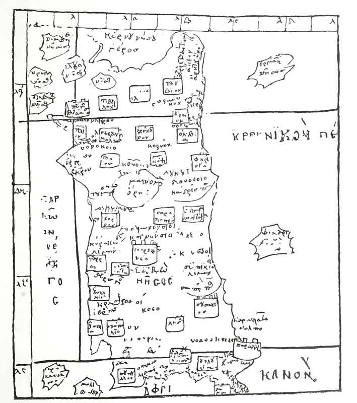
Map of Sardinia, 12th century based on Ptolemy's Map,. Vatopedi Monastery Mount Athos
HNN Breaking News
References
Ptolemy's Geography, Comments of Text and Maps!
Why probably America was discovered
Links
The Earliest Known Map (from Ancient Maps Website)
First edition of the Geographia published outside of Italy in Ulm Germany by Lienhart Holle, 1482
Ancient Greek geographic texts Preliminary version
J. Lennart Berggren and Alexander Jones, Ptolemy's Geography : An Annotated Translation of the Theoretical Chapters
, Princeton University Press, ISBN 0-691-01042-0
| Ancient Greece
Science, Technology , Medicine , Warfare, , Biographies , Life , Cities/Places/Maps , Arts , Literature , Philosophy ,Olympics, Mythology , History , Images Medieval Greece / Byzantine Empire Science, Technology, Arts, , Warfare , Literature, Biographies, Icons, History Modern Greece Cities, Islands, Regions, Fauna/Flora ,Biographies , History , Warfare, Science/Technology, Literature, Music , Arts , Film/Actors , Sport , Fashion --- |
