
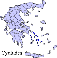
Administrative Region : South Aegean
Regional unit : Thira
 |
 |
Santorini (Greek: Σαντορίνη, pronounced [sadoˈrini]), officially Thira (Greek: Θήρα [ˈθira]), is an island located in the southern Aegean Sea, about 200 km (120 mi) southeast from Greece's mainland. It is the largest island of a small, circular archipelago which bears the same name and is the remnant of a volcanic caldera. It forms the southernmost member of the Cyclades group of islands, with an area of approximately 73 km2 (28 sq mi) and a 2001 census population of 13,670. The municipality of Santorini comprises the inhabited islands of Santorini and Therasia and the uninhabited islands of Nea Kameni, Palaia Kameni, Aspronisi, and Christiana. The total land area is 90.623 km2 (34.990 sq mi). Santorini is part of the Santorini peripheral unit.[1]
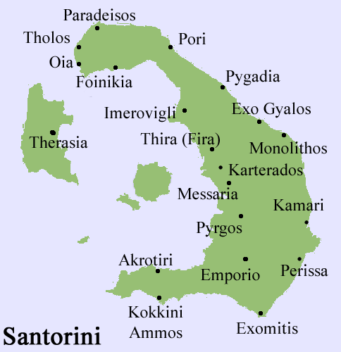
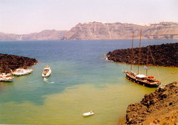
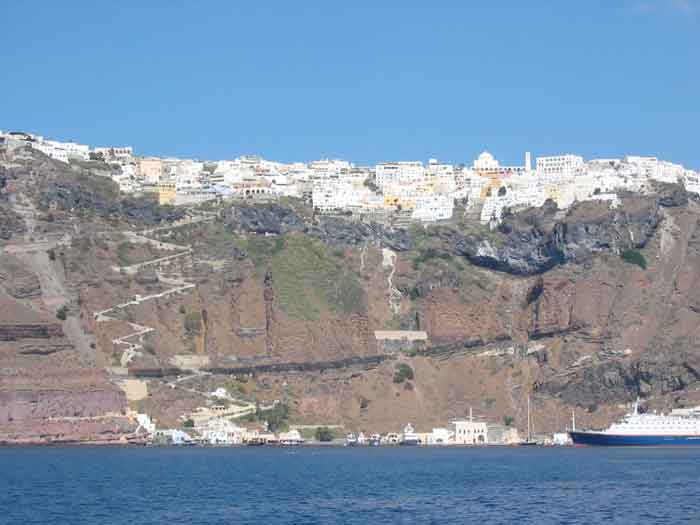
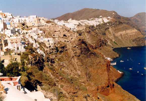
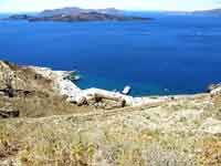
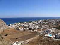
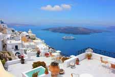
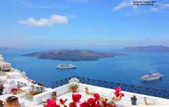
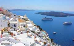
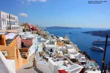
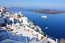
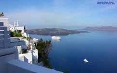
Santorini is essentially what remains after an enormous volcanic explosion that destroyed the earliest settlements, on a formerly single island, and created the current geological caldera. A giant central, rectangular lagoon, which measures about 12 by 7 km (7.5 by 4.3 mi), is surrounded by 300 m (980 ft) high, steep cliffs on three sides. The main island slopes downward to the Aegean Sea. On the fourth side, the lagoon is separated from the sea by another much smaller island called Therasia; the lagoon is connected to the sea in two places, in the northwest and southwest. The water in the center of the lagoon is nearly 400 m (1,300 ft) deep, thus making it a safe harbor for all kinds of shipping. The island's harbors all lie in the lagoon, and there are no ports on the perimeter of the island; the capital, Fira, clings to the top of the cliff looking down on the lagoon. The volcanic rocks present from the prior eruptions feature olivine and have a notably small presence of hornblende.[2]
It is the most active volcanic center in the South Aegean Volcanic Arc, though what remains today is chiefly a water-filled caldera. The volcanic arc is approximately 500 km (310 mi) long and 20 to 40 km (12 to 25 mi) wide. The region first became volcanically active around 3–4 million years ago, though volcanism on Thera began around 2 million years ago with the extrusion of dacitic lavas from vents around the Akrotiri.
The island is the site of one of the largest volcanic eruptions in recorded history: the Minoan eruption (sometimes called the Thera eruption), which occurred some 3600 years ago at the height of the Minoan civilization. The eruption left a large caldera surrounded by volcanic ash deposits hundreds of feet deep and may have led indirectly to the collapse of the Minoan civilization on the island of Crete, 110 km (68 mi) to the south, through a gigantic tsunami. This theory is not, however, supported by chronology, in that the collapse of the Minoan civilization did not occur at the date of the tsunami, but some 90 years later.[CN] Another popular theory holds that the Thera eruption is the source of the legend of Atlantis.[3]
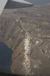
Santorini, Satellite Images, Greece
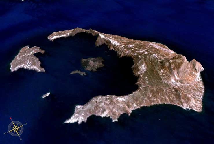
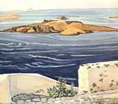
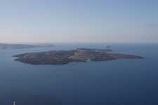
The largest island is Thera, the smaller island top left is Therasia. The three small islands are Aspronisi (in the southern channel between Therasia and Thera), Palea Kammeni and Nea Kammeni (nearest the centre of the caldera).
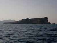
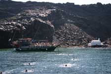
A Trip to Néa Kamméni in the centre of the caldera [Source]
Names
Santorini was named by the Latin Empire in the thirteenth century, and is a reference to Saint Irene. Before then, it was known as Kallístē (Καλλίστη, "the most beautiful one"), Strongýlē (Greek: Στρογγύλη, "the circular one"),[4] or Thēra. The name Thera was revived in the nineteenth century as the official name of the island and its main city, but the colloquial name Santorini is still in popular use. During the Ottoman Empire's domination of the Aegean Sea, the Turkish exonym for the island was "Santurin" or "Santoron".[5]
Municipality
The present municipality of Thera (officially: "Thira") (Greek: Δήμος Θήρας),[6][7] which covers all settlements on the islands of Santorini and Therasia, was formed at the 2011 local government reform, by the merger of the former Oia and Thera municipalities.[1]
Oia is now called a Κοινότητα (commune), within the municipality of Thera, and it comprises the local subdivisions (Greek: τοπικό διαμέρισμα) of Therasia and Oia, Greece|Oia.
The municipality of Thera includes an additional 12 local subdivisions on Santorini island: Akrotiri, Emporio, Episkopis Gonia, Exo Gonia, Imerovigli, Karterakos, Megalohori, Mesaria, Pyrgos Kallistis, Thera (the seat of the municipality), Vothon, and Vourvoulos.[8]
Geologic setting
Main article: Santorini caldera
The Cyclades are part of a metamorphic complex that is known as the Cycladic Massif. The complex formed during the Miocene and was folded and metamorphosed during the Alpine Orogeny around 60 million years ago. Thera is built upon a small, non-volcanic basement that represents the former non-volcanic island, which was approximately 9 by 6 km (5.6 by 3.7 mi). The basement rock primarily comprises metamorphosed limestone and schist, which date from the Alpine Orogeny. These non-volcanic rocks are exposed at the Profitis Ilias Mountains, Mesa Vouno, the Gavrillos ridge, Pyrgos, Monolithos, and the inner side of the caldera wall between Cape Plaka and Athinios.
The metamorphic grade comprises a blueschist facies, which results from tectonic deformation by the subduction of the African Plate beneath the Eurasian Plate. Subduction occurred between the Oligocene and the Miocene, and the metamorphic grade represents the southernmost extent of the Cycladic blueschist belt.
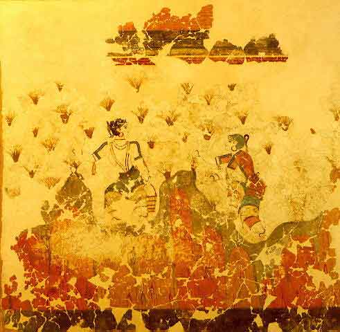
The "saffron-gatherers, saffron crocus flowers, represented as small red tufts, are gathered by two women in a fragmentary Minoan fresco from Akrotiri of Santorini, (See History of Saffron)
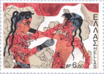
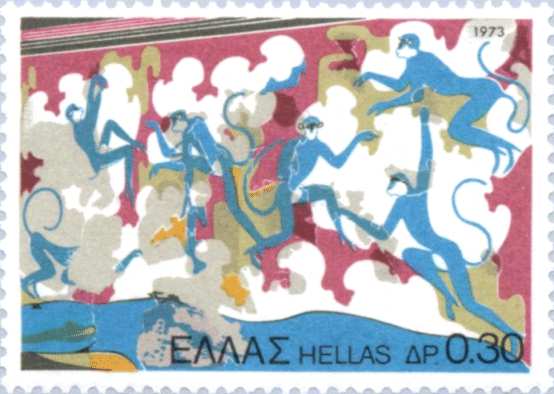
Boxing children, blue monkeys: See Akrotiri
Volcanism on Santorini is due to the Hellenic Trench subduction zone southwest of Crete. The oceanic crust of the northern margin of the African Plate is being subducted under Greece and the Aegean Sea. which comprises thinned continental crust. The subduction compels the formation of the Hellenic arc, which includes Santorini and other volcanic centers, such as Methana, Milos, and Kos.[9]
Geography
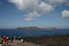
Satellite image of Santorini caldera. The large island to the east is Thera, with Aspronisi and Therasia making up the rest of the caldera ring, clockwise. In the centre is the larger Nea Kameni and the smaller Palea Kameni
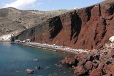
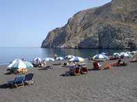
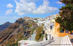
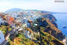
The island is the remnant of a volcanic cone whose top was blown off. The inner coast around the caldera is a sheer precipice of more than 300 m drop at its highest, and exhibits the various layers of solidified lava on top of each other, and the main towns perched on the crest. The ground then slopes outwards and downwards towards the outer perimeter, and the outer beaches are smooth and shallow. Beach sand color depends on which geologic layer is exposed; there are beaches with sand or pebbles made of solidified lava of various colors: the Red Beach, the Black Beach, the White Beach, etc. The water at the darker colored beaches is significantly warmer because the lava acts as a heat absorber.
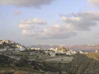
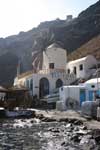
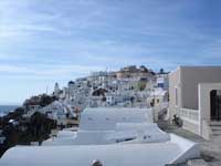
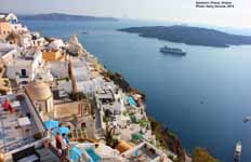
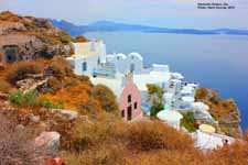
Oia , Santorini [Source]
|
|
||
|
The Thira Mars crater was named after Thira / Santorini |
Climate
Santorini and Anafi are the only locations in Europe to feature a hot desert climate according to the Köppen climate classification system.[10]
History
Minoan Akrotiri
The "saffron-gatherers"
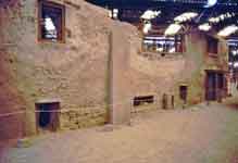
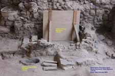
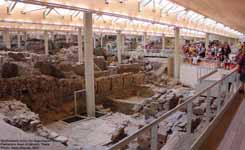
Excavations starting in 1967 at the site called Akrotiri under the late Professor Spyridon Marinatos have made Thera the best-known "Minoan" site outside of Crete, the homeland of the culture. The island was not known as Thera at this time. Only the southern tip of a large town has been uncovered, yet it has revealed complexes of multi-level buildings, streets, and squares with remains of walls standing as high as eight metres, all entombed in the solidified ash of the famous eruption of Thera. The site was not a palace-complex such as are found in Crete, but its excellent masonry and fine wall-paintings show that this was certainly no conglomeration of merchants' warehousing either. A loom-workshop suggests organized textile weaving for export. This Bronze Age civilization thrived between 3000 to 2000 BC, and reached its peak in the period 2000 to 1580 BC.[11]
Some of the houses in Akrotiri are major structures, some amongst them three storeys high. Its streets, squares, and walls were preserved in the layers of ejecta, sometimes as tall as eight metres, and indicating this was a major town. In many houses stone staircases are still intact, and they contain huge ceramic storage jars (pithoi), mills, and pottery. Noted archaeological remains found in Akrotiri are wall paintings or frescoes, which have kept their original colour well, as they were preserved under many meters of volcanic ash. The town also had a highly developed drainage system and, judging from the fine artwork, its citizens were clearly sophisticated and relatively wealthy people.
Pipes with running water and water closets found at Akrotiri are the oldest such utilities discovered. The pipes run in twin systems, indicating that the Therans used both hot and cold water supplies; the origin of the hot water probably was geothermic, given the volcano's proximity. The dual pipe system suggesting hot and cold running water, the advanced architecture, and the apparent layout of the Akrotiri find resemble Plato's description of the legendary lost city of Atlantis, further indicating the Minoans as the culture which primarily inspired the Atlantis legend.[3]
Landscape of spring time - Fresco from the Bronze Age, Akrotiri
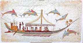
Fragmentary wall-paintings at Akrotiri lack the insistent religious or mythological content familiar in Classical Greek décor. Instead, the Minoan frescoes depict "Saffron-Gatherers", who offer their crocus-stamens to a seated lady, perhaps a goddess. Crocus has been discovered to have many medicinal values including the relief of menstrual pain. This has led many[who?] archaeologists to believe that the fresco of the saffron/crocus gatherers is a coming of age fresco dealing with female pubescence. In another house are two antelopes, painted with a kind of confident, flowing, decorative, calligraphic line, the famous fresco of a fisherman with his double strings of fish strung by their gills, and the flotilla of pleasure boats, accompanied by leaping dolphins, where ladies take their ease in the shade of light canopies, among other frescoes.
The well preserved ruins of the ancient town often are compared to the spectacular ruins at Pompeii in Italy. The canopy covering the ruins collapsed in an accident in September 2005, killing one tourist and injuring seven more. The site remains closed while a new canopy is being built.
The oldest signs of human settlement are Late Neolithic (4th millennium BC or earlier), but ca. 2000–1650 BC Akrotiri developed into one of the Aegean's major Bronze Age ports, with recovered objects that had come, not just from Crete, but also from Anatolia, Cyprus, Syria, and Egypt as well as from the Dodecanese and the Greek mainland.
Dating of the Bronze Age eruption
The Minoan eruption provides a fixed point for the chronology of the second millennium BC in the Aegean, because evidence of the eruption occurs throughout the region and the site itself contains material culture from outside. The eruption occurred during the "Late Minoan IA" period at Crete and the "Late Cycladic I" period in the surrounding islands.
Archaeological evidence, based on the established chronology of Bronze Age Mediterranean cultures dates the eruption to around 1500 BC.[12] These dates, however, conflict with Radiocarbon dating which indicates that the eruption occurred about 1645–1600 BC.[13] Around the time of the radiocarbon-indicated date of the eruption, there is evidence for a significant climatic event in the Northern Hemisphere. The evidence includes failure of crops in China, as well as evidence from tree rings. The tree rings date the climatic event to 1628 BC.[14][15]
Ancient and medieval Santorini
Prehistoric Site of Akrotiri
Santorini remained unoccupied throughout the rest of the Bronze Age, during which time the Greeks took over Crete. At Knossos, in a LMIIIA context (14th century BC), seven Linear B texts while calling upon "all the gods" make sure to grant primacy to an elsewhere-unattested entity called qe-ra-si-ja and, once, qe-ra-si-jo. If the endings -ia[s] and -ios represent an ethnikonic suffix, then this means "The One From Qeras[os]". If aspirated, *Qhera- would have become "Thera-" in later Greek. "Therasia" and its ethnikon "Therasios" are both attested in later Greek; and, since -sos was itself a genitive suffix in the Aegean Sprachbund, *Qeras[os] could also shrink to *Qera. An alternate view takes qe-ra-si-ja and qe-ra-si-jo as proof of androgyny, and applies this name by similar arguments to the legendary seer, Tiresias, but these views are not mutually exclusive of one another. If qe-ra-si-ja was an ethnikon first, then in following him/her/it the Cretans also feared whence it came.[16]
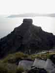
Over the centuries after the general catastrophes of 1200 BC,[vague] Phoenicians founded a site on Thera. Herodotus reports that the Phoenicians called the island Callista and lived on it for eight generations.[17] Then, in the 9th century BC, Dorians founded the main Hellenic city - on Mesa Vouno, 396 m above sea level. This group later claimed that they had named the city and the island after their leader, Theras. Today, that city is referred to as Ancient Thera.
Apollonius Rhodius' Argonautica, written in Hellenistic Egypt in the 3rd century BC, includes an origin and sovereignty myth of Thera being given by Triton in Libya to the Greek Argonaut Euphemus, son of Poseidon, in the form of a clod of dirt. After carrying the dirt next to his heart for several days, Euphemus dreamt that he nursed the dirt with milk from his breast, and that the dirt turned into a beautiful woman with whom he had sex. The woman then told him that she was a daughter of Triton named Kalliste, and that when he threw the dirt into the sea it would grow into an island for his descendants to live on. The poem goes on to claim that the island was named Thera after Euphemus' descendant Theras, son of Autesion, the leader of a group of refugee settlers from Lemnos.
The Dorians have left a number of inscriptions incised in stone, in the vicinity of the temple of Apollo, attesting to pederastic relations between the authors and their eromenoi. These inscriptions, found by Friedrich Hiller von Gaertringen, have been thought by some archaeologists to be of a ritual, celebratory nature, due to their large size, careful construction and - in some cases - execution by craftsmen other than the authors.
According to Herodotus (4.149-165), following a drought of seven years, Thera sent out colonists who founded a number of cities in northern Africa, including Cyrene.
In the 5th century BC, Dorian Thera did not join the Delian League with Athens; and during the Peloponnesian War, Thera sided with Dorian Sparta, against Athens. The Athenians took the island during the war, but lost it again after the Battle of Aegospotami.
During the Hellenistic period, the island was a major naval base for the Ptolemaic Egypt.
As with other Greek territories, Thera then was ruled by the Romans; it passed to the eastern side of the Empire when it divided - which now is known as the Byzantine Empire.
According to George Cedrenus, the volcano erupted in the summer of 727, the tenth year of the reign of Leo III the Isaurian.[18] He writes: "In the same year, in the summer, a vapour like an oven's fire boiled up for days out of the middle of the islands of Thera and Therasia from the depths of the sea, and the whole place burned like fire, little by little thickening and turning to stone, and the air seemed to be a fiery torch."
During the Crusades, the "Franks" (Catholic Western Europeans) settled it, while in the 13th century AD, the Venetians annexed the isle to the Duchy of Naxos and renamed it "Santorini", that is "Saint Irene". Santorini came under Ottoman rule in 1579.
Santorini in the Greek State
Santorini became independent from Ottoman rule in 1821, during the Greek War of Independence and was united with Greece in 1830 under the Treaty of London.
Modern Santorini
In 1956 a major earthquake and a volcanic eruption resulted in the demolishing of many buildings on the island, leading to the desertion of many of its villages.
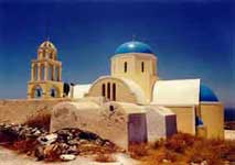
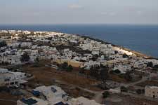
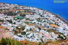
The expansion of tourism has resulted the growth of the economy and population. The major settlements include Fira (Phira), Oia, Emporio, Kamari, Perissa, Imerovigli, Pyrgos, and Therasia. Akrotiri is a major archaeological site, with ruins from the Minoan era. Santorini's primary industry is tourism, particularly in the summer months. The island's pumice quarries have been closed since 1986, in order to preserve the caldera. Santorini was ranked world's top island for 2011 in Travel+Leisure Magazine.[19]
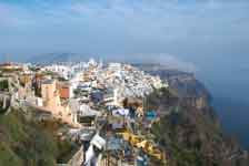
Panoramic view of Santorini's principal city, Fira
Aridity
Santorini has no rivers, and water is scarce. Until the early 1990s locals filled water cisterns from the rain that fell on roofs and courts, from small springs, and with imported assistance from other areas of Greece. In recent years a desalination plant has provided running, yet non-potable, water to most houses. Since rain is rare on the island from mid-spring till mid-autumn, many plants depend on the scant moisture provided by the common, early morning fog condensing on the ground as dew.
Wine industry
Main article: Santorini (wine)
Café in Akrotiri
The island remains the home of a small, but flourishing, wine industry, based on the indigenous grape variety, Assyrtiko, with auxiliary cultivations of two other Aegean varietals, Athiri and Aidani. The vines are extremely old and resistant to phylloxera (attributed by local winemakers to the well-drained volcanic soil and its chemistry), so the vines needed no replacement during the great phylloxera epidemic of the early 20th century. In their adaptation to their habitat, such vines are planted far apart, as their principal source of moisture is dew, and they often are trained in the shape of low-spiralling baskets, with the grapes hanging inside to protect them from the winds.
The viticultural pride of the island is the sweet and strong Vinsanto (Italian: "holy wine"), a dessert wine made from the best sun-dried Assyrtiko, Athiri, and Aidani grapes and undergoing long barrel aging (up to twenty or twenty-five years for the top cuvées). It matures to a sweet, dark amber-orange, unctuous dessert wine that has achieved worldwide fame, possessing the standard Assyrtiko aromas of citrus and minerals, layered with overtones of nuts, raisins, figs, honey and tea.
White wines from the island are extremely dry with a strong, citrus scent and mineral and iodide salt aromas contributed by the ashy volcanic soil, whereas barrel aging gives to some of the white wines a slight frankincense aroma, much like Vinsanto. It is not easy to be a winegrower in Santorini; the hot and dry conditions give the soil a very low productivity. The yield per acre is only 10 to 20% of the yields that are common in France or California. The island's wines are standardised and protected by the "Vinsanto" and "Santorini" OPAP designations of origin.
Agriculture
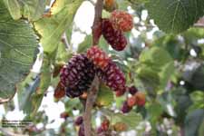
Due to its unique ecology and climate, and especially its volcanic ash soil, Santorini is home to unique and prized produce. The Santorini tomatoes are renowned; they are cherry tomatoes that are extremely flavorful and sweet, and with an intensely red, staining color. Santorini "fava" is a purée made of the hulled, then sun-dried, then boiled legume Lathyrus sativus - not from the yellow split pea as in the rest of Greece. The white eggplants of Santorini are very sweet, with very few seeds, and can be eaten raw. The katsoúni is a unique local variety of large cucumbers which, if left unpicked when green, turn yellow and acquire a sweet taste almost indistinguishable from that of melon.
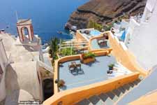
Architecture
Houses built on the edge of the caldera
The traditional architecture of Santorini is similar to that of the other Cyclades, with low-lying cubical houses, made of local stone and whitewashed or limewashed with various volcanic ashes used as colors. The unique characteristic is the common utilisation of the hypóskapha: extensions of houses dug sideways or downwards into the surrounding pumice. These rooms are prized because of the high insulation provided by the air-filled pumice, and are used as living quarters of unique coolness in the summer and warmth in the winter, and also as premium storage space for produce and especially for wine cellaring: the Kánava wineries of Santorini.
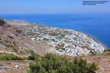
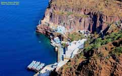
Santorini Airport viewed from Ancient Thera
Airport
See also: Santorini (Thira) National Airport
Santorini is one of the few Cyclades Islands with a major airport. It is about 6 km southeast of downtown Thera. The main asphalt runway (16L-34R) is 2,125 meters (6,972 feet) in length. The parallel taxiway was built to runway specification (16R-34L). It can accommodate Boeing 757, Boeing 737, Airbus 320 series, Avro RJ, Fokker 70, and ATR 72. Scheduled airlines include the new Olympic Air, Aegean Airlines and Athens Airways, with chartered flights from other airlines during the summer. Transportation to and from the air terminal is through buses, taxis, hotel car-pickups and rental cars.
Volcanic eruptions
Recent volcanism
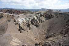
Volcanic craters at Santorini today
Fira from Nea Kameni Volcanic Island
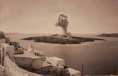
In 1707 an undersea volcano breached the sea surface, forming the current centre of activity at Nea Kameni in the centre of the lagoon, and eruptions centred on it continue — the twentieth century saw three such, the last in 1950. Santorini was also struck by a devastating earthquake in 1956. Although the volcano is quiescent at the present time, at the current active crater (there are several former craters on Nea Kameni), steam and sulphur dioxide are given off.
Santorini has erupted many times, with varying degrees of explosivity. There have been at least twelve large explosive eruptions, of which at least four were caldera-forming.[9] The most famous eruption is the Minoan eruption, detailed below. Eruptive products range from basalt all the way to rhyolite, and the rhyolitic products are associated with the most explosive eruptions.
The earliest eruptions, many of which were submarine, were on the Akrotiri Peninsula, and active between 650,000 and 550,000 years ago.[9] These are geochemically distinct from the later volcanism, as they contain amphiboles.
Over the past 360,000 years there have been two major cycles, each culminating with two caldera-forming eruptions. The cycles end when the magma evolves to a rhyolitic composition, causing the most explosive eruptions. In between the caldera-forming eruptions are a series of sub-cycles. Lava flows and small explosive eruptions build up cones, which are thought to impede the flow of magma to the surface.[9] This allows the formation of large magma chambers, in which the magma can evolve to more silicic compositions. Once this happens, a large explosive eruption destroys the cone. The Kameni islands in the centre of the lagoon are the most recent example of a cone built by this volcano, with much of them hidden beneath the water.
Minoan eruption
Main article: Minoan eruption
Physical eruption
Recent ISS aerial image of the volcano crater
The devastating volcanic eruption of Thera has become the most famous single event in the Aegean before the fall of Troy. It may have been one of the largest volcanic eruptions on Earth in the last few thousand years, with an estimated 7 on the VEI (volcanic explosivity index). The violent eruption was centered on a small island just north of the existing island of Nea Kameni in the centre of the caldera; the caldera itself was formed several hundred thousand years ago by the collapse of the centre of a circular island, caused by the emptying of the magma chamber during an eruption. It has been filled several times by ignimbrite since then, and the process repeated itself, most recently 21,000 years ago. The northern part of the caldera was refilled by the volcano, then collapsing once more during the Minoan eruption. Before the Minoan eruption, the caldera formed a nearly continuous ring with the only entrance between the tiny island of Aspronisi and Thera; the eruption destroyed the sections of the ring between Aspronisi and Therasia, and between Therasia and Thera, creating two new channels.
On Santorini, a deposit of white tephra thrown from the eruption is found lying up to 60 m (200 ft) thick, overlying the soil marking the ground level before the eruption, and forming a layer divided into three fairly distinct bands indicating different phases of the eruption. New archaeological discoveries by a team of international scientists, in 2006, have revealed that the Santorini event was much more massive than previously thought; it expelled 61 cubic kilometres (15 cu mi) of magma and rock into the Earth's atmosphere, compared to previous estimates of only 39 cubic kilometres (9.4 cu mi) in 1991,[20][21] producing an estimated 100 cubic kilometres (24 cu mi) of tephra. Only the Mount Tambora volcanic eruption of 1815, the 181 AD eruption of Lake Taupo, and possibly Baekdu Mountain's 969 AD eruption released more material into the atmosphere during the past 5,000 years.
Panoramic view of the Santorini caldera, taken from Oia
Speculation on an Exodus connection
In The Parting of the Sea: How Volcanoes, Earthquakes, and Plagues Shaped the Exodus Story,[22] geologist Barbara J. Sivertsen seeks to establish a link between the eruption of Santorini ca. 1628 BC and the Exodus from Egypt in the Bible.
A 2006 documentary film by Simcha Jacobovici, The Exodus Decoded,[23] postulates that the eruption of the Santorini Island volcano (c. 1500 BC, +/-50) caused all the biblical plagues described against Egypt, this date also corresponds to the Biblical dating of Moses in Egypt c. 1500 BC +/-50. The film asserts that the Hyksos were the Israelites and that some of them may have originally been from Mycenae. The film also asserts that these original Mycenaean Israelites fled Egypt (which they had in fact ruled for some time) after the eruption, back to Mycenae. The pharaoh with whom they identify the Pharaoh of the Exodus is Ahmose I. Rather than crossing the Red Sea, Jacobovici argued a marshy area in northern Egypt known as the "Reed Sea" would have been alternately drained and flooded by tsunamis caused by the caldera collapse, and could have been crossed during the Exodus.
Jacobovici's assertions in The Exodus Decoded have been extensively criticized by religious scholars.[24][25]
Speculation on an Atlantis connection
Main article: Location hypotheses of Atlantis
Archaeological, seismological, and vulcanological evidence[26][27][28] has been presented linking the Atlantis myth to Santorini. Speculation suggesting that Thera/Santorini was the inspiration for Plato's Atlantis began with the excavation of Akrotiri in the 1960s, and gained increased currency as reconstructions of the island's pre-eruption shape and landscape frescos located under the ash both strongly resembled Plato's description. The possibility has been more recently popularized by television documentaries such as: The History Channel programme Lost Worlds (episode "Atlantis"), the Discovery Channel's Solving History with Olly Steeds, and the BBC's Atlantis, The Evidence that suggests that Thera is Plato's Atlantis.[29][30]
Recent eruptions
Post-Minoan eruptive activity is concentrated on the Kameni islands, in the center of the lagoon. They have been formed since the Minoan eruption, and the first of them broke the surface of the sea in 197 BC[9] Nine subaerial eruptions are recorded in the historical record since that time, with the most recent ending in 1950. Since then the volcano has been quiescent.
Division of the municipality of Thira, population 12440 in 2001:
- Thira / Δ.δ. Θήρας [ 2291 ]
- Thira / η Θήρα [ 2113 ]
- Anydros (island) / ο Άνυδρος (νησίδα) [ 0 ]
- Askania (island) / τα Ασκανιά (νησίδα) [ 0 ]
- Aspronisi (island) / το Ασπρονήσι (νησίδα) [ 0 ]
- Exo Gialos / ο Έξω Γιαλός (Δ.δ. Θήρας) [ 57 ]
- Exo Katoikies / οι Έξω Κατοικίες [ 19 ]
- Eschati (island) / η Εσχάτη (νησίδα) [ 0 ]
- Mesa Katoikies / οι Μέσα Κατοικίες [ 102 ]
- Nea Kameni (island) / η Νέα Καμένη [ 0 ]
- Ormos Firon / ο Όρμος Φηρών [ 0 ]
- Palaia Kameni (island) / η Παλαιά Καμένη [ 0 ]
- Christiana / τα Χριστιανά [ 0 ]
- Christiani (island) / η Χριστιανή (νησίδα) [ 0 ]
- Akrotiri / Δ.δ. Ακρωτηρίου -- το Ακρωτήρι [ 450 ]
- Vothon / Δ.δ. Βόθωνος [ 671 ]
- Vothon / ο Βόθων [ 605 ]
- Agia Paraskevi / η Αγία Παρασκευή [ 66 ]
- Vourvoulos / Δ.δ. Βουρβούλου -- ο Βουρβούλος [ 475 ]
- Emporion / Δ.δ. Εμπορείου [ 2465 ]
- Exo Gonia / Δ.δ. Έξω Γωνιάς [ 375 ]
- Exo Gonia / η Έξω Γωνιά [ 331 ]
- Perivolia / τα Περιβόλια [ 44 ]
- Episkopi Gonias / Δ.δ. Επισκοπής Γωνιάς [ 1430 ]
- Episkopi Gonias / η Επισκοπή Γωνιάς [ 79 ]
- Kamari / το Καμάριον [ 1.351 ]
- Imerovigli / Δ.δ. Ημεροβιγλίου [ 503 ]
- Imerovigli / το Ημεροβίγλιον [ 467 ]
- Panagia Kalou / η Παναγία Καλού [ 36 ]
- Karterados / Δ.δ. Καρτεράδου [ 1108 ]
- Karterados / ο Καρτεράδος [ 1089 ]
- Exo Gialos / ο Έξω Γιαλός (Δ.δ. Καρτεράδου) [ 19 ]
- Megalochorion / Δ.δ. Μεγαλοχωρίου -- το Μεγαλοχώριον [ 460 ]
- Mesaria / Δ.δ. Μεσαριάς [ 1480 ]
- Mesaria / η Μεσαριά [ 1075 ]
- Monolithos / ο Μονόλιθος [ 405 ]
- Pyrgos Kallistis / Δ.δ. Πύργου Καλλίστης [ 732 ]
- Pyrgos Kallistis / ο Πύργος Καλλίστης [ 732 ]
- Moni Profitou Iliou / η Μονή Προφήτου Ηλιού [ 0 ]
- Ormos Athinios / ο Όρμος Αθηνιός [ 0 ]
See also
List of volcanoes in Greece
Summer Lovers was filmed in Santorini.
Notes
^ a b Kallikratis law Greece Ministry of Interior (Greek)
^ Michaēl Phytikas, The South Aegean Active Volcanic Arc: Present Knowledge and Future Perspectives
^ a b Charles Pellegrino, Unearthing Atlantis - An Archaeological Odyssey Vintage Books, 1991
^ C. Doumas (editor). Thera and the Aegean world: papers presented at the second international scientific congress, Santorini, Greece, August 1978. London, 1978. ISBN 0950613304
^ Prof. Erinc http://www.yachtworks.info/tr/ege_adalari.html or English: http://www.yachtworks.info/en/aegean_islands.html
^ "Δήμος Θήρας, the official municipal government website" (in Greek). Retrieved 2011-04-17.
^ "Municipality of Thira, English language version of the official municipal government website". Retrieved 2011-04-17.
^ "Spreadsheet table of all administrative subdivisions in Greece, and their population as of the 18 March 2001 census." (Excel). Hellenic Republic, Ministry of Interior, Decentralization and E-government. Retrieved 2011-04-17.
^ a b c d e Druitt, Timothy H.; L. Edwards, R.M. Mellors, D.M. Pyle, R. S. J. Sparks, M. Lanphere, M. Davies, B. Barriero (1999). Santorini Volcano. Geological Society Memoir. 19. London: Geological Society. ISBN 9781862390485.
^ http://www.hydrol-earth-syst-sci-discuss.net/4/439/2007/hessd-4-439-2007-print.pdf
^ TheModernAntiquarian.com, C. Michael Hogan, Akrotiri, The Modern Antiquarian (2007).
^ Warren PM (2006). Czerny E., Hein I., Hunger H., Melman D., Schwab A. (editors). ed. Timelines: Studies in Honour of Manfred Bietak (Orientalia Lovaniensia Analecta 149). Louvain-la-Neuve, Belgium: Peeters. pp. 2: 305–321. ISBN 90-429-1730-X.
^ Manning, Stuart W; Ramsey, CB, Kutschera, W, Higham, T, Kromer, B, Steier, P, and Wild, EM (2006). "Chronology for the Aegean Late Bronze Age 1700-1400 B.C.". Science (American Association for the Advancement of Science) 312 (5773): 565–569. doi:10.1126/science.1125682. PMID 16645092. Retrieved 2007-03-10.
^ Baillie, MGL (1989). "Irish Tree Rings and an Event in 1628 BC". The Thera Foundation. Retrieved 2007-03-10.
^ Grudd, H, Briffa, KR, Gunnarson, BE, & Linderholm, HW (2000). "Swedish tree rings provide new evidence in support of a major, widespread environmental disruption in 1628 BC". Geophysical Research Letters 27 (18): 2957–2960. Bibcode 2000GeoRL..27.2957G. doi:10.1029/1999GL010852.
^ TheraFoundation.org, Minoan Qe-Ra-Si-Ja. The Religious Impact of the Thera Volcano on Minoan Crete.
^ Herodotus iv. 147
^ George Cedrenus, Σύνοψις ἱστορίων, Vol I, p. 795.
^ Travel+Leisure: 2011 World's Best Awards Accessed 2011-07-16.
^ URI.edu, URI Department of Communications and Marketing
^ NationalGeographic.com, "Atlantis" Eruption Twice as Big as Previously Believed, Study Suggests.
^ Sivertsen, Barbara J (2009). The Parting of the Sea: How Volcanoes, Earthquakes, and Plagues Shaped the Story of the Exodus. Princeton University Press. ISBN 9780691137704.
^ "The Exodus Decoded Office Website". Theexodusdecoded.net. Retrieved 2010-10-24.
^ "Debunking "The Exodus Decoded"". September 20, 2006. Retrieved 8 August 2009.
^ "The Exodus Decoded: An Extended Review". Tuesday 19 Dec 2006. Retrieved 8 August 2009.
^ "Santorini Eruption (~1630 BC) and the legend of Atlantis". Retrieved 2008-03-09.
^ Vergano, Dan (2006-08-27). "Ye gods! Ancient volcano could have blasted Atlantis myth". USA Today. Retrieved 2008-03-09.
^ Lilley, Harvey (20 April 2007). "The wave that destroyed Atlantis". BBC Timewatch. Retrieved 2008-03-09.
^ Atlantis - The Evidence by Bettany Hughes BBC.co.uk, Timewatch, Atlantis - The Evidence
^ Has the real Atlantis finally been found … under a modern holiday paradise? by Bettany Hughes DailyMail.co.uk, Mail Online, 31 May 2010.
References
Forsyth, Phyllis Y.: Thera in the Bronze Age, Peter Lang Pub Inc, New York 1997. ISBN 0-8204-4889-3
History Channel's "Lost Worlds: Atlantis" archeology series. Features scientists Dr. J. Alexander MacGillivray (archeologist), Dr. Colin F. MacDonald (archaeologist), Professor Floyd McCoy (vulcanologist), Professor Clairy Palyvou (architect), Nahid Humbetli (geologist) and Dr. Gerassimos Papadopoulos (seismologist)
Further reading
Bond, A.; Sparks, R. S. J. (1976). "The Minoan eruption of Santorini, Greece". Journal of the Geological Society 132: 1. doi:10.1144/gsjgs.132.1.0001. edit
Doumas, C. (1983). Thera: Pompeii of the ancient Aegean. London: Thames and Hudson.
Pichler, H. and Friedrich, W.L. (1980). "Mechanism of the Minoan eruption of Santorini". Doumas, C. Papers and Proceedings of the Second International Scientific Congress on Thera and the Aegean World II.
Santorini Gallery

Retrieved from "http://en.wikipedia.org/"
All text is available under the terms of the GNU Free Documentation License
| Ancient Greece
Science, Technology , Medicine , Warfare, , Biographies , Life , Cities/Places/Maps , Arts , Literature , Philosophy ,Olympics, Mythology , History , Images Medieval Greece / Byzantine Empire Science, Technology, Arts, , Warfare , Literature, Biographies, Icons, History Modern Greece Cities, Islands, Regions, Fauna/Flora ,Biographies , History , Warfare, Science/Technology, Literature, Music , Arts , Film/Actors , Sport , Fashion --- |
