

.
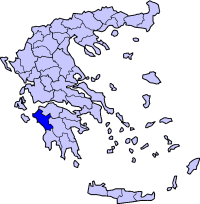
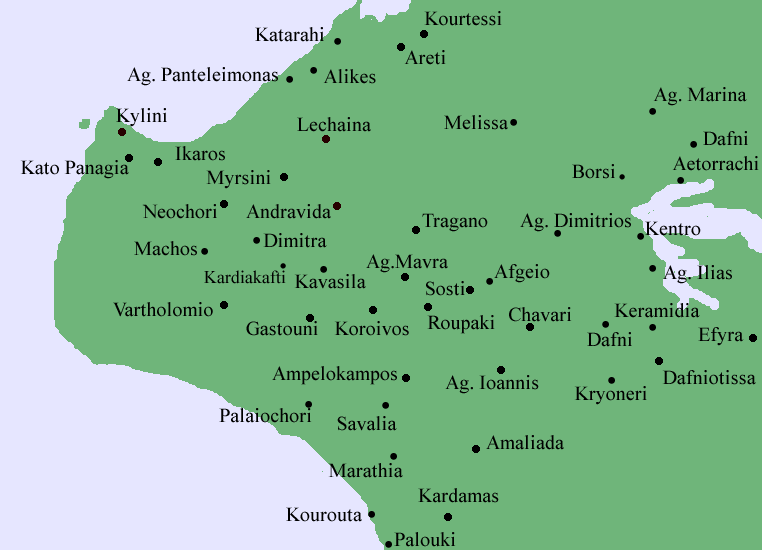
Roupaki (Greek: Ρουπάκι) is a community. Distance from Amaliada is 6 km N and 6 km E from the highway. Its neighboring communities and villages are Agia Mavra to the north, Afgeio and Sosti to the east, Aghios Ioannis to the southeast, Amaliada and Ampelokampos to the south and Koroivos to the west.
Location:
- Latitude: 37.859 (37°51'31') N
- Longitude: 21.325 (21°19'23') E
Postal code: 273 00
Elevation: about 5 to 6 m
Dialing code: +30-26220
Historical population:
| Year | Communal population |
|---|---|
| 1981 | 372 |
| 1991 | 423 |
| 2001 | 591 |
The community has a school, a church, a community centre along with the post office, and a square (plateia) located on the intersection of the roads connecting Gastouni and the Dam and Agia Mavra and Amaliada. Most of the population live with the two major roads. Forests are founded in the west and southeast with the rest of its lands is used for farming.
|
Municipalities of the Elis Prefecture
Alifeira | Amaliada | Andravida | Andritsaina | Ancient Olympia | Figaleia | Foloi | Gastouni | Iardanos | Kastro-Kyllinis | Lampeia | Lasiona | Lechaina | Oleni | Pineia | Pyrgos | Skillounta | Tragano |Vartholomio | Volakas | Vouprasia | Zacharo |
| Ancient Greece
Science, Technology , Medicine , Warfare, , Biographies , Life , Cities/Places/Maps , Arts , Literature , Philosophy ,Olympics, Mythology , History , Images Medieval Greece / Byzantine Empire Science, Technology, Arts, , Warfare , Literature, Biographies, Icons, History Modern Greece Cities, Islands, Regions, Fauna/Flora ,Biographies , History , Warfare, Science/Technology, Literature, Music , Arts , Film/Actors , Sport , Fashion --- |
Retrieved from "http://en.wikipedia.org/"
All text is available under the terms of the GNU Free Documentation License
