


- http://www.oreivatein.com/page/ mountains/p/parnitha/e_parnitha.htm (in Greek)
- Accurate Forecasts in Parnitha (Webcam)
- http://www.gianniskofinas.com/Vouna/parnitha/par.htm (in Greek)
- Birds in Parnitha (in Greek)
.
| Parnitha | |
|---|---|
| Elevation: | 1,413 m (official) |
| Latitude: | 38.133/°10' N |
| Longitude: | 22.6833 °41' W |
| Location: | north of Athens, Greece |
| Length: | 10 to 15 km, north to south approx. 10 km from east to west |
| Easiest route: | climb |
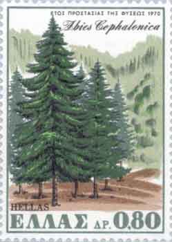
Mount Parnitha (Greek, modern: Πάρνηθα, ancient/Katharevousa: -is, sometimes Parnetha), older forms Parnes, Parnis is a mountain and range north of Athens and Menidi/Acharnae, the tallest on the peninsula of Attica. The mountain can be seen from Eleusis, Athens, and northern suburbs. Forests are situated on the mountain and it contains a cable car. Much of the mountain is also a National park protected since 1961. The mountains are surrounded by Aegaleo to the south, and Penteli to its southeast. The mountain has forests of Greek Fir and Aleppo Pine.
In Parnitha we have 42 types of mammals (out of 116 in Greece) and around 1100 types of plants (around 1/6 of the known types in Greece). Around 90 plants are Attica specific and 2 are found only in Parnitha.
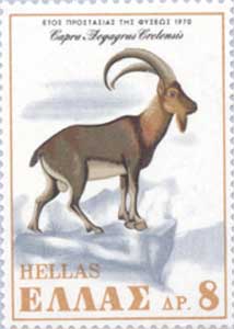
Since 1961 in Parnitha, the so called "Kri-Kri" imported from Crete.
The mountain also has many species of birds, 132 have been observed. The mountaintop is located 18 km N of Acharnae and about 30 km N of Athens. The view of southern Viotia and western east-central Athens can be seen.
Towns surrounding the mountain are Aspropyrgos (Thria), Fyli, Acharnae/Menidi, Varympompi, Thrakomakedones, Decelea, Avlona and Aghios Stefanos, GR-1 aka E75 surrounds the northern and eastern part of the mountain along with the Cephissus river. The new Attiki Odos sometimes referred to as GR-91 is in its south. The two plains are adjacent to the mountain (Thriasian, and Pedia). There are some landfills adjacent to the mountain range. The settlement includes Agia Triada Parnithas.
There have been several forest fires during the summer months of the early 2000s.
The mountain also has a chairlift on its southern face and forests dominate all its sides beneath 1,000 m. Abore 1,000 m, the central part, the western part and parts of the other areas are covered in grasses and bushes and under 300 m they are mainly made up of farmlands and urban areas in the east.
The municipality of Acharnes covers much of the mountain areas and is bounded with municipalities and communes which is the most number in the prefecture.
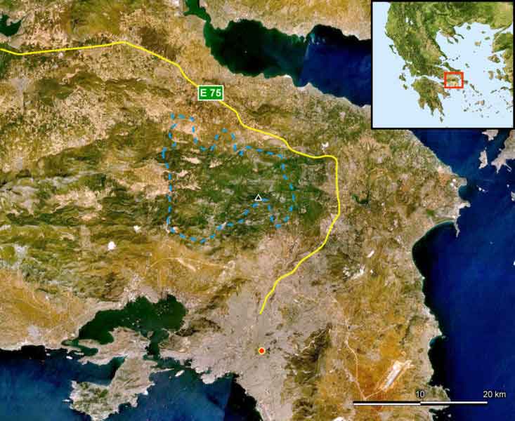
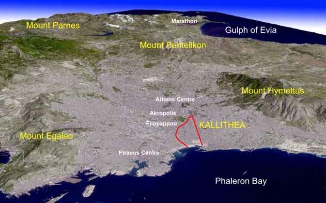
Mount Parnitha region marked
In Parnitha there is the cave of Pan, a nymphaeum (place of the Nymphs). Various small churches and monasteries are in Parnitha, the monastery Kleiston from the 11th century.
The casino, the Mount Parnes Casino is located somewhere in the mountain. Also, Parnitha includes Bafi.
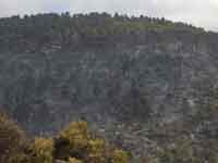
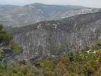
2007 wildfire
Parnitha suffered extensive damage from a wildfire on Thursday, June 28, 2007 around the morning and noon hours and continued for several days burning approximately 25,000 to 35,000 ha of land which made it became one of the worst recorded wildfires in the prefecture after Penteli (see Summer 2005 Wildfires in Greece). It was an event that never happened before except for a smaller one in the 1960s.[1] The fire consumed forest in two prefectures. Firefighters, helicopters and planes were all over the mountain and its edges fighting out the enormous blaze and took hours and days to contain. It spreaded rapidly with wind. It spreaded into northwestern edges of Greater Athens including Ano Liosia as well as towns and villages including Fyli, near Thrakomakedones, Pyli as well as Skoura and Schimatari north of the mountain, from Athens, it was seen burning throughout the night. In Schimatari in Viotia, it ruined several forests and its businesses. 80% of the forest is burned including 150 red deers (endangered species) and other rare animals. Its remains of the green firs and pines are sporadically located and by its edges. It resembles a scene of a burnt forest and an ugly winter, with the loss of its pine needles, it can see the horrifying mountain slopes and it can be seen throughout including by its summit and its valleys. Smoke can be seen from most of the Athens area including the westcentral suburbs, the downtown area and the northern suburbs and were formed like a line and it travelled over east Attica, the southern Euboea, Chios and near the edge of Turkey at a distance of approximately 250 km.
The fires later disintegrated. It also receives fresh air to the region especially Athens and its smog problems and. The air may become a little stale. Temperatures may rise and flood may become a problem for several years.
References
- ^ BBC. Greek forest fire close to Athens. Retrieved on 2007-06-29.
Links
| Ancient Greece
Science, Technology , Medicine , Warfare, , Biographies , Life , Cities/Places/Maps , Arts , Literature , Philosophy ,Olympics, Mythology , History , Images Medieval Greece / Byzantine Empire Science, Technology, Arts, , Warfare , Literature, Biographies, Icons, History Modern Greece Cities, Islands, Regions, Fauna/Flora ,Biographies , History , Warfare, Science/Technology, Literature, Music , Arts , Film/Actors , Sport , Fashion --- |
Retrieved from "http://en.wikipedia.org/"
All text is available under the terms of the GNU Free Documentation License
